Local events in Cincinnati
518 events in the next 90 days from 16 public calendars. All local events in Cincinnati
Checked October 20; the events page is refreshed daily.
Lakes near Cincinnati
The history under the water: the valley before, the dam, the stories. All Ohio lakes
Deep dives about Cincinnati
Long reads built from maps, newspapers and public records. All deep dives
- Cincinnati Union TerminalCincinnati Union Terminal, an Art Deco station built 1928-1933 for seven railroads, saw its last train in 1972 and has housed the Cincinnati Museum Center since 1990.
- Cincinnati ZooThe Cincinnati Zoo opened September 18, 1875, second-oldest in the U.S. The last passenger pigeon died there in 1914 and the last Carolina parakeet in 1918.
- Columbus Day in OhioColumbus Day in Ohio: state law, how the capital got its name in 1812, Ohio's statues and cities, and what the record shows about Columbus.
- Flock Cameras in OhioAbout 6,900 mapped plate readers in 80 Ohio counties: who runs them, who searched the data, the case for and against, and the bills before the legislature.
- Fort Ancient and Serpent MoundOhio's Fort Ancient farmers built maize villages from about AD 1000-1650. Nearby, Serpent Mound's true age is still disputed: about 300 BC or AD 1070.
- Harriet Beecher Stowe HouseLane Seminary built this Walnut Hills house for Lyman Beecher in 1833. Harriet lived here until her 1836 marriage; the 1834 Lane debates fed her later novel.
- Ohio data centersWhere Ohio's 182 data centers sit, who is building them, the tax breaks, the power and water they need, and the moratoriums and ballot fights over them.
- Ohio State FairThe Ohio State Fair began in Cincinnati in 1850, moved among ten Ohio cities, then settled in 1886 on the Columbus fairgrounds it still uses.
- Ohio's Road to StatehoodFrom the French and Indian War through St. Clair's defeat to a one-vote loss of Black suffrage, Ohio's path to statehood in 1803 was neither clean nor certain.
- Over-the-Rhine and Findlay MarketOver-the-Rhine is named for the Miami and Erie Canal, called 'the Rhine' by 1853. Findlay Market, opened in 1855, is Ohio's oldest surviving municipal market house.
- Roebling Suspension BridgeThe Roebling Suspension Bridge between Cincinnati and Covington opened on January 1, 1867, when its 1,057-foot main span was the longest in the world.
- Spring Grove CemeterySpring Grove, chartered on January 21, 1845, is a 733-acre cemetery and arboretum in Cincinnati. Adolph Strauch's landscape-lawn plan from 1854 became a national model.
- The Adena, Ohio's first mound buildersOhio's Adena culture raised the state's first burial mounds around 800 BC. It is named for Thomas Worthington's Chillicothe estate.
- The First Europeans in OhioMarquette saw the Ohio's mouth in 1673, but the first European known by name to live in Ohio was a French trader on the Cuyahoga around 1742.
- The Mound Builder MythOhio's earthworks were long blamed on a vanished 'lost race,' a myth that helped justify Indian Removal and outlived its 1894 federal debunking.
Notable people from Cincinnati
Ohioans tied to this place, each with a sourced profile. All notable Ohioans
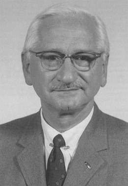 Albert B. Sabin1906-1993Virologist who developed the live, oral polio vaccine during 30 years at Cincinn...
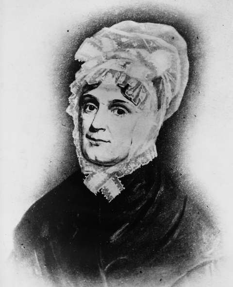 Anna Harrison1775-1864North Bend pioneer's daughter and wife of William Henry Harrison who was first l...
 Archie Griffin1954-Columbus-born Ohio State tailback who is the only player to win the Heisman Trop...
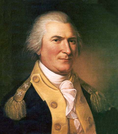 Arthur St. Clair1737-1818First governor of the Northwest Territory (1788-1802), who named Cincinnati and ...
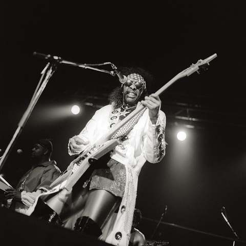 Bootsy Collins1951-Cincinnati-born funk bassist who learned his trade as a teenager at King Records...
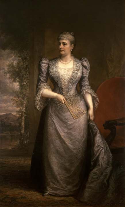 Caroline Harrison1832-1892Oxford-born music teacher and china painter who was first lady from 1889 to 1892...
 Doris Day1922-2019Cincinnati-born big-band singer and film star of Calamity Jane, The Man Who Knew...
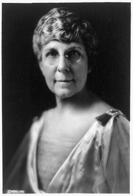 Florence Harding1860-1924Marion banker's daughter who ran the business side of the Marion Star, steered W...
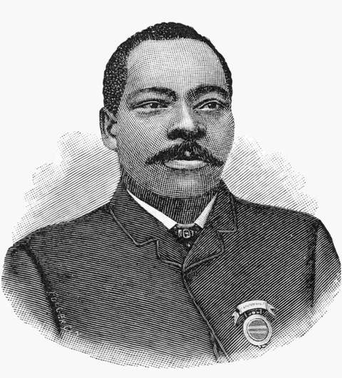 Granville T. Woods1856-1910Columbus-born electrical engineer who, working in Cincinnati, patented the Synch...
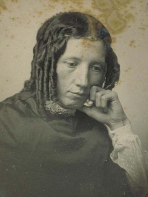 Harriet Beecher Stowe1811-1896Author of Uncle Tom's Cabin (1852), much of whose material came from her eightee...
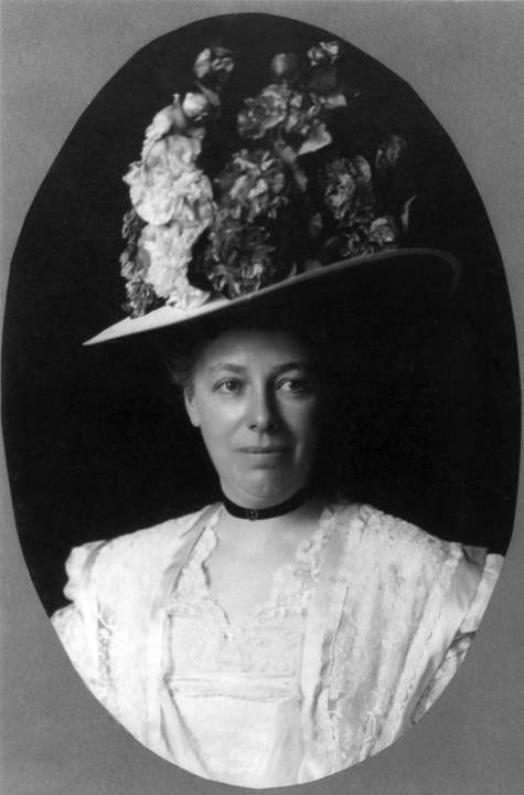 Helen Herron Taft1861-1943Cincinnati lawyer's daughter who steered William Howard Taft toward the presiden...
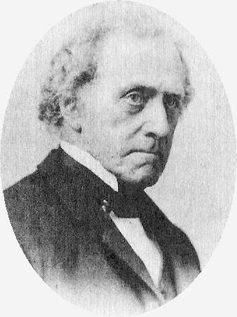 James Gamble1803-1891Irish-born Cincinnati soapmaker who in 1837 went into partnership with his broth...
 Jerry Lucas1940-Middletown and Ohio State basketball star who won state, NCAA, Olympic and NBA t...
 Karl Gordon Henize1926-1993Cincinnati-born astronomer who catalogued hundreds of emission-line stars and ne...
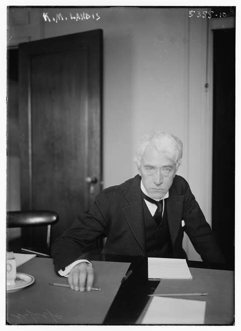 Kenesaw Mountain Landis1866-1944Butler County-born federal judge who fined Standard Oil $29 million in 1907 and,...
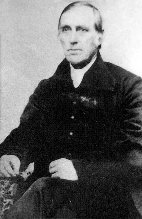 Levi Coffin1798-1877Quaker merchant, called the 'President of the Underground Railroad', who ran Cin...
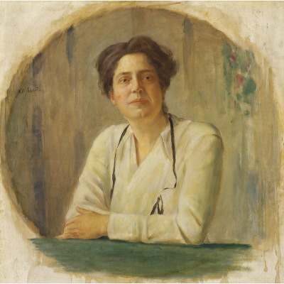 Lillian Wald1867-1940Cincinnati-born nurse who founded New York's Henry Street Settlement and visitin...
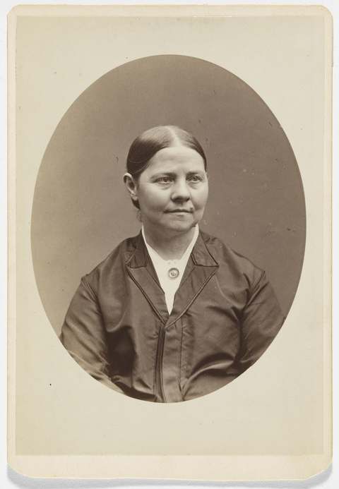 Lucy Stone1818-1893Abolitionist and suffrage orator who graduated from Oberlin College in 1847, the...
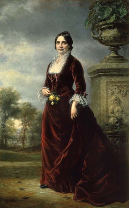 Lucy Webb Hayes1831-1889Chillicothe-born first lady (1877-1881), the first president's wife with a colle...
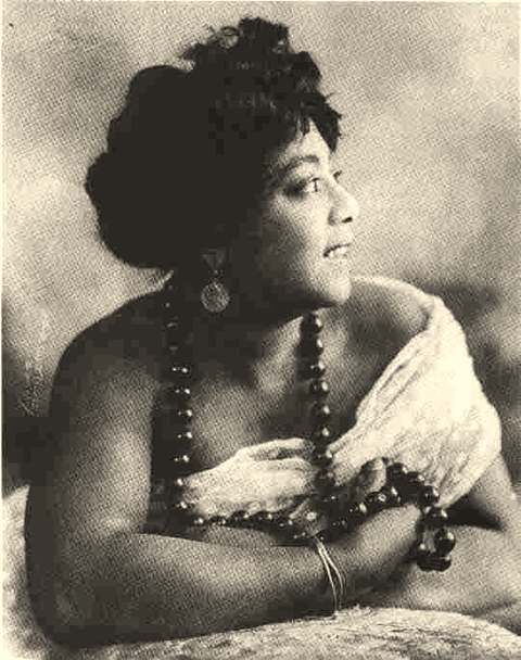 Mamie Smith1891-1946Cincinnati-born vaudeville singer whose 1920 Okeh recordings, above all 'Crazy B...
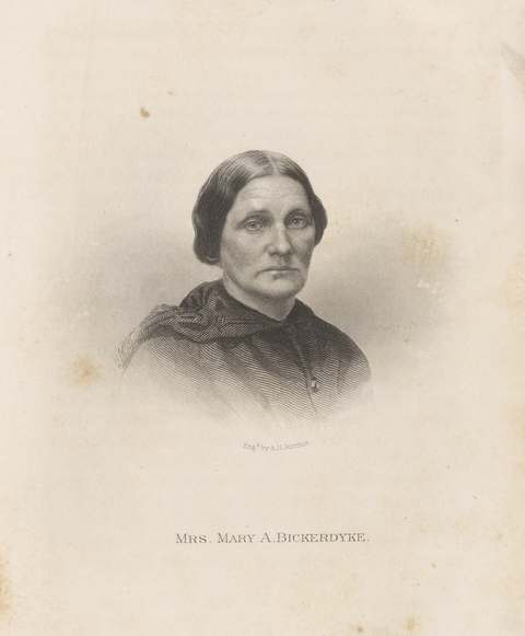 Mary Ann Bickerdyke1817-1901Knox County-born nurse and U.S. Sanitary Commission agent who ran field hospital...
 Neil Armstrong1930-2012Commander of Apollo 11 and the first person to walk on the Moon, July 20, 1969.
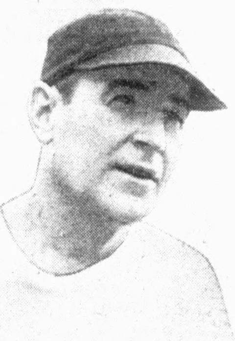 Paul Brown1908-1991Football coach who built Massillon, Ohio State, the Cleveland Browns and the Cin...
 Pete Rose1941-2024Cincinnati-born Reds star who collected a record 4,256 major league hits, accept...
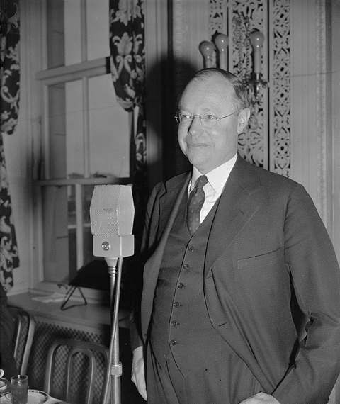 Robert A. Taft1889-1953Cincinnati lawyer and U.S. senator from Ohio (1939-1953), co-author of the Taft-...
 Roger Staubach1942-Cincinnati-born Purcell High quarterback who won the 1963 Heisman Trophy at Navy...
- RTRoger Troutman1951-1999Hamilton-born funk musician and producer who led the Dayton band Zapp with his b...
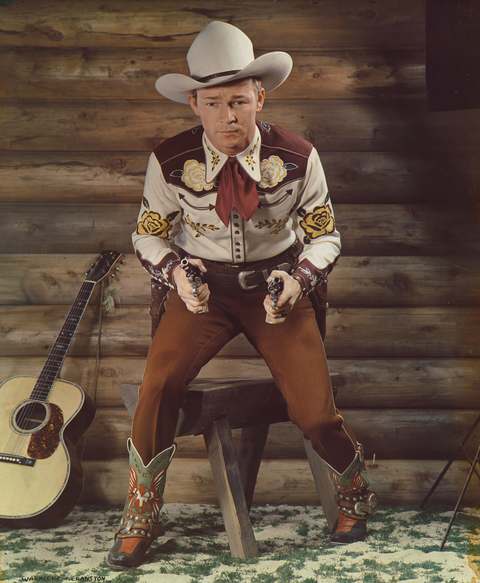 Roy Rogers1911-1998The 'King of the Cowboys': singing-cowboy film and television star with his hors...
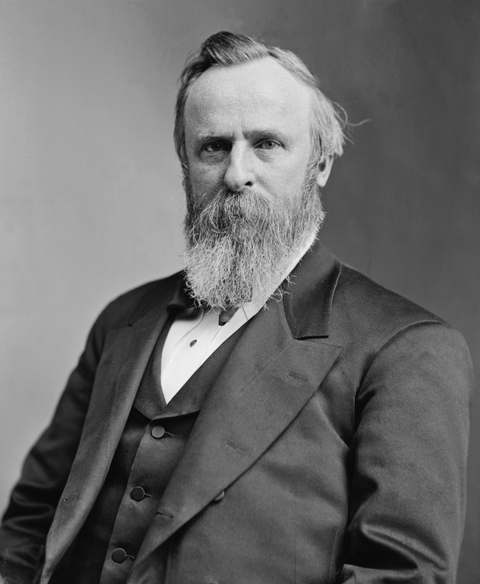 Rutherford B. Hayes1822-1893Nineteenth president, three-time governor of Ohio, and the president whose Fremo...
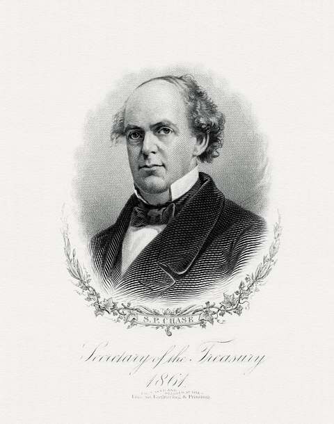 Salmon P. Chase1808-1873Cincinnati lawyer who defended freedom seekers and their helpers so often he was...
 Steven Spielberg1946-Cincinnati-born film director of Jaws, E.T., Schindler's List and Saving Private...
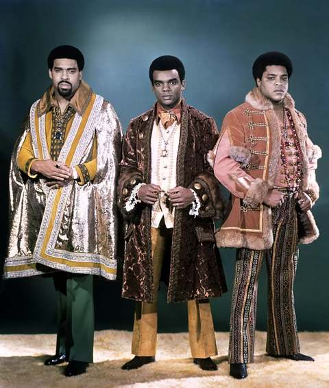 The Isley BrothersFamily vocal group from Cincinnati, begun as a gospel quartet in 1954, whose hit...
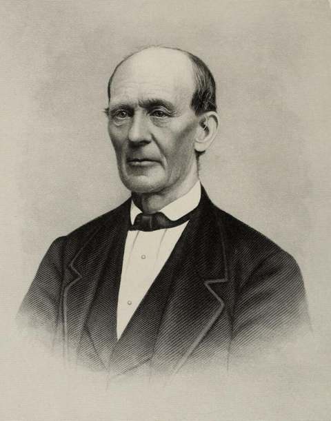 William Holmes McGuffey1800-1873Miami University professor who compiled the first McGuffey Eclectic Readers in O...
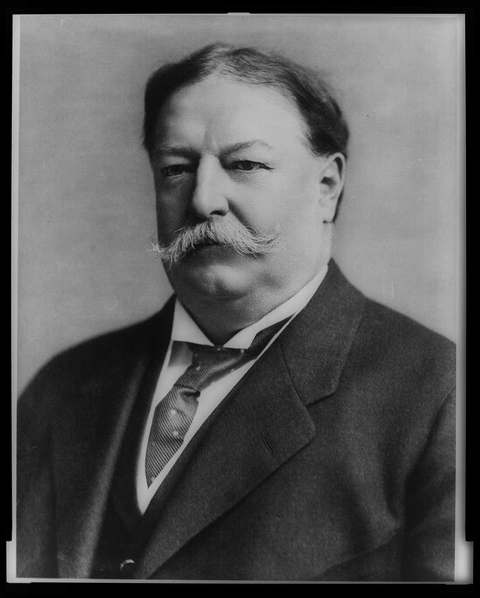 William Howard Taft1857-1930Twenty-seventh president and tenth Chief Justice of the United States, born and ...
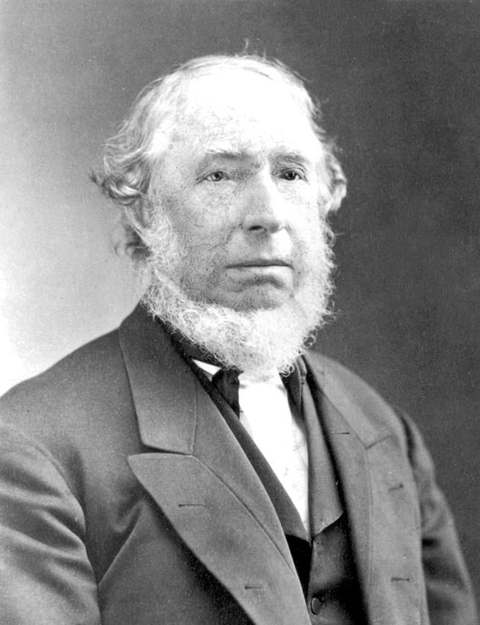 William Procter1801-1884English-born Cincinnati candlemaker who in 1837 went into partnership with his b...
History from Cincinnati
People and inventions tied to this place, each with its sources. All people · All inventions
- Aaron Burt ChampionPerson · 1842-1895
- Alexander Bonner LattaPerson · 1821-1865
- Bernard KrogerPerson · 1860-1938
- Cowboy CopasPerson · 1913-1963
- Daniel DrakePerson · 1785-1852
- Gamaliel BaileyPerson · 1807-1859
- Harley ProcterPerson · 1847-1920
- Harry WrightPerson · 1835-1895
- Henry HowePerson · 1816-1893
- Henry J. HeimlichPerson · 1920-2016
- Herman SchneiderPerson · 1872-1939
- James Norris GamblePerson · 1836-1932
- Jim TullyPerson · 1886-1947
- John A. RoeblingPerson · 1806-1869
- Joseph S. McVickerPerson
- Lyman BeecherPerson · 1775-1863
- Margaret GarnerPerson · 1833-1858
- Maria Longworth Nichols StorerPerson · 1849-1932
- Miles GreenwoodPerson
- Nicholas LongworthPerson · 1783-1863
- Noah W. McVickerPerson
- Ormsby M. MitchelPerson · 1810-1862
- Potter StewartPerson · 1915-1985
- Powel Crosley Jr.Person · 1886-1961
- Robert S. DuncansonPerson · -1872
- Ruth LyonsPerson · 1905-1988
- Stanley MatthewsPerson · 1824-1889
- Theodore Dwight WeldPerson · 1803-1895
- Tyrone PowerPerson · 1914-1958
- Victor MillsPerson · 1897-1997
- Worthington WhittredgePerson · 1820-1910
- Cincinnati Union TerminalInvention or first · 1933
- Cooperative education at the University of CincinnatiInvention or first · 1906
- Crisco shorteningInvention or first · 1911
- First major-league night gameInvention or first · 1935
- First paid steam-powered fire departmentInvention or first · 1852-1853
- First professional baseball teamInvention or first · 1869
- Heimlich maneuverInvention or first · 1974
- Hospital-based ambulance serviceInvention or first · 1865
- Ivory soapInvention or first · 1879
- John A. Roebling Suspension BridgeInvention or first · 1866-1867
- Kroger grocery chainInvention or first · 1883
- Martha, the last passenger pigeon, dies at the Cincinnati ZooInvention or first · 1914
- PampersInvention or first · 1961
- Play-DohInvention or first · 1956
- Procter & Gamble foundedInvention or first · 1837
- Rookwood PotteryInvention or first · 1880
- Sabin oral polio vaccineInvention or first · 1954-1962
- Tide detergentInvention or first · 1946
Videos about Cincinnati
Short videos we made from the old maps and records. All videos
How Cincinnati began
Cincinnati began on December 28, 1788, when a party led by Mathias Denman, Robert Patterson, and Israel Ludlow landed on the Ohio River's north bank opposite the mouth of the Licking River and laid out a town that surveyor John Filson named Losantiville. The Army built Fort Washington there in 1789 to anchor the Northwest Indian War campaigns, and in January 1790 territorial governor Arthur St. Clair renamed the settlement Cincinnati, for the Society of the Cincinnati of which he was president. It incorporated as a town in 1802 and as a city on March 1, 1819, then grew through steamboat trade, canal and rail connections, and heavy German and Irish immigration into the 19th century's "Porkopolis" and Queen City, reaching a peak population of just over 500,000 in 1950 before decades of decline and a recent uptick. Today it is Hamilton County's seat and the anchor of a three-state metropolitan area, with a downtown and riverfront still organized around the ground Denman's party chose in 1788.
Settled December 28, 1788, platted 1788 (Losantiville plat), incorporated town, January 1, 1802; city, March 1, 1819, by Mathias Denman, Robert Patterson, and Israel Ludlow, surveyed by John Filson.
Where the name comes from
The original settlement was named Losantiville by surveyor John Filson, a fanciful combination of French "ville" (city), Greek "anti" (opposite), Latin "os" (mouth), and the initial "L" for the Licking River, describing the site opposite the Licking's mouth. On January 4, 1790, Northwest Territory governor Arthur St. Clair renamed the town Cincinnati in honor of the Society of the Cincinnati, the Revolutionary War officers' organization he headed, itself named for the Roman statesman Lucius Quinctius Cincinnatus.
Before the town
No Native village, camp, or named site has been found inside the built-up city of Cincinnati itself in the sources consulted; the county-level record of prehistoric cultures, historic nations, and treaties that covered this ground includes the Symmes Purchase and the 1795 Treaty of Greenville cession under which the site was opened to the Denman party's 1788 settlement. Fort Washington, built in 1789 at the edge of the new town, staged the 1790 Harmar and 1791 St. Clair campaigns against the Miami, Shawnee, and allied nations to the north before Anthony Wayne's 1794 victory at Fallen Timbers.
Nations recorded here: Miami, Shawnee.
Timeline
- — On December 28, Mathias Denman, Robert Patterson, and Israel Ludlow's party lands opposite the mouth of the Licking River and lays out Losantiville, surveyed by John Filson.
- — The Army builds Fort Washington at the edge of the settlement under orders from General Josiah Harmar, with Major John Doughty overseeing construction, to support campaigns in the Northwest Indian War.
- — On January 4, territorial governor Arthur St. Clair renames Losantiville "Cincinnati" for the Society of the Cincinnati; the town's population is about 700.
- — Cincinnati incorporates as a town on January 1.
- — Steamboats begin operating on the Ohio River, opening fast shipping to St. Louis and New Orleans and establishing Cincinnati as a river commerce hub.
- — Cincinnati incorporates as a city on March 1.
- — The first section of the Miami and Erie Canal opens, linking Cincinnati to Middletown; the canal reaches Toledo and Lake Erie by 1840.
- — White mobs attack Black neighborhoods in a riot that drives roughly 1,200 Black residents to leave for Canada.
- — A mob of about 700 pro-slavery men attacks Black neighborhoods and destroys abolitionist James G. Birney's antislavery press.
- — Population reaches 115,435, making Cincinnati the sixth-largest city in the United States, fed by heavy German and Irish immigration.
- — The city completes the Cincinnati Southern Railway to Chattanooga, Tennessee, the only municipally owned interstate railroad in the United States (sold to Norfolk Southern in March 2024).
- — The Ohio River flood submerges low-lying Cincinnati, with water reaching about 80 feet, roughly 55 feet above normal river level; Cincinnati Union Terminal is flooded.
- — Cincinnati reaches its peak population of 503,998 before six decades of decline.
- — The census records 309,317 residents, the city's first population increase since 1950.
Stories
A daguerreotype panorama, the oldest of its kind
On the afternoon of September 24, 1848, at 1:55 p.m., Cincinnati photographers Charles Fontayne and William Southgate Porter set up along the Kentucky shore and exposed eight full-plate daguerreotypes in sequence, capturing roughly two miles of the Cincinnati riverfront in a single continuous image. The result is now recognized as the oldest surviving photographic panorama of an American city, showing steamboats lined up at the Public Landing, warehouses, church steeples, and the hillside beyond in astonishing detail, decades before roll film or the half-tone printing that would later make newspaper photography routine. The plates survived in private hands for more than a century before conservators reassembled and restored them, and they now stand as the clearest surviving record of what the young, booming river city actually looked like at mid-century, just two years before its population passed 115,000.
From frontier stockade to Queen City
The ground Cincinnati now covers was, for its first years, a fort. Fort Washington went up in 1789 at the edge of the new Losantiville settlement, a two-story log stockade with corner blockhouses large enough to garrison 1,500 men, built to stage the Army's campaigns against the Miami, Shawnee, and allied nations to the north. General Josiah Harmar's 1790 expedition marched from it and was defeated near Kekionga; Arthur St. Clair's 1791 campaign, launched from the same fort, suffered the worst defeat the United States Army ever took from Native forces; only Anthony Wayne's 1793-94 campaign, staged from Fort Washington a third time, broke the stalemate at Fallen Timbers and forced the 1795 Treaty of Greenville. With the frontier war over, the fort fell out of use, was down to about 35 soldiers by 1802, and was abandoned in 1803 in favor of Newport Barracks across the river in Kentucky. The town that outlived it took the fort's place as the region's anchor, incorporating as a city in 1819 and, riding the steamboat trade and German and Irish immigration, growing into the sixth-largest city in the United States by 1850.
Photographs
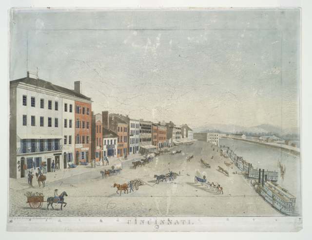
Photo: John Caspar Wild (artist), Henry R. Robinson (lithographer), public domain · Wikimedia Commons

Photo: Charles H. Fontayne and William Southgate Porter, no known copyright restrictions · Wikimedia Commons

Photo: War Department, Army Air Forces (unknown photographer), public domain · Wikimedia Commons
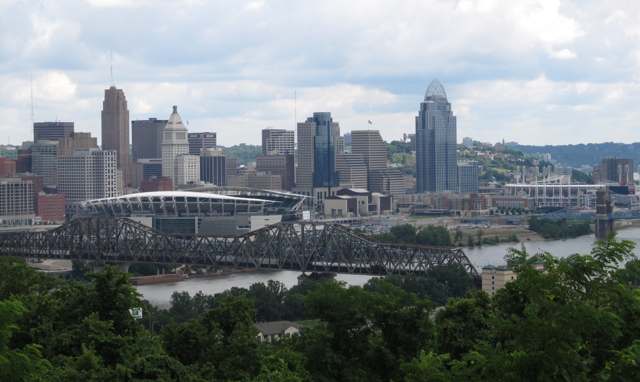
Photo: Ynsalh, CC BY-SA 4.0 · Wikimedia Commons
Local history sources: en.wikipedia.org · en.wikipedia.org · en.wikipedia.org · commons.wikimedia.org · commons.wikimedia.org · commons.wikimedia.org · commons.wikimedia.org
Historic places
238 places in Cincinnati on the National Register of Historic Places, 9 of them National Historic Landmarks. Press a pin or a name for its whole record.
-
Carew Tower LandmarkBuilding · Cincinnati · listed 1982
- Address
- W. 5th St. and Fountain Sq.
- Where
- Cincinnati, Hamilton County · ZIP 45203
- What it is
- Building
- Listed on the National Register
- 1982
- National Historic Landmark
- Yes
- NRIS reference number
- 82003578
- Coordinates
- 39.10095, -84.52516
National Register file (NPS) ↗ Search Wikipedia ↗ Street map and directions ↗ On the Cracked Buckeye map
-
Cincinnati Music Hall LandmarkBuilding · Cincinnati · listed 1970
- Address
- 1243 Elm St.
- Where
- Cincinnati, Hamilton County · ZIP 45202
- What it is
- Building
- Listed on the National Register
- 1970
- National Historic Landmark
- Yes
- NRIS reference number
- 70000496
- Coordinates
- 39.10946, -84.51897
National Register file (NPS) ↗ Search Wikipedia ↗ Street map and directions ↗ On the Cracked Buckeye map
-
Cincinnati Observatory Building LandmarkBuilding · Cincinnati · listed 1980
- Address
- Observatory Pl.
- Where
- Cincinnati, Hamilton County · ZIP 45208
- What it is
- Building
- Listed on the National Register
- 1980
- National Historic Landmark
- Yes
- NRIS reference number
- 80003043
- Coordinates
- 39.14287, -84.42264
National Register file (NPS) ↗ Search Wikipedia ↗ Street map and directions ↗ On the Cracked Buckeye map
-
Cincinnati Zoo's Historic Reptile House LandmarkBuilding · Cincinnati · listed 1987
- Address
- 3400 Vine St.
- Where
- Cincinnati, Hamilton County · ZIP 45220
- What it is
- Building
- Listed on the National Register
- 1987
- National Historic Landmark
- Yes
- NRIS reference number
- 87000905
- Coordinates
- 39.14420, -84.50917
National Register file (NPS) ↗ Search Wikipedia ↗ Street map and directions ↗ On the Cracked Buckeye map
-
MAJESTIC LandmarkStructure · Cincinnati · listed 1989
- Address
- Ohio River below Central Bridge
- Where
- Cincinnati, Hamilton County · ZIP 45202
- What it is
- Structure
- Listed on the National Register
- 1989
- National Historic Landmark
- Yes
- NRIS reference number
- 89002456
- Coordinates
- 39.09704, -84.50283
National Register file (NPS) ↗ Search Wikipedia ↗ Street map and directions ↗ On the Cracked Buckeye map
-
Pendleton, George Hunt, House LandmarkBuilding · Cincinnati · listed 1966
- Address
- 559 E. Liberty St.
- Where
- Cincinnati, Hamilton County · ZIP 45202
- What it is
- Building
- Listed on the National Register
- 1966
- National Historic Landmark
- Yes
- NRIS reference number
- 66000611
- Coordinates
- 39.11204, -84.50442
National Register file (NPS) ↗ Search Wikipedia ↗ Street map and directions ↗ On the Cracked Buckeye map
-
Plum Street Temple LandmarkBuilding · Cincinnati · listed 1972
- Address
- 8th and Plum Sts.
- Where
- Cincinnati, Hamilton County · ZIP 45202
- What it is
- Building
- Listed on the National Register
- 1972
- National Historic Landmark
- Yes
- NRIS reference number
- 72001021
- Coordinates
- 39.10377, -84.51801
National Register file (NPS) ↗ Search Wikipedia ↗ Street map and directions ↗ On the Cracked Buckeye map
-
Taft Museum LandmarkBuilding · Cincinnati · listed 1973
- Address
- 316 Pike St.
- Where
- Cincinnati, Hamilton County · ZIP 45202
- What it is
- Building
- Listed on the National Register
- 1973
- National Historic Landmark
- Yes
- NRIS reference number
- 73001470
- Coordinates
- 39.10208, -84.50289
National Register file (NPS) ↗ Search Wikipedia ↗ Street map and directions ↗ On the Cracked Buckeye map
-
William Howard Taft National Historic Site LandmarkBuilding · Cincinnati · listed 1966
- Address
- 2038 Auburn Ave.
- Where
- Cincinnati, Hamilton County · ZIP 45219
- What it is
- Building
- Listed on the National Register
- 1966
- National Historic Landmark
- Yes
- NRIS reference number
- 66000612
- Coordinates
- 39.11969, -84.50843
National Register file (NPS) ↗ Search Wikipedia ↗ Street map and directions ↗ On the Cracked Buckeye map
-
Alameda Flats, TheBuilding · Cincinnati · listed 2014
- Address
- 3580-3586 Reading Rd.
- Where
- Cincinnati, Hamilton County · ZIP 45229
- What it is
- Building
- Listed on the National Register
- 2014
- NRIS reference number
- 14000293
- Coordinates
- 39.14530, -84.48894
National Register file (NPS) ↗ Search Wikipedia ↗ Street map and directions ↗ On the Cracked Buckeye map
-
Alexandra, TheBuilding · Cincinati · listed 1997
- Address
- 921 E. William H. Taft Rd.
- Where
- Cincinati, Hamilton County · ZIP 45206
- What it is
- Building
- Listed on the National Register
- 1997
- NRIS reference number
- 97001223
- Coordinates
- 39.12703, -84.48920
National Register file (NPS) ↗ Search Wikipedia ↗ Street map and directions ↗ On the Cracked Buckeye map
-
Alkemeyer Commercial BuildingsBuilding · Cincinnati · listed 1980
- Address
- 19-23 W. Court St.
- Where
- Cincinnati, Hamilton County · ZIP 45202
- What it is
- Building
- Listed on the National Register
- 1980
- NRIS reference number
- 80003034
- Coordinates
- 39.10604, -84.51452
National Register file (NPS) ↗ Search Wikipedia ↗ Street map and directions ↗ On the Cracked Buckeye map
-
Alms and Doepke Dry Goods CompanyBuilding · Cincinnati · listed 1980
- Address
- 222 E. Central Pkwy.
- Where
- Cincinnati, Hamilton County · ZIP 45202
- What it is
- Building
- Listed on the National Register
- 1980
- NRIS reference number
- 80003035
- Coordinates
- 39.10802, -84.51035
National Register file (NPS) ↗ Search Wikipedia ↗ Street map and directions ↗ On the Cracked Buckeye map
-
Ambassador, TheBuilding · Cincinnati · listed 2014
- Address
- 722-724 Gholson Ave.
- Where
- Cincinnati, Hamilton County · ZIP 45229
- What it is
- Building
- Listed on the National Register
- 2014
- NRIS reference number
- 14000356
- Coordinates
- 39.14729, -84.48925
National Register file (NPS) ↗ Search Wikipedia ↗ Street map and directions ↗ On the Cracked Buckeye map
-
American Can Company BuildingBuilding · Cincinnati · listed 2007
- Address
- 4101 Spring Grove Ave.
- Where
- Cincinnati, Hamilton County · ZIP 45223
- What it is
- Building
- Listed on the National Register
- 2007
- NRIS reference number
- 07001092
- Coordinates
- 39.16039, -84.53709
National Register file (NPS) ↗ Search Wikipedia ↗ Street map and directions ↗ On the Cracked Buckeye map
-
Anderson FerryHistoric district · Cincinnati · listed 1982
- Address
- Off U.S. 50
- Where
- Cincinnati, Hamilton County · ZIP 45233
- What it is
- Historic district
- Listed on the National Register
- 1982
- NRIS reference number
- 82003575
- Coordinates
- 39.07652, -84.62438
National Register file (NPS) ↗ Search Wikipedia ↗ Street map and directions ↗ On the Cracked Buckeye map
-
Apostolic Bethlehem Temple ChurchBuilding · Cincinnati · listed 1973
- Address
- 1205 Elm St.
- Where
- Cincinnati, Hamilton County · ZIP 45202
- What it is
- Building
- Listed on the National Register
- 1973
- NRIS reference number
- 73001453
- Coordinates
- 39.10801, -84.51844
National Register file (NPS) ↗ Search Wikipedia ↗ Street map and directions ↗ On the Cracked Buckeye map
-
B & O Freight TerminalBuilding · Cincinnati · listed 1986
- Address
- 700 Pete Rose Way
- Where
- Cincinnati, Hamilton County · ZIP 45203
- What it is
- Building
- Listed on the National Register
- 1986
- NRIS reference number
- 86003521
- Coordinates
- 39.09561, -84.52431
National Register file (NPS) ↗ Search Wikipedia ↗ Street map and directions ↗ On the Cracked Buckeye map
-
Baker, John S., HouseBuilding · Cincinnati · listed 1979
- Address
- 1887 Madison Rd.
- Where
- Cincinnati, Hamilton County · ZIP 45206
- What it is
- Building
- Listed on the National Register
- 1979
- NRIS reference number
- 79001852
- Coordinates
- 39.12927, -84.46784
National Register file (NPS) ↗ Search Wikipedia ↗ Street map and directions ↗ On the Cracked Buckeye map
-
Balch HouseBuilding · Cincinnati · listed 1980
- Address
- 267 Greendale Ave.
- Where
- Cincinnati, Hamilton County · ZIP 45220
- What it is
- Building
- Listed on the National Register
- 1980
- NRIS reference number
- 80003036
- Coordinates
- 39.15124, -84.51762
National Register file (NPS) ↗ Search Wikipedia ↗ Street map and directions ↗ On the Cracked Buckeye map
-
Baldwin Piano Company BuildingBuilding · Cincinnati · listed 2016
- Address
- 655 Eden Park Dr.
- Where
- Cincinnati, Hamilton County · ZIP 45202
- What it is
- Building
- Listed on the National Register
- 2016
- NRIS reference number
- 16000043
- Coordinates
- 39.11473, -84.49838
National Register file (NPS) ↗ Search Wikipedia ↗ Street map and directions ↗ On the Cracked Buckeye map
-
Bates BuildingBuilding · Cincinnati · listed 1979
- Address
- 3819 Eastern Ave.
- Where
- Cincinnati, Hamilton County · ZIP 45226
- What it is
- Building
- Listed on the National Register
- 1979
- NRIS reference number
- 79002700
- Coordinates
- 39.11126, -84.43541
National Register file (NPS) ↗ Search Wikipedia ↗ Street map and directions ↗ On the Cracked Buckeye map
-
Bauer ApartmentsBuilding · Cincinnati · listed 1982
- Address
- 2015-2017 Madison Rd.
- Where
- Cincinnati, Hamilton County · ZIP 45208
- What it is
- Building
- Listed on the National Register
- 1982
- NRIS reference number
- 82001465
- Coordinates
- 39.13194, -84.46219
National Register file (NPS) ↗ Search Wikipedia ↗ Street map and directions ↗ On the Cracked Buckeye map
-
Beech Avenue HousesBuilding · Cincinnati · listed 1979
- Address
- 1120 and 1128 Beech Ave.
- Where
- Cincinnati, Hamilton County · ZIP 45205
- What it is
- Building
- Listed on the National Register
- 1979
- NRIS reference number
- 79001853
- Coordinates
- 39.11294, -84.57713
National Register file (NPS) ↗ Search Wikipedia ↗ Street map and directions ↗ On the Cracked Buckeye map
-
Bepler, August, HouseBuilding · Cincinnati · listed 1977
- Address
- 805 Tusculum Ave.
- Where
- Cincinnati, Hamilton County · ZIP 45226
- What it is
- Building
- Listed on the National Register
- 1977
- NRIS reference number
- 77001062
- Coordinates
- 39.11635, -84.42528
National Register file (NPS) ↗ Search Wikipedia ↗ Street map and directions ↗ On the Cracked Buckeye map
-
Bernheim HouseBuilding · Cincinnati · listed 1983
- Address
- 195 Greenhills Rd.
- Where
- Cincinnati, Hamilton County · ZIP 45208
- What it is
- Building
- Listed on the National Register
- 1983
- NRIS reference number
- 83001977
- Coordinates
- 39.13214, -84.44287
National Register file (NPS) ↗ Search Wikipedia ↗ Street map and directions ↗ On the Cracked Buckeye map
-
Boulter, Cedric G., and Patricia Neils, HouseBuilding · Cincinnati · listed 1999
- Address
- 1 Rawson Woods Circle
- Where
- Cincinnati, Hamilton County · ZIP 45220
- What it is
- Building
- Listed on the National Register
- 1999
- NRIS reference number
- 99000512
- Coordinates
- 39.15181, -84.52315
National Register file (NPS) ↗ Search Wikipedia ↗ Street map and directions ↗ On the Cracked Buckeye map
-
Bramble, Ayres L., HouseBuilding · Cincinnati · listed 1982
- Address
- 4416 Homer Ave.
- Where
- Cincinnati, Hamilton County · ZIP 45227
- What it is
- Building
- Listed on the National Register
- 1982
- NRIS reference number
- 82003576
- Coordinates
- 39.15183, -84.38823
National Register file (NPS) ↗ Search Wikipedia ↗ Street map and directions ↗ On the Cracked Buckeye map
-
Brittany Apartment BuildingBuilding · Cincinnati · listed 1980
- Address
- 100-104 W. 9th St.
- Where
- Cincinnati, Hamilton County · ZIP 45202
- What it is
- Building
- Listed on the National Register
- 1980
- NRIS reference number
- 80003037
- Coordinates
- 39.10525, -84.51565
National Register file (NPS) ↗ Search Wikipedia ↗ Street map and directions ↗ On the Cracked Buckeye map
-
Brunswick--Balke--Collender BuildingBuilding · Cincinnati
- Address
- 130-132 E. 6th St.
- Where
- Cincinnati, Hamilton County · ZIP 45202
- What it is
- Building
- Latest NPS certification action
- 2017
- NRIS reference number
- 100000568
- Coordinates
- 39.10311, -84.51057
National Register file (NPS) ↗ Search Wikipedia ↗ Street map and directions ↗ On the Cracked Buckeye map
-
Building at 620-622 Vine StreetBuilding · Cincinnati
- Address
- 620-622 Vine St.
- Where
- Cincinnati, Hamilton County · ZIP 45202
- What it is
- Building
- Latest NPS certification action
- 2018
- NRIS reference number
- 100002121
- Coordinates
- 39.10130, -84.51323
National Register file (NPS) ↗ Search Wikipedia ↗ Street map and directions ↗ On the Cracked Buckeye map
-
Bullerdick, Frederick E. and Catherine, HouseBuilding · Cincinnati · listed 2007
- Address
- 4321 Hamilton Ave.
- Where
- Cincinnati, Hamilton County · ZIP 45223
- What it is
- Building
- Listed on the National Register
- 2007
- NRIS reference number
- 07001295
- Coordinates
- 39.16632, -84.54145
National Register file (NPS) ↗ Search Wikipedia ↗ Street map and directions ↗ On the Cracked Buckeye map
-
Burckhardt, A. E., HouseBuilding · Cincinnati · listed 1980
- Address
- 400 Forest Ave.
- Where
- Cincinnati, Hamilton County · ZIP 45229
- What it is
- Building
- Listed on the National Register
- 1980
- NRIS reference number
- 80003038
- Coordinates
- 39.14661, -84.49938
National Register file (NPS) ↗ Search Wikipedia ↗ Street map and directions ↗ On the Cracked Buckeye map
-
Burdsal, Samuel, HouseBuilding · Cincinnati · listed 1982
- Address
- 1342 Broadway St.
- Where
- Cincinnati, Hamilton County · ZIP 45202
- What it is
- Building
- Listed on the National Register
- 1982
- NRIS reference number
- 82003577
- Coordinates
- 39.11122, -84.50840
National Register file (NPS) ↗ Search Wikipedia ↗ Street map and directions ↗ On the Cracked Buckeye map
-
Burroughs, C. H., HouseBuilding · Cincinnati · listed 1980
- Address
- 1010 Chapel St.
- Where
- Cincinnati, Hamilton County · ZIP 45206
- What it is
- Building
- Listed on the National Register
- 1980
- NRIS reference number
- 80003039
- Coordinates
- 39.13134, -84.48639
National Register file (NPS) ↗ Search Wikipedia ↗ Street map and directions ↗ On the Cracked Buckeye map
-
Calvary Episcopal Church Sunday SchoolBuilding · Cincinnati · listed 1980
- Address
- 3770 Clifton Ave.
- Where
- Cincinnati, Hamilton County · ZIP 45220
- What it is
- Building
- Listed on the National Register
- 1980
- NRIS reference number
- 80003040
- Coordinates
- 39.15232, -84.51746
National Register file (NPS) ↗ Search Wikipedia ↗ Street map and directions ↗ On the Cracked Buckeye map
-
Capt. Stone HouseBuilding · Cincinnati · listed 1980
- Address
- 405 Oak St.
- Where
- Cincinnati, Hamilton County · ZIP 45219
- What it is
- Building
- Listed on the National Register
- 1980
- NRIS reference number
- 80003041
- Coordinates
- 39.13080, -84.50145
National Register file (NPS) ↗ Search Wikipedia ↗ Street map and directions ↗ On the Cracked Buckeye map
-
Cary, Freeman Grant, Pleasant Hill AcademyBuilding · Cincinnati · listed 1999
- Address
- 5651 Hamilton Ave.
- Where
- Cincinnati, Hamilton County · ZIP 45224
- What it is
- Building
- Listed on the National Register
- 1999
- NRIS reference number
- 99000511
- Coordinates
- 39.19359, -84.55213
National Register file (NPS) ↗ Search Wikipedia ↗ Street map and directions ↗ On the Cracked Buckeye map
-
Church, John, Company BuildingBuilding · Cincinnati · listed 1994
- Address
- 14--16 E. Fourth St.
- Where
- Cincinnati, Hamilton County · ZIP 45202
- What it is
- Building
- Listed on the National Register
- 1994
- NRIS reference number
- 94000592
- Coordinates
- 39.10030, -84.51189
National Register file (NPS) ↗ Search Wikipedia ↗ Street map and directions ↗ On the Cracked Buckeye map
-
Cincinnati and Suburban Telephone Company BuildingBuilding · Cincinnati · listed 1995
- Address
- 209 W. Seventh St.
- Where
- Cincinnati, Hamilton County · ZIP 45202
- What it is
- Building
- Listed on the National Register
- 1995
- NRIS reference number
- 95000495
- Coordinates
- 39.10285, -84.51712
National Register file (NPS) ↗ Search Wikipedia ↗ Street map and directions ↗ On the Cracked Buckeye map
-
Cincinnati City HallBuilding · Cincinnati · listed 1972
- Address
- 801 Plum St.
- Where
- Cincinnati, Hamilton County · ZIP 45202
- What it is
- Building
- Listed on the National Register
- 1972
- NRIS reference number
- 72001017
- Coordinates
- 39.10425, -84.51938
National Register file (NPS) ↗ Search Wikipedia ↗ Street map and directions ↗ On the Cracked Buckeye map
-
Cincinnati Enquirer BuildingBuilding · Cincinnati · listed 1985
- Address
- 617 Vine St.
- Where
- Cincinnati, Hamilton County · ZIP 45202
- What it is
- Building
- Listed on the National Register
- 1985
- NRIS reference number
- 85002787
- Coordinates
- 39.10313, -84.51364
National Register file (NPS) ↗ Search Wikipedia ↗ Street map and directions ↗ On the Cracked Buckeye map
-
Cincinnati Gymnasium and Athletic ClubBuilding · Cincinnati · listed 1983
- Address
- 111 Shillito Pl.
- Where
- Cincinnati, Hamilton County · ZIP 45202
- What it is
- Building
- Listed on the National Register
- 1983
- NRIS reference number
- 83001978
- Coordinates
- 39.10254, -84.51528
National Register file (NPS) ↗ Search Wikipedia ↗ Street map and directions ↗ On the Cracked Buckeye map
-
Cincinnati Tennis ClubBuilding · Cincinnati · listed 1983
- Address
- Dexter and Wold Aves.
- Where
- Cincinnati, Hamilton County · ZIP 45207
- What it is
- Building
- Listed on the National Register
- 1983
- NRIS reference number
- 83001979
- Coordinates
- 39.13416, -84.46929
National Register file (NPS) ↗ Search Wikipedia ↗ Street map and directions ↗ On the Cracked Buckeye map
-
Cincinnati Work House and HospitalBuilding · Cincinnati · listed 1980
- Address
- 3208 Colerain Ave.
- Where
- Cincinnati, Hamilton County · ZIP 45225
- What it is
- Building
- Listed on the National Register
- 1980
- NRIS reference number
- 80003044
- Coordinates
- 39.14237, -84.53702
National Register file (NPS) ↗ Search Wikipedia ↗ Street map and directions ↗ On the Cracked Buckeye map
-
Clauder's PharmacyBuilding · Cincinnati · listed 1979
- Address
- 4026 Eastern Ave.
- Where
- Cincinnati, Hamilton County · ZIP 45226
- What it is
- Building
- Listed on the National Register
- 1979
- NRIS reference number
- 79002696
- Coordinates
- 39.10875, -84.43203
National Register file (NPS) ↗ Search Wikipedia ↗ Street map and directions ↗ On the Cracked Buckeye map
-
Clifton Methodist Episcopal ChurchBuilding · Cincinnati · listed 2007
- Address
- 3418 Clifton Ave.
- Where
- Cincinnati, Hamilton County · ZIP 45220
- What it is
- Building
- Listed on the National Register
- 2007
- NRIS reference number
- 07000297
- Coordinates
- 39.14432, -84.51867
National Register file (NPS) ↗ Search Wikipedia ↗ Street map and directions ↗ On the Cracked Buckeye map
-
Coca-Cola Bottling CorporationBuilding · Cincinnati · listed 1987
- Address
- 1507 Dana Ave.
- Where
- Cincinnati, Hamilton County · ZIP 45207
- What it is
- Building
- Listed on the National Register
- 1987
- NRIS reference number
- 87000985
- Coordinates
- 39.14642, -84.47382
National Register file (NPS) ↗ Search Wikipedia ↗ Street map and directions ↗ On the Cracked Buckeye map
-
College Hill Town HallBuilding · Cincinnati · listed 1978
- Address
- Belmont Ave. and Larch St.
- Where
- Cincinnati, Hamilton County · ZIP 45224
- What it is
- Building
- Listed on the National Register
- 1978
- NRIS reference number
- 78002075
- Coordinates
- 39.19372, -84.54958
National Register file (NPS) ↗ Search Wikipedia ↗ Street map and directions ↗ On the Cracked Buckeye map
-
Columbia Baptist CemeterySite · Cincinnati · listed 1979
- Address
- Northside of Wilmer Rd.
- Where
- Cincinnati, Hamilton County · ZIP 45226
- What it is
- Site
- Listed on the National Register
- 1979
- NRIS reference number
- 79002709
- Coordinates
- 39.10626, -84.42912
National Register file (NPS) ↗ Search Wikipedia ↗ Street map and directions ↗ On the Cracked Buckeye map
-
Cote BonnevilleBuilding · Cincinnati · listed 1984
- Address
- 4850 Colerain Ave.
- Where
- Cincinnati, Hamilton County · ZIP 45223
- What it is
- Building
- Listed on the National Register
- 1984
- NRIS reference number
- 84000448
- Coordinates
- 39.17024, -84.55572
National Register file (NPS) ↗ Search Wikipedia ↗ Street map and directions ↗ On the Cracked Buckeye map
-
Court Street FirehouseBuilding · Cincinnati · listed 1974
- Address
- 311 W. Court St.
- Where
- Cincinnati, Hamilton County · ZIP 45202
- What it is
- Building
- Listed on the National Register
- 1974
- NRIS reference number
- 74001510
- Coordinates
- 39.10524, -84.51935
National Register file (NPS) ↗ Search Wikipedia ↗ Street map and directions ↗ On the Cracked Buckeye map
-
Courtland FlatsBuilding · Cincinnati · listed 1984
- Address
- 117-121 E. Court St.
- Where
- Cincinnati, Hamilton County · ZIP 45202
- What it is
- Building
- Listed on the National Register
- 1984
- NRIS reference number
- 84001046
- Coordinates
- 39.10651, -84.51156
National Register file (NPS) ↗ Search Wikipedia ↗ Street map and directions ↗ On the Cracked Buckeye map
-
Covenant First Presbyterian ChurchBuilding · Cincinnati · listed 1973
- Address
- 8th and Elm Sts.
- Where
- Cincinnati, Hamilton County · ZIP 45202
- What it is
- Building
- Listed on the National Register
- 1973
- NRIS reference number
- 73001455
- Coordinates
- 39.10393, -84.51720
National Register file (NPS) ↗ Search Wikipedia ↗ Street map and directions ↗ On the Cracked Buckeye map
-
Cox, George B., HouseBuilding · Cincinnati · listed 1973
- Address
- Brookline and Jefferson Aves.
- Where
- Cincinnati, Hamilton County · ZIP 45220
- What it is
- Building
- Listed on the National Register
- 1973
- NRIS reference number
- 73001456
- Coordinates
- 39.14254, -84.51503
National Register file (NPS) ↗ Search Wikipedia ↗ Street map and directions ↗ On the Cracked Buckeye map
-
Cox, Jacob D., HouseBuilding · Cincinnati · listed 1975
- Address
- 241--243 Gilman Ave.
- Where
- Cincinnati, Hamilton County · ZIP 45219
- What it is
- Building
- Listed on the National Register
- 1975
- NRIS reference number
- 75001416
- Coordinates
- 39.12197, -84.50535
National Register file (NPS) ↗ Search Wikipedia ↗ Street map and directions ↗ On the Cracked Buckeye map
-
Crescent, TheBuilding · Cincinnati · listed 2014
- Address
- 3719 Reading Rd.
- Where
- Cincinnati, Hamilton County · ZIP 45229
- What it is
- Building
- Listed on the National Register
- 2014
- NRIS reference number
- 14000336
- Coordinates
- 39.14918, -84.48702
National Register file (NPS) ↗ Search Wikipedia ↗ Street map and directions ↗ On the Cracked Buckeye map
-
Crosley BuildingBuilding · Cincinnati · listed 2015
- Address
- 1329-1333 Arlington St.
- Where
- Cincinnati, Hamilton County · ZIP 45225
- What it is
- Building
- Listed on the National Register
- 2015
- NRIS reference number
- 15000042
- Coordinates
- 39.14311, -84.53982
National Register file (NPS) ↗ Search Wikipedia ↗ Street map and directions ↗ On the Cracked Buckeye map
-
Cummins SchoolBuilding · Cincinnati · listed 1986
- Address
- 824 Wiliam H. Taft Rd.
- Where
- Cincinnati, Hamilton County · ZIP 45206
- What it is
- Building
- Listed on the National Register
- 1986
- NRIS reference number
- 86000014
- Coordinates
- 39.12796, -84.49085
National Register file (NPS) ↗ Search Wikipedia ↗ Street map and directions ↗ On the Cracked Buckeye map
-
Cuvier Press ClubBuilding · Cincinnati · listed 1972
- Address
- 22 Garfield Pl.
- Where
- Cincinnati, Hamilton County · ZIP 45202
- What it is
- Building
- Listed on the National Register
- 1972
- NRIS reference number
- 72001019
- Coordinates
- 39.10477, -84.51451
National Register file (NPS) ↗ Search Wikipedia ↗ Street map and directions ↗ On the Cracked Buckeye map
-
Davidson, Tyler, FountainObject · Cincinnati · listed 1979
- Address
- 5th St.
- Where
- Cincinnati, Hamilton County · ZIP 45202
- What it is
- Object
- Listed on the National Register
- 1979
- NRIS reference number
- 79001854
- Coordinates
- 39.10139, -84.51208
National Register file (NPS) ↗ Search Wikipedia ↗ Street map and directions ↗ On the Cracked Buckeye map
-
Decker, Stephen, RowhouseBuilding · Cincinnati · listed 1979
- Address
- 531-541 Tusculum Ave.
- Where
- Cincinnati, Hamilton County · ZIP 45226
- What it is
- Building
- Listed on the National Register
- 1979
- NRIS reference number
- 79002693
- Coordinates
- 39.11554, -84.43341
National Register file (NPS) ↗ Search Wikipedia ↗ Street map and directions ↗ On the Cracked Buckeye map
-
Derby, H. W., BuildingBuilding · Cincinnati · listed 1980
- Address
- 300 W. 4th St.
- Where
- Cincinnati, Hamilton County · ZIP 45202
- What it is
- Building
- Listed on the National Register
- 1980
- NRIS reference number
- 80003045
- Coordinates
- 39.09934, -84.51747
National Register file (NPS) ↗ Search Wikipedia ↗ Street map and directions ↗ On the Cracked Buckeye map
-
Detmer, A. M., HouseBuilding · Cincinnati · listed 1980
- Address
- 1520 Chapel St.
- Where
- Cincinnati, Hamilton County · ZIP 45206
- What it is
- Building
- Listed on the National Register
- 1980
- NRIS reference number
- 80003046
- Coordinates
- 39.13106, -84.48004
National Register file (NPS) ↗ Search Wikipedia ↗ Street map and directions ↗ On the Cracked Buckeye map
-
Doctors' BuildingBuilding · Cincinnati · listed 1986
- Address
- 19 Garfield Pl.
- Where
- Cincinnati, Hamilton County · ZIP 45202
- What it is
- Building
- Listed on the National Register
- 1986
- NRIS reference number
- 86003317
- Coordinates
- 39.10414, -84.51453
National Register file (NPS) ↗ Search Wikipedia ↗ Street map and directions ↗ On the Cracked Buckeye map
-
Domhoff BuildingsBuilding · Cincinnati · listed 1980
- Address
- 4201-4203 Hamilton Ave. and 1604-1614 Chase Ave.
- Where
- Cincinnati, Hamilton County · ZIP 45223
- What it is
- Building
- Listed on the National Register
- 1980
- NRIS reference number
- 80003047
- Coordinates
- 39.16269, -84.53944
National Register file (NPS) ↗ Search Wikipedia ↗ Street map and directions ↗ On the Cracked Buckeye map
-
Duttenhofer BuildingBuilding · Cincinnati
- Address
- 299 E. 6th St.
- Where
- Cincinnati, Hamilton County · ZIP 45202
- What it is
- Building
- Latest NPS certification action
- 2017
- NRIS reference number
- 100001933
- Coordinates
- 39.10284, -84.50860
National Register file (NPS) ↗ Search Wikipedia ↗ Street map and directions ↗ On the Cracked Buckeye map
-
East Fourth Street Historic DistrictHistoric district · Cincinnati · listed 1988
- Address
- 123, 127, and 135--137 E. Fourth St.
- Where
- Cincinnati, Hamilton County · ZIP 45202
- What it is
- Historic district
- Listed on the National Register
- 1988
- NRIS reference number
- 88000078
- Coordinates
- 39.10215, -84.51009
National Register file (NPS) ↗ Search Wikipedia ↗ Street map and directions ↗ On the Cracked Buckeye map
-
East Walnut Hills FirehouseBuilding · Cincinnati · listed 1983
- Address
- Madison Rd. and Hackberry St.
- Where
- Cincinnati, Hamilton County · ZIP 45206
- What it is
- Building
- Listed on the National Register
- 1983
- NRIS reference number
- 83001980
- Coordinates
- 39.13013, -84.47452
National Register file (NPS) ↗ Search Wikipedia ↗ Street map and directions ↗ On the Cracked Buckeye map
-
Eastern Hills Young Men's Christian Association (YMCA)Building · Cincinnati · listed 2016
- Address
- 1228 E. McMillan St.
- Where
- Cincinnati, Hamilton County · ZIP 45206
- What it is
- Building
- Listed on the National Register
- 2016
- NRIS reference number
- 16000847
- Coordinates
- 39.12582, -84.48341
National Register file (NPS) ↗ Search Wikipedia ↗ Street map and directions ↗ On the Cracked Buckeye map
-
Eckert BuildingBuilding · Cincinnati · listed 1983
- Address
- 2600 Woodburn Ave.
- Where
- Cincinnati, Hamilton County · ZIP 45206
- What it is
- Building
- Listed on the National Register
- 1983
- NRIS reference number
- 83001981
- Coordinates
- 39.12742, -84.47832
National Register file (NPS) ↗ Search Wikipedia ↗ Street map and directions ↗ On the Cracked Buckeye map
-
Eden Park Stand PipeStructure · Cincinnati · listed 1980
- Address
- Eden Park Dr.
- Where
- Cincinnati, Hamilton County · ZIP 45206
- What it is
- Structure
- Listed on the National Register
- 1980
- NRIS reference number
- 80003048
- Coordinates
- 39.11727, -84.49013
National Register file (NPS) ↗ Search Wikipedia ↗ Street map and directions ↗ On the Cracked Buckeye map
-
Eden Park Station No. 7Building · Cincinnati · listed 1980
- Address
- 1430 Martin Dr.
- Where
- Cincinnati, Hamilton County · ZIP 45202
- What it is
- Building
- Listed on the National Register
- 1980
- NRIS reference number
- 80003049
- Coordinates
- 39.11310, -84.49109
National Register file (NPS) ↗ Search Wikipedia ↗ Street map and directions ↗ On the Cracked Buckeye map
-
EdgecliffBuilding · Cincinnati · listed 1980
- Address
- 2220 Victory Pkwy.
- Where
- Cincinnati, Hamilton County · ZIP 45206
- What it is
- Building
- Listed on the National Register
- 1980
- NRIS reference number
- 80003050
- Coordinates
- 39.12169, -84.48396
National Register file (NPS) ↗ Search Wikipedia ↗ Street map and directions ↗ On the Cracked Buckeye map
-
Eighteenth District SchoolBuilding · Cincinnati · listed 1980
- Address
- 1326 Hopple St.
- Where
- Cincinnati, Hamilton County · ZIP 45225
- What it is
- Building
- Listed on the National Register
- 1980
- NRIS reference number
- 80003051
- Coordinates
- 39.13735, -84.53824
National Register file (NPS) ↗ Search Wikipedia ↗ Street map and directions ↗ On the Cracked Buckeye map
-
Elsinore ArchStructure · Cincinnati · listed 1980
- Address
- 1700 Gilbert Ave.
- Where
- Cincinnati, Hamilton County · ZIP 45202
- What it is
- Structure
- Listed on the National Register
- 1980
- NRIS reference number
- 80003052
- Coordinates
- 39.11507, -84.49948
National Register file (NPS) ↗ Search Wikipedia ↗ Street map and directions ↗ On the Cracked Buckeye map
-
Episcopal Church of the ResurrectionBuilding · Cincinnati · listed 1977
- Address
- 7346--48 Kirkwood La.
- Where
- Cincinnati, Hamilton County · ZIP 45233
- What it is
- Building
- Listed on the National Register
- 1977
- NRIS reference number
- 77001064
- Coordinates
- 39.12675, -84.70274
National Register file (NPS) ↗ Search Wikipedia ↗ Street map and directions ↗ On the Cracked Buckeye map
-
Fairview Public School AnnexBuilding · Cincinnati · listed 2010
- Address
- 255 Warner St and 2232 Stratford Ave
- Where
- Cincinnati, Hamilton County · ZIP 45219
- What it is
- Building
- Listed on the National Register
- 2010
- NRIS reference number
- 10000756
- Coordinates
- 39.12427, -84.52280
National Register file (NPS) ↗ Search Wikipedia ↗ Street map and directions ↗ On the Cracked Buckeye map
-
Fenwick Club AnnexBuilding · Cincinnati · listed 1973
- Address
- 426 E. 5th St.
- Where
- Cincinnati, Hamilton County · ZIP 45202
- What it is
- Building
- Listed on the National Register
- 1973
- NRIS reference number
- 73001458
- Coordinates
- 39.10251, -84.50568
National Register file (NPS) ↗ Search Wikipedia ↗ Street map and directions ↗ On the Cracked Buckeye map
-
Field, Walter, HouseBuilding · Cincinnati · listed 1980
- Address
- 3725 Reading Rd.
- Where
- Cincinnati, Hamilton County · ZIP 45229
- What it is
- Building
- Listed on the National Register
- 1980
- NRIS reference number
- 80003053
- Coordinates
- 39.15112, -84.48661
National Register file (NPS) ↗ Search Wikipedia ↗ Street map and directions ↗ On the Cracked Buckeye map
-
Findlay Market BuildingBuilding · Cincinnati · listed 1972
- Address
- Esplanade at Elder St., between Elm and Race Sts.
- Where
- Cincinnati, Hamilton County · ZIP 45202
- What it is
- Building
- Listed on the National Register
- 1972
- NRIS reference number
- 72001020
- Coordinates
- 39.11532, -84.51899
National Register file (NPS) ↗ Search Wikipedia ↗ Street map and directions ↗ On the Cracked Buckeye map
-
First Congregational-Unitarian ChurchBuilding · Cincinnati · listed 1976
- Address
- 2901 Reading Rd.
- Where
- Cincinnati, Hamilton County · ZIP 45219
- What it is
- Building
- Listed on the National Register
- 1976
- NRIS reference number
- 76001434
- Coordinates
- 39.13190, -84.49805
National Register file (NPS) ↗ Search Wikipedia ↗ Street map and directions ↗ On the Cracked Buckeye map
-
First German Methodist Episcopal ChurchBuilding · Cincinnati · listed 1980
- Address
- 1310 Race St.
- Where
- Cincinnati, Hamilton County · ZIP 45202
- What it is
- Building
- Listed on the National Register
- 1980
- NRIS reference number
- 80003054
- Coordinates
- 39.10977, -84.51630
National Register file (NPS) ↗ Search Wikipedia ↗ Street map and directions ↗ On the Cracked Buckeye map
-
First National Bank BuildingBuilding · Cincinnati
- Address
- 105 E. 4th St.
- Where
- Cincinnati, Hamilton County · ZIP 45202
- What it is
- Building
- Latest NPS certification action
- 2017
- NRIS reference number
- 100000570
- Coordinates
- 39.09994, -84.51051
National Register file (NPS) ↗ Search Wikipedia ↗ Street map and directions ↗ On the Cracked Buckeye map
-
First Universalist ChurchBuilding · Cincinnati · listed 1980
- Address
- 2600 Essex Pl.
- Where
- Cincinnati, Hamilton County · ZIP 45206
- What it is
- Building
- Listed on the National Register
- 1980
- NRIS reference number
- 80003055
- Coordinates
- 39.12707, -84.49522
National Register file (NPS) ↗ Search Wikipedia ↗ Street map and directions ↗ On the Cracked Buckeye map
-
Ford Motor Company Cincinnati PlantBuilding · Cincinnati · listed 1989
- Address
- 660 Lincoln Ave.
- Where
- Cincinnati, Hamilton County · ZIP 45206
- What it is
- Building
- Listed on the National Register
- 1989
- NRIS reference number
- 89000460
- Coordinates
- 39.13297, -84.49327
National Register file (NPS) ↗ Search Wikipedia ↗ Street map and directions ↗ On the Cracked Buckeye map
-
Freund--Heintz HouseBuilding · Cincinnati · listed 2003
- Address
- 3332 Whitfiled Ave.
- Where
- Cincinnati, Hamilton County · ZIP 45220
- What it is
- Building
- Listed on the National Register
- 2003
- NRIS reference number
- 03000806
- Coordinates
- 39.14326, -84.52380
National Register file (NPS) ↗ Search Wikipedia ↗ Street map and directions ↗ On the Cracked Buckeye map
-
Friedlander, Abraham J., HouseBuilding · Cincinnati · listed 1979
- Address
- 8 W. 9th St.
- Where
- Cincinnati, Hamilton County · ZIP 45202
- What it is
- Building
- Listed on the National Register
- 1979
- NRIS reference number
- 79001855
- Coordinates
- 39.10549, -84.51414
National Register file (NPS) ↗ Search Wikipedia ↗ Street map and directions ↗ On the Cracked Buckeye map
-
Fulton-Presbyterian CemeterySite · Cincinnati · listed 1979
- Address
- Carrel St.
- Where
- Cincinnati, Hamilton County · ZIP 45226
- What it is
- Site
- Listed on the National Register
- 1979
- NRIS reference number
- 79002706
- Coordinates
- 39.10679, -84.43303
National Register file (NPS) ↗ Search Wikipedia ↗ Street map and directions ↗ On the Cracked Buckeye map
-
General Hospital Nurses' HomeBuilding · Cincinnati · listed 2005
- Address
- 311 Albert Sabin Way
- Where
- Cincinnati, Hamilton County · ZIP 45267
- What it is
- Building
- Listed on the National Register
- 2005
- NRIS reference number
- 05000581
- Coordinates
- 39.13908, -84.50240
National Register file (NPS) ↗ Search Wikipedia ↗ Street map and directions ↗ On the Cracked Buckeye map
-
German Evangelical Protestant Cemetery ChapelBuilding · Cincinnati · listed 2008
- Address
- 3701 Vine St.
- Where
- Cincinnati, Hamilton County · ZIP 45217
- What it is
- Building
- Listed on the National Register
- 2008
- NRIS reference number
- 08000115
- Coordinates
- 39.15601, -84.50882
National Register file (NPS) ↗ Search Wikipedia ↗ Street map and directions ↗ On the Cracked Buckeye map
-
Gerrard, Stephen A., MansionBuilding · Cincinnati · listed 1987
- Address
- 748 Betula Ave.
- Where
- Cincinnati, Hamilton County · ZIP 45229
- What it is
- Building
- Listed on the National Register
- 1987
- NRIS reference number
- 87001940
- Coordinates
- 39.16101, -84.48591
National Register file (NPS) ↗ Search Wikipedia ↗ Street map and directions ↗ On the Cracked Buckeye map
-
Gilbert RowBuilding · Cincinnati · listed 1982
- Address
- 2152-2166 Gilbert Ave.
- Where
- Cincinnati, Hamilton County · ZIP 45206
- What it is
- Building
- Listed on the National Register
- 1982
- NRIS reference number
- 82003579
- Coordinates
- 39.12010, -84.49408
National Register file (NPS) ↗ Search Wikipedia ↗ Street map and directions ↗ On the Cracked Buckeye map
-
Glencoe-Auburn Hotel and Clecoe-Auburn Place Row HousesHistoric district · Cincinnati · listed 2003
- Address
- Glencoe Place, Leroy Court, View Court
- Where
- Cincinnati, Hamilton County · ZIP 45219
- What it is
- Historic district
- Listed on the National Register
- 2003
- NRIS reference number
- 03001286
- Coordinates
- 39.12288, -84.51017
National Register file (NPS) ↗ Search Wikipedia ↗ Street map and directions ↗ On the Cracked Buckeye map
-
Goldsmith, Moses, BuildingBuilding · Cincinnati · listed 1982
- Address
- 356 Bryant
- Where
- Cincinnati, Hamilton County · ZIP 45220
- What it is
- Building
- Listed on the National Register
- 1982
- NRIS reference number
- 82003580
- Coordinates
- 39.14583, -84.52163
National Register file (NPS) ↗ Search Wikipedia ↗ Street map and directions ↗ On the Cracked Buckeye map
-
Goodall BuildingBuilding · Cincinnati · listed 1984
- Address
- 324 W. 9th St.
- Where
- Cincinnati, Hamilton County · ZIP 45202
- What it is
- Building
- Listed on the National Register
- 1984
- NRIS reference number
- 84003710
- Coordinates
- 39.10471, -84.51983
National Register file (NPS) ↗ Search Wikipedia ↗ Street map and directions ↗ On the Cracked Buckeye map
-
Goshorn, Sir Alfred T., HouseBuilding · Cincinnati · listed 1973
- Address
- 3540 Clifton Ave.
- Where
- Cincinnati, Hamilton County · ZIP 45220
- What it is
- Building
- Listed on the National Register
- 1973
- NRIS reference number
- 73001459
- Coordinates
- 39.14720, -84.51834
National Register file (NPS) ↗ Search Wikipedia ↗ Street map and directions ↗ On the Cracked Buckeye map
-
Grace ChurchBuilding · Cincinnati · listed 1982
- Address
- 3626 Reading Rd.
- Where
- Cincinnati, Hamilton County · ZIP 45229
- What it is
- Building
- Listed on the National Register
- 1982
- NRIS reference number
- 82003581
- Coordinates
- 39.14816, -84.48724
National Register file (NPS) ↗ Search Wikipedia ↗ Street map and directions ↗ On the Cracked Buckeye map
-
Gruen Watch Company--Time HillBuilding · Cincinnati · listed 1996
- Address
- 401 E. McMillan St.
- Where
- Cincinnati, Hamilton County · ZIP 45202
- What it is
- Building
- Listed on the National Register
- 1996
- NRIS reference number
- 96000219
- Coordinates
- 39.12585, -84.50174
National Register file (NPS) ↗ Search Wikipedia ↗ Street map and directions ↗ On the Cracked Buckeye map
-
Gwynne BuildingBuilding · Cincinnati · listed 1979
- Address
- 6th and Main Sts
- Where
- Cincinnati, Hamilton County · ZIP 45202
- What it is
- Building
- Listed on the National Register
- 1979
- NRIS reference number
- 79001856
- Coordinates
- 39.10314, -84.50982
National Register file (NPS) ↗ Search Wikipedia ↗ Street map and directions ↗ On the Cracked Buckeye map
-
Haddon HallBuilding · Cincinnati · listed 1982
- Address
- 3418 Reading Rd.
- Where
- Cincinnati, Hamilton County · ZIP 45229
- What it is
- Building
- Listed on the National Register
- 1982
- NRIS reference number
- 82003582
- Coordinates
- 39.14168, -84.49215
National Register file (NPS) ↗ Search Wikipedia ↗ Street map and directions ↗ On the Cracked Buckeye map
-
Hamilton County Memorial BuildingBuilding · Cincinnati · listed 1978
- Address
- Elm and Grant Sts.
- Where
- Cincinnati, Hamilton County · ZIP 45202
- What it is
- Building
- Listed on the National Register
- 1978
- NRIS reference number
- 78002076
- Coordinates
- 39.10864, -84.51830
National Register file (NPS) ↗ Search Wikipedia ↗ Street map and directions ↗ On the Cracked Buckeye map
-
Hannaford, Samuel, HouseBuilding · Cincinnati · listed 1980
- Address
- 768 Derby Ave.
- Where
- Cincinnati, Hamilton County · ZIP 45232
- What it is
- Building
- Listed on the National Register
- 1980
- NRIS reference number
- 80003056
- Coordinates
- 39.17154, -84.51910
National Register file (NPS) ↗ Search Wikipedia ↗ Street map and directions ↗ On the Cracked Buckeye map
-
Hart, Edward, HouseBuilding · Cincinnati
- Address
- 818 Glenwood Ave.
- Where
- Cincinnati, Hamilton County · ZIP 45229
- What it is
- Building
- Latest NPS certification action
- 2023
- NRIS reference number
- 100008694
- Coordinates
- 39.14785, -84.48805
National Register file (NPS) ↗ Search Wikipedia ↗ Street map and directions ↗ On the Cracked Buckeye map
-
Hatch, George, HouseBuilding · Cincinnati · listed 2008
- Address
- 830 Dayton St
- Where
- Cincinnati, Hamilton County · ZIP 45214
- What it is
- Building
- Listed on the National Register
- 2008
- NRIS reference number
- 08000583
- Coordinates
- 39.11841, -84.52812
National Register file (NPS) ↗ Search Wikipedia ↗ Street map and directions ↗ On the Cracked Buckeye map
-
Hemann, Joseph A., HouseBuilding · Cincinnati · listed 1980
- Address
- 49 W. McMillan St.
- Where
- Cincinnati, Hamilton County · ZIP 45219
- What it is
- Building
- Listed on the National Register
- 1980
- NRIS reference number
- 80003057
- Coordinates
- 39.12738, -84.51406
National Register file (NPS) ↗ Search Wikipedia ↗ Street map and directions ↗ On the Cracked Buckeye map
-
Hewson-Gutting HouseBuilding · Cincinnati · listed 1979
- Address
- 515 Lafayette Ave.
- Where
- Cincinnati, Hamilton County · ZIP 45220
- What it is
- Building
- Listed on the National Register
- 1979
- NRIS reference number
- 79001857
- Coordinates
- 39.15491, -84.52501
National Register file (NPS) ↗ Search Wikipedia ↗ Street map and directions ↗ On the Cracked Buckeye map
-
Hoadley, George, Jr., HouseBuilding · Cincinnati · listed 1990
- Address
- 2337 Grandin Rd.
- Where
- Cincinnati, Hamilton County · ZIP 45208
- What it is
- Building
- Listed on the National Register
- 1990
- NRIS reference number
- 90000380
- Coordinates
- 39.12821, -84.45261
National Register file (NPS) ↗ Search Wikipedia ↗ Street map and directions ↗ On the Cracked Buckeye map
-
Hoffner Historic DistrictHistoric district · Cincinnati · listed 1978
- Address
- Bounded by Bluerock, Moline Court, Langland, and Hamilton Aves.
- Where
- Cincinnati, Hamilton County · ZIP 45223
- What it is
- Historic district
- Listed on the National Register
- 1978
- NRIS reference number
- 78002077
- Coordinates
- 39.16053, -84.53939
National Register file (NPS) ↗ Search Wikipedia ↗ Street map and directions ↗ On the Cracked Buckeye map
-
Hoodin BuildingBuilding · Cincinnati · listed 1979
- Address
- 3719-3725 Eastern Ave.
- Where
- Cincinnati, Hamilton County · ZIP 45226
- What it is
- Building
- Listed on the National Register
- 1979
- NRIS reference number
- 79002708
- Coordinates
- 39.11144, -84.43564
National Register file (NPS) ↗ Search Wikipedia ↗ Street map and directions ↗ On the Cracked Buckeye map
-
Hooper BuildingBuilding · Cincinnati · listed 1980
- Address
- 139-151 W. 4th St.
- Where
- Cincinnati, Hamilton County · ZIP 45202
- What it is
- Building
- Listed on the National Register
- 1980
- NRIS reference number
- 80003058
- Coordinates
- 39.09930, -84.51551
National Register file (NPS) ↗ Search Wikipedia ↗ Street map and directions ↗ On the Cracked Buckeye map
-
Hotel MetropoleBuilding · Cincinnati · listed 2009
- Address
- 609 Walnut St.
- Where
- Cincinnati, Hamilton County · ZIP 45202
- What it is
- Building
- Listed on the National Register
- 2009
- NRIS reference number
- 09000443
- Coordinates
- 39.10304, -84.51209
National Register file (NPS) ↗ Search Wikipedia ↗ Street map and directions ↗ On the Cracked Buckeye map
-
Houston HouseBuilding · Cincinnati · listed 1979
- Address
- 3708 Mead Ave.
- Where
- Cincinnati, Hamilton County · ZIP 45226
- What it is
- Building
- Listed on the National Register
- 1979
- NRIS reference number
- 79002704
- Coordinates
- 39.11276, -84.43825
National Register file (NPS) ↗ Search Wikipedia ↗ Street map and directions ↗ On the Cracked Buckeye map
-
Hulbert House and McAlpin Bridal CottageBuilding · Cincinnati · listed 1982
- Address
- 333 and 341 Lafayette Ave.
- Where
- Cincinnati, Hamilton County · ZIP 45220
- What it is
- Building
- Listed on the National Register
- 1982
- NRIS reference number
- 82003583
- Coordinates
- 39.15615, -84.51999
National Register file (NPS) ↗ Search Wikipedia ↗ Street map and directions ↗ On the Cracked Buckeye map
-
Hummel, George, HouseBuilding · Cincinnati · listed 1980
- Address
- 3423 Whitfield Ave.
- Where
- Cincinnati, Hamilton County · ZIP 45220
- What it is
- Building
- Listed on the National Register
- 1980
- NRIS reference number
- 80003059
- Coordinates
- 39.14530, -84.52228
National Register file (NPS) ↗ Search Wikipedia ↗ Street map and directions ↗ On the Cracked Buckeye map
-
Hyde Park Methodist Episcopal ChurchBuilding · Cincinnati · listed 2009
- Address
- 1345 Grace Ave.
- Where
- Cincinnati, Hamilton County · ZIP 45208
- What it is
- Building
- Listed on the National Register
- 2009
- NRIS reference number
- 08001294
- Coordinates
- 39.13648, -84.43244
National Register file (NPS) ↗ Search Wikipedia ↗ Street map and directions ↗ On the Cracked Buckeye map
-
Ida Street ViaductStructure · Cincinnati · listed 1980
- Address
- Ida St. between Monastery and Paradrome Sts.
- Where
- Cincinnati, Hamilton County · ZIP 45202
- What it is
- Structure
- Listed on the National Register
- 1980
- NRIS reference number
- 80003060
- Coordinates
- 39.10543, -84.49448
National Register file (NPS) ↗ Search Wikipedia ↗ Street map and directions ↗ On the Cracked Buckeye map
-
Ingalls BuildingBuilding · Cincinnati · listed 1975
- Address
- 6 E. 4th St.
- Where
- Cincinnati, Hamilton County · ZIP 45202
- What it is
- Building
- Listed on the National Register
- 1975
- NRIS reference number
- 75001418
- Coordinates
- 39.09533, -84.50675
National Register file (NPS) ↗ Search Wikipedia ↗ Street map and directions ↗ On the Cracked Buckeye map
-
Kellogg HouseBuilding · Cincinnati · listed 1979
- Address
- 3807 Eastern Ave.
- Where
- Cincinnati, Hamilton County · ZIP 45226
- What it is
- Building
- Listed on the National Register
- 1979
- NRIS reference number
- 79002702
- Coordinates
- 39.11144, -84.43564
National Register file (NPS) ↗ Search Wikipedia ↗ Street map and directions ↗ On the Cracked Buckeye map
-
Kestler BuildingBuilding · Cincinnati · listed 1979
- Address
- 4024 Eastern Ave.
- Where
- Cincinnati, Hamilton County · ZIP 45226
- What it is
- Building
- Listed on the National Register
- 1979
- NRIS reference number
- 79002695
- Coordinates
- 39.10884, -84.43215
National Register file (NPS) ↗ Search Wikipedia ↗ Street map and directions ↗ On the Cracked Buckeye map
-
King Records Studio BuildingsBuilding · Cincinnati
- Address
- 1536-1540 Brewster Ave.
- Where
- Cincinnati, Hamilton County · ZIP 45207
- What it is
- Building
- Latest NPS certification action
- 2022
- NRIS reference number
- 100008067
- Coordinates
- 39.14457, -84.47634
National Register file (NPS) ↗ Search Wikipedia ↗ Street map and directions ↗ On the Cracked Buckeye map
-
Kinsey, TheBuilding · Cincinnati · listed 2013
- Address
- 2415 Maplewood Ave.
- Where
- Cincinnati, Hamilton County · ZIP 45219
- What it is
- Building
- Listed on the National Register
- 2013
- NRIS reference number
- 13000937
- Coordinates
- 39.12512, -84.50500
National Register file (NPS) ↗ Search Wikipedia ↗ Street map and directions ↗ On the Cracked Buckeye map
-
Kirby Road SchoolBuilding · Cincinnati · listed 2013
- Address
- 1710 Bruce Avenue Rd.
- Where
- Cincinnati, Hamilton County · ZIP 45223
- What it is
- Building
- Listed on the National Register
- 2013
- NRIS reference number
- 13000681
- Coordinates
- 39.16761, -84.54583
National Register file (NPS) ↗ Search Wikipedia ↗ Street map and directions ↗ On the Cracked Buckeye map
-
Krippendorf-Dittman CompanyBuilding · Cincinnati · listed 1980
- Address
- 628 Sycamore St.
- Where
- Cincinnati, Hamilton County · ZIP 45202
- What it is
- Building
- Listed on the National Register
- 1980
- NRIS reference number
- 80003061
- Coordinates
- 39.10392, -84.50818
National Register file (NPS) ↗ Search Wikipedia ↗ Street map and directions ↗ On the Cracked Buckeye map
-
Krumberg, Theodore, BuildingBuilding · Cincinnati · listed 1982
- Address
- 1201 Main St.
- Where
- Cincinnati, Hamilton County · ZIP 45202
- What it is
- Building
- Listed on the National Register
- 1982
- NRIS reference number
- 82001467
- Coordinates
- 39.10886, -84.51159
National Register file (NPS) ↗ Search Wikipedia ↗ Street map and directions ↗ On the Cracked Buckeye map
-
La Tosca FlatsBuilding · Cincinnati · listed 1999
- Address
- 2700 Observatory Ave.
- Where
- Cincinnati, Hamilton County · ZIP 45208
- What it is
- Building
- Listed on the National Register
- 1999
- NRIS reference number
- 99000096
- Coordinates
- 39.13808, -84.44254
National Register file (NPS) ↗ Search Wikipedia ↗ Street map and directions ↗ On the Cracked Buckeye map
-
Landt BuildingBuilding · Cincinnati · listed 1979
- Address
- 3815-3817 Eastern Ave.
- Where
- Cincinnati, Hamilton County · ZIP 45226
- What it is
- Building
- Listed on the National Register
- 1979
- NRIS reference number
- 79002703
- Coordinates
- 39.11135, -84.43552
National Register file (NPS) ↗ Search Wikipedia ↗ Street map and directions ↗ On the Cracked Buckeye map
-
Langdon HouseBuilding · Cincinnati · listed 1969
- Address
- 3626 Eastern Ave.
- Where
- Cincinnati, Hamilton County · ZIP 45226
- What it is
- Building
- Listed on the National Register
- 1969
- NRIS reference number
- 69000143
- Coordinates
- 39.11360, -84.43761
National Register file (NPS) ↗ Search Wikipedia ↗ Street map and directions ↗ On the Cracked Buckeye map
-
Levy, Harry Milton, HouseBuilding · Cincinnati · listed 1998
- Address
- 2383 Observatory Ave.
- Where
- Cincinnati, Hamilton County · ZIP 45208
- What it is
- Building
- Listed on the National Register
- 1998
- NRIS reference number
- 98000040
- Coordinates
- 39.13808, -84.45457
National Register file (NPS) ↗ Search Wikipedia ↗ Street map and directions ↗ On the Cracked Buckeye map
-
LillybanksBuilding · Cincinnati · listed 1983
- Address
- 2386 Grandin Rd.
- Where
- Cincinnati, Hamilton County · ZIP 45208
- What it is
- Building
- Listed on the National Register
- 1983
- NRIS reference number
- 83001982
- Coordinates
- 39.12797, -84.44961
National Register file (NPS) ↗ Search Wikipedia ↗ Street map and directions ↗ On the Cracked Buckeye map
-
Lloyd, John Uri, HouseBuilding · Cincinnati · listed 1973
- Address
- 3901 Clifton Ave.
- Where
- Cincinnati, Hamilton County · ZIP 45220
- What it is
- Building
- Listed on the National Register
- 1973
- NRIS reference number
- 73001461
- Coordinates
- 39.15727, -84.51752
National Register file (NPS) ↗ Search Wikipedia ↗ Street map and directions ↗ On the Cracked Buckeye map
-
Lombardy Apartment BuildingBuilding · Cincinnati · listed 1980
- Address
- 318-326 W. 4th St.
- Where
- Cincinnati, Hamilton County · ZIP 45202
- What it is
- Building
- Listed on the National Register
- 1980
- NRIS reference number
- 80003062
- Coordinates
- 39.09917, -84.51806
National Register file (NPS) ↗ Search Wikipedia ↗ Street map and directions ↗ On the Cracked Buckeye map
-
Lowrie, S. Gale and Agnes P., HouseBuilding · Cincinnati
- Address
- 20 Rawson Woods Cir.
- Where
- Cincinnati, Hamilton County · ZIP 45220
- What it is
- Building
- Latest NPS certification action
- 2017
- NRIS reference number
- 100000666
- Coordinates
- 39.15035, -84.52264
National Register file (NPS) ↗ Search Wikipedia ↗ Street map and directions ↗ On the Cracked Buckeye map
-
LuNeack HouseBuilding · Cincinnati · listed 1979
- Address
- 3718 Mead Ave.
- Where
- Cincinnati, Hamilton County · ZIP 45226
- What it is
- Building
- Listed on the National Register
- 1979
- NRIS reference number
- 79002705
- Coordinates
- 39.11249, -84.43814
National Register file (NPS) ↗ Search Wikipedia ↗ Street map and directions ↗ On the Cracked Buckeye map
-
Lunkenheimer, Frederick, HouseBuilding · Cincinnati · listed 1985
- Address
- 2133 Luray
- Where
- Cincinnati, Hamilton County · ZIP 45206
- What it is
- Building
- Listed on the National Register
- 1985
- NRIS reference number
- 85001690
- Coordinates
- 39.11881, -84.48834
National Register file (NPS) ↗ Search Wikipedia ↗ Street map and directions ↗ On the Cracked Buckeye map
-
Madam Fredin's Eden Park School and Neighboring Row HouseBuilding · Cincinnati · listed 1979
- Address
- 938--946 Morris St. and 922--932 Morris St.
- Where
- Cincinnati, Hamilton County · ZIP 45206
- What it is
- Building
- Listed on the National Register
- 1979
- NRIS reference number
- 79001858
- Coordinates
- 39.11867, -84.49447
National Register file (NPS) ↗ Search Wikipedia ↗ Street map and directions ↗ On the Cracked Buckeye map
-
Mardot Antique ShopBuilding · Cincinnati · listed 1979
- Address
- 3964 Eastern Ave.
- Where
- Cincinnati, Hamilton County · ZIP 45226
- What it is
- Building
- Listed on the National Register
- 1979
- NRIS reference number
- 79002698
- Coordinates
- 39.10912, -84.43248
National Register file (NPS) ↗ Search Wikipedia ↗ Street map and directions ↗ On the Cracked Buckeye map
-
Masonic Temple Price Hill Lodge, No. 524Building · Cincinnati
- Address
- 3301 Price Ave.
- Where
- Cincinnati, Hamilton County · ZIP 45205
- What it is
- Building
- Latest NPS certification action
- 2017
- NRIS reference number
- 100001269
- Coordinates
- 39.10692, -84.56479
National Register file (NPS) ↗ Search Wikipedia ↗ Street map and directions ↗ On the Cracked Buckeye map
-
May, David and Mary, HouseBuilding · Cincinnati · listed 1996
- Address
- 3723 Washington Ave.
- Where
- Cincinnati, Hamilton County · ZIP 45229
- What it is
- Building
- Listed on the National Register
- 1996
- NRIS reference number
- 96000931
- Coordinates
- 39.15209, -84.49445
National Register file (NPS) ↗ Search Wikipedia ↗ Street map and directions ↗ On the Cracked Buckeye map
-
Mayer, S. C., HouseBuilding · Cincinnati · listed 1980
- Address
- 1614 Main St.
- Where
- Cincinnati, Hamilton County · ZIP 45202
- What it is
- Building
- Listed on the National Register
- 1980
- NRIS reference number
- 80003063
- Coordinates
- 39.11328, -84.51213
National Register file (NPS) ↗ Search Wikipedia ↗ Street map and directions ↗ On the Cracked Buckeye map
-
McKinley SchoolBuilding · Cincinnati · listed 1979
- Address
- 3905 Eastern Ave.
- Where
- Cincinnati, Hamilton County · ZIP 45226
- What it is
- Building
- Listed on the National Register
- 1979
- NRIS reference number
- 79002697
- Coordinates
- 39.10979, -84.43419
National Register file (NPS) ↗ Search Wikipedia ↗ Street map and directions ↗ On the Cracked Buckeye map
-
Mecklenburg's GardenBuilding · Cincinnati · listed 1976
- Address
- 302 E. University Ave.
- Where
- Cincinnati, Hamilton County · ZIP 45219
- What it is
- Building
- Listed on the National Register
- 1976
- NRIS reference number
- 76001436
- Coordinates
- 39.13254, -84.50266
National Register file (NPS) ↗ Search Wikipedia ↗ Street map and directions ↗ On the Cracked Buckeye map
-
Melbourne FlatsBuilding · Cincinnati · listed 1984
- Address
- 39 W. McMillan St.
- Where
- Cincinnati, Hamilton County · ZIP 45219
- What it is
- Building
- Listed on the National Register
- 1984
- NRIS reference number
- 84000132
- Coordinates
- 39.12754, -84.51325
National Register file (NPS) ↗ Search Wikipedia ↗ Street map and directions ↗ On the Cracked Buckeye map
-
Miller, Charles A., HouseBuilding · Cincinnati · listed 1980
- Address
- 1817 Chase St.
- Where
- Cincinnati, Hamilton County · ZIP 45223
- What it is
- Building
- Listed on the National Register
- 1980
- NRIS reference number
- 80003064
- Coordinates
- 39.16459, -84.54805
National Register file (NPS) ↗ Search Wikipedia ↗ Street map and directions ↗ On the Cracked Buckeye map
-
Mills' RowBuilding · Cincinnati · listed 1977
- Address
- 2201--2209 Park Ave.
- Where
- Cincinnati, Hamilton County · ZIP 45206
- What it is
- Building
- Listed on the National Register
- 1977
- NRIS reference number
- 77001065
- Coordinates
- 39.12041, -84.48724
National Register file (NPS) ↗ Search Wikipedia ↗ Street map and directions ↗ On the Cracked Buckeye map
-
Mitchell, Richard H., HouseBuilding · Cincinnati · listed 1980
- Address
- 3 Burton Woods Lane
- Where
- Cincinnati, Hamilton County · ZIP 45229
- What it is
- Building
- Listed on the National Register
- 1980
- NRIS reference number
- 80003065
- Coordinates
- 39.15663, -84.48728
National Register file (NPS) ↗ Search Wikipedia ↗ Street map and directions ↗ On the Cracked Buckeye map
-
Mohawk Place Historic DistrictHistoric district · Cincinnati · listed 2015
- Address
- 241-290 McMicken Ave., 2009-2024 Mohawk Pl., 218-256 Mohawk St., 2026 Central Pkwy.
- Where
- Cincinnati, Hamilton County · ZIP 45214
- What it is
- Historic district
- Listed on the National Register
- 2015
- NRIS reference number
- 15000563
- Coordinates
- 39.11809, -84.52346
National Register file (NPS) ↗ Search Wikipedia ↗ Street map and directions ↗ On the Cracked Buckeye map
-
Moormann, Bernard H., HouseBuilding · Cincinnati · listed 1973
- Address
- 1514 E. McMillan St.
- Where
- Cincinnati, Hamilton County · ZIP 45206
- What it is
- Building
- Listed on the National Register
- 1973
- NRIS reference number
- 73001462
- Coordinates
- 39.12532, -84.47712
National Register file (NPS) ↗ Search Wikipedia ↗ Street map and directions ↗ On the Cracked Buckeye map
-
Morrison HouseBuilding · Cincinnati · listed 1973
- Address
- 750 Ludlow Ave.
- Where
- Cincinnati, Hamilton County · ZIP 45220
- What it is
- Building
- Listed on the National Register
- 1973
- NRIS reference number
- 73001463
- Coordinates
- 39.14850, -84.52847
National Register file (NPS) ↗ Search Wikipedia ↗ Street map and directions ↗ On the Cracked Buckeye map
-
Mount Adams Public SchoolBuilding · Cincinnati · listed 1980
- Address
- 1125 St. Gregory St.
- Where
- Cincinnati, Hamilton County · ZIP 45202
- What it is
- Building
- Listed on the National Register
- 1980
- NRIS reference number
- 80003066
- Coordinates
- 39.10865, -84.49795
National Register file (NPS) ↗ Search Wikipedia ↗ Street map and directions ↗ On the Cracked Buckeye map
-
Northside United Methodist ChurchBuilding · Cincinnati · listed 1980
- Address
- 1674 Chase
- Where
- Cincinnati, Hamilton County · ZIP 45223
- What it is
- Building
- Listed on the National Register
- 1980
- NRIS reference number
- 80003068
- Coordinates
- 39.16386, -84.54344
National Register file (NPS) ↗ Search Wikipedia ↗ Street map and directions ↗ On the Cracked Buckeye map
-
Norwell ResidenceBuilding · Cincinnati · listed 1979
- Address
- 506 Tusculum Ave.
- Where
- Cincinnati, Hamilton County · ZIP 45226
- What it is
- Building
- Listed on the National Register
- 1979
- NRIS reference number
- 79002707
- Coordinates
- 39.11481, -84.43320
National Register file (NPS) ↗ Search Wikipedia ↗ Street map and directions ↗ On the Cracked Buckeye map
-
Oesterlein Machine Company--Fashion Frocks, Inc. ComplexBuilding · Cincinnati · listed 2005
- Address
- 3301 Colerain Av., 1326 Monmouth Av.
- Where
- Cincinnati, Hamilton County · ZIP 45225
- What it is
- Building
- Listed on the National Register
- 2005
- NRIS reference number
- 05001186
- Coordinates
- 39.14349, -84.53879
National Register file (NPS) ↗ Search Wikipedia ↗ Street map and directions ↗ On the Cracked Buckeye map
-
Ohio National Guard ArmoryBuilding · Cincinnati · listed 1980
- Address
- 1437-1439 Western Ave.
- Where
- Cincinnati, Hamilton County · ZIP 45214
- What it is
- Building
- Listed on the National Register
- 1980
- NRIS reference number
- 80003069
- Coordinates
- 39.11155, -84.53231
National Register file (NPS) ↗ Search Wikipedia ↗ Street map and directions ↗ On the Cracked Buckeye map
-
Old College Hill Post OfficeBuilding · Cincinnati · listed 1976
- Address
- 1624 Pasadena Ave.
- Where
- Cincinnati, Hamilton County · ZIP 45224
- What it is
- Building
- Listed on the National Register
- 1976
- NRIS reference number
- 76001437
- Coordinates
- 39.19231, -84.54685
National Register file (NPS) ↗ Search Wikipedia ↗ Street map and directions ↗ On the Cracked Buckeye map
-
Old St. Mary's Church, School and RectoryBuilding · Cincinnati · listed 1976
- Address
- 123 E. 13th St.
- Where
- Cincinnati, Hamilton County · ZIP 45202
- What it is
- Building
- Listed on the National Register
- 1976
- NRIS reference number
- 76001439
- Coordinates
- 39.10968, -84.51202
National Register file (NPS) ↗ Search Wikipedia ↗ Street map and directions ↗ On the Cracked Buckeye map
-
Our Lady of Mercy High SchoolBuilding · Cincinnati · listed 1980
- Address
- 1409 Western Ave.
- Where
- Cincinnati, Hamilton County · ZIP 45214
- What it is
- Building
- Listed on the National Register
- 1980
- NRIS reference number
- 80003070
- Coordinates
- 39.11083, -84.53234
National Register file (NPS) ↗ Search Wikipedia ↗ Street map and directions ↗ On the Cracked Buckeye map
-
Over-the-Rhine Historic District (Boundary Increase)Building · Cincinnati · listed 2014
- Address
- 308-322, 500-550 Reading Rd., 222 W. 12th St., 1208, 1416-1430, 1544, 1600, 1628, 1900 Central Pkwy.
- Where
- Cincinnati, Hamilton County · ZIP 45214
- What it is
- Building
- Listed on the National Register
- 2014
- NRIS reference number
- 14000337
- Coordinates
- 39.11595, -84.52255
National Register file (NPS) ↗ Search Wikipedia ↗ Street map and directions ↗ On the Cracked Buckeye map
-
Palace HotelBuilding · Cincinnati · listed 1980
- Address
- 6th and Vine Sts.
- Where
- Cincinnati, Hamilton County · ZIP 45202
- What it is
- Building
- Listed on the National Register
- 1980
- NRIS reference number
- 80003071
- Coordinates
- 39.10268, -84.51343
National Register file (NPS) ↗ Search Wikipedia ↗ Street map and directions ↗ On the Cracked Buckeye map
-
Palace TheatreBuilding · Cincinnati · listed 1980
- Address
- 12 E. 6th St.
- Where
- Cincinnati, Hamilton County · ZIP 45202
- What it is
- Building
- Listed on the National Register
- 1980
- NRIS reference number
- 80004067
- Coordinates
- 39.10257, -84.51274
National Register file (NPS) ↗ Search Wikipedia ↗ Street map and directions ↗ On the Cracked Buckeye map
-
Park FlatsBuilding · Cincinnati · listed 1983
- Address
- 2378-2384 Park Ave.
- Where
- Cincinnati, Hamilton County · ZIP 45206
- What it is
- Building
- Listed on the National Register
- 1983
- NRIS reference number
- 83001986
- Coordinates
- 39.12551, -84.48596
National Register file (NPS) ↗ Search Wikipedia ↗ Street map and directions ↗ On the Cracked Buckeye map
-
Parkside ApartmentsBuilding · Cincinnati · listed 2008
- Address
- 3315-3317 Jefferson Ave.
- Where
- Cincinnati, Hamilton County · ZIP 45220
- What it is
- Building
- Listed on the National Register
- 2008
- NRIS reference number
- 08000116
- Coordinates
- 39.14103, -84.51394
National Register file (NPS) ↗ Search Wikipedia ↗ Street map and directions ↗ On the Cracked Buckeye map
-
Peters-Kupferschmid HouseBuilding · Cincinnati · listed 1984
- Address
- 2167 Grandin Rd.
- Where
- Cincinnati, Hamilton County · ZIP 45208
- What it is
- Building
- Listed on the National Register
- 1984
- NRIS reference number
- 84000134
- Coordinates
- 39.13064, -84.45854
National Register file (NPS) ↗ Search Wikipedia ↗ Street map and directions ↗ On the Cracked Buckeye map
-
Pfleger Family HousesBuilding · Cincinnati · listed 1980
- Address
- 216 and 218 Erkenbrecker Ave.
- Where
- Cincinnati, Hamilton County · ZIP 45229
- What it is
- Building
- Listed on the National Register
- 1980
- NRIS reference number
- 80003072
- Coordinates
- 39.14242, -84.50543
National Register file (NPS) ↗ Search Wikipedia ↗ Street map and directions ↗ On the Cracked Buckeye map
-
Phoenix Building/Cincinnati ClubBuilding · Cincinnati · listed 1985
- Address
- 30 Garfield Pl. and 812 Race St.
- Where
- Cincinnati, Hamilton County · ZIP 45202
- What it is
- Building
- Listed on the National Register
- 1985
- NRIS reference number
- 85000068
- Coordinates
- 39.10488, -84.51520
National Register file (NPS) ↗ Search Wikipedia ↗ Street map and directions ↗ On the Cracked Buckeye map
-
Phoenix ClubBuilding · Cincinnati · listed 1980
- Address
- 9th and Race Sts.
- Where
- Cincinnati, Hamilton County · ZIP 45202
- What it is
- Building
- Listed on the National Register
- 1980
- NRIS reference number
- 80003073
- Coordinates
- 39.10506, -84.51519
National Register file (NPS) ↗ Search Wikipedia ↗ Street map and directions ↗ On the Cracked Buckeye map
-
Pilgrim Presbyterian ChurchBuilding · Cincinnati · listed 1980
- Address
- 1222 Ida St.
- Where
- Cincinnati, Hamilton County · ZIP 45202
- What it is
- Building
- Listed on the National Register
- 1980
- NRIS reference number
- 80003074
- Coordinates
- 39.10999, -84.49883
National Register file (NPS) ↗ Search Wikipedia ↗ Street map and directions ↗ On the Cracked Buckeye map
-
Poinciana FlatsBuilding · Cincinnati · listed 2014
- Address
- 3522 Reading Rd.
- Where
- Cincinnati, Hamilton County · ZIP 45229
- What it is
- Building
- Listed on the National Register
- 2014
- NRIS reference number
- 14000294
- Coordinates
- 39.14549, -84.49004
National Register file (NPS) ↗ Search Wikipedia ↗ Street map and directions ↗ On the Cracked Buckeye map
-
Police Station No. 2Building · Cincinnati · listed 1981
- Address
- 314 Broadway
- Where
- Cincinnati, Hamilton County · ZIP 45202
- What it is
- Building
- Listed on the National Register
- 1981
- NRIS reference number
- 81000655
- Coordinates
- 39.10002, -84.50288
National Register file (NPS) ↗ Search Wikipedia ↗ Street map and directions ↗ On the Cracked Buckeye map
-
Police Station No. 3Building · Cincinnati · listed 1981
- Address
- 3201 Warsaw Ave.
- Where
- Cincinnati, Hamilton County · ZIP 45205
- What it is
- Building
- Listed on the National Register
- 1981
- NRIS reference number
- 81000435
- Coordinates
- 39.10967, -84.56291
National Register file (NPS) ↗ Search Wikipedia ↗ Street map and directions ↗ On the Cracked Buckeye map
-
Police Station No. 5Building · Cincinnati · listed 1980
- Address
- 1024-1026 York St.
- Where
- Cincinnati, Hamilton County · ZIP 45214
- What it is
- Building
- Listed on the National Register
- 1980
- NRIS reference number
- 80003075
- Coordinates
- 39.11777, -84.53256
National Register file (NPS) ↗ Search Wikipedia ↗ Street map and directions ↗ On the Cracked Buckeye map
-
Police Station No. 6Building · Cincinnati · listed 1981
- Address
- Delta Ave. and Columbia Pkwy.
- Where
- Cincinnati, Hamilton County · ZIP 45226
- What it is
- Building
- Listed on the National Register
- 1981
- NRIS reference number
- 81000436
- Coordinates
- 39.11730, -84.43970
National Register file (NPS) ↗ Search Wikipedia ↗ Street map and directions ↗ On the Cracked Buckeye map
-
Police Station No. 7Building · Cincinnati · listed 1981
- Address
- 355 McMillan St.
- Where
- Cincinnati, Hamilton County · ZIP 45219
- What it is
- Building
- Listed on the National Register
- 1981
- NRIS reference number
- 81000437
- Coordinates
- 39.12807, -84.52526
National Register file (NPS) ↗ Search Wikipedia ↗ Street map and directions ↗ On the Cracked Buckeye map
-
Powell, Henry, HouseBuilding · Cincinnati · listed 1980
- Address
- 2209 Auburn Ave.
- Where
- Cincinnati, Hamilton County · ZIP 45219
- What it is
- Building
- Listed on the National Register
- 1980
- NRIS reference number
- 80003076
- Coordinates
- 39.12221, -84.50846
National Register file (NPS) ↗ Search Wikipedia ↗ Street map and directions ↗ On the Cracked Buckeye map
-
Power BuildingBuilding · Cincinnati · listed 1999
- Address
- 224 E. 8th St.
- Where
- Cincinnati, Hamilton County · ZIP 45202
- What it is
- Building
- Listed on the National Register
- 1999
- NRIS reference number
- 99000276
- Coordinates
- 39.10529, -84.50894
National Register file (NPS) ↗ Search Wikipedia ↗ Street map and directions ↗ On the Cracked Buckeye map
-
Probasco FountainStructure · Cincinnati · listed 1980
- Address
- Clifton Ave.
- Where
- Cincinnati, Hamilton County · ZIP 45220
- What it is
- Structure
- Listed on the National Register
- 1980
- NRIS reference number
- 80003077
- Coordinates
- 39.15054, -84.51845
National Register file (NPS) ↗ Search Wikipedia ↗ Street map and directions ↗ On the Cracked Buckeye map
-
Probasco, Henry, HouseBuilding · Cincinnati · listed 1972
- Address
- 430 W. Cliff Lane
- Where
- Cincinnati, Hamilton County · ZIP 45220
- What it is
- Building
- Listed on the National Register
- 1972
- NRIS reference number
- 72001022
- Coordinates
- 39.15817, -84.52385
National Register file (NPS) ↗ Search Wikipedia ↗ Street map and directions ↗ On the Cracked Buckeye map
-
Procter and Collier-Beau Brummell BuildingBuilding · Cincinnati · listed 1984
- Address
- 440 E. McMillan St.
- Where
- Cincinnati, Hamilton County · ZIP 45206
- What it is
- Building
- Listed on the National Register
- 1984
- NRIS reference number
- 84002714
- Coordinates
- 39.12690, -84.50031
National Register file (NPS) ↗ Search Wikipedia ↗ Street map and directions ↗ On the Cracked Buckeye map
-
Race Street Historic DistrictHistoric district · Cincinnati · listed 1995
- Address
- Roughly, along Race, W. 6th and W. 7th Sts. and Shillito Pl.
- Where
- Cincinnati, Hamilton County · ZIP 45202
- What it is
- Historic district
- Listed on the National Register
- 1995
- NRIS reference number
- 95000878
- Coordinates
- 39.10303, -84.51503
National Register file (NPS) ↗ Search Wikipedia ↗ Street map and directions ↗ On the Cracked Buckeye map
-
Ransley Apartment BuildingBuilding · Cincinnati · listed 1980
- Address
- 2390 Kemper Lane
- Where
- Cincinnati, Hamilton County · ZIP 45206
- What it is
- Building
- Listed on the National Register
- 1980
- NRIS reference number
- 80003079
- Coordinates
- 39.12555, -84.48764
National Register file (NPS) ↗ Search Wikipedia ↗ Street map and directions ↗ On the Cracked Buckeye map
-
Ratterman, Bernard, HouseBuilding · Cincinnati · listed 1982
- Address
- 1349 Broadway
- Where
- Cincinnati, Hamilton County · ZIP 45202
- What it is
- Building
- Listed on the National Register
- 1982
- NRIS reference number
- 82003584
- Coordinates
- 39.11204, -84.50893
National Register file (NPS) ↗ Search Wikipedia ↗ Street map and directions ↗ On the Cracked Buckeye map
-
Rattermann, Heinrich A., HouseBuilding · Cincinnati · listed 1980
- Address
- 510 York St.
- Where
- Cincinnati, Hamilton County · ZIP 45214
- What it is
- Building
- Listed on the National Register
- 1980
- NRIS reference number
- 80003080
- Coordinates
- 39.11731, -84.52355
National Register file (NPS) ↗ Search Wikipedia ↗ Street map and directions ↗ On the Cracked Buckeye map
-
Rawson HouseBuilding · Cincinnati · listed 1973
- Address
- 3767 Clifton Ave.
- Where
- Cincinnati, Hamilton County · ZIP 45220
- What it is
- Building
- Listed on the National Register
- 1973
- NRIS reference number
- 73001465
- Coordinates
- 39.15236, -84.51943
National Register file (NPS) ↗ Search Wikipedia ↗ Street map and directions ↗ On the Cracked Buckeye map
-
Reakirt BuildingBuilding · Cincinnati
- Address
- 126-128 E. 6th St.
- Where
- Cincinnati, Hamilton County · ZIP 45202
- What it is
- Building
- Latest NPS certification action
- 2017
- NRIS reference number
- 100000569
- Coordinates
- 39.10310, -84.51079
National Register file (NPS) ↗ Search Wikipedia ↗ Street map and directions ↗ On the Cracked Buckeye map
-
Regal TheaterBuilding · Cincinnati
- Address
- 1201 Linn St.
- Where
- Cincinnati, Hamilton County · ZIP 45203
- What it is
- Building
- Latest NPS certification action
- 2023
- NRIS reference number
- 100009302
- Coordinates
- 39.10808, -84.52818
National Register file (NPS) ↗ Search Wikipedia ↗ Street map and directions ↗ On the Cracked Buckeye map
-
Resor, William, HouseBuilding · Cincinnati · listed 1973
- Address
- 254 Greendale Ave.
- Where
- Cincinnati, Hamilton County · ZIP 45220
- What it is
- Building
- Listed on the National Register
- 1973
- NRIS reference number
- 73001466
- Coordinates
- 39.15176, -84.51685
National Register file (NPS) ↗ Search Wikipedia ↗ Street map and directions ↗ On the Cracked Buckeye map
-
Riverview House ApartmentsBuilding · Cincinnati
- Address
- 2538 Hackberry St.
- Where
- Cincinnati, Hamilton County · ZIP 45206
- What it is
- Building
- Latest NPS certification action
- 2023
- NRIS reference number
- 100009044
- Coordinates
- 39.12595, -84.47501
National Register file (NPS) ↗ Search Wikipedia ↗ Street map and directions ↗ On the Cracked Buckeye map
-
Robb, L. B., DrugstoreBuilding · Cincinnati · listed 1979
- Address
- 4030 Eastern Ave.
- Where
- Cincinnati, Hamilton County · ZIP 45226
- What it is
- Building
- Listed on the National Register
- 1979
- NRIS reference number
- 79002694
- Coordinates
- 39.10857, -84.43193
National Register file (NPS) ↗ Search Wikipedia ↗ Street map and directions ↗ On the Cracked Buckeye map
-
Rookwood PotteryBuilding · Cincinnati · listed 1972
- Address
- Celestial and Rookwood Pl.
- Where
- Cincinnati, Hamilton County · ZIP 45206
- What it is
- Building
- Listed on the National Register
- 1972
- NRIS reference number
- 72001023
- Coordinates
- 39.12246, -84.49793
National Register file (NPS) ↗ Search Wikipedia ↗ Street map and directions ↗ On the Cracked Buckeye map
-
Ropes, Nathaniel, BuildingBuilding · Cincinnati · listed 1982
- Address
- 917 Main St.
- Where
- Cincinnati, Hamilton County · ZIP 45202
- What it is
- Building
- Listed on the National Register
- 1982
- NRIS reference number
- 82003585
- Coordinates
- 39.10623, -84.51099
National Register file (NPS) ↗ Search Wikipedia ↗ Street map and directions ↗ On the Cracked Buckeye map
-
Russell, Charles B., HouseBuilding · Cincinnati · listed 1980
- Address
- 3416 Brookline Ave.
- Where
- Cincinnati, Hamilton County · ZIP 45220
- What it is
- Building
- Listed on the National Register
- 1980
- NRIS reference number
- 80003081
- Coordinates
- 39.14308, -84.51501
National Register file (NPS) ↗ Search Wikipedia ↗ Street map and directions ↗ On the Cracked Buckeye map
-
Sacred Heart AcademyBuilding · Cincinnati · listed 1973
- Address
- 525 Lafayette St.
- Where
- Cincinnati, Hamilton County · ZIP 45220
- What it is
- Building
- Listed on the National Register
- 1973
- NRIS reference number
- 73001467
- Coordinates
- 39.15306, -84.52716
National Register file (NPS) ↗ Search Wikipedia ↗ Street map and directions ↗ On the Cracked Buckeye map
-
Sands, George F., SchoolBuilding · Cincinnati
- Address
- 940 Poplar St.
- Where
- Cincinnati, Hamilton County · ZIP 45214
- What it is
- Building
- Latest NPS certification action
- 2017
- NRIS reference number
- 100001507
- Coordinates
- 39.11346, -84.53102
National Register file (NPS) ↗ Search Wikipedia ↗ Street map and directions ↗ On the Cracked Buckeye map
-
Saxony Apartment BuildingBuilding · Cincinnati · listed 1980
- Address
- 105-111 W. 9th St.
- Where
- Cincinnati, Hamilton County · ZIP 45202
- What it is
- Building
- Listed on the National Register
- 1980
- NRIS reference number
- 80003083
- Coordinates
- 39.10525, -84.51553
National Register file (NPS) ↗ Search Wikipedia ↗ Street map and directions ↗ On the Cracked Buckeye map
-
Scarlet OaksBuilding · Cincinnati · listed 1973
- Address
- 440 Lafayette Ave.
- Where
- Cincinnati, Hamilton County · ZIP 45220
- What it is
- Building
- Listed on the National Register
- 1973
- NRIS reference number
- 73001468
- Coordinates
- 39.15709, -84.52563
National Register file (NPS) ↗ Search Wikipedia ↗ Street map and directions ↗ On the Cracked Buckeye map
-
Scott, George, HouseBuilding · Cincinnati · listed 1980
- Address
- 565 Purcell Ave.
- Where
- Cincinnati, Hamilton County · ZIP 45204
- What it is
- Building
- Listed on the National Register
- 1980
- NRIS reference number
- 80003084
- Coordinates
- 39.10265, -84.55482
National Register file (NPS) ↗ Search Wikipedia ↗ Street map and directions ↗ On the Cracked Buckeye map
-
SHOWBOAT MAJESTICStructure · Cincinnati · listed 1980
- Address
- Broadway St.
- Where
- Cincinnati, Hamilton County · ZIP 45202
- What it is
- Structure
- Listed on the National Register
- 1980
- NRIS reference number
- 80003085
- Coordinates
- 39.09646, -84.50474
National Register file (NPS) ↗ Search Wikipedia ↗ Street map and directions ↗ On the Cracked Buckeye map
-
Somerset Apartments, TheBuilding · Cincinnati · listed 2014
- Address
- 802-814 Blair Ave.
- Where
- Cincinnati, Hamilton County · ZIP 45229
- What it is
- Building
- Listed on the National Register
- 2014
- NRIS reference number
- 14000355
- Coordinates
- 39.13940, -84.49237
National Register file (NPS) ↗ Search Wikipedia ↗ Street map and directions ↗ On the Cracked Buckeye map
-
South Crescent Arms, TheBuilding · Cincinnati
- Address
- 3700 Reading Rd.
- Where
- Cincinnati, Hamilton County · ZIP 45229
- What it is
- Building
- Latest NPS certification action
- 2021
- NRIS reference number
- 100006851
- Coordinates
- 39.15052, -84.48624
National Register file (NPS) ↗ Search Wikipedia ↗ Street map and directions ↗ On the Cracked Buckeye map
-
Spencer Town HallBuilding · Cincinnati · listed 1979
- Address
- 3833 Eastern Ave.
- Where
- Cincinnati, Hamilton County · ZIP 45226
- What it is
- Building
- Listed on the National Register
- 1979
- NRIS reference number
- 79002701
- Coordinates
- 39.11098, -84.43508
National Register file (NPS) ↗ Search Wikipedia ↗ Street map and directions ↗ On the Cracked Buckeye map
-
Spring Grove Cemetery ChapelBuilding · Cincinnati · listed 1980
- Address
- 4521 Spring Grove Ave.
- Where
- Cincinnati, Hamilton County · ZIP 45223
- What it is
- Building
- Listed on the National Register
- 1980
- NRIS reference number
- 80003086
- Coordinates
- 39.16443, -84.52352
National Register file (NPS) ↗ Search Wikipedia ↗ Street map and directions ↗ On the Cracked Buckeye map
-
St. Aloysius OrphanageBuilding · Cincinnati · listed 2012
- Address
- 4721 Reading Rd.
- Where
- Cincinnati, Hamilton County · ZIP 45237
- What it is
- Building
- Listed on the National Register
- 2012
- NRIS reference number
- 12000835
- Coordinates
- 39.17145, -84.46937
National Register file (NPS) ↗ Search Wikipedia ↗ Street map and directions ↗ On the Cracked Buckeye map
-
St. Aloysius--on--the--OhioBuilding · Cincinnati · listed 2014
- Address
- 134 Whipple & 6207, 6214 & 6218 Portage Sts., 6206 Gracely Dr.
- Where
- Cincinnati, Hamilton County · ZIP 45233
- What it is
- Building
- Listed on the National Register
- 2014
- NRIS reference number
- 14001075
- Coordinates
- 39.10332, -84.68449
National Register file (NPS) ↗ Search Wikipedia ↗ Street map and directions ↗ On the Cracked Buckeye map
-
St. Francis De Sales Church Historic DistrictHistoric district · Cincinnati · listed 1974
- Address
- Woodburn Ave. and Madison Rd.
- Where
- Cincinnati, Hamilton County · ZIP 45206
- What it is
- Historic district
- Listed on the National Register
- 1974
- NRIS reference number
- 74001512
- Coordinates
- 39.13008, -84.47649
National Register file (NPS) ↗ Search Wikipedia ↗ Street map and directions ↗ On the Cracked Buckeye map
-
St. Francis HospitalBuilding · Cincinnati · listed 1984
- Address
- 1860 Queen City Ave.
- Where
- Cincinnati, Hamilton County · ZIP 45214
- What it is
- Building
- Listed on the National Register
- 1984
- NRIS reference number
- 84003714
- Coordinates
- 39.12710, -84.56034
National Register file (NPS) ↗ Search Wikipedia ↗ Street map and directions ↗ On the Cracked Buckeye map
-
St. Francis Xavier ChurchBuilding · Cincinnati · listed 1980
- Address
- 607 Sycamore St.
- Where
- Cincinnati, Hamilton County · ZIP 45202
- What it is
- Building
- Listed on the National Register
- 1980
- NRIS reference number
- 80003087
- Coordinates
- 39.10349, -84.50900
National Register file (NPS) ↗ Search Wikipedia ↗ Street map and directions ↗ On the Cracked Buckeye map
-
St. George Parish and Newman CenterBuilding · Cincinnati · listed 1980
- Address
- 42 Calhoun St.
- Where
- Cincinnati, Hamilton County · ZIP 45219
- What it is
- Building
- Listed on the National Register
- 1980
- NRIS reference number
- 80003088
- Coordinates
- 39.12861, -84.51251
National Register file (NPS) ↗ Search Wikipedia ↗ Street map and directions ↗ On the Cracked Buckeye map
-
St. Patrick's Catholic ChurchBuilding · Cincinnati · listed 1978
- Address
- 1662 Blue Rock
- Where
- Cincinnati, Hamilton County · ZIP 45223
- What it is
- Building
- Listed on the National Register
- 1978
- NRIS reference number
- 78002081
- Coordinates
- 39.16076, -84.54170
National Register file (NPS) ↗ Search Wikipedia ↗ Street map and directions ↗ On the Cracked Buckeye map
-
St. Paul Church Historic DistrictHistoric district · Cincinnati · listed 1974
- Address
- Spring, 12th and Pendleton Sts.
- Where
- Cincinnati, Hamilton County · ZIP 45202
- What it is
- Historic district
- Listed on the National Register
- 1974
- NRIS reference number
- 74001513
- Coordinates
- 39.10451, -84.50642
National Register file (NPS) ↗ Search Wikipedia ↗ Street map and directions ↗ On the Cracked Buckeye map
-
St. Peter's Lick Run Historic DistrictHistoric district · Cincinnati · listed 1989
- Address
- 2145--2153 Queen City Ave.
- Where
- Cincinnati, Hamilton County · ZIP 45211
- What it is
- Historic district
- Listed on the National Register
- 1989
- NRIS reference number
- 89001453
- Coordinates
- 39.14588, -84.57126
National Register file (NPS) ↗ Search Wikipedia ↗ Street map and directions ↗ On the Cracked Buckeye map
-
St. Peter-In-Chains CathedralBuilding · Cincinnati · listed 1973
- Address
- 325 W. 8th St.
- Where
- Cincinnati, Hamilton County · ZIP 45202
- What it is
- Building
- Listed on the National Register
- 1973
- NRIS reference number
- 73001469
- Coordinates
- 39.10367, -84.51963
National Register file (NPS) ↗ Search Wikipedia ↗ Street map and directions ↗ On the Cracked Buckeye map
-
St. Rosa ChurchBuilding · Cincinnati · listed 1982
- Address
- 2501 Eastern Ave.
- Where
- Cincinnati, Hamilton County · ZIP 45226
- What it is
- Building
- Listed on the National Register
- 1982
- NRIS reference number
- 82003587
- Coordinates
- 39.12087, -84.45050
National Register file (NPS) ↗ Search Wikipedia ↗ Street map and directions ↗ On the Cracked Buckeye map
-
Stites HouseBuilding · Cincinnati · listed 1979
- Address
- 315 Stites Ave.
- Where
- Cincinnati, Hamilton County · ZIP 45226
- What it is
- Building
- Listed on the National Register
- 1979
- NRIS reference number
- 79002699
- Coordinates
- 39.11142, -84.43460
National Register file (NPS) ↗ Search Wikipedia ↗ Street map and directions ↗ On the Cracked Buckeye map
-
Stowe, Harriet Beecher, HouseBuilding · Cincinnati · listed 1970
- Address
- 2950 Gilbert Ave.
- Where
- Cincinnati, Hamilton County · ZIP 45206
- What it is
- Building
- Listed on the National Register
- 1970
- NRIS reference number
- 70000497
- Coordinates
- 39.13317, -84.48735
National Register file (NPS) ↗ Search Wikipedia ↗ Street map and directions ↗ On the Cracked Buckeye map
-
Terrace Plaza HotelBuilding · Cincinatti
- Address
- 15 W. 6th St.
- Where
- Cincinatti, Hamilton County · ZIP 45202
- What it is
- Building
- Latest NPS certification action
- 2017
- NRIS reference number
- 100001493
- Coordinates
- 39.10014, -84.51410
National Register file (NPS) ↗ Search Wikipedia ↗ Street map and directions ↗ On the Cracked Buckeye map
-
Thomson, Peter G., HouseBuilding · Cincinnati · listed 1979
- Address
- 5870 Belmont Ave.
- Where
- Cincinnati, Hamilton County · ZIP 45224
- What it is
- Building
- Listed on the National Register
- 1979
- NRIS reference number
- 79001860
- Coordinates
- 39.19904, -84.55426
National Register file (NPS) ↗ Search Wikipedia ↗ Street map and directions ↗ On the Cracked Buckeye map
-
Times-Star BuildingBuilding · Cincinnati · listed 1983
- Address
- 800 Broadway
- Where
- Cincinnati, Hamilton County · ZIP 45202
- What it is
- Building
- Listed on the National Register
- 1983
- NRIS reference number
- 83004309
- Coordinates
- 39.10586, -84.50649
National Register file (NPS) ↗ Search Wikipedia ↗ Street map and directions ↗ On the Cracked Buckeye map
-
Traction Company BuildingBuilding · Cincinnati
- Address
- 432 Walnut St.
- Where
- Cincinnati, Hamilton County · ZIP 45202
- What it is
- Building
- Latest NPS certification action
- 2017
- NRIS reference number
- 100001270
- Coordinates
- 39.09927, -84.51107
National Register file (NPS) ↗ Search Wikipedia ↗ Street map and directions ↗ On the Cracked Buckeye map
-
Twentieth Century TheatreBuilding · Cincinnati · listed 1993
- Address
- 3023--3025 Madison Rd.
- Where
- Cincinnati, Hamilton County · ZIP 45209
- What it is
- Building
- Listed on the National Register
- 1993
- NRIS reference number
- 93000879
- Coordinates
- 39.15085, -84.43305
National Register file (NPS) ↗ Search Wikipedia ↗ Street map and directions ↗ On the Cracked Buckeye map
-
Underwriters Salvage CorpsBuilding · Cincinnati · listed 1982
- Address
- 110-112 E. 8th St.
- Where
- Cincinnati, Hamilton County · ZIP 45202
- What it is
- Building
- Listed on the National Register
- 1982
- NRIS reference number
- 82003589
- Coordinates
- 39.10498, -84.51161
National Register file (NPS) ↗ Search Wikipedia ↗ Street map and directions ↗ On the Cracked Buckeye map
-
Union Trust BuildingBuilding · Cincinnati · listed 2008
- Address
- 36 E. 4th St.
- Where
- Cincinnati, Hamilton County · ZIP 45202
- What it is
- Building
- Listed on the National Register
- 2008
- NRIS reference number
- 08000802
- Coordinates
- 39.10028, -84.51156
National Register file (NPS) ↗ Search Wikipedia ↗ Street map and directions ↗ On the Cracked Buckeye map
-
United States Post Office and Court HouseBuilding · Cincinnati · listed 2015
- Address
- 100 E. 5th St.
- Where
- Cincinnati, Hamilton County · ZIP 45202
- What it is
- Building
- Listed on the National Register
- 2015
- NRIS reference number
- 15000184
- Coordinates
- 39.09979, -84.51055
National Register file (NPS) ↗ Search Wikipedia ↗ Street map and directions ↗ On the Cracked Buckeye map
-
Verona ApartmentsBuilding · Cincinnati · listed 2008
- Address
- 2356 Park Ave.
- Where
- Cincinnati, Hamilton County · ZIP 45206
- What it is
- Building
- Listed on the National Register
- 2008
- NRIS reference number
- 08000625
- Coordinates
- 39.12439, -84.48605
National Register file (NPS) ↗ Search Wikipedia ↗ Street map and directions ↗ On the Cracked Buckeye map
-
Wallace, Charlton, HouseBuilding · Cincinnati · listed 1976
- Address
- 2563 Hackberry St.
- Where
- Cincinnati, Hamilton County · ZIP 45206
- What it is
- Building
- Listed on the National Register
- 1976
- NRIS reference number
- 76001441
- Coordinates
- 39.12694, -84.47672
National Register file (NPS) ↗ Search Wikipedia ↗ Street map and directions ↗ On the Cracked Buckeye map
-
Walnut Hills United Presbyterian ChurchBuilding · Cincinnati · listed 1980
- Address
- 2601 Gilbert Ave.
- Where
- Cincinnati, Hamilton County · ZIP 45206
- What it is
- Building
- Listed on the National Register
- 1980
- NRIS reference number
- 80003089
- Coordinates
- 39.12785, -84.48964
National Register file (NPS) ↗ Search Wikipedia ↗ Street map and directions ↗ On the Cracked Buckeye map
-
West Fourth Street Historic District (Boundary Increase)Historic district · Cincinnati · listed 2007
- Address
- 1-35, 2-18 W. Fourth St.
- Where
- Cincinnati, Hamilton County · ZIP 45202
- What it is
- Historic district
- Listed on the National Register
- 2007
- NRIS reference number
- 07000028
- Coordinates
- 39.09982, -84.51341
National Register file (NPS) ↗ Search Wikipedia ↗ Street map and directions ↗ On the Cracked Buckeye map
-
West Fourth Street Historic District (Boundary Increase)Historic district · Cincinnati · listed 2015
- Address
- 309 Vine St.
- Where
- Cincinnati, Hamilton County · ZIP 45202
- What it is
- Historic district
- Listed on the National Register
- 2015
- NRIS reference number
- 15000326
- Coordinates
- 39.09706, -84.51293
National Register file (NPS) ↗ Search Wikipedia ↗ Street map and directions ↗ On the Cracked Buckeye map
-
Weston, John Henry, HouseBuilding · Cincinnati · listed 2002
- Address
- 1321 Michigan Ave.
- Where
- Cincinnati, Hamilton County · ZIP 45208
- What it is
- Building
- Listed on the National Register
- 2002
- NRIS reference number
- 02000218
- Coordinates
- 39.13610, -84.44238
National Register file (NPS) ↗ Search Wikipedia ↗ Street map and directions ↗ On the Cracked Buckeye map
-
Westwood United Methodist ChurchBuilding · Cincinnati · listed 1980
- Address
- Epworth and Edwiler Sts.
- Where
- Cincinnati, Hamilton County · ZIP 45211
- What it is
- Building
- Listed on the National Register
- 1980
- NRIS reference number
- 80003090
- Coordinates
- 39.15105, -84.59908
National Register file (NPS) ↗ Search Wikipedia ↗ Street map and directions ↗ On the Cracked Buckeye map
-
Wilson, Samuel and Sally, HouseBuilding · Cincinnati · listed 2000
- Address
- 1502 Aster Place
- Where
- Cincinnati, Hamilton County · ZIP 45224
- What it is
- Building
- Listed on the National Register
- 2000
- NRIS reference number
- 00001295
- Coordinates
- 39.19208, -84.54431
National Register file (NPS) ↗ Search Wikipedia ↗ Street map and directions ↗ On the Cracked Buckeye map
-
Wilson-Gibson HouseBuilding · Cincinnati · listed 1976
- Address
- 425 Oak St.
- Where
- Cincinnati, Hamilton County · ZIP 45206
- What it is
- Building
- Listed on the National Register
- 1976
- NRIS reference number
- 76001444
- Coordinates
- 39.13014, -84.49164
National Register file (NPS) ↗ Search Wikipedia ↗ Street map and directions ↗ On the Cracked Buckeye map
-
Windsor Public SchoolBuilding · Cincinnati · listed 2015
- Address
- 937 Windsor St.,
- Where
- Cincinnati, Hamilton County · ZIP 45206
- What it is
- Building
- Listed on the National Register
- 2015
- NRIS reference number
- 15000095
- Coordinates
- 39.12222, -84.49000
National Register file (NPS) ↗ Search Wikipedia ↗ Street map and directions ↗ On the Cracked Buckeye map
-
Winton Place Methodist Episcopal ChurchBuilding · Cincinnati · listed 1980
- Address
- 700 E. Epworth Ave.
- Where
- Cincinnati, Hamilton County · ZIP 45232
- What it is
- Building
- Listed on the National Register
- 1980
- NRIS reference number
- 80003091
- Coordinates
- 39.17347, -84.51637
National Register file (NPS) ↗ Search Wikipedia ↗ Street map and directions ↗ On the Cracked Buckeye map
-
Wise, Isaac M., Temple-CenterBuilding · Cincinnati
- Address
- 3771 Reading Rd.
- Where
- Cincinnati, Hamilton County · ZIP 45229
- What it is
- Building
- Latest NPS certification action
- 2019
- NRIS reference number
- 100003527
- Coordinates
- 39.15253, -84.48529
National Register file (NPS) ↗ Search Wikipedia ↗ Street map and directions ↗ On the Cracked Buckeye map
-
Wolfe, Mary A., HouseBuilding · Cincinnati · listed 1980
- Address
- 965 Burton Ave.
- Where
- Cincinnati, Hamilton County · ZIP 45229
- What it is
- Building
- Listed on the National Register
- 1980
- NRIS reference number
- 80003092
- Coordinates
- 39.14978, -84.48342
National Register file (NPS) ↗ Search Wikipedia ↗ Street map and directions ↗ On the Cracked Buckeye map
-
Worth, Gorham A., HouseBuilding · Cincinnati · listed 1973
- Address
- 2316 Auburncrest Ave.
- Where
- Cincinnati, Hamilton County · ZIP 45219
- What it is
- Building
- Listed on the National Register
- 1973
- NRIS reference number
- 73001472
- Coordinates
- 39.12361, -84.50644
National Register file (NPS) ↗ Search Wikipedia ↗ Street map and directions ↗ On the Cracked Buckeye map
-
Wright, Daniel Thew, HouseBuilding · Cincinnati · listed 1982
- Address
- 3716 River Rd.
- Where
- Cincinnati, Hamilton County · ZIP 45204
- What it is
- Building
- Listed on the National Register
- 1982
- NRIS reference number
- 82003590
- Coordinates
- 39.07919, -84.59609
National Register file (NPS) ↗ Search Wikipedia ↗ Street map and directions ↗ On the Cracked Buckeye map
-
Young Women's Christian Association of CincinnatiBuilding · Cincinnati · listed 1982
- Address
- 9th and Walnut Sts.
- Where
- Cincinnati, Hamilton County · ZIP 45202
- What it is
- Building
- Listed on the National Register
- 1982
- NRIS reference number
- 82003591
- Coordinates
- 39.10544, -84.51194
National Register file (NPS) ↗ Search Wikipedia ↗ Street map and directions ↗ On the Cracked Buckeye map
Source: National Park Service, National Register of Historic Places point file. The listing year is shown where NPS's certification date agrees with the listing's reference number. Listing recognizes significance; it does not restrict a private owner.
Water
Ohio River intake at the plant's riverfront on Kellogg Ave in the California neighborhood, east Cincinnati The water here
- Cincinnati Public Water System98% of residentsOhio River (Miller Plant, ~88%) plus Great Miami Buried Valley Aquifer wells (~12%)
- Norwood City1% of residentsOhio River (Miller Plant, ~88%) plus Great Miami Buried Valley Aquifer wells (~12%)
- Reading City0% of residentsOhio River (Miller Plant, ~88%) plus Great Miami Buried Valley Aquifer wells (~12%)
- Wyoming City0% of residentsMill Creek valley aquifer (6 city wells)
Hospitals, fire stations and more
Inside Cincinnati's boundary: 15 hospitals, 27 health centers, 6 dialysis centers, 22 nursing homes, 26 fire and EMS stations, 9 colleges, 3 power plants, 84 public schools, 37 private schools, 4 poor-rated bridges, 17 libraries, 41 museums, 8 police stations, 60 public charging sites, 26 Superfund sites, 108 Toxics Release Inventory facilities, 54 stations and terminals and 208 spill cases. Press a pin or a name for its whole record and its source.
To keep this page quick to load, the spill cases, Toxics Release Inventory facilities, Superfund sites, poor-rated bridges, stations and terminals, public charging sites, museums, power plants, dialysis centers, private schools, colleges, health centers, police stations, libraries, nursing homes, fire and EMS stations and public schools are pinned on the pages of its ZIP codes instead, under Spills, Toxic releases, Toxic sites, Bridges, Transit, EV chargers, Libraries, Power plants, Hospitals, Schools, Colleges, Police, Nursing homes and Fire and EMS.
Hospitals (15)
-
Blueridge Vista Health and WellnessPsychiatric hospital · Cincinnati
- What it is
- Psychiatric hospital
- Address
- 5500 Verulam Ave, Cincinnati, OH 45213
- County
- Hamilton County
- Beds
- 44
- Ownership
- Proprietary
- Medicare overall rating
- not rated
- Emergency department (Medicare)
- No
- Phone
- (513) 489-7100
- Medicare ID
- 364057
Medicare Care Compare ↗ Where HIFLD got this record ↗ HIFLD hospitals (source) ↗ Street map and directions ↗
-
Children's Hosp Mc - College HillPsychiatric hospital · Cincinnati
- What it is
- Psychiatric hospital
- Address
- 5642 Hamilton Avenue, Cincinnati, OH 45224
- County
- Hamilton County
- Beds
- 94
- Ownership
- Non-profit
- Phone
- (513) 803-0505
Where HIFLD got this record ↗ HIFLD hospitals (source) ↗ Street map and directions ↗
-
Children's Hosp. Medical Center Trauma level IChildren's hospital · Cincinnati
- What it is
- Children's hospital
- Address
- 3333 Burnet Avenue, Cincinnati, OH 45229
- County
- Hamilton County
- Beds
- 476
- Trauma center
- Level I Pediatric
- Helipad
- Yes
- Ownership
- Non-profit
- Medicare overall rating
- not rated
- Emergency department (Medicare)
- Yes
- Medicare reports it as
- Cincinnati Children's Hospital Medical Center
- Phone
- (513) 803-0505
- Medicare ID
- 363300
Medicare Care Compare ↗ Where HIFLD got this record ↗ HIFLD hospitals (source) ↗ Street map and directions ↗
-
Christ HospitalSpecialty hospital · Cincinnati
- What it is
- Specialty hospital
- Address
- 2139 Auburn Avenue, Cincinnati, OH 45219
- County
- Hamilton County
- Beds
- 621
- Helipad
- Yes
- Ownership
- Non-profit
- Medicare overall rating
- 5 of 5 stars
- Emergency department (Medicare)
- Yes
- Phone
- (513) 585-1139
- Medicare ID
- 360163
Medicare Care Compare ↗ Hospital's website ↗ Where HIFLD got this record ↗ HIFLD hospitals (source) ↗ Street map and directions ↗
-
Cincinnati Children's Hospital Center for Simulation and ResearchChildren's hospital · Cincinnati
- What it is
- Children's hospital
- Address
- 619 Oak St, 2Nd Fl, Cincinnati, OH 45206
- County
- Hamilton County
- Ownership
- Proprietary
- Phone
- (513) 636-1173
Where HIFLD got this record ↗ HIFLD hospitals (source) ↗ Street map and directions ↗
-
Cincinnati Va Medical CenterMilitary hospital · Cincinnati
- What it is
- Military hospital
- Address
- 3200 Vine Street, Cincinnati, OH 45220
- County
- Hamilton County
- Beds
- 268
- Ownership
- Government - federal
- Medicare overall rating
- 4 of 5 stars
- Emergency department (Medicare)
- Yes
- Phone
- (513) 861-3100
- Medicare ID
- 36003F
Medicare Care Compare ↗ Hospital's website ↗ Where HIFLD got this record ↗ HIFLD hospitals (source) ↗ Street map and directions ↗
-
Daniel Drake Center for Post - Acute Care LlcSpecialty hospital · Cincinnati
- What it is
- Specialty hospital
- Address
- 151 W Galbraith Road, Cincinnati, OH 45216
- County
- Hamilton County
- Beds
- 211
- Ownership
- Non-profit
- Phone
- (513) 418-2624
Where HIFLD got this record ↗ HIFLD hospitals (source) ↗ Street map and directions ↗
-
Encompass Health Rehabilitation Hospital of CincinnatiRehabilitation hospital · Cincinnati
- What it is
- Rehabilitation hospital
- Address
- 151 West Galbraith Rd, Cincinnati, OH 45216
- County
- Hamilton County
- Beds
- 60
- Ownership
- Proprietary
- Phone
- (513) 418-5655
Where HIFLD got this record ↗ HIFLD hospitals (source) ↗ Street map and directions ↗
-
Glenwood Behavioral Health HospitalPsychiatric hospital · Cincinnati
- What it is
- Psychiatric hospital
- Address
- 2446 Kipling Avenue, Cincinnati, OH 45239
- County
- Hamilton County
- Beds
- 80
- Ownership
- Proprietary
- Medicare overall rating
- not rated
- Emergency department (Medicare)
- No
- Phone
- (513) 866-2220
- Medicare ID
- 364065
Medicare Care Compare ↗ Where HIFLD got this record ↗ HIFLD hospitals (source) ↗ Street map and directions ↗
-
Good Samaritan HospitalGeneral hospital · Cincinnati
- What it is
- General hospital
- Address
- 375 Dixmyth Avenue, Cincinnati, OH 45220
- County
- Hamilton County
- Beds
- 632
- Helipad
- Yes
- Ownership
- Non-profit
- Medicare overall rating
- 4 of 5 stars
- Emergency department (Medicare)
- Yes
- Phone
- (513) 862-9212
- Medicare ID
- 360134
Medicare Care Compare ↗ Hospital's website ↗ Where HIFLD got this record ↗ HIFLD hospitals (source) ↗ Street map and directions ↗
-
Select Specialty Hosp - CincinnatiSpecialty hospital · Cincinnati
- What it is
- Specialty hospital
- Address
- 2139 Auburn Avenue, 3 West, Cincinnati, OH 45219
- County
- Hamilton County
- Beds
- 30
- Ownership
- Proprietary
- Phone
- (513) 862-4444
Where HIFLD got this record ↗ HIFLD hospitals (source) ↗ Street map and directions ↗
-
Shriners Hosp for ChildrenChildren's hospital · Cincinnati
- What it is
- Children's hospital
- Address
- 3229 Burnett Avenue, Cincinnati, OH 45229
- County
- Hamilton County
- Beds
- 30
- Helipad
- Yes
- Ownership
- Non-profit
- Phone
- (513) 872-6317
Hospital's website ↗ Where HIFLD got this record ↗ HIFLD hospitals (source) ↗ Street map and directions ↗
-
Summit Behavioral HealthcarePsychiatric hospital · Cincinnati
- What it is
- Psychiatric hospital
- Address
- 1101 Summit Road, Cincinnati, OH 45237
- County
- Hamilton County
- Beds
- 291
- Ownership
- Government - state
- Medicare overall rating
- not rated
- Emergency department (Medicare)
- No
- Phone
- (513) 948-3600
- Medicare ID
- 364035
Medicare Care Compare ↗ Hospital's website ↗ Where HIFLD got this record ↗ HIFLD hospitals (source) ↗ Street map and directions ↗
-
Trihealth Rehabilitation Hospital, LlcRehabilitation hospital · Cincinnati
- What it is
- Rehabilitation hospital
- Address
- 2155 Dana Avenue, Cincinnati, OH 45207
- County
- Hamilton County
- Beds
- 60
- Ownership
- Proprietary
- Phone
- (513) 601-0333
Hospital's website ↗ Where HIFLD got this record ↗ HIFLD hospitals (source) ↗ Street map and directions ↗
-
University of Cincinnati Medical Center, Llc Trauma level IGeneral hospital · Cincinnati
- What it is
- General hospital
- Address
- 3188 Bellevue Avenue, Cincinnati, OH 45219
- County
- Hamilton County
- Beds
- 677
- Trauma center
- Level I
- Ownership
- Non-profit
- Medicare overall rating
- 3 of 5 stars
- Emergency department (Medicare)
- Yes
- Phone
- (513) 584-0776
- Medicare ID
- 360003
Medicare Care Compare ↗ Where HIFLD got this record ↗ HIFLD hospitals (source) ↗ Street map and directions ↗
Source: HIFLD hospitals inventory via FEMA (closed hospitals it still lists left out, hospitals opened since added), with Medicare Care Compare ratings matched by name and address.
Its ZIP codes
Each ZIP code that touches Cincinnati, with the share of its residents who live here and the same headline figures as the ZIP page.
Local government
Who holds office in Cincinnati, how its elections and ballot issues came out, and the state auditor's record.
Who holds office
| Office | Name | Party | Term ends | Contact |
|---|---|---|---|---|
| Mayor | Aftab Pureval | 513-352-3250 · mayor.aftab@cincinnati-oh.gov 801 Plum St., Suite 150, Cincinnati, OH 45202 · website | ||
| Council Member (Vice Mayor) | Jan Michele Kearney | 513-352-5205 · jan-michele.kearney@cincinnati-oh.gov 801 Plum St., Room 356, Cincinnati, OH 45202 · website | ||
| Council Member (President Pro Tempore) | Scotty Johnson | 513-352-4610 · scotty.johnson@cincinnati-oh.gov 801 Plum St., Room 349, Cincinnati, OH 45202 · website | ||
| Council Member | Meeka Owens | 513-352-3466 · meeka.owens@cincinnati-oh.gov 801 Plum St., Room 352, Cincinnati, OH 45202 · website | ||
| Council Member | Mark Jeffreys | 513-352-3464 · mark.jeffreys@cincinnati-oh.gov 801 Plum St., Room 351, Cincinnati, OH 45202 · website | ||
| Council Member | Jeff Cramerding | 513-352-3640 · jeff.cramerding@cincinnati-oh.gov 801 Plum St., Room 346B, Cincinnati, OH 45202 · website | ||
| Council Member | Seth Walsh | 513-352-5232 · seth.walsh@cincinnati-oh.gov 801 Plum St., Room 354, Cincinnati, OH 45202 · website | ||
| Council Member | Anna Albi | 513-352-5280 · anna.albi@cincinnati-oh.gov 801 Plum St., Room 348, Cincinnati, OH 45202 · website | ||
| Council Member | Evan Nolan | 513-352-5243 · evan.nolan@cincinnati-oh.gov 801 Plum St., Room 350, Cincinnati, OH 45202 · website | ||
| Council Member | Ryan James | 513-352-5210 · ryan.james@cincinnati-oh.gov 801 Plum St., Room 346A, Cincinnati, OH 45202 · website | ||
| Board President (Cincinnati Public Schools) | Brandon Craig | 2029-12-31 | 513-363-0040 · craibra@cpsboe.k12.oh.us Cincinnati Public Schools, Office of the Board Members, P.O. Box 5381, Cincinnati, OH 45201-5381 (Building: 2651 Burnet Avenue, Cincinnati, OH 45219) · website | |
| Board Vice President (Cincinnati Public Schools) | Kareem Moncree-Moffett, PhD | 2029-12-31 | 513-363-0040 · moffeka@cpsboe.k12.oh.us Cincinnati Public Schools, Office of the Board Members, P.O. Box 5381, Cincinnati, OH 45201-5381 (Building: 2651 Burnet Avenue, Cincinnati, OH 45219) · website | |
| Board Member (Cincinnati Public Schools) | Kari Armbruster | 2029-12-31 | 513-363-0040 · armbruk@cpsboe.k12.oh.us Cincinnati Public Schools, Office of the Board Members, P.O. Box 5381, Cincinnati, OH 45201-5381 (Building: 2651 Burnet Avenue, Cincinnati, OH 45219) · website | |
| Board Member (Cincinnati Public Schools) | Eve Bolton | 2027-12-31 | 513-363-0040 · boltone@cpsboe.k12.oh.us Cincinnati Public Schools, Office of the Board Members, P.O. Box 5381, Cincinnati, OH 45201-5381 (Building: 2651 Burnet Avenue, Cincinnati, OH 45219) · website | |
| Board Member (Cincinnati Public Schools) | Jim Crosset | 2029-12-31 | 513-363-0040 · crossej@cpsboe.k12.oh.us Cincinnati Public Schools, Office of the Board Members, P.O. Box 5381, Cincinnati, OH 45201-5381 (Building: 2651 Burnet Avenue, Cincinnati, OH 45219) · website | |
| Board Member (Cincinnati Public Schools) | Ben Lindy | 2027-12-31 | 513-363-0040 · lindybe@cpsboe.k12.oh.us Cincinnati Public Schools, Office of the Board Members, P.O. Box 5381, Cincinnati, OH 45201-5381 (Building: 2651 Burnet Avenue, Cincinnati, OH 45219) · website | |
| Board Member (Cincinnati Public Schools) | Kendra Mapp | 2027-12-31 | 513-363-0040 · mappken@cpsboe.k12.oh.us Cincinnati Public Schools, Office of the Board Members, P.O. Box 5381, Cincinnati, OH 45201-5381 (Building: 2651 Burnet Avenue, Cincinnati, OH 45219) · website |
Roster as of 2026-01-05: county board of elections.
Ballot issues
| Date | Issue | For | Against | Result |
|---|---|---|---|---|
| 2025-11-04 | Issue 1: LOCAL LIQUOR OPTION FOR PARTICULAR USE AT BUSINESS LOCATION (By Petition) CINCINNATI 6-B | 311 | 72 | Passed (81.2% for) |
| 2025-11-04 | Issue 2: PROPOSED CHARTER AMENDMENT CITY OF CINCINNATI (PUBLIC SAFETY HIRING) | 44,679 | 16,611 | Passed (72.9% for) |
| 2025-11-04 | Issue 3: PROPOSED CHARTER AMENDMENT CITY OF CINCINNATI (CAMPAIGN FINANCE) | 47,413 | 11,367 | Passed (80.66% for) |
| 2024-11-05 | Issue 3: LOCAL LIQUOR OPTION FOR PARTICULAR USE AT BUSINESS LOCATION (BY PETITION) CINCINNATI 1-I | 723 | 146 | Passed (83.2% for) |
| 2024-11-05 | Issue 4: LOCAL LIQUOR OPTION FOR PARTICULAR USE AT BUSINESS LOCATION (BY PETITION) CINCINNATI 2-I | 680 | 143 | Passed (82.62% for) |
| 2024-11-05 | Issue 5: LOCAL LIQUOR OPTION FOR PARTICULAR USE AT BUSINESS LOCATION (BY PETITION) CINCINNATI 6-A | 895 | 188 | Passed (82.64% for) |
| 2024-11-05 | Issue 6: LOCAL LIQUOR OPTION FOR PARTICULAR USE AT BUSINESS LOCATION (BY PETITION) CINCINNATI 20-B | 292 | 153 | Passed (65.62% for) |
| 2024-11-05 | Issue 7: LOCAL LIQUOR OPTION FOR SALE ON SUNDAY AT BUSINESS LOCATION (BY PETITION) CINCINNATI 20-B | 290 | 158 | Passed (64.73% for) |
| 2024-03-19 | Issue 1: LOCAL LIQUOR OPTION FOR PARTICULAR USE AT BUSINESS LOCATION (BY PETITION) CINCINNATI 18-B | 34 | 10 | Passed (77.27% for) |
| 2023-11-07 | Issue 22: PROPOSED ORDINANCE SALE OF CINCINNATI SOUTHERN RAILWAY CITY OF CINCINNATI | 44,250 | 41,369 | Passed (51.68% for) |
| 2023-11-07 | Issue 23: PROPOSED CHARTER AMENDMENT VOTING AND ELECTION REFORMS CITY OF CINCINNATI | 50,018 | 26,856 | Passed (65.06% for) |
| 2023-11-07 | Issue 24: PROPOSED CHARTER AMENDMENT AFFORDABLE HOUSING TAX CITY OF CINCINNATI | 25,788 | 56,817 | Failed (31.22% for) |
| 2022-11-08 | Issue 11: PROPOSED CHARTER AMENDMENT: CITY OF CINCINNATI | 67,893 | 16,447 | Passed (80.5% for) |
| 2021-11-02 | Issue 3: PROPOSED CHARTER AMENDMENT (BY PETITION) CITY OF CINCINNATI | 22,304 | 28,842 | Failed (43.61% for) |
| 2021-11-02 | Issue 4: SPECIAL ELECTION BY PETITION LOCAL OPTION ELECTION ON SUNDAY SALE OF LIQUOR (CINCINNATI 14-C) | 181 | 31 | Passed (85.38% for) |
| 2021-05-04 | Issue 1: PROPOSED CHARTER AMENDMENT: SUCCESSOR DESIGNATION (CITY OF CINCINNATI) | 25,443 | 7,696 | Passed (76.78% for) |
| 2021-05-04 | Issue 2: PROPOSED CHARTER AMENDMENT: PRE-CONVICTION SUSPENSION (CITY OF CINCINNATI) | 25,655 | 7,471 | Passed (77.45% for) |
| 2021-05-04 | Issue 3: PROPOSED CHARTER AMENDMENT: AFFORDABLE HOUSING (CITY OF CINCINNATI) | 9,316 | 24,869 | Failed (27.25% for) |
Elections for office
| Date | Office | Candidates and votes |
|---|---|---|
| 2025-11-04 | Member of Council at Large | Jan-Michele Lemon Kearney 44,742, 8.98%; Scotty Johnson 41,490, 8.33%; Meeka D. Owens 40,620, 8.15%; Anna Albi 39,764, 7.98%; Mark Jeffreys 39,058, 7.84%; Seth Walsh 35,774, 7.18%; Jeff Cramerding 35,460, 7.12%; Evan Nolan 35,388, 7.1%; Ryan James 34,319, 6.89%; Liz Keating 24,825, 4.98%; Christopher E. C. Smitherman 17,721, 3.56%; Laketa Cole 15,633, 3.14%; Linda Matthews 10,684, 2.14%; Don Driehaus 10,057, 2.02%; Gary Favors 10,041, 2.01%; Steven P. Goodin 9,784, 1.96%; Dale Mallory 8,141, 1.63%; Dawn Johnson 7,435, 1.49%; Aaron Weiner 6,550, 1.31%; Raffel Prophett 6,500, 1.3%; Stephan Pryor 5,374, 1.08%; Jerry Corbett 4,376, 0.88%; Audricia Brooks 4,317, 0.87%; Donald Washington 3,981, 0.8%; Brandon Nixon 3,093, 0.62%; Kevin Farmer 3,084, 0.62%; Brian Ennix (W) 123, 0.02% |
| 2025-11-04 | Mayor | Aftab Pureval 52,697, 78.31%; Cory Bowman 14,579, 21.66%; Julien Spivey (W) 20, 0.03% |
| 2025-05-06 | Mayor (NON primary) | Aftab Pureval (NON) 18,747, 82.57%; Cory Bowman (NON) 2,926, 12.89%; Brian Patrick Frank (NON) 1,031, 4.54% |
| 2023-11-07 | Member of Council at Large | Jan-Michele Lemon Kearney 49,822, 11.04%; Meeka D. Owens 49,783, 11.04%; Reggie Harris 49,339, 10.94%; Victoria Parks 46,341, 10.27%; Scotty Johnson 45,659, 10.12%; Mark Jeffreys 45,295, 10.04%; Anna Albi 44,770, 9.92%; Jeff Cramerding 42,650, 9.45%; Seth Walsh 40,641, 9.01%; Liz Keating 36,789, 8.16% |
| 2021-11-02 | Member of Council at Large | Jan-Michele Lemon Kearney 28,672, 7.45%; Greg Landsman 26,996, 7.02%; Reggie Harris 25,828, 6.71%; Meeka D. Owens 24,177, 6.29%; Victoria Parks 22,879, 5.95%; Scotty Johnson 20,265, 5.27%; Jeff M. Cramerding 19,695, 5.12%; Mark Jeffreys 18,772, 4.88%; Liz Keating 17,497, 4.55%; Michelle Dillingham 15,910, 4.14%; Phillip O'Neal 15,295, 3.98%; Kevin Flynn 13,888, 3.61%; Betsy Sundermann 13,830, 3.6%; Steven P. Goodin 12,794, 3.33%; Jim Tarbell 11,734, 3.05%; Brian Garry 10,258, 2.67%; Thomas Brinkman Jr. 9,805, 2.55%; John J. Williams 8,367, 2.18%; LaKeisha N. Cook 7,224, 1.88%; Jackie Frondorf 6,947, 1.81%; Jaime M. Castle 6,395, 1.66%; Peterson W. Mingo 5,278, 1.37%; Evan Holt 5,139, 1.34%; Kurt L. Grossman 4,975, 1.29%; Bill Frost 4,695, 1.22%; Galen G. Gordon 4,210, 1.09%; Te'Airea Powell 4,109, 1.07%; Stacey Smith 4,109, 1.07%; Jalen Alford 3,166, 0.82%; Rob Harris II 2,651, 0.69%; Andrew E. Kennedy 2,439, 0.63%; John Maher 2,158, 0.56%; Logan Simmering 1,652, 0.43%; K.A. Heard Jr. 1,496, 0.39%; Nick Jabin 1,358, 0.35% |
| 2021-11-02 | Mayor | Aftab Pureval 34,541, 65.84%; David Mann 17,919, 34.16% |
| 2021-05-04 | MAYOR (NON primary) | Aftab Pureval (NON) 13,302, 39.21%; David Mann (NON) 9,830, 28.97%; Cecil Thomas (NON) 5,589, 16.47%; Gavi Begtrup (NON) 3,229, 9.52%; Raffel Prophett (NON) 1,196, 3.53%; Herman J. Najoli (NON) 780, 2.3% |
Winners in bold. Results from the county board of elections' official canvass unless marked.
Auditor of State record
- No fiscal caution, watch or emergency on the Auditor of State's lists.
- Financial Health Indicators (the Auditor of State's 17 measures; critical / cautionary / positive): 2020 6 / 1 / 10; 2021 1 / 2 / 14; 2022 0 / 5 / 12; 2023 0 / 6 / 11; 2024 1 / 1 / 15; 2025 0 / 1 / 16.
- Financial Audit, 2024 to 2025, released 2026-06-25
- OP&F Examination, 2023, released 2025-05-08
- Financial Audit, 2023 to 2024, released 2025-04-03
The county
Hamilton County: 54 ZIP codes, 47 cities, villages and townships, 843,791 people.
Nearby places
Rain and snow
How much has actually fallen on Cincinnati, day by day, from 1905 to now. Daily totals, not averages.
- rain, last 30 days
- 1.05 in
- 2026-09-30 to 2026-10-29
- rain so far in 2026
- 46.5 in
- 7.6 in above normal for the date
- snow so far in 2026
- 15.7 in
- a normal year brings 16.2 in
- a normal year
- 45.9 in
- average of 30 years, 1991-2020
| Month | Rain (in) | Snow (in) | Days counted |
|---|---|---|---|
| October 2026 | 1.05 | — | 29 |
| September 2026 | 5.15 | — | 30 |
| August 2026 | 5.03 | — | 31 |
| July 2026 | 6.82 | — | 31 |
| June 2026 | 8.11 | — | 30 |
| May 2026 | 6.62 | — | 31 |
| April 2026 | 4.23 | — | 30 |
| March 2026 | 6.66 | 0.1 | 31 |
| February 2026 | 1.21 | 4.0 | 28 |
| January 2026 | 1.59 | 11.7 | 31 |
| December 2025 | 2.65 | 11.6 | 31 |
| November 2025 | 4.90 | 0.5 | 30 |
| Wettest year | 2011 — 67.4 in |
|---|---|
| Driest year | 1930 — 24.2 in |
| Snowiest year | 2010 — 39.9 in |
| Wettest day on record | 9 March 1964 — 4.78 in |
| Heaviest snowfall in a day | 23 December 2004 — 12.01 in |
| Deepest snow on the ground | 20 January 1978 — 15.98 in |
Almost every day here is a measurement: 100% of them come from a rain gauge standing inside Cincinnati itself.
44,377 days of records, 1905-01-01 to 2026-10-29. Source: NOAA NCEI GHCN-Daily, 3,240 gauges in and around Ohio. A day is "gauged" when a gauge standing inside the boundary reported it, and the value is the mean of those gauges. Otherwise it is interpolated by inverse distance from every gauge reporting within 50 miles. Nothing is carried forward, back-filled or smoothed. Against NOAA nClimDiv county monthly precipitation over 136,848 complete county-months (checked 2026-10-31): correlation 0.9515, median absolute difference 0.217 in a month. Built 2026-10-31 from the Cracked Buckeye precipitation archive. Snow is the softer number — snowfall is measured by hand with a ruler, no agency publishes a gridded county snowfall series, and blowing snow defeats every observer.
Environmental permits and filings
What Ohio EPA has on file for Cincinnati: permits, inspections, violations, cleanups and the state loans behind sewer and water work. Every line links to the agency's own document.
- facilities and sites on file
- 955
- those placed on the map inside Cincinnati
Data centers, power and big tech here. Ohio EPA files that name a data-center company, a power plant or substation, or a large technology firm:
- MIAMI FORT SUBSTATION (wastewater and stormwater discharge, latest Jan 17, 2025)
- AMAZON DKY4 (wastewater and stormwater discharge, latest Jan 16, 2025)
| Program | Facilities and sites |
|---|---|
| Voluntary cleanup | 246 |
| Hazardous waste | 196 |
| Air pollution | 145 |
| State water loans | 74 |
| State sewer loans | 71 |
| Wastewater and stormwater discharge | 70 |
| Site assessment | 59 |
| Contaminated-site cleanup | 23 |
| Sewer and water-line construction | 13 |
| Brownfield | 12 |
| Underground injection wells | 10 |
| Public drinking water | 8 |
| 10 smaller programs |
| Date | Facility or site | What |
|---|---|---|
| ELDA RECYCLING AND DISPOSAL FACILITY | Landfills inspection | |
| CINCINNATI PUBLIC WATER SYSTEM PWS | Public drinking water compliance letter | |
| CORE5 CENTER HILL BUILDING 1 | Wastewater and stormwater discharge permit | |
| EMERSON ELECTRIC CO FUSITE DIV FERNVIEW AVE, CINCINNATI | Contaminated-site cleanup cleanup response | |
| HARBISON WALKER INTERNATIONAL (HWI) | Air pollution notice of violation | |
| BASF CORP | Sewer and water-line construction permit | |
| MAYFLOWER ESTATES WWTP | Wastewater and stormwater discharge notice of violation | |
| CENTER HILL LANDFILL | Landfills director's approval | |
| DYSTAR HILTON DAVIS CORP | Air pollution inspection | |
| MILL CREEK WWTP | Air pollution inspection | |
| AMERICAN CRAFT BREWERY LLC | Air pollution permit | |
| INDIAN CREEK WWTP | Wastewater and stormwater discharge violation resolved | |
| EVANSTON - FIVE POINTS INTERSECTION | Voluntary cleanup technical help | |
| ENVIRONMENTAL ENTERPRISES INC | Hazardous waste inspection | |
| CINCINNATI PUBLIC WATER SYSTEM PWS | Public drinking water compliance letter | |
| SMYRNA READY MIX-KELLOGG PLANT | Air pollution report | |
| SPRINGDALE QUALITY CLEANERS H3524 | Air pollution report | |
| CLEANER CONCEPTS 2 LLC | Air pollution report | |
| METROPOLITAN SEWER DIS LITTLE MIAMI WWTP | Air pollution report | |
| OSBORNE COINAGE CO | Air pollution report | |
| THE SAWYER PLACE CO | Air pollution report | |
| ELDA RECYCLING AND DISPOSAL FACILITY | Landfills report | |
| DUKE ENERGY OHIO INC EAST END GAS WORKS OHIO | Wetland and stream fill permit | |
| ELDA RECYCLING AND DISPOSAL FACILITY | Landfills plan | |
| QUEENSGATE SOUTH, CINCINNATI | Voluntary cleanup inspection |
Source: Ohio EPA eDocument portal (edocpub.epa.ohio.gov), indexed 2026-10-14. Facilities are placed on the map from Ohio EPA's own map layers, EPA's Facility Registry, coordinates written in the filings, or a geocoded street address. A permit filed under a private person's name (most are household septic systems) is counted but never named, placed or linked; licenses for individual workers and open-burning notices are left out entirely.
Quick answers
What county is Cincinnati, Ohio in?
Cincinnati is a city in Hamilton County, Ohio, with 309,490 residents.
When was Cincinnati, Ohio founded?
Cincinnati was settled December 28, 1788; laid out 1788 (Losantiville plat); incorporated town, January 1, 1802; city, March 1, 1819. Founders on record: Mathias Denman, Robert Patterson, and Israel Ludlow, surveyed by John Filson. Source
How did Cincinnati, Ohio get its name?
The original settlement was named Losantiville by surveyor John Filson, a fanciful combination of French "ville" (city), Greek "anti" (opposite), Latin "os" (mouth), and the initial "L" for the Licking River, describing the site opposite the Licking's mouth. Source
What ZIP code is Cincinnati, Ohio?
Cincinnati is served by ZIP codes 45202, 45203, 45206, 45207, 45208, 45214, 45219, 45220, 45223, 45225, 45226, 45232, 45229, 45205, 45209, 45204, 45213, 45224, 45237, 45216, 45211, 45227, 45230, 45238, 45217, 45233, 45239, 45212 and 45215; 45202 holds the largest share of its residents.
Where does Cincinnati, Ohio get its water?
The main water source for Cincinnati (Cincinnati Public Water System): Ohio River intake at the plant's riverfront on Kellogg Ave in the California neighborhood, east Cincinnati.
Cite this page
Cite this page as:
Cracked Buckeye, "Cincinnati, Hamilton County", https://crackedbuckeye.com/place/cincinnati/, built 2026-10-31, accessed [date].
How to cite · Report a correction · Built 2026-10-31
