Local events in Mansfield
108 events in the next 90 days from 8 public calendars. All local events in Mansfield
Checked October 20; the events page is refreshed daily.
Lakes near Mansfield
The history under the water: the valley before, the dam, the stories. All Ohio lakes
Deep dives about Mansfield
Long reads built from maps, newspapers and public records. All deep dives
- Ohio State FairThe Ohio State Fair began in Cincinnati in 1850, moved among ten Ohio cities, then settled in 1886 on the Columbus fairgrounds it still uses.
- Ohio State ReformatoryThe Ohio State Reformatory in Mansfield opened in 1896 for young first offenders, closed in 1990 and was the main filming location for The Shawshank Redemption.
Notable people from Mansfield
Ohioans tied to this place, each with a sourced profile. All notable Ohioans
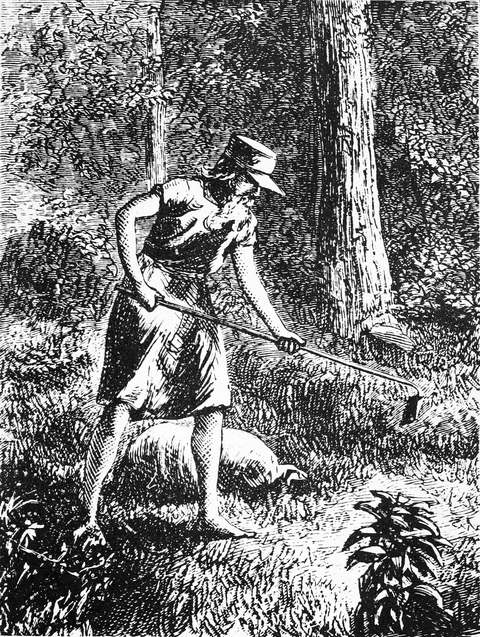 John Chapman (Johnny Appleseed)1774-1845Itinerant nurseryman and Swedenborgian missionary who planted apple-seedling nur...
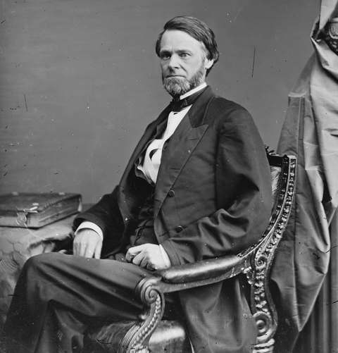 John Sherman1823-1900Mansfield lawyer who spent nearly 32 years as an Ohio senator, served as Treasur...
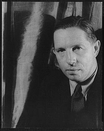 Louis Bromfield1896-1956Mansfield-born Pulitzer Prize novelist who came home to rebuild worn-out farmlan...
History from Mansfield
People and inventions tied to this place, each with its sources. All people · All inventions
How Mansfield began
Mansfield was laid out in June 1808 by surveyors James Hedges, Joseph Larwell and Jacob Newman on a ridge chosen for a dependable spring, and named for Col. Jared Mansfield, U.S. Surveyor General, who directed the survey. It became Richland County's seat and, still on the edge of the frontier during the War of 1812, its settlers built two blockhouses on the public square for protection. The arrival of three railroads between 1846 and 1863 turned the small county seat into a manufacturing center producing stoves, brass goods, farm implements and tires; growth continued through the twentieth century even as heavy industry later declined. Today Mansfield remains Richland County's seat and largest city.
Settled 1808, platted 1808, incorporated 1828 (village), 1857 (city), by James Hedges, Joseph Larwell, and Jacob Newman.
Where the name comes from
Named for Col. Jared Mansfield, the U.S. Surveyor General who directed the survey and platting of the town.
Before the town
No village, mound, or named trail specific to the Mansfield town site itself is recorded in the sources consulted. The area lay just north of the 1795 Treaty of Greenville line, which ran through the southeastern part of Richland County, so the ground Mansfield was platted on passed out of recognized Native title only in 1805, by the Treaty of Fort Industry, three years before the town was laid out. During the War of 1812 Mansfield's settlers, still on the edge of the frontier, built two blockhouses overnight on the public square (now Central Park) for protection against Indian raids allied with the British, and 1903 local history records that 'a number of its citizens were murdered by the Indians' in that period; one blockhouse survived to serve as the county's first courthouse and jail. Greentown, a large Delaware (Lenape) village of roughly 150 dwellings whose removal and burning in 1812 set off much of the regional panic, stood about twelve miles southeast of Mansfield in what is now Green Township, Ashland County -- not within Mansfield or Richland County -- and is treated fully in the county-level file, not here.
Nations recorded here: Wyandot, Lenape (Delaware), Shawnee.
Timeline
- — James Hedges, Joseph Larwell, and Jacob Newman lay out Mansfield in June, and Samuel Martin builds the town's first log cabin on lot 97.
- — Settlers build two blockhouses on the public square for defense during the War of 1812; one later serves as the county's courthouse and jail until 1816.
- — Mansfield is incorporated as a village.
- — The Mansfield and Sandusky Railroad reaches the town, the first of three railroads that arrive by 1863 and turn Mansfield into a regional manufacturing center.
- — Railroad executive John Robinson builds Oak Hill Cottage, a Gothic Revival house at 310 Springmill Street later known locally as 'Shanes Castle.'
- — Mansfield is incorporated as a city, with a population of 5,121.
- — The Ohio State Reformatory is constructed on Reformatory Road to designs by architect Levi T. Scofield in the Romanesque Revival style.
- — The Great Flood drops several inches of rain on Mansfield, and the Lincoln Highway is routed through the city the same year.
- — A federal court order closes the Ohio State Reformatory after decades of conditions litigation.
Stories
Two blockhouses in a single night
When word of Indian raids allied with the British reached Mansfield during the War of 1812, the town's small population of settlers threw up two log blockhouses on the public square -- now Central Park -- reportedly in a single night. The square had been platted as open common ground only four years earlier. One of the blockhouses outlived the emergency: after the war it served as Richland County's first courthouse and jail until a permanent building was ready in 1816, then did duty as a schoolhouse. Its story is a reminder of how thin the line between frontier village and wilderness still was in 1812, just seventeen years after the Treaty of Greenville had drawn the nearby boundary line through the county's southeastern corner.
From reform prison to movie set
The Ohio State Reformatory took nearly a quarter-century to build, from 1886 to 1910, on Reformatory Road north of downtown. Architect Levi T. Scofield designed it in a Romanesque Revival style meant to inspire moral reform rather than simple punishment, with a soaring central hall lit by tiers of barred windows. It operated for more than ninety years before a 1990 federal court order shut it down over conditions. Rather than being demolished, the empty prison found a second life in 1994 as the primary filming location for The Shawshank Redemption, and it now draws visitors from around the world as a historic site and museum.
Photographs
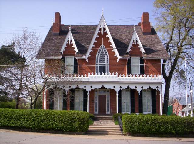
Photo: (WT-shared) OHWiki at wts wikivoyage, CC BY-SA 4.0 · Wikimedia Commons
Local history sources: en.wikipedia.org · richland.ohgenweb.org · en.wikipedia.org · en.wikipedia.org · richlandcountyhistory.com · ashlandcountypictures.com · commons.wikimedia.org
Historic places
43 places in Mansfield on the National Register of Historic Places. Press a pin or a name for its whole record.
-
Barr, Jacob H., HouseBuilding · Mansfield · listed 1983
- Address
- 646 Park Ave., W.
- Where
- Mansfield, Richland County · ZIP 44906
- What it is
- Building
- Listed on the National Register
- 1983
- NRIS reference number
- 83002023
- Coordinates
- 40.75940, -82.53880
National Register file (NPS) ↗ Search Wikipedia ↗ Street map and directions ↗ On the Cracked Buckeye map
-
Bissman BlockBuilding · Mansfield · listed 1986
- Address
- 193 N. Main St.
- Where
- Mansfield, Richland County · ZIP 44902
- What it is
- Building
- Listed on the National Register
- 1986
- NRIS reference number
- 86002882
- Coordinates
- 40.76367, -82.51538
National Register file (NPS) ↗ Search Wikipedia ↗ Street map and directions ↗ On the Cracked Buckeye map
-
Bissman, B.F., HouseBuilding · Mansfield · listed 1983
- Address
- 458 Park Ave., W.
- Where
- Mansfield, Richland County · ZIP 44903
- What it is
- Building
- Listed on the National Register
- 1983
- NRIS reference number
- 83002024
- Coordinates
- 40.75903, -82.53305
National Register file (NPS) ↗ Search Wikipedia ↗ Street map and directions ↗ On the Cracked Buckeye map
-
Bissman, Peter, HouseBuilding · Mansfield · listed 1983
- Address
- 462 Park Ave., W.
- Where
- Mansfield, Richland County · ZIP 44903
- What it is
- Building
- Listed on the National Register
- 1983
- NRIS reference number
- 83002025
- Coordinates
- 40.75902, -82.53322
National Register file (NPS) ↗ Search Wikipedia ↗ Street map and directions ↗ On the Cracked Buckeye map
-
Building at 240 Park Avenue WestBuilding · Mansfield · listed 1983
- Address
- 240 Park Ave., W.
- Where
- Mansfield, Richland County · ZIP 44902
- What it is
- Building
- Listed on the National Register
- 1983
- NRIS reference number
- 83002026
- Coordinates
- 40.75910, -82.52422
National Register file (NPS) ↗ Search Wikipedia ↗ Street map and directions ↗ On the Cracked Buckeye map
-
Building at 252-254 Park Avenue WestBuilding · Mansfield · listed 1984
- Address
- 252-254 Park Ave., W.
- Where
- Mansfield, Richland County · ZIP 44902
- What it is
- Building
- Listed on the National Register
- 1984
- NRIS reference number
- 84003802
- Coordinates
- 40.75909, -82.52452
National Register file (NPS) ↗ Search Wikipedia ↗ Street map and directions ↗ On the Cracked Buckeye map
-
Building at 309 Park Avenue WestBuilding · Mansfield · listed 1984
- Address
- 309 Park Ave., W.
- Where
- Mansfield, Richland County · ZIP 44907
- What it is
- Building
- Listed on the National Register
- 1984
- NRIS reference number
- 84003801
- Coordinates
- 40.75180, -82.51736
National Register file (NPS) ↗ Search Wikipedia ↗ Street map and directions ↗ On the Cracked Buckeye map
-
Building at 415 Park Avenue WestBuilding · Mansfield · listed 1984
- Address
- 415 Park Ave., W.
- Where
- Mansfield, Richland County · ZIP 44907
- What it is
- Building
- Listed on the National Register
- 1984
- NRIS reference number
- 84003799
- Coordinates
- 40.75180, -82.51736
National Register file (NPS) ↗ Search Wikipedia ↗ Street map and directions ↗ On the Cracked Buckeye map
-
Bushnell, Martin, HouseBuilding · Mansfield · listed 1974
- Address
- 34 Sturges Ave.
- Where
- Mansfield, Richland County · ZIP 44903
- What it is
- Building
- Listed on the National Register
- 1974
- NRIS reference number
- 74001609
- Coordinates
- 40.75294, -82.52325
National Register file (NPS) ↗ Search Wikipedia ↗ Street map and directions ↗ On the Cracked Buckeye map
-
Central United Methodist ChurchBuilding · Mansfield · listed 1983
- Address
- 378 Park Ave., W.
- Where
- Mansfield, Richland County · ZIP 44903
- What it is
- Building
- Listed on the National Register
- 1983
- NRIS reference number
- 83002027
- Coordinates
- 40.75935, -82.52932
National Register file (NPS) ↗ Search Wikipedia ↗ Street map and directions ↗ On the Cracked Buckeye map
-
City Mills BuildingBuilding · Mansfield · listed 1986
- Address
- 160 N. Main St.
- Where
- Mansfield, Richland County · ZIP 44902
- What it is
- Building
- Listed on the National Register
- 1986
- NRIS reference number
- 86003500
- Coordinates
- 40.76492, -82.51502
National Register file (NPS) ↗ Search Wikipedia ↗ Street map and directions ↗ On the Cracked Buckeye map
-
Colonial, TheBuilding · Mansfield · listed 1983
- Address
- 283 Park Ave., W.
- Where
- Mansfield, Richland County · ZIP 44903
- What it is
- Building
- Listed on the National Register
- 1983
- NRIS reference number
- 83002028
- Coordinates
- 40.75867, -82.52575
National Register file (NPS) ↗ Search Wikipedia ↗ Street map and directions ↗ On the Cracked Buckeye map
-
Cook, J.M., HouseBuilding · Mansfield · listed 1983
- Address
- 429 Park Ave., W.
- Where
- Mansfield, Richland County · ZIP 44906
- What it is
- Building
- Listed on the National Register
- 1983
- NRIS reference number
- 83002029
- Coordinates
- 40.75869, -82.53144
National Register file (NPS) ↗ Search Wikipedia ↗ Street map and directions ↗ On the Cracked Buckeye map
-
Douglas, S.M., HouseBuilding · Mansfield · listed 1983
- Address
- 437 Park Ave., W.
- Where
- Mansfield, Richland County · ZIP 44906
- What it is
- Building
- Listed on the National Register
- 1983
- NRIS reference number
- 83002030
- Coordinates
- 40.75873, -82.53168
National Register file (NPS) ↗ Search Wikipedia ↗ Street map and directions ↗ On the Cracked Buckeye map
-
Dow HouseBuilding · Mansfield · listed 1983
- Address
- 564 Park Ave., W.
- Where
- Mansfield, Richland County · ZIP 44906
- What it is
- Building
- Listed on the National Register
- 1983
- NRIS reference number
- 83002031
- Coordinates
- 40.75907, -82.53637
National Register file (NPS) ↗ Search Wikipedia ↗ Street map and directions ↗ On the Cracked Buckeye map
-
First English Lutheran ChurchBuilding · Mansfield · listed 1983
- Address
- 53 Park Ave., W.
- Where
- Mansfield, Richland County · ZIP 44902
- What it is
- Building
- Listed on the National Register
- 1983
- NRIS reference number
- 83002032
- Coordinates
- 40.75833, -82.51769
National Register file (NPS) ↗ Search Wikipedia ↗ Street map and directions ↗ On the Cracked Buckeye map
-
Fraser HouseBuilding · Mansfield · listed 1983
- Address
- 681 Park Ave., W.
- Where
- Mansfield, Richland County · ZIP 44906
- What it is
- Building
- Listed on the National Register
- 1983
- NRIS reference number
- 83002033
- Coordinates
- 40.75888, -82.54092
National Register file (NPS) ↗ Search Wikipedia ↗ Street map and directions ↗ On the Cracked Buckeye map
-
Gilbert, F.A., HouseBuilding · Mansfield · listed 1984
- Address
- 343 Park Ave., W.
- Where
- Mansfield, Richland County · ZIP 44906
- What it is
- Building
- Listed on the National Register
- 1984
- NRIS reference number
- 84003800
- Coordinates
- 40.75869, -82.52783
National Register file (NPS) ↗ Search Wikipedia ↗ Street map and directions ↗ On the Cracked Buckeye map
-
Hancock and Dow BuildingBuilding · Mansfield · listed 1987
- Address
- 21 E. Fourth St.
- Where
- Mansfield, Richland County · ZIP 44902
- What it is
- Building
- Listed on the National Register
- 1987
- NRIS reference number
- 86002864
- Coordinates
- 40.76108, -82.51491
National Register file (NPS) ↗ Search Wikipedia ↗ Street map and directions ↗ On the Cracked Buckeye map
-
Kern, Rufus A., HouseBuilding · Mansfield · listed 1983
- Address
- 608 Park Ave., W.
- Where
- Mansfield, Richland County · ZIP 44906
- What it is
- Building
- Listed on the National Register
- 1983
- NRIS reference number
- 83002034
- Coordinates
- 40.75933, -82.53726
National Register file (NPS) ↗ Search Wikipedia ↗ Street map and directions ↗ On the Cracked Buckeye map
-
Krause, John, HouseBuilding · Mansfield · listed 1983
- Address
- 428 Park Ave., W.
- Where
- Mansfield, Richland County · ZIP 44903
- What it is
- Building
- Listed on the National Register
- 1983
- NRIS reference number
- 83002035
- Coordinates
- 40.75923, -82.53133
National Register file (NPS) ↗ Search Wikipedia ↗ Street map and directions ↗ On the Cracked Buckeye map
-
Mansfield Savings BankBuilding · Mansfield · listed 1986
- Address
- 4 W. Fourth St.
- Where
- Mansfield, Richland County · ZIP 44902
- What it is
- Building
- Listed on the National Register
- 1986
- NRIS reference number
- 86002872
- Coordinates
- 40.76108, -82.51562
National Register file (NPS) ↗ Search Wikipedia ↗ Street map and directions ↗ On the Cracked Buckeye map
-
Mansfield Woman's ClubBuilding · Mansfield · listed 1983
- Address
- 145 Park Ave., W.
- Where
- Mansfield, Richland County · ZIP 44902
- What it is
- Building
- Listed on the National Register
- 1983
- NRIS reference number
- 83002037
- Coordinates
- 40.75855, -82.52101
National Register file (NPS) ↗ Search Wikipedia ↗ Street map and directions ↗ On the Cracked Buckeye map
-
Mansfield, Judge, HouseBuilding · Mansfield · listed 1983
- Address
- 228 Park Ave., W.
- Where
- Mansfield, Richland County · ZIP 44902
- What it is
- Building
- Listed on the National Register
- 1983
- NRIS reference number
- 83002036
- Coordinates
- 40.75423, -82.51730
National Register file (NPS) ↗ Search Wikipedia ↗ Street map and directions ↗ On the Cracked Buckeye map
-
May Realty BuildingBuilding · Mansfield · listed 1986
- Address
- 22--32 S. Park St.
- Where
- Mansfield, Richland County · ZIP 44902
- What it is
- Building
- Listed on the National Register
- 1986
- NRIS reference number
- 86002865
- Coordinates
- 40.75787, -82.51484
National Register file (NPS) ↗ Search Wikipedia ↗ Street map and directions ↗ On the Cracked Buckeye map
-
Mechanics Building and Loan CompanyBuilding · Mansfield · listed 1983
- Address
- 2 S. Main St.
- Where
- Mansfield, Richland County · ZIP 44902
- What it is
- Building
- Listed on the National Register
- 1983
- NRIS reference number
- 83002038
- Coordinates
- 40.75849, -82.51574
National Register file (NPS) ↗ Search Wikipedia ↗ Street map and directions ↗ On the Cracked Buckeye map
-
Oak Hill CottageBuilding · Mansfield · listed 1969
- Address
- 310 Springmill St.
- Where
- Mansfield, Richland County · ZIP 44902
- What it is
- Building
- Listed on the National Register
- 1969
- NRIS reference number
- 69000149
- Coordinates
- 40.76779, -82.51779
National Register file (NPS) ↗ Search Wikipedia ↗ Street map and directions ↗ On the Cracked Buckeye map
-
Ohio TheatreBuilding · Mansfield · listed 1983
- Address
- 136 Park Ave., W.
- Where
- Mansfield, Richland County · ZIP 44902
- What it is
- Building
- Listed on the National Register
- 1983
- NRIS reference number
- 83002040
- Coordinates
- 40.75900, -82.52102
National Register file (NPS) ↗ Search Wikipedia ↗ Street map and directions ↗ On the Cracked Buckeye map
-
Old Carriage BarnBuilding · Mansfield · listed 1983
- Address
- 337 Park Ave., W.
- Where
- Mansfield, Richland County · ZIP 44906
- What it is
- Building
- Listed on the National Register
- 1983
- NRIS reference number
- 83002041
- Coordinates
- 40.75860, -82.52794
National Register file (NPS) ↗ Search Wikipedia ↗ Street map and directions ↗ On the Cracked Buckeye map
-
Pacific Curios AntiquesBuilding · Mansfield · listed 1983
- Address
- 365 Park Ave., W.
- Where
- Mansfield, Richland County · ZIP 44906
- What it is
- Building
- Listed on the National Register
- 1983
- NRIS reference number
- 83002042
- Coordinates
- 40.75867, -82.52931
National Register file (NPS) ↗ Search Wikipedia ↗ Street map and directions ↗ On the Cracked Buckeye map
-
Park Avenue Baptist ChurchBuilding · Mansfield · listed 1983
- Address
- 296 Park Ave., W.
- Where
- Mansfield, Richland County · ZIP 44906
- What it is
- Building
- Listed on the National Register
- 1983
- NRIS reference number
- 83002043
- Coordinates
- 40.75939, -82.52612
National Register file (NPS) ↗ Search Wikipedia ↗ Street map and directions ↗ On the Cracked Buckeye map
-
Richland Trust BuildingBuilding · Mansfield · listed 1983
- Address
- 3 Park Ave., W.
- Where
- Mansfield, Richland County · ZIP 44902
- What it is
- Building
- Listed on the National Register
- 1983
- NRIS reference number
- 83002044
- Coordinates
- 40.75876, -82.51574
National Register file (NPS) ↗ Search Wikipedia ↗ Street map and directions ↗ On the Cracked Buckeye map
-
Ritter, William, HouseBuilding · Mansfield · listed 1978
- Address
- 181 S. Main St.
- Where
- Mansfield, Richland County · ZIP 44902
- What it is
- Building
- Listed on the National Register
- 1978
- NRIS reference number
- 78002178
- Coordinates
- 40.75349, -82.51568
National Register file (NPS) ↗ Search Wikipedia ↗ Street map and directions ↗ On the Cracked Buckeye map
-
Sandiford, Robert, HouseBuilding · Mansfield · listed 1983
- Address
- 544 Park Ave., W.
- Where
- Mansfield, Richland County · ZIP 44906
- What it is
- Building
- Listed on the National Register
- 1983
- NRIS reference number
- 83002045
- Coordinates
- 40.75927, -82.53524
National Register file (NPS) ↗ Search Wikipedia ↗ Street map and directions ↗ On the Cracked Buckeye map
-
Sherman, John, Memorial GatewayStructure · Mansfield · listed 1983
- Address
- 699 Park Ave., W.
- Where
- Mansfield, Richland County · ZIP 44906
- What it is
- Structure
- Listed on the National Register
- 1983
- NRIS reference number
- 83002046
- Coordinates
- 40.75893, -82.54057
National Register file (NPS) ↗ Search Wikipedia ↗ Street map and directions ↗ On the Cracked Buckeye map
-
Soldiers and Sailors Memorial Building and Madison TheaterBuilding · Mansfield · listed 1980
- Address
- 36 Park Ave., W.
- Where
- Mansfield, Richland County · ZIP 44902
- What it is
- Building
- Listed on the National Register
- 1980
- NRIS reference number
- 80003214
- Coordinates
- 40.75888, -82.51687
National Register file (NPS) ↗ Search Wikipedia ↗ Street map and directions ↗ On the Cracked Buckeye map
-
St. Peters ChurchBuilding · Mansfield · listed 1979
- Address
- 54 S. Mulberry St
- Where
- Mansfield, Richland County · ZIP 44902
- What it is
- Building
- Listed on the National Register
- 1979
- NRIS reference number
- 79001930
- Coordinates
- 40.75688, -82.51849
National Register file (NPS) ↗ Search Wikipedia ↗ Street map and directions ↗ On the Cracked Buckeye map
-
Stewart TowersBuilding · Mansfield · listed 1983
- Address
- 13 Park Ave., W.
- Where
- Mansfield, Richland County · ZIP 44902
- What it is
- Building
- Listed on the National Register
- 1983
- NRIS reference number
- 83002048
- Coordinates
- 40.75852, -82.51639
National Register file (NPS) ↗ Search Wikipedia ↗ Street map and directions ↗ On the Cracked Buckeye map
-
Sturges, Susan, HouseBuilding · Mansfield · listed 1983
- Address
- 317 Park Ave., W.
- Where
- Mansfield, Richland County · ZIP 44906
- What it is
- Building
- Listed on the National Register
- 1983
- NRIS reference number
- 83002049
- Coordinates
- 40.75866, -82.52635
National Register file (NPS) ↗ Search Wikipedia ↗ Street map and directions ↗ On the Cracked Buckeye map
-
Tappan HouseBuilding · Mansfield · listed 1983
- Address
- 308 Park Ave., W.
- Where
- Mansfield, Richland County · ZIP 44907
- What it is
- Building
- Listed on the National Register
- 1983
- NRIS reference number
- 83002050
- Coordinates
- 40.75198, -82.51719
National Register file (NPS) ↗ Search Wikipedia ↗ Street map and directions ↗ On the Cracked Buckeye map
-
Upson HouseBuilding · Mansfield · listed 1983
- Address
- 234 Park Ave., W.
- Where
- Mansfield, Richland County · ZIP 44902
- What it is
- Building
- Listed on the National Register
- 1983
- NRIS reference number
- 83002051
- Coordinates
- 40.75401, -82.51729
National Register file (NPS) ↗ Search Wikipedia ↗ Street map and directions ↗ On the Cracked Buckeye map
-
Voegele BuildingBuilding · Mansfield · listed 2000
- Address
- 211 N. Main St.
- Where
- Mansfield, Richland County · ZIP 44902
- What it is
- Building
- Listed on the National Register
- 2000
- NRIS reference number
- 99001687
- Coordinates
- 40.76376, -82.51592
National Register file (NPS) ↗ Search Wikipedia ↗ Street map and directions ↗ On the Cracked Buckeye map
-
Ward, W. S., HouseBuilding · Mansfield · listed 1983
- Address
- 350 Park Ave., W.
- Where
- Mansfield, Richland County · ZIP 44906
- What it is
- Building
- Listed on the National Register
- 1983
- NRIS reference number
- 83002052
- Coordinates
- 40.75904, -82.52843
National Register file (NPS) ↗ Search Wikipedia ↗ Street map and directions ↗ On the Cracked Buckeye map
Source: National Park Service, National Register of Historic Places point file. The listing year is shown where NPS's certification date agrees with the listing's reference number. Listing recognizes significance; it does not restrict a private owner.
Water
Clear Fork Reservoir, a 4.5-billion-gallon impoundment of the Clear Fork southwest of the treatment plant, supplemented by 9 city groundwater wells The water here
- Mansfield City77% of residentsClear Fork Reservoir (Clear Fork of the Mohican River), plus 9 city wells
- Ontario City8% of residentsGroundwater wells (3 wells)
- Lexington Village3% of residentsGroundwater wells (3 wells)
- Eastview Community Water Association2% of residentsGroundwater wells (3 wells)
- Madison Water District2% of residentsGroundwater wells (4 wells)
- Aqua Ohio - Mansfield System #011% of residentsGroundwater wells (2 wells)
- Aqua Ohio - Mansfield System #071% of residentsGroundwater wells (4 wells)
- Peyton Community Well1% of residentsGroundwater wells (1 wells)
- Heatherwood Community Water Assoc1% of residentsGroundwater wells (1 wells)
- Crestwood Hills C and R Association1% of residentsGroundwater wells (2 wells)
- Aqua Ohio - Mansfield System #061% of residentsGroundwater wells (2 wells)
- Aqua Ohio - Mansfield System #020% of residentsGroundwater wells (3 wells)
- Lakeview Estates MHP0% of residentsGroundwater wells (2 wells)
- Expressview Comm Water Association0% of residentsGroundwater wells (2 wells)
- Walnut Hills Water Association0% of residentsGroundwater wells (3 wells)
- Aqua Ohio - Mansfield System #030% of residentsGroundwater wells (1 wells)
- Shelly Acres Water Association0% of residentsGroundwater wells (3 wells)
- Aqua Ohio - Mansfield System #040% of residentsGroundwater wells (1 wells)
- Southern Estates Water Assoc0% of residentsGroundwater wells (2 wells)
- Hillside MHP0% of residentsGroundwater wells (1 wells)
- Cedar Creek MHP0% of residentsGroundwater wells (2 wells)
- Waterfall Estates MHP0% of residentsGroundwater wells (1 wells)
- Aqua Ohio - Mansfield System #080% of residentsGroundwater wells (1 wells)
- Hanley Acres Water Association0% of residentsGroundwater wells (2 wells)
- Hillsdale Community Water Association Pw0% of residentsGroundwater wells (1 wells)
- Colonial Hills MHP0% of residentsGroundwater wells (1 wells)
- Briarwood Estates MHP0% of residentsGroundwater wells (2 wells)
- Willow Park Water Association0% of residentsGroundwater wells (2 wells)
- Heatherwood Terrace Townhouses0% of residentsGroundwater wells (2 wells)
- Hanley Village Water Association0% of residentsGroundwater wells (2 wells)
- M & H MHP, Llc0% of residentsGroundwater wells (1 wells)
- Edgewood Estates0% of residentsGroundwater wells (1 wells)
Hospitals, fire stations and more
Inside Mansfield's boundary: 1 hospital, 5 health centers, 2 dialysis centers, 4 nursing homes, 6 fire and EMS stations, 2 colleges, 1 power plant, 15 public schools, 4 private schools, 2 poor-rated bridges, 2 libraries, 6 museums, 2 police stations, 7 public charging sites, 5 Superfund sites, 37 Toxics Release Inventory facilities and 31 spill cases. Press a pin or a name for its whole record and its source.
Hospitals (1)
-
Medcentral Hlth Sys - Mansfield Trauma level IIGeneral hospital · Mansfield
- What it is
- General hospital
- Address
- 335 Glessner Avenue, Mansfield, OH 44903
- County
- Richland County
- Beds
- 368
- Trauma center
- Level II
- Helipad
- Yes
- Ownership
- Non-profit
- Medicare overall rating
- 3 of 5 stars
- Emergency department (Medicare)
- Yes
- Medicare reports it as
- Ohiohealth Mansfield Hospital
- Phone
- (419) 526-8000
- Medicare ID
- 360118
Medicare Care Compare ↗ Where HIFLD got this record ↗ HIFLD hospitals (source) ↗ Street map and directions ↗
Source: HIFLD hospitals inventory via FEMA (closed hospitals it still lists left out, hospitals opened since added), with Medicare Care Compare ratings matched by name and address.
Community health centers (5)
-
Cornerstone OB/GYNHealth center · Mansfield
- Run by
- a federally qualified health center
- Setting
- Clinic
- City
- Mansfield
- Coordinates
- 40.73826, -82.55486
Find a Health Center (HRSA) ↗ HRSA data (source) ↗ Street map and directions ↗
-
Five Points Primary CareHealth center · Mansfield
- Run by
- a federally qualified health center
- Setting
- Clinic
- City
- Mansfield
- Coordinates
- 40.75920, -82.52342
Find a Health Center (HRSA) ↗ HRSA data (source) ↗ Street map and directions ↗
-
Mansfield Family Health 2Health center · Mansfield
- Run by
- a federally qualified health center
- Setting
- Clinic
- City
- Mansfield
- Coordinates
- 40.73870, -82.52661
Find a Health Center (HRSA) ↗ HRSA data (source) ↗ Street map and directions ↗
-
Third Street Community Clinic, Inc.Health center · Mansfield
- Run by
- a federally qualified health center
- Setting
- Clinic
- City
- Mansfield
- Coordinates
- 40.76062, -82.53730
Find a Health Center (HRSA) ↗ HRSA data (source) ↗ Street map and directions ↗
-
Third Street Family Health Services AdminstrationHealth center · Ontario
- Run by
- a federally qualified health center
- Setting
- Clinic
- City
- Ontario
- Coordinates
- 40.76033, -82.56623
Find a Health Center (HRSA) ↗ HRSA data (source) ↗ Street map and directions ↗
Source: HRSA health center service delivery sites, active, September 2026 (school-based sites left out). Health centers see patients whether or not they have insurance, with fees on a sliding scale.
Dialysis centers (2)
-
Fmc - Mansfield Kidney CenterDialysis · Mansfield
- Address
- 647 Bally Row, Mansfield, OH 44906
- Dialysis stations
- 19
- Medicare star rating
- 3 of 5 stars
- Services
- in-center hemodialysis, peritoneal dialysis, home hemodialysis training
- Ownership
- for profit
- Chain
- Fresenius Medical Care
- Medicare certified since
- 1990-01-25
- Phone
- (419) 775-1730
- Medicare ID
- 362508
Medicare Care Compare ↗ CMS dialysis facility list (source) ↗ Street map and directions ↗
-
Fmc Dialysis Services Richland CountyDialysis · Mansfield
- Address
- 680 Bally Row, Mansfield, OH 44906
- Dialysis stations
- 24
- Medicare star rating
- 2 of 5 stars
- Services
- in-center hemodialysis
- Ownership
- for profit
- Chain
- Fresenius Medical Care
- Medicare certified since
- 2000-02-23
- Phone
- (419) 774-0180
- Medicare ID
- 362619
Medicare Care Compare ↗ CMS dialysis facility list (source) ↗ Street map and directions ↗
Source: CMS dialysis facility list, September 2026, geocoded with the Census Bureau batch geocoder (an address it could not place sits at its ZIP center).
Nursing homes (4)
-
Crystal Care Center of Mansfie3 of 5 stars · Mansfield
- Address
- 1159 Wyandotte Ave, Mansfield, OH 44906
- Certified beds
- 74
- Residents on an average day
- 63
- Medicare overall rating
- 3 of 5 stars
- Health inspections
- 4 of 5 stars
- Staffing
- 1 of 5 stars
- Quality measures
- 4 of 5 stars
- Penalties since 2023
- none
- Ownership
- For profit - Partnership
- Takes
- Medicare and Medicaid
- Phone
- (419) 747-2666
- Medicare ID
- 365945
Medicare Care Compare ↗ CMS nursing home data (source) ↗ Street map and directions ↗
-
Jag Healthcare Mansfield1 of 5 stars · Mansfield
- Address
- 50 Blymyer Avenue, Mansfield, OH 44903
- Certified beds
- 66
- Residents on an average day
- 61
- Medicare overall rating
- 1 of 5 stars
- Health inspections
- 1 of 5 stars
- Staffing
- 1 of 5 stars
- Quality measures
- 3 of 5 stars
- Penalties since 2023
- 1 fine totalling $130,240, 1 payment denial (latest 2024-04-15)
- Ownership
- For profit - Corporation
- Chain
- JAG HEALTHCARE
- Takes
- Medicare and Medicaid
- Phone
- (419) 774-5100
- Medicare ID
- 365118
Medicare Care Compare ↗ CMS nursing home data (source) ↗ Street map and directions ↗
-
Liberty Nursing Center of Mansfield2 of 5 stars · Mansfield
- Address
- 535 Lexington Avenue, Mansfield, OH 44907
- Certified beds
- 68
- Residents on an average day
- 56
- Medicare overall rating
- 2 of 5 stars
- Health inspections
- 2 of 5 stars
- Staffing
- 4 of 5 stars
- Quality measures
- 2 of 5 stars
- Penalties since 2023
- 1 fine totalling $41,243 (latest 2025-05-13)
- Ownership
- For profit - Individual
- Takes
- Medicare and Medicaid
- Phone
- (419) 756-7111
- Medicare ID
- 365475
Medicare Care Compare ↗ CMS nursing home data (source) ↗ Street map and directions ↗
-
Winchester Terrace2 of 5 stars · Mansfield
- Address
- 70 Winchester Rd, Mansfield, OH 44907
- Certified beds
- 83
- Residents on an average day
- 52
- Medicare overall rating
- 2 of 5 stars
- Health inspections
- 2 of 5 stars
- Staffing
- 1 of 5 stars
- Quality measures
- 5 of 5 stars
- Penalties since 2023
- 1 fine totalling $14,015 (latest 2025-09-18)
- Ownership
- For profit - Corporation
- Takes
- Medicare and Medicaid
- Phone
- (419) 756-4747
- Medicare ID
- 365911
Medicare Care Compare ↗ CMS nursing home data (source) ↗ Street map and directions ↗
Source: CMS Care Compare nursing home provider and penalties files; Medicare star ratings run 1 to 5.
Fire and EMS stations (6)
-
179th Airlift Wing Fire DepartmentMansfield
- Address
- 1947 Harrington Memorial Parkway, Mansfield, OH 44903
- Coordinates
- 40.81128, -82.52024
USGS National Map structures (source) ↗ Street map and directions ↗
-
Mansfield Fire Department - Station 1Mansfield
- Address
- 140 East 3rd Street, Mansfield, OH 44902
- Coordinates
- 40.75933, -82.51046
USGS National Map structures (source) ↗ Street map and directions ↗
-
Mansfield Fire Department Station 2Mansfield
- Address
- 35 North Brookwood Way, Mansfield, OH 44906
- Coordinates
- 40.76026, -82.56414
USGS National Map structures (source) ↗ Street map and directions ↗
-
Mansfield Fire Department Station 3Mansfield
- Address
- 705 Sunset Boulevard, Mansfield, OH 44907
- Coordinates
- 40.72583, -82.54222
USGS National Map structures (source) ↗ Street map and directions ↗
-
Mansfield Fire Department Station 4Mansfield
- Address
- 1020 South Main Street, Mansfield, OH 44907
- Coordinates
- 40.73101, -82.51394
USGS National Map structures (source) ↗ Street map and directions ↗
-
Mansfield Fire Department Station 6Mansfield
- Address
- 677 Springmill Street, Mansfield, OH 44903
- Coordinates
- 40.77211, -82.52893
USGS National Map structures (source) ↗ Street map and directions ↗
Source: USGS National Map structures (most Ohio records last updated 2019 to 2022), checked against the Columbus and Cleveland station lists. The department that answers a call is set by jurisdiction and mutual aid, not by distance.
Colleges (2)
-
North Central State CollegePublic community or technical college · Mansfield
- What it is
- Public community or technical college
- City
- Mansfield
- Students, 2023-24 (12-month count)
- 3,211
- Tuition and fees, in state
- $4,624
- Tuition and fees, out of state
- $9,102
- Graduation rate
- 34% (all programs, within 150% of normal time) (a class of 354)
- IPEDS unit ID
- 204422
College Navigator (NCES) ↗ IPEDS data (source) ↗ Street map and directions ↗
-
Ohio State University-Mansfield CampusRegional campus of a public university · Mansfield
- What it is
- Regional campus of a public university
- City
- Mansfield
- Students, 2023-24 (12-month count)
- 1,102
- Tuition and fees, in state
- $9,212
- Tuition and fees, out of state
- $34,718
- Graduation rate
- 14% of bachelor's students, within six years (a class of 434)
- IPEDS unit ID
- 204680
College Navigator (NCES) ↗ IPEDS data (source) ↗ Street map and directions ↗
Source: NCES IPEDS 2024 directory, 2023-24 enrollment and tuition, graduation rates for the 2017 (four-year) and 2020 (two-year) entering classes.
Power plants (1)
-
Broshco Fabricated ProductsNatural gas · 5 MW
- Capacity
- 5 MW
- Main source
- Natural gas
- Technology
- Natural Gas Fired Combustion Turbine
- Operator
- Broshco Fabricated Products
- Sector
- Industrial CHP
- Where
- Mansfield, Richland County
- Generating units
- 4
- Built
- 2001 (first unit); newest unit 2005
- EIA plant code
- 59373
EIA plant page ↗ EIA-860 (source) ↗ Street map and directions ↗
Source: EIA-860 power plant inventory via HIFLD (February 2025), with plant codes, units and years from EIA-860 2025.
Public schools (15)
-
Buckeye Community SchoolOntario
- Address
- 1404 Park Ave W, Ontario, OH 44906
- Kind (NCES)
- Regular School
- Students, 2023-24
- 479
- Teachers (full-time equivalent)
- 9
- NCES school ID
- 390161806018
-
Cypress High SchoolMansfield
- Address
- 1160 W 4th St, Mansfield, OH 44906
- Kind (NCES)
- Regular School
- Students, 2023-24
- 169
- Teachers (full-time equivalent)
- 9
- NCES school ID
- 390161705991
-
Foundation AcademyMansfield
- Address
- 1050 Wyandotte Ave, Mansfield, OH 44906
- Kind (NCES)
- Regular School
- Students, 2023-24
- 431
- Teachers (full-time equivalent)
- 23
- NCES school ID
- 390130105401
-
GOAL Digital AcademyMansfield
- Address
- 890 W 4th St Ste 400, Mansfield, OH 44906
- Kind (NCES)
- Regular School
- Students, 2023-24
- 770
- Teachers (full-time equivalent)
- 42.96
- NCES school ID
- 390015104763
-
Legacy Academy of Excellence MansfieldMansfield
- Address
- 215 N Trimble Rd, Mansfield, OH 44906
- NCES school ID
- 391006110897
-
Lexington Pre-SchoolOntario
- Address
- 890 W 4th St, Ontario, OH 44906
- Kind (NCES)
- Regular School
- Students, 2023-24
- 35
- NCES school ID
- 390494310878
-
Malabar Intermediate School3 of 5 stars · Mansfield
- Address
- 205 W Cook Rd, Mansfield, OH 44907
- School district
- Mansfield City School District
- Kind (NCES)
- Regular School
- Students, 2023-24
- 732
- Teachers (full-time equivalent)
- 46.94
- Report card, 2025-26
- 3 of 5 stars
- Performance index
- 57.9%
- Ohio building IRN
- 003624
- NCES school ID
- 390442901215
NCES school record ↗ Ohio School Report Card ↗ Street map and directions ↗
-
Mansfield Middle School2 of 5 stars · Mansfield
- Address
- 124 N Linden Rd, Mansfield, OH 44906
- School district
- Mansfield City School District
- Kind (NCES)
- Regular School
- Students, 2023-24
- 412
- Teachers (full-time equivalent)
- 35.93
- Report card, 2025-26
- 2 of 5 stars
- Performance index
- 45.6%
- Ohio building IRN
- 022301
- NCES school ID
- 390442901219
NCES school record ↗ Ohio School Report Card ↗ Street map and directions ↗
-
Mansfield Senior High School3.5 of 5 stars · Mansfield
- Address
- 124 N Linden Rd, Mansfield, OH 44906
- School district
- Mansfield City School District
- Kind (NCES)
- Regular School
- Students, 2023-24
- 825
- Teachers (full-time equivalent)
- 68.14
- Report card, 2025-26
- 3.5 of 5 stars
- Performance index
- 65.3%
- Four-year graduation rate
- 93.7%
- Ohio building IRN
- 022483
- NCES school ID
- 390442901220
NCES school record ↗ Ohio School Report Card ↗ Street map and directions ↗
-
Mansfield Spanish Immersion School4.5 of 5 stars · Mansfield
- Address
- 460 Davis Rd, Mansfield, OH 44907
- School district
- Mansfield City School District
- Kind (NCES)
- Regular School
- Students, 2023-24
- 221
- Teachers (full-time equivalent)
- 21.33
- Report card, 2025-26
- 4.5 of 5 stars
- Performance index
- 90.3%
- Ohio building IRN
- 010158
- NCES school ID
- 390442905450
NCES school record ↗ Ohio School Report Card ↗ Street map and directions ↗
-
Sherman Elementary School3 of 5 stars · Mansfield
- Address
- 1138 Springmill St, Mansfield, OH 44906
- School district
- Mansfield City School District
- Kind (NCES)
- Regular School
- Students, 2023-24
- 497
- Teachers (full-time equivalent)
- 33
- Report card, 2025-26
- 3 of 5 stars
- Ohio building IRN
- 034405
- NCES school ID
- 390442901225
NCES school record ↗ Ohio School Report Card ↗ Street map and directions ↗
-
Springmill STEM Elementary2.5 of 5 stars · Mansfield
- Address
- 1200 Nestor Dr, Mansfield, OH 44906
- School district
- Mansfield City School District
- Kind (NCES)
- Regular School
- Students, 2023-24
- 212
- Teachers (full-time equivalent)
- 15.5
- Report card, 2025-26
- 2.5 of 5 stars
- Performance index
- 60.1%
- Ohio building IRN
- 015745
- NCES school ID
- 390442905872
NCES school record ↗ Ohio School Report Card ↗ Street map and directions ↗
-
The Richland School of Academic ArtsMansfield
- Address
- 1456 Park Ave W, Mansfield, OH 44906
- Kind (NCES)
- Regular School
- Students, 2023-24
- 348
- Teachers (full-time equivalent)
- 26
- NCES school ID
- 390138105634
-
Tyger Digital AcademyMansfield
- Address
- 176 Hedges St, Mansfield, OH 44902
- Kind (NCES)
- Regular School
- Students, 2023-24
- 83
- Teachers (full-time equivalent)
- 11.5
- NCES school ID
- 390442906215
-
Woodland Elementary SchoolMansfield
- Address
- 460 Davis Rd, Mansfield, OH 44907
- Kind (NCES)
- Regular School
- Students, 2023-24
- 201
- Teachers (full-time equivalent)
- 13
- NCES school ID
- 390442901230
Source: NCES EDGE public school locations 2024-25 and Common Core of Data 2023-24 (type, students, teachers); Ohio School Report Cards 2025-26 (Department of Education and Workforce), matched by name within the district.
Private schools (4)
-
-- Mansfield Christian School-Private, conservative Christian · Mansfield
- Address
- 500 Logan Rd, Mansfield, OH 44907
- Kind
- conservative Christian
- Students, 2023-24
- 673
- Teachers (full-time equivalent)
- 41.3
- Students per teacher
- 16.2954
- Phone
- (419) 756-5651
- NCES private school ID
- Y2162569
-
Discovery SchoolPrivate, nonsectarian · Mansfield
- Address
- 855 Millsboro Rd, Mansfield, OH 44903
- Kind
- nonsectarian
- Students, 2023-24
- 104
- Teachers (full-time equivalent)
- 9
- Students per teacher
- 11.5556
- Phone
- (419) 756-8880
- NCES private school ID
- 01905392
-
St Peter's ElementaryPrivate, Catholic · Mansfield
- Address
- 63 S Mulberry St, Mansfield, OH 44902
- Kind
- Catholic
- Students, 2023-24
- 87
- Teachers (full-time equivalent)
- 9.8
- Students per teacher
- 8.87755
- Phone
- (419) 524-2572
- NCES private school ID
- 01061018
-
St Peters SchoolPrivate, Catholic · Mansfield
- Address
- 104 W 1St St, Mansfield, OH 44902
- Kind
- Catholic
- Students, 2023-24
- 146
- Teachers (full-time equivalent)
- 17.6
- Students per teacher
- 8.29545
- Phone
- (419) 524-2572
- NCES private school ID
- 01061029
Source: NCES Private School Survey 2023-24.
Bridges rated poor (2)
-
Luther Place over Ritters RunPoor · built 1999
- Condition
- Poor: a deck, superstructure, substructure or culvert rated 4 or below on the 0 to 9 scale
- What it is
- Bridge
- Built
- 1999
- Length
- 7 ft
- Owner
- City
- Vehicles a day
- 2,986
- Coordinates
- 40.75774, -82.51121
National Bridge Inventory (source) ↗ Street map and directions ↗
-
Road Around Lake over North Lake HeadwatersPoor · built 2021
- Condition
- Poor: a deck, superstructure, substructure or culvert rated 4 or below on the 0 to 9 scale
- What it is
- Bridge
- Built
- 2021
- Length
- 9 ft
- Owner
- City
- Vehicles a day
- 172
- Coordinates
- 40.76681, -82.53736
National Bridge Inventory (source) ↗ Street map and directions ↗
Source: FHWA National Bridge Inventory 2025. "Poor" means one major part rated 4 or below on the 0 to 9 scale; it calls for repair, not closing, unless the state posts or closes the bridge.
Public libraries (2)
-
Mansfield-Richland County Public Library Bs1Bookmobile stop · Mansfield
- Address
- 43 W. Third St, Mansfield, OH 44902
- What it is
- Bookmobile stop
- Library system
- Mansfield-Richland County Public Library
- Open
- 1,404 hours a year, 52 weeks
- System's visits, FY2024
- 514,540
- System's loans, FY2024
- 1,567,119
- People the system serves
- 99,110
- Phone
- (419) 522-2780
IMLS Public Libraries Survey (source) ↗ Street map and directions ↗
-
Mansfield/Richland County Public LibraryCentral library · Mansfield
- Address
- 43 W. Third St., Mansfield, OH 44902
- What it is
- Central library
- Library system
- Mansfield-Richland County Public Library
- Open
- 3,328 hours a year, 52 weeks
- Building
- 33,530 sq ft
- System's visits, FY2024
- 514,540
- System's loans, FY2024
- 1,567,119
- People the system serves
- 99,110
- Phone
- (419) 521-3100
IMLS Public Libraries Survey (source) ↗ Street map and directions ↗
Source: IMLS Public Libraries Survey FY2024 (outlets and their systems). Any Ohio resident can get a free card at any Ohio public library.
Museums, historical societies, gardens and zoos (6)
-
Cosby Educational Heritage CenterMuseum · Mansfield
- What it is
- Museum
- City
- Mansfield
- Coordinates
- 40.77107, -82.52295
Search Wikipedia ↗ IMLS Museum Data Files (source) ↗ Street map and directions ↗
The museum list is IMLS's 2018 file; a museum may have closed or moved since.
-
Kingwood CenterArboretum or botanical garden · Mansfield
- What it is
- Arboretum or botanical garden
- City
- Mansfield
- Coordinates
- 40.75924, -82.55001
Search Wikipedia ↗ IMLS Museum Data Files (source) ↗ Street map and directions ↗
The museum list is IMLS's 2018 file; a museum may have closed or moved since.
-
Little Buckeye Children'S MuseumChildren's museum · Mansfield
- What it is
- Children's museum
- City
- Mansfield
- Coordinates
- 40.76117, -82.51741
Search Wikipedia ↗ IMLS Museum Data Files (source) ↗ Street map and directions ↗
The museum list is IMLS's 2018 file; a museum may have closed or moved since.
-
Mansfield Art CenterArt museum · Mansfield
- What it is
- Art museum
- City
- Mansfield
- Coordinates
- 40.74687, -82.54011
Search Wikipedia ↗ IMLS Museum Data Files (source) ↗ Street map and directions ↗
The museum list is IMLS's 2018 file; a museum may have closed or moved since.
-
Richland County Historical SocietyHistorical society · Mansfield
- What it is
- Historical society
- City
- Mansfield
- Coordinates
- 40.76760, -82.51793
Search Wikipedia ↗ IMLS Museum Data Files (source) ↗ Street map and directions ↗
The museum list is IMLS's 2018 file; a museum may have closed or moved since.
-
Soldiers And Sailors Memorial BuildingHistory museum · Mansfield
- What it is
- History museum
- City
- Mansfield
- Coordinates
- 40.75841, -82.51411
Search Wikipedia ↗ IMLS Museum Data Files (source) ↗ Street map and directions ↗
The museum list is IMLS's 2018 file; a museum may have closed or moved since.
Source: IMLS Museum Data Files, 2018.
Police stations (2)
-
Mansfield Police DepartmentMansfield
- Address
- 30 North Diamond Street, Mansfield, OH 44902
- Coordinates
- 40.75881, -82.51313
USGS National Map structures (source) ↗ Street map and directions ↗
-
Richland County Sheriff's OfficeMansfield
- Address
- 597 Park Avenue East, Mansfield, OH 44905
- Coordinates
- 40.75858, -82.49129
USGS National Map structures (source) ↗ Street map and directions ↗
Source: USGS National Map structures, police stations, corrected and completed by hand (September 2026). The department that answers a call is set by jurisdiction, not by distance.
Public EV charging (7)
-
Graham Chevrolet Cadillac DC fast2 DC fast · 1 Level 2 · MANSFIELD
- Address
- 1515 WEST 4TH STREET, MANSFIELD, OH 44906
- Ports
- 2 DC fast · 1 Level 2
- Plugs
- CCS, J1772
- Network
- EV Connect
- Hours
- 24 hours daily
- Phone
- 866-816-7584
Station Locator (NREL) ↗ Alternative Fuels Data Center (source) ↗ Street map and directions ↗
-
Graham Ford DC fast6 DC fast · Mansfield
- Address
- 1515 W 4th St, Mansfield, OH 44903
- Ports
- 6 DC fast
- Plugs
- CCS
- Network
- FORD_CHARGE
- Hours
- 24 hours daily
- Phone
- 888-357-1009
Station Locator (NREL) ↗ Alternative Fuels Data Center (source) ↗ Street map and directions ↗
-
GRAHAM HYUNDAI EV 1 DC fast2 DC fast · Mansfield
- Address
- 1515 West 4th Street, Mansfield, OH 44906
- Ports
- 2 DC fast
- Plugs
- CCS, CHAdeMO
- Network
- ChargePoint Network
- Hours
- 24 hours daily
- Phone
- 888-758-4389
Station Locator (NREL) ↗ Alternative Fuels Data Center (source) ↗ Street map and directions ↗
-
GRAHAM TOYOTA CT4K 12 Level 2 · Mansfield
- Address
- 1515 W 4th St, Mansfield, OH 44906
- Ports
- 2 Level 2
- Plugs
- J1772
- Network
- ChargePoint Network
- Hours
- 24 hours daily
- Phone
- 888-758-4389
Station Locator (NREL) ↗ Alternative Fuels Data Center (source) ↗ Street map and directions ↗
-
Mechanics Bank1 Level 2 · Mansfield
- Address
- 2 S Main St, Mansfield, OH 44902
- Ports
- 1 Level 2
- Plugs
- J1772
- Network
- AMPUP
- Hours
- 24 hours daily
- Phone
- 833-692-6787
Station Locator (NREL) ↗ Alternative Fuels Data Center (source) ↗ Street map and directions ↗
-
OHM MANS GENERAL 14 Level 2 · Mansfield
- Address
- 335 Glessner Ave, Mansfield, OH 44903
- Ports
- 4 Level 2
- Plugs
- J1772
- Network
- ChargePoint Network
- Hours
- 24 hours daily
- Phone
- 888-758-4389
Station Locator (NREL) ↗ Alternative Fuels Data Center (source) ↗ Street map and directions ↗
-
Walmart 5471 (Mansfield, OH) DC fast4 DC fast · Mansfield
- Address
- 2485 Possum Run Rd, Mansfield, OH 44903
- Ports
- 4 DC fast
- Plugs
- CCS, CHAdeMO
- Network
- Electrify America
- Hours
- 24 hours daily
- Phone
- 833-632-2778
Station Locator (NREL) ↗ Alternative Fuels Data Center (source) ↗ Street map and directions ↗
Source: NREL Alternative Fuels Data Center station list (May 2026), public and open stations, the posts at one address counted as one site.
Superfund sites (5)
-
Mansfield Naval Reserve CenterSuperfund program · Mansfield
- Address
- 170 Ashland Rd, Mansfield, OH 44902
- County
- Richland County
- Status
- Superfund program site, not on the National Priorities List
- Federal facility
- Yes
- EPA program ID
- OHR000033415
- EPA registry ID
- 110004731434
EPA facility record ↗ EPA Facility Registry Service (source) ↗ Street map and directions ↗
-
Moritz Inc.Superfund program · Mansfield
- Address
- 400 Park Ave E, Mansfield, OH 44905
- County
- Richland County
- Status
- Superfund program site, not on the National Priorities List
- EPA program ID
- OHN000508059
- EPA registry ID
- 110000617645
EPA facility record ↗ EPA Facility Registry Service (source) ↗ Street map and directions ↗
-
Rowland Avenue Mercury SpillSuperfund program · Mansfield
- Address
- 231 Rowland Ave, Mansfield, OH 44903
- County
- Richland County
- Status
- Superfund program site, not on the National Priorities List
- EPA program ID
- OHN000506655
- EPA registry ID
- 110070122343
EPA facility record ↗ EPA Facility Registry Service (source) ↗ Street map and directions ↗
-
Westbrook Country ClubSuperfund program · Mansfield
- Address
- 1098 Springmill Street, Mansfield, OH 44906
- County
- Richland County
- Status
- Superfund program site, not on the National Priorities List
- EPA program ID
- OHN000505556
- EPA registry ID
- 110071101270
EPA facility record ↗ EPA Facility Registry Service (source) ↗ Street map and directions ↗
-
Westlynn SiteSuperfund program · Mansfield
- Address
- 336 Cedar Rd., Mansfield, OH 44903
- County
- Richland County
- Status
- Superfund program site, not on the National Priorities List
- EPA program ID
- OHN000510901
- EPA registry ID
- 110055128909
EPA facility record ↗ EPA Facility Registry Service (source) ↗ Street map and directions ↗
Source: EPA Facility Registry Service, Superfund (SEMS) and National Priorities List sites. Many program sites were assessed and needed no cleanup.
Facilities reporting toxic releases (37)
-
Amerascrew IncToxics Release Inventory · Mansfield
- Address
- 653 Lida St, Mansfield, OH 44903
- County
- Richland County
- Status
- Reports to the Toxics Release Inventory (active)
- EPA program ID
- 4490WMRSCR653LI
- EPA registry ID
- 110000850017
EPA facility record ↗ EPA Facility Registry Service (source) ↗ Street map and directions ↗
-
Anotech CorpToxics Release Inventory · Mansfield
- Address
- 140 Mansfield Industrial Pky., Mansfield, OH 44903
- County
- Richland County
- Status
- Reports to the Toxics Release Inventory (active)
- EPA program ID
- 44903NTCHC140MA
- EPA registry ID
- 110002112589
EPA facility record ↗ EPA Facility Registry Service (source) ↗ Street map and directions ↗
-
As America Inc - Am Std Brands (0370010176)As America Inc - Am Std Brands (03700Toxics Release Inventory · Mansfield
- Address
- 41 Cairns Rd., Mansfield, OH 44903
- County
- Richland County
- Status
- Reports to the Toxics Release Inventory (active)
- EPA program ID
- 44903CRNPL41CAI
- EPA registry ID
- 110000391932
EPA facility record ↗ EPA Facility Registry Service (source) ↗ Street map and directions ↗
-
Barnes Pumps IncToxics Release Inventory · Mansfield
- Address
- 651 North Main Street, Mansfield, OH 44902
- County
- Richland County
- Status
- Reports to the Toxics Release Inventory (active)
- EPA program ID
- 44902PBDYB651NO
- EPA registry ID
- 110001623315
EPA facility record ↗ EPA Facility Registry Service (source) ↗ Street map and directions ↗
-
Broshco Fabricated ProductsToxics Release Inventory · Mansfield
- Address
- 1595 W Longview Ave, Mansfield, OH 44906
- County
- Richland County
- Status
- Reports to the Toxics Release Inventory (active)
- EPA program ID
- 4490WBRSHC1595W
- EPA registry ID
- 110060280155
EPA facility record ↗ EPA Facility Registry Service (source) ↗ Street map and directions ↗
-
Brost Mansfield Llc Dba Brost FoundryToxics Release Inventory · Mansfield
- Address
- 198 Wayne St, Mansfield, OH 44902
- County
- Richland County
- Status
- Reports to the Toxics Release Inventory (open)
- EPA program ID
- 44902LDGBR198WA
- EPA registry ID
- 110000907458
EPA facility record ↗ EPA Facility Registry Service (source) ↗ Street map and directions ↗
-
Bunting Bearings LlcToxics Release Inventory · Mansfield
- Address
- 153 E. 5Th St., Mansfield, OH 44902
- County
- Richland County
- Status
- Reports to the Toxics Release Inventory (open)
- EPA program ID
- 44902GLPCH153EA
- EPA registry ID
- 110000391914
EPA facility record ↗ EPA Facility Registry Service (source) ↗ Street map and directions ↗
-
Cleveland-Cliffs Steel Corp - Mansfield FacilityToxics Release Inventory · Mansfield
- Address
- 913 Bowman St, Mansfield, OH 44903
- County
- Richland County
- Status
- Reports to the Toxics Release Inventory (open)
- EPA program ID
- 44901MPRDT913BO
- EPA registry ID
- 110000391898
EPA facility record ↗ EPA Facility Registry Service (source) ↗ Street map and directions ↗
-
Crestline Paint CoToxics Release Inventory · Mansfield
- Address
- 515 Newman Street, Mansfield, OH 44902
- County
- Richland County
- Status
- Reports to the Toxics Release Inventory (active)
- EPA program ID
- 44901CRSTL515NE
- EPA registry ID
- 110000823440
EPA facility record ↗ EPA Facility Registry Service (source) ↗ Street map and directions ↗
-
Designed Metal Prods IncToxics Release Inventory · Mansfield
- Address
- 119 Elm St., Mansfield, OH 44902
- County
- Richland County
- Status
- Reports to the Toxics Release Inventory (active)
- EPA program ID
- 44902DSGND119EL
- EPA registry ID
- 110000391905
EPA facility record ↗ EPA Facility Registry Service (source) ↗ Street map and directions ↗
-
Diversified Assemblies IncToxics Release Inventory · Mansfield
- Address
- 555 Park Ave. E., Mansfield, OH 44905
- County
- Richland County
- Status
- Reports to the Toxics Release Inventory (active)
- EPA program ID
- 44905DVRSF555PA
- EPA registry ID
- 110002112623
EPA facility record ↗ EPA Facility Registry Service (source) ↗ Street map and directions ↗
-
G & T Industries of Ohio IncToxics Release Inventory · Mansfield
- Address
- 179 E Longview Ave, Mansfield, OH 44903
- County
- Richland County
- Status
- Reports to the Toxics Release Inventory (active)
- EPA program ID
- 44901GTNDS179EA
- EPA registry ID
- 110002112552
EPA facility record ↗ EPA Facility Registry Service (source) ↗ Street map and directions ↗
-
Gorman Rupp CoToxics Release Inventory · Mansfield
- Address
- 305 Bowman St., Mansfield, OH 44901
- County
- Richland County
- Status
- Reports to the Toxics Release Inventory (active)
- EPA program ID
- 44901GRMNR305BO
- EPA registry ID
- 110000391889
EPA facility record ↗ EPA Facility Registry Service (source) ↗ Street map and directions ↗
-
Gorman Rupp Company (0370010056)Toxics Release Inventory · Mansfield
- Address
- 100 Rupp Rd, Mansfield, OH 44903
- County
- Richland County
- Status
- Reports to the Toxics Release Inventory (open)
- EPA program ID
- 44903GRMNR1RUPP
- EPA registry ID
- 110025404453
EPA facility record ↗ EPA Facility Registry Service (source) ↗ Street map and directions ↗
-
Gorman-Rupp CoToxics Release Inventory · Mansfield
- Address
- 180 E. 4Th St., Mansfield, OH 44902
- County
- Richland County
- Status
- Reports to the Toxics Release Inventory (active)
- EPA program ID
- 44902GRMNR180E4
- EPA registry ID
- 110002112561
EPA facility record ↗ EPA Facility Registry Service (source) ↗ Street map and directions ↗
-
Ideal Electric Power CompanyToxics Release Inventory · Mansfield
- Address
- 330 East First Street, Mansfield, OH 44902
- County
- Richland County
- Status
- Reports to the Toxics Release Inventory (active)
- EPA program ID
- 44903DLLCT330EA
- EPA registry ID
- 110001623333
EPA facility record ↗ EPA Facility Registry Service (source) ↗ Street map and directions ↗
-
Jay Plastics IncToxics Release Inventory · Mansfield
- Address
- 150 E Longview Ave, Mansfield, OH 44903
- County
- Richland County
- Status
- Reports to the Toxics Release Inventory (open)
- EPA program ID
- 44905JYPLS150EL
- EPA registry ID
- 110016760058
EPA facility record ↗ EPA Facility Registry Service (source) ↗ Street map and directions ↗
-
Mansfield Foundry CorporationToxics Release Inventory · Mansfield
- Address
- 500 North Main Street, Mansfield, OH 44902
- County
- Richland County
- Status
- Reports to the Toxics Release Inventory (active)
- EPA program ID
- 44903MNSFL500NO
- EPA registry ID
- 110000391950
EPA facility record ↗ EPA Facility Registry Service (source) ↗ Street map and directions ↗
-
Metal Conversions LtdToxics Release Inventory · Mansfield
- Address
- 175 E Longview Ave, Mansfield, OH 44903
- County
- Richland County
- Status
- Reports to the Toxics Release Inventory
- EPA program ID
- TRI_OFFSITE_1327
- EPA registry ID
- 110070691798
EPA facility record ↗ EPA Facility Registry Service (source) ↗ Street map and directions ↗
-
Moritz International Inc. (0370010048)Toxics Release Inventory · Mansfield
- Address
- 665 North Main St., Mansfield, OH 44902
- County
- Richland County
- Status
- Reports to the Toxics Release Inventory (***unchanged***)
- EPA program ID
- 4490WMRTZN665NM
- EPA registry ID
- 110004707434
EPA facility record ↗ EPA Facility Registry Service (source) ↗ Street map and directions ↗
-
Newartesian Management CoToxics Release Inventory · Mansfield
- Address
- 210 Newman St., Mansfield, OH 44902
- County
- Richland County
- Status
- Reports to the Toxics Release Inventory (closed)
- EPA program ID
- 44902NWRTS210NE
- EPA registry ID
- 110002112570
EPA facility record ↗ EPA Facility Registry Service (source) ↗ Street map and directions ↗
-
Newman Technology, Inc (0370010118)Toxics Release Inventory · Mansfield
- Address
- 100 Cairns Road, Mansfield, OH 44903
- County
- Richland County
- Status
- Reports to the Toxics Release Inventory (open)
- EPA program ID
- 44903NWMNT100CA
- EPA registry ID
- 110000493573
EPA facility record ↗ EPA Facility Registry Service (source) ↗ Street map and directions ↗
-
Ob Transit Prods IncToxics Release Inventory · Mansfield
- Address
- 380 N Main St, Mansfield, OH 44902
- County
- Richland County
- Status
- Reports to the Toxics Release Inventory (closed)
- EPA program ID
- 44903BTRNS380NO
- EPA registry ID
- 110011434171
EPA facility record ↗ EPA Facility Registry Service (source) ↗ Street map and directions ↗
-
Pan Glo MansfieldToxics Release Inventory · Mansfield
- Address
- 1711 N. Main St., Mansfield, OH 44903
- County
- Richland County
- Status
- Reports to the Toxics Release Inventory (active)
- EPA program ID
- 44903PNGLM1711N
- EPA registry ID
- 110013813409
EPA facility record ↗ EPA Facility Registry Service (source) ↗ Street map and directions ↗
-
Richland Screw Machine Products IncToxics Release Inventory · Mansfield
- Address
- 531 Grant St., Mansfield, OH 44903
- County
- Richland County
- Status
- Reports to the Toxics Release Inventory (active)
- EPA program ID
- 44903RCHLN531GR
- EPA registry ID
- 110000391969
EPA facility record ↗ EPA Facility Registry Service (source) ↗ Street map and directions ↗
-
Sensmeier Oil Co IncToxics Release Inventory · Mansfield
- Address
- 375 North Main Street, Mansfield, OH 44902
- County
- Richland County
- Status
- Reports to the Toxics Release Inventory (active)
- EPA program ID
- 44902SNSMR375NM
- EPA registry ID
- 110000391923
EPA facility record ↗ EPA Facility Registry Service (source) ↗ Street map and directions ↗
-
Shiloh CorpToxics Release Inventory · Mansfield
- Address
- 402 9Th Ave, Mansfield, OH 44905
- County
- Richland County
- Status
- Reports to the Toxics Release Inventory (active)
- EPA program ID
- 44905SHLHC42NIN
- EPA registry ID
- 110004669895
EPA facility record ↗ EPA Facility Registry Service (source) ↗ Street map and directions ↗
-
Taylor Metal ProductsToxics Release Inventory · Mansfield
- Address
- 700 Springmill St., Mansfield, OH 44903
- County
- Richland County
- Status
- Reports to the Toxics Release Inventory (active)
- EPA program ID
- 44903TYLRM700SP
- EPA registry ID
- 110002112598
EPA facility record ↗ EPA Facility Registry Service (source) ↗ Street map and directions ↗
-
Taylor Plating CoToxics Release Inventory · Mansfield
- Address
- Rear 700 Springmill St, Mansfield, OH 44903
- County
- Richland County
- Status
- Reports to the Toxics Release Inventory (active)
- EPA program ID
- 44903TYLRP700SP
- EPA registry ID
- 110000814469
EPA facility record ↗ EPA Facility Registry Service (source) ↗ Street map and directions ↗
-
Therm-O-Disc IncToxics Release Inventory · Mansfield
- Address
- 1320 S. Main St., Mansfield, OH 44907
- County
- Richland County
- Status
- Reports to the Toxics Release Inventory
- EPA program ID
- 44907THRMD1320S
- EPA registry ID
- 110000392030
EPA facility record ↗ EPA Facility Registry Service (source) ↗ Street map and directions ↗
-
Tyco Electronics Hartman Electrical ManufacturingToxics Release Inventory · Mansfield
- Address
- 175 N Diamond St, Mansfield, OH 44902
- County
- Richland County
- Status
- Reports to the Toxics Release Inventory (open)
- EPA program ID
- 44902TYCLC175ND
- EPA registry ID
- 110025332995
EPA facility record ↗ EPA Facility Registry Service (source) ↗ Street map and directions ↗
-
U.S. Air Force Mansfield Ang Small Arms RangeToxics Release Inventory · Mansfield
- Address
- 1947 Harrington Memorial Rd, Mansfield, OH 44903
- County
- Richland County
- Status
- Reports to the Toxics Release Inventory (active)
- Federal facility
- Yes
- EPA program ID
- 44903SRFRC1947H
- EPA registry ID
- 110037143962
EPA facility record ↗ EPA Facility Registry Service (source) ↗ Street map and directions ↗
-
W.C.I.Range DivisionToxics Release Inventory · Mansfield
- Address
- 250 Wayne Street, Mansfield, OH 44902
- County
- Richland County
- Status
- Reports to the Toxics Release Inventory (active)
- EPA program ID
- 44902WHTCN250WA
- EPA registry ID
- 110001623306
EPA facility record ↗ EPA Facility Registry Service (source) ↗ Street map and directions ↗
-
Warren Rupp, Inc.Toxics Release Inventory · Mansfield
- Address
- 800 North Main Street, Mansfield, OH 44902
- County
- Richland County
- Status
- Reports to the Toxics Release Inventory (active)
- EPA program ID
- 44902WRRNR800NM
- EPA registry ID
- 110000850696
EPA facility record ↗ EPA Facility Registry Service (source) ↗ Street map and directions ↗
-
Weiss IndustriesToxics Release Inventory · Mansfield
- Address
- 2480 N Main St, Mansfield, OH 44903
- County
- Richland County
- Status
- Reports to the Toxics Release Inventory (active)
- EPA program ID
- 44903WSSND2472N
- EPA registry ID
- 110004591558
EPA facility record ↗ EPA Facility Registry Service (source) ↗ Street map and directions ↗
-
Westside Towing and SalvageToxics Release Inventory · Mansfield
- Address
- 169 W. Longview Ave., Mansfield, OH 44903
- County
- Richland County
- Status
- Reports to the Toxics Release Inventory (active)
- EPA program ID
- 44905MNSFL169WL
- EPA registry ID
- 110000391996
EPA facility record ↗ EPA Facility Registry Service (source) ↗ Street map and directions ↗
-
White Consolidated Industries Inc Laundry DivToxics Release Inventory · Mansfield
- Address
- 246 East Fourth Street, Mansfield, OH 44902
- County
- Richland County
- Status
- Reports to the Toxics Release Inventory (active)
- EPA program ID
- 44902WHTCN246EA
- EPA registry ID
- 110001623235
EPA facility record ↗ EPA Facility Registry Service (source) ↗ Street map and directions ↗
Source: EPA Facility Registry Service, Toxics Release Inventory reporters. Reporting a release is required of large users of listed chemicals; it is not by itself a violation.
Spills reported since 2021 (31)
-
Sewage Human2025-12-31 · Mansfield
- Reported
- 2025-12-31
- What spilled
- Sewage Human
- Where
- Mansfield, Richland County
- Ohio EPA district office
- NWDO
- Ohio EPA case number
- 2512EPA0002075
Ohio EPA spill reports (source) ↗ Street map and directions ↗
-
Fuel Diesel / Diesel Fuel (Vehicle On Or Off Road)2025-12-11 · Mansfield
- Reported
- 2025-12-11
- What spilled
- Fuel Diesel / Diesel Fuel (Vehicle On Or Off Road)
- Largest amount reported
- 70 gallons
- Where
- Mansfield, Richland County
- Ohio EPA district office
- NWDO
- Ohio EPA case number
- 2512EPA0001988
Ohio EPA spill reports (source) ↗ Street map and directions ↗
-
Fuel Gasoline ( 25% Ethanol Not E85)2025-11-19 · Mansfield
- Reported
- 2025-11-19
- What spilled
- Fuel Gasoline ( 25% Ethanol Not E85)
- Where
- Mansfield, Richland County
- Ohio EPA district office
- NWDO
- Ohio EPA case number
- 2511EPA0001885
Ohio EPA spill reports (source) ↗ Street map and directions ↗
-
Oil Transformer Non Pcb2025-08-16 · Mansfield
- Reported
- 2025-08-16
- What spilled
- Oil Transformer Non Pcb
- Largest amount reported
- 40 gallons
- Where
- Mansfield, Richland County
- Ohio EPA district office
- NWDO
- Ohio EPA case number
- 2508EPA0001379
Ohio EPA spill reports (source) ↗ Street map and directions ↗
-
Mercury / Quicksilver (Hg)2025-07-15 · Mansfield
- Reported
- 2025-07-15
- What spilled
- Mercury / Quicksilver (Hg)
- Where
- Mansfield, Richland County
- Ohio EPA district office
- NWDO
- Ohio EPA case number
- 2507EPA0001178
Ohio EPA spill reports (source) ↗ Street map and directions ↗
-
Material Unknown2025-06-26 · Mansfield
- Reported
- 2025-06-26
- What spilled
- Material Unknown
- Where
- Mansfield, Richland County
- Ohio EPA district office
- NWDO
- Ohio EPA case number
- 2506EPA0001058
Ohio EPA spill reports (source) ↗ Street map and directions ↗
-
Oil Motor / Lube Oil / Vehicle2025-05-12 · Mansfield
- Reported
- 2025-05-12
- What spilled
- Oil Motor / Lube Oil / Vehicle
- Largest amount reported
- 36 gallons
- Where
- Mansfield, Richland County
- Ohio EPA district office
- NWDO
- Ohio EPA case number
- 2505EPA0000748
Ohio EPA spill reports (source) ↗ Street map and directions ↗
-
Oil Transformer Non Pcb2025-03-22 · Mansfield
- Reported
- 2025-03-22
- What spilled
- Oil Transformer Non Pcb
- Largest amount reported
- 30 gallons
- Where
- Mansfield, Richland County
- Ohio EPA district office
- NWDO
- Ohio EPA case number
- 2503EPA0000418
Ohio EPA spill reports (source) ↗ Street map and directions ↗
-
Fuel Diesel / Diesel Fuel (Vehicle On Or Off Road)2025-02-08 · Mansfield
- Reported
- 2025-02-08
- What spilled
- Fuel Diesel / Diesel Fuel (Vehicle On Or Off Road)
- Largest amount reported
- 50 gallons
- Where
- Mansfield, Richland County
- Ohio EPA district office
- NWDO
- Ohio EPA case number
- 2502EPA0000169
Ohio EPA spill reports (source) ↗ Street map and directions ↗
-
Fuel Gasoline ( 25% Ethanol Not E85)2025-01-22 · Mansfield
- Reported
- 2025-01-22
- What spilled
- Fuel Gasoline ( 25% Ethanol Not E85)
- Largest amount reported
- 30 gallons
- Where
- Mansfield, Richland County
- Ohio EPA district office
- NWDO
- Ohio EPA case number
- 2501EPA0000082
Ohio EPA spill reports (source) ↗ Street map and directions ↗
-
Fuel Gasoline ( 25% Ethanol Not E85)2024-04-16 · Mansfield
- Reported
- 2024-04-16
- What spilled
- Fuel Gasoline ( 25% Ethanol Not E85)
- Where
- Mansfield, Richland County
- Ohio EPA district office
- NWDO
- Ohio EPA case number
- 2404EPA0000639
Ohio EPA spill reports (source) ↗ Street map and directions ↗
-
Sewage Human2024-03-03 · Mansfield
- Reported
- 2024-03-03
- What spilled
- Sewage Human
- Where
- Mansfield, Richland County
- Ohio EPA district office
- NWDO
- Ohio EPA case number
- 2403EPA0000328
Ohio EPA spill reports (source) ↗ Street map and directions ↗
-
Lead (Pb)2024-02-22 · Mansfield
- Reported
- 2024-02-22
- What spilled
- Lead (Pb)
- Where
- Mansfield, Richland County
- Ohio EPA district office
- NWDO
- Ohio EPA case number
- 2402EPA0000295
Ohio EPA spill reports (source) ↗ Street map and directions ↗
-
Material Unknown2023-12-20 · Mansfield
- Reported
- 2023-12-20
- What spilled
- Material Unknown
- Where
- Mansfield, Richland County
- Ohio EPA district office
- NWDO
- Ohio EPA case number
- 2312EPA0002074
Ohio EPA spill reports (source) ↗ Street map and directions ↗
-
Paint Nos / Lacquer (Not Specified)2023-11-09 · Mansfield
- Reported
- 2023-11-09
- What spilled
- Paint Nos / Lacquer (Not Specified)
- Where
- Mansfield, Richland County
- Ohio EPA district office
- NWDO
- Ohio EPA case number
- 2311EPA0001912
Ohio EPA spill reports (source) ↗ Street map and directions ↗
-
Other / All Other / Trade Name / Mixture / Solution Etc2023-11-07 · Mansfield
- Reported
- 2023-11-07
- What spilled
- Other / All Other / Trade Name / Mixture / Solution Etc
- Where
- Mansfield, Richland County
- Ohio EPA district office
- NWDO
- Ohio EPA case number
- 2311EPA0001899
Ohio EPA spill reports (source) ↗ Street map and directions ↗
-
Sewage Human2023-08-24 · Mansfield
- Reported
- 2023-08-24
- What spilled
- Sewage Human
- Where
- Mansfield, Richland County
- Ohio EPA district office
- NWDO
- Ohio EPA case number
- 2308EPA0001475
Ohio EPA spill reports (source) ↗ Street map and directions ↗
-
Material Undetermined / Other2023-08-18 · Mansfield
- Reported
- 2023-08-18
- What spilled
- Material Undetermined / Other
- Where
- Mansfield, Richland County
- Ohio EPA district office
- NWDO
- Ohio EPA case number
- 2308EPA0001434
Ohio EPA spill reports (source) ↗ Street map and directions ↗
-
Sheen Rainbow / Hydrocarbon2023-08-09 · Mansfield
- Reported
- 2023-08-09
- What spilled
- Sheen Rainbow / Hydrocarbon
- Where
- Mansfield, Richland County
- Ohio EPA district office
- NWDO
- Ohio EPA case number
- 2308EPA0001370
Ohio EPA spill reports (source) ↗ Street map and directions ↗
-
Fuel Gasoline ( 25% Ethanol Not E85)2022-12-26 · Mansfield
- Reported
- 2022-12-26
- What spilled
- Fuel Gasoline ( 25% Ethanol Not E85)
- Largest amount reported
- 50 gallons
- Where
- Mansfield, Richland County
- Ohio EPA district office
- NWDO
- Ohio EPA case number
- 2212EPA0001916
Ohio EPA spill reports (source) ↗ Street map and directions ↗
-
Fuel Diesel / Diesel Fuel (Vehicle On Or Off Road)2022-11-17 · Mansfield
- Reported
- 2022-11-17
- What spilled
- Fuel Diesel / Diesel Fuel (Vehicle On Or Off Road)
- Largest amount reported
- 150 gallons
- Where
- Mansfield, Richland County
- Ohio EPA district office
- NWDO
- Ohio EPA case number
- 2211EPA0001714
Ohio EPA spill reports (source) ↗ Street map and directions ↗
-
Material Brown Reached water2022-10-28 · Mansfield
- Reported
- 2022-10-28
- What spilled
- Material Brown
- Reached a waterway
- 70 - Touby Run
- Where
- Mansfield, Richland County
- Ohio EPA district office
- NWDO
- Ohio EPA case number
- 2210EPA0001613
Ohio EPA spill reports (source) ↗ Street map and directions ↗
-
Other / All Other / Trade Name / Mixture / Solution Etc2022-05-03 · Mansfield
- Reported
- 2022-05-03
- What spilled
- Other / All Other / Trade Name / Mixture / Solution Etc
- Largest amount reported
- 25 gallons
- Where
- Mansfield, Richland County
- Ohio EPA district office
- NWDO
- Ohio EPA case number
- 2205EPA0000629
Ohio EPA spill reports (source) ↗ Street map and directions ↗
-
Fuel Jet / Kerosene (All)2022-02-17 · Mansfield
- Reported
- 2022-02-17
- What spilled
- Fuel Jet / Kerosene (All)
- Largest amount reported
- 60 gallons
- Where
- Mansfield, Richland County
- Ohio EPA district office
- NWDO
- Ohio EPA case number
- 2202EPA0000187
Ohio EPA spill reports (source) ↗ Street map and directions ↗
-
Oil Hydraulic Fluid(S) Reached water2021-10-01 · Mansfield
- Reported
- 2021-10-01
- What spilled
- Oil Hydraulic Fluid(S)
- Largest amount reported
- 5 gallons
- Reached a waterway
- 99 - Unnamed
- Where
- Mansfield, Richland County
- Ohio EPA district office
- NWDO
- Ohio EPA case number
- 2110EPA0001553
Ohio EPA spill reports (source) ↗ Street map and directions ↗
-
Oil Transformer Non Pcb Reached water2021-03-28 · Mansfield
- Reported
- 2021-03-28
- What spilled
- Oil Transformer Non Pcb
- Largest amount reported
- 1 gallons
- Reached a waterway
- 99 - Unnamed
- Where
- Mansfield, Richland County
- Ohio EPA district office
- NWDO
- Ohio EPA case number
- 2103EPA0000416
Ohio EPA spill reports (source) ↗ Street map and directions ↗
-
Material Green Reached water2021-01-20 · Mansfield
- Reported
- 2021-01-20
- What spilled
- Material Green
- Reached a waterway
- 99 - Unnamed
- Where
- Mansfield, Richland County
- Ohio EPA district office
- NWDO
- Ohio EPA case number
- 2101EPA0000081
Ohio EPA spill reports (source) ↗ Street map and directions ↗
-
Fuel Oil/ Home Heating / Heating Oil2026-05-11 · Mansfield
- Reported
- 2026-05-11
- What spilled
- Fuel Oil/ Home Heating / Heating Oil
- Where
- Mansfield, Richland County
- Ohio EPA district office
- NWDO
- Ohio EPA case number
- 2605EPA0000783
Ohio EPA spill reports (source) ↗ Street map and directions ↗
-
Fuel Diesel / Diesel Fuel (Vehicle On Or Off Road)2026-04-23 · Mansfield
- Reported
- 2026-04-23
- What spilled
- Fuel Diesel / Diesel Fuel (Vehicle On Or Off Road)
- Largest amount reported
- 25 gallons
- Where
- Mansfield, Richland County
- Ohio EPA district office
- NWDO
- Ohio EPA case number
- 2604EPA0000685
Ohio EPA spill reports (source) ↗ Street map and directions ↗
-
Mercury / Quicksilver (Hg)2026-04-04 · Mansfield
- Reported
- 2026-04-04
- What spilled
- Mercury / Quicksilver (Hg)
- Where
- Mansfield, Richland County
- Ohio EPA district office
- NWDO
- Ohio EPA case number
- 2604EPA0000571
Ohio EPA spill reports (source) ↗ Street map and directions ↗
-
Oil Transformer Non Pcb2026-01-29 · Mansfield
- Reported
- 2026-01-29
- What spilled
- Oil Transformer Non Pcb
- Largest amount reported
- 24 gallons
- Where
- Mansfield, Richland County
- Ohio EPA district office
- NWDO
- Ohio EPA case number
- 2601EPA0000107
Ohio EPA spill reports (source) ↗ Street map and directions ↗
Source: Ohio EPA emergency response spill reports, 2021 to September 2026, one point per case where Ohio EPA placed it. A report is what the caller or responder recorded; amounts are often blank or estimated.
Its ZIP codes
Each ZIP code that touches Mansfield, with the share of its residents who live here and the same headline figures as the ZIP page.
Local government
Who holds office in Mansfield, how its elections and ballot issues came out, and the state auditor's record.
Who holds office
| Office | Name | Party | Term ends | Contact |
|---|---|---|---|---|
| Mayor | Jodie Perry | 419-755-9626 · jperry@mansfieldohio.gov 30 North Diamond St., Mansfield, OH 44902 · website | ||
| President of Council | Phillip Scott | 419-755-9680 · pscott@mansfieldohio.gov 30 North Diamond St., Mansfield, OH 44902 · website | ||
| Council Member, Ward 1 | Mike Miranda | 419-755-9680 · mmiranda@mansfieldohio.gov 30 North Diamond St., Mansfield, OH 44902 · website | ||
| Council Member, Ward 2 | Cheryl Meier | 419-755-9680 · cmeier@mansfieldohio.gov 30 North Diamond St., Mansfield, OH 44902 · website | ||
| Council Member, Ward 3 | Crystal Davis-Weese | 419-755-9680 · cweese@mansfieldohio.gov 30 North Diamond St., Mansfield, OH 44902 · website | ||
| Council Member, Ward 4 | Antoinette Daley | 419-755-9680 · adaley@mansfieldohio.gov 30 North Diamond St., Mansfield, OH 44902 · website | ||
| Council Member, Ward 5 | Aurelio Diaz | 419-755-9680 · adiaz@mansfieldohio.gov 30 North Diamond St., Mansfield, OH 44902 · website | ||
| Council Member, Ward 6 | Deborah Mount | 419-755-9680 · dmount@mansfieldohio.gov 30 North Diamond St., Mansfield, OH 44902 · website | ||
| Council Member, At Large | David Falquette | 419-755-9680 · dfalquette@mansfieldohio.gov 30 North Diamond St., Mansfield, OH 44902 · website | ||
| Council Member, At Large | Shari Robertson | 419-755-9680 · srobertson@mansfieldohio.gov 30 North Diamond St., Mansfield, OH 44902 · website | ||
| Finance Director | Kelly Converse | 419-755-9781 · kconverse@mansfieldohio.gov 30 North Diamond St., Mansfield, OH 44902 · website | ||
| Law Director | Roeliff Harper | 419-755-9662 · lawdirector@mansfieldohio.gov 30 North Diamond St., Mansfield, OH 44902 · website | ||
| Clerk of Courts | Dan Smith | 419-755-9632 30 North Diamond St., Mansfield, OH 44902 · website |
Roster as of 2026-09-18: county board of elections.
Elections for office
| Date | Office | Candidates and votes |
|---|---|---|
| 2015-11-03 | Mayor | Tim Theaker 5,606, 54.4%; Ron Abrams 4,638, 45.0%; Gloria Curtis 44, 0.43% |
| 2015-11-03 | Director of Law | John Spon 5,536, 55.07%; David L. Remy 4,516, 44.93% |
| 2015-11-03 | Director of Finance | Linn Steward 6,634, 100.0% |
| 2015-11-03 | Council at Large | Don Bryant 6,513, 100.0% |
| 2015-11-03 | Council Member, 6th Ward | Garnetta Pender 707, 54.51%; Michael J. Mount 590, 45.49% |
| 2015-11-03 | Council Member, 4th Ward | Walden A. Jefferson 872, 100.0% |
| 2015-11-03 | Council Member, 2nd Ward | Jeff Rock 1,407, 55.57%; Norval Blackwell 1,125, 44.43% |
Winners in bold. Results from the county board of elections' official canvass unless marked.
Auditor of State record
- Fiscal emergency: declared 2010-08-19, released 2014-07-07. source
- Fiscal watch: declared 2009-12-15, released 2010-08-19. source
- Financial Health Indicators (the Auditor of State's 17 measures; critical / cautionary / positive): 2019 0 / 1 / 16; 2020 0 / 2 / 15; 2021 0 / 3 / 14; 2022 0 / 3 / 14; 2023 0 / 1 / 16; 2024 0 / 3 / 14.
- Financial Audit, 2025, released 2026-09-08
- Financial Audit, 2024, released 2025-12-16
- Financial Audit, 2023, released 2024-08-27
The county
Richland County: 12 ZIP codes, 27 cities, villages and townships, 124,341 people.
Nearby places
Rain and snow
How much has actually fallen on Mansfield, day by day, from 1892 to now. Daily totals, not averages.
- rain, last 30 days
- 1.70 in
- 2026-09-30 to 2026-10-29
- rain so far in 2026
- 36.8 in
- about normal for the date
- snow so far in 2026
- 18.7 in
- a normal year brings 48.4 in
- a normal year
- 43.1 in
- average of 30 years, 1991-2020
| Month | Rain (in) | Snow (in) | Days counted |
|---|---|---|---|
| October 2026 | 1.70 | — | 29 |
| September 2026 | 3.69 | — | 30 |
| August 2026 | 5.40 | — | 31 |
| July 2026 | 2.61 | — | 31 |
| June 2026 | 2.62 | — | 30 |
| May 2026 | 5.64 | — | 31 |
| April 2026 | 5.73 | — | 30 |
| March 2026 | 6.46 | 0.5 | 31 |
| February 2026 | 1.03 | 2.5 | 28 |
| January 2026 | 1.86 | 15.7 | 31 |
| December 2025 | 2.77 | 9.2 | 31 |
| November 2025 | 2.00 | 1.8 | 30 |
| Wettest year | 1990 — 67.2 in |
|---|---|
| Driest year | 1963 — 21.9 in |
| Snowiest year | 1893 — 103.5 in |
| Wettest day on record | 21 August 2007 — 4.34 in |
| Heaviest snowfall in a day | 22 December 2004 — 15.20 in |
| Deepest snow on the ground | 9 January 1905 — 25.00 in |
56% of these days are measurements from a gauge inside Mansfield; the rest are estimated from the nearest gauges around it.
48,724 days of records, 1892-12-01 to 2026-10-29. Source: NOAA NCEI GHCN-Daily, 3,240 gauges in and around Ohio. A day is "gauged" when a gauge standing inside the boundary reported it, and the value is the mean of those gauges. Otherwise it is interpolated by inverse distance from every gauge reporting within 50 miles. Nothing is carried forward, back-filled or smoothed. Against NOAA nClimDiv county monthly precipitation over 136,848 complete county-months (checked 2026-10-31): correlation 0.9515, median absolute difference 0.217 in a month. Built 2026-10-31 from the Cracked Buckeye precipitation archive. Snow is the softer number — snowfall is measured by hand with a ruler, no agency publishes a gridded county snowfall series, and blowing snow defeats every observer.
Environmental permits and filings
What Ohio EPA has on file for Mansfield: permits, inspections, violations, cleanups and the state loans behind sewer and water work. Every line links to the agency's own document.
- facilities and sites on file
- 246
- those placed on the map inside Mansfield
| Program | Facilities and sites |
|---|---|
| Hazardous waste | 98 |
| Voluntary cleanup | 42 |
| Air pollution | 36 |
| Wastewater and stormwater discharge | 23 |
| Contaminated-site cleanup | 15 |
| Federal Facilities | 7 |
| Brownfield | 5 |
| Public drinking water | 4 |
| State sewer loans | 4 |
| Landfills | 3 |
| Site assessment | 2 |
| Wetland and stream fill | 2 |
| 5 smaller programs |
| Date | Facility or site | What |
|---|---|---|
| RUMPKE WASTE INC RICHLAND COUNTY TRANSFER FACILITY | Municipal Solid Waste Transfer Facilities inspection | |
| WESTBROOK COUNTRY CLUB - IRRIGATION LAKE | Wastewater and stormwater discharge permit | |
| JONES POTATO CHIP CO | Air pollution report | |
| MANSFIELD GRAPHICS INC | Wastewater and stormwater discharge inspection | |
| OHIO AIR NATL GUARD 179TH TAW, MANSFIELD | Federal Facilities cleanup response | |
| HEATHERWOOD TERRACE TOWNHOUSES PWS | Public drinking water violation resolved | |
| ER BOLIANTZ PACKING CO 1325 N MAIN | Wastewater and stormwater discharge permit | |
| RICHLAND CO SANITARY LANDFILL | Landfills report | |
| HEATHERWOOD TERRACE TOWNHOUSES PWS | Public drinking water notice of violation | |
| GORMAN RUPP CO | Air pollution permit | |
| WARREN RUPP INC | Air pollution permit | |
| OHIO AIR NATL GUARD 179TH TAW, MANSFIELD | Federal Facilities cleanup response | |
| MANSFIELD FOUNDRY CORP | Voluntary cleanup inspection | |
| OHIO AIR NATL GUARD 179TH TAW, MANSFIELD | Federal Facilities cleanup response | |
| MANSFIELD FOUNDRY CORP | Voluntary cleanup inspection | |
| MANSFIELD FOUNDRY CORP | Voluntary cleanup inspection | |
| BROST MANSFIELD LLC | Air pollution permit | |
| OHIO AIR NATL GUARD 179TH TAW, MANSFIELD | Federal Facilities cleanup response | |
| MLB LIMITED, MANSFIELD | Voluntary cleanup inspection | |
| MLB LIMITED, MANSFIELD | Voluntary cleanup inspection | |
| OHIO AIR NATL GUARD 179TH TAW, MANSFIELD | Federal Facilities cleanup response | |
| MAR-ZANE INC PLANT #21 | Air pollution inspection | |
| WARREN RUPP INC | Air pollution permit | |
| RICHLAND CO SANITARY LANDFILL | Landfills inspection | |
| TMS INTERNATIONAL LLC | Wastewater and stormwater discharge permit |
Source: Ohio EPA eDocument portal (edocpub.epa.ohio.gov), indexed 2026-10-14. Facilities are placed on the map from Ohio EPA's own map layers, EPA's Facility Registry, coordinates written in the filings, or a geocoded street address. A permit filed under a private person's name (most are household septic systems) is counted but never named, placed or linked; licenses for individual workers and open-burning notices are left out entirely.
Quick answers
What county is Mansfield, Ohio in?
Mansfield is a city in Richland County, Ohio, with 47,534 residents.
When was Mansfield, Ohio founded?
Mansfield was settled 1808; laid out 1808; incorporated 1828 (village), 1857 (city). Founders on record: James Hedges, Joseph Larwell, and Jacob Newman. Source
How did Mansfield, Ohio get its name?
Named for Col. Source
What ZIP code is Mansfield, Ohio?
Mansfield is served by ZIP codes 44902, 44907, 44906, 44905, 44903 and 44904; 44902 holds the largest share of its residents.
Where does Mansfield, Ohio get its water?
The main water source for Mansfield (Mansfield City): Clear Fork Reservoir, a 4.5-billion-gallon impoundment of the Clear Fork southwest of the treatment plant, supplemented by 9 city groundwater wells.
Cite this page
Cite this page as:
Cracked Buckeye, "Mansfield, Richland County", https://crackedbuckeye.com/place/mansfield/, built 2026-10-31, accessed [date].
How to cite · Report a correction · Built 2026-10-31
