Local events in Ontario
14 events in the next 90 days from 2 public calendars. All local events in Ontario
Checked October 20; the events page is refreshed daily.
How Ontario began
Ontario was laid out in December 1834 by Hiram Cook on the southwest quarter of Section 21 of Springfield Township, beside the trail from Mansfield to Bucyrus, and named for Ontario County, New York; the rival village of New Castle was laid out on the same section the same month but faded, while Ontario gained churches, an academy and, in the 1860s, a station on the Atlantic and Great Western Railroad. It had about 200 people in 1880. The Lincoln Highway (1913, later U.S. Route 30) and the General Motors Fisher Body stamping plant (1956) turned the crossroads into a manufacturing and retail center; residents incorporated a village in 1958 to take in the plant, and Ontario became a city in 2001.
Settled 1834 (George Hoover built the first cabin, at Cook's urging), platted December 1834, incorporated 1958 (village), 2001 (city), by Hiram Cook.
Where the name comes from
Named for Ontario County, New York, the native place of Hiram Cook, who owned the land (Wikipedia and Baughman's 1908 county history). Graham's 1880 county history instead says Cook came in 1820 'from a place called Ontario, in Orange County, N. Y.'
Before the town
No Native village, mound or burial is recorded at the Ontario town site. The town grew up on the trail from Mansfield to Bucyrus by way of Galion, which in 1834 was 'only wide enough for the passage of horses and footmen'; the 1880 county history says Indian trails were the only highways when Springfield Township was first settled, and that one trace used by the Wyandot, Lenape (Delaware) and Shawnee ran past Spring Mills, northeast of Ontario, from the head of the Rocky Fork to the Sandusky River. Colonel William Crawford's column followed that trace in 1782. The land lies north of the 1795 Greenville Treaty line and was ceded at the Treaty of Fort Industry (1805).
Nations recorded here: Wyandot, Lenape (Delaware), Shawnee.
- Trace from the Rocky Fork to the Sandusky River (trail) — Past Spring Mills, northeast of Ontario, in Springfield Township, 18th century; followed by Crawford's column in 1782 (archive.org)
Timeline
- — Hiram Cook comes to Springfield Township and buys a farm a few miles south of the future town site.
- — Hiram Cook plats Ontario in December on the southwest quarter of Section 21; New Castle, laid out the same month on the same section by Frederick Cassell and Adam Webber, becomes its rival.
- — John Evans and A. Atwood open Ontario's first store.
- — The Methodist Episcopal congregation, which began at Bigelow Chapel and Taylor's meeting house in the countryside, builds the first church in Ontario (Baughman's 1908 history gives 1835).
- — The United Presbyterians, founded by the Finney family and other Associate Presbyterians who had met in houses and barns for thirty years, build a frame church; the same year a large brick building is put up for high-school purposes.
- — The Presbyterians, whose congregation began at Five Corners in 1822 and moved by way of Pleasant Hill, build a church in Ontario.
- — A man who had escaped slavery, sold eleven times, tells his story to an audience at the United Presbyterian church in Ontario, at a meeting arranged by abolitionist Joseph Roe, who lived just west of town.
- — The Atlantic and Great Western Railroad, later the Erie mainline, reaches Ontario and establishes a station; Graham's 1880 history dates its first passenger cars through New Castle to 1864.
- — The Ontario high-school building closes after receiving students from a distance since 1850 and is taken over by the Masonic fraternity.
- — The Lincoln Highway is routed through Ontario, becoming U.S. Route 30 in 1928.
- — The Springfield Township School, a Renaissance Revival building designed by Fred J. Porter and D. Roy Virtue, is built at what is now 3560 Park Avenue West.
- — General Motors builds a Fisher Body stamping plant in Springfield Township next to the settlement.
- — Residents vote on June 25 to incorporate Ontario as a village, bringing the GM plant inside its boundaries.
- — Ontario becomes a city on April 30 after its population passes 5,300.
- — The Springfield Township School is listed on the National Register of Historic Places on April 24.
Stories
Two towns on one section
In December 1834 two villages were laid out on Section 21 of Springfield Township along the Mansfield-Bucyrus trail. New Castle was platted by Frederick Cassell and Adam Webber, surveyed by John Stewart, and had a tavern kept by Webber and a Lutheran church built in 1838. A mile to the west Hiram Cook platted Ontario in the woods, persuaded George Hoover to build the first cabin, where Hoover kept a blacksmith shop and a few groceries, and built a hotel on the trail himself. Ontario stood higher and sat on crossing stage lines, and its churches, stores and academy drew the country congregations in. By 1880 the county historian found New Castle's church empty and its population about forty, while Ontario had about 200 people.
A village built around a stamping plant
For more than a century after 1834 Ontario stayed a small crossroads settlement, a stop on the Erie Railroad and then on the Lincoln Highway. In 1956 General Motors built a large Fisher Body stamping plant just outside the settlement in Springfield Township. To bring the plant and the development it would draw inside a municipal boundary, residents voted on June 25, 1958, to incorporate Ontario as a village. The town grew through the late twentieth century into a retail and manufacturing center and became a city in 2001.
Ontario Academy
In 1850 Ontario put up a large brick building for high-school purposes. It took in students from a distance for more than twenty years, and Baughman's 1908 county history credits the Ontario academy with much of the town's early growth. Its doors closed in 1874, and by 1880 the Masonic fraternity occupied the building while the town's children went to a new brick schoolhouse on the east side. In 1928 the township replaced its schools with the Springfield Township School on Park Avenue West, which was listed on the National Register of Historic Places in 2003 and has since been converted into apartments.
Photographs
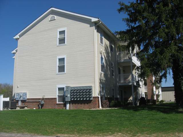
Photo: Nyttend / Wikimedia Commons, public domain · Wikimedia Commons
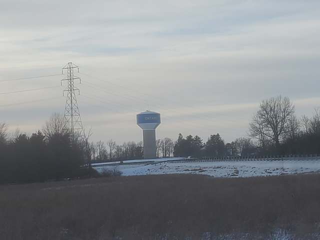
Photo: JBTHEMILKER / Wikimedia Commons, CC BY-SA 4.0 · Wikimedia Commons
Local history sources: en.wikipedia.org · en.wikipedia.org · archive.org · archive.org · archive.org · archive.org · archive.org · archive.org · archive.org · archive.org · npgallery.nps.gov · commons.wikimedia.org · commons.wikimedia.org
Historic places
1 place in Ontario on the National Register of Historic Places. Press a pin or a name for its whole record.
-
Springfield Township SchoolBuilding · Ontario · listed 2003
- Address
- 3560 Park Ave. W
- Where
- Ontario, Richland County · ZIP 44906
- What it is
- Building
- Listed on the National Register
- 2003
- NRIS reference number
- 03000325
- Coordinates
- 40.76085, -82.64244
National Register file (NPS) ↗ Search Wikipedia ↗ Street map and directions ↗ On the Cracked Buckeye map
Source: National Park Service, National Register of Historic Places point file. The listing year is shown where NPS's certification date agrees with the listing's reference number. Listing recognizes significance; it does not restrict a private owner.
Water
Clear Fork Reservoir, a 4.5-billion-gallon impoundment of the Clear Fork southwest of the treatment plant, supplemented by 9 city groundwater wells The water here
- Mansfield City60% of residentsClear Fork Reservoir (Clear Fork of the Mohican River), plus 9 city wells
- Ontario City30% of residentsGroundwater wells (3 wells)
- Aqua Ohio - Mansfield System #015% of residentsGroundwater wells (2 wells)
- Peyton Community Well3% of residentsGroundwater wells (1 wells)
- Aqua Ohio - Mansfield System #021% of residentsGroundwater wells (3 wells)
- Lakeview Estates MHP0% of residentsGroundwater wells (2 wells)
- Eastview Community Water Association0% of residentsGroundwater wells (3 wells)
- Aqua Ohio - Mansfield System #030% of residentsGroundwater wells (1 wells)
- Briarwood Estates MHP0% of residentsGroundwater wells (2 wells)
- Madison Water District0% of residentsGroundwater wells (4 wells)
- Aqua Ohio - Mansfield System #080% of residentsGroundwater wells (1 wells)
- Hanley Acres Water Association0% of residentsGroundwater wells (2 wells)
- Willow Park Water Association0% of residentsGroundwater wells (2 wells)
- Hillside MHP0% of residentsGroundwater wells (1 wells)
Hospitals, fire stations and more
Inside Ontario's boundary: 1 hospital, 1 dialysis center, 1 fire or EMS station, 2 colleges, 3 public schools, 1 library, 1 police station, 1 public charging site, 4 Toxics Release Inventory facilities and 4 spill cases. Press a pin or a name for its whole record and its source.
Hospitals (1)
-
Avita Ontario HospitalGeneral hospital · Ontario
- What it is
- General hospital
- Address
- 715 Richland Mall, Ontario, OH 44906
- County
- Richland County
- Beds
- 26
- Helipad
- Yes
- Ownership
- Non-profit
- Medicare overall rating
- 4 of 5 stars
- Emergency department (Medicare)
- Yes
- Medicare reports it as
- Avita Ontario
- Phone
- (567) 307-7666
- Medicare ID
- 360365
Medicare Care Compare ↗ Hospital's website ↗ Where HIFLD got this record ↗ HIFLD hospitals (source) ↗ Street map and directions ↗
Source: HIFLD hospitals inventory via FEMA (closed hospitals it still lists left out, hospitals opened since added), with Medicare Care Compare ratings matched by name and address.
Dialysis centers (1)
-
Davita Mid Ohio DialysisDialysis · Ontario
- Address
- 2148 W 4Th St, Ontario, OH 44906
- Dialysis stations
- 13
- Medicare star rating
- 3 of 5 stars
- Services
- in-center hemodialysis, peritoneal dialysis, home hemodialysis training
- Ownership
- for profit
- Chain
- DaVita
- Medicare certified since
- 2013-12-09
- Phone
- (419) 747-4039
- Medicare ID
- 362804
Medicare Care Compare ↗ CMS dialysis facility list (source) ↗ Street map and directions ↗
Source: CMS dialysis facility list, September 2026, geocoded with the Census Bureau batch geocoder (an address it could not place sits at its ZIP center).
Fire and EMS stations (1)
-
Springfield Township Fire Department Station 1Ontario
- Address
- 3700 Park Avenue West, Ontario, OH 44903
- Coordinates
- 40.76099, -82.64807
USGS National Map structures (source) ↗ Street map and directions ↗
Source: USGS National Map structures (most Ohio records last updated 2019 to 2022), checked against the Columbus and Cleveland station lists. The department that answers a call is set by jurisdiction and mutual aid, not by distance.
Colleges (2)
-
Apex Academy Hair Skin Nails School of CosmetologyFor-profit career school · Ontario
- What it is
- For-profit career school
- City
- Ontario
- Students, 2023-24 (12-month count)
- 58
- IPEDS unit ID
- 490434
College Navigator (NCES) ↗ IPEDS data (source) ↗ Street map and directions ↗
-
Ross Medical Education Center-OntarioFor-profit career school · Ontario
- What it is
- For-profit career school
- City
- Ontario
- Students, 2023-24 (12-month count)
- 86
- IPEDS unit ID
- 480532
College Navigator (NCES) ↗ IPEDS data (source) ↗ Street map and directions ↗
Source: NCES IPEDS 2024 directory, 2023-24 enrollment and tuition, graduation rates for the 2017 (four-year) and 2020 (two-year) entering classes.
Public schools (3)
-
Ontario High School4 of 5 stars · Mansfield
- Address
- 467 Shelby Ontario Rd, Mansfield, OH 44906
- School district
- Ontario Local School District
- Kind (NCES)
- Regular School
- Students, 2023-24
- 534
- Teachers (full-time equivalent)
- 29.62
- Report card, 2025-26
- 4 of 5 stars
- Performance index
- 87.6%
- Four-year graduation rate
- 98.7%
- Ohio building IRN
- 028670
- NCES school ID
- 390494703608
NCES school record ↗ Ohio School Report Card ↗ Street map and directions ↗
-
Ontario Middle School4 of 5 stars · Mansfield
- Address
- 447 Shelby Ontario Rd, Mansfield, OH 44906
- School district
- Ontario Local School District
- Kind (NCES)
- Regular School
- Students, 2023-24
- 472
- Teachers (full-time equivalent)
- 21.37
- Report card, 2025-26
- 4 of 5 stars
- Performance index
- 83.3%
- Ohio building IRN
- 028688
- NCES school ID
- 390494703609
NCES school record ↗ Ohio School Report Card ↗ Street map and directions ↗
-
Stingel Elementary School4.5 of 5 stars · Ontario
- Address
- 426 Shelby Ontario Rd, Ontario, OH 44906
- School district
- Ontario Local School District
- Kind (NCES)
- Regular School
- Students, 2023-24
- 904
- Teachers (full-time equivalent)
- 41
- Report card, 2025-26
- 4.5 of 5 stars
- Performance index
- 84.2%
- Ohio building IRN
- 139485
- NCES school ID
- 390494703677
NCES school record ↗ Ohio School Report Card ↗ Street map and directions ↗
Source: NCES EDGE public school locations 2024-25 and Common Core of Data 2023-24 (type, students, teachers); Ohio School Report Cards 2025-26 (Department of Education and Workforce), matched by name within the district.
Public libraries (1)
-
Ontario Branch LibraryBranch · Mansfield
- Address
- 2221 Village Mall Dr, Mansfield, OH 44906
- What it is
- Branch
- Library system
- Mansfield-Richland County Public Library
- Open
- 3,172 hours a year, 52 weeks
- Building
- 9,675 sq ft
- System's visits, FY2024
- 514,540
- System's loans, FY2024
- 1,567,119
- People the system serves
- 99,110
- Phone
- (419) 529-4912
IMLS Public Libraries Survey (source) ↗ Street map and directions ↗
Source: IMLS Public Libraries Survey FY2024 (outlets and their systems). Any Ohio resident can get a free card at any Ohio public library.
Police stations (1)
-
Ontario Police DepartmentOntario
- Address
- 555 Stumbo Road, Ontario, OH 44906
- Coordinates
- 40.76670, -82.59798
USGS National Map structures (source) ↗ Street map and directions ↗
Source: USGS National Map structures, police stations, corrected and completed by hand (September 2026). The department that answers a call is set by jurisdiction, not by distance.
Public EV charging (1)
-
Spitzer Chrysler Dodge Jeep Ram2 Level 2 · Ontario
- Address
- 1777 West 4th Street, Ontario, OH 44906
- Ports
- 2 Level 2
- Plugs
- J1772
- Network
- Blink Network
- Hours
- 24 hours daily
- Phone
- 888-998-2546
Station Locator (NREL) ↗ Alternative Fuels Data Center (source) ↗ Street map and directions ↗
Source: NREL Alternative Fuels Data Center station list (May 2026), public and open stations, the posts at one address counted as one site.
Facilities reporting toxic releases (4)
-
Burner Systems InternationalToxics Release Inventory · Mansfield
- Address
- 525 Beer Road, Mansfield, OH 44906
- County
- Richland County
- Status
- Reports to the Toxics Release Inventory (active)
- EPA program ID
- 44906NVRSL525BE
- EPA registry ID
- 110000392003
EPA facility record ↗ EPA Facility Registry Service (source) ↗ Street map and directions ↗
-
Invensys Energy Com Trol DivToxics Release Inventory · Mansfield
- Address
- 535 Beer Road, Mansfield, OH 44906
- County
- Richland County
- Status
- Reports to the Toxics Release Inventory (active)
- EPA program ID
- 44906NVNSY535BE
- EPA registry ID
- 110004737090
EPA facility record ↗ EPA Facility Registry Service (source) ↗ Street map and directions ↗
-
Pepsi-Cola Bottling of MansfieldToxics Release Inventory · Mansfield
- Address
- 1820 Nussbaum Pkwy., Mansfield, OH 44906
- County
- Richland County
- Status
- Reports to the Toxics Release Inventory (active)
- EPA program ID
- 44906PPSCL1820N
- EPA registry ID
- 110000392012
EPA facility record ↗ EPA Facility Registry Service (source) ↗ Street map and directions ↗
-
Racer TrustToxics Release Inventory · Mansfield
- Address
- 2525 West Fourth Street, Mansfield, OH 44906
- County
- Richland County
- Status
- Reports to the Toxics Release Inventory (active)
- EPA program ID
- 44906CPCGR2525W
- EPA registry ID
- 110000814566
EPA facility record ↗ EPA Facility Registry Service (source) ↗ Street map and directions ↗
Source: EPA Facility Registry Service, Toxics Release Inventory reporters. Reporting a release is required of large users of listed chemicals; it is not by itself a violation.
Spills reported since 2021 (4)
-
Fuel Diesel / Diesel Fuel (Vehicle On Or Off Road)2025-05-22 · Ontario
- Reported
- 2025-05-22
- What spilled
- Fuel Diesel / Diesel Fuel (Vehicle On Or Off Road)
- Largest amount reported
- 30 gallons
- Where
- Ontario, Richland County
- Ohio EPA district office
- NWDO
- Ohio EPA case number
- 2505EPA0000829
Ohio EPA spill reports (source) ↗ Street map and directions ↗
-
Other / All Other / Trade Name / Mixture / Solution Etc2023-06-23 · Springfield Twp
- Reported
- 2023-06-23
- What spilled
- Other / All Other / Trade Name / Mixture / Solution Etc
- Where
- Springfield Twp, Richland County
- Ohio EPA district office
- NWDO
- Ohio EPA case number
- 2306EPA0001041
Ohio EPA spill reports (source) ↗ Street map and directions ↗
-
Waste Water2023-02-14 · Ontario
- Reported
- 2023-02-14
- What spilled
- Waste Water
- Where
- Ontario, Richland County
- Ohio EPA district office
- NWDO
- Ohio EPA case number
- 2302EPA0000226
Ohio EPA spill reports (source) ↗ Street map and directions ↗
-
Fuel Diesel / Diesel Fuel (Vehicle On Or Off Road)2026-03-02 · Ontario
- Reported
- 2026-03-02
- What spilled
- Fuel Diesel / Diesel Fuel (Vehicle On Or Off Road)
- Largest amount reported
- 100 gallons
- Where
- Ontario, Richland County
- Ohio EPA district office
- NWDO
- Ohio EPA case number
- 2603EPA0000275
Ohio EPA spill reports (source) ↗ Street map and directions ↗
Source: Ohio EPA emergency response spill reports, 2021 to September 2026, one point per case where Ohio EPA placed it. A report is what the caller or responder recorded; amounts are often blank or estimated.
Its ZIP codes
Each ZIP code that touches Ontario, with the share of its residents who live here and the same headline figures as the ZIP page.
| ZIP | Share | Water | Radon | Home value | Schools | Flood |
|---|---|---|---|---|---|---|
| 44906 Mansfield | 30% | Clear Fork Reservoir, a 4.5-billion-gallon impoundment of the Clear Fork southwest of the treatment plant, supplemented by 9 city groundwater wells | 3.9 pCi/L average radon | Median year built 1958 | Mansfield City · 3 stars overall | 0.0% of residents in the 1% floodplain |
| 44903 Mansfield | 7% | Mostly private wells | 4.5 pCi/L average radon | Median year built 1957 | Mansfield City · 3 stars overall | 2.1% of residents in the 1% floodplain |
Local government
How its elections and ballot issues came out and the state auditor's record.
Elections for office
| Date | Office | Candidates and votes |
|---|---|---|
| 2015-11-03 | Treasurer | Jim Hairston 1,325, 100.0% |
| 2015-11-03 | Council Member, 4th Ward | Daniel J. Zeiter 381, 100.0% |
| 2015-11-03 | Council Member, 3rd Ward | Mark Weidemyre 377, 100.0% |
| 2015-11-03 | Council Member, 2nd Ward | Michele A. Webb 229, 100.0% |
| 2015-11-03 | Council Member, 1st Ward | Leo C. Hess 264, 100.0% |
Winners in bold. Results from the county board of elections' official canvass unless marked. The county's results on file run through 2018-08-07; later elections are not loaded yet.
Auditor of State record
- No fiscal caution, watch or emergency on the Auditor of State's lists.
- Financial Health Indicators (the Auditor of State's 17 measures; critical / cautionary / positive): 2020 0 / 2 / 15; 2021 0 / 1 / 16; 2022 0 / 4 / 13; 2023 0 / 3 / 14; 2024 0 / 1 / 16; 2025 0 / 1 / 15.
- Financial Audit, 2024, released 2026-01-29
- Special Audit, 2023 to 2024, released 2025-12-18
- Financial Audit, 2023, released 2024-11-12
On the November 3, 2026 ballot
Statewide question: State Issue 3: Voter ID
Races, candidates and every question for an address: your ballot. County offices and judges are on your county board's sample ballot.
The county
Richland County: 12 ZIP codes, 27 cities, villages and townships with pages here, 124,893 people (Census Bureau estimate, July 2025).
Nearby places
Rain and snow
How much has actually fallen on Ontario, day by day, from 1892 to now. Daily totals, not averages.
- rain, last 30 days
- 1.47 in
- 2026-10-01 to 2026-10-30
- rain so far in 2026
- 41.7 in
- 4.5 in above normal for the date
- snow so far in 2026
- 23.9 in
- a normal year brings 31.9 in
- a normal year
- 44.0 in
- average of 30 years, 1991-2020
| Month | Rain (in) | Snow (in) | Days counted |
|---|---|---|---|
| October 2026 | 1.47 | — | 30 |
| September 2026 | 4.31 | — | 30 |
| August 2026 | 6.88 | — | 31 |
| July 2026 | 3.87 | — | 31 |
| June 2026 | 3.58 | — | 30 |
| May 2026 | 6.47 | — | 31 |
| April 2026 | 7.23 | — | 30 |
| March 2026 | 4.77 | 0.9 | 31 |
| February 2026 | 1.22 | 5.8 | 28 |
| January 2026 | 1.94 | 17.2 | 31 |
| December 2025 | 3.02 | 11.2 | 31 |
| November 2025 | 2.10 | 2.4 | 30 |
| Wettest year | 2011 — 65.1 in |
|---|---|
| Driest year | 1934 — 23.3 in |
| Wettest day on record | 21 August 2007 — 5.19 in |
| Heaviest snowfall in a day | 22 December 2004 — 14.41 in |
| Deepest snow on the ground | 9 January 1905 — 25.00 in |
79% of these days are measurements from a gauge inside Ontario; the rest are estimated from the nearest gauges around it.
48,730 days of records, 1892-12-01 to 2026-10-30. Source: NOAA NCEI GHCN-Daily, 3,240 gauges in and around Ohio. A day is "gauged" when a gauge standing inside the boundary reported it, and the value is the mean of those gauges. Otherwise it is interpolated by inverse distance from every gauge reporting within 50 miles. Nothing is carried forward, back-filled or smoothed. Against NOAA nClimDiv county monthly precipitation over 136,848 complete county-months (checked 2026-11-01): correlation 0.9515, median absolute difference 0.217 in a month. Built 2026-11-01 from the Cracked Buckeye precipitation archive. Snow is the softer number — snowfall is measured by hand with a ruler, no agency publishes a gridded county snowfall series, and blowing snow defeats every observer.
Environmental permits and filings
What Ohio EPA has on file for Ontario: permits, inspections, violations, cleanups and the state loans behind sewer and water work. Every line links to the agency's own document.
- facilities and sites on file
- 34
- those placed on the map inside Ontario
| Program | Facilities and sites |
|---|---|
| Hazardous waste | 14 |
| Voluntary cleanup | 6 |
| Air pollution | 4 |
| Wastewater and stormwater discharge | 3 |
| Contaminated-site cleanup | 2 |
| Sewer and water-line construction | 2 |
| Brownfield | 1 |
| Public drinking water | 1 |
| State sewer loans | 1 |
| Date | Facility or site | What |
|---|---|---|
| ROCK RD. LIFT STATION | Sewer and water-line construction permit | |
| ROCK RD. LIFT STATION | Sewer and water-line construction permit | |
| PR MACHINE WORKS INC - PLANT 2 | Air pollution report | |
| MANSFIELD VETERINARY HOSPITAL | Air pollution report | |
| CHICK-FIL-A INC - FSU 06140 ONTARIO-MANSFIELD | Wastewater and stormwater discharge permit | |
| UNIVERSAL TUBULAR SYSTEMS FORMER, ONTARIO | Voluntary cleanup inspection | |
| ONTARIO CITY PWS | Public drinking water report | |
| CITY OF ONTARIO | Sewer and water-line construction permit | |
| CITY OF ONTARIO | Sewer and water-line construction permit | |
| ONTARIO CITY PWS | Public drinking water plan | |
| CHICK-FIL-A INC - FSU 06140 ONTARIO-MANSFIELD | Wastewater and stormwater discharge permit | |
| ONTARIO CITY PWS | Public drinking water inspection | |
| ONTARIO CITY PWS | Public drinking water violation resolved | |
| ONTARIO CITY PWS | Public drinking water inspection | |
| PR MACHINE WORKS INC - PLANT 2 | Air pollution permit | |
| ONTARIO CITY PWS | Public drinking water notice of violation | |
| ONTARIO CITY PWS | Public drinking water inspection | |
| ONTARIO VILLAGE STU 2 | Public drinking water inspection | |
| ONTARIO CITY PWS | Public drinking water warning letter | |
| ONTARIO CITY PWS | Public drinking water notice of violation | |
| ONTARIO CITY PWS | Public drinking water compliance letter | |
| ONTARIO CITY PWS | Public drinking water notice of violation | |
| ONTARIO CITY PWS | Public drinking water compliance letter | |
| ONTARIO CITY PWS | Public drinking water inspection | |
| ONTARIO CITY PWS | Public drinking water compliance letter |
Source: Ohio EPA eDocument portal (edocpub.epa.ohio.gov), indexed 2026-10-14. Facilities are placed on the map from Ohio EPA's own map layers, EPA's Facility Registry, coordinates written in the filings, or a geocoded street address. A permit filed under a private person's name (most are household septic systems) is counted but never named, placed or linked; licenses for individual workers and open-burning notices are left out entirely.
Quick answers
What county is Ontario, Ohio in?
Ontario is a city in Richland County, Ohio, with 6,656 residents.
When was Ontario, Ohio founded?
Ontario was settled 1834 (George Hoover built the first cabin, at Cook's urging); laid out December 1834; incorporated 1958 (village), 2001 (city). Founders on record: Hiram Cook. Source
How did Ontario, Ohio get its name?
Named for Ontario County, New York, the native place of Hiram Cook, who owned the land (Wikipedia and Baughman's 1908 county history). Source
What ZIP code is Ontario, Ohio?
Ontario is served by ZIP codes 44906 and 44903; 44906 holds the largest share of its residents.
Where does Ontario, Ohio get its water?
The main water source for Ontario (Mansfield City): Clear Fork Reservoir, a 4.5-billion-gallon impoundment of the Clear Fork southwest of the treatment plant, supplemented by 9 city groundwater wells.
Cite this page
Cite this page as:
Cracked Buckeye, "Ontario, Richland County", https://crackedbuckeye.com/place/ontario/, built 2026-10-31, accessed [date].
How to cite · Report a correction · Built 2026-10-31