Local events in Franklin Township, Richland County
Nothing is posted for Franklin Township itself yet; here is what is on within 10 miles. All local events in Franklin Township, Richland County
Know a calendar we should watch? Send the link
Checked October 20; the events page is refreshed daily.
How Franklin Township, Richland County began
Franklin Township was erected June 4, 1816, out of the southeast corner of Blooming Grove Township, six miles square, and was cut to six miles by four when its two eastern tiers of sections went to the new Weller Township after Ashland County was formed in 1846. Settlers from western Pennsylvania and Virginia, many of them German Lutheran or Reformed, came up the Black Fork, along Beall's trail and the old State road from Mansfield to Ganges, on which Long's and Inks' (later Gates') taverns served the grain wagons bound for Lake Erie. The township had no town and, by 1880, only one railroad corner; its landmarks were churches such as Zeiters' (deeded 1834) and the Clay Church. Part of the city of Mansfield now extends into its southern edge, and Mansfield Lahm Regional Airport lies nearby.
Settled about 1814 (a Methodist society of twelve was organized at Peter Pittenger's house in 1815), incorporated June 4, 1816 (erected as a township), by early settlers Henry and Peter Pittenger and George Wolford.
Where the name comes from
No source consulted gives the reason for the name. The 1880 and 1908 county histories record only the township's erection; it is one of twenty-one Franklin Townships in Ohio, a name commonly given for Benjamin Franklin, but no Richland County account says so.
Before the town
Graham's 1880 county history says Native people used the township extensively for hunting and sugar making but had no known permanent camp; each year they made temporary camps along the valleys of Friend's and Brubaker creeks, where settlers later found many stone implements. On the bank of Brubaker's Creek, a short distance west of John Kendall's barn, finds pointed to an encampment and perhaps a small burying ground that had never been examined. Settlers told of Native hunters carrying lumps of lead they would say came only from near the 'Big Hill' (now in Weller Township), of a hunter the settlers called 'Greasy' who hunted deer by firelight on the Black Fork, and of a hunter named Cornstalk who visited Isaac Charles's cabin in the fall of 1816. The sources do not name the nation of these visitors. The land lies north of the Greenville Treaty line and was ceded at Fort Industry in 1805.
- Brubaker's Creek encampment (camp) — Bank of Brubaker's Creek a short distance west of John Kendall's barn (Kendall farmed Section 20), before settlement; possibly with a small burying ground (archive.org)
- Seasonal hunting and sugar camps (camp) — Valleys of Friend's and Brubaker creeks, 18th and early 19th centuries (archive.org)
Timeline
- — Peter Pittenger, George Wolford and the Rev. John Clingan organize a Methodist society of twelve members at Pittenger's house, said to be the first religious service in this part of the county.
- — Franklin Township is erected on June 4 out of the southeast corner of Blooming Grove Township, six miles square.
- — The parents of Isaiah Boyce arrive from England and settle on the old State road where it crosses Brubaker's Run at Five Corners.
- — In winter Peter Pittenger, James Furgeson and his sons track a bear from near Wolford's schoolhouse to Palmer's swamp; it is finally shot two miles further on, near Windsor.
- — The first schoolhouse is built on Joseph Flora's farm near Long's tavern, with Thomas Taylor as teacher; it later burns after a spelling school.
- — About this year Bishop Philander Chase holds a confirmation at the Boyce home, which Baughman calls the first confirmation service held in Richland County.
- — German Reformed and Lutheran societies are organized in the schoolhouse near Long's tavern; John Kendall arrives from England and settles on Section 20.
- — John Zeiters and his wife deed ground on December 30 to the Lutheran and Reformed congregations of 'Zeiters' Church'; its graveyard's first burial, Henry Wainbranner, dates from 1833.
- — About this year part of the Zeiters' congregation under Jacob Clay withdraws and builds the Clay Church on Section 32.
- — Franklin loses its two eastern tiers of sections on July 5 to the new Weller Township, leaving it six miles by four (Graham; Baughman dates Weller to 1846).
- — A Baptist church is built on Section 22 by families who had attended the Baptist church at Windsor.
- — The Tunkers, who had met in houses since the 1830s, build a frame church on Section 20 on ground given by Michael Keith and John Kendall.
- — Zeiters' log church is replaced by a brick church (Graham); Baughman reported in 1908 that the brick church had been taken down a few years before.
- — The Harmony Baptist Church is organized September 3 and in 1866 builds a church on Section 20 for $2,000.
Stories
Three cuts with a tomahawk
In the winter of 1817, with a light snow on the ground, Peter Pittenger, James Furgeson and Furgeson's sons picked up a bear track near the later site of Wolford's schoolhouse and followed it east to a hollow tree by Palmer's swamp. Half way through chopping the tree down, the bear came out among the dogs and ran along the edge of the swamp. The men had left their guns behind and had only an ax and a hatchet, which they could not swing without hitting a dog. Pittenger seized the bear by the rump and gave it three deep cuts in the back with his tomahawk before he had to let go. The wounded animal ran two miles further and was shot on the Page farm near Windsor.
Zeiters' Church and its epitaph
The German Lutheran and Reformed settlers of southern Franklin met first in the schoolhouse near Israel Long's tavern on the old State road, and about 1825 organized two congregations there. They united to build a log church on land John Zeiters deeded to them on December 30, 1834, and the building kept the name Zeiters' Church. Its graveyard's first burial was Henry Wainbranner, who died in 1833 at sixty-two; his stone carried the verse beginning 'Remember friends, as you pass by,' under which someone later pencilled a reply refusing to follow 'Unless I know which way you went.' A brick church replaced the log one in 1861, and about 1840 a group under Jacob Clay split off to build the Clay Church a mile to the west.
Nine wolves and a bear
A Franklin Township story recorded by Robert Yeager tells of his father, Josiah Yeager, who was reloading his rifle after shooting at a turkey when wolves rose up between him and his cabin, three at first and nine by nightfall. He climbed a tree but could not get his dog up after him, and the wolves killed the dog below. Having dropped his powder horn, he could only watch them prowl beneath him for hours. The scent of blood brought a bear, the wolves ran, and Yeager climbed down and ran home. The county paid bounties of up to $4 a wolf scalp; it paid out $308 in 1828 but only $4.08 in 1834, by which time wolves were nearly gone from the county.
Photographs
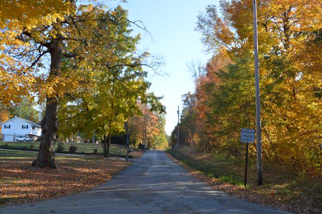
Photo: Nyttend / Wikimedia Commons, public domain · Wikimedia Commons
Local history sources: en.wikipedia.org · en.wikipedia.org · en.wikipedia.org · archive.org · archive.org · archive.org · archive.org · archive.org · archive.org · archive.org · archive.org · archive.org · archive.org · richlandcountyhistory.com · commons.wikimedia.org
Water
Mostly private wells The water here
- Mansfield City52% of residentsClear Fork Reservoir (Clear Fork of the Mohican River), plus 9 city wells
- Shelby City26% of residentsCity reservoirs (Nos. 2 & 3) fed by Black Fork Mohican River/Marsh Run
- Ontario City7% of residentsGroundwater wells (3 wells)
- Shiloh Village6% of residentsGroundwater wells (2 wells)
- Aqua Ohio - Mansfield System #022% of residentsGroundwater wells (3 wells)
- Lakeview Estates MHP2% of residentsGroundwater wells (2 wells)
- Eastview Community Water Association2% of residentsGroundwater wells (3 wells)
- Aqua Ohio - Mansfield System #031% of residentsGroundwater wells (1 wells)
- Madison Water District1% of residentsGroundwater wells (4 wells)
- Aqua Ohio - Mansfield System #080% of residentsGroundwater wells (1 wells)
- Hanley Acres Water Association0% of residentsGroundwater wells (2 wells)
- Willow Park Water Association0% of residentsGroundwater wells (2 wells)
- Hillside MHP0% of residentsGroundwater wells (1 wells)
Hospitals, fire stations and more
Inside Franklin Township, Richland County's boundary: 1 fire or EMS station and 6 spill cases. Press a pin or a name for its whole record and its source.
Fire and EMS stations (1)
-
Franklin Township Fire DepartmentShelby
- Address
- 505 Boyce Road, Shelby, OH 44875
- Coordinates
- 40.86527, -82.53190
USGS National Map structures (source) ↗ Street map and directions ↗
Source: USGS National Map structures (most Ohio records last updated 2019 to 2022), checked against the Columbus and Cleveland station lists. The department that answers a call is set by jurisdiction and mutual aid, not by distance.
Spills reported since 2021 (6)
-
Manure Nos (Not Specified)2025-05-21 · Franklin Twp
- Reported
- 2025-05-21
- What spilled
- Manure Nos (Not Specified)
- Where
- Franklin Twp, Richland County
- Ohio EPA district office
- NWDO
- Ohio EPA case number
- 2505EPA0000818
Ohio EPA spill reports (source) ↗ Street map and directions ↗
-
Material Undetermined / Other2023-12-05 · Franklin Twp
- Reported
- 2023-12-05
- What spilled
- Material Undetermined / Other
- Where
- Franklin Twp, Richland County
- Ohio EPA district office
- NWDO
- Ohio EPA case number
- 2312EPA0002020
Ohio EPA spill reports (source) ↗ Street map and directions ↗
-
Fuel Diesel / Diesel Fuel (Vehicle On Or Off Road)2023-06-26 · Franklin Twp
- Reported
- 2023-06-26
- What spilled
- Fuel Diesel / Diesel Fuel (Vehicle On Or Off Road); Oil Motor / Lube Oil / Vehicle
- Largest amount reported
- 80 gallons
- Where
- Franklin Twp, Richland County
- Ohio EPA district office
- NWDO
- Ohio EPA case number
- 2306EPA0001053
Ohio EPA spill reports (source) ↗ Street map and directions ↗
-
Manure Cattle Reached water2022-03-30 · Franklin Twp
- Reported
- 2022-03-30
- What spilled
- Manure Cattle
- Reached a waterway
- 99 - Unnamed
- Where
- Franklin Twp, Richland County
- Ohio EPA district office
- NWDO
- Ohio EPA case number
- 2203EPA0000427
Ohio EPA spill reports (source) ↗ Street map and directions ↗
-
Material Black Reached water2021-07-29 · Franklin Twp
- Reported
- 2021-07-29
- What spilled
- Material Black
- Reached a waterway
- 70 - Friends Creek
- Where
- Franklin Twp, Richland County
- Ohio EPA district office
- NWDO
- Ohio EPA case number
- 2107EPA0001150
Ohio EPA spill reports (source) ↗ Street map and directions ↗
-
Fuel Diesel / Diesel Fuel (Vehicle On Or Off Road)2026-05-01 · Franklin Twp
- Reported
- 2026-05-01
- What spilled
- Fuel Diesel / Diesel Fuel (Vehicle On Or Off Road)
- Largest amount reported
- 50 gallons
- Where
- Franklin Twp, Richland County
- Ohio EPA district office
- NWDO
- Ohio EPA case number
- 2605EPA0000735
Ohio EPA spill reports (source) ↗ Street map and directions ↗
Source: Ohio EPA emergency response spill reports, 2021 to September 2026, one point per case where Ohio EPA placed it. A report is what the caller or responder recorded; amounts are often blank or estimated.
Its ZIP codes
Each ZIP code that touches Franklin Township, Richland County, with the share of its residents who live here and the same headline figures as the ZIP page.
| ZIP | Share | Water | Radon | Home value | Schools | Flood |
|---|---|---|---|---|---|---|
| 44878 Bloominggrove Township and Shiloh | 8% | Mostly private wells | 5.2 pCi/L average radon | Median year built 1952 | Plymouth-Shiloh Local · 4 stars overall | 3.6% of residents in the 1% floodplain |
| 44903 Mansfield | 4% | Mostly private wells | 4.5 pCi/L average radon | Median year built 1957 | Mansfield City · 3 stars overall | 2.1% of residents in the 1% floodplain |
| 44875 Shelby | 2% | City reservoirs (Nos. 2 & 3) fed by Black Fork Mohican River/Marsh Run | 6.2 pCi/L average radon | Median year built 1951 | Shelby City · 4 stars overall | 4.6% of residents in the 1% floodplain |
Local government
How its elections and ballot issues came out and the state auditor's record.
Money issues on the ballot since 2015: 0 of 1 passed; of those asking for new or higher taxes, 0 of 1.
Ballot issues
| Date | Issue | For | Against | Result |
|---|---|---|---|---|
| 2015-11-03 | Issue: Franklin Twp-Tax Levy-Add'l- 1.5M-5Yrs-Current Exp (1.5 mills, additional) | 200 | 354 | Failed (36.1% for) |
Elections for office
| Date | Office | Candidates and votes |
|---|---|---|
| 2015-11-03 | Trustee (number of seats not on file, so winners are not marked) | Jeffery Lee Kuhn 301, 57.44%; Mike Keith 219, 41.79%; Write-In 4, 0.76% |
| 2015-11-03 | Fiscal Officer | Jennifer Washburn 381, 100.0% |
Winners in bold. Results from the county board of elections' official canvass unless marked. The county's results on file run through 2018-08-07; later elections are not loaded yet.
Auditor of State record
- Fiscal caution: declared 2013-08-08, released 2019-05-15. source
- Agreed Upon Procedures, 2023 to 2024, released 2025-08-05
On the November 3, 2026 ballot
Statewide question: State Issue 3: Voter ID
Races, candidates and every question for an address: your ballot. County offices and judges are on your county board's sample ballot.
The county
Richland County: 12 ZIP codes, 27 cities, villages and townships with pages here, 124,893 people (Census Bureau estimate, July 2025).
Nearby places
Quick answers
What county is Franklin Township, Ohio in?
Franklin Township, Richland County is a township in Richland County, Ohio, with 1,679 residents.
When was Franklin Township, Ohio founded?
Franklin Township, Richland County was settled about 1814 (a Methodist society of twelve was organized at Peter Pittenger's house in 1815); incorporated June 4, 1816 (erected as a township). Founders on record: early settlers Henry and Peter Pittenger and George Wolford. Source
What ZIP code is Franklin Township, Ohio?
Franklin Township, Richland County is served by ZIP codes 44878, 44903 and 44875; 44878 holds the largest share of its residents.
Where does Franklin Township, Ohio get its water?
The main water source for Franklin Township, Richland County (Mansfield City): Mostly private wells.
Cite this page
Cite this page as:
Cracked Buckeye, "Franklin Township, Richland County", https://crackedbuckeye.com/place/franklin-township-richland-county/, built 2026-11-02, accessed [date].
How to cite · Report a correction · Built 2026-11-02