How Madison Township, Licking County began
Madison Township holds the ground where Licking County's recorded settlement history begins: in 1798, Elias Hughes and John Ratliff squatted on the Bowling Green, a natural prairie along the Licking River, and planted the first corn a white settler ever raised within the county's future limits. A Delaware village the settlers knew only as "John Elliott's Wife's Town" had stood on the same prairie a generation earlier, visited by travelers in 1751 and 1773 but apparently gone by the early 1790s, its unexplained name and its people's fate both lost to the written record. The township was not formally organized until 1812, having been part of Licking Township before that, and its farmland along the Licking valley, watered by the Ohio Canal and the Central Ohio and Pan Handle railroads, became some of the most productive and, by the standards of the 1880s county historian, most beautifully kept in the state. Today it is a small, largely rural township on Newark's eastern edge, its National Register-listed buildings all standing across the line in Newark itself rather than within the township.
Settled 1798 (Elias Hughes and John Ratliff, on the Bowling Green prairie), incorporated 1812.
Where the name comes from
No source consulted states directly why the township was named Madison. It was organized in 1812, during James Madison's presidency, which is the most likely explanation, but no source consulted confirms this was the reason.
Before the town
Madison Township holds one of the more specifically documented Native village sites in the county's written record, even though, as the 1881 county history admits, its fuller story "is, and probably will remain, unwritten." A camp or town of the Lenape (Delaware), remembered only as "John Elliott's Wife's Town," occupied the Bowling Green prairie for a period the historian estimates at twenty to thirty years: trader Christopher Gist passed nearby in 1751 without mentioning it, but chaplain David Jones's 1773 diary records stopping at the village, and it apparently still stood some five or six years after that, when trader Judge Elliott is said to have lived there. By 1792, when Captain Samuel Brady's scouting party camped on the same prairie and named it Bowling Green, no mention of an Indian village survives, suggesting it had vanished by then, perhaps around the time of St. Clair's defeat in 1791. Workers excavating a bridge abutment on the Bowling Green run's east bank uncovered seven skeletons of "undoubted Indian type," probably the site's burial ground; one skeleton measured six feet three inches. A separate, smaller camp of Shawnee stood on Shawnee Run, on or near the farm of P. N. O'Bannon, giving the stream its name. Five unremarkable Mound Builder mounds, none large enough to be distinguished from hundreds of others across the county, are recorded on the farms of George A. Wilson, D. Wilson, Charles Montgomery and near the Bowling Green chapel. The 1909 Centennial History of the City of Newark and Licking County independently confirms the core of this account in its own, shorter Madison Township chapter: Gist's 1751 passage and mention of stopping at Indian villages along the trail, David Duncan and David Jones following the same route in February 1773, the excavation of skeletons on the Bowling Green run's east bank and the resulting burial-ground theory, and Captain Samuel Brady naming the prairie in 1792 with no Indian village then present. That later account, however, does not repeat the specific name "John Elliott's Wife's Town" or identify Judge Elliott by name, so that detail rests on the 1881 history alone.
Nations recorded here: Lenape (Delaware), Shawnee.
- John Elliott's Wife's Town (village) — on the Bowling Green prairie, along the Licking River, documented 1773, apparently gone by 1792 (archive.org)
- Probable burial ground, Bowling Green run (burial) — east bank of Bowling Green run, at a bridge abutment excavation, associated with John Elliott's Wife's Town (archive.org)
- Shawnee camp, Shawnee Run (camp) — on or near the P. N. O'Bannon farm, Shawnee Run, unspecified, pre-settlement (archive.org)
Timeline
- — Christopher Gist passes near the future site of the Bowling Green village on an Indian trail but does not mention it in his journal, suggesting the village did not yet exist.
- — In February, David Duncan and chaplain David Jones pass through on the same trail; Jones's diary records stopping at the Delaware village later called John Elliott's Wife's Town.
- — Captain Samuel Brady's scouting party camps on the Bowling Green prairie and names it, without mentioning any Indian village, suggesting the settlement had already disappeared.
- — Elias Hughes and John Ratliff squat on the Bowling Green prairie and plant corn, the first crop a white settler raises within what becomes Licking County.
- — Henry Hughes, son of Elias Hughes, is born, the first white child born in the township and the county.
- — Benjamin Green, Richard Pitzer, John Van Buskirk, Isaac Stadden's family and Captain Samuel Elliott all arrive during the year; on Christmas Day, the marriage of Col. John Stadden to Betsey Green becomes the eighth family in the township.
- — John Larabee, a Revolutionary War veteran who fought at Trenton, arrives from near Marietta and lives for months in a hollow sycamore tree while clearing land and building a cabin.
- — William O'Banon and other settlers arrive; O'Banon later serves as an early justice of the peace and as associate judge of the county's common pleas court from 1825 to 1839.
- — Jacob Nelson's mill, the township's first, is built on the south bank of the Licking River.
- — The first church built for religious purposes in the township, a hewed-log building on the Bowling Green prairie, is raised; it becomes known as the Bowling Green church.
- — Madison Township is formally organized, having previously been part of Licking Township, Fairfield County.
- — The Licking valley route through the township, served in 1881 by the Central Ohio and Pan Handle railroads, is by now carried by the Baltimore and Ohio and Panhandle lines alongside the Ohio Canal, reflecting the Central Ohio Railroad's absorption into the B&O system.
Stories
John Elliott's Wife's Town
For at least twenty years, and probably longer, a Delaware village stood on the Bowling Green prairie along the Licking River, known to later settlers only by the puzzling name John Elliott's Wife's Town. Christopher Gist passed close by in 1751 without mentioning any settlement there, but by February 1773 the missionary David Jones recorded stopping at the village on his own journey along the same trail. Judge Elliott, for whom the town was apparently named, is remembered as having kept a trading post there some years later, though the 1881 county history notes dryly that he was a single man at the time, undercutting any theory that the town honored an actual wife of his. By 1792, when Captain Samuel Brady's scouts camped on the same prairie and gave it the name Bowling Green, they recorded nothing of any Indian village, and the historian guesses it had vanished a year or so before, around the time of General St. Clair's defeat. All that survives of the town today is its name in an old book, and the seven skeletons workers found decades later while digging a bridge abutment into the east bank of the run that carries the name Bowling Green still.
The First Corn in the County
When Elias Hughes and John Ratliff reached the Bowling Green prairie in 1798, they found, in the county historian's words, "a farm ready-made to hand." The open, flower-covered grassland that had likely supported the vanished Delaware village needed no clearing; the two men simply turned the sod and planted corn that same year and for several years after, the first crop any white settler raised within what would become Licking County. Their cabins went up between Montour's Point and the Licking, home that first year to twenty-one people, the only white inhabitants of the future county until 1800 brought Benjamin Green, Richard Pitzer, John Van Buskirk, the Stadden family and Captain Samuel Elliott in quick succession. Hughes's son Henry, born in 1799, was the first white child born not just in the township but in the entire county, a distinction that placed Madison Township, quiet and rural ever since, at the very start of Licking County's written history.
A Hollow Sycamore for a House
John Larabee had already survived the Revolutionary War, including badly frozen feet at the Battle of Trenton, by the time he reached the Licking valley in the spring of 1801. Leaving his family behind near Marietta, he paddled up the Licking with a load of bacon and other provisions, landed near the mouth of Bowling Green run, and found what pioneers often relied on in the first weeks of settlement: a large, hollow sycamore tree more than ten feet across inside, ample room for a single man to camp while he cleared land and built something more permanent. He raised a few acres of corn that summer, built his cabin at his leisure, and returned to Marietta in the fall to bring his family to their new home, where they lived a pioneer's life for years afterward. Wholly illiterate but honest and industrious by every account, Larabee lived to be eighty-six, a Disciple church member who died in February 1846, one of the last living links to a hollow-tree beginning that the county's more comfortable later farms had long since made unimaginable.
Photographs
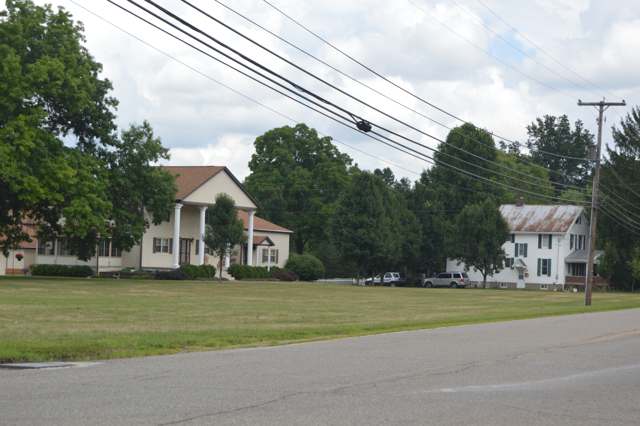
Photo: Nyttend, public domain · Wikimedia Commons
Local history sources: archive.org · archive.org · en.wikipedia.org · en.wikipedia.org · commons.wikimedia.org
Water
Mostly private wells The water here
- Newark City78% of residentsNorth Fork Licking River
- City of Heath20% of residentslocal wells
- Licking County Prescott Estates1% of residentsGroundwater wells (3 wells)
- Lakeshore Court Mobile Home1% of residentsGroundwater wells (1 wells)
- Villa Vista Mobile Home0% of residentsGroundwater wells (2 wells)
- St. Louisville Village0% of residentsGroundwater wells (2 wells)
- Winding Creek Estates0% of residentsGroundwater wells (1 wells)
- Valley Mobile Home Park0% of residentsGroundwater wells (2 wells)
- Muskingum County Water - Se0% of residentsMuskingum River buried valley aquifer (wells near Duncan Falls)
- Wilkins Mobile Home Park0% of residentsGroundwater wells (2 wells)
Its ZIP codes
Each ZIP code that touches Madison Township, Licking County, with the share of its residents who live here and the same headline figures as the ZIP page.
| ZIP | Share | Water | Radon | Home value | Schools | Flood |
|---|---|---|---|---|---|---|
| 43056 Heath | 5% | Mostly private wells | 8.8 pCi/L average radon | Median year built 1978 | Heath City · 4 stars overall | 5.8% of residents in the 1% floodplain |
| 43055 Newark | 4% | North Fork of the Licking River, drawn directly at riverbank intake screens beside the plant at the north end of Newark | 11.5 pCi/L average radon | Median year built 1960 | Newark City · 2.5 stars overall | 6.1% of residents in the 1% floodplain |
The county
Licking County: 17 ZIP codes, 38 cities, villages and townships, 160,939 people.
Nearby places
Cite this page
Cite this page as:
Cracked Buckeye (Open Shower Co), "Madison Township, Licking County", https://crackedbuckeye.com/place/madison-township-licking-county/, built 2026-09-16, accessed [date].
Machine-readable: /api/place/madison-township-licking-county.json (open JSON, CC BY 4.0 for the compilation; the underlying records keep their own terms) · How to cite · Report a correction · Built 2026-09-16