How Hanover began
Hanover grew up on the flat beside Rocky Fork's grist mill, where John Hoyt opened a grocery in 1835, but it was not formally platted until November 26-27, 1849, when John Hollister laid out the town on twelve hundred acres of his share of a four-thousand-acre tract his family had inherited from William Wells of Glastonbury, Connecticut. It was first named Fleming, for part-owner John M. Fleming, then renamed Hanover for its post office. The village sits on the Licking River in Hanover Township, downstream of Black Hand Gorge -- where a petroglyph said to have marked a safe-passage boundary for tribes traveling to the Flint Ridge quarries was destroyed by canal construction in 1828 -- and grew alongside the Ohio Canal and, later, two railroads that still cross the township. By 1881 it held about three hundred residents, two churches, a union school, and a mill that had already ground grain for the surrounding farms for over seventy years; it has since grown into Licking County's most populous unincorporated-turned-village community east of Newark, reaching 1,270 residents at the 2020 census.
Settled 1835 (John Hoyt's grocery on the flat by the grist mill), platted November 26-27, 1849, by John Hollister, on land inherited from William Wells of Glastonbury, Connecticut.
Where the name comes from
The town was first called "Fleming," after John M. Fleming, who had become part owner of the land, but the name was changed to Hanover once a post office of that name was established there; the village has been known by the post office's name ever since. No source consulted explains why "Hanover" itself was chosen for the post office.
Before the town
No Mound Builder or Indian site specific to the village site itself is recorded; the 1881 county history notes only that the wider township saw no permanent Indian camps in historic times, though the Bowling Green Indians used the area as a hunting ground. The village's setting gives it a real connection to deeper Native history, however: Hanover sits on the Licking River downstream of Black Hand Gorge, where a petroglyph in the shape of an outstretched black hand, with one elongated finger reportedly pointing toward a nearby mound, is believed to have marked the gorge as a place of safe passage for people traveling to quarry flint at Flint Ridge a few miles to the south -- flint worked there by Hopewell-era and other Native people for thousands of years. The petroglyph itself was destroyed in 1828 during construction of the Ohio and Erie Canal through the gorge; other surviving rock carvings nearby were later destroyed by blasting for an interurban railway in 1890. The land encompassing the village and gorge alike was ceded by the Treaty of Greenville of 1795.
Nations recorded here: Wyandot, Shawnee, Lenape (Delaware), Miami, Ottawa, Hopewell culture.
- Black Hand petroglyph (other) — Black Hand Gorge, on the Licking River in Hanover Township, upstream of Hanover village, prehistoric through 1828 (destroyed during canal construction) (en.wikipedia.org)
Timeline
- — The Treaty of Greenville cedes most of what becomes Ohio, including the future village site, to the United States.
- — Chester Wells, Captain Elisha Wells and John Hollister jointly build a grist mill on the Rocky Fork at the site later occupied by Hanover.
- — Construction begins on the Ohio and Erie Canal, which will pass through Hanover Township along the Licking River valley.
- — The Black Hand petroglyph, upstream at Black Hand Gorge, is destroyed during canal construction.
- — John Hoyt opens a grocery on the flat beside the grist mill, effectively founding the settlement that becomes Hanover.
- — John Hollister, surveyed by David Wyrick, formally lays out the town on the east side of Rocky Fork, first naming it Fleming.
- — Tracks for the Central Ohio Railroad are laid through the Licking valley in Hanover Township, including the 64-foot-high "Deep Cut" through sandstone at Black Hand Gorge; trains begin running the following year.
- — The Methodist Episcopal congregation, an offshoot of the church Rev. Joseph Thrap established decades earlier, builds its own church in the village.
- — A Presbyterian church organizes in Hanover with thirty-five members, after four years of biweekly preaching by Rev. Daniel Tenny of Newark.
- — The Presbyterian congregation completes a brick church, paid for in cash on completion at a cost of forty-seven hundred dollars.
- — The present Hanover Presbyterian Church building, on North Main Street, is constructed, replacing the 1872 brick edifice.
- — Blackhand Gorge becomes a dedicated Ohio State Nature Preserve, protecting 957 acres along the Licking River upstream of the village.
Stories
Named for a Chimney Landmark, Ended by a Canal
Long before Hanover village existed, Native travelers moving through the narrow, rock-walled gorge upstream on the Licking River passed a large petroglyph carved into the sandstone: a black hand with spread fingers, one finger unusually elongated, said to point toward a nearby burial mound. Local tradition and later historians have read it as a marker of safe conduct, a sign that all who passed through on their way south to quarry flint at Flint Ridge did so under a truce. The carving that gave the gorge its name did not survive into the industrial age -- it was destroyed in 1828 during construction of the Ohio and Erie Canal, which needed the gorge as a route for boats and water; other, lesser petroglyphs nearby lasted a few decades longer before blasting for an electric interurban railway erased them in 1890.
A Town Named Twice
William Wells of Glastonbury, Connecticut, once owned the entire four-thousand-acre quarter-township on which Hanover now sits, and divided it among his relatives, including Chester Wells and John Hollister. Hollister received twelve hundred acres and, in November 1849, had it surveyed and platted as a town -- but he did not call it Hanover. It was first named Fleming, honoring John M. Fleming, who had bought into part ownership of the land. Only after a post office opened under the name Hanover did the village quietly take that name for itself instead, leaving no trace of "Fleming" behind except in the county history's footnote.
Photographs
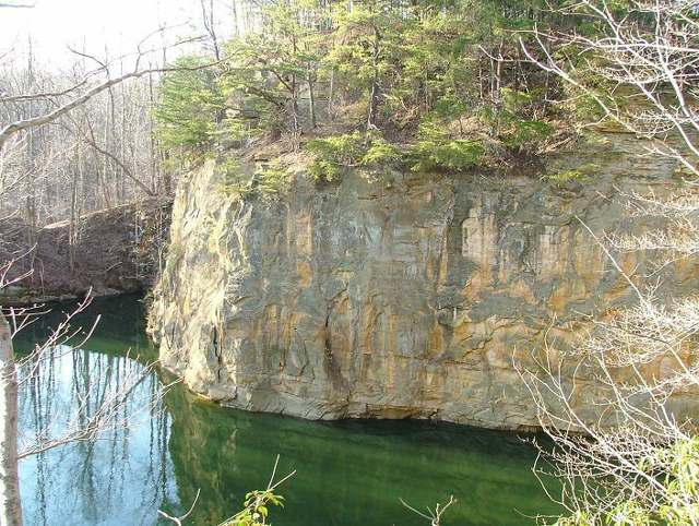
Photo: ChristopherM, via Wikimedia Commons, CC BY 2.5 · Wikimedia Commons
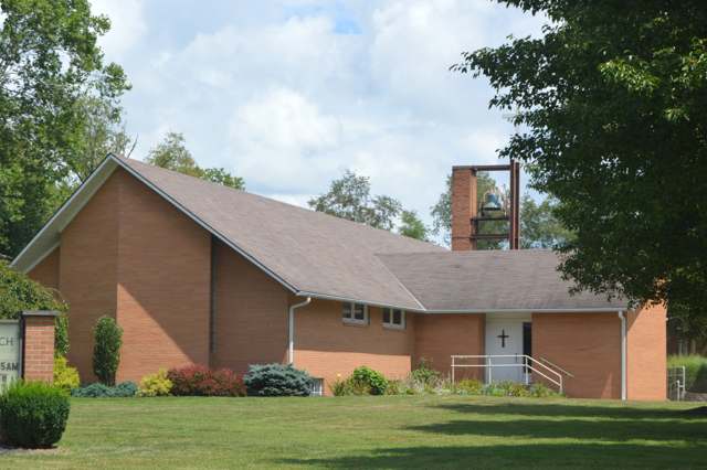
Photo: Nyttend, via Wikimedia Commons, public domain · Wikimedia Commons
Local history sources: archive.org · archive.org · en.wikipedia.org · en.wikipedia.org · en.wikipedia.org · en.wikipedia.org · commons.wikimedia.org · commons.wikimedia.org
Water
North Fork of the Licking River, drawn directly at riverbank intake screens beside the plant at the north end of Newark The water here
- Newark City98% of residentsNorth Fork Licking River
- Licking County Prescott Estates1% of residentsGroundwater wells (3 wells)
- Lakeshore Court Mobile Home1% of residentsGroundwater wells (1 wells)
- St. Louisville Village0% of residentsGroundwater wells (2 wells)
- City of Heath0% of residentslocal wells
- Winding Creek Estates0% of residentsGroundwater wells (1 wells)
- Valley Mobile Home Park0% of residentsGroundwater wells (2 wells)
- Wilkins Mobile Home Park0% of residentsGroundwater wells (2 wells)
Its ZIP codes
Each ZIP code that touches Hanover, with the share of its residents who live here and the same headline figures as the ZIP page.
| ZIP | Share | Water | Radon | Home value | Schools | Flood |
|---|---|---|---|---|---|---|
| 43055 Newark | 2% | North Fork of the Licking River, drawn directly at riverbank intake screens beside the plant at the north end of Newark | 11.5 pCi/L average radon | Median year built 1960 | Newark City · 2.5 stars overall | 6.1% of residents in the 1% floodplain |
The county
Licking County: 17 ZIP codes, 38 cities, villages and townships, 160,939 people.
Nearby places
Cite this page
Cite this page as:
Cracked Buckeye (Open Shower Co), "Hanover, Licking County", https://crackedbuckeye.com/place/hanover/, built 2026-09-16, accessed [date].
Machine-readable: /api/place/hanover.json (open JSON, CC BY 4.0 for the compilation; the underlying records keep their own terms) · How to cite · Report a correction · Built 2026-09-16