How Hanover Township, Licking County began
Hanover Township, on the Licking River's eastern approach into the county, was the corridor every early westward traveler and settler passed through, from the trader Christopher Gist in 1752 to the pioneers who followed the river valley after 1798. Organized April 19, 1808, the county's third township, it grew three small villages along the Rocky Fork and the river: Boston, Hanover (laid out 1849, first called Fleming), and Toboso, platted in 1852 where the Ohio Canal and the Central Ohio Railroad met the Licking Narrows. At the gorge's east end, a carved petroglyph known as the Black Hand, believed to have marked safe passage to the flint quarries upstream, was destroyed during the canal's construction in 1828; further rock carvings nearby survived until railroad blasting removed them in 1890. No source consulted explains the township's own name, and the 1881 county history states plainly that it holds 'no Indian history of consequence,' only its long use as a hunting ground.
Settled 1798-1801 (Philip Barrack, first permanent settler), incorporated April 19, 1808, the third township organized in the county.
Where the name comes from
No source consulted explains why the township is called Hanover. The 1881 county history's chapter on the township opens with its physical geography and pioneer history and does not address the origin of the name.
Before the town
The 1881 county history is direct about the limits of the record: 'No Indian history of consequence is connected with the township. No permanent camps of these red sons of the forest had an existence here in historic times, though it was used by the Bowling Green Indians as a hunting ground' - a reference to Native people associated with a separate place called 'the Bowling Green,' a natural prairie and early Indian village site on the Licking River that lies in what is now Madison Township, not this Hanover Township. Only a few small Mound Builder mounds are recorded within Hanover's own limits, including one on the farm of John H. Hughes between the canal and the Licking River, about eight feet high, and a smaller one on the farm of P. R. Denman. Far more striking is a site just outside the township's core farmland but within its eastern reach along the Licking: a carved petroglyph at the east end of Black Hand Gorge, near Toboso, showing a black hand with spread fingers and part of a wrist. According to local tradition recorded by the state nature preserve that now protects the gorge, the mark signified that all people passing through on their way to the flint quarries a few miles south had to do so in peace. The petroglyph was destroyed during construction of the Ohio and Erie Canal in 1828; additional carvings nearby, documented by Dr. James Salisbury and his brother before their loss, were destroyed by railroad blasting in 1890. The nature preserve's own account places Paleo-Indian and Hopewell-era use of the gorge as early as 13,000 BC. The land was ceded by the Treaty of Greenville in 1795.
Nations recorded here: Hopewell culture.
- Black Hand petroglyph (other) — east end of Black Hand Gorge, near Toboso, prehistoric; destroyed 1828, further carvings destroyed 1890 (en.wikipedia.org)
- Hughes farm mound (mound) — between the Ohio Canal and the Licking River, on the farm of John H. Hughes, prehistoric (Mound Builder) (archive.org)
Timeline
- — Paleo-Indian and, later, Hopewell-culture people occupy and pass through the Black Hand Gorge area, according to the state nature preserve's own account.
- — The Treaty of Greenville cedes most of what becomes Ohio, including the future Hanover Township, to the United States.
- — Christopher Gist becomes the first white man on record to enter Hanover Township, passing through the Licking valley.
- — A missionary remembered as Chaplain (David) Jones passes through the valley with trader David Duncan.
- — Philip Barrack, a Maryland native, squats near the later Claypool mills and then moves further up the valley near the Licking Narrows around 1801, becoming the township's first permanent settler.
- — Matthias Denman, from New Jersey, and Daniel Thompson, who becomes the township's largest landowner at four thousand acres, both settle in the township.
- — Chester Wells and John Hollister settle on the Rocky Fork; with Captain Elisha Wells, they build a grist-mill there in 1808.
- — Hanover Township is organized, the third township formed in the county.
- — The Black Hand petroglyph at the east end of Black Hand Gorge is destroyed during construction of the Ohio and Erie Canal.
- — John Hoyt opens a small grocery, founding the village of Boston, the first of the township's three villages.
- — John Hoyt opens a second grocery on the Rocky Fork flat near the grist-mill, founding the settlement that becomes Hanover village.
- — John Hollister lays out the town of Hanover, first named Fleming after part-owner John M. Fleming, and renamed Hanover for its post office.
- — William Stanberry's land at the lower end of the Licking Narrows is laid out as the village of Toboso, following completion of the Central Ohio Railroad alongside the Ohio Canal.
- — Railroad construction blasting destroys further Native rock carvings near the Black Hand petroglyph site, after Dr. James Salisbury and his brother had documented them.
- — A family photograph captures the north end of the electric interurban tunnel through Black Hand Gorge, near Toboso.
- — The Central Ohio Railroad route through Black Hand Gorge is abandoned following construction of the Dillon Dam.
Stories
The Hand That Marked Safe Passage
At the east end of Black Hand Gorge, where the Licking River cuts through sandstone narrows on its way toward Newark, an unknown hand once carved the image of a black hand with spread fingers and part of a wrist into the rock. Local tradition, as recorded by the state nature preserve that now protects the gorge, held that the mark meant every party passing through on the way to the flint quarries a few miles south, regardless of nation, had to travel in peace. The carving did not survive into the twentieth century to be studied by modern methods: workers building the Ohio and Erie Canal destroyed it in 1828. A second set of carvings nearby lasted a few decades longer, long enough for Dr. James Salisbury and his brother to document them, before railroad construction crews blasting through the gorge destroyed those too, in 1890. What remains today is the name alone, carried by the gorge, the nature preserve, and the little rail hamlet of Toboso built at its mouth.
Villages of the Rocky Fork
Hanover Township's three villages all trace back to enterprising storekeepers rather than formal town companies. John Hoyt opened a grocery in 1832 at a place that became known as Boston, 'not the Hub,' as the county historian felt obliged to clarify; when the railroads changed the flow of trade, Boston's promise faded. Three years later Hoyt tried again, on the flat by the grist-mill on Rocky Fork, and this time the settlement stuck, though the formal town was not surveyed until 1849, when John Hollister, who had inherited the land from a Connecticut relative, laid it out and named it Fleming after a part-owner; a post office soon changed the name to Hanover. Toboso came last, in 1852, when William Stanberry saw a chance to combine his land with the freshly completed Central Ohio Railroad and the older Ohio Canal at the foot of the Licking Narrows. All three villages depended on the same corridor of river, canal and rail that had carried travelers through Hanover Township since Christopher Gist first walked it in 1752.
Photographs
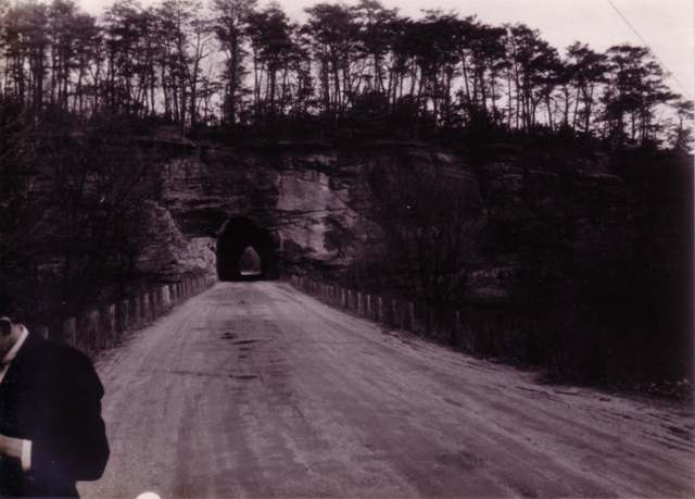
Photo: Charles Mangold, family photograph, via Wikimedia Commons, CC BY-SA 3.0 · Wikimedia Commons
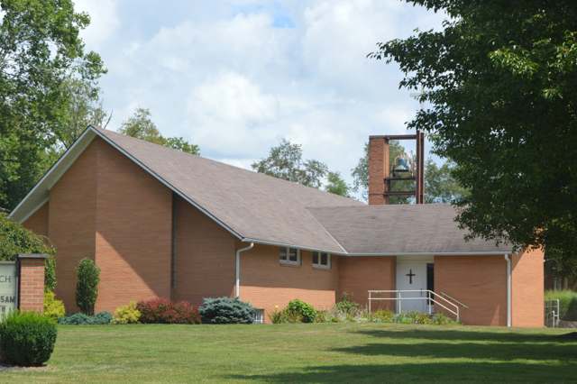
Photo: Nyttend, public domain · Wikimedia Commons
Local history sources: archive.org · en.wikipedia.org · en.wikipedia.org · en.wikipedia.org · en.wikipedia.org · commons.wikimedia.org · commons.wikimedia.org
Water
Mostly private wells The water here
- Newark City46% of residentsNorth Fork Licking River
- City of Heath43% of residentslocal wells
- Muskingum County Water - Se9% of residentsMuskingum River buried valley aquifer (wells near Duncan Falls)
- Villa Vista Mobile Home0% of residentsGroundwater wells (2 wells)
- Licking County Prescott Estates0% of residentsGroundwater wells (3 wells)
- Lakeshore Court Mobile Home0% of residentsGroundwater wells (1 wells)
- St. Louisville Village0% of residentsGroundwater wells (2 wells)
- Winding Creek Estates0% of residentsGroundwater wells (1 wells)
- Valley Mobile Home Park0% of residentsGroundwater wells (2 wells)
- Wilkins Mobile Home Park0% of residentsGroundwater wells (2 wells)
Its ZIP codes
Each ZIP code that touches Hanover Township, Licking County, with the share of its residents who live here and the same headline figures as the ZIP page.
| ZIP | Share | Water | Radon | Home value | Schools | Flood |
|---|---|---|---|---|---|---|
| 43056 Heath | 5% | Mostly private wells | 8.8 pCi/L average radon | Median year built 1978 | Heath City · 4 stars overall | 5.8% of residents in the 1% floodplain |
| 43830 Muskingum Township and Nashport | 4% | Mostly private wells | 7.1 pCi/L average radon | Appraisal records without year built | Tri-Valley Local · 4 stars overall | 1.2% of residents in the 1% floodplain |
| 43055 Newark | 1% | North Fork of the Licking River, drawn directly at riverbank intake screens beside the plant at the north end of Newark | 11.5 pCi/L average radon | Median year built 1960 | Newark City · 2.5 stars overall | 6.1% of residents in the 1% floodplain |
The county
Licking County: 17 ZIP codes, 38 cities, villages and townships, 160,939 people.
Nearby places
Cite this page
Cite this page as:
Cracked Buckeye (Open Shower Co), "Hanover Township, Licking County", https://crackedbuckeye.com/place/hanover-township-licking-county/, built 2026-09-16, accessed [date].
Machine-readable: /api/place/hanover-township-licking-county.json (open JSON, CC BY 4.0 for the compilation; the underlying records keep their own terms) · How to cite · Report a correction · Built 2026-09-16