How Hopewell Township, Licking County began
Hopewell Township holds the single most important Native American site in this part of Ohio: Flint Ridge, an eight-to-nine-mile vein of banded, multicolored Vanport flint that people quarried for tool-making for at least ten thousand years, trading the finished blades and points across much of eastern North America. White settlement reached the township about 1805-1806, and it organized in 1814; its village of Gratiot grew up on the National Road at the Muskingum County line after about 1831. The Ohio Historical Society made Flint Ridge a state memorial in 1934, and the site -- now called Flint Ridge Ancient Quarries and Nature Preserve, with a museum operated by the Ohio History Connection -- was added to the National Register of Historic Places in 1970. Away from the ridge itself, Hopewell remains a small, rural township of farms and a shared border village.
Settled 1805-1806, incorporated 1814.
Where the name comes from
No source consulted explains why Hopewell Township took its name; Wikipedia notes only that it is one of five townships named Hopewell across Ohio. The name has no confirmed connection to the archaeological "Hopewell culture," which is itself named for an unrelated farm near Chillicothe -- the coincidence that this Hopewell Township also happens to hold one of the culture's most important raw-material sources, Flint Ridge, appears to be just that, a coincidence, since no source ties the township's naming to the archaeological term.
Before the town
Flint Ridge is the most significant Native site of any kind covered in this local-history project. It is a ridge of Vanport flint, a banded, often brilliantly colored stone within the Allegheny Formation of Pennsylvanian age, running roughly eight to nine miles from east to west with an average width of more than two miles; about five miles of it lie in Hopewell Township, Licking County, several more miles continue east into a separate Hopewell Township across the line in Muskingum County, and its western tail reaches just over a mile into Franklin Township, Licking County. People quarried it for at least ten thousand years, beginning with Paleo-Indian and Archaic hunter-gatherers and continuing through the Adena and Hopewell mound-building cultures into the historic era; the 1881 county history describes "hundreds of old pits, some of them twenty feet deep, and covering more than a hundred acres," dug to reach flint that split more easily fresh from the ground than after exposure to weather. Excavated mounds on the ridge have yielded shell beads from the Gulf of Mexico and sheet mica, evidence of the long-distance trade networks the Hopewell culture is best known for; more recent scholarship has traced finished points and blades made from this flint as far as Kansas City and the Gulf coast, and flint from North Dakota's Knife River quarries has turned up in return at Ohio Hopewell sites, showing the exchange ran in both directions. Access to the quarries during the historic period likely ran through Black Hand Gorge on the Licking River to the north, in neighboring Hanover Township, where a petroglyph destroyed in 1828 is thought to have marked the route as a place of safe passage. The Ohio Historical Society made the richest concentration of surviving quarry pits a state memorial in 1934; it is now Flint Ridge Ancient Quarries and Nature Preserve, a 250-acre site with a museum operated by the Ohio History Connection, added to the National Register of Historic Places on November 10, 1970. Ohio flint from this ridge was named the state's official gemstone in 1965. The land itself, like the rest of Licking County, was ceded by the Treaty of Greenville of 1795; no source consulted names a specific historic-era Native village or leader tied to Hopewell Township beyond the flint quarries themselves.
Nations recorded here: Adena culture, Hopewell culture, Fort Ancient culture, Wyandot, Shawnee, Lenape (Delaware), Miami, Ottawa.
- Flint Ridge (ancient quarries) (other) — Flint Ridge, spanning the eastern part of Hopewell Township and continuing into Muskingum County and Franklin Township, at least 10,000 years of use, Paleo-Indian through the historic era (touring-ohio.com)
- Sepulchral and signal mounds on Flint Ridge (mound) — along Flint Ridge, Hopewell Township, Mound Builder era (archive.org)
Timeline
- prehistoric — People begin quarrying Vanport flint from Flint Ridge, a practice that continues for at least ten thousand years.
- — The Treaty of Greenville cedes most of what becomes Ohio, including the future Hopewell Township, to the United States.
- — William Hull, Isaac Farmer, Samuel Pollock and other families become the township's first white settlers.
- — Hopewell Township organizes; Isaac Farmer and Samuel Pollock are elected its first justices of the peace the following year.
- — Rev. James Quinn organizes the township's first religious society, a Methodist congregation, at the home of Widow Dickinson north of Brownsville.
- — The Methodist society builds a log church, heated in winter by burning charcoal in a stone-lined wooden box, since stoves and money for them were scarce on the ridge.
- — A Baptist church, one of the pioneer churches of Licking County, is established half a mile northwest of Gratiot.
- — Adam Smith lays out the village of Gratiot on the National Road at the Licking-Muskingum county line, naming it for General Charles Gratiot of the U.S. Army.
- — Ohio flint, most famously the banded flint of Flint Ridge, is designated the state's official gemstone.
- — The Ohio Historical Society establishes Flint Ridge State Memorial to protect the ridge's ancient quarry pits and natural setting.
- — Flint Ridge is added to the National Register of Historic Places.
Stories
Ten Thousand Years of Digging
Long before it had a museum or a state designation, Flint Ridge was simply the best place in Ohio to find the raw material for a knife, a spear point, or an arrowhead. The 1881 county history, quoting the geologist Colonel Charles Whittlesey, describes hundreds of ancient pits along the ridge, some twenty feet deep and spread across more than a hundred acres, where generations of people had learned that flint split more easily fresh from the ground than after it had weathered on the surface. Around the pits lie broad fields of rejected, half-worked chips -- the debris of countless attempts to shape a piece of stone into something clear and homogeneous enough to become a finished blade. Excavated mounds along the ridge have turned up shell beads that started out in the Gulf of Mexico and sheets of mica, proof that whatever was made here traveled a very long way from home, and that other things traveled just as far in return.
From Quarry to State Memorial
For more than a century after Ohio became a state, Flint Ridge remained mostly what it had always been: farmland pocked with mysterious, water-filled pits that puzzled the settlers who plowed around them. Early investigators including Caleb Atwater in 1818, Dr. S. P. Hildreth in 1838, and the geologist J. W. Foster all examined the ridge and concluded, from the sheer quantity of flint chips scattered across it, that both the Mound Builders and later Indians had worked the deposit heavily and shipped finished pieces elsewhere. It took until 1934 for the Ohio Historical Society to formally protect part of the ridge as a state memorial, and until 1970 for the site to reach the National Register of Historic Places. Today, as Flint Ridge Ancient Quarries and Nature Preserve, it is run by the Ohio History Connection with an on-site museum explaining what the pits meant to the people who dug them.
Photographs
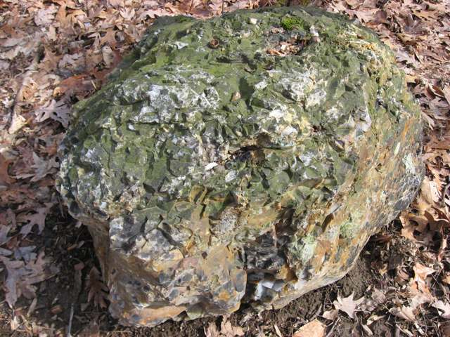
Photo: Nyttend, via Wikimedia Commons, public domain · Wikimedia Commons
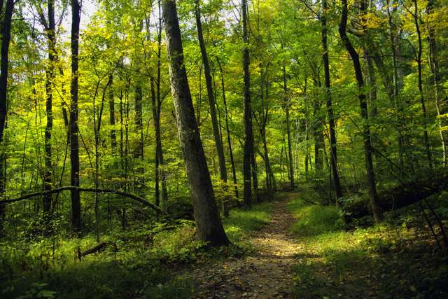
Photo: Niagara66, via Wikimedia Commons, CC BY-SA 4.0 · Wikimedia Commons
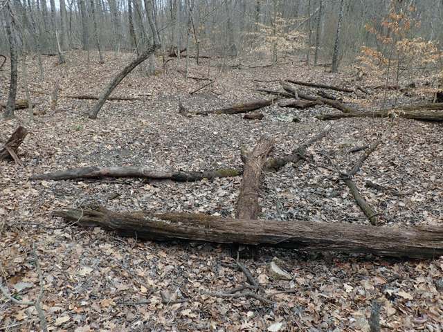
Photo: James St. John, via Wikimedia Commons, CC BY 2.0 · Wikimedia Commons
Local history sources: archive.org · archive.org · en.wikipedia.org · en.wikipedia.org · touring-ohio.com · en.wikipedia.org · en.wikipedia.org · en.wikipedia.org · en.wikipedia.org · commons.wikimedia.org · commons.wikimedia.org · commons.wikimedia.org
Water
Mostly private wells The water here
- City of Heath92% of residentslocal wells
- Muskingum County Water - Se4% of residentsMuskingum River buried valley aquifer (wells near Duncan Falls)
- Glenford Village2% of residentsGroundwater wells (2 wells)
- Villa Vista Mobile Home1% of residentsGroundwater wells (2 wells)
- Maysville Regional Water1% of residentsMuskingum River buried valley aquifer (wells near Duncan Falls)
Its ZIP codes
Each ZIP code that touches Hopewell Township, Licking County, with the share of its residents who live here and the same headline figures as the ZIP page.
| ZIP | Share | Water | Radon | Home value | Schools | Flood |
|---|---|---|---|---|---|---|
| 43739 Hopewell Township and Glenford | 10% | Mostly private wells | 9.0 pCi/L average radon | Median year built 1990 | Northern Local · 3 stars overall | 12% of residents in the 1% floodplain |
| 43746 Hopewell Township and Hopewell | 8% | Mostly private wells | 5.0 pCi/L average radon | Appraisal records without year built | West Muskingum Local · 3.5 stars overall | 6.8% of residents in the 1% floodplain |
| 43760 Madison Township and Mount Perry | 6% | Mostly private wells | 6.3 pCi/L average radon | Median year built 1995 | Northern Local · 3 stars overall | 1.9% of residents in the 1% floodplain |
| 43056 Heath | 5% | Mostly private wells | 8.8 pCi/L average radon | Median year built 1978 | Heath City · 4 stars overall | 5.8% of residents in the 1% floodplain |
The county
Licking County: 17 ZIP codes, 38 cities, villages and townships, 160,939 people.
Nearby places
Cite this page
Cite this page as:
Cracked Buckeye (Open Shower Co), "Hopewell Township, Licking County", https://crackedbuckeye.com/place/hopewell-township-licking-county/, built 2026-09-16, accessed [date].
Machine-readable: /api/place/hopewell-township-licking-county.json (open JSON, CC BY 4.0 for the compilation; the underlying records keep their own terms) · How to cite · Report a correction · Built 2026-09-16