Local events in Chillicothe
144 events in the next 90 days from 8 public calendars. All local events in Chillicothe
Checked October 20; the events page is refreshed daily.
Lakes near Chillicothe
The history under the water: the valley before, the dam, the stories. All Ohio lakes
Deep dives about Chillicothe
Long reads built from maps, newspapers and public records. All deep dives
- Adena MansionThomas Worthington built Adena, a sandstone hilltop house near Chillicothe, in 1805-1807 from Latrobe's plans. A mound dug there in 1901 named the Adena culture.
- Fort Ancient and Serpent MoundOhio's Fort Ancient farmers built maize villages from about AD 1000-1650. Nearby, Serpent Mound's true age is still disputed: about 300 BC or AD 1070.
- Ohio's Road to StatehoodFrom the French and Indian War through St. Clair's defeat to a one-vote loss of Black suffrage, Ohio's path to statehood in 1803 was neither clean nor certain.
- The Adena, Ohio's first mound buildersOhio's Adena culture raised the state's first burial mounds around 800 BC. It is named for Thomas Worthington's Chillicothe estate.
- The Hopewell CultureOhio's Hopewell people built moon-aligned earthworks around AD 90-430, moved Yellowstone obsidian 1,500 miles, and left a 2023 UNESCO World Heritage Site.
- The Mound Builder MythOhio's earthworks were long blamed on a vanished 'lost race,' a myth that helped justify Indian Removal and outlived its 1894 federal debunking.
Notable people from Chillicothe
Ohioans tied to this place, each with a sourced profile. All notable Ohioans
 Blue Jacket (Weyapiersenwah)c. 1743-c. 1810Shawnee war leader who, with the Miami leader Little Turtle, led the Native conf...
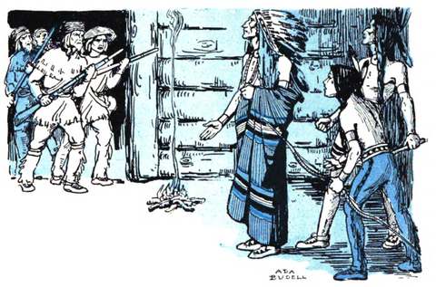 Cornstalk (Hokoleskwa)1720-1777Shawnee war leader of the Mekoche division whose town stood on the Pickaway Plai...
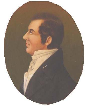 Edward Tiffin1766-1829Chillicothe physician and Methodist preacher who presided over the 1802 constitu...
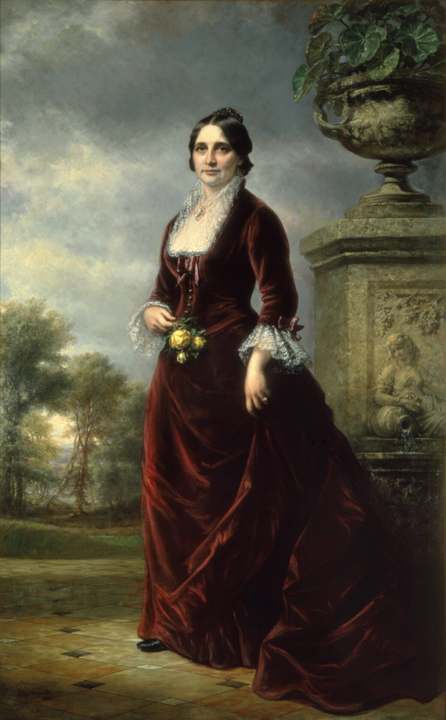 Lucy Webb Hayes1831-1889Chillicothe-born first lady (1877-1881), the first president's wife with a colle...
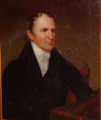 Thomas Worthington1773-1827Chillicothe land developer who led the push for Ohio statehood, served as one of...
History from Chillicothe
People and inventions tied to this place, each with its sources. All people · All inventions
How Chillicothe began
Chillicothe was founded in 1796 by General Nathaniel Massie and other surveyors on land in the Virginia Military District along the Scioto River, at a site the Shawnee had earlier called by variants of the same name. It served as capital of the remnant Northwest Territory from 1800, hosted Ohio's 1802 constitutional convention, and was the state's first capital from 1803 to 1810 and again from 1812 to 1816, before Columbus took over permanently. Ross County is the heart of the ancient Hopewell tradition (about 1 to 400 CE), and five of the earthwork groups that gave the culture its name now form Hopewell Culture National Historical Park in and around the city. Chillicothe later grew on the Ohio and Erie Canal and on paper, shoe and steel industries, and during World War I hosted Camp Sherman, one of the nation's largest Army training cantonments, built on and around the Mound City earthworks.
Settled 1796, platted 1796, incorporated 1802, by Nathaniel Massie, who laid out the town on land he had surveyed in the Virginia Military District after the Treaty of Greenville (1795) opened the Scioto valley to settlement.
Where the name comes from
The name comes from the Shawnee word Chala·ka·tha (also spelled Chalahgawtha, rendered in early accounts as "Chillicothe"), meaning roughly "principal town" or "place of the principal chief." Chalahgawtha was one of the five major divisions of the Shawnee nation, and wherever that division's leading town stood at a given time, English speakers called it "Chillicothe" -- which is why the name recurs at several different sites across Ohio (and in Kentucky) as Shawnee towns moved. The 1902 county history notes early writers also linked the name to "Chillicoco" in Indian Territory as a cognate.
Before the town
Ross County lies at the center of the Hopewell cultural tradition (about 1 to 400 CE), which is itself named for a site here: the Hopewell Mound Group, on the farm of Mordecai Hopewell along the North Fork of Paint Creek northwest of the city, first excavated by Warren K. Moorehead in 1891-92. Mound City Group, now the visitor center of Hopewell Culture National Historical Park, sits about two miles north of Chillicothe on State Route 104 and was mapped by Ephraim Squier and Edwin Davis in the 1840s; it contains 25 mounds inside a 13-acre square enclosure and was excavated again by William C. Mills in 1920-21 after the U.S. Army had leveled part of it to build Camp Sherman. Hopeton Earthworks, High Bank Works and Seip Earthworks, also Ross County Hopewell sites, are additional units of the same park. Squier and Davis's Chillicothe-area digs recovered hundreds of effigy pipes and other ceremonial goods now central to understanding Hopewell art and trade. Adena-culture (about 800 BC-AD 100) burial mounds are also documented in the county, including the mound for which that culture is named, on Thomas Worthington's Adena estate at the edge of Chillicothe. As for the historic Shawnee: the name "Chillicothe" (Chalahgawtha) was used for several different towns as the Shawnee Chalahgawtha division relocated over the 1700s -- the best-known, destroyed in 1780 and 1782, stood far to the west near present Oldtown in Greene County and is a separate site from anything at Ross County. Within Ross County itself, two Chalahgawtha/Chillicothe towns are recorded: one at Hopetown, about three miles north of the present city (near the Hopewell/Hopeton earthworks), and "Old Chillicothe" (Old Town) at the site of present Frankfort on the North Fork of Paint Creek, which the Shawnee occupied into the 1780s until it was destroyed in Benjamin Logan's 1786 campaign. The 1795 Treaty of Greenville, signed by Shawnee, Wyandot, Lenape (Delaware), Miami, Ottawa and other nations after their defeat at Fallen Timbers, ceded most of the Scioto valley including the Chillicothe site to the United States and opened it to the Virginia Military District surveys that produced the city three years later.
Nations recorded here: Shawnee, Adena culture, Hopewell culture.
- Hopewell Mound Group (earthwork) — on the former Mordecai Hopewell farm, North Fork of Paint Creek, Ross County, northwest of Chillicothe, Hopewell culture, c. 1-400 CE (en.wikipedia.org)
- Mound City Group (earthwork) — 16062 State Route 104, about 2 miles north of Chillicothe, Hopewell culture, c. 1-400 CE; overbuilt by Camp Sherman 1917-1920, restored 1920s (nps.gov)
- Adena Mound (mound) — the Adena estate (Thomas Worthington's home), edge of Chillicothe -- namesake site of the Adena culture, Adena culture, c. 800 BC-AD 100 (ohiohistorycentral.org)
- Chalahgawtha / "Old Chillicothe" at Hopetown (village) — about 3 miles north of present Chillicothe, near the Hopewell/Hopeton earthworks, historic Shawnee town, 18th century (en.wikipedia.org)
- "Old Chillicothe" (Old Town) at Frankfort (village) — site of present Frankfort, on the North Fork of Paint Creek, Ross County, occupied into the 1780s; destroyed 1786 (archive.org)
Timeline
- — The Treaty of Greenville cedes the Scioto valley, including the future Chillicothe site, to the United States, ending the war that followed the defeat of the Northwest Confederacy at Fallen Timbers.
- — Nathaniel Massie lays out Chillicothe on the Scioto River as a Virginia Military District town.
- — Ross County is organized with Chillicothe as county seat.
- — Chillicothe becomes capital of the remaining Northwest Territory after Indiana Territory is split off.
- — Ohio's constitutional convention meets in Chillicothe.
- — The first Ohio General Assembly convenes in Chillicothe on March 1, statehood day; Chillicothe becomes Ohio's first state capital.
- — The state capital moves temporarily to Zanesville.
- — The capital returns to Chillicothe.
- — The Ohio General Assembly selects Columbus as the permanent state capital, ending Chillicothe's role as seat of government.
- — The Ohio and Erie Canal reaches Chillicothe, spurring construction of canal warehouses including the surviving Canal Warehouse at Main and Mulberry streets (built c. 1830-31).
- — Ephraim Squier and Edwin Davis survey and map the Hopewell-era earthworks of the Scioto valley, including Mound City near Chillicothe, published in Ancient Monuments of the Mississippi Valley.
- — The great Ohio flood of March 1913 inundates Chillicothe's low-lying streets, including Hickory Street.
- — The U.S. Army builds Camp Sherman just north of Chillicothe, grading over part of the Mound City earthworks to create one of the largest World War I training cantonments in the country.
- — After Camp Sherman closes, the Ohio Historical Society (William C. Mills) excavates and the earthworks at Mound City are restored using the 1840s Squier and Davis maps.
- — President Warren G. Harding proclaims Mound City Group a national monument.
- — Chillicothe's water treatment plant opens on Park Street; the site is later cleared to become Veterans Memorial Park.
- — Congress expands Mound City Group National Monument to include part of the Hopeton Earthworks and authorizes study of other regional sites.
- — The city's current water treatment plant goes into service in Yoctangee Park, next to the municipal well field.
- — Congress renames and expands the park as Hopewell Culture National Historical Park, adding Hopeton Earthworks, High Bank Works, Hopewell Mound Group and Seip Earthworks alongside Mound City Group.
- — An Ohio EPA source water assessment rates the aquifer feeding Chillicothe's well field highly susceptible to contamination.
Stories
A frontier town made the state's first capital
Nathaniel Massie had already founded Manchester on the Ohio River when he turned to the Scioto valley in 1796, surveying land he was entitled to as a Virginia Military District locator and laying out Chillicothe on a bluff above the river. Settlers poured in fast: the town had a courthouse, a jail and hundreds of residents within a few years, and it quickly became the commercial and political hub of the Virginia Military District. When the Northwest Territory's legislature split off Indiana Territory in 1800, Chillicothe -- already the seat of Ross County -- became capital of what remained, and delegates met there in November 1802 to write Ohio's first constitution. On March 1, 1803, the first Ohio General Assembly convened in the two-story stone courthouse known as "Old Stone," a date Ohioans still mark as Statehood Day. The capital moved to Zanesville in 1810 in a political compromise, came back to Chillicothe in 1812, and was fixed permanently at the new town of Columbus in 1816 -- ending, after twenty years, Chillicothe's run at the seat of Ohio government.
The culture named for a Ross County farm
In 1891 and 1892 the archaeologist Warren K. Moorehead excavated a large group of geometric earthworks and mounds on the farm of Mordecai Hopewell, along the North Fork of Paint Creek northwest of Chillicothe. The site produced such extraordinary quantities of worked copper, mica, obsidian, marine shell and effigy pipes that archaeologists later adopted "Hopewell" as the name for the entire Middle Woodland-period culture and trade network it represented -- one that stretched from the Rocky Mountains to the Atlantic coast and from Ontario to the Gulf of Mexico, even though the people themselves left no name for their own culture. Chillicothe and the surrounding Scioto valley turned out to be the network's ceremonial center: Mound City, Hopeton, High Bank and Seip earthworks all sit within a few miles of the city, and together with the Hopewell Mound Group itself they now make up Hopewell Culture National Historical Park.
An army camp built over the mounds
When the United States entered World War I in 1917, the Army needed cantonments fast, and it chose a stretch of farmland just north of Chillicothe -- land that included the Mound City earthworks -- to build Camp Sherman. Within months the camp held tens of thousands of soldiers and became, for a time, one of the largest training posts in the country; part of the earthen enclosure at Mound City was leveled to make room for camp buildings. Once the war ended and the camp was decommissioned in the early 1920s, the Ohio Historical Society excavated the site and restored the mounds and walls using the 1840s survey maps drawn by Ephraim Squier and Edwin Davis, work precise enough that Mound City Group could be proclaimed a national monument by President Harding in 1923 -- turning a wartime training ground back into one of the most important ancient sites in Ohio.
Photographs
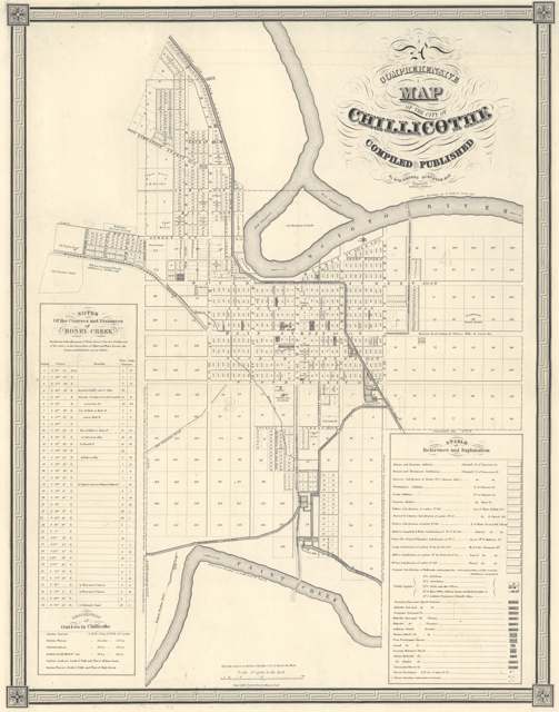
Photo: Wyd Wesson, public domain · Wikimedia Commons
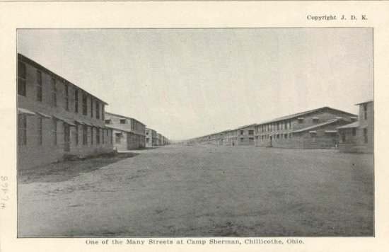
Photo: Philomen Frey Photographs collection, Mennonite Church USA Archives, no known copyright restrictions · Wikimedia Commons
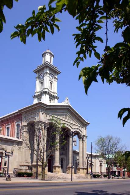
Photo: Rdikeman (English Wikipedia), CC BY-SA 3.0 · Wikimedia Commons
Local history sources: en.wikipedia.org · ohiohistorycentral.org · ohiohistorycentral.org · ohiohistorycentral.org · nps.gov · nps.gov · en.wikipedia.org · en.wikipedia.org · en.wikipedia.org · archive.org · chillicotheoh.gov · commons.wikimedia.org · commons.wikimedia.org · commons.wikimedia.org · commons.wikimedia.org · commons.wikimedia.org · commons.wikimedia.org
Historic places
12 places in Chillicothe on the National Register of Historic Places. Press a pin or a name for its whole record.
-
Canal WarehouseBuilding · Chillicothe · listed 1973
- Address
- Main and Mulberry Sts.
- Where
- Chillicothe, Ross County · ZIP 45601
- What it is
- Building
- Listed on the National Register
- 1973
- NRIS reference number
- 73001522
- Coordinates
- 39.33424, -82.97870
National Register file (NPS) ↗ Search Wikipedia ↗ Street map and directions ↗ On the Cracked Buckeye map
-
Chillicothe Water And Power Company Pumping StationBuilding · Chillicothe · listed 1979
- Address
- Enderlin Circle
- Where
- Chillicothe, Ross County · ZIP 45601
- What it is
- Building
- Listed on the National Register
- 1979
- NRIS reference number
- 79001932
- Coordinates
- 39.33950, -82.98175
National Register file (NPS) ↗ Search Wikipedia ↗ Street map and directions ↗ On the Cracked Buckeye map
-
Macomb, Mary Worthington, HouseBuilding · Chillicothe · listed 1976
- Address
- 490 S. Paint St.
- Where
- Chillicothe, Ross County · ZIP 45601
- What it is
- Building
- Listed on the National Register
- 1976
- NRIS reference number
- 76001525
- Coordinates
- 39.32196, -82.98004
National Register file (NPS) ↗ Search Wikipedia ↗ Street map and directions ↗ On the Cracked Buckeye map
-
Majestic TheatreBuilding · Chillicothe · listed 1979
- Address
- Roughly bounded by Water, 4th, Walnut and Hickory Sts.
- Where
- Chillicothe, Ross County · ZIP 45601
- What it is
- Building
- Listed on the National Register
- 1979
- NRIS reference number
- 79001931
- Coordinates
- 39.33492, -82.98101
National Register file (NPS) ↗ Search Wikipedia ↗ Street map and directions ↗ On the Cracked Buckeye map
-
Mountain HouseBuilding · Chillicothe · listed 1978
- Address
- Highland Ave.
- Where
- Chillicothe, Ross County · ZIP 45601
- What it is
- Building
- Listed on the National Register
- 1978
- NRIS reference number
- 78002181
- Coordinates
- 39.33205, -82.99117
National Register file (NPS) ↗ Search Wikipedia ↗ Street map and directions ↗ On the Cracked Buckeye map
-
Oak HillBuilding · Chillicothe · listed 1973
- Address
- Dun Rd.
- Where
- Chillicothe, Ross County · ZIP 45601
- What it is
- Building
- Listed on the National Register
- 1973
- NRIS reference number
- 73001527
- Coordinates
- 39.32634, -83.02430
National Register file (NPS) ↗ Search Wikipedia ↗ Street map and directions ↗ On the Cracked Buckeye map
-
Renick House, Paint HillBuilding · Chillicothe · listed 1973
- Address
- 17 Mead Dr.
- Where
- Chillicothe, Ross County · ZIP 45601
- What it is
- Building
- Listed on the National Register
- 1973
- NRIS reference number
- 73001528
- Coordinates
- 39.32341, -82.99058
National Register file (NPS) ↗ Search Wikipedia ↗ Street map and directions ↗ On the Cracked Buckeye map
-
Seip HouseBuilding · Chillicothe · listed 1981
- Address
- 345 Allen Ave.
- Where
- Chillicothe, Ross County · ZIP 45601
- What it is
- Building
- Listed on the National Register
- 1981
- NRIS reference number
- 81000450
- Coordinates
- 39.34174, -82.99342
National Register file (NPS) ↗ Search Wikipedia ↗ Street map and directions ↗ On the Cracked Buckeye map
-
Story Mound State MemorialStructure · Chillicothe · listed 1973
- Address
- East of junction of Cherokee and Delano Streets
- Where
- Chillicothe, Ross County · ZIP 45601
- What it is
- Structure
- Listed on the National Register
- 1973
- NRIS reference number
- 73001529
- Coordinates
- 39.34208, -82.99946
National Register file (NPS) ↗ Search Wikipedia ↗ Street map and directions ↗ On the Cracked Buckeye map
-
TanglewoodBuilding · Chillicothe · listed 1979
- Address
- 177 Belleview Ave.
- Where
- Chillicothe, Ross County · ZIP 45601
- What it is
- Building
- Listed on the National Register
- 1979
- NRIS reference number
- 79001934
- Coordinates
- 39.32759, -82.98838
National Register file (NPS) ↗ Search Wikipedia ↗ Street map and directions ↗ On the Cracked Buckeye map
-
Vanmeter Church Street HouseBuilding · Chillicothe · listed 1979
- Address
- 178 Church St.
- Where
- Chillicothe, Ross County · ZIP 45601
- What it is
- Building
- Listed on the National Register
- 1979
- NRIS reference number
- 79001935
- Coordinates
- 39.33619, -82.99117
National Register file (NPS) ↗ Search Wikipedia ↗ Street map and directions ↗ On the Cracked Buckeye map
-
Walke, Anthony, and Susan Cardinal, HouseBuilding · Chillicothe · listed 2007
- Address
- 381 Western Ave.
- Where
- Chillicothe, Ross County · ZIP 45601
- What it is
- Building
- Listed on the National Register
- 2007
- NRIS reference number
- 07000065
- Coordinates
- 39.33517, -82.99839
National Register file (NPS) ↗ Search Wikipedia ↗ Street map and directions ↗ On the Cracked Buckeye map
Source: National Park Service, National Register of Historic Places point file. The listing year is shown where NPS's certification date agrees with the listing's reference number. Listing recognizes significance; it does not restrict a private owner.
Water
Seven active wells in the Scioto Buried River Valley Aquifer (the CCR's own name) serving the city well field near Yoctangee Park. The City of Chillicothe also has emergency connections with Ross County Water Company and the Chillicothe Correctional Institution; neither was used in 2025. The water here
- Chillicothe City51% of residentsScioto Buried Valley Aquifer (Teays Valley system) wells
- Ross County Water Co. Inc49% of residentsTeays Valley Aquifer (buried valley groundwater)
- Kingston Village1% of residentsTeays Valley Aquifer (buried valley groundwater)
Hospitals, fire stations and more
Inside Chillicothe's boundary: 3 health centers, 1 dialysis center, 2 nursing homes, 2 fire and EMS stations, 3 colleges, 1 power plant, 6 public schools, 1 private school, 4 libraries, 7 museums, 2 police stations, 5 public charging sites, 3 Toxics Release Inventory facilities and 10 spill cases. Press a pin or a name for its whole record and its source.
Community health centers (3)
-
Chillicothe Admin 2Health center · Chillicothe
- Run by
- a federally qualified health center
- Setting
- Clinic
- City
- Chillicothe
- Coordinates
- 39.33672, -82.98060
Find a Health Center (HRSA) ↗ HRSA data (source) ↗ Street map and directions ↗
-
Chillicothe DentalHealth center · Chillicothe
- Run by
- a federally qualified health center
- Setting
- Clinic
- City
- Chillicothe
- Coordinates
- 39.33601, -83.00092
Find a Health Center (HRSA) ↗ HRSA data (source) ↗ Street map and directions ↗
-
Hopewell Health Centers - ChillicotheHealth center · Chillicothe
- Run by
- a federally qualified health center
- Setting
- Clinic
- City
- Chillicothe
- Coordinates
- 39.33353, -83.01268
Find a Health Center (HRSA) ↗ HRSA data (source) ↗ Street map and directions ↗
Source: HRSA health center service delivery sites, active, September 2026 (school-based sites left out). Health centers see patients whether or not they have insurance, with fees on a sliding scale.
Dialysis centers (1)
-
Davita Adena DialysisDialysis · Chillicothe
- Address
- 1180 N. Bridge Street, Chillicothe, OH 45601
- Dialysis stations
- 17
- Medicare star rating
- 4 of 5 stars
- Services
- in-center hemodialysis, peritoneal dialysis
- Ownership
- for profit
- Chain
- DaVita
- Medicare certified since
- 2012-02-13
- Phone
- (740) 773-3733
- Medicare ID
- 362777
Medicare Care Compare ↗ CMS dialysis facility list (source) ↗ Street map and directions ↗
Source: CMS dialysis facility list, September 2026, geocoded with the Census Bureau batch geocoder (an address it could not place sits at its ZIP center).
Nursing homes (2)
-
Chillicothe Post Acute3 of 5 stars · Chillicothe
- Address
- 1058 Columbus St, Chillicothe, OH 45601
- Certified beds
- 99
- Residents on an average day
- 82
- Medicare overall rating
- 3 of 5 stars
- Health inspections
- 2 of 5 stars
- Staffing
- 2 of 5 stars
- Quality measures
- 5 of 5 stars
- Penalties since 2023
- none
- Ownership
- For profit - Limited Liability company
- Chain
- PACS GROUP
- Takes
- Medicare and Medicaid
- Phone
- (740) 773-5000
- Medicare ID
- 365576
Medicare Care Compare ↗ CMS nursing home data (source) ↗ Street map and directions ↗
-
Westmoreland Place1 of 5 stars · Chillicothe
- Address
- 230 Cherry St, Chillicothe, OH 45601
- Certified beds
- 139
- Residents on an average day
- 86
- Medicare overall rating
- 1 of 5 stars
- Health inspections
- 1 of 5 stars
- Staffing
- 1 of 5 stars
- Quality measures
- 4 of 5 stars
- Penalties since 2023
- none
- Ownership
- For profit - Corporation
- Chain
- CARECORE HEALTH
- Takes
- Medicare and Medicaid
- Phone
- (740) 773-6470
- Medicare ID
- 365597
Medicare Care Compare ↗ CMS nursing home data (source) ↗ Street map and directions ↗
Source: CMS Care Compare nursing home provider and penalties files; Medicare star ratings run 1 to 5.
Fire and EMS stations (2)
-
Chillicothe Fire Department Station 1Chillicothe
- Address
- 54 East Water Street, Chillicothe, OH 45601
- Coordinates
- 39.33580, -82.98091
USGS National Map structures (source) ↗ Street map and directions ↗
-
Chillicothe Fire Department Station 4Chillicothe
- Address
- 100 University Drive, Chillicothe, OH 45601
- Coordinates
- 39.32744, -83.00712
USGS National Map structures (source) ↗ Street map and directions ↗
Source: USGS National Map structures (most Ohio records last updated 2019 to 2022), checked against the Columbus and Cleveland station lists. The department that answers a call is set by jurisdiction and mutual aid, not by distance.
Colleges (3)
-
Hair AcademyFor-profit career school · Chillicothe
- What it is
- For-profit career school
- City
- Chillicothe
- Students, 2023-24 (12-month count)
- 42
- IPEDS unit ID
- 497675
College Navigator (NCES) ↗ IPEDS data (source) ↗ Street map and directions ↗
-
Ohio University-Chillicothe CampusPublic university · Chillicothe
- What it is
- Public university
- City
- Chillicothe
- Students, 2023-24 (12-month count)
- 3,591
- Tuition and fees, in state
- $6,178
- Tuition and fees, out of state
- $9,170
- Graduation rate
- 14% of bachelor's students, within six years (a class of 223)
- IPEDS unit ID
- 204820
College Navigator (NCES) ↗ IPEDS data (source) ↗ Street map and directions ↗
-
Pickaway Ross Joint Vocational School DistrictPublic career school · Chillicothe
- What it is
- Public career school
- City
- Chillicothe
- Students, 2023-24 (12-month count)
- 413
- IPEDS unit ID
- 407513
College Navigator (NCES) ↗ IPEDS data (source) ↗ Street map and directions ↗
Source: NCES IPEDS 2024 directory, 2023-24 enrollment and tuition, graduation rates for the 2017 (four-year) and 2020 (two-year) entering classes.
Power plants (1)
-
Pixelle Specialty Solutions LLC - ChilliBiomass · 32 MW
- Capacity
- 32 MW
- By fuel
- natural gas 13 MW, biomass 20 MW
- Main source
- Biomass
- Technology
- Wood/Wood Waste Biomass; Natural Gas Steam Turbine;
- Operator
- Pixelle Specialty Solution, LLC
- Sector
- Industrial CHP
- Where
- Chillicothe, Ross County
- Generating units
- 4
- Built
- 1952 (first unit); newest unit 1978
- EIA plant code
- 10244
EIA plant page ↗ EIA-860 (source) ↗ Street map and directions ↗
Source: EIA-860 power plant inventory via HIFLD (February 2025), with plant codes, units and years from EIA-860 2025.
Public schools (6)
-
Chillicothe High School3 of 5 stars · Chillicothe
- Address
- 421 Yoctangee Pkwy, Chillicothe, OH 45601
- School district
- Chillicothe City School District
- Kind (NCES)
- Regular School
- Students, 2023-24
- 859
- Teachers (full-time equivalent)
- 42
- Report card, 2025-26
- 3 of 5 stars
- Performance index
- 69.2%
- Four-year graduation rate
- 92.1%
- Ohio building IRN
- 006296
- NCES school ID
- 390437400281
NCES school record ↗ Ohio School Report Card ↗ Street map and directions ↗
-
Chillicothe Intermediate School2.5 of 5 stars · Chillicothe
- Address
- 345 Arch St, Chillicothe, OH 45601
- School district
- Chillicothe City School District
- Kind (NCES)
- Regular School
- Students, 2023-24
- 754
- Teachers (full-time equivalent)
- 46
- Report card, 2025-26
- 2.5 of 5 stars
- Performance index
- 64.5%
- Ohio building IRN
- 037234
- NCES school ID
- 390437400287
NCES school record ↗ Ohio School Report Card ↗ Street map and directions ↗
-
Chillicothe Middle School4 of 5 stars · Chillicothe
- Address
- 381 Yoctangee Pkwy, Chillicothe, OH 45601
- School district
- Chillicothe City School District
- Kind (NCES)
- Regular School
- Students, 2023-24
- 381
- Teachers (full-time equivalent)
- 28.5
- Report card, 2025-26
- 4 of 5 stars
- Performance index
- 71.8%
- Ohio building IRN
- 034736
- NCES school ID
- 390437400286
NCES school record ↗ Ohio School Report Card ↗ Street map and directions ↗
-
Chillicothe Primary School2.5 of 5 stars · Chillicothe
- Address
- 235 Cherry St, Chillicothe, OH 45601
- School district
- Chillicothe City School District
- Kind (NCES)
- Regular School
- Students, 2023-24
- 546
- Teachers (full-time equivalent)
- 27
- Report card, 2025-26
- 2.5 of 5 stars
- Ohio building IRN
- 025841
- NCES school ID
- 390437400285
NCES school record ↗ Ohio School Report Card ↗ Street map and directions ↗
-
Mt. Logan Early Childhood CenterChillicothe
- Address
- 841 E Main St, Chillicothe, OH 45601
- Kind (NCES)
- Regular School
- Students, 2023-24
- 105
- Teachers (full-time equivalent)
- 11
- NCES school ID
- 390437405981
-
Southern Ohio Career AcademyChillicothe
- Address
- 30 E Main St, Chillicothe, OH 45601
- Kind (NCES)
- Regular School
- Students, 2023-24
- 42
- Teachers (full-time equivalent)
- 3.5
- NCES school ID
- 391005510873
Source: NCES EDGE public school locations 2024-25 and Common Core of Data 2023-24 (type, students, teachers); Ohio School Report Cards 2025-26 (Department of Education and Workforce), matched by name within the district.
Private schools (1)
-
Bishop Flaget SchoolPrivate, Catholic · Chillicothe
- Address
- 570 Parsons Ave, Chillicothe, OH 45601
- Kind
- Catholic
- Students, 2023-24
- 172
- Teachers (full-time equivalent)
- 15.8
- Students per teacher
- 10.8861
- Phone
- (740) 774-2970
- NCES private school ID
- 01060138
Source: NCES Private School Survey 2023-24.
Public libraries (4)
-
Chillicothe and Ross County Public LibraryCentral library · Chillicothe
- Address
- 140 S Paint St, Chillicothe, OH 45601
- What it is
- Central library
- Library system
- Chillicothe and Ross County Public Library
- Open
- 3,120 hours a year, 52 weeks
- Building
- 44,137 sq ft
- System's visits, FY2024
- 217,776
- System's loans, FY2024
- 429,173
- People the system serves
- 77,093
- Phone
- (740) 702-4145
IMLS Public Libraries Survey (source) ↗ Street map and directions ↗
-
Chillicothe and Ross County Public Library Bs1Bookmobile stop · Chillicothe
- Address
- 140 S Paint St, Chillicothe, OH 45601
- What it is
- Bookmobile stop
- Library system
- Chillicothe and Ross County Public Library
- Open
- 520 hours a year, 52 weeks
- System's visits, FY2024
- 217,776
- System's loans, FY2024
- 429,173
- People the system serves
- 77,093
- Phone
- (740) 702-4145
IMLS Public Libraries Survey (source) ↗ Street map and directions ↗
-
Mt. Logan Satellite BranchBranch · Chillicothe
- Address
- 841 E. Main St., Chillicothe, OH 45601
- What it is
- Branch
- Library system
- Chillicothe and Ross County Public Library
- Open
- 600 hours a year, 50 weeks
- Building
- 2,000 sq ft
- System's visits, FY2024
- 217,776
- System's loans, FY2024
- 429,173
- People the system serves
- 77,093
- Phone
- (740) 702-4145
IMLS Public Libraries Survey (source) ↗ Street map and directions ↗
-
Northside BranchBranch · Chillicothe
- Address
- 550 Buckeye Street, Chillicothe, OH 45601
- What it is
- Branch
- Library system
- Chillicothe and Ross County Public Library
- Open
- 3,120 hours a year, 52 weeks
- Building
- 10,400 sq ft
- System's visits, FY2024
- 217,776
- System's loans, FY2024
- 429,173
- People the system serves
- 77,093
- Phone
- (740) 702-4100
IMLS Public Libraries Survey (source) ↗ Street map and directions ↗
Source: IMLS Public Libraries Survey FY2024 (outlets and their systems). Any Ohio resident can get a free card at any Ohio public library.
Museums, historical societies, gardens and zoos (7)
-
Adena Mansion And Gardens SocietyHistorical society · Chillicothe
- What it is
- Historical society
- City
- Chillicothe
- Coordinates
- 39.35454, -83.01246
Search Wikipedia ↗ IMLS Museum Data Files (source) ↗ Street map and directions ↗
The museum list is IMLS's 2018 file; a museum may have closed or moved since.
-
Adena State MemorialMuseum · Chillicothe
- What it is
- Museum
- City
- Chillicothe
- Coordinates
- 39.35464, -83.01268
Search Wikipedia ↗ IMLS Museum Data Files (source) ↗ Street map and directions ↗
The museum list is IMLS's 2018 file; a museum may have closed or moved since.
-
James M Thomas MuseumMuseum · Chillicothe
- What it is
- Museum
- City
- Chillicothe
- Coordinates
- 39.33320, -82.98136
Search Wikipedia ↗ IMLS Museum Data Files (source) ↗ Street map and directions ↗
The museum list is IMLS's 2018 file; a museum may have closed or moved since.
-
Lucy Hayes Heritage CenterHistory museum · Chillicothe
- What it is
- History museum
- City
- Chillicothe
- Coordinates
- 39.33419, -83.00310
Search Wikipedia ↗ IMLS Museum Data Files (source) ↗ Street map and directions ↗
The museum list is IMLS's 2018 file; a museum may have closed or moved since.
-
Pump House Art GalleryHistorical society · Chillicothe
- What it is
- Historical society
- City
- Chillicothe
- Coordinates
- 39.33419, -83.00310
Search Wikipedia ↗ IMLS Museum Data Files (source) ↗ Street map and directions ↗
The museum list is IMLS's 2018 file; a museum may have closed or moved since.
-
Ross County Historical SocietyHistorical society · Chillicothe
- What it is
- Historical society
- City
- Chillicothe
- Coordinates
- 39.33048, -82.98256
Search Wikipedia ↗ IMLS Museum Data Files (source) ↗ Street map and directions ↗
The museum list is IMLS's 2018 file; a museum may have closed or moved since.
-
South Central Ohio Preservation SocietyHistorical society · Chillicothe
- What it is
- Historical society
- City
- Chillicothe
- Coordinates
- 39.33541, -82.99087
Search Wikipedia ↗ IMLS Museum Data Files (source) ↗ Street map and directions ↗
The museum list is IMLS's 2018 file; a museum may have closed or moved since.
Source: IMLS Museum Data Files, 2018.
Police stations (2)
-
Chillicothe Police DepartmentChillicothe
- Address
- 28 North Paint Street, Chillicothe, OH 45601
- Coordinates
- 39.33414, -82.98286
USGS National Map structures (source) ↗ Street map and directions ↗
-
Ross County Sheriff's OfficeChillicothe
- Address
- 28 North Paint Street, Chillicothe, OH 45601
- Coordinates
- 39.33417, -82.98272
USGS National Map structures (source) ↗ Street map and directions ↗
Source: USGS National Map structures, police stations, corrected and completed by hand (September 2026). The department that answers a call is set by jurisdiction, not by distance.
Public EV charging (5)
-
Coughlin Chevrolet Buick GMC Of Chillicothe DC fast1 DC fast · CHILLICOTHE
- Address
- 1221 N BRDGE ST, CHILLICOTHE, OH 45601
- Ports
- 1 DC fast
- Plugs
- CCS
- Network
- EV Connect
- Hours
- 24 hours daily
- Phone
- 866-816-7584
Station Locator (NREL) ↗ Alternative Fuels Data Center (source) ↗ Street map and directions ↗
-
NOURSE TOYOTA TOYOTA SRV1 Level 2 · Chillicothe
- Address
- 423 N Bridge St, Chillicothe, OH 45601
- Ports
- 1 Level 2
- Plugs
- J1772
- Network
- ChargePoint Network
- Hours
- 24 hours daily
- Phone
- 888-758-4389
Station Locator (NREL) ↗ Alternative Fuels Data Center (source) ↗ Street map and directions ↗
-
YOCTANGEE CHILLICOTHE DC fast1 DC fast · 2 Level 2 · Chillicothe
- Address
- 37 E Water St, Chillicothe, OH 45601
- Ports
- 1 DC fast · 2 Level 2
- Plugs
- CCS, CHAdeMO, J1772
- Network
- ChargePoint Network
- Hours
- 24 hours daily
- Phone
- 888-758-4389
Station Locator (NREL) ↗ Alternative Fuels Data Center (source) ↗ Street map and directions ↗
-
YOCTANGEE YOCTANGEEPARK2 DC fast1 DC fast · 2 Level 2 · Chillicothe
- Address
- 37 E Water St Side, Chillicothe, OH 45601
- Ports
- 1 DC fast · 2 Level 2
- Plugs
- CCS, CHAdeMO, J1772
- Network
- ChargePoint Network
- Hours
- 24 hours daily
- Phone
- 888-758-4389
Station Locator (NREL) ↗ Alternative Fuels Data Center (source) ↗ Street map and directions ↗
-
Zane Plaza - Tesla Supercharger DC fast8 DC fast · Chillicothe
- Address
- 1080 N. Bridge Street, Chillicothe, OH 45601
- Ports
- 8 DC fast
- Plugs
- Tesla (NACS)
- Network
- Tesla
- Hours
- 24 hours daily. Please check Tesla's online station map to see if an adapter is required at this location.
- Phone
- 877-798-3752
Station Locator (NREL) ↗ Alternative Fuels Data Center (source) ↗ Street map and directions ↗
Source: NREL Alternative Fuels Data Center station list (May 2026), public and open stations, the posts at one address counted as one site.
Facilities reporting toxic releases (3)
-
Barber Spring OhioToxics Release Inventory · Chillicothe
- Address
- 387 Wetzel Dr., Chillicothe, OH 45601
- County
- Ross County
- Status
- Reports to the Toxics Release Inventory (active)
- EPA program ID
- 45601NMSPR387WE
- EPA registry ID
- 110000395126
EPA facility record ↗ EPA Facility Registry Service (source) ↗ Street map and directions ↗
-
Pixelle Specialty Solutions Llc (0671010028)Toxics Release Inventory · Chillicothe
- Address
- 232 East 8Th St., Chillicothe, OH 45601
- County
- Ross County
- Status
- Reports to the Toxics Release Inventory (open)
- EPA program ID
- 45601MDCRP401SP
- EPA registry ID
- 110000395117
EPA facility record ↗ EPA Facility Registry Service (source) ↗ Street map and directions ↗
-
Specialty Minerals IncToxics Release Inventory · Chillicothe
- Address
- Paint & 11Th Street, Chillicothe, OH 45601
- County
- Ross County
- Status
- Reports to the Toxics Release Inventory (active)
- EPA program ID
- 45601PFZRSPAINT
- EPA registry ID
- 110002472725
EPA facility record ↗ EPA Facility Registry Service (source) ↗ Street map and directions ↗
Source: EPA Facility Registry Service, Toxics Release Inventory reporters. Reporting a release is required of large users of listed chemicals; it is not by itself a violation.
Spills reported since 2021 (10)
-
Fuel Diesel / Diesel Fuel (Vehicle On Or Off Road)2024-11-22 · Chillicothe
- Reported
- 2024-11-22
- What spilled
- Fuel Diesel / Diesel Fuel (Vehicle On Or Off Road)
- Largest amount reported
- 15 gallons
- Where
- Chillicothe, Ross County
- Ohio EPA district office
- SEDO
- Ohio EPA case number
- 2411EPA0001920
Ohio EPA spill reports (source) ↗ Street map and directions ↗
-
Hydrogen Sulfide (H2S)2024-07-08 · Chillicothe
- Reported
- 2024-07-08
- What spilled
- Hydrogen Sulfide (H2S)
- Where
- Chillicothe, Ross County
- Ohio EPA district office
- SEDO
- Ohio EPA case number
- 2407EPA0001151
Ohio EPA spill reports (source) ↗ Street map and directions ↗
-
Asbestos2023-10-25 · Chillicothe
- Reported
- 2023-10-25
- What spilled
- Asbestos
- Where
- Chillicothe, Ross County
- Ohio EPA district office
- SEDO
- Ohio EPA case number
- 2310EPA0001828
Ohio EPA spill reports (source) ↗ Street map and directions ↗
-
Sewage Human2023-07-26 · Chillicothe
- Reported
- 2023-07-26
- What spilled
- Sewage Human
- Where
- Chillicothe, Ross County
- Ohio EPA district office
- SEDO
- Ohio EPA case number
- 2307EPA0001271
Ohio EPA spill reports (source) ↗ Street map and directions ↗
-
Material White2023-07-15 · Chillicothe
- Reported
- 2023-07-15
- What spilled
- Material White
- Where
- Chillicothe, Ross County
- Ohio EPA district office
- SEDO
- Ohio EPA case number
- 2307EPA0001191
Ohio EPA spill reports (source) ↗ Street map and directions ↗
-
Fuel Diesel / Diesel Fuel (Vehicle On Or Off Road)2022-12-23 · Chillicothe
- Reported
- 2022-12-23
- What spilled
- Fuel Diesel / Diesel Fuel (Vehicle On Or Off Road)
- Largest amount reported
- 60 gallons
- Where
- Chillicothe, Ross County
- Ohio EPA district office
- SEDO
- Ohio EPA case number
- 2212EPA0001902
Ohio EPA spill reports (source) ↗ Street map and directions ↗
-
Fuel Diesel / Diesel Fuel (Vehicle On Or Off Road)2022-07-06 · Chillicothe
- Reported
- 2022-07-06
- What spilled
- Fuel Diesel / Diesel Fuel (Vehicle On Or Off Road)
- Largest amount reported
- 80 gallons
- Where
- Chillicothe, Ross County
- Ohio EPA district office
- SEDO
- Ohio EPA case number
- 2207EPA0001021
Ohio EPA spill reports (source) ↗ Street map and directions ↗
-
Waste Water Reached water2022-05-21 · Chillicothe
- Reported
- 2022-05-21
- What spilled
- Waste Water
- Reached a waterway
- 99 - Unnamed
- Where
- Chillicothe, Ross County
- Ohio EPA district office
- SEDO
- Ohio EPA case number
- 2205EPA0000752
Ohio EPA spill reports (source) ↗ Street map and directions ↗
-
Other / All Other / Trade Name / Mixture / Solution Etc2026-04-25 · Chillicothe
- Reported
- 2026-04-25
- What spilled
- Other / All Other / Trade Name / Mixture / Solution Etc
- Where
- Chillicothe, Ross County
- Ohio EPA district office
- SEDO
- Ohio EPA case number
- 2604EPA0000697
Ohio EPA spill reports (source) ↗ Street map and directions ↗
-
Oil Hydraulic Fluid(S)2026-03-26 · Chillicothe
- Reported
- 2026-03-26
- What spilled
- Oil Hydraulic Fluid(S)
- Largest amount reported
- 80 gallons
- Where
- Chillicothe, Ross County
- Ohio EPA district office
- SEDO
- Ohio EPA case number
- 2603EPA0000494
Ohio EPA spill reports (source) ↗ Street map and directions ↗
Source: Ohio EPA emergency response spill reports, 2021 to September 2026, one point per case where Ohio EPA placed it. A report is what the caller or responder recorded; amounts are often blank or estimated.
Its ZIP codes
Each ZIP code that touches Chillicothe, with the share of its residents who live here and the same headline figures as the ZIP page.
Local government
Who holds office in Chillicothe, how its elections and ballot issues came out, and the state auditor's record.
Auditor of State record
- Fiscal caution: declared 2012-10-23, released 2018-11-15. source
- Financial Health Indicators (the Auditor of State's 17 measures; critical / cautionary / positive): 2020 0 / 6 / 11; 2021 1 / 1 / 15; 2022 1 / 1 / 15; 2023 2 / 0 / 15; 2024 1 / 1 / 15; 2025 1 / 2 / 13.
- Financial Audit, 2024, released 2025-12-11
- OPERS Examination, 2024, released 2025-05-08
- Financial Audit, 2023, released 2024-09-24
The county
Ross County: 10 ZIP codes, 25 cities, villages and townships, 77,708 people.
Nearby places
Rain and snow
How much has actually fallen on Chillicothe, day by day, from 1893 to now. Daily totals, not averages.
- rain, last 30 days
- 0.67 in
- 2026-09-30 to 2026-10-29
- rain so far in 2026
- 40.4 in
- 5.3 in above normal for the date
- snow so far in 2026
- 14.0 in
- a normal year brings 15.6 in
- a normal year
- 41.7 in
- average of 30 years, 1991-2020
| Month | Rain (in) | Snow (in) | Days counted |
|---|---|---|---|
| October 2026 | 0.67 | — | 29 |
| September 2026 | 7.80 | — | 30 |
| August 2026 | 6.04 | — | 31 |
| July 2026 | 4.26 | — | 31 |
| June 2026 | 4.10 | — | 30 |
| May 2026 | 4.87 | — | 31 |
| April 2026 | 3.41 | — | 30 |
| March 2026 | 6.83 | 0.4 | 31 |
| February 2026 | 0.98 | 3.7 | 28 |
| January 2026 | 1.46 | 9.9 | 31 |
| December 2025 | 2.06 | 9.8 | 31 |
| November 2025 | 3.17 | 2.0 | 30 |
| Wettest year | 2018 — 59.6 in |
|---|---|
| Driest year | 1930 — 23.5 in |
| Snowiest year | 1910 — 50.5 in |
| Wettest day on record | 23 June 1968 — 4.80 in |
| Heaviest snowfall in a day | 13 February 1940 — 10.51 in |
| Deepest snow on the ground | 14 April 1916 — 26.84 in |
39% of these days are measurements from a gauge inside Chillicothe; the rest are estimated from the nearest gauges around it.
48,876 days of records, 1893-01-01 to 2026-10-29. Source: NOAA NCEI GHCN-Daily, 3,240 gauges in and around Ohio. A day is "gauged" when a gauge standing inside the boundary reported it, and the value is the mean of those gauges. Otherwise it is interpolated by inverse distance from every gauge reporting within 50 miles. Nothing is carried forward, back-filled or smoothed. Against NOAA nClimDiv county monthly precipitation over 136,848 complete county-months (checked 2026-10-31): correlation 0.9515, median absolute difference 0.217 in a month. Built 2026-10-31 from the Cracked Buckeye precipitation archive. Snow is the softer number — snowfall is measured by hand with a ruler, no agency publishes a gridded county snowfall series, and blowing snow defeats every observer.
Environmental permits and filings
What Ohio EPA has on file for Chillicothe: permits, inspections, violations, cleanups and the state loans behind sewer and water work. Every line links to the agency's own document.
- facilities and sites on file
- 70
- those placed on the map inside Chillicothe
| Program | Facilities and sites |
|---|---|
| Hazardous waste | 41 |
| Wastewater and stormwater discharge | 10 |
| Air pollution | 5 |
| Sewer and water-line construction | 5 |
| Contaminated-site cleanup | 2 |
| Site assessment | 2 |
| Brownfield | 1 |
| Cessation Of Regulated Operations | 1 |
| State sewer loans | 1 |
| Underground injection wells | 1 |
| Voluntary cleanup | 1 |
| Date | Facility or site | What |
|---|---|---|
| US PAPER MILL LLC | Sewer and water-line construction permit | |
| CHILLICOTHE WWTP-EASTERLY | Brownfield assessment | |
| US PAPER MILL LLC | Wastewater and stormwater discharge notice of violation | |
| US PAPER MILL LLC | Wastewater and stormwater discharge permit | |
| US PAPER MILL LLC | Wastewater and stormwater discharge permit | |
| LEGGETT ACCELERATED MAINLINE REPLACEMENT PROJECT | Wastewater and stormwater discharge permit | |
| RIVERSIDE STREET AMRP | Wastewater and stormwater discharge permit | |
| US PAPER MILL LLC | Cessation Of Regulated Operations inspection | |
| CHILLICOTHE WWTP-EASTERLY | Brownfield assessment | |
| SPARKLE CLEANERS INC | Air pollution report | |
| CHILLICOTHE WWTP-EASTERLY | Brownfield assessment | |
| US PAPER MILL COMPANY LLC | Air pollution permit | |
| BARBER SPRING OHIO | Wastewater and stormwater discharge permit | |
| BARBER SPRING OHIO | Wastewater and stormwater discharge permit | |
| ROSS COUNTY | Sewer and water-line construction permit | |
| US PAPER MILL LLC | Cessation Of Regulated Operations compliance letter | |
| CHILLICOTHE WWTP-EASTERLY | Brownfield assessment | |
| US PAPER MILL LLC | Wastewater and stormwater discharge permit | |
| US PAPER MILL LLC | Cessation Of Regulated Operations director's approval | |
| HOPEWELL REGIONAL VISITOR'S CENTER | Wastewater and stormwater discharge permit | |
| CHILLICOTHE WWTP-EASTERLY | Sewer and water-line construction permit | |
| US PAPER MILL LLC | Wastewater and stormwater discharge permit | |
| US PAPER MILL LLC | Wastewater and stormwater discharge inspection | |
| ROSS COUNTY | Sewer and water-line construction permit | |
| SHEETZ - CHILLICOTHE OH | Wastewater and stormwater discharge inspection |
Source: Ohio EPA eDocument portal (edocpub.epa.ohio.gov), indexed 2026-10-14. Facilities are placed on the map from Ohio EPA's own map layers, EPA's Facility Registry, coordinates written in the filings, or a geocoded street address. A permit filed under a private person's name (most are household septic systems) is counted but never named, placed or linked; licenses for individual workers and open-burning notices are left out entirely.
Quick answers
What county is Chillicothe, Ohio in?
Chillicothe is a city in Ross County, Ohio, with 22,059 residents.
When was Chillicothe, Ohio founded?
Chillicothe was settled 1796; laid out 1796; incorporated 1802. Founders on record: Nathaniel Massie, who laid out the town on land he had surveyed in the Virginia Military District after the Treaty of Greenville (1795) opened the Scioto valley to settlement. Source
How did Chillicothe, Ohio get its name?
The name comes from the Shawnee word Chala·ka·tha (also spelled Chalahgawtha, rendered in early accounts as "Chillicothe"), meaning roughly "principal town" or "place of the principal chief." Chalahgawtha was one of the five major divisions of the Shawnee nation, and wherever that division's leading town stood at a given time, English speakers called it "Chillicothe" -- which is why the name recurs at several different sites across Ohio (and in Kentucky) as Shawnee towns moved. Source
What ZIP code is Chillicothe, Ohio?
Most of Chillicothe is in ZIP code 45601.
Where does Chillicothe, Ohio get its water?
The main water source for Chillicothe (Chillicothe City): Seven active wells in the Scioto Buried River Valley Aquifer (the CCR's own name) serving the city well field near Yoctangee Park. The City of Chillicothe also has emergency connections with Ross County Water Company and the Chillicothe Correctional Institution; neither was used in 2025.
Cite this page
Cite this page as:
Cracked Buckeye, "Chillicothe, Ross County", https://crackedbuckeye.com/place/chillicothe/, built 2026-10-31, accessed [date].
How to cite · Report a correction · Built 2026-10-31
