Local events in Twin Township, Ross County
Nothing is posted for Twin Township itself yet; here is what is on within 10 miles. All local events in Twin Township, Ross County
Know a calendar we should watch? Send the link
Checked October 20; the events page is refreshed daily.
How Twin Township, Ross County began
Twin Township sits in south-central Ross County in the foothills of the Appalachians, named for the Upper and Lower Twin Creeks that bracket it, with its only village, Bourneville, laid out at the center on U.S. Route 50. Settlers reached the ground around 1811 and called their crossroads "Twintown"; in 1832 two of its founders, Isaac McCrackin and John Boswell, replatted and renamed it Bourneville after Alexander Bourne, a Massachusetts-born Ohio militia colonel and the state's leading cartographer of the canal era, though no record shows Bourne ever set foot in the township he was honored in. The township also holds Spruce Hill Works, which the preserve's owner calls the largest Hopewell hilltop enclosure discovered to date, on a ridge above Bourneville overlooking the Paint Creek valley. In the twentieth century the township's best-known resident was Myrl Shoemaker, a 24-year state representative who became Ohio's 57th lieutenant governor in 1983 and died in office at his home in Bourneville in 1985. The township remains rural and largely unincorporated, with a 2020 population of 3,492.
Settled c. 1811, the crossroads later platted as Bourneville, platted 1832, when Isaac McCrackin and John Boswell replatted and renamed the settlement of "Twintown" as Bourneville, by Isaac McCrackin and John Boswell (Bourneville's 1832 platting/renaming); the township's own organization date is not recorded in the sources found.
Where the name comes from
The township takes its name from the Upper Twin Creek and Lower Twin Creek, which flank Bourneville at the township's center -- the same "twin" pairing gave the original settlement its first name, "Twintown," before the 1832 renaming. Bourneville itself was renamed in 1832 by early leaders Isaac McCrackin and John Boswell for Alexander Bourne (1786-c.1860s), a Massachusetts-born colonel of the Ohio militia during the War of 1812 who went on to survey Ohio's early canal system as canal commissioner and to draw a comprehensive 1820 map of the state's 70 counties; he also sited the town that became Perrysburg on the Maumee in 1816. No source found explains why McCrackin and Boswell chose to honor Bourne specifically, and no record places Bourne in Twin Township itself.
Before the town
Twin Township holds Spruce Hill Works, on a hilltop overlooking Bourneville and the Paint Creek valley: a roughly triangular stone-walled hilltop enclosure of about 140 acres, its wall running more than two miles, built by Hopewell culture people (roughly 100 BC-AD 500) using stone rather than the earth typical of the culture's other great enclosures -- one of only three hilltop works in the region built this way. The Arc of Appalachia, which owns the preserve, calls it the largest Hopewell hilltop enclosure yet discovered in the United States; it sits above the Baum and Seip earthwork complexes in the Paint Creek floodplain below, and shows burning at roughly thirty points along its walls (fused sandstone, vitrified soil, burnt clay) whose cause and period remain disputed among archaeologists; some researchers place parts of the wall later than the classic Hopewell era. Ephraim Squier and Edwin Davis surveyed and illustrated the site as "Stone Work (Spruce Hill), Near Bourneville" in their 1848 Ancient Monuments of the Mississippi Valley, one of the earliest scientific records of an Ohio earthwork. The National Park Service alerted the Arc of Appalachia in 2008 that the site was headed to auction; the land trust bought the 269-acre preserve with Clean Ohio funding and private donations and holds it today as a protected natural and historic area. No source found names a Native village, trail or treaty specific to Twin Township beyond Spruce Hill Works itself.
Nations recorded here: Hopewell culture.
- Spruce Hill Works (earthwork) — Twin Township, on a hilltop above Bourneville overlooking the Paint Creek valley, above the Baum and Seip works, Hopewell culture, roughly 100 BC-AD 500 (period of some wall sections disputed); 269-acre preserve, 140-acre stone-walled hilltop enclosure over 2 miles of wall; listed on the National Register of Historic Places February 23, 1972; illustrated by Squier and Davis, 1848 (arcofappalachia.org)
Timeline
- — Hopewell culture people build the stone-walled hilltop enclosure known as Spruce Hill Works on the ridge above the future Bourneville.
- — Settlers establish the crossroads community at the center of the future township, first known as "Twintown" for the Upper and Lower Twin Creeks.
- — Isaac McCrackin and John Boswell replat and rename Twintown as Bourneville, honoring cartographer and militia colonel Alexander Bourne; the post office opens the same year and has run continuously since.
- — Ephraim Squier and Edwin Davis publish their survey of the Spruce Hill stone-walled earthwork near Bourneville in Ancient Monuments of the Mississippi Valley.
- — Myrl Shoemaker, the township's best-known modern resident, is born in Chillicothe; he would settle in Bourneville and represent the area 24 years in the Ohio House.
- — Myrl Shoemaker of Bourneville is sworn in as Ohio's 57th lieutenant governor under Governor Dick Celeste, simultaneously serving as director of the Ohio Department of Natural Resources -- the first lieutenant governor in the country to hold a cabinet post concurrently.
- — Shoemaker dies of cancer at his home in Bourneville while still in office and is buried in Twin Township Cemetery.
- — The National Park Service warns the Arc of Appalachia that Spruce Hill faces auction; the land trust buys the 269-acre site with Clean Ohio funds and private donations to preserve it.
Stories
A Cartographer Who Never Came
The settlers who founded the crossroads at the heart of Twin Township in 1811 called it plainly for its setting, "Twintown," bracketed as it was by the Upper and Lower Twin Creeks. Two decades later, in 1832, town fathers Isaac McCrackin and John Boswell decided the place deserved a grander name and replatted it as Bourneville, after Alexander Bourne, a Massachusetts-born colonel of the Ohio militia who had distinguished himself in the War of 1812 and gone on to survey much of the state's canal system as canal commissioner, producing along the way a detailed 1820 map showing all 70 of Ohio's counties. Bourne had already lent his name to real work on the ground elsewhere -- he sited the Maumee River town that became Perrysburg in 1816 -- but no record turns up any visit, survey, or even a passing connection between Bourne and the Ross County township that took his name. It was, evidently, simple admiration: a frontier settlement borrowing the prestige of a well-known statewide figure for its own new identity, a pattern common enough in early Ohio town-naming even when, as here, the honoree never saw the place.
The Largest Stone Hilltop in the Hopewell World
On the ridge above Bourneville, Hopewell culture people built something unusual even among their famously ambitious earthworks: instead of piling up an enclosure of soil on the floodplain below, as they did at Baum and Seip a few miles off, they walled the rim of a steep, flat-topped hill with stone, running the wall more than two miles around roughly 140 acres -- by its owner's account, the largest Hopewell hilltop enclosure discovered to date. Squier and Davis mapped and published it in 1848 as "Stone Work (Spruce Hill), Near Bourneville," one of the first scientific illustrations of an Ohio earthwork to reach a national audience. At about thirty points along the wall, archaeologists have found evidence of intense fire: fused and glazed sandstone, vitrified soil, burnt clay and cinders, whose purpose and date are still debated. The site nearly disappeared from public access in 2008, when the National Park Service learned it was headed for auction and alerted the Arc of Appalachia; the conservancy raised Clean Ohio funds and private donations to buy all 269 acres, and the hilltop that Hopewell builders walled two thousand years ago is now a protected preserve, forested except for the open ridgetop meadow at its center.
Lieutenant Governor of a Township
Myrl Shoemaker was born in Chillicothe in 1913 and spent his political career representing the rural country around his adopted home of Bourneville, serving 24 years in the Ohio House of Representatives before Governor-elect Dick Celeste picked him as a running mate in 1982 to shore up support downstate. Sworn in as Ohio's 57th lieutenant governor in January 1983, Shoemaker also took the director's chair at the Ohio Department of Natural Resources, becoming the first lieutenant governor in the country to hold a cabinet post at the same time. He resigned the cabinet role in July 1985 as cancer worsened, and died at his home in Bourneville on July 30, 1985, still lieutenant governor, and was buried in Twin Township Cemetery. His son Mike had already won his father's old House seat in 1983 and went on to the state senate, keeping the Shoemaker name in Ohio politics for another generation out of the same small township.
Photographs
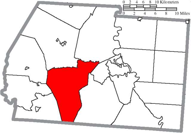
Photo: Ruhrfisch and Nyttend, Wikimedia Commons, CC BY-SA 3.0 · Wikimedia Commons
Local history sources: en.wikipedia.org · en.wikipedia.org · ohiohistory.org · en.wikipedia.org · arcofappalachia.org · en.wikipedia.org · commons.wikimedia.org
Water
Eight wells in the buried Teays River Aquifer, in the Scioto valley north of Chillicothe The water here
- Ross County Water Co. Inc62% of residentsTeays Valley Aquifer (buried valley groundwater)
- Chillicothe City31% of residentsScioto Buried Valley Aquifer (Teays Valley system) wells
- Frankfort Village4% of residentsGroundwater wells (2 wells)
- Bainbridge Village3% of residentsGroundwater wells (2 wells)
- Kingston Village0% of residentsTeays Valley Aquifer (buried valley groundwater)
Hospitals, fire stations and more
Inside Twin Township, Ross County's boundary: 1 fire or EMS station, 1 poor-rated bridge and 2 spill cases. Press a pin or a name for its whole record and its source.
Fire and EMS stations (1)
-
Twin Township Volunteer Fire DepartmentBourneville
- Address
- 11521 US Highway 50, Bourneville, OH 45617
- Coordinates
- 39.28096, -83.15884
USGS National Map structures (source) ↗ Street map and directions ↗
Source: USGS National Map structures (most Ohio records last updated 2019 to 2022), checked against the Columbus and Cleveland station lists. The department that answers a call is set by jurisdiction and mutual aid, not by distance.
Bridges rated poor (1)
-
Spruce Hill Rd over Black RunPoor · built 1940
- Condition
- Poor: a deck, superstructure, substructure or culvert rated 4 or below on the 0 to 9 scale
- What it is
- Bridge
- Built
- 1940
- Length
- 12 ft
- Owner
- County
- Vehicles a day
- 11
- Coordinates
- 39.29026, -83.12879
National Bridge Inventory (source) ↗ Street map and directions ↗
Source: FHWA National Bridge Inventory 2025. "Poor" means one major part rated 4 or below on the 0 to 9 scale; it calls for repair, not closing, unless the state posts or closes the bridge.
Spills reported since 2021 (2)
-
Fuel Diesel / Diesel Fuel (Vehicle On Or Off Road)2025-12-08 · Twin Twp
- Reported
- 2025-12-08
- What spilled
- Fuel Diesel / Diesel Fuel (Vehicle On Or Off Road)
- Largest amount reported
- 50 gallons
- Where
- Twin Twp, Ross County
- Ohio EPA district office
- SEDO
- Ohio EPA case number
- 2512EPA0001969
Ohio EPA spill reports (source) ↗ Street map and directions ↗
-
Oil Hydraulic Fluid(S)2026-01-16 · Twin Twp
- Reported
- 2026-01-16
- What spilled
- Oil Hydraulic Fluid(S)
- Largest amount reported
- 30 gallons
- Where
- Twin Twp, Ross County
- Ohio EPA district office
- SEDO
- Ohio EPA case number
- 2601EPA0000060
Ohio EPA spill reports (source) ↗ Street map and directions ↗
Source: Ohio EPA emergency response spill reports, 2021 to September 2026, one point per case where Ohio EPA placed it. A report is what the caller or responder recorded; amounts are often blank or estimated.
Its ZIP codes
Each ZIP code that touches Twin Township, Ross County, with the share of its residents who live here and the same headline figures as the ZIP page.
Local government
Who holds office in Twin Township, Ross County, how its elections and ballot issues came out, and the state auditor's record.
Money issues on the ballot since 2022: 0 of 1 passed.
Ballot issues
| Date | Issue | For | Against | Result |
|---|---|---|---|---|
| 2022-11-08 | Issue: Twin Township | 808 | 333 | Passed (70.82% for) |
| 2022-05-03 | Issue: Twin Township Fire and EMS 3.0 Mills (3.0 mills) | 221 | 230 | Failed (49.0% for) |
Auditor of State record
- No fiscal caution, watch or emergency on the Auditor of State's lists.
- Agreed Upon Procedures, 2024 to 2025, released 2026-07-28
- Financial Audit, 2022 to 2023, released 2024-10-15
The county
Ross County: 10 ZIP codes, 25 cities, villages and townships, 77,708 people.
Nearby places
Quick answers
What county is Twin Township, Ohio in?
Twin Township, Ross County is a township in Ross County, Ohio, with 3,492 residents.
When was Twin Township, Ohio founded?
Twin Township, Ross County was settled c. 1811, the crossroads later platted as Bourneville; laid out 1832, when Isaac McCrackin and John Boswell replatted and renamed the settlement of "Twintown" as Bourneville. Founders on record: Isaac McCrackin and John Boswell (Bourneville's 1832 platting/renaming); the township's own organization date is not recorded in the sources found. Source
How did Twin Township, Ohio get its name?
The township takes its name from the Upper Twin Creek and Lower Twin Creek, which flank Bourneville at the township's center -- the same "twin" pairing gave the original settlement its first name, "Twintown," before the 1832 renaming. Source
What ZIP code is Twin Township, Ohio?
Twin Township, Ross County is served by ZIP codes 45617, 45681, 45612, 45628 and 45601; 45617 holds the largest share of its residents.
Where does Twin Township, Ohio get its water?
The main water source for Twin Township, Ross County (Ross County Water Co. Inc): Eight wells in the buried Teays River Aquifer, in the Scioto valley north of Chillicothe.
Cite this page
Cite this page as:
Cracked Buckeye, "Twin Township, Ross County", https://crackedbuckeye.com/place/twin-township-ross-county/, built 2026-10-31, accessed [date].
How to cite · Report a correction · Built 2026-10-31
