Local events in Huntington Township, Ross County
10 events in the next 90 days from 2 public calendars. All local events in Huntington Township, Ross County
Checked October 20; the events page is refreshed daily.
How Huntington Township, Ross County began
Huntington Township, in the hilly south of Ross County along Paint Creek, was organized by the county commissioners on March 5, 1811 from parts of Scioto and Twin townships; its first election, on April 1, 1811, was held at Charles Mitchell's house and chose David Murphy, Frederick Bishop and Daniel Chestnut as justices. William Richie had built a cabin on Ralston's Run before 1800, and Benjamin Ralston, Michael Thomas, the Chestnuts and the Bishops followed. The township holds stone enclosures and mounds on Black Run and Paint Creek, the cave where William Hewitt lived as a hermit for fourteen years (d. 1834), and two unincorporated places, Denver and Knockemstiff. It had 6,069 residents in 2020.
Settled before 1800 (William Richie, on Ralston's Run); most settlers came 1796-1810 from the Scioto bottoms and the East, incorporated March 5, 1811 (organized by the Ross County commissioners from parts of Scioto and Twin townships), by William Richie first; the township was organized by the county commissioners.
Where the name comes from
No source checked says why the commissioners called the township Huntington; there are other Huntington Townships in Brown, Gallia and Lorain counties. The 1902 history prints the commissioners' order of March 5, 1811: 'Said township to be known as Huntington township,' with elections at Charles Mitchell's house, without giving a reason.
Before the town
Huntington has a good record of prehistoric stone and earth works and pioneer-era Native encounters, mostly from the 1871 and 1902 county histories. On the east side of Black Run, on the Minney farm, is a stone wall enclosing about an acre with inner partition walls, once four to six feet high; about 200 yards south is a stone circle 100 feet across and five or six feet high, with a ten-foot stone mound in its center (Finley and Bennett give somewhat different measurements). On the John Dunn farm on Paint Creek is a circular earthwork three or four feet high and about a hundred feet across; on the next farm are two mounds, one eight feet high and 25 feet across, the other 60 by 40 by eight to ten feet; and a large mound on the James Steele farm was honeycombed by foxes. Finley (1871) also describes a stone mound near an old Indian trail on Vanscoy's farm on Indian Creek and ancient stone-covered graves near the Alum Cliffs. The authors attribute the works to a vanished 'Lost Race' (the usual nineteenth-century view); no archaeological dating is given. For the historic period, settlers remembered an old Indian trail from Chillicothe to Portsmouth, 'Captain Johnny's' shooting of the war chief Toa-willa-wa in July 1798, a killing in 1798 that sent the Indians of the neighborhood hunting the settler Thompson for two years, and Daniel Chestnut and William Richie serving as frontier guardsmen to watch the Ross County Indians. Finley's statement that two of General Harmar's battles in 1790 were fought on Paint Creek in Huntington Township is not correct: Harmar's campaign was against the Miami capital Kekionga, near modern Fort Wayne, Indiana.
- Stone enclosure and stone circle on Black Run (earthwork) — east side of Black Run, Minney farm, about four miles southeast of Bourneville: an acre-sized stone wall and, 200 yards south, a stone circle 100 feet across with a central stone mound, prehistoric; undated (archive.org)
- Circular earthwork and mounds on the John Dunn and adjoining farms (mound) — Paint Creek, Huntington Township, prehistoric; undated (archive.org)
- Stone mound near an old Indian trail on Indian Creek (mound) — farm of Aaron Vanscoy, head of a branch of Indian Creek, undated (archive.org)
- Indian trail from Chillicothe to Portsmouth (trail) — through the south of the township, near the Hester home, before and during early settlement (archive.org)
Timeline
- — Michael Thomas, later a scout under General Wayne, comes on horseback from Pennsylvania; he soon trades his 100 acres near Chillicothe for 500 in Huntington Township.
- — Daniel Chestnut brings his wife and five children to the Scioto valley; about 1805 they move to Indian Creek in Huntington Township.
- — In July the boy William Chestnut sees 'Captain Johnny' shoot the war chief Toa-willa-wa in the forehead, and later that year a drunken Indian's boast of having killed Thompson's relatives ends with the settler Thompson killing him and fleeing for seventeen years.
- — William Richie has built his cabin on Ralston's Run before this year, the first settler there; Benjamin Ralston, a Vermonter, is the second.
- — William Selby, born in Anne Arundel County, Maryland, comes among the early settlers and hews a farm out of the woods; he serves in the War of 1812.
- — Robert Bishop comes from Berkeley County, Virginia, by wagon and lives in the township sixty-four years; Henry Bishop of the same county buys land there the next year.
- — William Hewitt, a Virginian, comes to Ohio, hunts for some years, and then lives fourteen years in a cave on the Portsmouth pike until his death in 1834.
- — On March 5 the Ross County commissioners organize Huntington Township from parts of Scioto and Twin townships, with elections at Charles Mitchell's; on April 1 David Murphy, Frederick Bishop and Daniel Chestnut are elected justices.
- — William Chestnut volunteers in May in Captain Rutley's company in Tupper's brigade and serves ninety days at Fort Meigs.
- — William Hewitt, the hermit, dies at Waverly at age seventy after catching cold in a rainstorm; a monument is later raised above his cave.
- — A post office named Hooppole (Hoopole) opens at Farmersville; it keeps that name to 1882.
- — Finley's Pioneer Record gives a full Huntington chapter; the township has justices I. J. Finley, Samuel Rinehart and A. J. Pummell, and has never sent a county officer to office except Finley, in 1868-69.
- — A post office named Denver opens in the south of the township; it closes in 1935.
- — Bennett's county history describes Huntington as very rough and broken land, good for grazing and fruit, with Alum cliffs, glacial terraces and the works on Black Run.
- — The census records 6,069 people in the township; Denver and Knockemstiff are its unincorporated places.
Stories
William Hewitt, the hermit of the cave
William Hewitt came from Virginia about 1808, a large, muscular, intelligent man who told his neighbor Mr. Neborgall that he had walked out one morning intending to be gone for days, came home the same night and found another man in his bed with his wife. He thought of killing them both, then decided he could live alone in the woods and left for Ohio. He lived first in a bark shanty on Crooked Creek near Farmersville, then in a cabin with no doors or windows near the Toops farm, and finally for fourteen years in a cave under a shelving rock on the Portsmouth pike, dressed in buckskin he made himself, living on bear and deer, drying venison on sticks around a bed of coals and using it as bread, and trading venison for salt and ammunition. He read his Bible on Sundays and never hunted that day, and was an extraordinary singer and whistler. When a well-dressed stranger rode up one morning to 'get the history of your life,' Hewitt told him to leave quickly or he would give him 'a history of hell.' Caught in a night of rain on the Scioto bottoms, he took a cold that ended his life in 1834 at Waverly; a small mound above the cave bears an inscription that he occupied it fourteen years 'while all was a wilderness around him.'
A cabin on Ralston's Run
William Richie is the earliest settler recorded for Huntington Township. Bennett's 1902 county history says he located and built his cabin on Ralston's Run before 1800 and spent his remaining years there; Benjamin Ralston, a Vermonter with a wife and one son, was the second in that neighborhood and planted one of the first orchards in the county. Richie and Daniel Chestnut were later frontier guardsmen whose job was to watch the Ross County Indians and report any suspicious move. Finley's 1871 account adds a comic episode of their spy duty: with Col. Barnes stationed at Waverly, Richie threw off his blanket to chase a wild turkey, and the colonel, finding the blanket in the path, wheeled his horse and galloped back, supposing there were Indians about, until Chestnut hailed him from under a tree and explained. It was more than eleven years from Richie's first cabin to the township's organization on March 5, 1811, with Murphy, Bishop and Chestnut as its first justices.
Squire Chestnut's thirty lashes
Daniel Chestnut was one of the three justices elected at the township's first election in 1811 and held the office for seventeen years. In one case a man named Shears, brought before him for stealing a small sum from a Mr. Ogden, pleaded guilty and was sentenced to jail. On the way to the county jail Shears told the constable he would rather take thirty lashes. The constable asked the Squire, who went to the woods and cut five stout hickory switches, and the constable applied them while Chestnut stood by as 'moderator or umpire.' After each five cuts hostilities ceased, the wounds were bathed in whisky by the magistrate, and Shears was admonished to lead a better life. Twenty-nine lashes later, 'well laid on,' Shears was released, perhaps wiser.
Photographs
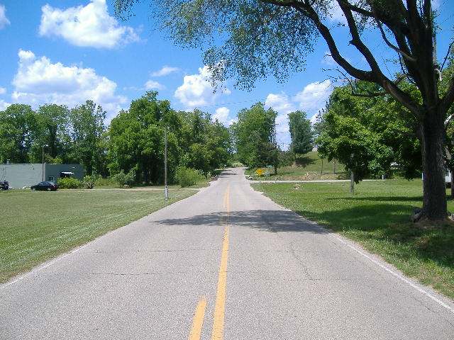
Photo: Aesopposea, CC BY-SA 3.0 · Wikimedia Commons
Local history sources: en.wikipedia.org · archive.org · archive.org · archive.org · ross.ohgenweb.org · postalhistory.com · en.wikipedia.org · commons.wikimedia.org
Water
Seven active wells in the Scioto Buried River Valley Aquifer (the CCR's own name) serving the city well field near Yoctangee Park. The City of Chillicothe also has emergency connections with Ross County Water Company and the Chillicothe Correctional Institution; neither was used in 2025. The water here
- Ross County Water Co. Inc46% of residentsTeays Valley Aquifer (buried valley groundwater)
- Chillicothe City45% of residentsScioto Buried Valley Aquifer (Teays Valley system) wells
- Waverly City6% of residentsGroundwater wells (3 wells)
- Aqua Ohio - Lake White1% of residentsGroundwater wells (3 wells)
- Pike Water, Inc.-plant1% of residentsTeays Valley Buried Valley Aquifer (wells near Jasper)
- Bainbridge Village1% of residentsGroundwater wells (2 wells)
- Kingston Village1% of residentsTeays Valley Aquifer (buried valley groundwater)
Hospitals, fire stations and more
Inside Huntington Township, Ross County's boundary: 1 fire or EMS station, 3 public schools, 7 poor-rated bridges and 6 spill cases. Press a pin or a name for its whole record and its source.
Fire and EMS stations (1)
-
Huntington Township Fire DepartmentChillicothe
- Address
- 6038 Blain Highway, Chillicothe, OH 45601
- Coordinates
- 39.23969, -83.05764
USGS National Map structures (source) ↗ Street map and directions ↗
Source: USGS National Map structures (most Ohio records last updated 2019 to 2022), checked against the Columbus and Cleveland station lists. The department that answers a call is set by jurisdiction and mutual aid, not by distance.
Public schools (3)
-
Huntington Elementary School3 of 5 stars · Chillicothe
- Address
- 188 Huntsman Rd, Chillicothe, OH 45601
- School district
- Huntington Local School District
- Kind (NCES)
- Regular School
- Students, 2023-24
- 409
- Teachers (full-time equivalent)
- 29
- Report card, 2025-26
- 3 of 5 stars
- Performance index
- 74.4%
- Ohio building IRN
- 017137
- NCES school ID
- 390495003614
NCES school record ↗ Ohio School Report Card ↗ Street map and directions ↗
-
Huntington High School3 of 5 stars · Chillicothe
- Address
- 188 Huntsman Rd, Chillicothe, OH 45601
- School district
- Huntington Local School District
- Kind (NCES)
- Regular School
- Students, 2023-24
- 306
- Teachers (full-time equivalent)
- 22
- Report card, 2025-26
- 3 of 5 stars
- Performance index
- 64.9%
- Four-year graduation rate
- 94.5%
- Ohio building IRN
- 017160
- NCES school ID
- 390495003615
NCES school record ↗ Ohio School Report Card ↗ Street map and directions ↗
-
Huntington Middle School2.5 of 5 stars · Chillicothe
- Address
- 188 Huntsman Rd, Chillicothe, OH 45601
- School district
- Huntington Local School District
- Kind (NCES)
- Regular School
- Students, 2023-24
- 313
- Teachers (full-time equivalent)
- 21
- Report card, 2025-26
- 2.5 of 5 stars
- Performance index
- 64%
- Ohio building IRN
- 137265
- NCES school ID
- 390495002791
NCES school record ↗ Ohio School Report Card ↗ Street map and directions ↗
Source: NCES EDGE public school locations 2024-25 and Common Core of Data 2023-24 (type, students, teachers); Ohio School Report Cards 2025-26 (Department of Education and Workforce), matched by name within the district.
Bridges rated poor (7)
-
Blain Highway over Crooked CreekPoor · built 1939
- Condition
- Poor: a deck, superstructure, substructure or culvert rated 4 or below on the 0 to 9 scale
- What it is
- Bridge
- Built
- 1939
- Length
- 16 ft
- Owner
- County
- Vehicles a day
- 397
- Coordinates
- 39.21406, -83.03114
National Bridge Inventory (source) ↗ Street map and directions ↗
-
Blain Highway over Ralston RunPoor · built 1939
- Condition
- Poor: a deck, superstructure, substructure or culvert rated 4 or below on the 0 to 9 scale
- What it is
- Bridge
- Built
- 1939
- Length
- 10 ft
- Owner
- County
- Vehicles a day
- 933
- Coordinates
- 39.24107, -83.06001
National Bridge Inventory (source) ↗ Street map and directions ↗
-
Massieville Rd over Indian CreekPoor · built 1948
- Condition
- Poor: a deck, superstructure, substructure or culvert rated 4 or below on the 0 to 9 scale
- What it is
- Bridge
- Built
- 1948
- Length
- 11 ft
- Owner
- County
- Vehicles a day
- 1,384
- Coordinates
- 39.24306, -82.98320
National Bridge Inventory (source) ↗ Street map and directions ↗
-
Mt. Tabor Rd over Tributary Indian CreekPoor · built 1940
- Condition
- Poor: a deck, superstructure, substructure or culvert rated 4 or below on the 0 to 9 scale
- What it is
- Bridge
- Built
- 1940
- Length
- 8 ft
- Owner
- County
- Vehicles a day
- 1,336
- Coordinates
- 39.23048, -83.01038
National Bridge Inventory (source) ↗ Street map and directions ↗
-
Mt. Tabor Rd over Tributary Indian CreekPoor · built 1900
- Condition
- Poor: a deck, superstructure, substructure or culvert rated 4 or below on the 0 to 9 scale
- What it is
- Bridge
- Built
- 1900
- Length
- 10 ft
- Owner
- County
- Vehicles a day
- 1,336
- Coordinates
- 39.23348, -83.00109
National Bridge Inventory (source) ↗ Street map and directions ↗
-
Rozelle Creek Rd over Rozelle CreekPoor · built 1900
- Condition
- Poor: a deck, superstructure, substructure or culvert rated 4 or below on the 0 to 9 scale
- What it is
- Bridge
- Built
- 1900
- Length
- 15 ft
- Owner
- County
- Vehicles a day
- 1,517
- Coordinates
- 39.24740, -82.98948
National Bridge Inventory (source) ↗ Street map and directions ↗
-
SR 772 over Ralston RunPoor · built 1980
- Condition
- Poor: a deck, superstructure, substructure or culvert rated 4 or below on the 0 to 9 scale
- What it is
- Bridge
- Built
- 1980
- Length
- 30 ft
- Owner
- State
- Vehicles a day
- 2,704
- Coordinates
- 39.25594, -83.04955
National Bridge Inventory (source) ↗ Street map and directions ↗
Source: FHWA National Bridge Inventory 2025. "Poor" means one major part rated 4 or below on the 0 to 9 scale; it calls for repair, not closing, unless the state posts or closes the bridge.
Spills reported since 2021 (6)
-
Material Undetermined / Other Reached water2025-10-13 · Huntington Twp
- Reported
- 2025-10-13
- What spilled
- Material Undetermined / Other
- Reached a waterway
- 99 - Unnamed
- Where
- Huntington Twp, Ross County
- Ohio EPA district office
- SEDO
- Ohio EPA case number
- 2510EPA0001684
Ohio EPA spill reports (source) ↗ Street map and directions ↗
-
Other / All Other / Trade Name / Mixture / Solution Etc2024-11-11 · Huntington Twp
- Reported
- 2024-11-11
- What spilled
- Other / All Other / Trade Name / Mixture / Solution Etc
- Where
- Huntington Twp, Ross County
- Ohio EPA district office
- SEDO
- Ohio EPA case number
- 2411EPA0001869
Ohio EPA spill reports (source) ↗ Street map and directions ↗
-
Fuel Diesel / Diesel Fuel (Vehicle On Or Off Road)2024-11-07 · Huntington Twp
- Reported
- 2024-11-07
- What spilled
- Fuel Diesel / Diesel Fuel (Vehicle On Or Off Road)
- Largest amount reported
- 25 gallons
- Where
- Huntington Twp, Ross County
- Ohio EPA district office
- SEDO
- Ohio EPA case number
- 2411EPA0001853
Ohio EPA spill reports (source) ↗ Street map and directions ↗
-
Fuel Diesel / Diesel Fuel (Vehicle On Or Off Road) Reached water2024-08-23 · Huntington Twp
- Reported
- 2024-08-23
- What spilled
- Fuel Diesel / Diesel Fuel (Vehicle On Or Off Road)
- Largest amount reported
- 200 gallons
- Reached a waterway
- 99 - Unnamed
- Where
- Huntington Twp, Ross County
- Ohio EPA district office
- SEDO
- Ohio EPA case number
- 2408EPA0001459
Ohio EPA spill reports (source) ↗ Street map and directions ↗
-
Fuel Diesel / Diesel Fuel (Vehicle On Or Off Road)2024-07-10 · Huntington Twp
- Reported
- 2024-07-10
- What spilled
- Fuel Diesel / Diesel Fuel (Vehicle On Or Off Road)
- Largest amount reported
- 30 gallons
- Where
- Huntington Twp, Ross County
- Ohio EPA district office
- SEDO
- Ohio EPA case number
- 2407EPA0001157
Ohio EPA spill reports (source) ↗ Street map and directions ↗
-
Oil Motor / Lube Oil / Vehicle2023-10-27 · Huntington Twp
- Reported
- 2023-10-27
- What spilled
- Oil Motor / Lube Oil / Vehicle
- Where
- Huntington Twp, Ross County
- Ohio EPA district office
- SEDO
- Ohio EPA case number
- 2310EPA0001847
Ohio EPA spill reports (source) ↗ Street map and directions ↗
Source: Ohio EPA emergency response spill reports, 2021 to September 2026, one point per case where Ohio EPA placed it. A report is what the caller or responder recorded; amounts are often blank or estimated.
Its ZIP codes
Each ZIP code that touches Huntington Township, Ross County, with the share of its residents who live here and the same headline figures as the ZIP page.
Local government
Who holds office in Huntington Township, Ross County, how its elections and ballot issues came out, and the state auditor's record.
Money issues on the ballot since 2022: 2 of 2 passed; of those asking for new or higher taxes, 2 of 2.
Ballot issues
| Date | Issue | For | Against | Result |
|---|---|---|---|---|
| 2022-11-08 | Issue: Huntington Township (Additional) | 1,015 | 641 | Passed (61.29% for) |
| 2022-11-08 | Issue: Huntington Township (Replacement) | 1,006 | 644 | Passed (60.97% for) |
Auditor of State record
- No fiscal caution, watch or emergency on the Auditor of State's lists.
- Financial Audit, 2023 to 2024, released 2026-01-08
The county
Ross County: 10 ZIP codes, 25 cities, villages and townships, 77,708 people.
Nearby places
Quick answers
What county is Huntington Township, Ohio in?
Huntington Township, Ross County is a township in Ross County, Ohio, with 6,069 residents.
When was Huntington Township, Ohio founded?
Huntington Township, Ross County was settled before 1800 (William Richie, on Ralston's Run); most settlers came 1796-1810 from the Scioto bottoms and the East; incorporated March 5, 1811 (organized by the Ross County commissioners from parts of Scioto and Twin townships). Founders on record: William Richie first; the township was organized by the county commissioners. Source
What ZIP code is Huntington Township, Ohio?
Huntington Township, Ross County is served by ZIP codes 45601, 45690 and 45612; 45601 holds the largest share of its residents.
Where does Huntington Township, Ohio get its water?
The main water source for Huntington Township, Ross County (Ross County Water Co. Inc): Seven active wells in the Scioto Buried River Valley Aquifer (the CCR's own name) serving the city well field near Yoctangee Park. The City of Chillicothe also has emergency connections with Ross County Water Company and the Chillicothe Correctional Institution; neither was used in 2025.
Cite this page
Cite this page as:
Cracked Buckeye, "Huntington Township, Ross County", https://crackedbuckeye.com/place/huntington-township-ross-county/, built 2026-10-31, accessed [date].
How to cite · Report a correction · Built 2026-10-31
