Local events in Liberty Township, Ross County
Liberty Township itself has 1 event posted in the next 90 days; the others here are within 10 miles. All local events in Liberty Township, Ross County
Checked October 20; the events page is refreshed daily.
How Liberty Township, Ross County began
Liberty Township, in the southeastern part of Ross County, was set off from Jefferson Township in 1832. Its earliest settlers arrived by 1800, drawn to Highbank prairie and the bottomlands along Salt Creek before the federal land sales opened. The township's one real village, Londonderry, was laid out in 1831 by Adam Stewart and Nathan Cox and grew into a small trading and rail town near its now-vanished rival, Vigo. Today the township is mostly farmland with Londonderry, population about 2,600 across the township as a whole, its only center.
Settled by 1800 (William Schooley, Amos Taylor and others on Highbank prairie), platted 1832 (township organized, set off from Jefferson Township), by organized as a township; no single founder recorded.
Where the name comes from
The township was very likely named, like many Ohio townships, for the abstract virtue "Liberty" rather than for a person or place; no source found gives a specific naming account for the township itself. The one platted village inside it, Londonderry, was named for Londonderry, Northern Ireland, the birthplace of one of its founders' forebears; its post office was originally called Gillespieville, for first postmaster James Gillespie, because another Ohio post office already used the name Londonderry, and it did not take the name Londonderry until 1929.
Before the town
No source found documents a specific named Shawnee town, camp, or trail sited within Liberty Township itself, and none should be assumed: the Shawnee town name "Chillicothe" (also called "Old Chillicothe") was used at several different village sites in Ohio at different times as the Shawnee relocated, and the presence of that name near the county seat does not place a Shawnee town in this township. What is documented locally is prehistoric, not historic-period Shawnee: nineteenth-century accounts of Liberty Township describe ancient earthworks on several farms, including octagonal and circular fortifications, one enclosing about fifteen acres, and a mound on the Ed Harness farm roughly 100 feet long that was opened and found to contain human skeletons of notably small stature, which the writers took for a burial place of women and children. These are unattributed to a specific culture in the source and are consistent with the Adena or Hopewell mound-building traditions general to the Scioto Valley. For the county-level Shawnee, Wyandot, and treaty history.
Nations recorded here: Adena culture, Hopewell culture.
- Earthworks on Liberty Township farms (unnamed) (earthwork) — Several farms in Liberty Township, Ross County (exact locations not given in source), Prehistoric, culture not specified in source (genealogytrails.com)
- Mound on the Ed Harness farm (burial) — Ed Harness farm, Liberty Township, Ross County, Prehistoric, culture not specified in source (genealogytrails.com)
Timeline
- — William Schooley settles in what becomes Liberty Township, on section eighteen, land his wife inherited from her father Thomas Bowens, who settled on the adjoining tract.
- — Amos Taylor settles on Highbank prairie, later relocating to the east side of Walnut Creek, where he died.
- — Joseph Cox settles on section fourteen in the township and remains there the rest of his life.
- — Adam Stewart and Nathan Cox lay out the village of Londonderry; Cox later sells his interest and leaves the county.
- — Liberty Township is organized, set off from Jefferson Township.
- — A post office opens at Londonderry under the name Gillespieville, after first postmaster James Gillespie.
- — The Gillespieville post office is renamed Londonderry.
- — Harley Warrick, later the best-known Mail Pouch Tobacco barn sign painter in the country, is born in Londonderry to a dairy-farming family.
- — The U.S. Census records 2,623 residents of Liberty Township.
Stories
Two villages, half a mile apart
When the Cincinnati, Hamilton & Dayton and the Baltimore & Ohio Southwestern railroads crossed Liberty Township on their way southeast, a second settlement called Vigo grew up on the township line to work the rail trade, barely half a mile south of the older village of Londonderry. For decades the two traded business back and forth: Vigo had the depot and the freight sheds, Londonderry had the post office and the older stores, and William Day ran a gunsmith shop in Londonderry for about thirty years through it all. Vigo eventually faded as rail traffic declined through the twentieth century, and Londonderry, still on U.S. Route 50 at its junction with State Route 327, is the township's one place name that shows up on a modern map. The rivalry between the two is remembered mainly in the county histories that were written while both were still going concerns.
The last Mail Pouch man
Harley Warrick was born in 1924 on his family's dairy farm at Londonderry. He came home from World War II in 1946 needing work, and a Mail Pouch Tobacco crew happened through looking for painters; Warrick, trained by veteran painter Maurice Zimmerman, spent the next fifty-five years painting the company's black-and-yellow barn advertisements across thirteen states, working freehand with no stencils or templates, by eye alone, at a pace of roughly two barns a day with a partner. He was known to slip in a deliberate misspelling now and then just to see if anyone noticed. The Highway Beautification Act of 1965 killed most roadside barn advertising, but Mail Pouch barns won a historic exemption, and when Warrick retired in 1991 he was the last man still painting them for the company; the Smithsonian later exhibited his work, and he kept making miniature painted barns after he moved to Belmont, Ohio, until his death in 2000.
Photographs
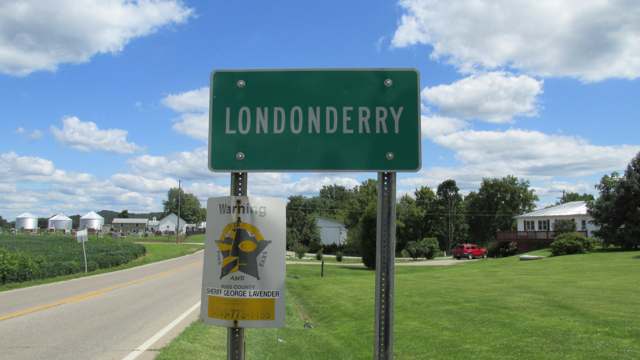
Photo: Aesopposea, via Wikimedia Commons, CC BY-SA 3.0 · Wikimedia Commons
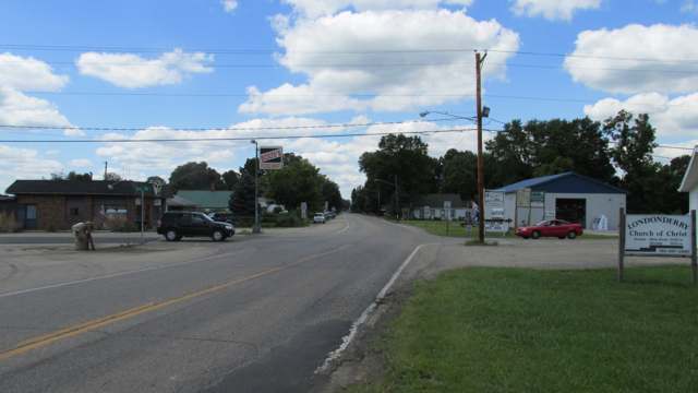
Photo: Aesopposea, via Wikimedia Commons, CC BY-SA 3.0 · Wikimedia Commons
Local history sources: en.wikipedia.org · en.wikipedia.org · genealogytrails.com · en.wikipedia.org · commons.wikimedia.org · commons.wikimedia.org
Historic places
1 place in Liberty Township, Ross County on the National Register of Historic Places. Press a pin or a name for its whole record.
-
Highbank FarmBuilding · Chillicothe · listed 1980
- Address
- SE of Chillicothe on OH 35
- Where
- Chillicothe, Ross County · ZIP 45601
- What it is
- Building
- Listed on the National Register
- 1980
- NRIS reference number
- 80003215
- Coordinates
- 39.27091, -82.89682
National Register file (NPS) ↗ Search Wikipedia ↗ Street map and directions ↗ On the Cracked Buckeye map
Source: National Park Service, National Register of Historic Places point file. The listing year is shown where NPS's certification date agrees with the listing's reference number. Listing recognizes significance; it does not restrict a private owner.
Water
Eight wells in the buried Teays River Aquifer, in the Scioto valley north of Chillicothe The water here
- Ross County Water Co. Inc72% of residentsTeays Valley Aquifer (buried valley groundwater)
- Chillicothe City28% of residentsScioto Buried Valley Aquifer (Teays Valley system) wells
- Kingston Village0% of residentsTeays Valley Aquifer (buried valley groundwater)
Hospitals, fire stations and more
Inside Liberty Township, Ross County's boundary: 1 fire or EMS station, 3 public schools, 2 poor-rated bridges and 3 spill cases. Press a pin or a name for its whole record and its source.
Fire and EMS stations (1)
-
Liberty Township Fire DepartmentLondonderry
- Address
- 34568 US Highway 50, Londonderry, OH 45647
- Coordinates
- 39.26891, -82.81144
USGS National Map structures (source) ↗ Street map and directions ↗
Source: USGS National Map structures (most Ohio records last updated 2019 to 2022), checked against the Columbus and Cleveland station lists. The department that answers a call is set by jurisdiction and mutual aid, not by distance.
Public schools (3)
-
Southeastern Elementary School4 of 5 stars · Chillicothe
- Address
- 2003 Lancaster Rd, Chillicothe, OH 45601
- School district
- Southeastern Local School District
- Kind (NCES)
- Regular School
- Students, 2023-24
- 379
- Teachers (full-time equivalent)
- 25
- Report card, 2025-26
- 4 of 5 stars
- Performance index
- 79.7%
- Ohio building IRN
- 021295
- NCES school ID
- 390495203621
NCES school record ↗ Ohio School Report Card ↗ Street map and directions ↗
-
Southeastern High School3.5 of 5 stars · Chillicothe
- Address
- 2003 Lancaster Rd, Chillicothe, OH 45601
- School district
- Southeastern Local School District
- Kind (NCES)
- Regular School
- Students, 2023-24
- 251
- Teachers (full-time equivalent)
- 22.7
- Report card, 2025-26
- 3.5 of 5 stars
- Performance index
- 78.8%
- Four-year graduation rate
- 98.7%
- Ohio building IRN
- 035204
- NCES school ID
- 390495203623
NCES school record ↗ Ohio School Report Card ↗ Street map and directions ↗
-
Southeastern Middle School3.5 of 5 stars · Chillicothe
- Address
- 2003 Lancaster Rd, Chillicothe, OH 45601
- School district
- Southeastern Local School District
- Kind (NCES)
- Regular School
- Students, 2023-24
- 300
- Teachers (full-time equivalent)
- 14
- Report card, 2025-26
- 3.5 of 5 stars
- Performance index
- 77.8%
- Ohio building IRN
- 016055
- NCES school ID
- 390495203620
NCES school record ↗ Ohio School Report Card ↗ Street map and directions ↗
Source: NCES EDGE public school locations 2024-25 and Common Core of Data 2023-24 (type, students, teachers); Ohio School Report Cards 2025-26 (Department of Education and Workforce), matched by name within the district.
Bridges rated poor (2)
-
Musgrove Rd over Csx RailroadPoor · built 1927
- Condition
- Poor: a deck, superstructure, substructure or culvert rated 4 or below on the 0 to 9 scale
- What it is
- Bridge
- Built
- 1927
- Length
- 23 ft
- Owner
- County
- Vehicles a day
- 1,173
- Coordinates
- 39.25169, -82.87074
National Bridge Inventory (source) ↗ Street map and directions ↗
-
Musgrove Rd over Goshen RunPoor · built 1900
- Condition
- Poor: a deck, superstructure, substructure or culvert rated 4 or below on the 0 to 9 scale
- What it is
- Bridge
- Built
- 1900
- Length
- 10 ft
- Owner
- County
- Vehicles a day
- 446
- Coordinates
- 39.25177, -82.80158
National Bridge Inventory (source) ↗ Street map and directions ↗
Source: FHWA National Bridge Inventory 2025. "Poor" means one major part rated 4 or below on the 0 to 9 scale; it calls for repair, not closing, unless the state posts or closes the bridge.
Spills reported since 2021 (3)
-
Fuel Diesel / Diesel Fuel (Vehicle On Or Off Road)2025-04-19 · Liberty Twp
- Reported
- 2025-04-19
- What spilled
- Fuel Diesel / Diesel Fuel (Vehicle On Or Off Road)
- Where
- Liberty Twp, Ross County
- Ohio EPA district office
- SEDO
- Ohio EPA case number
- 2504EPA0000595
Ohio EPA spill reports (source) ↗ Street map and directions ↗
-
Fuel Diesel / Diesel Fuel (Vehicle On Or Off Road)2024-03-12 · Liberty Twp
- Reported
- 2024-03-12
- What spilled
- Fuel Diesel / Diesel Fuel (Vehicle On Or Off Road)
- Largest amount reported
- 100 gallons
- Where
- Liberty Twp, Ross County
- Ohio EPA district office
- SEDO
- Ohio EPA case number
- 2403EPA0000390
Ohio EPA spill reports (source) ↗ Street map and directions ↗
-
Fuel Diesel / Diesel Fuel (Vehicle On Or Off Road)2026-06-17 · Liberty Twp
- Reported
- 2026-06-17
- What spilled
- Fuel Diesel / Diesel Fuel (Vehicle On Or Off Road)
- Largest amount reported
- 40 gallons
- Where
- Liberty Twp, Ross County
- Ohio EPA district office
- SEDO
- Ohio EPA case number
- 2606EPA0001078
Ohio EPA spill reports (source) ↗ Street map and directions ↗
Source: Ohio EPA emergency response spill reports, 2021 to September 2026, one point per case where Ohio EPA placed it. A report is what the caller or responder recorded; amounts are often blank or estimated.
Its ZIP codes
Each ZIP code that touches Liberty Township, Ross County, with the share of its residents who live here and the same headline figures as the ZIP page.
| ZIP | Share | Water | Radon | Home value | Schools | Flood |
|---|---|---|---|---|---|---|
| 45647 Liberty Township and Londonderry | 49% | Eight wells in the buried Teays River Aquifer, in the Scioto valley north of Chillicothe | 2.0 pCi/L average radon | Median year built 1974 | Southeastern Local · 4 stars overall | 1.5% of residents in the 1% floodplain |
| 45601 Chillicothe | 3% | Seven active wells in the Scioto Buried River Valley Aquifer (the CCR's own name) serving the city well field near Yoctangee Park. The City of Chillicothe also has emergency connections with Ross County Water Company and the Chillicothe Correctional Institution; neither was used in 2025. | 6.3 pCi/L average radon | Median year built 1972 | Chillicothe City · 3 stars overall | 2.9% of residents in the 1% floodplain |
Local government
Who holds office in Liberty Township, Ross County, how its elections and ballot issues came out, and the state auditor's record.
Auditor of State record
- No fiscal caution, watch or emergency on the Auditor of State's lists.
- Agreed Upon Procedures, 2024 to 2025, released 2026-07-28
- Financial Audit, 2022 to 2023, released 2024-08-08
The county
Ross County: 10 ZIP codes, 25 cities, villages and townships, 77,708 people.
Nearby places
Quick answers
What county is Liberty Township, Ohio in?
Liberty Township, Ross County is a township in Ross County, Ohio, with 2,623 residents.
When was Liberty Township, Ohio founded?
Liberty Township, Ross County was settled by 1800 (William Schooley, Amos Taylor and others on Highbank prairie); laid out 1832 (township organized, set off from Jefferson Township). Founders on record: organized as a township; no single founder recorded. Source
How did Liberty Township, Ohio get its name?
The township was very likely named, like many Ohio townships, for the abstract virtue "Liberty" rather than for a person or place; no source found gives a specific naming account for the township itself. Source
What ZIP code is Liberty Township, Ohio?
Liberty Township, Ross County is served by ZIP codes 45647 and 45601; 45647 holds the largest share of its residents.
Where does Liberty Township, Ohio get its water?
The main water source for Liberty Township, Ross County (Ross County Water Co. Inc): Eight wells in the buried Teays River Aquifer, in the Scioto valley north of Chillicothe.
Cite this page
Cite this page as:
Cracked Buckeye, "Liberty Township, Ross County", https://crackedbuckeye.com/place/liberty-township-ross-county/, built 2026-10-31, accessed [date].
How to cite · Report a correction · Built 2026-10-31
