Water system
Ross County Water Co. Inc
EPA ID OH7101412 · Ross County · 35,345 people served
Ross County Water Co. Inc treats its own water from Teays Valley Aquifer (buried valley groundwater).
The system's record
- Aquifer
- Teays Valley Aquifer
- Active wells
- 8
- Serves
- 35,345 people · Ross County
- EPA ID
- OH7101412
Eight production wells pump from the Teays Valley (buried river) Aquifer; raw water is hard (400-440 mg/L), softened during treatment.
About this area's water
Did you know
- The company draws from the Teays River Aquifer, which its CCR calls one of the three major underground aquifers in the state of Ohio - the buried channel of a pre-glacial river.
- A single eight-well field feeds two treatment plants, North and South, each rated at 3.5 million gallons per day.
- It is a nonprofit, member-owned utility run by five trustees and 42 employees, serving about 15,000 customers across Ross, Pike, Pickaway, Vinton, Hocking and Jackson counties.
- Finished water leaves the plants at 120-140 mg/L hardness (7-8 grains per gallon) with unusually high alkalinity of 240-280 mg/L.
History4
- 1980IRS grants Ross County Water Company tax-exempt status as a 501(c)(12) member-owned mutual utility, effective September 1980.
- 2024Company reports no MCL or action-level violations across bacteriological, radioactive, disinfection-byproduct, lead/copper and PFAS monitoring.
- 2024Participates in EPA's fifth Unregulated Contaminant Monitoring Rule round; of 29 PFAS compounds plus lithium, only PFPeA is detected, at the South plant.
- 2024A system-wide water rate increase takes effect with July 2024 billing.
Treatment & pressure
How it is treated
Eight wells in the buried Teays Valley aquifer feed two 3.5 MGD plants (North and South). The CCR does not publish the treatment train; finished water is chlorinated (1.21 ppm) and fluoridated (0.90 ppm), leaving at 120-140 mg/L hardness and 240-280 mg/L alkalinity.
Water pressure
not published - no system-wide psi figure appears in the 2024 CCR or on the company's website; water is delivered from two plants across a rural six-county network.
What it costs
$9.68 per 1,000 gallons
Effective with July 2024 billing, 5/8" meter: $26.54 minimum for the first 1,500 gal, then $9.68/1,000 gal for the next 8,500, $7.82 for the next 40,000, $5.04 above 50,000.…
Water quality & impurities9
| Contaminant | Level | Limit | Year |
|---|---|---|---|
| TTHM (Total Trihalomethanes) Range 16.6-22.3 ppb, no violation. | 22.3 ppb | 80 ppb | 2024 |
| HAA5 (Haloacetic Acids) Range 7.1-8.1 ppb, no violation. | 8.1 ppb | 60 ppb | 2024 |
| Nitrate Range 0.40-0.96 ppm; typical source is fertilizer runoff. | 0.75 ppm | 10 ppm | 2024 |
| Fluoride Range 0.76-1.10 ppm; added to promote strong teeth. | 0.90 ppm | 4 ppm | 2024 |
| Total Chlorine Range 0.58-1.79 ppm, no violation. | 1.21 ppm | 4 ppm (MRDL) | 2024 |
| Lead (90th percentile) 0 of 30 samples over the action level; no lead service lines identified. | 1.5 ppb | 15 ppb action… | 2024 |
| Copper (90th percentile) 0 of 30 samples over the action level. | 0.94 ppm | 1.3 ppm action… | 2024 |
| PFPeA (perfluoropentanoic acid) South plant entry point; only PFAS detected of 29 tested under UCMR5. No federal MCL. | 0.0031 ppb (ug/L) | 0.0030 ppb… | 2024 |
| Radium-228 No violation; erosion of natural deposits. | 2.72 pCi/L | 5 pCi/L… | 2022 |
EPA compliance record
Lead at the tap: 90th-percentile result 1.8 ppb in 2025 (action level 15 ppb).
EPA record: no health-based violations since 2015.
Projects & plans2
Recent and current work
- Lead service line inventory · 2024 · completed
Found no lead, galvanized-requiring-replacement, or unknown-material service lines, using historic records and visual inspections.
Planned or needed
- Phase X service territory extension · planned
Mains to be extended to portions of Upper Twin, Fordyce, Pricer Ridge, Benner Hill, Mt Olive, Turkey Ridge and Wisecup Hill roads. No published cost or date.
Supply stress
Ohio EPA's source water susceptibility analysis rates the aquifer at this well field HIGH susceptibility to contamination, because of the aquifer's sensitivity and several potential contaminant sources inside the protection zone - though no contamination has been detected. Growth pressure comes from continued rural expansion needing new…
Sewers
Sanitary
Ross County Water Company supplies drinking water only and operates no sewers. Its service area is rural and largely unincorporated; no public sanitary sewer system serving Bourneville, South Salem, Richmond Dale, Londonderry, Kingston or Frankfort was identified in the sources reviewed.
Storm
No public storm sewer system or stormwater utility was identified for these rural areas in the sources reviewed.
Sourcesverified
Compiled from the utility's own reports and public records, then independently re-checked against primary sources.
Main supplier in 6 ZIP codes
Serves
Main water supplier in 8 ZIP codes
- 45617 · Twin Township and Bourneville100% of residents
- 45647 · Liberty Township and Londonderry92% of residents
- 45628 · Concord Township and Frankfort80% of residents
- 45681 · Buckskin Township and South Salem68% of residents
- 45673 · Jefferson Township and Richmond Dale65% of residents
- 45644 · Kingston41% of residents
- 45672 · Jackson Township and Ray21% of residents
- 43152 · Benton Township and South Bloomingville6% of residents
Also present in 9 more ZIP codes
- 45601 · Chillicothe44% of residents
- 43115 · Deerfield Township and Clarksburg23% of residents
- 45612 · Paxton Township and Bainbridge12% of residents
- 43135 · Perry Township and Laurelville12% of residents
- 45123 · Greenfield11% of residents
- 45690 · Waverly8% of residents
- 43160 · Washington Court House1% of residents
- 43113 · Circleville0% of residents
- 45651 · Mcarthur and Mc Arthur0% of residents
Population-weighted resident shares; a ZIP code can have more than one system on record. Recomputed from each ZIP's own system list, not from the map's cached footprint.
Buys from · Sells to
Ross County Water Co. Inc does not buy water from another system on record; it treats its own source water.
3 systems on record buy water from Ross County Water Co. Inc: Kingston Village, Pike Water, Inc.-ross 2, Pike Water, Inc.-ross 3.
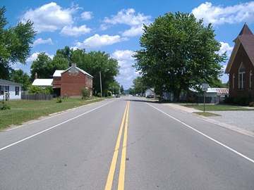
Photograph
On the map
Show this system's territory on the map — 17 ZIP codes in all.
Sources
U.S. EPA SDWIS and Community Water System Service Area Boundaries (v3, 2026), Ohio EPA primacy data, 2020 census blocks: the system serving most residents, traced through purchases to the treating utility; Ohio EPA 2023 Sewer and Water Rate Survey (Ohio State, May 2025) for household bills; Ohio EPA DEFA loan awards since 2016 for the loans paragraph · EPA SDWIS · EPA service area boundaries · Ohio EPA drinking water · Ohio EPA rate survey
Ross County Water Co. Inc's own pages: rosscowater.org, web.ohioruralwater.org