Local events in Green Township, Ross County
3 events in the next 90 days from 1 public calendar. All local events in Green Township, Ross County
Checked October 20; the events page is refreshed daily.
How Green Township, Ross County began
Green Township was one of the original townships of Ross County, given its first definite boundaries in April 1803 by associate judges Reuben Abrams, William Patton, and Felix Renick, and later reduced when Colerain and other townships were cut from it. Settlement began in the 1790s along Kinnikinnick Creek and the Scioto River bottoms, land that had been Shawnee hunting and town ground within living memory of the first arrivals. Thomas Ing platted the village of Ingstown, later Kingston, in 1816, and it grew into the county's third-largest town on the strength of milling, distilling, and the rich Pickaway-line farmland. The township today is farm country north of Chillicothe, with Kingston and the crossroads hamlet of Kinnikinnick as its population centers.
Settled 1795 (approximate, first cabins), platted 1816 (Kingston, as Ingstown), by boundaries fixed April 1803 by judges Reuben Abrams, William Patton and Felix Renick; Kingston platted by Thomas Ing.
Where the name comes from
Green Township is one of sixteen townships named Green statewide in Ohio; the 1902 county history does not give a specific reason for the choice in Ross County. Kingston was first platted and known as Ingstown, after founder Thomas Ing, and took its present name by 1816.
Before the town
Green Township sits at the northern edge of the Shawnee heartland around Chillicothe and the Pickaway Plains, and the 1902 county history records specific Shawnee-associated ground on what became the Boggs farm, which lay within Green Township's original bounds but, that history says, lies wholly within present Pickaway County: 'Squaw Town,' 'Cornstalk Town,' and 'Black Mount' are named as aboriginal towns on that property, along with 'many Indian mounds, or relics of the Mound Builders.' The same history places a historic elm tree near Major John Boggs's cabin as the site where Lord Dunmore met with Native leaders in 1774, during the campaign that ended Dunmore's War; this is a local tradition recorded in the county history rather than a National Register-documented site, and it should be read with that caution. Two Hopewell-era earthwork sites are listed on the National Register within the township: Cedar-Bank Works, on the east bank of the Scioto north of Chillicothe, and the Gartner Mound and Village Site, along the Scioto about six miles north of Chillicothe. The village of Kinnikinnick, in the township's north end, takes its name from Kinnikinnick Creek; kinnikinnick is an Algonquian-derived word for a smoking mixture of dried bark and herbs, though no source found ties the place name to a documented Shawnee or other historic-nation settlement at that exact spot. No source found assigns a specific historic Shawnee town site to the Kingston village plat itself; the broader Chillicothe-area record includes other Shawnee towns, and the 1795 Treaty of Greenville cession that opened this land to survey and settlement.
Nations recorded here: Shawnee.
- Cedar-Bank Works (earthwork) — east bank of the Scioto River, north of Chillicothe, Green Township, Hopewell (c. 100 BC - AD 500) (en.wikipedia.org)
- Gartner Mound and Village Site (mound) — along the Scioto River, about 6 miles north of Chillicothe, Green Township, Hopewell (c. 100 BC - AD 500) (en.wikipedia.org)
- Squaw Town, Cornstalk Town, and Black Mount (village) — on the historic Boggs farm, in present Pickaway County (within Green Township's original bounds), per the 1902 county history, historic Shawnee, pre-1795 (ohiogenealogyexpress.com)
- Lord Dunmore council elm (other) — near Major John Boggs's cabin site, in present Pickaway County, per local tradition recorded in 1902, 1774 (Dunmore's War) (ohiogenealogyexpress.com)
Timeline
- — Associate judges Reuben Abrams, William Patton and Felix Renick set the first definite boundaries of Green Township in April.
- — Fourteen members organized Mount Pleasant Presbyterian Church in August and built a 30-foot-square log meeting house before winter.
- — The Reverend James Quinn organized Bethel Methodist Episcopal Church to serve the township's southeastern residents.
- — Thomas Ing platted the village of Ingstown, soon renamed Kingston, in northern Green Township.
- — Kingston's Methodist Episcopal congregation put up a brick church building.
- — Kingston Academy grew out of the churches' educational efforts as an institution of higher learning for the village.
- — A post office named Kinnikinnick opened in the township's north end; it stayed in operation until 1910.
Stories
Milling on Kinnickinnick Creek
About 1795 William McCoy built the first mill on Kinnickinnick Creek in what would become Green Township, one of the earliest commercial works in this end of the county. John Crouse bought and enlarged the mill in 1798, adding a distillery that turned a steady profit through the War of 1812, when soldiers and settlers alike needed both flour and whiskey. Major John Boggs, who had settled nearby around 1788 or 1798 depending on the source, ran a parallel operation: by 1803 he was loading flat-boats with flour and shipping them down the Scioto and Ohio to New Orleans, a long and risky haul for a young township. Between the mill, the distillery, and the river trade, Green Township's economy was built on grain from its first decade, well before Kingston existed as a platted town.
A tavern town on the road to Chillicothe
Kingston grew fast enough after its 1816 platting to become the third-largest town in Ross County, and its taverns did a brisk trade with travelers on the road between Chillicothe and the Pickaway country to the north. The 1902 county history records that Kingston's inns hosted Henry Clay, Felix Grundy, and President James Monroe among their guests, evidence of how much through-traffic passed this crossroads in the early republic. The same rolling, fertile ground that had drawn Shawnee towns before 1795 made Green Township some of the richest farmland in the county after settlement, and Kingston's growth rode directly on that agricultural wealth.
Photographs
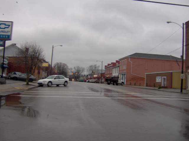
Photo: Nyttend, public domain · Wikimedia Commons
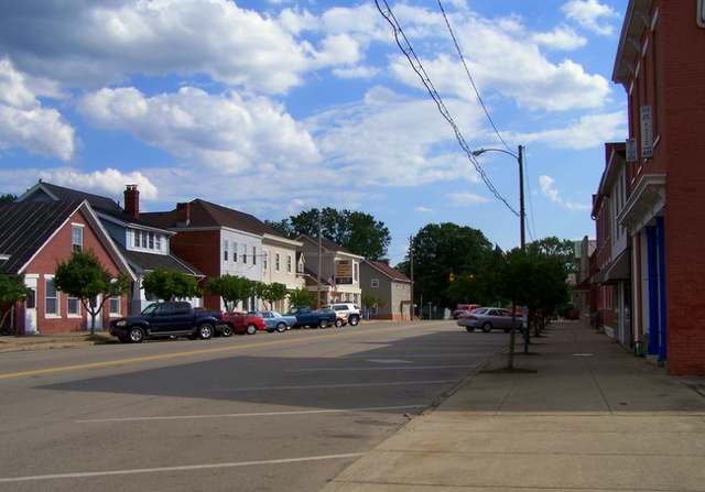
Photo: Neanias, public domain · Wikimedia Commons
Local history sources: ohiogenealogyexpress.com · en.wikipedia.org · en.wikipedia.org · en.wikipedia.org · commons.wikimedia.org · commons.wikimedia.org
Water
Eight wells in the buried Teays River Aquifer, in the Scioto valley north of Chillicothe The water here
- Ross County Water Co. Inc50% of residentsTeays Valley Aquifer (buried valley groundwater)
- Chillicothe City39% of residentsScioto Buried Valley Aquifer (Teays Valley system) wells
- Kingston Village10% of residentsTeays Valley Aquifer (buried valley groundwater)
Hospitals, fire stations and more
Inside Green Township, Ross County's boundary: 1 hospital, 1 fire or EMS station, 1 power plant, 4 public schools, 1 poor-rated bridge, 1 public charging site, 5 Toxics Release Inventory facilities and 8 spill cases. Press a pin or a name for its whole record and its source.
Hospitals (1)
-
Adena Regional Medical CenterGeneral hospital · Chillicothe
- What it is
- General hospital
- Address
- 272 Hospital Road, Chillicothe, OH 45601
- County
- Ross County
- Beds
- 266
- Helipad
- Yes
- Ownership
- Non-profit
- Medicare overall rating
- 3 of 5 stars
- Emergency department (Medicare)
- Yes
- Phone
- (740) 779-7500
- Medicare ID
- 360159
Medicare Care Compare ↗ Hospital's website ↗ Where HIFLD got this record ↗ HIFLD hospitals (source) ↗ Street map and directions ↗
Source: HIFLD hospitals inventory via FEMA (closed hospitals it still lists left out, hospitals opened since added), with Medicare Care Compare ratings matched by name and address.
Fire and EMS stations (1)
-
Green Township Fire Department Station 2Chillicothe
- Address
- 1296 Delano Road, Chillicothe, OH 45601
- Coordinates
- 39.40678, -82.96545
USGS National Map structures (source) ↗ Street map and directions ↗
Source: USGS National Map structures (most Ohio records last updated 2019 to 2022), checked against the Columbus and Cleveland station lists. The department that answers a call is set by jurisdiction and mutual aid, not by distance.
Power plants (1)
-
Salt City Solar Project - HybridSolar · 50 MW
- Capacity
- 50 MW
- Main source
- Solar
- Technology
- Solar Photovoltaic
- Operator
- Salt City Solar LLC
- Sector
- IPP Non-CHP
- Where
- Circleville, Ross County
- Generating units
- 1
- Built
- 2023
- EIA plant code
- 65302
EIA plant page ↗ EIA-860 (source) ↗ Street map and directions ↗
Source: EIA-860 power plant inventory via HIFLD (February 2025), with plant codes, units and years from EIA-860 2025.
Public schools (4)
-
Pickaway-Ross Career & Technology CenterChillicothe
- Address
- 895 Crouse Chapel Rd, Chillicothe, OH 45601
- Kind (NCES)
- Career and Technical School
- Students, 2023-24
- 710
- NCES school ID
- 390514304085
-
Zane Trace Elementary School3 of 5 stars · Chillicothe
- Address
- 946 State Route 180, Chillicothe, OH 45601
- School district
- Zane Trace Local School District
- Kind (NCES)
- Regular School
- Students, 2023-24
- 489
- Teachers (full-time equivalent)
- 30
- Report card, 2025-26
- 3 of 5 stars
- Performance index
- 77.8%
- Ohio building IRN
- 005736
- NCES school ID
- 390495403627
NCES school record ↗ Ohio School Report Card ↗ Street map and directions ↗
-
Zane Trace High School3 of 5 stars · Chillicothe
- Address
- 946 State Route 180, Chillicothe, OH 45601
- School district
- Zane Trace Local School District
- Kind (NCES)
- Regular School
- Students, 2023-24
- 363
- Teachers (full-time equivalent)
- 17
- Report card, 2025-26
- 3 of 5 stars
- Performance index
- 71.4%
- Four-year graduation rate
- 93.5%
- Ohio building IRN
- 042572
- NCES school ID
- 390495403628
NCES school record ↗ Ohio School Report Card ↗ Street map and directions ↗
-
Zane Trace Middle School3.5 of 5 stars · Chillicothe
- Address
- 946 State Route 180, Chillicothe, OH 45601
- School district
- Zane Trace Local School District
- Kind (NCES)
- Regular School
- Students, 2023-24
- 367
- Teachers (full-time equivalent)
- 23
- Report card, 2025-26
- 3.5 of 5 stars
- Performance index
- 77.2%
- Ohio building IRN
- 019117
- NCES school ID
- 390495403629
NCES school record ↗ Ohio School Report Card ↗ Street map and directions ↗
Source: NCES EDGE public school locations 2024-25 and Common Core of Data 2023-24 (type, students, teachers); Ohio School Report Cards 2025-26 (Department of Education and Workforce), matched by name within the district.
Bridges rated poor (1)
-
Sulphur Spring Rd over Tributary Scioto RiverPoor · built 1940
- Condition
- Poor: a deck, superstructure, substructure or culvert rated 4 or below on the 0 to 9 scale
- What it is
- Bridge
- Built
- 1940
- Length
- 10 ft
- Owner
- County
- Vehicles a day
- 884
- Coordinates
- 39.41025, -82.94107
National Bridge Inventory (source) ↗ Street map and directions ↗
Source: FHWA National Bridge Inventory 2025. "Poor" means one major part rated 4 or below on the 0 to 9 scale; it calls for repair, not closing, unless the state posts or closes the bridge.
Public EV charging (1)
-
ADENA STATION 14 Level 2 · Chillicothe
- Address
- 272 Hospital rd, Chillicothe, OH 45601
- Ports
- 4 Level 2
- Plugs
- J1772
- Network
- ChargePoint Network
- Hours
- 24 hours daily
- Phone
- 888-758-4389
Station Locator (NREL) ↗ Alternative Fuels Data Center (source) ↗ Street map and directions ↗
Source: NREL Alternative Fuels Data Center station list (May 2026), public and open stations, the posts at one address counted as one site.
Facilities reporting toxic releases (5)
-
Camoplast Accufab IncToxics Release Inventory · Chillicothe
- Address
- 90 Colomet Drive, Chillicothe, OH 45601
- County
- Ross County
- Status
- Reports to the Toxics Release Inventory (active)
- EPA program ID
- 45601CCRTP90COL
- EPA registry ID
- 110000395091
EPA facility record ↗ EPA Facility Registry Service (source) ↗ Street map and directions ↗
-
Commercial Vehicle Group - ChillicotheToxics Release Inventory · Chillicothe
- Address
- 75 Chamber Driver, Chillicothe, OH 45601
- County
- Ross County
- Status
- Reports to the Toxics Release Inventory (open)
- EPA program ID
- 4560WCMMRC75CHA
- EPA registry ID
- 110043670738
EPA facility record ↗ EPA Facility Registry Service (source) ↗ Street map and directions ↗
-
Kenworth Truck CoToxics Release Inventory · Chillicothe
- Address
- 65 Kenworth Dr, Chillicothe, OH 45601
- County
- Ross County
- Status
- Reports to the Toxics Release Inventory (active)
- EPA program ID
- 45601KNWRT65KEN
- EPA registry ID
- 110000395108
EPA facility record ↗ EPA Facility Registry Service (source) ↗ Street map and directions ↗
-
Mead Corp Opas PlantToxics Release Inventory · Chillicothe
- Address
- 1101 River Road, Chillicothe, OH 45601
- County
- Ross County
- Status
- Reports to the Toxics Release Inventory (active)
- EPA program ID
- 45601MDCRP1101R
- EPA registry ID
- 110002114051
EPA facility record ↗ EPA Facility Registry Service (source) ↗ Street map and directions ↗
-
Ysk CorpToxics Release Inventory · Chillicothe
- Address
- 1 Colomet Drive, Chillicothe, OH 45601
- County
- Ross County
- Status
- Reports to the Toxics Release Inventory
- EPA program ID
- 4560WYSKCR1CLME
- EPA registry ID
- 110000850721
EPA facility record ↗ EPA Facility Registry Service (source) ↗ Street map and directions ↗
Source: EPA Facility Registry Service, Toxics Release Inventory reporters. Reporting a release is required of large users of listed chemicals; it is not by itself a violation.
Spills reported since 2021 (8)
-
Antifreeze Vehicle Cooling2025-05-23 · Green Twp
- Reported
- 2025-05-23
- What spilled
- Antifreeze Vehicle Cooling; Fuel Diesel / Diesel Fuel (Vehicle On Or Off Road); Oil Motor / Lube Oil / Vehicle
- Where
- Green Twp, Ross County
- Ohio EPA district office
- SEDO
- Ohio EPA case number
- 2505EPA0000831
Ohio EPA spill reports (source) ↗ Street map and directions ↗
-
Fuel Diesel / Diesel Fuel (Vehicle On Or Off Road)2025-02-26 · Green Twp
- Reported
- 2025-02-26
- What spilled
- Fuel Diesel / Diesel Fuel (Vehicle On Or Off Road)
- Largest amount reported
- 150 gallons
- Where
- Green Twp, Ross County
- Ohio EPA district office
- SEDO
- Ohio EPA case number
- 2502EPA0000259
Ohio EPA spill reports (source) ↗ Street map and directions ↗
-
Pesticide(S) Nos (Not Specified)2023-08-08 · Green Twp
- Reported
- 2023-08-08
- What spilled
- Pesticide(S) Nos (Not Specified)
- Where
- Green Twp, Ross County
- Ohio EPA district office
- SEDO
- Ohio EPA case number
- 2308EPA0001364
Ohio EPA spill reports (source) ↗ Street map and directions ↗
-
Orphan Container(S)2022-06-22 · Green Twp
- Reported
- 2022-06-22
- What spilled
- Orphan Container(S)
- Where
- Green Twp, Ross County
- Ohio EPA district office
- SEDO
- Ohio EPA case number
- 2206EPA0000947
Ohio EPA spill reports (source) ↗ Street map and directions ↗
-
Material Blue2022-05-21 · Orange Twp
- Reported
- 2022-05-21
- What spilled
- Material Blue
- Where
- Orange Twp, Delaware County
- Ohio EPA district office
- SEDO
- Ohio EPA case number
- 2205EPA0000751
Ohio EPA spill reports (source) ↗ Street map and directions ↗
-
Oil Hydraulic Fluid(S)2022-04-14 · Green Twp
- Reported
- 2022-04-14
- What spilled
- Oil Hydraulic Fluid(S)
- Largest amount reported
- 8 gallons
- Where
- Green Twp, Ross County
- Ohio EPA district office
- SEDO
- Ohio EPA case number
- 2204EPA0000511
Ohio EPA spill reports (source) ↗ Street map and directions ↗
-
Material Undetermined / Other2021-01-02 · Green Twp
- Reported
- 2021-01-02
- What spilled
- Material Undetermined / Other
- Where
- Green Twp, Ross County
- Ohio EPA district office
- SEDO
- Ohio EPA case number
- 2101EPA0000003
Ohio EPA spill reports (source) ↗ Street map and directions ↗
-
Chemical(S) Unk2026-08-31 · Green Twp
- Reported
- 2026-08-31
- What spilled
- Chemical(S) Unk
- Where
- Green Twp, Ross County
- Ohio EPA district office
- SEDO
- Ohio EPA case number
- 2608EPA0001626
Ohio EPA spill reports (source) ↗ Street map and directions ↗
Source: Ohio EPA emergency response spill reports, 2021 to September 2026, one point per case where Ohio EPA placed it. A report is what the caller or responder recorded; amounts are often blank or estimated.
Its ZIP codes
Each ZIP code that touches Green Township, Ross County, with the share of its residents who live here and the same headline figures as the ZIP page.
Local government
Who holds office in Green Township, Ross County, how its elections and ballot issues came out, and the state auditor's record.
Ballot issues
| Date | Issue | For | Against | Result |
|---|---|---|---|---|
| 2022-11-08 | Issue: Green Township | 1,018 | 958 | Passed (51.52% for) |
Auditor of State record
- No fiscal caution, watch or emergency on the Auditor of State's lists.
- Financial Audit, 2022 to 2023, released 2024-08-08
The county
Ross County: 10 ZIP codes, 25 cities, villages and townships, 77,708 people.
Nearby places
Quick answers
What county is Green Township, Ohio in?
Green Township, Ross County is a township in Ross County, Ohio, with 3,995 residents.
When was Green Township, Ohio founded?
Green Township, Ross County was settled 1795 (approximate, first cabins); laid out 1816 (Kingston, as Ingstown). Founders on record: boundaries fixed April 1803 by judges Reuben Abrams, William Patton and Felix Renick; Kingston platted by Thomas Ing. Source
How did Green Township, Ohio get its name?
Green Township is one of sixteen townships named Green statewide in Ohio; the 1902 county history does not give a specific reason for the choice in Ross County. Source
What ZIP code is Green Township, Ohio?
Green Township, Ross County is served by ZIP codes 45644 and 45601; 45644 holds the largest share of its residents.
Where does Green Township, Ohio get its water?
The main water source for Green Township, Ross County (Ross County Water Co. Inc): Eight wells in the buried Teays River Aquifer, in the Scioto valley north of Chillicothe.
Cite this page
Cite this page as:
Cracked Buckeye, "Green Township, Ross County", https://crackedbuckeye.com/place/green-township-ross-county/, built 2026-10-31, accessed [date].
How to cite · Report a correction · Built 2026-10-31
