Local events in Wayne Township, Butler County
Wayne Township itself has 1 event posted in the next 90 days; the others here are within 10 miles. All local events in Wayne Township, Butler County
Checked October 20; the events page is refreshed daily.
How Wayne Township, Butler County began
Wayne Township, the sixth township organized in Butler County, was erected from St. Clair Township by the county commissioners on December 2, 1805 and named for Revolutionary War general Anthony Wayne. Sitting between Trenton and Oxford in the north-central county, it holds the village of Jacksonburg and part of Seven Mile, and northeast of Jacksonburg it preserves the Mann Mound, an Adena-culture burial mound whose stacked limestone burial vaults were exposed by a gravel-quarrying operation in 1868. The township remains rural today, with a population of 4,375 recorded in 2020 across 36.6 square miles.
Incorporated 1805, by The Butler County Commissioners, erecting it from St. Clair Township.
Where the name comes from
Wayne Township was named for General Anthony Wayne, the Revolutionary War officer who later commanded U.S. forces to victory at the 1794 Battle of Fallen Timbers and negotiated the 1795 Treaty of Greenville that opened this part of Ohio to settlement; it is one of roughly twenty Ohio townships bearing his name.
Before the town
Wayne Township holds the Mann Mound, an Adena-culture burial mound in Section 12, northeast of Jacksonburg: about 20 feet high, 540 feet in circumference, and covering roughly an acre, the second-largest surviving mound in Butler County. Inside, Adena builders stacked burial vaults of limestone slabs, each about 3 feet square, layered with gravel between them from the mound's base nearly to its summit. In 1868, local residents quarrying gravel broke into several of these vaults and recovered eight skeletons, which were sent to the Smithsonian Institution; archaeologist J. P. MacLean recorded the site in an 1879 survey. It was listed on the National Register of Historic Places on October 7, 1971. The 1905 county history also records the camping ground of the Indian chief Killbuck near the Shiloh church, at the mouth of a stream emptying into Elk Creek: Killbuck, 'about half civilized', kept his clan there and refused to go west when his warriors left, later going to Indiana. It tells, as a family tradition, how Indians visiting the Harper family in 1800 took the three-year-old Elizabeth Harper, who was said to have been seen in 1842 as the wife of an Indian warrior.
Nations recorded here: Adena culture.
- Killbuck's camping ground near Shiloh church (camp) — mouth of a stream emptying into Elk Creek, near Shiloh church, Wayne Township, early 1800s (archive.org)
Timeline
- — William Harper settles with his family on Section 19; in the spring of 1800 Indians visiting for sugar-making take his three-year-old daughter Elizabeth, who is never found, though a friend sees her in 1842 married to an Indian warrior with two children.
- — James Withrow, from Nelson County, Kentucky, and his brother John settle in the township.
- — Wayne Township is erected from St. Clair Township by the Butler County Commissioners on December 2, the sixth township organized in the county.
- — Jacksonburg is laid out on February 16 by Benjamin Vancleve, John Baird, John Craig and Henry Weaver; John Baird builds the first tavern and William Phares keeps the first store.
- — Jacksonburg reaches its greatest prosperity, with as many as fifty teams putting up for the night at its taverns, two hotels, four stores and a pork-packing house.
- — The Eaton-to-Hamilton turnpike through Seven Mile, sixty feet wide for three teams abreast, is built in 1833-34 by a stock company with John Woods as president.
- — Seven Mile is laid out in 1841 by John Walter on the lands of Samuel Brand, who had built a mill and a distillery that he ran until 1835; it is incorporated in 1875.
- — A stock company founds an academy at Seven Mile with I. N. Hughes as principal; R. B. Hanby, author of 'Nellie Gray', succeeds him.
- — A gravel-quarrying operation northeast of Jacksonburg breaks into the Mann Mound's limestone burial vaults, exposing eight skeletons later sent to the Smithsonian Institution.
- — Archaeologist J. P. MacLean records the Mann Mound in a survey of Ohio earthworks.
- — The township has 1,343 people, down from 1,562 in 1840; Jacksonburg's 77 residents make it the smallest municipality in Ohio.
- — The Mann Mound is listed on the National Register of Historic Places on October 7.
- — Township population is recorded at 4,375 across 36.6 square miles.
Stories
A mound opened by a gravel crew
For decades the Mann Mound stood at the edge of a field northeast of Jacksonburg the way it had for roughly two thousand years, its Adena builders' careful work -- limestone burial vaults stacked in gravel-separated layers nearly to the summit of a mound 20 feet high and better than 500 feet around -- hidden beneath a covering of trees and undisturbed earth. In 1868 that changed abruptly, when local residents digging for construction gravel cut into the mound's flank and broke straight into several of the stacked stone vaults inside, exposing burial chambers no one living had ever seen opened. Eight skeletons came out of the mound as a result and were shipped off to the Smithsonian Institution for study, a common fate for Native remains disturbed by 19th-century excavation and quarrying across Ohio. Archaeologist J. P. MacLean formally recorded the site eleven years later, in 1879, and despite the damage from the original quarrying, the Mann Mound survived well enough to be listed on the National Register of Historic Places in 1971 -- still, more than a century after it was cut into, the second-largest mound left standing anywhere in Butler County.
The child the Indians took
About 1798 William Harper settled his family on Section 19 of what became Wayne Township. In the spring of 1800, in sugar-making time, Indians came in numbers to visit the Harpers as they were accustomed to do, and an old squaw grew very friendly with the family, especially with little Elizabeth, three years old. One evening Mrs. Harper sent two children for the cows and the little girl followed, calling to them to stop; they were in too much of a hurry to attend to her. When they came home Elizabeth was missing. The next morning small footprints were found in the mud where she had crossed a stream, and beside them moccasin tracks; the Indians were gone. Her father and mother visited all the Indian camps in search but never found her. In 1842 a man who knew the Harpers saw a woman he recognized by the family likeness; she had married an Indian warrior, had two children, and afterward went west of the Mississippi with her tribe and was never heard of again. Her parents had died long before, still despairing of finding her.
Photographs
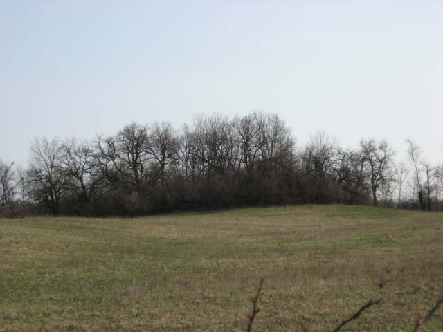
Photo: Nyttend, public domain · Wikimedia Commons
Local history sources: en.wikipedia.org · en.wikipedia.org · commons.wikimedia.org · archive.org
Water
Four wells on a 100-acre district wellfield over the Great Miami valley aquifer, St. Clair Twp, north of Hamilton The water here
- Butler Co. Water District 225% of residentsHamilton wells (Great Miami aquifer) + Cincinnati (Ohio River + wells)
- Southwest Regional Water District22% of residentsGreat Miami Buried Valley Aquifer (wells)
- Trenton City20% of residentsGreat Miami River Buried Valley Aquifer (wells)
- Middletown City18% of residentsGreat Miami Buried Valley Aquifer (wells)
- Hamilton Public Water System13% of residentsGreat Miami Buried Valley Aquifer (wells)
- New Miami Village1% of residentsGroundwater wells (3 wells)
- Fairfield City0% of residentsGreat Miami Buried Valley Aquifer (wells)
- Catalina Mobile Home Park0% of residentsGroundwater wells (2 wells)
Hospitals, fire stations and more
Inside Wayne Township, Butler County's boundary: 1 fire or EMS station, 1 poor-rated bridge, 3 spill cases and 1 mound or earthwork. Press a pin or a name for its whole record and its source.
Fire and EMS stations (1)
-
Wayne Township Fire DepartmentMiddletown
- Address
- 4575 Middletown Oxford Road, Middletown, OH 45042
- Coordinates
- 39.53788, -84.50397
USGS National Map structures (source) ↗ Street map and directions ↗
Source: USGS National Map structures (most Ohio records last updated 2019 to 2022), checked against the Columbus and Cleveland station lists. The department that answers a call is set by jurisdiction and mutual aid, not by distance.
Bridges rated poor (1)
-
Shurz Rd over Elk CreekPoor · built 1971
- Condition
- Poor: a deck, superstructure, substructure or culvert rated 4 or below on the 0 to 9 scale
- What it is
- Bridge
- Built
- 1971
- Length
- 35 ft
- Owner
- County
- Vehicles a day
- 330
- Coordinates
- 39.56380, -84.52021
National Bridge Inventory (source) ↗ Street map and directions ↗
Source: FHWA National Bridge Inventory 2025. "Poor" means one major part rated 4 or below on the 0 to 9 scale; it calls for repair, not closing, unless the state posts or closes the bridge.
Spills reported since 2021 (3)
-
Fuel Oil/ Home Heating / Heating Oil2024-03-14 · Monroe
- Reported
- 2024-03-14
- What spilled
- Fuel Oil/ Home Heating / Heating Oil
- Where
- Monroe, Butler County
- Ohio EPA district office
- SWDO
- Ohio EPA case number
- 2403EPA0000402
Ohio EPA spill reports (source) ↗ Street map and directions ↗
-
Material Blue Reached water2023-07-26 · Wayne Twp
- Reported
- 2023-07-26
- What spilled
- Material Blue
- Reached a waterway
- 99 - Unnamed
- Where
- Wayne Twp, Butler County
- Ohio EPA district office
- SWDO
- Ohio EPA case number
- 2307EPA0001269
Ohio EPA spill reports (source) ↗ Street map and directions ↗
-
Fuel Diesel / Diesel Fuel (Vehicle On Or Off Road)2021-07-29 · Wayne Twp
- Reported
- 2021-07-29
- What spilled
- Fuel Diesel / Diesel Fuel (Vehicle On Or Off Road)
- Where
- Wayne Twp, Butler County
- Ohio EPA district office
- SWDO
- Ohio EPA case number
- 2107EPA0001151
Ohio EPA spill reports (source) ↗ Street map and directions ↗
Source: Ohio EPA emergency response spill reports, 2021 to September 2026, one point per case where Ohio EPA placed it. A report is what the caller or responder recorded; amounts are often blank or estimated.
Mounds and earthworks (1)
-
Mann MoundMound · Adena culture
- What it is
- Mound
- Age
- Adena culture
- Where
- Section 12, Wayne Township, northeast of Jacksonburg
- County
- Butler County
- Named in the history of
- Wayne Township, Butler County
- Map point
- from the site's Wikipedia article
Wikipedia article (point and source) ↗ Street map and directions ↗
Many mounds stand on private land; visit only those open to the public.
Source: the History records' native sites, each placed by its own Wikipedia article; sites no article places are named on the History card but not pinned.
Its ZIP codes
Each ZIP code that touches Wayne Township, Butler County, with the share of its residents who live here and the same headline figures as the ZIP page.
Local government
Who holds office in Wayne Township, Butler County, how its elections and ballot issues came out, and the state auditor's record.
Who holds office
| Office | Name | Party | Term ends | Contact |
|---|---|---|---|---|
| Township Fiscal Officer | Laura M. Daley | 11/2/2027 | ||
| Township Trustee | Michael Truster | 11/2/2027 | ||
| Township Trustee | Bill Jones | 11/6/2029 | ||
| Township Trustee | Edward G. Truster | 11/6/2029 |
Roster as of 2026-07-27: county board of elections.
Auditor of State record
- No fiscal caution, watch or emergency on the Auditor of State's lists.
- Financial Audit, 2023 to 2024, released 2025-12-18
The county
Butler County: 13 ZIP codes, 22 cities, villages and townships, 382,868 people.
Nearby places
Quick answers
What county is Wayne Township, Ohio in?
Wayne Township, Butler County is a township in Butler County, Ohio, with 3,848 residents.
When was Wayne Township, Ohio founded?
Wayne Township, Butler County was incorporated 1805. Founders on record: The Butler County Commissioners, erecting it from St. Clair Township. Source
How did Wayne Township, Ohio get its name?
Wayne Township was named for General Anthony Wayne, the Revolutionary War officer who later commanded U.S. forces to victory at the 1794 Battle of Fallen Timbers and negotiated the 1795 Treaty of Greenville that opened this part of Ohio to settlement; it is one of roughly twenty Ohio townships bearing his name. Source
What ZIP code is Wayne Township, Ohio?
Wayne Township, Butler County is served by ZIP codes 45062, 45064, 45067, 45042 and 45011; 45062 holds the largest share of its residents.
Where does Wayne Township, Ohio get its water?
The main water source for Wayne Township, Butler County (Butler Co. Water District 2): Four wells on a 100-acre district wellfield over the Great Miami valley aquifer, St. Clair Twp, north of Hamilton.
Cite this page
Cite this page as:
Cracked Buckeye, "Wayne Township, Butler County", https://crackedbuckeye.com/place/wayne-township-butler-county/, built 2026-10-31, accessed [date].
How to cite · Report a correction · Built 2026-10-31
