Local events in Richland Township, Belmont County
16 events in the next 90 days from 2 public calendars. All local events in Richland Township, Belmont County
Checked October 20; the events page is refreshed daily.
How Richland Township, Belmont County began
Richland Township was set off from Kirkwood Township on February 24, 1802, and enlarged twice more by 1809, taking its name from the richness of its soil and the coal and limestone underlying it. St. Clairsville, Belmont County's seat, sits in the township's center. Long before European settlement, a hilltop just west of St. Clairsville and a 50-acre flat above U.S. Route 40 north of town were both occupied Native villages, excavated in the 1970s and 1980s and now on the National Register as the Brokaw Site and the Opatrny Village Site. The township's rural stretches also hold the George-Caldwell-Grum Farm, an 1813 farmstead worked by only three families across more than 150 years and remembered locally for hiding freedom seekers on the Underground Railroad.
Incorporated February 24, 1802 (set off from Kirkwood Township; boundary extended 1802 and 1809), by Belmont County commissioners.
Where the name comes from
The township was named Richland for the richness of its soil and for the coal and limestone found within its borders.
Before the town
Richland Township holds two of Belmont County's most substantial documented Native American sites. The Brokaw Site, on a hilltop about 1,240 feet above sea level just west of St. Clairsville off U.S. Route 40, was a small (2 to 3 acre) village occupied across the Archaic through Late Woodland periods, its residents drawn by a strategic overlook of an early trail (later the National Road) and by four nearby springs; landowner John Brokaw allowed excavation from 1972 to 1974 before the site's listing on the National Register in 1976 delayed his plan to strip-mine the property. A few miles away, the Opatrny Village Site, a 50-acre flat north of U.S. Route 40 near the Belmont Hills Country Club, was a much larger village of the Monongahela culture, a maize-farming, pottery-making people contemporary with the Fort Ancient culture elsewhere in Ohio, occupied roughly AD 1000 to 1600; a 1980 excavation found occupational debris more than 1.5 feet thick, though the site's full extent was never determined and much of it remains intact today. Neither site is tied by name to a specific historic-era nation such as the Shawnee or Lenape; both predate the eighteenth-century nations. No historic-era (post-1700) Native village or trail specific to Richland Township beyond the general county-wide picture was found in the sources consulted.
- Brokaw Site (village) — hilltop off U.S. Route 40, Richland Township, just west of St. Clairsville, Archaic through Late Woodland (occupation spanning roughly 8000 BC to AD 1000) (en.wikipedia.org)
- Opatrny Village Site (village) — U.S. Route 40 north of Belmont Hills Country Club, Richland Township, near St. Clairsville, AD 1000-1600 (Monongahela culture) (en.wikipedia.org)
Timeline
- — Richland Township is set off from Kirkwood Township on February 24, taking its name from the fertility of its soil.
- — The township's boundary is extended south into Pultney Township for the second time, on March 7, fixing its present limits.
- — Travis George receives 175 acres of land from his father-in-law along what became Lloydsville-Bannock Road, founding the farm later known as the George-Caldwell-Grum Farm.
- — The Grum family purchases the farm from the Caldwells, becoming only the third family to own it in more than a century.
- — Landowner John Brokaw permits a formal excavation of the hilltop village site on his property, running through 1974 and uncovering Archaic through Late Woodland projectile points and ceramics.
- — The Opatrny Village Site, a 50-acre Monongahela-culture village site north of U.S. Route 40, is added to the National Register of Historic Places on May 21.
- — The Brokaw Site is added to the National Register of Historic Places on June 17, halting a planned coal strip-mining operation on the property.
Stories
A farmhouse built to hide freedom seekers
In 1813, Travis George took 175 acres along what is now Lloydsville-Bannock Road from his father-in-law and started a farm that would stay in only three families' hands for more than 150 years: the Georges, then the Caldwells, then, from 1927, the Grums. Local tradition holds that the farmhouse was built, or later modified, with features specifically meant to hide people escaping slavery as they moved north on the Underground Railroad, a route that ran through Ohio's Quaker-settled counties along the upper Ohio Valley. The farm's National Register listing recognizes both its unusually long single-lineage-adjacent ownership and its place in that history. Today the Grum family still lives in the farmhouse their grandparents bought a century ago.
Two villages under a coal county's hills
Long before St. Clairsville existed, at least two Native villages occupied the ridges just outside it. On a hilltop to the west, people camped and built across thousands of years, from the Archaic period into the Late Woodland, drawn by an overlook of a trail that later became the National Road and by four springs feeding toward the Ohio River; when the 20th-century landowner John Brokaw let archaeologists dig there in the early 1970s, what they found was substantial enough to stop his plan to strip-mine the hill for coal. A few miles north, a much larger village, 50 acres of it, belonged to the Monongahela culture, farmers who grew maize and made distinctive pottery between roughly AD 1000 and 1600 in the same general era as the Fort Ancient people elsewhere in Ohio; a 1980 dig found more than a foot and a half of occupation debris but never finished mapping the site's true size. Both places sit on the National Register today, protected in part by their own remoteness from the highway development that has reshaped the land around them.
Photographs
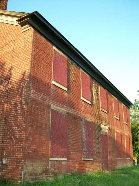
Photo: Bwsmith84, Wikimedia Commons, CC BY 3.0 · Wikimedia Commons
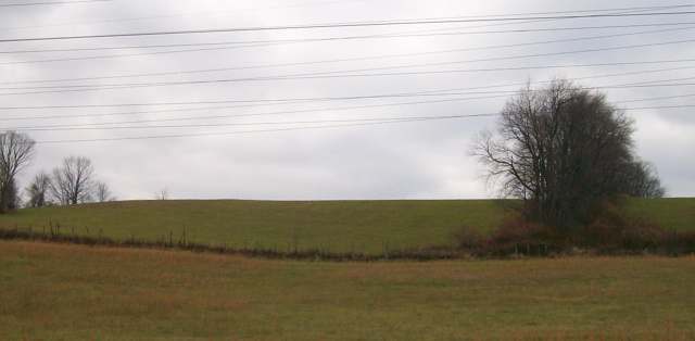
Photo: Bwsmith84, Wikimedia Commons, CC BY 3.0 · Wikimedia Commons
Local history sources: en.wikipedia.org · en.wikipedia.org · en.wikipedia.org · wtrf.com · en.wikipedia.org · commons.wikimedia.org · commons.wikimedia.org
Historic places
2 places in Richland Township, Belmont County on the National Register of Historic Places. Press a pin or a name for its whole record.
-
Brick Tavern HouseBuilding · St. Clairsville · listed 1995
- Address
- US 40 W of St. Clairsville, Richland Township
- Where
- St. Clairsville, Belmont County · ZIP 43950
- What it is
- Building
- Listed on the National Register
- 1995
- NRIS reference number
- 95001330
- Coordinates
- 40.07362, -80.98270
National Register file (NPS) ↗ Search Wikipedia ↗ Street map and directions ↗ On the Cracked Buckeye map
-
Great Western SchoolhouseBuilding · St. Clairsville · listed 1979
- Address
- W of St. Clairsville on U.S. 40
- Where
- St. Clairsville, Belmont County · ZIP 43950
- What it is
- Building
- Listed on the National Register
- 1979
- NRIS reference number
- 79001787
- Coordinates
- 40.07289, -80.98105
National Register file (NPS) ↗ Search Wikipedia ↗ Street map and directions ↗ On the Cracked Buckeye map
Source: National Park Service, National Register of Historic Places point file. The listing year is shown where NPS's certification date agrees with the listing's reference number. Listing recognizes significance; it does not restrict a private owner.
Water
Mostly private wells The water here
- St. Clairsville, City Of94% of residentsSt. Clairsville Main & Provident Reservoirs (local runoff)
- Bellaire Public Water System2% of residentsOhio River (via bank infiltration wells)
- Belmont Public Water System2% of residentsGroundwater wells (2 wells)
- Belmont Co. Sanitary District 31% of residentsOhio River valley aquifer (wells)
- Tri-county Water Authority1% of residentsOhio River valley aquifer (wells)
- York Township Water Authority0% of residentsGroundwater wells (3 wells)
- Shadyside Public Water System0% of residentsGroundwater wells (2 wells)
- Morristown Public Water System0% of residentsOhio River valley aquifer (wells)
Hospitals, fire stations and more
Inside Richland Township, Belmont County's boundary: 3 health centers, 1 dialysis center, 2 nursing homes, 2 fire and EMS stations, 2 colleges, 2 high-hazard dams, 1 public school, 1 private school, 1 museum, 2 police stations, 1 public charging site, 93 shale and injection wells, 2 Superfund sites and 34 spill cases. Press a pin or a name for its whole record and its source.
Community health centers (3)
-
OHHC St. ClairsvilleHealth center · Saint Clairsville
- Run by
- a federally qualified health center
- Setting
- Clinic
- City
- Saint Clairsville
- Coordinates
- 40.07512, -80.97665
Find a Health Center (HRSA) ↗ HRSA data (source) ↗ Street map and directions ↗
-
Southeast Inc., Mobile Medical Unit - Eastern OhioHealth center · Saint Clairsville
- Run by
- a federally qualified health center
- Setting
- Clinic
- City
- Saint Clairsville
- Coordinates
- 40.07954, -80.96915
Find a Health Center (HRSA) ↗ HRSA data (source) ↗ Street map and directions ↗
-
Southeast, Inc. - St. ClairsvilleHealth center · Saint Clairsville
- Run by
- a federally qualified health center
- Setting
- Clinic
- City
- Saint Clairsville
- Coordinates
- 40.07954, -80.96915
Find a Health Center (HRSA) ↗ HRSA data (source) ↗ Street map and directions ↗
Source: HRSA health center service delivery sites, active, September 2026 (school-based sites left out). Health centers see patients whether or not they have insurance, with fees on a sliding scale.
Dialysis centers (1)
-
Davita Belmont DialysisDialysis · Saint Clairsville
- Address
- 68639 Bannock Road, Saint Clairsville, OH 43950
- Dialysis stations
- 10
- Medicare star rating
- 3 of 5 stars
- Services
- in-center hemodialysis, peritoneal dialysis
- Ownership
- for profit
- Chain
- DaVita
- Medicare certified since
- 2000-03-01
- Phone
- (740) 699-0220
- Medicare ID
- 362561
Medicare Care Compare ↗ CMS dialysis facility list (source) ↗ Street map and directions ↗
Source: CMS dialysis facility list, September 2026, geocoded with the Census Bureau batch geocoder (an address it could not place sits at its ZIP center).
Nursing homes (2)
-
Belmont Manor4 of 5 stars · St Clairsville
- Address
- 51999 Guirino Drive, St Clairsville, OH 43950
- Certified beds
- 57
- Residents on an average day
- 51
- Medicare overall rating
- 4 of 5 stars
- Health inspections
- 3 of 5 stars
- Staffing
- 4 of 5 stars
- Quality measures
- 5 of 5 stars
- Penalties since 2023
- none
- Ownership
- For profit - Corporation
- Takes
- Medicare and Medicaid
- Phone
- (740) 695-4404
- Medicare ID
- 366190
- Map point
- the ZIP's center (the address did not geocode)
Medicare Care Compare ↗ CMS nursing home data (source) ↗ Street map and directions ↗
-
Cumberland Pointe Care Center3 of 5 stars · St Clairsville
- Address
- 68637 Bannock Road, St Clairsville, OH 43950
- Certified beds
- 75
- Residents on an average day
- 67
- Medicare overall rating
- 3 of 5 stars
- Health inspections
- 3 of 5 stars
- Staffing
- 3 of 5 stars
- Quality measures
- 3 of 5 stars
- Penalties since 2023
- none
- Ownership
- For profit - Corporation
- Chain
- FOUNDATIONS HEALTH SOLUTIONS
- Takes
- Medicare and Medicaid
- Phone
- (740) 695-2500
- Medicare ID
- 366177
Medicare Care Compare ↗ CMS nursing home data (source) ↗ Street map and directions ↗
Source: CMS Care Compare nursing home provider and penalties files; Medicare star ratings run 1 to 5.
Fire and EMS stations (2)
-
Cumberland Trail Fire District Station 23 - 2Saint Clairsville
- Address
- 68389 Stewart Drive, Saint Clairsville, OH 43950
- Coordinates
- 40.07618, -80.86744
USGS National Map structures (source) ↗ Street map and directions ↗
-
Glencoe Volunteer Fire Department Station 25Glencoe
- Address
- 50083 2nd Street, Glencoe, OH 43928
- Coordinates
- 40.00855, -80.88915
USGS National Map structures (source) ↗ Street map and directions ↗
Source: USGS National Map structures (most Ohio records last updated 2019 to 2022), checked against the Columbus and Cleveland station lists. The department that answers a call is set by jurisdiction and mutual aid, not by distance.
Colleges (2)
-
Belmont CollegePublic two-year college · St Clairsville
- What it is
- Public two-year college
- City
- St Clairsville
- Students, 2023-24 (12-month count)
- 965
- Tuition and fees, in state
- $4,815
- Tuition and fees, out of state
- $7,525
- Graduation rate
- 39% within three years (a class of 122)
- IPEDS unit ID
- 201283
College Navigator (NCES) ↗ IPEDS data (source) ↗ Street map and directions ↗
-
Ohio University-Eastern CampusPublic university · Saint Clairsville
- What it is
- Public university
- City
- Saint Clairsville
- Students, 2023-24 (12-month count)
- 2,298
- Tuition and fees, in state
- $6,178
- Tuition and fees, out of state
- $9,170
- Graduation rate
- 20% of bachelor's students, within six years (a class of 109)
- IPEDS unit ID
- 204802
College Navigator (NCES) ↗ IPEDS data (source) ↗ Street map and directions ↗
Source: NCES IPEDS 2024 directory, 2023-24 enrollment and tuition, graduation rates for the 2017 (four-year) and 2020 (two-year) entering classes.
High-hazard dams (2)
-
Belmont Hills Country Club Lake Dam PoorNeffs Run · condition: poor
- Hazard class
- High: a failure would probably cost a life
- Condition
- Poor (assessed 10/02/2023)
- River or stream
- Neffs Run
- Purpose
- Water Supply
- Type
- Earth
- Height
- 21 ft
- Storage
- 70 acre-feet
- Completed
- 1940
- Owner type
- Private
- County
- Belmont County
- Nearest town (NID)
- Warnock
- Last inspection
- 10/11/2022
- Emergency action plan
- Yes
- NID ID
- OH01218
National Inventory of Dams record ↗ National Inventory of Dams (source) ↗ Street map and directions ↗
-
St. Clairsville Reservoir No. 2 DamJug Run · condition: satisfactory
- Hazard class
- High: a failure would probably cost a life
- Condition
- Satisfactory (assessed 11/27/2025)
- River or stream
- Jug Run
- Purpose
- Water Supply
- Type
- Earth
- Height
- 31 ft
- Storage
- 87 acre-feet
- Completed
- 1920
- Owner type
- Local Government
- County
- Belmont County
- Nearest town (NID)
- Provident
- Last inspection
- 10/11/2022
- Emergency action plan
- Yes
- NID ID
- OH00794
National Inventory of Dams record ↗ National Inventory of Dams (source) ↗ Street map and directions ↗
Source: U.S. Army Corps of Engineers National Inventory of Dams, August 2026. "High hazard" rates what a failure would cost downstream, not how likely one is; the condition is the state's assessment.
Public schools (1)
-
Belmont Career CenterSaint Clairsville
- Address
- 68090 Hammond Rd, Saint Clairsville, OH 43950
- Kind (NCES)
- Career and Technical School
- Students, 2023-24
- 328
- Teachers (full-time equivalent)
- 35
- NCES school ID
- 390508504275
Source: NCES EDGE public school locations 2024-25 and Common Core of Data 2023-24 (type, students, teachers); Ohio School Report Cards 2025-26 (Department of Education and Workforce), matched by name within the district.
Private schools (1)
-
East Richland Christian SchoolsPrivate, conservative Christian · Saint Clairsville
- Address
- 67888 Friends Church Rd, Saint Clairsville, OH 43950
- Kind
- conservative Christian
- Students, 2023-24
- 184
- Teachers (full-time equivalent)
- 14.5
- Students per teacher
- 12.6897
- Phone
- (740) 312-5637
- NCES private school ID
- A0108634
Source: NCES Private School Survey 2023-24.
Museums, historical societies, gardens and zoos (1)
-
Oue GalleryArt museum · Saint Clairsville
- What it is
- Art museum
- City
- Saint Clairsville
- Coordinates
- 40.07212, -80.97079
Search Wikipedia ↗ IMLS Museum Data Files (source) ↗ Street map and directions ↗
The museum list is IMLS's 2018 file; a museum may have closed or moved since.
Source: IMLS Museum Data Files, 2018.
Police stations (2)
-
Belmont County Sheriff's OfficeSaint Clairsville
- Address
- 68137 Hammond Road, Saint Clairsville, OH 43950
- Coordinates
- 40.07838, -80.96035
USGS National Map structures (source) ↗ Street map and directions ↗
-
Richland Township Police DepartmentSt. Clairsville
- Address
- 66565 Warnock St Clairsville Road, St. Clairsville, OH 43950
- Coordinates
- 40.05419, -80.91706
Where this record comes from ↗ USGS National Map structures (source) ↗ Street map and directions ↗
Source: USGS National Map structures, police stations, corrected and completed by hand (September 2026). The department that answers a call is set by jurisdiction, not by distance.
Public EV charging (1)
-
Whiteside Chevrolet GMC DC fast2 DC fast · Clairsville
- Address
- 50714 National Rd E St, Clairsville, OH 43950
- Ports
- 2 DC fast
- Plugs
- CCS, CHAdeMO
- Network
- RED_E
- Phone
- 313-262-6722
Station Locator (NREL) ↗ Alternative Fuels Data Center (source) ↗ Street map and directions ↗
Source: NREL Alternative Fuels Data Center station list (May 2026), public and open stations, the posts at one address counted as one site.
Shale and injection wells (93)
-
Antolak E Rch Bl 9HUtica shale well
- What it is
- Utica shale well
- Drilled sideways
- Yes
- Operator
- Ascent Resources Utica Llc
- County
- Belmont County
- API well number
- 34013216350000
- Coordinates
- 40.04363, -80.90090
ODNR oil and gas wells (source) ↗ Street map and directions ↗
The point is the surface well head (the pad); a horizontal well runs a mile or more underground from it.
-
Antolak N Rch Bl 5HUtica shale well
- What it is
- Utica shale well
- Drilled sideways
- Yes
- Operator
- Ascent Resources Utica Llc
- County
- Belmont County
- API well number
- 34013216520000
- Coordinates
- 40.04373, -80.90094
ODNR oil and gas wells (source) ↗ Street map and directions ↗
The point is the surface well head (the pad); a horizontal well runs a mile or more underground from it.
-
Antolak Ne Rch Bl 7HUtica shale well
- What it is
- Utica shale well
- Drilled sideways
- Yes
- Operator
- Ascent Resources Utica Llc
- County
- Belmont County
- API well number
- 34013216530000
- Coordinates
- 40.04368, -80.90092
ODNR oil and gas wells (source) ↗ Street map and directions ↗
The point is the surface well head (the pad); a horizontal well runs a mile or more underground from it.
-
Antolak Nw Rch Bl 1HUtica shale well
- What it is
- Utica shale well
- Drilled sideways
- Yes
- Operator
- Ascent Resources Utica Llc
- County
- Belmont County
- API well number
- 34013216500000
- Coordinates
- 40.04384, -80.90099
ODNR oil and gas wells (source) ↗ Street map and directions ↗
The point is the surface well head (the pad); a horizontal well runs a mile or more underground from it.
-
Antolak Nw Rch Bl 3HUtica shale well
- What it is
- Utica shale well
- Drilled sideways
- Yes
- Operator
- Ascent Resources Utica Llc
- County
- Belmont County
- API well number
- 34013216510000
- Coordinates
- 40.04378, -80.90096
ODNR oil and gas wells (source) ↗ Street map and directions ↗
The point is the surface well head (the pad); a horizontal well runs a mile or more underground from it.
-
Barton 210154 1AUtica shale well
- What it is
- Utica shale well
- Drilled sideways
- Yes
- Operator
- Gulfport Appalachia Llc
- County
- Belmont County
- API well number
- 34013211010000
- Coordinates
- 40.09006, -80.88903
ODNR oil and gas wells (source) ↗ Street map and directions ↗
The point is the surface well head (the pad); a horizontal well runs a mile or more underground from it.
-
Barton 210154 2BUtica shale well
- What it is
- Utica shale well
- Drilled sideways
- Yes
- Operator
- Gulfport Appalachia Llc
- County
- Belmont County
- API well number
- 34013212290000
- Coordinates
- 40.09007, -80.88898
ODNR oil and gas wells (source) ↗ Street map and directions ↗
The point is the surface well head (the pad); a horizontal well runs a mile or more underground from it.
-
Barton 210154 3CUtica shale well
- What it is
- Utica shale well
- Drilled sideways
- Yes
- Operator
- Gulfport Appalachia Llc
- County
- Belmont County
- API well number
- 34013212310000
- Coordinates
- 40.09008, -80.88893
ODNR oil and gas wells (source) ↗ Street map and directions ↗
The point is the surface well head (the pad); a horizontal well runs a mile or more underground from it.
-
Barton 210154 4DUtica shale well
- What it is
- Utica shale well
- Drilled sideways
- Yes
- Operator
- Gulfport Appalachia Llc
- County
- Belmont County
- API well number
- 34013212300000
- Coordinates
- 40.09009, -80.88888
ODNR oil and gas wells (source) ↗ Street map and directions ↗
The point is the surface well head (the pad); a horizontal well runs a mile or more underground from it.
-
Big Tex 2HUtica shale well
- What it is
- Utica shale well
- Drilled sideways
- Yes
- Operator
- Rice Drilling D Llc
- County
- Belmont County
- API well number
- 34013216020000
- Coordinates
- 40.04318, -80.94169
ODNR oil and gas wells (source) ↗ Street map and directions ↗
The point is the surface well head (the pad); a horizontal well runs a mile or more underground from it.
-
Big Tex 4HUtica shale well
- What it is
- Utica shale well
- Drilled sideways
- Yes
- Operator
- Rice Drilling D Llc
- County
- Belmont County
- API well number
- 34013216030000
- Coordinates
- 40.04324, -80.94169
ODNR oil and gas wells (source) ↗ Street map and directions ↗
The point is the surface well head (the pad); a horizontal well runs a mile or more underground from it.
-
Big Tex 6HUtica shale well
- What it is
- Utica shale well
- Drilled sideways
- Yes
- Operator
- Rice Drilling D Llc
- County
- Belmont County
- API well number
- 34013216040000
- Coordinates
- 40.04329, -80.94168
ODNR oil and gas wells (source) ↗ Street map and directions ↗
The point is the surface well head (the pad); a horizontal well runs a mile or more underground from it.
-
Big Tex Scl6H1Utica shale well
- What it is
- Utica shale well
- Drilled sideways
- Yes
- Operator
- Rice Drilling D Llc
- County
- Belmont County
- API well number
- 34013214220000
- Coordinates
- 40.04339, -80.94172
ODNR oil and gas wells (source) ↗ Street map and directions ↗
The point is the surface well head (the pad); a horizontal well runs a mile or more underground from it.
-
Big Tex Scl6H13Utica shale well
- What it is
- Utica shale well
- Drilled sideways
- Yes
- Operator
- Rice Drilling D Llc
- County
- Belmont County
- API well number
- 34013214210000
- Coordinates
- 40.04342, -80.94164
ODNR oil and gas wells (source) ↗ Street map and directions ↗
The point is the surface well head (the pad); a horizontal well runs a mile or more underground from it.
-
Big Tex Scl6H5Utica shale well
- What it is
- Utica shale well
- Drilled sideways
- Yes
- Operator
- Rice Drilling D Llc
- County
- Belmont County
- API well number
- 34013214200000
- Coordinates
- 40.04353, -80.94172
ODNR oil and gas wells (source) ↗ Street map and directions ↗
The point is the surface well head (the pad); a horizontal well runs a mile or more underground from it.
-
Big Tex Scl6H9Utica shale well
- What it is
- Utica shale well
- Drilled sideways
- Yes
- Operator
- Rice Drilling D Llc
- County
- Belmont County
- API well number
- 34013214230000
- Coordinates
- 40.04356, -80.94164
ODNR oil and gas wells (source) ↗ Street map and directions ↗
The point is the surface well head (the pad); a horizontal well runs a mile or more underground from it.
-
Blessed E Rch Bl 7HUtica shale well
- What it is
- Utica shale well
- Drilled sideways
- Yes
- Operator
- Ascent Resources Utica Llc
- County
- Belmont County
- API well number
- 34013213010000
- Coordinates
- 40.01162, -80.87456
ODNR oil and gas wells (source) ↗ Street map and directions ↗
The point is the surface well head (the pad); a horizontal well runs a mile or more underground from it.
-
Blessed E Rch Bl 9HUtica shale well
- What it is
- Utica shale well
- Drilled sideways
- Yes
- Operator
- Ascent Resources Utica Llc
- County
- Belmont County
- API well number
- 34013213020000
- Coordinates
- 40.01163, -80.87449
ODNR oil and gas wells (source) ↗ Street map and directions ↗
The point is the surface well head (the pad); a horizontal well runs a mile or more underground from it.
-
Blessed N Rch Bl 5HUtica shale well
- What it is
- Utica shale well
- Drilled sideways
- Yes
- Operator
- Ascent Resources Utica Llc
- County
- Belmont County
- API well number
- 34013213000000
- Coordinates
- 40.01160, -80.87463
ODNR oil and gas wells (source) ↗ Street map and directions ↗
The point is the surface well head (the pad); a horizontal well runs a mile or more underground from it.
-
Blessed Nw Rch Bl 1HUtica shale well
- What it is
- Utica shale well
- Drilled sideways
- Yes
- Operator
- Ascent Resources Utica Llc
- County
- Belmont County
- API well number
- 34013214150000
- Coordinates
- 40.01158, -80.87477
ODNR oil and gas wells (source) ↗ Street map and directions ↗
The point is the surface well head (the pad); a horizontal well runs a mile or more underground from it.
-
Blessed W Rch Bl 3HUtica shale well
- What it is
- Utica shale well
- Drilled sideways
- Yes
- Operator
- Ascent Resources Utica Llc
- County
- Belmont County
- API well number
- 34013212990000
- Coordinates
- 40.01159, -80.87470
ODNR oil and gas wells (source) ↗ Street map and directions ↗
The point is the surface well head (the pad); a horizontal well runs a mile or more underground from it.
-
Borovich W Rch Bl 1HUtica shale well
- What it is
- Utica shale well
- Drilled sideways
- Yes
- Operator
- Ascent Resources Utica Llc
- County
- Belmont County
- API well number
- 34013211500000
- Coordinates
- 40.01514, -80.89058
ODNR oil and gas wells (source) ↗ Street map and directions ↗
The point is the surface well head (the pad); a horizontal well runs a mile or more underground from it.
-
Borovich W Rch Bl 3HUtica shale well
- What it is
- Utica shale well
- Drilled sideways
- Yes
- Operator
- Ascent Resources Utica Llc
- County
- Belmont County
- API well number
- 34013211700000
- Coordinates
- 40.01519, -80.89057
ODNR oil and gas wells (source) ↗ Street map and directions ↗
The point is the surface well head (the pad); a horizontal well runs a mile or more underground from it.
-
Breeze E Rch Bl 3HUtica shale well
- What it is
- Utica shale well
- Drilled sideways
- Yes
- Operator
- Ascent Resources Utica Llc
- County
- Belmont County
- API well number
- 34013214810000
- Coordinates
- 40.03637, -80.97995
ODNR oil and gas wells (source) ↗ Street map and directions ↗
The point is the surface well head (the pad); a horizontal well runs a mile or more underground from it.
-
Breeze E Rch Bl 5HUtica shale well
- What it is
- Utica shale well
- Drilled sideways
- Yes
- Operator
- Ascent Resources Utica Llc
- County
- Belmont County
- API well number
- 34013214820000
- Coordinates
- 40.03643, -80.97996
ODNR oil and gas wells (source) ↗ Street map and directions ↗
The point is the surface well head (the pad); a horizontal well runs a mile or more underground from it.
-
Breeze W Rch Bl 1HUtica shale well
- What it is
- Utica shale well
- Drilled sideways
- Yes
- Operator
- Ascent Resources Utica Llc
- County
- Belmont County
- API well number
- 34013214800000
- Coordinates
- 40.03632, -80.97993
ODNR oil and gas wells (source) ↗ Street map and directions ↗
The point is the surface well head (the pad); a horizontal well runs a mile or more underground from it.
-
Carlos E Rch Bl 3HHorizontal shale well · Well drilled
- What it is
- Horizontal shale well
- Drilled sideways
- Yes
- Status (ODNR)
- Well drilled
- Operator
- Ascent Resources Utica Llc
- County
- Belmont County
- API well number
- 34013215300000
- Coordinates
- 40.04115, -80.97056
ODNR oil and gas wells (source) ↗ Street map and directions ↗
The point is the surface well head (the pad); a horizontal well runs a mile or more underground from it.
-
Carlos E Rch Bl 3HHorizontal shale well
- What it is
- Horizontal shale well
- Drilled sideways
- Yes
- Operator
- Ascent Resources Utica Llc
- County
- Belmont County
- API well number
- 34013215410000
- Coordinates
- 40.04110, -80.97053
ODNR oil and gas wells (source) ↗ Street map and directions ↗
The point is the surface well head (the pad); a horizontal well runs a mile or more underground from it.
-
Carlos W Rch Bl 1HHorizontal shale well
- What it is
- Horizontal shale well
- Drilled sideways
- Yes
- Operator
- Ascent Resources Utica Llc
- County
- Belmont County
- API well number
- 34013215370000
- Coordinates
- 40.04115, -80.97056
ODNR oil and gas wells (source) ↗ Street map and directions ↗
The point is the surface well head (the pad); a horizontal well runs a mile or more underground from it.
-
Coffield E Rch Bl 6HUtica shale well
- What it is
- Utica shale well
- Drilled sideways
- Yes
- Operator
- Ascent Resources Utica Llc
- County
- Belmont County
- API well number
- 34013213340000
- Coordinates
- 40.04387, -80.88114
ODNR oil and gas wells (source) ↗ Street map and directions ↗
The point is the surface well head (the pad); a horizontal well runs a mile or more underground from it.
-
Coffield S Rch Bl 4H-AUtica shale well
- What it is
- Utica shale well
- Drilled sideways
- Yes
- Operator
- Ascent Resources Utica Llc
- County
- Belmont County
- API well number
- 34013213640000
- Coordinates
- 40.04387, -80.88121
ODNR oil and gas wells (source) ↗ Street map and directions ↗
The point is the surface well head (the pad); a horizontal well runs a mile or more underground from it.
-
Coffield Se Rch Bl 8HUtica shale well
- What it is
- Utica shale well
- Drilled sideways
- Yes
- Operator
- Ascent Resources Utica Llc
- County
- Belmont County
- API well number
- 34013213080000
- Coordinates
- 40.04387, -80.88100
ODNR oil and gas wells (source) ↗ Street map and directions ↗
The point is the surface well head (the pad); a horizontal well runs a mile or more underground from it.
-
Coffield W Rch Bl 2HUtica shale well
- What it is
- Utica shale well
- Drilled sideways
- Yes
- Operator
- Ascent Resources Utica Llc
- County
- Belmont County
- API well number
- 34013214470000
- Coordinates
- 40.04388, -80.88129
ODNR oil and gas wells (source) ↗ Street map and directions ↗
The point is the surface well head (the pad); a horizontal well runs a mile or more underground from it.
-
Coleman Rch Bl 1HUtica shale well
- What it is
- Utica shale well
- Drilled sideways
- Yes
- Operator
- Ascent Resources Utica Llc
- County
- Belmont County
- API well number
- 34013210300000
- Coordinates
- 40.07919, -80.93723
ODNR oil and gas wells (source) ↗ Street map and directions ↗
The point is the surface well head (the pad); a horizontal well runs a mile or more underground from it.
-
Coleman Rch Bl 2HUtica shale well
- What it is
- Utica shale well
- Drilled sideways
- Yes
- Operator
- Ascent Resources Utica Llc
- County
- Belmont County
- API well number
- 34013214140000
- Coordinates
- 40.09760, -80.93816
ODNR oil and gas wells (source) ↗ Street map and directions ↗
The point is the surface well head (the pad); a horizontal well runs a mile or more underground from it.
-
Coleman Rch Bl 4HUtica shale well
- What it is
- Utica shale well
- Drilled sideways
- Yes
- Operator
- Ascent Resources Utica Llc
- County
- Belmont County
- API well number
- 34013214130000
- Coordinates
- 40.09770, -80.93810
ODNR oil and gas wells (source) ↗ Street map and directions ↗
The point is the surface well head (the pad); a horizontal well runs a mile or more underground from it.
-
Cook S Rch Bl 4HUtica shale well
- What it is
- Utica shale well
- Drilled sideways
- Yes
- Operator
- Ascent Resources Utica Llc
- County
- Belmont County
- API well number
- 34013215710000
- Coordinates
- 40.00040, -80.89043
ODNR oil and gas wells (source) ↗ Street map and directions ↗
The point is the surface well head (the pad); a horizontal well runs a mile or more underground from it.
-
Cook Unit 2HUtica shale well
- What it is
- Utica shale well
- Drilled sideways
- Yes
- Operator
- Ascent Resources Utica Llc
- County
- Belmont County
- API well number
- 34013207670000
- Coordinates
- 40.00038, -80.89053
ODNR oil and gas wells (source) ↗ Street map and directions ↗
The point is the surface well head (the pad); a horizontal well runs a mile or more underground from it.
-
Cook Unit Rch Bl 6HUtica shale well
- What it is
- Utica shale well
- Drilled sideways
- Yes
- Operator
- Ascent Resources Utica Llc
- County
- Belmont County
- API well number
- 34013215600000
- Coordinates
- 40.00042, -80.89036
ODNR oil and gas wells (source) ↗ Street map and directions ↗
The point is the surface well head (the pad); a horizontal well runs a mile or more underground from it.
-
Crowie E Rch Bl 3HUtica shale well
- What it is
- Utica shale well
- Drilled sideways
- Yes
- Operator
- Ascent Resources Utica Llc
- County
- Belmont County
- API well number
- 34013214110000
- Coordinates
- 40.09765, -80.93813
ODNR oil and gas wells (source) ↗ Street map and directions ↗
The point is the surface well head (the pad); a horizontal well runs a mile or more underground from it.
-
Crowie Rch Bl 1HUtica shale well
- What it is
- Utica shale well
- Drilled sideways
- Yes
- Operator
- Ascent Resources Utica Llc
- County
- Belmont County
- API well number
- 34013214120000
- Coordinates
- 40.09754, -80.93819
ODNR oil and gas wells (source) ↗ Street map and directions ↗
The point is the surface well head (the pad); a horizontal well runs a mile or more underground from it.
-
Dorsey 210009 3BUtica shale well
- What it is
- Utica shale well
- Drilled sideways
- Yes
- Operator
- Gulfport Appalachia Llc
- County
- Belmont County
- API well number
- 34013210640000
- Coordinates
- 40.09628, -80.86522
ODNR oil and gas wells (source) ↗ Street map and directions ↗
The point is the surface well head (the pad); a horizontal well runs a mile or more underground from it.
-
Dorsey 210009 4AUtica shale well
- What it is
- Utica shale well
- Drilled sideways
- Yes
- Operator
- Gulfport Appalachia Llc
- County
- Belmont County
- API well number
- 34013210610000
- Coordinates
- 40.09630, -80.86527
ODNR oil and gas wells (source) ↗ Street map and directions ↗
The point is the surface well head (the pad); a horizontal well runs a mile or more underground from it.
-
Dorsey 210963 1BUtica shale well
- What it is
- Utica shale well
- Drilled sideways
- Yes
- Operator
- Gulfport Appalachia Llc
- County
- Belmont County
- API well number
- 34013210630000
- Coordinates
- 40.09624, -80.86513
ODNR oil and gas wells (source) ↗ Street map and directions ↗
The point is the surface well head (the pad); a horizontal well runs a mile or more underground from it.
-
Dorsey 210963 2AUtica shale well
- What it is
- Utica shale well
- Drilled sideways
- Yes
- Operator
- Gulfport Appalachia Llc
- County
- Belmont County
- API well number
- 34013210620000
- Coordinates
- 40.09626, -80.86518
ODNR oil and gas wells (source) ↗ Street map and directions ↗
The point is the surface well head (the pad); a horizontal well runs a mile or more underground from it.
-
Earley- Rose Clr Bl 8HUtica shale well
- What it is
- Utica shale well
- Drilled sideways
- Yes
- Operator
- Ascent Resources Utica Llc
- County
- Belmont County
- API well number
- 34013210990000
- Coordinates
- 40.09958, -80.84057
ODNR oil and gas wells (source) ↗ Street map and directions ↗
The point is the surface well head (the pad); a horizontal well runs a mile or more underground from it.
-
Earley-Rose Rch Bl 6HUtica shale well
- What it is
- Utica shale well
- Drilled sideways
- Yes
- Operator
- Ascent Resources Utica Llc
- County
- Belmont County
- API well number
- 34013214440000
- Coordinates
- 40.09729, -80.85499
ODNR oil and gas wells (source) ↗ Street map and directions ↗
The point is the surface well head (the pad); a horizontal well runs a mile or more underground from it.
-
Emersyn E Rch Bl 3HUtica shale well
- What it is
- Utica shale well
- Drilled sideways
- Yes
- Operator
- Ascent Resources Utica Llc
- County
- Belmont County
- API well number
- 34013209360000
- Coordinates
- 40.08669, -80.99421
ODNR oil and gas wells (source) ↗ Street map and directions ↗
The point is the surface well head (the pad); a horizontal well runs a mile or more underground from it.
-
Emersyn W Rch Bl 1HUtica shale well
- What it is
- Utica shale well
- Drilled sideways
- Yes
- Operator
- Ascent Resources Utica Llc
- County
- Belmont County
- API well number
- 34013209370000
- Coordinates
- 40.08669, -80.99414
ODNR oil and gas wells (source) ↗ Street map and directions ↗
The point is the surface well head (the pad); a horizontal well runs a mile or more underground from it.
-
Gmr (Swiw #4) 1 InjectionInjection well (Class II)
- What it is
- Injection well (Class II)
- Operator
- Omni Energy Group Llc
- County
- Belmont County
- API well number
- 34013214780000
- Coordinates
- 40.07314, -80.96574
ODNR oil and gas wells (source) ↗ Street map and directions ↗
-
Gmr (Swiw #5) 2 InjectionInjection well (Class II)
- What it is
- Injection well (Class II)
- Operator
- Omni Energy Group Llc
- County
- Belmont County
- API well number
- 34013214790000
- Coordinates
- 40.07277, -80.96581
ODNR oil and gas wells (source) ↗ Street map and directions ↗
-
Henderson E Rch Bl 6HUtica shale well
- What it is
- Utica shale well
- Drilled sideways
- Yes
- Operator
- Ascent Resources Utica Llc
- County
- Belmont County
- API well number
- 34013214340000
- Coordinates
- 40.05032, -80.93550
ODNR oil and gas wells (source) ↗ Street map and directions ↗
The point is the surface well head (the pad); a horizontal well runs a mile or more underground from it.
-
Henderson W Rch Bl 2HUtica shale well
- What it is
- Utica shale well
- Drilled sideways
- Yes
- Operator
- Ascent Resources Utica Llc
- County
- Belmont County
- API well number
- 34013214360000
- Coordinates
- 40.05036, -80.93564
ODNR oil and gas wells (source) ↗ Street map and directions ↗
The point is the surface well head (the pad); a horizontal well runs a mile or more underground from it.
-
Henderson W Rch Bl 4HUtica shale well
- What it is
- Utica shale well
- Drilled sideways
- Yes
- Operator
- Ascent Resources Utica Llc
- County
- Belmont County
- API well number
- 34013214350000
- Coordinates
- 40.05034, -80.93557
ODNR oil and gas wells (source) ↗ Street map and directions ↗
The point is the surface well head (the pad); a horizontal well runs a mile or more underground from it.
-
Kemper A Unit 1HUtica shale well
- What it is
- Utica shale well
- Drilled sideways
- Yes
- Operator
- Ascent Resources Utica Llc
- County
- Belmont County
- API well number
- 34013208710000
- Coordinates
- 39.98659, -80.83549
ODNR oil and gas wells (source) ↗ Street map and directions ↗
The point is the surface well head (the pad); a horizontal well runs a mile or more underground from it.
-
Kemper B Unit 8HUtica shale well
- What it is
- Utica shale well
- Drilled sideways
- Yes
- Operator
- Ascent Resources Utica Llc
- County
- Belmont County
- API well number
- 34013208510000
- Coordinates
- 39.98662, -80.83549
ODNR oil and gas wells (source) ↗ Street map and directions ↗
The point is the surface well head (the pad); a horizontal well runs a mile or more underground from it.
-
Kurth Unit A 4HUtica shale well
- What it is
- Utica shale well
- Drilled sideways
- Yes
- Operator
- Ascent Resources Utica Llc
- County
- Belmont County
- API well number
- 34013209140000
- Coordinates
- 40.03028, -80.84188
ODNR oil and gas wells (source) ↗ Street map and directions ↗
The point is the surface well head (the pad); a horizontal well runs a mile or more underground from it.
-
Kurth Unit A Rch Bl 7HUtica shale well
- What it is
- Utica shale well
- Drilled sideways
- Yes
- Operator
- Ascent Resources Utica Llc
- County
- Belmont County
- API well number
- 34013215560000
- Coordinates
- 40.03041, -80.84180
ODNR oil and gas wells (source) ↗ Street map and directions ↗
The point is the surface well head (the pad); a horizontal well runs a mile or more underground from it.
-
Kurth Unit B 3HUtica shale well
- What it is
- Utica shale well
- Drilled sideways
- Yes
- Operator
- Ascent Resources Utica Llc
- County
- Belmont County
- API well number
- 34013211470000
- Coordinates
- 40.03035, -80.84184
ODNR oil and gas wells (source) ↗ Street map and directions ↗
The point is the surface well head (the pad); a horizontal well runs a mile or more underground from it.
-
Kurth Unit C 6HUtica shale well
- What it is
- Utica shale well
- Drilled sideways
- Yes
- Operator
- Ascent Resources Utica Llc
- County
- Belmont County
- API well number
- 34013209150000
- Coordinates
- 40.03025, -80.84190
ODNR oil and gas wells (source) ↗ Street map and directions ↗
The point is the surface well head (the pad); a horizontal well runs a mile or more underground from it.
-
Kurth Unit C Rch Bl 1HUtica shale well
- What it is
- Utica shale well
- Drilled sideways
- Yes
- Operator
- Ascent Resources Utica Llc
- County
- Belmont County
- API well number
- 34013215540000
- Coordinates
- 40.03051, -80.84173
ODNR oil and gas wells (source) ↗ Street map and directions ↗
The point is the surface well head (the pad); a horizontal well runs a mile or more underground from it.
-
Kurth Unit D 5HUtica shale well
- What it is
- Utica shale well
- Drilled sideways
- Yes
- Operator
- Ascent Resources Utica Llc
- County
- Belmont County
- API well number
- 34013211410000
- Coordinates
- 40.03031, -80.84186
ODNR oil and gas wells (source) ↗ Street map and directions ↗
The point is the surface well head (the pad); a horizontal well runs a mile or more underground from it.
-
Kurth Unit D Rch Bl 2HUtica shale well
- What it is
- Utica shale well
- Drilled sideways
- Yes
- Operator
- Ascent Resources Utica Llc
- County
- Belmont County
- API well number
- 34013215550000
- Coordinates
- 40.03046, -80.84176
ODNR oil and gas wells (source) ↗ Street map and directions ↗
The point is the surface well head (the pad); a horizontal well runs a mile or more underground from it.
-
Lorraine Clr Bl 6HUtica shale well
- What it is
- Utica shale well
- Drilled sideways
- Yes
- Operator
- Ascent Resources Utica Llc
- County
- Belmont County
- API well number
- 34013211000000
- Coordinates
- 40.09961, -80.84063
ODNR oil and gas wells (source) ↗ Street map and directions ↗
The point is the surface well head (the pad); a horizontal well runs a mile or more underground from it.
-
Lude # 1H-34Utica shale well
- What it is
- Utica shale well
- Drilled sideways
- Yes
- Operator
- Ascent Resources Utica Llc
- County
- Belmont County
- API well number
- 34013206790000
- Coordinates
- 40.07704, -80.99732
ODNR oil and gas wells (source) ↗ Street map and directions ↗
The point is the surface well head (the pad); a horizontal well runs a mile or more underground from it.
-
Orc 211791 1AHorizontal shale well
- What it is
- Horizontal shale well
- Drilled sideways
- Yes
- Operator
- Gulfport Appalachia Llc
- County
- Belmont County
- API well number
- 34013215270000
- Coordinates
- 40.07639, -80.85601
ODNR oil and gas wells (source) ↗ Street map and directions ↗
The point is the surface well head (the pad); a horizontal well runs a mile or more underground from it.
-
Orc 211792 2AHorizontal shale well
- What it is
- Horizontal shale well
- Drilled sideways
- Yes
- Operator
- Gulfport Appalachia Llc
- County
- Belmont County
- API well number
- 34013215310000
- Coordinates
- 40.07635, -80.85599
ODNR oil and gas wells (source) ↗ Street map and directions ↗
The point is the surface well head (the pad); a horizontal well runs a mile or more underground from it.
-
Porterfield B E Rch Bl 5HUtica shale well
- What it is
- Utica shale well
- Drilled sideways
- Yes
- Operator
- Ascent Resources Utica Llc
- County
- Belmont County
- API well number
- 34013208640000
- Coordinates
- 40.09250, -80.91921
ODNR oil and gas wells (source) ↗ Street map and directions ↗
The point is the surface well head (the pad); a horizontal well runs a mile or more underground from it.
-
Porterfield B E Rch Bl 7HUtica shale well
- What it is
- Utica shale well
- Drilled sideways
- Yes
- Operator
- Ascent Resources Utica Llc
- County
- Belmont County
- API well number
- 34013208630000
- Coordinates
- 40.09254, -80.91916
ODNR oil and gas wells (source) ↗ Street map and directions ↗
The point is the surface well head (the pad); a horizontal well runs a mile or more underground from it.
-
Porterfield B E Rch Bl 9HUtica shale well
- What it is
- Utica shale well
- Drilled sideways
- Yes
- Operator
- Ascent Resources Utica Llc
- County
- Belmont County
- API well number
- 34013208760000
- Coordinates
- 40.09257, -80.91910
ODNR oil and gas wells (source) ↗ Street map and directions ↗
The point is the surface well head (the pad); a horizontal well runs a mile or more underground from it.
-
Porterfield B W Rch Bl 1HUtica shale well
- What it is
- Utica shale well
- Drilled sideways
- Yes
- Operator
- Ascent Resources Utica Llc
- County
- Belmont County
- API well number
- 34013208610000
- Coordinates
- 40.09242, -80.91931
ODNR oil and gas wells (source) ↗ Street map and directions ↗
The point is the surface well head (the pad); a horizontal well runs a mile or more underground from it.
-
Porterfield B W Rch Bl 3H-AUtica shale well
- What it is
- Utica shale well
- Drilled sideways
- Yes
- Operator
- Ascent Resources Utica Llc
- County
- Belmont County
- API well number
- 34013209010000
- Coordinates
- 40.09239, -80.91937
ODNR oil and gas wells (source) ↗ Street map and directions ↗
The point is the surface well head (the pad); a horizontal well runs a mile or more underground from it.
-
Porterfield Gas Unit A 1H-17Marcellus shale well
- What it is
- Marcellus shale well
- Drilled sideways
- Yes
- Operator
- Ascent Resources Utica Llc
- County
- Belmont County
- API well number
- 34013206200000
- Coordinates
- 40.08858, -80.93314
ODNR oil and gas wells (source) ↗ Street map and directions ↗
The point is the surface well head (the pad); a horizontal well runs a mile or more underground from it.
-
Porterfield Gas Unit B 1H-17Marcellus shale well
- What it is
- Marcellus shale well
- Drilled sideways
- Yes
- Operator
- Ascent Resources Utica Llc
- County
- Belmont County
- API well number
- 34013206190000
- Coordinates
- 40.08870, -80.93304
ODNR oil and gas wells (source) ↗ Street map and directions ↗
The point is the surface well head (the pad); a horizontal well runs a mile or more underground from it.
-
Porterfield Gas Unit C 1H-17Utica shale well
- What it is
- Utica shale well
- Drilled sideways
- Yes
- Operator
- Ascent Resources Utica Llc
- County
- Belmont County
- API well number
- 34013206610000
- Coordinates
- 40.08905, -80.93298
ODNR oil and gas wells (source) ↗ Street map and directions ↗
The point is the surface well head (the pad); a horizontal well runs a mile or more underground from it.
-
Richland B 2H-34Utica shale well
- What it is
- Utica shale well
- Drilled sideways
- Yes
- Operator
- Ascent Resources Utica Llc
- County
- Belmont County
- API well number
- 34013207350000
- Coordinates
- 40.07701, -80.99739
ODNR oil and gas wells (source) ↗ Street map and directions ↗
The point is the surface well head (the pad); a horizontal well runs a mile or more underground from it.
-
Ross Se Rch Bl 11HUtica shale well
- What it is
- Utica shale well
- Drilled sideways
- Yes
- Operator
- Ascent Resources Utica Llc
- County
- Belmont County
- API well number
- 34013210310000
- Coordinates
- 40.07917, -80.93730
ODNR oil and gas wells (source) ↗ Street map and directions ↗
The point is the surface well head (the pad); a horizontal well runs a mile or more underground from it.
-
Skyhawk Scl5H10Utica shale well
- What it is
- Utica shale well
- Drilled sideways
- Yes
- Operator
- Rice Drilling D Llc
- County
- Belmont County
- API well number
- 34013213960000
- Coordinates
- 40.06560, -80.89380
ODNR oil and gas wells (source) ↗ Street map and directions ↗
The point is the surface well head (the pad); a horizontal well runs a mile or more underground from it.
-
Skyhawk Scl5H12Utica shale well
- What it is
- Utica shale well
- Drilled sideways
- Yes
- Operator
- Rice Drilling D Llc
- County
- Belmont County
- API well number
- 34013213950000
- Coordinates
- 40.06560, -80.89374
ODNR oil and gas wells (source) ↗ Street map and directions ↗
The point is the surface well head (the pad); a horizontal well runs a mile or more underground from it.
-
Skyhawk Scl5H2Utica shale well
- What it is
- Utica shale well
- Drilled sideways
- Yes
- Operator
- Rice Drilling D Llc
- County
- Belmont County
- API well number
- 34013213940000
- Coordinates
- 40.06560, -80.89401
ODNR oil and gas wells (source) ↗ Street map and directions ↗
The point is the surface well head (the pad); a horizontal well runs a mile or more underground from it.
-
Skyhawk Scl5H4Utica shale well
- What it is
- Utica shale well
- Drilled sideways
- Yes
- Operator
- Rice Drilling D Llc
- County
- Belmont County
- API well number
- 34013213930000
- Coordinates
- 40.06560, -80.89396
ODNR oil and gas wells (source) ↗ Street map and directions ↗
The point is the surface well head (the pad); a horizontal well runs a mile or more underground from it.
-
Skyhawk Scl5H6Utica shale well
- What it is
- Utica shale well
- Drilled sideways
- Yes
- Operator
- Rice Drilling D Llc
- County
- Belmont County
- API well number
- 34013213920000
- Coordinates
- 40.06560, -80.89391
ODNR oil and gas wells (source) ↗ Street map and directions ↗
The point is the surface well head (the pad); a horizontal well runs a mile or more underground from it.
-
Skyhawk Scl5H8Utica shale well
- What it is
- Utica shale well
- Drilled sideways
- Yes
- Operator
- Rice Drilling D Llc
- County
- Belmont County
- API well number
- 34013213970000
- Coordinates
- 40.06560, -80.89385
ODNR oil and gas wells (source) ↗ Street map and directions ↗
The point is the surface well head (the pad); a horizontal well runs a mile or more underground from it.
-
Snodgrass 210010 1BUtica shale well
- What it is
- Utica shale well
- Drilled sideways
- Yes
- Operator
- Gulfport Appalachia Llc
- County
- Belmont County
- API well number
- 34013211100000
- Coordinates
- 40.04870, -80.85356
ODNR oil and gas wells (source) ↗ Street map and directions ↗
The point is the surface well head (the pad); a horizontal well runs a mile or more underground from it.
-
Snodgrass 210010 3AUtica shale well
- What it is
- Utica shale well
- Drilled sideways
- Yes
- Operator
- Gulfport Appalachia Llc
- County
- Belmont County
- API well number
- 34013211070000
- Coordinates
- 40.04878, -80.85353
ODNR oil and gas wells (source) ↗ Street map and directions ↗
The point is the surface well head (the pad); a horizontal well runs a mile or more underground from it.
-
Snodgrass 211255 2BUtica shale well
- What it is
- Utica shale well
- Drilled sideways
- Yes
- Operator
- Gulfport Appalachia Llc
- County
- Belmont County
- API well number
- 34013211060000
- Coordinates
- 40.04874, -80.85355
ODNR oil and gas wells (source) ↗ Street map and directions ↗
The point is the surface well head (the pad); a horizontal well runs a mile or more underground from it.
-
Snodgrass 211255 4AUtica shale well
- What it is
- Utica shale well
- Drilled sideways
- Yes
- Operator
- Gulfport Appalachia Llc
- County
- Belmont County
- API well number
- 34013211110000
- Coordinates
- 40.04882, -80.85352
ODNR oil and gas wells (source) ↗ Street map and directions ↗
The point is the surface well head (the pad); a horizontal well runs a mile or more underground from it.
-
Three Dads Rch Bl 2HUtica shale well
- What it is
- Utica shale well
- Drilled sideways
- Yes
- Operator
- Ascent Resources Utica Llc
- County
- Belmont County
- API well number
- 34013214380000
- Coordinates
- 40.09737, -80.85508
ODNR oil and gas wells (source) ↗ Street map and directions ↗
The point is the surface well head (the pad); a horizontal well runs a mile or more underground from it.
-
Three Dads Rch Bl 4HUtica shale well
- What it is
- Utica shale well
- Drilled sideways
- Yes
- Operator
- Ascent Resources Utica Llc
- County
- Belmont County
- API well number
- 34013214370000
- Coordinates
- 40.09733, -80.85504
ODNR oil and gas wells (source) ↗ Street map and directions ↗
The point is the surface well head (the pad); a horizontal well runs a mile or more underground from it.
-
Wright Unit A 5HUtica shale well
- What it is
- Utica shale well
- Drilled sideways
- Yes
- Operator
- Ascent Resources Utica Llc
- County
- Belmont County
- API well number
- 34013213860000
- Coordinates
- 40.00577, -80.84247
ODNR oil and gas wells (source) ↗ Street map and directions ↗
The point is the surface well head (the pad); a horizontal well runs a mile or more underground from it.
-
Wright Unit A 7HUtica shale well
- What it is
- Utica shale well
- Drilled sideways
- Yes
- Operator
- Ascent Resources Utica Llc
- County
- Belmont County
- API well number
- 34013208890000
- Coordinates
- 40.00568, -80.84245
ODNR oil and gas wells (source) ↗ Street map and directions ↗
The point is the surface well head (the pad); a horizontal well runs a mile or more underground from it.
-
Wright Unit B 1HUtica shale well
- What it is
- Utica shale well
- Drilled sideways
- Yes
- Operator
- Ascent Resources Utica Llc
- County
- Belmont County
- API well number
- 34013213870000
- Coordinates
- 40.00581, -80.84255
ODNR oil and gas wells (source) ↗ Street map and directions ↗
The point is the surface well head (the pad); a horizontal well runs a mile or more underground from it.
-
Wright Unit B 3HUtica shale well
- What it is
- Utica shale well
- Drilled sideways
- Yes
- Operator
- Ascent Resources Utica Llc
- County
- Belmont County
- API well number
- 34013209650000
- Coordinates
- 40.00573, -80.84246
ODNR oil and gas wells (source) ↗ Street map and directions ↗
The point is the surface well head (the pad); a horizontal well runs a mile or more underground from it.
Source: ODNR Division of Oil and Gas Resources well inventory (September 2026): drilled Utica, Marcellus and horizontal wells and Class II injection wells not plugged. Older vertical wells are on the full map.
Superfund sites (2)
-
Blue Ribbon PaintSuperfund program · N. of Village Blaine
- Address
- On Hillside Off County Rd.10, N. of Village Blaine, OH 43950
- County
- Belmont County
- Status
- Superfund program site, not on the National Priorities List
- EPA program ID
- OHN000508214
- EPA registry ID
- 110071101477
EPA facility record ↗ EPA Facility Registry Service (source) ↗ Street map and directions ↗
-
Buckeye ReclamationSuperfund program · Saint Clairsville
- Address
- State Route 214 1Mi South of I-90, Saint Clairsville, OH 43950
- County
- Belmont County
- Status
- Deleted from the National Priorities List (cleanup done)
- EPA program ID
- OHD980509657
- EPA registry ID
- 110009323491
EPA facility record ↗ EPA Facility Registry Service (source) ↗ Street map and directions ↗
Source: EPA Facility Registry Service, Superfund (SEMS) and National Priorities List sites. Many program sites were assessed and needed no cleanup.
Spills reported since 2021 (34)
-
Oil Motor / Lube Oil / Vehicle2025-11-22 · Richland Twp
- Reported
- 2025-11-22
- What spilled
- Oil Motor / Lube Oil / Vehicle
- Where
- Richland Twp, Belmont County
- Ohio EPA district office
- SEDO
- Ohio EPA case number
- 2511EPA0001910
Ohio EPA spill reports (source) ↗ Street map and directions ↗
-
Fuel Diesel / Diesel Fuel (Vehicle On Or Off Road)2025-08-11 · Richland Twp
- Reported
- 2025-08-11
- What spilled
- Fuel Diesel / Diesel Fuel (Vehicle On Or Off Road)
- Largest amount reported
- 30 gallons
- Where
- Richland Twp, Belmont County
- Ohio EPA district office
- SEDO
- Ohio EPA case number
- 2508EPA0001348
Ohio EPA spill reports (source) ↗ Street map and directions ↗
-
Fuel Diesel / Diesel Fuel (Vehicle On Or Off Road)2025-07-07 · Richland Twp
- Reported
- 2025-07-07
- What spilled
- Fuel Diesel / Diesel Fuel (Vehicle On Or Off Road)
- Largest amount reported
- 50 gallons
- Where
- Richland Twp, Belmont County
- Ohio EPA district office
- SEDO
- Ohio EPA case number
- 2507EPA0001119
Ohio EPA spill reports (source) ↗ Street map and directions ↗
-
Fuel Diesel / Diesel Fuel (Vehicle On Or Off Road)2024-11-28 · Richland Twp
- Reported
- 2024-11-28
- What spilled
- Fuel Diesel / Diesel Fuel (Vehicle On Or Off Road)
- Largest amount reported
- 50 gallons
- Where
- Richland Twp, Belmont County
- Ohio EPA district office
- SEDO
- Ohio EPA case number
- 2411EPA0001955
Ohio EPA spill reports (source) ↗ Street map and directions ↗
-
Fuel Diesel / Diesel Fuel (Vehicle On Or Off Road)2024-07-22 · Richland Twp
- Reported
- 2024-07-22
- What spilled
- Fuel Diesel / Diesel Fuel (Vehicle On Or Off Road)
- Largest amount reported
- 75 gallons
- Where
- Richland Twp, Belmont County
- Ohio EPA district office
- SEDO
- Ohio EPA case number
- 2407EPA0001248
Ohio EPA spill reports (source) ↗ Street map and directions ↗
-
Fuel Diesel / Diesel Fuel (Vehicle On Or Off Road)2024-06-06 · Richland Twp
- Reported
- 2024-06-06
- What spilled
- Fuel Diesel / Diesel Fuel (Vehicle On Or Off Road)
- Largest amount reported
- 50 gallons
- Where
- Richland Twp, Belmont County
- Ohio EPA district office
- SEDO
- Ohio EPA case number
- 2406EPA0000946
Ohio EPA spill reports (source) ↗ Street map and directions ↗
-
Fuel Diesel / Diesel Fuel (Vehicle On Or Off Road)2024-05-29 · Richland Twp
- Reported
- 2024-05-29
- What spilled
- Fuel Diesel / Diesel Fuel (Vehicle On Or Off Road)
- Largest amount reported
- 40 gallons
- Where
- Richland Twp, Belmont County
- Ohio EPA district office
- SEDO
- Ohio EPA case number
- 2405EPA0000904
Ohio EPA spill reports (source) ↗ Street map and directions ↗
-
Oil Motor / Lube Oil / Vehicle2024-05-29 · Richland Twp
- Reported
- 2024-05-29
- What spilled
- Oil Motor / Lube Oil / Vehicle
- Largest amount reported
- 20 gallons
- Where
- Richland Twp, Belmont County
- Ohio EPA district office
- SEDO
- Ohio EPA case number
- 2405EPA0000902
Ohio EPA spill reports (source) ↗ Street map and directions ↗
-
Oil Hydraulic Fluid(S)2024-05-04 · Richland Twp
- Reported
- 2024-05-04
- What spilled
- Oil Hydraulic Fluid(S); Fuel Diesel / Diesel Fuel (Vehicle On Or Off Road)
- Largest amount reported
- 100 gallons
- Where
- Richland Twp, Belmont County
- Ohio EPA district office
- SEDO
- Ohio EPA case number
- 2405EPA0000749
Ohio EPA spill reports (source) ↗ Street map and directions ↗
-
Material Blue2024-03-22 · Richland Twp
- Reported
- 2024-03-22
- What spilled
- Material Blue
- Where
- Richland Twp, Belmont County
- Ohio EPA district office
- SEDO
- Ohio EPA case number
- 2403EPA0000453
Ohio EPA spill reports (source) ↗ Street map and directions ↗
-
Fuel Diesel / Diesel Fuel (Vehicle On Or Off Road)2024-03-02 · Richland Twp
- Reported
- 2024-03-02
- What spilled
- Fuel Diesel / Diesel Fuel (Vehicle On Or Off Road)
- Largest amount reported
- 75 gallons
- Where
- Richland Twp, Belmont County
- Ohio EPA district office
- SEDO
- Ohio EPA case number
- 2403EPA0000320
Ohio EPA spill reports (source) ↗ Street map and directions ↗
-
Propane (C3H8)2024-02-06 · Richland Twp
- Reported
- 2024-02-06
- What spilled
- Propane (C3H8)
- Largest amount reported
- 150 gallons
- Where
- Richland Twp, Belmont County
- Ohio EPA district office
- SEDO
- Ohio EPA case number
- 2402EPA0000200
Ohio EPA spill reports (source) ↗ Street map and directions ↗
-
Fuel Diesel / Diesel Fuel (Vehicle On Or Off Road)2024-01-13 · Richland Twp
- Reported
- 2024-01-13
- What spilled
- Fuel Diesel / Diesel Fuel (Vehicle On Or Off Road)
- Where
- Richland Twp, Belmont County
- Ohio EPA district office
- SEDO
- Ohio EPA case number
- 2401EPA0000076
Ohio EPA spill reports (source) ↗ Street map and directions ↗
-
Fuel Diesel / Diesel Fuel (Vehicle On Or Off Road)2023-12-19 · Richland Twp
- Reported
- 2023-12-19
- What spilled
- Fuel Diesel / Diesel Fuel (Vehicle On Or Off Road)
- Where
- Richland Twp, Belmont County
- Ohio EPA district office
- SEDO
- Ohio EPA case number
- 2312EPA0002067
Ohio EPA spill reports (source) ↗ Street map and directions ↗
-
Fuel Diesel / Diesel Fuel (Vehicle On Or Off Road)2023-11-17 · Richland Twp
- Reported
- 2023-11-17
- What spilled
- Fuel Diesel / Diesel Fuel (Vehicle On Or Off Road)
- Largest amount reported
- 80 gallons
- Where
- Richland Twp, Belmont County
- Ohio EPA district office
- SEDO
- Ohio EPA case number
- 2311EPA0001947
Ohio EPA spill reports (source) ↗ Street map and directions ↗
-
Fuel Diesel / Diesel Fuel (Vehicle On Or Off Road)2023-10-21 · Richland Twp
- Reported
- 2023-10-21
- What spilled
- Fuel Diesel / Diesel Fuel (Vehicle On Or Off Road); Oil Motor / Lube Oil / Vehicle
- Largest amount reported
- 75 gallons
- Where
- Richland Twp, Belmont County
- Ohio EPA district office
- SEDO
- Ohio EPA case number
- 2310EPA0001810
Ohio EPA spill reports (source) ↗ Street map and directions ↗
-
Fuel Diesel / Diesel Fuel (Vehicle On Or Off Road)2023-09-26 · Richland Twp
- Reported
- 2023-09-26
- What spilled
- Fuel Diesel / Diesel Fuel (Vehicle On Or Off Road)
- Where
- Richland Twp, Belmont County
- Ohio EPA district office
- SEDO
- Ohio EPA case number
- 2309EPA0001672
Ohio EPA spill reports (source) ↗ Street map and directions ↗
-
Drilling Waste / Cuttings2023-06-16 · Richland Twp
- Reported
- 2023-06-16
- What spilled
- Drilling Waste / Cuttings
- Where
- Richland Twp, Belmont County
- Ohio EPA district office
- SEDO
- Ohio EPA case number
- 2306EPA0001004
Ohio EPA spill reports (source) ↗ Street map and directions ↗
-
Oil Petroleum Not Otherwise Specified (Nos) Reached water2023-03-21 · Richland Twp
- Reported
- 2023-03-21
- What spilled
- Oil Petroleum Not Otherwise Specified (Nos)
- Reached a waterway
- 07 - Jug Run
- Where
- Richland Twp, Belmont County
- Ohio EPA district office
- SEDO
- Ohio EPA case number
- 2303EPA0000414
Ohio EPA spill reports (source) ↗ Street map and directions ↗
-
Fuel Diesel / Diesel Fuel (Vehicle On Or Off Road)2022-08-11 · Richland Twp
- Reported
- 2022-08-11
- What spilled
- Fuel Diesel / Diesel Fuel (Vehicle On Or Off Road)
- Largest amount reported
- 50 gallons
- Where
- Richland Twp, Belmont County
- Ohio EPA district office
- SEDO
- Ohio EPA case number
- 2208EPA0001217
Ohio EPA spill reports (source) ↗ Street map and directions ↗
-
Fuel Diesel / Diesel Fuel (Vehicle On Or Off Road)2022-07-28 · Richland Twp
- Reported
- 2022-07-28
- What spilled
- Fuel Diesel / Diesel Fuel (Vehicle On Or Off Road)
- Where
- Richland Twp, Belmont County
- Ohio EPA district office
- SEDO
- Ohio EPA case number
- 2207EPA0001148
Ohio EPA spill reports (source) ↗ Street map and directions ↗
-
Fuel Diesel / Diesel Fuel (Vehicle On Or Off Road)2022-05-16 · Richland Twp
- Reported
- 2022-05-16
- What spilled
- Fuel Diesel / Diesel Fuel (Vehicle On Or Off Road)
- Largest amount reported
- 140 gallons
- Where
- Richland Twp, Belmont County
- Ohio EPA district office
- SEDO
- Ohio EPA case number
- 2205EPA0000709
Ohio EPA spill reports (source) ↗ Street map and directions ↗
-
Fuel Diesel / Diesel Fuel (Vehicle On Or Off Road)2022-04-03 · Richland Twp
- Reported
- 2022-04-03
- What spilled
- Fuel Diesel / Diesel Fuel (Vehicle On Or Off Road)
- Largest amount reported
- 50 gallons
- Where
- Richland Twp, Belmont County
- Ohio EPA district office
- SEDO
- Ohio EPA case number
- 2204EPA0000460
Ohio EPA spill reports (source) ↗ Street map and directions ↗
-
Other / All Other / Trade Name / Mixture / Solution Etc Reached water2021-12-24 · Richland Twp
- Reported
- 2021-12-24
- What spilled
- Other / All Other / Trade Name / Mixture / Solution Etc
- Reached a waterway
- 99 - Unnamed
- Where
- Richland Twp, Belmont County
- Ohio EPA district office
- SEDO
- Ohio EPA case number
- 2112EPA0001906
Ohio EPA spill reports (source) ↗ Street map and directions ↗
-
Material Unknown2021-10-28 · Richland Twp
- Reported
- 2021-10-28
- What spilled
- Material Unknown
- Where
- Richland Twp, Belmont County
- Ohio EPA district office
- SEDO
- Ohio EPA case number
- 2110EPA0001672
Ohio EPA spill reports (source) ↗ Street map and directions ↗
-
Fuel Diesel / Diesel Fuel (Vehicle On Or Off Road)2021-10-05 · Richland Twp
- Reported
- 2021-10-05
- What spilled
- Fuel Diesel / Diesel Fuel (Vehicle On Or Off Road)
- Where
- Richland Twp, Belmont County
- Ohio EPA district office
- SEDO
- Ohio EPA case number
- 2110EPA0001576
Ohio EPA spill reports (source) ↗ Street map and directions ↗
-
Other / All Other / Trade Name / Mixture / Solution Etc2021-09-24 · Richland Twp
- Reported
- 2021-09-24
- What spilled
- Other / All Other / Trade Name / Mixture / Solution Etc
- Largest amount reported
- 200 gallons
- Where
- Richland Twp, Belmont County
- Ohio EPA district office
- SEDO
- Ohio EPA case number
- 2109EPA0001515
Ohio EPA spill reports (source) ↗ Street map and directions ↗
-
Fuel Diesel / Diesel Fuel (Vehicle On Or Off Road)2021-07-23 · Richland Twp
- Reported
- 2021-07-23
- What spilled
- Fuel Diesel / Diesel Fuel (Vehicle On Or Off Road)
- Largest amount reported
- 40 gallons
- Where
- Richland Twp, Belmont County
- Ohio EPA district office
- SEDO
- Ohio EPA case number
- 2107EPA0001115
Ohio EPA spill reports (source) ↗ Street map and directions ↗
-
Oil Motor / Lube Oil / Vehicle2021-06-30 · Richland Twp
- Reported
- 2021-06-30
- What spilled
- Oil Motor / Lube Oil / Vehicle
- Largest amount reported
- 5 gallons
- Where
- Richland Twp, Meigs County
- Ohio EPA district office
- SEDO
- Ohio EPA case number
- 2106EPA0000966
Ohio EPA spill reports (source) ↗ Street map and directions ↗
-
Material Orange Reached water2021-06-22 · Richland Twp
- Reported
- 2021-06-22
- What spilled
- Material Orange
- Reached a waterway
- 07 - Kings Run
- Where
- Richland Twp, Belmont County
- Ohio EPA district office
- SEDO
- Ohio EPA case number
- 2106EPA0000910
Ohio EPA spill reports (source) ↗ Street map and directions ↗
-
Brine Oil And Gas Related2021-06-10 · Richland Twp
- Reported
- 2021-06-10
- What spilled
- Brine Oil And Gas Related
- Where
- Richland Twp, Belmont County
- Ohio EPA district office
- SEDO
- Ohio EPA case number
- 2106EPA0000829
Ohio EPA spill reports (source) ↗ Street map and directions ↗
-
Oil Motor / Lube Oil / Vehicle2021-03-03 · Richland Twp
- Reported
- 2021-03-03
- What spilled
- Oil Motor / Lube Oil / Vehicle
- Where
- Richland Twp, Belmont County
- Ohio EPA district office
- SEDO
- Ohio EPA case number
- 2103EPA0000282
Ohio EPA spill reports (source) ↗ Street map and directions ↗
-
Fuel Diesel / Diesel Fuel (Vehicle On Or Off Road)2026-05-08 · Richland Twp
- Reported
- 2026-05-08
- What spilled
- Fuel Diesel / Diesel Fuel (Vehicle On Or Off Road)
- Largest amount reported
- 25 gallons
- Where
- Richland Twp, Belmont County
- Ohio EPA district office
- SEDO
- Ohio EPA case number
- 2605EPA0000773
Ohio EPA spill reports (source) ↗ Street map and directions ↗
-
Fuel Diesel / Diesel Fuel (Vehicle On Or Off Road)2026-03-16 · Richland Twp
- Reported
- 2026-03-16
- What spilled
- Fuel Diesel / Diesel Fuel (Vehicle On Or Off Road)
- Largest amount reported
- 100 gallons
- Where
- Richland Twp, Belmont County
- Ohio EPA district office
- SEDO
- Ohio EPA case number
- 2603EPA0000407
Ohio EPA spill reports (source) ↗ Street map and directions ↗
Source: Ohio EPA emergency response spill reports, 2021 to September 2026, one point per case where Ohio EPA placed it. A report is what the caller or responder recorded; amounts are often blank or estimated.
Its ZIP codes
Each ZIP code that touches Richland Township, Belmont County, with the share of its residents who live here and the same headline figures as the ZIP page.
Local government
Who holds office in Richland Township, Belmont County, how its elections and ballot issues came out, and the state auditor's record.
Ballot issues
| Date | Issue | For | Against | Result |
|---|---|---|---|---|
| 2019-11-05 | Issue: Local Liquor Option (Sunday Sales) 0101 - Richland Twp 5 | 155 | 75 | Passed (67.39% for) |
| 2016-11-08 | Issue: Richland Twp - Electric Aggregation | 1,979 | 1,526 | Passed (56.46% for) |
| 2016-11-08 | Issue: Richland Twp - Gas Aggregation | 1,999 | 1,507 | Passed (57.02% for) |
Elections for office
| Date | Office | Candidates and votes |
|---|---|---|
| 2021-11-02 | Township Trustee (unofficial count) | Jim DeNoble 1,431, 32.69%; Rick Ferrell 1,299, 29.67%; Kathy Kaluger 692, 15.81%; Jay A. Stephens 956, 21.84% |
| 2021-11-02 | Township Fiscal Officer (unofficial count) | Matthew S. Berher 1,184, 50.11%; Mike Smith 1,179, 49.89% |
| 2019-11-05 | Township Trustee | Gregory Clark 858, 33.06%; Thomas W. Costine 836, 32.22%; Carl Lehman 393, 15.14%; Todd W. Witchey 508, 19.58% |
| 2019-11-05 | Township Fiscal Officer | Cindi L. Henry 2,049, 100.0% |
| 2017-11-07 | Township Trustees | Rick Ferrell 1,557, 30.56%; Kathy Kaluger 950, 18.65%; Jay A. Stephens 862, 16.92%; Gregory Clark 803, 15.76%; Charlie DeClemente 531, 10.42%; Roger Devore 392, 7.69% |
| 2015-11-03 | Township Trustee | Greg Reline 2,735, 71.11%; Jay A. Stephens 1,111, 28.89% |
| 2015-11-03 | Township Fiscal Officer | Cindi L. Henry 3,195, 100.0% |
Winners in bold. Results from the county board of elections' official canvass unless marked.
The county
Belmont County: 23 ZIP codes, 29 cities, villages and townships, 64,982 people.
Nearby places
Quick answers
What county is Richland Township, Ohio in?
Richland Township, Belmont County is a township in Belmont County, Ohio, with 9,582 residents.
When was Richland Township, Ohio founded?
Richland Township, Belmont County was incorporated February 24, 1802 (set off from Kirkwood Township; boundary extended 1802 and 1809). Founders on record: Belmont County commissioners. Source
How did Richland Township, Ohio get its name?
The township was named Richland for the richness of its soil and for the coal and limestone found within its borders. Source
What ZIP code is Richland Township, Ohio?
Richland Township, Belmont County is served by ZIP codes 43928, 43972, 43950, 43933, 43718 and 43906; 43928 holds the largest share of its residents.
Where does Richland Township, Ohio get its water?
The main water source for Richland Township, Belmont County (St. Clairsville, City Of): Mostly private wells.
Cite this page
Cite this page as:
Cracked Buckeye, "Richland Township, Belmont County", https://crackedbuckeye.com/place/richland-township-belmont-county/, built 2026-10-31, accessed [date].
How to cite · Report a correction · Built 2026-10-31
