Water system
Shadyside Public Water System
EPA ID OH0701612 · Belmont County · 3,689 people served
Shadyside Public Water System treats its own water from Groundwater wells (2 wells).
The system's record
- Active wells
- 2
- Serves
- 3,689 people · Belmont County
- EPA ID
- OH0701612
About this area's water
Did you know
- The 1990 Wegee and Pipe Creek flash flood killed 26 people and the communications failures during the response pushed Ohio to build a statewide interoperable emergency radio system.
- Shadyside sits beside the site of the R.E. Burger Power Station, a coal plant that burned on the Ohio River bank just south of town for 67 years, from 1944 to 2011.
- Blue flags sprouting in Shadyside yards in 2026 are not village markings - they are a U.S. EPA lead service line study being run with the engineering firm Arcadis.
- Shadyside is a genuinely quiet publisher: no consumer confidence report, no rate schedule and no utility ordinance appear anywhere on the village website - the water department's public footprint is a phone number, a…
Source: en.wikipedia.orgvisitshadysideohio.comvisitshadysideohio.com
History4
- 1879The railroad reached the area, and Shadyside began to develop along the Ohio River.
- 1901The town site was platted; the name came from a local tree-lined farm.
- 1944The R.E. Burger coal-fired power station began generating just south of Shadyside; it ran until 2011.
- 1990On June 14 a flash flood - three to six inches of rain in under two hours on the ridges to the west - sent a reported 10- to 30-foot wall of water down Pipe Creek, Wegee Creek and Cumberland Run…
Source: en.wikipedia.org
Treatment & pressure
How it is treated
The Village of Shadyside Water & Sewage Department (50 E 39th St) runs the system. EPA SDWIS lists two groundwater wells feeding the Shadyside WTP, plus the Madison Pump Station and two storage tanks (South Tank #1 and North Tank #2) on the distribution system. The only treatment processes recorded…
Source: data.epa.govdata.epa.govvisitshadysideohio.com
Water pressure
Not published. No CCR, engineering report or pressure-zone map was located.
What it costs
No rate schedule is published. The village's New Service Form states a $100 deposit to open an account (applied to the final bill, credited in full after 10 years of ownership)…
Water quality & impurities3
| Contaminant | Level | Limit | Year |
|---|---|---|---|
| Lead (90th percentile, sampling rounds) All five reported rounds are roughly a third of the action level or less. | 0.00318 -… mg/L | 0.015 mg/L… | most… |
| Lead service line notices Non-health-based reporting violation that began July 2, 2025 and is recorded as resolved. | N/A N/A | N/A | 2025 |
| Other non-health-based violations… Administrative "other" violations open since January 7, 2020 and January 7, 2026; a third from November 8, 2018 is… | N/A N/A | N/A | 2020… |
Source: data.epa.govdata.epa.gov
EPA compliance record
Lead at the tap: 90th-percentile result 3.2 ppb in 2023 (action level 15 ppb).
EPA record: no health-based violations since 2015.
3 violations of any kind logged since 2020: 3 for a report, record or notice that was missing, late or incomplete (the yearly water quality report, a public notice, lead line records).
Projects & plans3
Recent and current work
- Monroe Street water and sewer line replacement/repair · $59,000 · 2026 · under construction
Approved under the prior administration and reported by Mayor Meintel in July 2026 as beginning soon; needed because of a hillside slip. The village solicitor… - U.S. EPA lead service line study of village water lines · 2026 · under construction
Run by EPA in partnership with Arcadis; the blue flags appearing in residents' yards in mid-2026 mark the survey, not village work.
Source: visitshadysideohio.com
Planned or needed
- Wastewater facility evaluation · 2026 · planned
Listed among the priority projects in the village's 2026 revenue certification to the Belmont County Auditor; no cost has been stated publicly.
Source: visitshadysideohio.com
Supply stress
No drought, aquifer-yield or plant-capacity data is published for this system. What the record does show is administrative rather than contamination strain: two non-health-based compliance violations have been open since 2020 and 2026, the village publishes no annual water quality report online, and its current infrastructure work is…
Sewers
Sanitary
The village runs its own sanitary sewer through the Village of Shadyside Water & Sewage Department (50 E 39th St; director Zac Clift). A wastewater facility evaluation is on the village's 2026 priority project list. No plant name, capacity, receiving stream or enforcement history was located in published sources.
Storm
Not published.
Source: visitshadysideohio.comvisitshadysideohio.comvisitshadysideohio.com
Sourcesverified
Compiled from the utility's own reports and public records, then independently re-checked against primary sources.
Main supplier in 1 ZIP code
Serves
Main water supplier in 1 ZIP code
- 43947 · Shadyside74% of residents
Also present in 1 more ZIP code
- 43933 · Smith Township and Jacobsburg2% of residents
Population-weighted resident shares; a ZIP code can have more than one system on record. Recomputed from each ZIP's own system list, not from the map's cached footprint.
Buys from · Sells to
Shadyside Public Water System does not buy water from another system on record; it treats its own source water.
No other system is on record buying water from Shadyside Public Water System.
What the records show about Shadyside Public Water System
Who runs it
EPA's record says Shadyside Public Water System has 1,723 service connections and serves 3,689 people.
EPA classes it as a community water system, one that serves the same residents all year.
Its office telephone on EPA's record is 740-676-4748.
Source: EPA Safe Drinking Water Information System (SDWIS), water system record.
How the water is treated
EPA's treatment table registers these steps for Shadyside Public Water System: chlorine disinfection and fluoridation.
The list is what each system registered with EPA for treatment plants EPA still shows as active, and it can lag a plant upgrade.
Source: EPA Safe Drinking Water Information System (SDWIS) treatment table (EPA Envirofacts, pulled September 2026).
Violations
EPA's record shows no health-based violations for Shadyside Public Water System since 2015.
EPA logs 3 violations of any kind since 2020: 3 for a report, record or notice that was missing, late or incomplete (the yearly water quality report, a public notice, lead line records).
Source: EPA Safe Drinking Water Information System (SDWIS) violation records: health-based violations with compliance periods beginning in 2015 or later, all violations from 2020 or later (EPA Envirofacts, pulled September 2026).
Lead and copper at the tap
In the sampling period ending December 2023, the 90th-percentile lead result at Shadyside Public Water System was 3.2 ppb, under both the current 15 ppb action level and the 10 ppb level that applies from 2027.
The highest result on file is 5.1 ppb, in the period ending December 2019.
EPA has 5 sampling periods on file for Shadyside Public Water System since 2016, the first ending in 2016; no period was above 10 ppb.
Every water system has to inventory its service lines, the pipes from the main to each building. In the inventory Shadyside Public Water System sent EPA, 1,601 lines are counted.
H2Ohio paid the Rural Community Assistance Partnership to help this small system build its lead service line inventory (Ohio EPA).
| Material | Lines |
|---|---|
| Lead | 0 |
| Galvanized, needing replacement | 0 |
| Unknown material | 1,592 |
| Not lead | 9 |
| All lines | 1,601 |
Systems sample taps in the homes most likely to have lead pipes or solder. The 90th-percentile result is the level nine in ten of the sampled homes were at or below. Lead comes mostly from service lines and house plumbing, not the source water, so a low result for the system does not clear an old house.
EPA's dashboard status for this inventory: reported all required service line types.
Source: EPA Safe Drinking Water Information System (SDWIS) lead and copper 90th-percentile results (EPA Envirofacts), sampling periods ending 2016 or later; EPA's service line inventory dashboard, Ohio's 2026 Q2 submission.
PFAS
EPA's fifth national round of testing (UCMR 5) took 2 samples of the water entering the pipes of Shadyside Public Water System in 2024 and measured 29 PFAS.
The highest PFOA or PFOS result, 6 ng/L, is at or above the federal limit of 4 ng/L that EPA set in 2024. Systems have until 2029 to comply, and in May 2026 EPA proposed letting systems apply for two more years. One sample over the limit is not a violation: compliance is judged on a running annual average.
The highest PFAS results were PFHxS 11 ng/L, PFBS 11 ng/L, and PFOA 6 ng/L.
The hazard index for the PFHxS, PFNA, GenX and PFBS mixture reached 1.18 in the worst sample; above 1 would exceed the 2024 mixture limit, which EPA proposed in May 2026 to withdraw.
Ohio EPA's own statewide sampling tested 1 plant of Shadyside Public Water System (latest sample March 2021). The highest result was PFHxS at 7.2 ppt (ppt is the same unit as ng/L), against Ohio's action level of 140 ppt. Those action levels are the ones Ohio EPA used for the survey; the 2024 federal limit for PFOA and PFOS is 4 ng/L.
| Compound | Highest result | Federal limit |
|---|---|---|
| PFOA | 6 ng/L | 4 ng/L |
| PFOS | not detected | 4 ng/L |
PFAS are the 'forever chemicals' from firefighting foam, plating shops and non-stick coatings. Results are for water leaving the plant, not your tap.
Source: EPA UCMR 5 occurrence data (final release, August 2026); Ohio EPA statewide PFAS sampling, 2019 to 2021, and its sampling status map.
Disinfection byproducts
Chlorine that disinfects water also reacts with organic matter to form byproducts. Two groups have federal limits: total trihalomethanes (TTHM, 80 µg/L) and five haloacetic acids (HAA5, 60 µg/L), judged on running yearly averages at each sampling site.
For TTHM, the average of Shadyside Public Water System's samples in 2019, the last year it was sampled, was 3.5 µg/L. The worst yearly average was 10.4 µg/L and the highest single sample was 16.4 µg/L, from 30 samples taken from 2012 to 2019.
For HAA5, the average in the last year sampled was 1.6 µg/L. The worst yearly average was 30.8 µg/L and the highest single sample was 83.5 µg/L, from 31 samples.
| Byproduct | Limit | Latest yearly average | Worst yearly average | Highest sample | Samples |
|---|---|---|---|---|---|
| TTHM | 80 µg/L | 3.5 µg/L (2019) | 10.4 µg/L | 16.4 µg/L | 30 |
| HAA5 | 60 µg/L | 1.6 µg/L | 30.8 µg/L | 83.5 µg/L | 31 |
A yearly average of 0 means nothing was detected in that year's samples. EPA's file stops at 2019; Ohio EPA's Drinking Water Watch has newer results.
Source: EPA Six-Year Review 4 compliance monitoring data, 2012 to 2019, distribution-system samples (non-detects counted as zero).
Nitrate, arsenic and radioactivity
Nitrate: the highest of 8 samples was 3.44 mg/L (as nitrogen) in 2012; in 2019, the last year sampled, the highest was 1.56 mg/L. No sample was over the limit of 10 mg/L. Nitrate above 10 is unsafe for infants.
Arsenic was not detected in 2 samples (limit 10 µg/L).
| Contaminant | Samples | Highest result | Limit | Samples over limit |
|---|---|---|---|---|
| Nitrate (as nitrogen) | 8 | 3.44 mg/L | 10 mg/L | 0 |
| Arsenic | 2 | not detected | 10 µg/L | 0 |
Measured in finished water: at the plant's entry points and in the distribution system; raw well and intake samples are left out. Non-detects count as zero.
Source: EPA Six-Year Review 4 compliance monitoring data, 2012 to 2019, finished water.
Solvents and fuels
EPA's file holds results for all six solvent and fuel compounds it checked. tetrachloroethylene (PCE) was detected in 1 of 3 samples, highest 0.59 µg/L (limit 5). Benzene, carbon tetrachloride, 1,2-dichloroethane, trichloroethylene, and vinyl chloride were not detected in 3 samples each.
| Compound | Limit | Samples | Detected in | Highest result | Samples over limit |
|---|---|---|---|---|---|
| Benzene | 5 µg/L | 3 | 0 of 3 | not detected | 0 |
| Carbon tetrachloride | 5 µg/L | 3 | 0 of 3 | not detected | 0 |
| 1,2-dichloroethane | 5 µg/L | 3 | 0 of 3 | not detected | 0 |
| Trichloroethylene (TCE) | 5 µg/L | 3 | 0 of 3 | not detected | 0 |
| Tetrachloroethylene (PCE) | 5 µg/L | 3 | 1 of 3 | 0.59 µg/L | 0 |
| Vinyl chloride | 2 µg/L | 3 | 0 of 3 | not detected | 0 |
"Not detected" means the lab's result was below what its method can measure, not that the compound is absent. Non-detects count as zero in the highest-result column.
Source: EPA Six-Year Review 4 compliance monitoring data, 2012 to 2019, finished water.
Farm chemicals and metals
EPA's file holds results for all nine herbicides and metals it checked. Detected: barium in 2 of 2 samples, highest 40.7 µg/L (limit 2,000). Not detected: atrazine, alachlor, 2,4-D, chromium, cadmium, mercury, selenium, and thallium, in 2 samples each.
| Substance | Kind | Limit | Samples | Detected in | Highest result | Samples over limit |
|---|---|---|---|---|---|---|
| Atrazine | Farm chemical | 3 µg/L | 2 | 0 of 2 | not detected | 0 |
| Alachlor | Farm chemical | 2 µg/L | 2 | 0 of 2 | not detected | 0 |
| 2,4-D | Farm chemical | 70 µg/L | 2 | 0 of 2 | not detected | 0 |
| Chromium | Metal | 100 µg/L | 2 | 0 of 2 | not detected | 0 |
| Cadmium | Metal | 5 µg/L | 2 | 0 of 2 | not detected | 0 |
| Barium | Metal | 2,000 µg/L | 2 | 2 of 2 | 40.7 µg/L | 0 |
| Mercury | Metal | 2 µg/L | 2 | 0 of 2 | not detected | 0 |
| Selenium | Metal | 50 µg/L | 2 | 0 of 2 | not detected | 0 |
| Thallium | Metal | 2 µg/L | 2 | 0 of 2 | not detected | 0 |
Non-detects count as zero in the highest-result column.
Source: EPA Six-Year Review 4 compliance monitoring data, 2012 to 2019, finished water.
Bacteria in the pipes
From 2012 to 2019, 1 of 385 routine total coliform samples taken in the distribution system at Shadyside Public Water System tested positive (0.26%); in 2019, the last year on file, 0 of 48 did. E. coli was never found in the 1 sample tested for it.
A positive coliform test is a warning sign, not a violation by itself. E. coli is a sign that human or animal waste may have reached the water. Coliform counts are routine samples only; E. coli counts include repeat samples.
Source: EPA Six-Year Review 4 compliance monitoring data, 2012 to 2019, distribution-system presence/absence tests for total coliform and E. coli.
Fluoride
The Ohio Department of Health's report to the CDC (My Water's Fluoride) says Shadyside Public Water System adjusts the fluoride level to the recommended level for preventing tooth decay.
EPA's treatment table lists fluoridation among the steps at Shadyside Public Water System.
Measured fluoride: 0.83 mg/L on average at the plant's entry points in 2017 (in the range dentists aim for); samples ran from 0.78 to 0.83 mg/L across 2 samples in 2012 to 2019.
The recommended level for preventing tooth decay is 0.7 mg/L; the federal limit is 4 mg/L. The treatment list is what each system registered with EPA and can lag a plant upgrade.
Source: CDC My Water's Fluoride (fluoridation status as reported by the Ohio Department of Health, fetched September 2026); EPA Safe Drinking Water Information System (SDWIS) treatment table; EPA Six-Year Review 4 compliance monitoring data, 2012 to 2019, entry-point fluoride samples.
Lithium
Lithium was not detected in 2 UCMR 5 samples at Shadyside Public Water System, last sampled in 2024 (the method reports from 9 µg/L).
Lithium is not regulated. EPA's draft health reference level is 10 µg/L, and it occurs naturally in deep groundwater, so well systems in the northwest run highest.
Source: EPA UCMR 5 occurrence data (final release, August 2026), samples from 2023 to 2025.
How well the service area is mapped
EPA estimated the service area of Shadyside Public Water System with a computer model rather than drawing it from the utility's map, so its edges are approximate.
Counting the people who live in the ZIP codes it overlaps, this atlas estimates 3,754 residents are inside the boundary, 102% of the 3,689 people Shadyside Public Water System reports serving.
The resident count is an estimate from 2020 Census ZIP-code populations, not a count of customers.
Source: EPA Service Area Boundaries; resident estimate by this atlas from ZIP-code overlap.
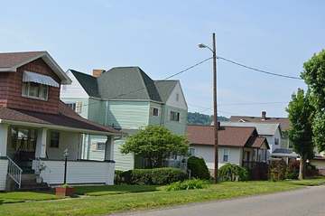
Photograph
On the map
Show this system's territory on the map — 2 ZIP codes in all.
Sources
U.S. EPA SDWIS and Community Water System Service Area Boundaries (v3, 2026), Ohio EPA primacy data, 2020 census blocks: the system serving most residents, traced through purchases to the treating utility; Ohio EPA 2023 Sewer and Water Rate Survey (Ohio State, May 2025) for household bills; Ohio EPA DEFA loan awards since 2016 for the loans paragraph · EPA SDWIS · EPA service area boundaries · Ohio EPA drinking water · Ohio EPA rate survey
EPA's own record for this system: Enforcement and Compliance History report for OH0701612 (EPA ECHO).
Notable facts: en.wikipedia.org, visitshadysideohio.com, visitshadysideohio.com
History: en.wikipedia.org
Water quality: data.epa.gov, data.epa.gov
Planned work: visitshadysideohio.com
Capital projects: visitshadysideohio.com
Rates: visitshadysideohio.com, visitshadysideohio.com
Sewers: visitshadysideohio.com, visitshadysideohio.com, visitshadysideohio.com
Treatment: data.epa.gov, data.epa.gov, visitshadysideohio.com, visitshadysideohio.com
Supply stress: data.epa.gov, visitshadysideohio.com
