Local events in Marion Township, Noble County
Nothing is posted for Marion Township itself yet; here is what is on within 20 miles. All local events in Marion Township, Noble County
Know a calendar we should watch? Send the link
Checked October 20; the events page is refreshed daily.
How Marion Township, Noble County began
Marion Township, in the eastern part of Noble County, has taxpayers recorded as early as 1833 and was formally erected as a township in 1851 when Noble County itself was formed. Samuel Danford, who had settled there in 1817, is its best-documented pioneer; his farm hosted Methodist worship from 1818 on and later a church and the Glady Cemetery, all still standing as the Samuel Danford Farm, Church and Cemetery. Moses Horton founded Summerfield, the township's and the county's second-largest village, platted in 1827 and named for the minister John Summerfield. Irish and Scotch settlers formed their own neighborhood in the township, and Lexington, once a village, has since vanished from the map.
Settled 1817 (Samuel Danford), platted Summerfield platted 1827, incorporated township erected 1851, by Samuel Danford (earliest documented settler); Moses Horton (founder of Summerfield).
Where the name comes from
Marion Township is one of twelve Ohio townships of that name, the standard pattern honoring Francis Marion, the Revolutionary War general known as the 'Swamp Fox.' No source specific to this township's 1851 naming was found.
Before the town
No Native American village, trail, mound or documented encounter specific to Marion Township was found in the sources checked. Settlement here, as recorded, begins with Samuel Danford in 1817, over two decades after the Treaty of Greenville cession.
Timeline
- — Samuel Danford settled at what became his farm north of the future village of Summerfield and built a log cabin.
- — Local Methodists began meeting for worship on the Danford farm, the start of what became the Glady Methodist Church congregation.
- — Summerfield was platted and named for minister John Summerfield; Moses Horton is credited as its founder.
- — Taxpayers are recorded in the area that would become Marion Township, before it was formally organized.
- — Marion Township was erected when Noble County was formed from parts of Guernsey, Morgan, Monroe and Washington counties.
- — The Glady Methodist Church congregation built a church building on the Danford property; it was used until the congregation dissolved in 1905.
- — The Samuel Danford Farm, Church and Cemetery was listed on the National Register of Historic Places.
Stories
From log cabin to Glady Cemetery
Samuel Danford arrived in the township in 1817 and put up a log cabin, the seed of a farm that would stay in his family's use for generations. Methodists in the neighborhood began worshipping on his land as early as 1818, meeting informally until 1869, when the congregation, known as Glady Methodist Church, finally built a permanent church on the Danford property. Beside the church grew Glady Cemetery, the burial ground for Danford, his family, and other early Marion Township pioneers. The church itself closed when the congregation dissolved in 1905, but the farm, church building and cemetery together were listed on the National Register of Historic Places in 1980 — nearly a century and a half after Danford first broke ground.
Moses Horton's Summerfield
Moses Horton platted Summerfield in 1827 and named it for John Summerfield, a minister; the choice reflected the religious temper of many of the township's early settlers, the same temper that had already put a Methodist meeting on Samuel Danford's farm a decade earlier. Summerfield grew into the second-largest village in Noble County, drawing Irish and Scotch settlers who formed their own recognized neighborhood in the township alongside it, while the older settlement of Lexington, once its own village nearby, faded out and is remembered today only as an extinct place-name in the county history.
Photographs
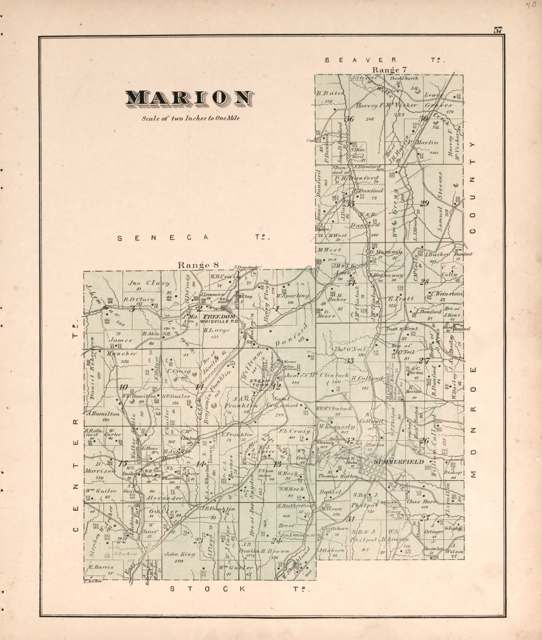
Photo: Wall, Mann & Hall; Worley & Bracher, via Library of Congress, public domain · Wikimedia Commons
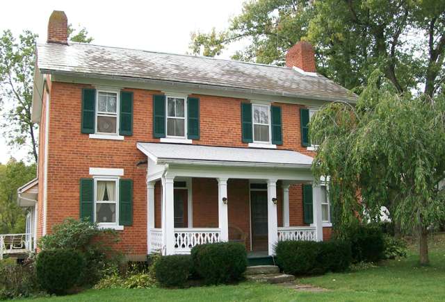
Photo: Bwsmith84, CC BY 3.0 · Wikimedia Commons
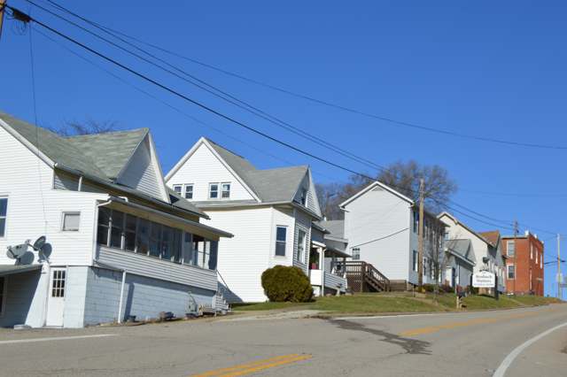
Photo: Nyttend, public domain · Wikimedia Commons
Local history sources: en.wikipedia.org · en.wikipedia.org · en.wikipedia.org · archive.org · en.wikipedia.org · en.wikipedia.org · en.wikipedia.org · commons.wikimedia.org · commons.wikimedia.org · commons.wikimedia.org
Historic places
1 place in Marion Township, Noble County on the National Register of Historic Places. Press a pin or a name for its whole record.
-
Danford, Samuel, Farm, Church and CemeteryBuilding · Summerfield · listed 1980
- Address
- N of Summerfield on SR 5-A
- Where
- Summerfield, Noble County · ZIP 43788
- What it is
- Building
- Listed on the National Register
- 1980
- NRIS reference number
- 80003204
- Coordinates
- 39.85856, -81.34869
National Register file (NPS) ↗ Search Wikipedia ↗ Street map and directions ↗ On the Cracked Buckeye map
Source: National Park Service, National Register of Historic Places point file. The listing year is shown where NPS's certification date agrees with the listing's reference number. Listing recognizes significance; it does not restrict a private owner.
Water
Mostly private wells The water here
- Clear Water Corporation86% of residentsWolf Run Lake (primary) + Caldwell Lake (backup reservoirs)
- Quaker City14% of residentsBarnesville Reservoirs #1, #2 & Slope Creek Reservoir
Hospitals, fire stations and more
Inside Marion Township, Noble County's boundary: 1 poor-rated bridge, 27 shale and injection wells, 1 Toxics Release Inventory facility and 2 spill cases. Press a pin or a name for its whole record and its source.
Bridges rated poor (1)
-
Township Road 208 over East ForkPoor · built 1900
- Condition
- Poor: a deck, superstructure, substructure or culvert rated 4 or below on the 0 to 9 scale
- What it is
- Bridge
- Built
- 1900
- Length
- 14 ft
- Owner
- County
- Vehicles a day
- 96
- Coordinates
- 39.78321, -81.39679
National Bridge Inventory (source) ↗ Street map and directions ↗
Source: FHWA National Bridge Inventory 2025. "Poor" means one major part rated 4 or below on the 0 to 9 scale; it calls for repair, not closing, unless the state posts or closes the bridge.
Shale and injection wells (27)
-
Bloom Mrn Nb 1HUtica shale well
- What it is
- Utica shale well
- Drilled sideways
- Yes
- Operator
- Ascent Resources Utica Llc
- County
- Noble County
- API well number
- 34121246430000
- Coordinates
- 39.81990, -81.39506
ODNR oil and gas wells (source) ↗ Street map and directions ↗
The point is the surface well head (the pad); a horizontal well runs a mile or more underground from it.
-
Bloom Mrn Nb 3HUtica shale well
- What it is
- Utica shale well
- Drilled sideways
- Yes
- Operator
- Ascent Resources Utica Llc
- County
- Noble County
- API well number
- 34121246420000
- Coordinates
- 39.81994, -81.39502
ODNR oil and gas wells (source) ↗ Street map and directions ↗
The point is the surface well head (the pad); a horizontal well runs a mile or more underground from it.
-
Bloom Mrn Nb 5HUtica shale well
- What it is
- Utica shale well
- Drilled sideways
- Yes
- Operator
- Ascent Resources Utica Llc
- County
- Noble County
- API well number
- 34121246410000
- Coordinates
- 39.81999, -81.39498
ODNR oil and gas wells (source) ↗ Street map and directions ↗
The point is the surface well head (the pad); a horizontal well runs a mile or more underground from it.
-
Bloom Mrn Nb 7HUtica shale well
- What it is
- Utica shale well
- Drilled sideways
- Yes
- Operator
- Ascent Resources Utica Llc
- County
- Noble County
- API well number
- 34121246400000
- Coordinates
- 39.82004, -81.39494
ODNR oil and gas wells (source) ↗ Street map and directions ↗
The point is the surface well head (the pad); a horizontal well runs a mile or more underground from it.
-
Matador Mr Nbl 30 2HUtica shale well
- What it is
- Utica shale well
- Drilled sideways
- Yes
- Operator
- Ascent Resources Utica Llc
- County
- Noble County
- API well number
- 34121244530000
- Coordinates
- 39.81956, -81.39534
ODNR oil and gas wells (source) ↗ Street map and directions ↗
The point is the surface well head (the pad); a horizontal well runs a mile or more underground from it.
-
Matador Mr Nbl 30 4HUtica shale well
- What it is
- Utica shale well
- Drilled sideways
- Yes
- Operator
- Ascent Resources Utica Llc
- County
- Noble County
- API well number
- 34121244460100
- Coordinates
- 39.81952, -81.39538
ODNR oil and gas wells (source) ↗ Street map and directions ↗
The point is the surface well head (the pad); a horizontal well runs a mile or more underground from it.
-
Matador Mr Nbl 30 6HUtica shale well
- What it is
- Utica shale well
- Drilled sideways
- Yes
- Operator
- Ascent Resources Utica Llc
- County
- Noble County
- API well number
- 34121244480000
- Coordinates
- 39.81947, -81.39542
ODNR oil and gas wells (source) ↗ Street map and directions ↗
The point is the surface well head (the pad); a horizontal well runs a mile or more underground from it.
-
Vault N Mr Nbl 39 1HUtica shale well
- What it is
- Utica shale well
- Drilled sideways
- Yes
- Operator
- Ascent Resources Utica Llc
- County
- Noble County
- API well number
- 34121245230000
- Coordinates
- 39.80855, -81.40349
ODNR oil and gas wells (source) ↗ Street map and directions ↗
The point is the surface well head (the pad); a horizontal well runs a mile or more underground from it.
-
Vault N Mr Nbl 39 3HUtica shale well
- What it is
- Utica shale well
- Drilled sideways
- Yes
- Operator
- Ascent Resources Utica Llc
- County
- Noble County
- API well number
- 34121245240000
- Coordinates
- 39.80857, -81.40340
ODNR oil and gas wells (source) ↗ Street map and directions ↗
The point is the surface well head (the pad); a horizontal well runs a mile or more underground from it.
-
Vault N Mr Nbl 39 5HUtica shale well
- What it is
- Utica shale well
- Drilled sideways
- Yes
- Operator
- Ascent Resources Utica Llc
- County
- Noble County
- API well number
- 34121245210000
- Coordinates
- 39.80853, -81.40342
ODNR oil and gas wells (source) ↗ Street map and directions ↗
The point is the surface well head (the pad); a horizontal well runs a mile or more underground from it.
-
Vault S Mr Nbl 39 2HUtica shale well
- What it is
- Utica shale well
- Drilled sideways
- Yes
- Operator
- Ascent Resources Utica Llc
- County
- Noble County
- API well number
- 34121245180000
- Coordinates
- 39.80865, -81.40343
ODNR oil and gas wells (source) ↗ Street map and directions ↗
The point is the surface well head (the pad); a horizontal well runs a mile or more underground from it.
-
Vault S Mr Nbl 39 4HUtica shale well
- What it is
- Utica shale well
- Drilled sideways
- Yes
- Operator
- Ascent Resources Utica Llc
- County
- Noble County
- API well number
- 34121245170000
- Coordinates
- 39.80870, -81.40340
ODNR oil and gas wells (source) ↗ Street map and directions ↗
The point is the surface well head (the pad); a horizontal well runs a mile or more underground from it.
-
Warner-Barto 1HuUtica shale well
- What it is
- Utica shale well
- Drilled sideways
- Yes
- Operator
- Inr Ohio Llc
- County
- Noble County
- API well number
- 34121244810000
- Coordinates
- 39.81842, -81.32934
ODNR oil and gas wells (source) ↗ Street map and directions ↗
The point is the surface well head (the pad); a horizontal well runs a mile or more underground from it.
-
Warner-Barto 2HuUtica shale well
- What it is
- Utica shale well
- Drilled sideways
- Yes
- Operator
- Inr Ohio Llc
- County
- Noble County
- API well number
- 34121244820000
- Coordinates
- 39.81840, -81.32930
ODNR oil and gas wells (source) ↗ Street map and directions ↗
The point is the surface well head (the pad); a horizontal well runs a mile or more underground from it.
-
Warner-Dailey 1HuUtica shale well
- What it is
- Utica shale well
- Drilled sideways
- Yes
- Operator
- Inr Ohio Llc
- County
- Noble County
- API well number
- 34121245310000
- Coordinates
- 39.81831, -81.32913
ODNR oil and gas wells (source) ↗ Street map and directions ↗
The point is the surface well head (the pad); a horizontal well runs a mile or more underground from it.
-
Warner-Dailey 2HuUtica shale well
- What it is
- Utica shale well
- Drilled sideways
- Yes
- Operator
- Inr Ohio Llc
- County
- Noble County
- API well number
- 34121245300000
- Coordinates
- 39.81828, -81.32908
ODNR oil and gas wells (source) ↗ Street map and directions ↗
The point is the surface well head (the pad); a horizontal well runs a mile or more underground from it.
-
Warner-Kahrig 1HuUtica shale well
- What it is
- Utica shale well
- Drilled sideways
- Yes
- Operator
- Inr Ohio Llc
- County
- Noble County
- API well number
- 34121244780000
- Coordinates
- 39.81838, -81.32926
ODNR oil and gas wells (source) ↗ Street map and directions ↗
The point is the surface well head (the pad); a horizontal well runs a mile or more underground from it.
-
Warner-Kahrig 2HuUtica shale well
- What it is
- Utica shale well
- Drilled sideways
- Yes
- Operator
- Inr Ohio Llc
- County
- Noble County
- API well number
- 34121244770000
- Coordinates
- 39.81835, -81.32921
ODNR oil and gas wells (source) ↗ Street map and directions ↗
The point is the surface well head (the pad); a horizontal well runs a mile or more underground from it.
-
Warner-Kahrig 3HuUtica shale well
- What it is
- Utica shale well
- Drilled sideways
- Yes
- Operator
- Inr Ohio Llc
- County
- Noble County
- API well number
- 34121244930000
- Coordinates
- 39.81833, -81.32917
ODNR oil and gas wells (source) ↗ Street map and directions ↗
The point is the surface well head (the pad); a horizontal well runs a mile or more underground from it.
-
Wilson-Graves 1HuUtica shale well
- What it is
- Utica shale well
- Drilled sideways
- Yes
- Operator
- Inr Ohio Llc
- County
- Noble County
- API well number
- 34121244620000
- Coordinates
- 39.82283, -81.31876
ODNR oil and gas wells (source) ↗ Street map and directions ↗
The point is the surface well head (the pad); a horizontal well runs a mile or more underground from it.
-
Wilson-Graves 2HuUtica shale well
- What it is
- Utica shale well
- Drilled sideways
- Yes
- Operator
- Inr Ohio Llc
- County
- Noble County
- API well number
- 34121244630000
- Coordinates
- 39.82281, -81.31872
ODNR oil and gas wells (source) ↗ Street map and directions ↗
The point is the surface well head (the pad); a horizontal well runs a mile or more underground from it.
-
Wilson-Graves 3HuUtica shale well
- What it is
- Utica shale well
- Drilled sideways
- Yes
- Operator
- Inr Ohio Llc
- County
- Noble County
- API well number
- 34121244640000
- Coordinates
- 39.82278, -81.31868
ODNR oil and gas wells (source) ↗ Street map and directions ↗
The point is the surface well head (the pad); a horizontal well runs a mile or more underground from it.
-
Wilson-Graves 4HuUtica shale well
- What it is
- Utica shale well
- Drilled sideways
- Yes
- Operator
- Inr Ohio Llc
- County
- Noble County
- API well number
- 34121244730000
- Coordinates
- 39.82286, -81.31880
ODNR oil and gas wells (source) ↗ Street map and directions ↗
The point is the surface well head (the pad); a horizontal well runs a mile or more underground from it.
-
Wilson-Siberian 1HuUtica shale well
- What it is
- Utica shale well
- Drilled sideways
- Yes
- Operator
- Inr Ohio Llc
- County
- Noble County
- API well number
- 34121245320000
- Coordinates
- 39.82275, -81.31864
ODNR oil and gas wells (source) ↗ Street map and directions ↗
The point is the surface well head (the pad); a horizontal well runs a mile or more underground from it.
-
Wilson-Siberian 2HuUtica shale well
- What it is
- Utica shale well
- Drilled sideways
- Yes
- Operator
- Inr Ohio Llc
- County
- Noble County
- API well number
- 34121245350000
- Coordinates
- 39.82273, -81.31860
ODNR oil and gas wells (source) ↗ Street map and directions ↗
The point is the surface well head (the pad); a horizontal well runs a mile or more underground from it.
-
Wilson-Siberian 3HuUtica shale well
- What it is
- Utica shale well
- Drilled sideways
- Yes
- Operator
- Inr Ohio Llc
- County
- Noble County
- API well number
- 34121244670000
- Coordinates
- 39.82270, -81.31856
ODNR oil and gas wells (source) ↗ Street map and directions ↗
The point is the surface well head (the pad); a horizontal well runs a mile or more underground from it.
-
Wilson-Siberian 4HuUtica shale well
- What it is
- Utica shale well
- Drilled sideways
- Yes
- Operator
- Inr Ohio Llc
- County
- Noble County
- API well number
- 34121245330000
- Coordinates
- 39.82268, -81.31852
ODNR oil and gas wells (source) ↗ Street map and directions ↗
The point is the surface well head (the pad); a horizontal well runs a mile or more underground from it.
Source: ODNR Division of Oil and Gas Resources well inventory (September 2026): drilled Utica, Marcellus and horizontal wells and Class II injection wells not plugged. Older vertical wells are on the full map.
Facilities reporting toxic releases (1)
-
Seneca Gas Processing PlantToxics Release Inventory · Summerfield
- Address
- 26645 Zep Road East, Summerfield, OH 43788
- County
- Noble County
- Status
- Reports to the Toxics Release Inventory (***unchanged***)
- EPA program ID
- 4378WSNCGS26645
- EPA registry ID
- 110056339797
EPA facility record ↗ EPA Facility Registry Service (source) ↗ Street map and directions ↗
Source: EPA Facility Registry Service, Toxics Release Inventory reporters. Reporting a release is required of large users of listed chemicals; it is not by itself a violation.
Spills reported since 2021 (2)
-
Oil Petroleum Not Otherwise Specified (Nos)2024-08-15 · Marion Twp
- Reported
- 2024-08-15
- What spilled
- Oil Petroleum Not Otherwise Specified (Nos)
- Where
- Marion Twp, Noble County
- Ohio EPA district office
- SEDO
- Ohio EPA case number
- 2408EPA0001411
Ohio EPA spill reports (source) ↗ Street map and directions ↗
-
Sheen Rainbow / Hydrocarbon2024-07-15 · Marion Twp
- Reported
- 2024-07-15
- What spilled
- Sheen Rainbow / Hydrocarbon
- Where
- Marion Twp, Noble County
- Ohio EPA district office
- SEDO
- Ohio EPA case number
- 2407EPA0001194
Ohio EPA spill reports (source) ↗ Street map and directions ↗
Source: Ohio EPA emergency response spill reports, 2021 to September 2026, one point per case where Ohio EPA placed it. A report is what the caller or responder recorded; amounts are often blank or estimated.
Its ZIP codes
Each ZIP code that touches Marion Township, Noble County, with the share of its residents who live here and the same headline figures as the ZIP page.
| ZIP | Share | Water | Radon | Home value | Schools | Flood |
|---|---|---|---|---|---|---|
| 43788 Marion Township and Summerfield | 33% | Mostly private wells | Too few radon tests | Appraisal records without year built | Noble Local · 3.5 stars overall | 2.9% of residents in the 1% floodplain |
| 43779 Center Township and Sarahsville | 10% | Mostly private wells | Too few radon tests | Appraisal records without year built | Noble Local · 3.5 stars overall | 2.5% of residents in the 1% floodplain |
| 43773 Beaver Township and Quaker City | 1% | Mostly private wells | Too few radon tests | Appraisal records without year built | East Guernsey Local · 3.5 stars overall | 6.6% of residents in the 1% floodplain |
Local government
Who holds office in Marion Township, Noble County, how its elections and ballot issues came out, and the state auditor's record.
Elections for office
| Date | Office | Candidates and votes |
|---|---|---|
| 2021-11-02 | Township Trustee | Luke T. Archer 56, 50.45%; Maurice Warner 55, 49.55% |
| 2019-11-05 | Township Trustee | Bill Warner 96, 100.0% |
| 2019-11-05 | Township Fiscal Officer | John Cline 110, 100.0% |
Winners in bold. Results from the county board of elections' official canvass unless marked.
Auditor of State record
- No fiscal caution, watch or emergency on the Auditor of State's lists.
- Agreed Upon Procedures, 2024 to 2025, released 2026-07-09
The county
Noble County: 6 ZIP codes, 14 cities, villages and townships, 11,290 people.
Nearby places
Quick answers
What county is Marion Township, Ohio in?
Marion Township, Noble County is a township in Noble County, Ohio, with 381 residents.
When was Marion Township, Ohio founded?
Marion Township, Noble County was settled 1817 (Samuel Danford); laid out Summerfield platted 1827; incorporated township erected 1851. Founders on record: Samuel Danford (earliest documented settler); Moses Horton (founder of Summerfield). Source
How did Marion Township, Ohio get its name?
Marion Township is one of twelve Ohio townships of that name, the standard pattern honoring Francis Marion, the Revolutionary War general known as the 'Swamp Fox.' No source specific to this township's 1851 naming was found. Source
What ZIP code is Marion Township, Ohio?
Marion Township, Noble County is served by ZIP codes 43788 and 43779; 43788 holds the largest share of its residents.
Where does Marion Township, Ohio get its water?
The main water source for Marion Township, Noble County (Clear Water Corporation): Mostly private wells.
Cite this page
Cite this page as:
Cracked Buckeye, "Marion Township, Noble County", https://crackedbuckeye.com/place/marion-township-noble-county/, built 2026-10-31, accessed [date].
How to cite · Report a correction · Built 2026-10-31
