Local events in Beaver Township, Noble County
Nothing is posted for Beaver Township itself yet; here is what is on within 20 miles. All local events in Beaver Township, Noble County
Know a calendar we should watch? Send the link
Checked October 20; the events page is refreshed daily.
How Beaver Township, Noble County began
Beaver Township occupies Noble County's northeastern corner and came into Noble County in 1851 from Guernsey County, along with Wayne, Seneca and Buffalo townships. John and James Reed, from New Jersey, are named as its first permanent settlers in 1804, followed by the Carpenter family and John Tyrrell by 1810; most of the pioneers came from Maryland, Virginia and Pennsylvania, and a Catholic congregation was organized here as early as 1819. Distilleries on a stream east of Batesville gave it the name Whisky Run, and John House built a log grist mill on Beaver Fork by 1816. Its one village, Batesville, once called Williamsburg, was platted in 1827. The township had 1,829 people in 1880 and 755 at the 2020 census.
Settled 1804 (John and James Reed, from New Jersey), incorporated organized June 1816 in Guernsey County (June 3 in Howe's account, June 8 in the 1887 county history); reorganized in Noble County May 1, 1851, by Guernsey County commissioners; boundaries reset by the Noble County commissioners.
Where the name comes from
Beaver Township was formed from parts of Seneca and Oxford Townships in Guernsey County in June 1816. It is drained by the Beaver Fork of Wills Creek, but no source read states whether the township was named for the stream or for the animal.
Before the town
No Native American village, trail or camp inside Beaver Township is recorded in the sources read. Martin's 1904 county history says a mound known as the Bates Mound, opened in 1872, was in Beaver Township and held three skeletons; Howe's earlier account places the same mound in Seneca Township, so it is filed with Seneca here and its location should be treated as unsettled. The pioneer Joseph Carpenter, a Revolutionary soldier who settled here after about 1806, had faced danger from Native war parties earlier near Moundsville, in present West Virginia. The land lies in the Muskingum watershed, opened to American settlement by the 1795 Treaty of Greenville.
Nations recorded here: Wyandot, Shawnee, Lenape (Delaware), Mingo (Seneca-Cayuga), Miami.
Timeline
- — John and James Reed, from New Jersey, settled in what became Beaver Township, probably its first permanent settlers.
- — Thomas, John and Joseph Carpenter, from Virginia, and John Tyrrell had settled in the township by this year.
- — James Eagon settled on the creek, and John Starr, later a leading Methodist, settled in the township.
- — John House and his brother-in-law Thomas Ball came from Greene County, Pennsylvania, cutting their own road from Leatherwood Creek.
- — Beaver Township was formed from parts of Seneca and Oxford Townships in Guernsey County, on June 3 by one account and June 8 by another.
- — John House had a log grist mill running on the creek by this year, and later a sawmill; he also kept an early distillery on Beaver Fork.
- — On a petition of twenty-two inhabitants, Guernsey County ordered an election at Philip Wendell's house to choose trustees for the school section.
- — The Rev. Edward Fenwick organized a Catholic congregation, first called St. Dominic's, with Edmund Gallagher, Colonel John De Long and John S. Jeffries among its first members.
- — The Wesleyan Chapel Methodist society was organized in the northeast part of the township; its first log church was built by volunteer labor in 1828.
- — Catholic settlers at what became Batesville, then called Williamsburg, erected a log church.
- — Williamsburg, later Batesville, was platted for William Finley, with Lebbeus Fordyce as surveyor.
- — The Guernsey County tax duplicate, the oldest surviving, listed 13,809 acres in Beaver Township valued at $20,396, with a total tax of $208.52.
- — Noble County was organized on March 11 from parts of Guernsey, Monroe, Morgan and Washington counties; Beaver, Wayne, Seneca and Buffalo townships came from Guernsey County.
- — The Noble County commissioners fixed Beaver Township's boundaries at 27 sections; Samuel Gebhart became its first justice of the peace under the new county on November 11.
- — On the petition of William H. Eagon and twenty-four others, six half-sections were taken from Wayne Township and added to Beaver.
- — The log Catholic church at Batesville was replaced with a brick church built at a cost of $8,000.
- — From 1869 to 1871 farmers within two miles of the Summerfield and Batesville turnpike were taxed heavily to build it.
- — The census counted 1,829 people in Beaver Township.
Stories
A creek named for its stills
East of Batesville runs Whisky Run, which took its name from the distilleries along its banks. The 1887 county history names Jacob Clinedinst, George Peters and Michael Upmeyer, each with a still a short distance apart, and James Eagon farther down; John House had another on Beaver Fork. Whisky sold for 25 to 37 and a half cents a gallon, and a gallon was worth a bushel of corn, so that it came nearer to being legal tender than anything but money, which was scarce. The history adds that a man who did not offer a neighbor a drink was set down as mean, though habitual drunkenness was rare.
Panther tracks on Whisky Run
Beaver's first settlers found turkeys and deer in plenty, many wolves and a few bears and panthers. Samuel Carpenter, crossing near the site of Batesville, heard what he took for a person crying in distress, answered it, and hurried home when he realized a panther was coming toward him. Another time John Joy found strange tracks on Whisky Run leading into a cleft in the rocks and crawled in to look. John Tyrrell and the Carpenters came back with him, and Tyrrell said the tracks were a panther's; fresh tracks with long gaps between them showed the animal had left in great leaps since Joy's visit. The neighbors followed it a long way with their guns but never killed it.
The justice who filed his cases in the walls
John House came from Greene County, Pennsylvania, in 1812, built a log grist mill on the creek by 1816 and served eighteen years as the township's justice of the peace. The 1887 county history says he kept no docket. Instead he wrote his cases on slips of paper and stuck them into the cracks between the logs of his house. The history calls him an honest man and says the same of his son Nathan, who had lived in the township since 1812. The House mill was rebuilt twice, and the last one was still standing when the history was written.
Batesville, formerly Williamsburg
Beaver Township's only village, Batesville, sits roughly sixteen miles northeast of Caldwell and about five miles south of Spencer in Guernsey County. It was first known as Williamsburg before taking the Batesville name. Its Catholic congregation, one of the township's oldest institutions, built a log church as early as 1825; by 1853 the congregation replaced it with a brick building costing $8,000.
Photographs
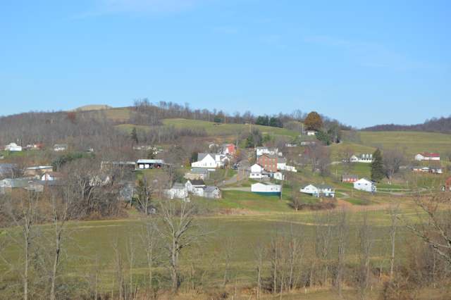
Photo: Nyttend, public domain · Wikimedia Commons
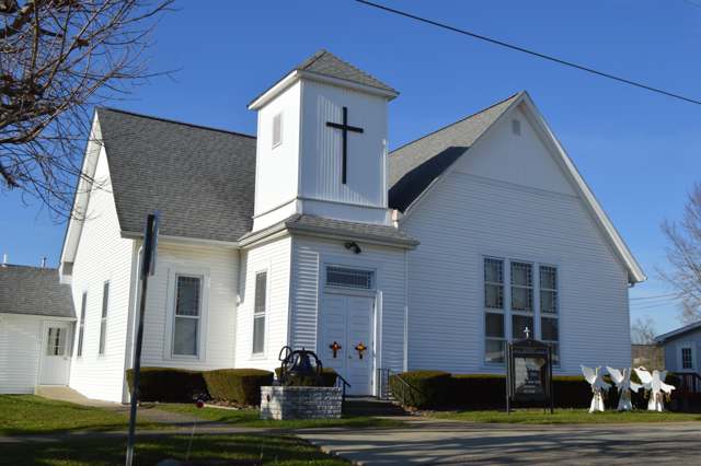
Photo: Nyttend, public domain · Wikimedia Commons
Local history sources: en.wikipedia.org · en.wikipedia.org · en.wikipedia.org · freepages.rootsweb.com · en.wikipedia.org · en.wikipedia.org · en.wikipedia.org · archive.org · archive.org · archive.org · commons.wikimedia.org · commons.wikimedia.org
Water
Mostly private wells The water here
- Quaker City100% of residentsBarnesville Reservoirs #1, #2 & Slope Creek Reservoir
Hospitals, fire stations and more
Inside Beaver Township, Noble County's boundary: 1 high-hazard dam, 2 poor-rated bridges, 70 shale and injection wells and 3 spill cases. Press a pin or a name for its whole record and its source.
High-hazard dams (1)
-
Cline Lake DamTributary To Seneca Fork Willis Creek · condition: fair
- Hazard class
- High: a failure would probably cost a life
- Condition
- Fair (assessed 11/14/2023)
- River or stream
- Tributary To Seneca Fork Willis Creek
- Purpose
- Recreation
- Type
- Earth
- Height
- 47 ft
- Storage
- 192 acre-feet
- Completed
- 2003
- Owner type
- Private
- County
- Noble County
- Nearest town (NID)
- Senecaville
- Last inspection
- 10/18/2022
- Emergency action plan
- Yes
- NID ID
- OH03060
National Inventory of Dams record ↗ National Inventory of Dams (source) ↗ Street map and directions ↗
Source: U.S. Army Corps of Engineers National Inventory of Dams, August 2026. "High hazard" rates what a failure would cost downstream, not how likely one is; the condition is the state's assessment.
Bridges rated poor (2)
-
SR 147 over Whiskey RunPoor · built 1948
- Condition
- Poor: a deck, superstructure, substructure or culvert rated 4 or below on the 0 to 9 scale
- What it is
- Bridge
- Built
- 1948
- Length
- 9 ft
- Owner
- State
- Vehicles a day
- 1,022
- Coordinates
- 39.91374, -81.30473
National Bridge Inventory (source) ↗ Street map and directions ↗
-
Township Road 392 over StreamPoor · built 1900
- Condition
- Poor: a deck, superstructure, substructure or culvert rated 4 or below on the 0 to 9 scale
- What it is
- Bridge
- Built
- 1900
- Length
- 10 ft
- Owner
- County
- Vehicles a day
- 96
- Coordinates
- 39.94951, -81.24010
National Bridge Inventory (source) ↗ Street map and directions ↗
Source: FHWA National Bridge Inventory 2025. "Poor" means one major part rated 4 or below on the 0 to 9 scale; it calls for repair, not closing, unless the state posts or closes the bridge.
Shale and injection wells (70)
-
Alpha-Zimmer 1HuUtica shale well
- What it is
- Utica shale well
- Drilled sideways
- Yes
- Operator
- Inr Ohio Llc
- County
- Noble County
- API well number
- 34121246650000
- Coordinates
- 39.92686, -81.27556
ODNR oil and gas wells (source) ↗ Street map and directions ↗
The point is the surface well head (the pad); a horizontal well runs a mile or more underground from it.
-
Alpha-Zimmer 2HuUtica shale well
- What it is
- Utica shale well
- Drilled sideways
- Yes
- Operator
- Inr Ohio Llc
- County
- Noble County
- API well number
- 34121246660000
- Coordinates
- 39.92690, -81.27554
ODNR oil and gas wells (source) ↗ Street map and directions ↗
The point is the surface well head (the pad); a horizontal well runs a mile or more underground from it.
-
Alpha-Zimmer E 1HuUtica shale well
- What it is
- Utica shale well
- Drilled sideways
- Yes
- Operator
- Inr Ohio Llc
- County
- Noble County
- API well number
- 34121246670000
- Coordinates
- 39.92693, -81.27552
ODNR oil and gas wells (source) ↗ Street map and directions ↗
The point is the surface well head (the pad); a horizontal well runs a mile or more underground from it.
-
Brown 210044 1AUtica shale well
- What it is
- Utica shale well
- Drilled sideways
- Yes
- Operator
- Gulfport Appalachia Llc
- County
- Noble County
- API well number
- 34121245510000
- Coordinates
- 39.90444, -81.25943
ODNR oil and gas wells (source) ↗ Street map and directions ↗
The point is the surface well head (the pad); a horizontal well runs a mile or more underground from it.
-
Brown 210044 2BUtica shale well
- What it is
- Utica shale well
- Drilled sideways
- Yes
- Operator
- Gulfport Appalachia Llc
- County
- Noble County
- API well number
- 34121245520000
- Coordinates
- 39.90440, -81.25942
ODNR oil and gas wells (source) ↗ Street map and directions ↗
The point is the surface well head (the pad); a horizontal well runs a mile or more underground from it.
-
Brown 210044 3CUtica shale well
- What it is
- Utica shale well
- Drilled sideways
- Yes
- Operator
- Gulfport Appalachia Llc
- County
- Noble County
- API well number
- 34121245500000
- Coordinates
- 39.90436, -81.25941
ODNR oil and gas wells (source) ↗ Street map and directions ↗
The point is the surface well head (the pad); a horizontal well runs a mile or more underground from it.
-
Byler-Bruce 1HuUtica shale well
- What it is
- Utica shale well
- Drilled sideways
- Yes
- Operator
- Inr Ohio Llc
- County
- Noble County
- API well number
- 34121245050000
- Coordinates
- 39.90220, -81.33095
ODNR oil and gas wells (source) ↗ Street map and directions ↗
The point is the surface well head (the pad); a horizontal well runs a mile or more underground from it.
-
Byler-Bruce 2HstuUtica shale well
- What it is
- Utica shale well
- Drilled sideways
- Yes
- Operator
- Inr Ohio Llc
- County
- Noble County
- API well number
- 34121245060000
- Coordinates
- 39.90221, -81.33090
ODNR oil and gas wells (source) ↗ Street map and directions ↗
The point is the surface well head (the pad); a horizontal well runs a mile or more underground from it.
-
Byler-Bruce 3HuUtica shale well
- What it is
- Utica shale well
- Drilled sideways
- Yes
- Operator
- Inr Ohio Llc
- County
- Noble County
- API well number
- 34121245070000
- Coordinates
- 39.90223, -81.33085
ODNR oil and gas wells (source) ↗ Street map and directions ↗
The point is the surface well head (the pad); a horizontal well runs a mile or more underground from it.
-
Byler-Hallett 1HuUtica shale well
- What it is
- Utica shale well
- Drilled sideways
- Yes
- Operator
- Inr Ohio Llc
- County
- Noble County
- API well number
- 34121244920000
- Coordinates
- 39.90213, -81.33115
ODNR oil and gas wells (source) ↗ Street map and directions ↗
The point is the surface well head (the pad); a horizontal well runs a mile or more underground from it.
-
Byler-Hallett 2HuUtica shale well
- What it is
- Utica shale well
- Drilled sideways
- Yes
- Operator
- Inr Ohio Llc
- County
- Noble County
- API well number
- 34121245110000
- Coordinates
- 39.90215, -81.33110
ODNR oil and gas wells (source) ↗ Street map and directions ↗
The point is the surface well head (the pad); a horizontal well runs a mile or more underground from it.
-
Byler-Hallett 3HuUtica shale well
- What it is
- Utica shale well
- Drilled sideways
- Yes
- Operator
- Inr Ohio Llc
- County
- Noble County
- API well number
- 34121245120000
- Coordinates
- 39.90217, -81.33105
ODNR oil and gas wells (source) ↗ Street map and directions ↗
The point is the surface well head (the pad); a horizontal well runs a mile or more underground from it.
-
Byler-Hallett 4HuUtica shale well
- What it is
- Utica shale well
- Drilled sideways
- Yes
- Operator
- Inr Ohio Llc
- County
- Noble County
- API well number
- 34121245130000
- Coordinates
- 39.90218, -81.33100
ODNR oil and gas wells (source) ↗ Street map and directions ↗
The point is the surface well head (the pad); a horizontal well runs a mile or more underground from it.
-
Capstone-Arick 1HuUtica shale well
- What it is
- Utica shale well
- Drilled sideways
- Yes
- Operator
- Inr Ohio Llc
- County
- Noble County
- API well number
- 34121246700000
- Coordinates
- 39.93045, -81.26657
ODNR oil and gas wells (source) ↗ Street map and directions ↗
The point is the surface well head (the pad); a horizontal well runs a mile or more underground from it.
-
Capstone-Arick 2HuUtica shale well
- What it is
- Utica shale well
- Drilled sideways
- Yes
- Operator
- Inr Ohio Llc
- County
- Noble County
- API well number
- 34121246710000
- Coordinates
- 39.93041, -81.26656
ODNR oil and gas wells (source) ↗ Street map and directions ↗
The point is the surface well head (the pad); a horizontal well runs a mile or more underground from it.
-
Capstone-Carmen 1HuUtica shale well
- What it is
- Utica shale well
- Drilled sideways
- Yes
- Operator
- Inr Ohio Llc
- County
- Noble County
- API well number
- 34121246680000
- Coordinates
- 39.93053, -81.26661
ODNR oil and gas wells (source) ↗ Street map and directions ↗
The point is the surface well head (the pad); a horizontal well runs a mile or more underground from it.
-
Capstone-Carmen 2HuUtica shale well
- What it is
- Utica shale well
- Drilled sideways
- Yes
- Operator
- Inr Ohio Llc
- County
- Noble County
- API well number
- 34121246690000
- Coordinates
- 39.93049, -81.26659
ODNR oil and gas wells (source) ↗ Street map and directions ↗
The point is the surface well head (the pad); a horizontal well runs a mile or more underground from it.
-
English-Reed 1HuUtica shale well
- What it is
- Utica shale well
- Drilled sideways
- Yes
- Operator
- Inr Ohio Llc
- County
- Noble County
- API well number
- 34121247050000
- Coordinates
- 39.93620, -81.25198
ODNR oil and gas wells (source) ↗ Street map and directions ↗
The point is the surface well head (the pad); a horizontal well runs a mile or more underground from it.
-
English-Reed 2HuUtica shale well
- What it is
- Utica shale well
- Drilled sideways
- Yes
- Operator
- Inr Ohio Llc
- County
- Noble County
- API well number
- 34121247060000
- Coordinates
- 39.93617, -81.25195
ODNR oil and gas wells (source) ↗ Street map and directions ↗
The point is the surface well head (the pad); a horizontal well runs a mile or more underground from it.
-
English-Windsor 1HuUtica shale well
- What it is
- Utica shale well
- Drilled sideways
- Yes
- Operator
- Inr Ohio Llc
- County
- Noble County
- API well number
- 34121247070000
- Coordinates
- 39.93614, -81.25191
ODNR oil and gas wells (source) ↗ Street map and directions ↗
The point is the surface well head (the pad); a horizontal well runs a mile or more underground from it.
-
Ervin 1HuUtica shale well
- What it is
- Utica shale well
- Drilled sideways
- Yes
- Operator
- Inr Ohio Llc
- County
- Noble County
- API well number
- 34121244990000
- Coordinates
- 39.90798, -81.32476
ODNR oil and gas wells (source) ↗ Street map and directions ↗
The point is the surface well head (the pad); a horizontal well runs a mile or more underground from it.
-
Ervin 2HuUtica shale well
- What it is
- Utica shale well
- Drilled sideways
- Yes
- Operator
- Inr Ohio Llc
- County
- Noble County
- API well number
- 34121245000000
- Coordinates
- 39.90794, -81.32476
ODNR oil and gas wells (source) ↗ Street map and directions ↗
The point is the surface well head (the pad); a horizontal well runs a mile or more underground from it.
-
Ervin 3HuUtica shale well
- What it is
- Utica shale well
- Drilled sideways
- Yes
- Operator
- Inr Ohio Llc
- County
- Noble County
- API well number
- 34121245020000
- Coordinates
- 39.90790, -81.32476
ODNR oil and gas wells (source) ↗ Street map and directions ↗
The point is the surface well head (the pad); a horizontal well runs a mile or more underground from it.
-
Ervin 4HuUtica shale well
- What it is
- Utica shale well
- Drilled sideways
- Yes
- Operator
- Inr Ohio Llc
- County
- Noble County
- API well number
- 34121245030000
- Coordinates
- 39.90786, -81.32475
ODNR oil and gas wells (source) ↗ Street map and directions ↗
The point is the surface well head (the pad); a horizontal well runs a mile or more underground from it.
-
Ervin-Carl 1HuUtica shale well
- What it is
- Utica shale well
- Drilled sideways
- Yes
- Operator
- Inr Ohio Llc
- County
- Noble County
- API well number
- 34121244960000
- Coordinates
- 39.90807, -81.32477
ODNR oil and gas wells (source) ↗ Street map and directions ↗
The point is the surface well head (the pad); a horizontal well runs a mile or more underground from it.
-
Ervin-Carl 2HuUtica shale well
- What it is
- Utica shale well
- Drilled sideways
- Yes
- Operator
- Inr Ohio Llc
- County
- Noble County
- API well number
- 34121244970000
- Coordinates
- 39.90803, -81.32477
ODNR oil and gas wells (source) ↗ Street map and directions ↗
The point is the surface well head (the pad); a horizontal well runs a mile or more underground from it.
-
Ervin-Carl 3HuUtica shale well
- What it is
- Utica shale well
- Drilled sideways
- Yes
- Operator
- Inr Ohio Llc
- County
- Noble County
- API well number
- 34121244980000
- Coordinates
- 39.90815, -81.32477
ODNR oil and gas wells (source) ↗ Street map and directions ↗
The point is the surface well head (the pad); a horizontal well runs a mile or more underground from it.
-
Ervin-Dollison 1HuUtica shale well
- What it is
- Utica shale well
- Drilled sideways
- Yes
- Operator
- Inr Ohio Llc
- County
- Noble County
- API well number
- 34121244040000
- Coordinates
- 39.90811, -81.32477
ODNR oil and gas wells (source) ↗ Street map and directions ↗
The point is the surface well head (the pad); a horizontal well runs a mile or more underground from it.
-
Guernsey 2HUtica shale well
- What it is
- Utica shale well
- Drilled sideways
- Yes
- Operator
- Inr Ohio Llc
- County
- Noble County
- API well number
- 34121243640100
- Coordinates
- 39.94626, -81.28703
ODNR oil and gas wells (source) ↗ Street map and directions ↗
The point is the surface well head (the pad); a horizontal well runs a mile or more underground from it.
-
Noble 1HuUtica shale well
- What it is
- Utica shale well
- Drilled sideways
- Yes
- Operator
- Inr Ohio Llc
- County
- Noble County
- API well number
- 34121243650000
- Coordinates
- 39.94623, -81.28700
ODNR oil and gas wells (source) ↗ Street map and directions ↗
The point is the surface well head (the pad); a horizontal well runs a mile or more underground from it.
-
Noble-Guernsey 1HuUtica shale well
- What it is
- Utica shale well
- Drilled sideways
- Yes
- Operator
- Inr Ohio Llc
- County
- Noble County
- API well number
- 34121243630100
- Coordinates
- 39.94630, -81.28704
ODNR oil and gas wells (source) ↗ Street map and directions ↗
The point is the surface well head (the pad); a horizontal well runs a mile or more underground from it.
-
Price-Diamond 1HstuUtica shale well
- What it is
- Utica shale well
- Drilled sideways
- Yes
- Operator
- Inr Ohio Llc
- County
- Noble County
- API well number
- 34121244890000
- Coordinates
- 39.93596, -81.31616
ODNR oil and gas wells (source) ↗ Street map and directions ↗
The point is the surface well head (the pad); a horizontal well runs a mile or more underground from it.
-
Price-Diamond 2HstuUtica shale well
- What it is
- Utica shale well
- Drilled sideways
- Yes
- Operator
- Inr Ohio Llc
- County
- Noble County
- API well number
- 34121244880000
- Coordinates
- 39.93597, -81.31610
ODNR oil and gas wells (source) ↗ Street map and directions ↗
The point is the surface well head (the pad); a horizontal well runs a mile or more underground from it.
-
Price-Diamond 3HuUtica shale well
- What it is
- Utica shale well
- Drilled sideways
- Yes
- Operator
- Inr Ohio Llc
- County
- Noble County
- API well number
- 34121244950000
- Coordinates
- 39.93597, -81.31605
ODNR oil and gas wells (source) ↗ Street map and directions ↗
The point is the surface well head (the pad); a horizontal well runs a mile or more underground from it.
-
Price-Mahoney 1HuUtica shale well
- What it is
- Utica shale well
- Drilled sideways
- Yes
- Operator
- Inr Ohio Llc
- County
- Noble County
- API well number
- 34121244840000
- Coordinates
- 39.93595, -81.31626
ODNR oil and gas wells (source) ↗ Street map and directions ↗
The point is the surface well head (the pad); a horizontal well runs a mile or more underground from it.
-
Price-Mahoney 2HuUtica shale well
- What it is
- Utica shale well
- Drilled sideways
- Yes
- Operator
- Inr Ohio Llc
- County
- Noble County
- API well number
- 34121244830000
- Coordinates
- 39.93595, -81.31621
ODNR oil and gas wells (source) ↗ Street map and directions ↗
The point is the surface well head (the pad); a horizontal well runs a mile or more underground from it.
-
Quintel 1HuUtica shale well
- What it is
- Utica shale well
- Drilled sideways
- Yes
- Operator
- Inr Ohio Llc
- County
- Noble County
- API well number
- 34121245920000
- Coordinates
- 39.88554, -81.27623
ODNR oil and gas wells (source) ↗ Street map and directions ↗
The point is the surface well head (the pad); a horizontal well runs a mile or more underground from it.
-
Quintel 2HuUtica shale well
- What it is
- Utica shale well
- Drilled sideways
- Yes
- Operator
- Inr Ohio Llc
- County
- Noble County
- API well number
- 34121245960000
- Coordinates
- 39.88558, -81.27621
ODNR oil and gas wells (source) ↗ Street map and directions ↗
The point is the surface well head (the pad); a horizontal well runs a mile or more underground from it.
-
Quintel 3HuUtica shale well
- What it is
- Utica shale well
- Drilled sideways
- Yes
- Operator
- Inr Ohio Llc
- County
- Noble County
- API well number
- 34121245940000
- Coordinates
- 39.88562, -81.27620
ODNR oil and gas wells (source) ↗ Street map and directions ↗
The point is the surface well head (the pad); a horizontal well runs a mile or more underground from it.
-
Quintel-Brion 1HuUtica shale well
- What it is
- Utica shale well
- Drilled sideways
- Yes
- Operator
- Inr Ohio Llc
- County
- Noble County
- API well number
- 34121246020000
- Coordinates
- 39.88535, -81.27631
ODNR oil and gas wells (source) ↗ Street map and directions ↗
The point is the surface well head (the pad); a horizontal well runs a mile or more underground from it.
-
Quintel-Brion 2HuUtica shale well
- What it is
- Utica shale well
- Drilled sideways
- Yes
- Operator
- Inr Ohio Llc
- County
- Noble County
- API well number
- 34121246030000
- Coordinates
- 39.88538, -81.27630
ODNR oil and gas wells (source) ↗ Street map and directions ↗
The point is the surface well head (the pad); a horizontal well runs a mile or more underground from it.
-
Quintel-Perseus 1HuUtica shale well
- What it is
- Utica shale well
- Drilled sideways
- Yes
- Operator
- Inr Ohio Llc
- County
- Noble County
- API well number
- 34121246040000
- Coordinates
- 39.88542, -81.27628
ODNR oil and gas wells (source) ↗ Street map and directions ↗
The point is the surface well head (the pad); a horizontal well runs a mile or more underground from it.
-
Quintel-Perseus 2HuUtica shale well
- What it is
- Utica shale well
- Drilled sideways
- Yes
- Operator
- Inr Ohio Llc
- County
- Noble County
- API well number
- 34121246060000
- Coordinates
- 39.88546, -81.27626
ODNR oil and gas wells (source) ↗ Street map and directions ↗
The point is the surface well head (the pad); a horizontal well runs a mile or more underground from it.
-
Quintel-Perseus 3HuUtica shale well
- What it is
- Utica shale well
- Drilled sideways
- Yes
- Operator
- Inr Ohio Llc
- County
- Noble County
- API well number
- 34121246050000
- Coordinates
- 39.88550, -81.27625
ODNR oil and gas wells (source) ↗ Street map and directions ↗
The point is the surface well head (the pad); a horizontal well runs a mile or more underground from it.
-
Quintel-Potter 1HuUtica shale well
- What it is
- Utica shale well
- Drilled sideways
- Yes
- Operator
- Inr Ohio Llc
- County
- Noble County
- API well number
- 34121245980000
- Coordinates
- 39.88566, -81.27618
ODNR oil and gas wells (source) ↗ Street map and directions ↗
The point is the surface well head (the pad); a horizontal well runs a mile or more underground from it.
-
Quintel-Potter 2HuUtica shale well
- What it is
- Utica shale well
- Drilled sideways
- Yes
- Operator
- Inr Ohio Llc
- County
- Noble County
- API well number
- 34121245970000
- Coordinates
- 39.88570, -81.27617
ODNR oil and gas wells (source) ↗ Street map and directions ↗
The point is the surface well head (the pad); a horizontal well runs a mile or more underground from it.
-
Quintel-Potter 3HuUtica shale well · Drilling
- What it is
- Utica shale well
- Status (ODNR)
- Drilling
- Operator
- Inr Ohio Llc
- County
- Noble County
- API well number
- 34121245950000
- Coordinates
- 39.88574, -81.27615
ODNR oil and gas wells (source) ↗ Street map and directions ↗
-
Roe-Dollison 2HuUtica shale well
- What it is
- Utica shale well
- Drilled sideways
- Yes
- Operator
- Inr Ohio Llc
- County
- Noble County
- API well number
- 34121244350000
- Coordinates
- 39.91360, -81.31458
ODNR oil and gas wells (source) ↗ Street map and directions ↗
The point is the surface well head (the pad); a horizontal well runs a mile or more underground from it.
-
Roe-Dollison 3HuUtica shale well
- What it is
- Utica shale well
- Drilled sideways
- Yes
- Operator
- Inr Ohio Llc
- County
- Noble County
- API well number
- 34121244360000
- Coordinates
- 39.91360, -81.31453
ODNR oil and gas wells (source) ↗ Street map and directions ↗
The point is the surface well head (the pad); a horizontal well runs a mile or more underground from it.
-
Roe-Dollison 4HuUtica shale well
- What it is
- Utica shale well
- Drilled sideways
- Yes
- Operator
- Inr Ohio Llc
- County
- Noble County
- API well number
- 34121244370000
- Coordinates
- 39.91360, -81.31448
ODNR oil and gas wells (source) ↗ Street map and directions ↗
The point is the surface well head (the pad); a horizontal well runs a mile or more underground from it.
-
Roe-Grissom 1HuUtica shale well
- What it is
- Utica shale well
- Drilled sideways
- Yes
- Operator
- Inr Ohio Llc
- County
- Noble County
- API well number
- 34121244850000
- Coordinates
- 39.91360, -81.31442
ODNR oil and gas wells (source) ↗ Street map and directions ↗
The point is the surface well head (the pad); a horizontal well runs a mile or more underground from it.
-
Roe-Grissom 2HuUtica shale well
- What it is
- Utica shale well
- Drilled sideways
- Yes
- Operator
- Inr Ohio Llc
- County
- Noble County
- API well number
- 34121244860000
- Coordinates
- 39.91360, -81.31437
ODNR oil and gas wells (source) ↗ Street map and directions ↗
The point is the surface well head (the pad); a horizontal well runs a mile or more underground from it.
-
Roe-Grissom 3HuUtica shale well
- What it is
- Utica shale well
- Drilled sideways
- Yes
- Operator
- Inr Ohio Llc
- County
- Noble County
- API well number
- 34121244870000
- Coordinates
- 39.91360, -81.31431
ODNR oil and gas wells (source) ↗ Street map and directions ↗
The point is the surface well head (the pad); a horizontal well runs a mile or more underground from it.
-
Roe-Grissom 4HuUtica shale well
- What it is
- Utica shale well
- Drilled sideways
- Yes
- Operator
- Inr Ohio Llc
- County
- Noble County
- API well number
- 34121244940000
- Coordinates
- 39.91360, -81.31426
ODNR oil and gas wells (source) ↗ Street map and directions ↗
The point is the surface well head (the pad); a horizontal well runs a mile or more underground from it.
-
Schultz-Dingus 1HuUtica shale well
- What it is
- Utica shale well
- Drilled sideways
- Yes
- Operator
- Inr Ohio Llc
- County
- Noble County
- API well number
- 34121246210000
- Coordinates
- 39.93713, -81.30731
ODNR oil and gas wells (source) ↗ Street map and directions ↗
The point is the surface well head (the pad); a horizontal well runs a mile or more underground from it.
-
Schultz-Dingus 2HuUtica shale well
- What it is
- Utica shale well
- Drilled sideways
- Yes
- Operator
- Inr Ohio Llc
- County
- Noble County
- API well number
- 34121246220000
- Coordinates
- 39.93717, -81.30731
ODNR oil and gas wells (source) ↗ Street map and directions ↗
The point is the surface well head (the pad); a horizontal well runs a mile or more underground from it.
-
Schultz-Dingus 3HuUtica shale well
- What it is
- Utica shale well
- Drilled sideways
- Yes
- Operator
- Inr Ohio Llc
- County
- Noble County
- API well number
- 34121246230000
- Coordinates
- 39.93722, -81.30730
ODNR oil and gas wells (source) ↗ Street map and directions ↗
The point is the surface well head (the pad); a horizontal well runs a mile or more underground from it.
-
Troyer-Hannahs 1HuUtica shale well
- What it is
- Utica shale well
- Drilled sideways
- Yes
- Operator
- Inr Ohio Llc
- County
- Noble County
- API well number
- 34121246270000
- Coordinates
- 39.87286, -81.33466
ODNR oil and gas wells (source) ↗ Street map and directions ↗
The point is the surface well head (the pad); a horizontal well runs a mile or more underground from it.
-
Troyer-Hannahs 2HuUtica shale well
- What it is
- Utica shale well
- Drilled sideways
- Yes
- Operator
- Inr Ohio Llc
- County
- Noble County
- API well number
- 34121246290000
- Coordinates
- 39.87289, -81.33462
ODNR oil and gas wells (source) ↗ Street map and directions ↗
The point is the surface well head (the pad); a horizontal well runs a mile or more underground from it.
-
Troyer-Mcvickers 1HuUtica shale well
- What it is
- Utica shale well
- Drilled sideways
- Yes
- Operator
- Inr Ohio Llc
- County
- Noble County
- API well number
- 34121246300000
- Coordinates
- 39.87291, -81.33457
ODNR oil and gas wells (source) ↗ Street map and directions ↗
The point is the surface well head (the pad); a horizontal well runs a mile or more underground from it.
-
Troyer-Mcvickers 2HstuUtica shale well
- What it is
- Utica shale well
- Drilled sideways
- Yes
- Operator
- Inr Ohio Llc
- County
- Noble County
- API well number
- 34121246310000
- Coordinates
- 39.87293, -81.33453
ODNR oil and gas wells (source) ↗ Street map and directions ↗
The point is the surface well head (the pad); a horizontal well runs a mile or more underground from it.
-
Troyer-Mcvickers 3HuUtica shale well
- What it is
- Utica shale well
- Drilled sideways
- Yes
- Operator
- Inr Ohio Llc
- County
- Noble County
- API well number
- 34121246280000
- Coordinates
- 39.87295, -81.33448
ODNR oil and gas wells (source) ↗ Street map and directions ↗
The point is the surface well head (the pad); a horizontal well runs a mile or more underground from it.
-
Troyer-Notchtop 1HuUtica shale well
- What it is
- Utica shale well
- Drilled sideways
- Yes
- Operator
- Inr Ohio Llc
- County
- Noble County
- API well number
- 34121245840000
- Coordinates
- 39.87297, -81.33444
ODNR oil and gas wells (source) ↗ Street map and directions ↗
The point is the surface well head (the pad); a horizontal well runs a mile or more underground from it.
-
Wehr 1HuUtica shale well
- What it is
- Utica shale well
- Drilled sideways
- Yes
- Operator
- Inr Ohio Llc
- County
- Noble County
- API well number
- 34121246010000
- Coordinates
- 39.89894, -81.27377
ODNR oil and gas wells (source) ↗ Street map and directions ↗
The point is the surface well head (the pad); a horizontal well runs a mile or more underground from it.
-
Wehr 2HuUtica shale well
- What it is
- Utica shale well
- Drilled sideways
- Yes
- Operator
- Inr Ohio Llc
- County
- Noble County
- API well number
- 34121246120000
- Coordinates
- 39.89893, -81.27372
ODNR oil and gas wells (source) ↗ Street map and directions ↗
The point is the surface well head (the pad); a horizontal well runs a mile or more underground from it.
-
Wehr Unit 3HuUtica shale well · Well drilled
- What it is
- Utica shale well
- Drilled sideways
- Yes
- Status (ODNR)
- Well drilled
- Operator
- Inr Ohio Llc
- County
- Noble County
- API well number
- 34121246110000
- Coordinates
- 39.89892, -81.27367
ODNR oil and gas wells (source) ↗ Street map and directions ↗
The point is the surface well head (the pad); a horizontal well runs a mile or more underground from it.
-
Wehr-Slash 1HuUtica shale well
- What it is
- Utica shale well
- Drilled sideways
- Yes
- Operator
- Inr Ohio Llc
- County
- Noble County
- API well number
- 34121246100000
- Coordinates
- 39.89889, -81.27351
ODNR oil and gas wells (source) ↗ Street map and directions ↗
The point is the surface well head (the pad); a horizontal well runs a mile or more underground from it.
-
Wehr-Slash 2HuUtica shale well
- What it is
- Utica shale well
- Drilled sideways
- Yes
- Operator
- Inr Ohio Llc
- County
- Noble County
- API well number
- 34121246090000
- Coordinates
- 39.89888, -81.27346
ODNR oil and gas wells (source) ↗ Street map and directions ↗
The point is the surface well head (the pad); a horizontal well runs a mile or more underground from it.
-
Wehr-Wolf 1HuUtica shale well
- What it is
- Utica shale well
- Drilled sideways
- Yes
- Operator
- Inr Ohio Llc
- County
- Noble County
- API well number
- 34121246140000
- Coordinates
- 39.89891, -81.27362
ODNR oil and gas wells (source) ↗ Street map and directions ↗
The point is the surface well head (the pad); a horizontal well runs a mile or more underground from it.
-
Wehr-Wolf 2HuUtica shale well
- What it is
- Utica shale well
- Drilled sideways
- Yes
- Operator
- Inr Ohio Llc
- County
- Noble County
- API well number
- 34121246130000
- Coordinates
- 39.89890, -81.27357
ODNR oil and gas wells (source) ↗ Street map and directions ↗
The point is the surface well head (the pad); a horizontal well runs a mile or more underground from it.
Source: ODNR Division of Oil and Gas Resources well inventory (September 2026): drilled Utica, Marcellus and horizontal wells and Class II injection wells not plugged. Older vertical wells are on the full map.
Spills reported since 2021 (3)
-
Natural Gas2025-09-12 · Beaver Twp
- Reported
- 2025-09-12
- What spilled
- Natural Gas
- Where
- Beaver Twp, Noble County
- Ohio EPA district office
- SEDO
- Ohio EPA case number
- 2509EPA0001546
Ohio EPA spill reports (source) ↗ Street map and directions ↗
-
Acid Nos (Not Specified) Reached water2021-01-23 · Beaver Twp
- Reported
- 2021-01-23
- What spilled
- Acid Nos (Not Specified)
- Reached a waterway
- 99 - Unnamed
- Where
- Beaver Twp, Noble County
- Ohio EPA district office
- SEDO
- Ohio EPA case number
- 2101EPA0000097
Ohio EPA spill reports (source) ↗ Street map and directions ↗
-
Natural Gas2026-06-29 · Beaver Twp
- Reported
- 2026-06-29
- What spilled
- Natural Gas
- Where
- Beaver Twp, Noble County
- Ohio EPA district office
- SEDO
- Ohio EPA case number
- 2606EPA0001160
Ohio EPA spill reports (source) ↗ Street map and directions ↗
Source: Ohio EPA emergency response spill reports, 2021 to September 2026, one point per case where Ohio EPA placed it. A report is what the caller or responder recorded; amounts are often blank or estimated.
Its ZIP codes
Each ZIP code that touches Beaver Township, Noble County, with the share of its residents who live here and the same headline figures as the ZIP page.
| ZIP | Share | Water | Radon | Home value | Schools | Flood |
|---|---|---|---|---|---|---|
| 43773 Beaver Township and Quaker City | 22% | Mostly private wells | Too few radon tests | Appraisal records without year built | East Guernsey Local · 3.5 stars overall | 6.6% of residents in the 1% floodplain |
The county
Guernsey County: 14 ZIP codes, 32 cities, villages and townships, 39,085 people.
Nearby places
Quick answers
What county is Beaver Township, Ohio in?
Beaver Township, Noble County is a township in Guernsey County, Ohio, with 654 residents.
When was Beaver Township, Ohio founded?
Beaver Township, Noble County was settled 1804 (John and James Reed, from New Jersey); incorporated organized June 1816 in Guernsey County (June 3 in Howe's account, June 8 in the 1887 county history); reorganized in Noble County May 1, 1851. Founders on record: Guernsey County commissioners; boundaries reset by the Noble County commissioners. Source
How did Beaver Township, Ohio get its name?
Beaver Township was formed from parts of Seneca and Oxford Townships in Guernsey County in June 1816. Source
What ZIP code is Beaver Township, Ohio?
Most of Beaver Township, Noble County is in ZIP code 43773.
Where does Beaver Township, Ohio get its water?
The main water source for Beaver Township, Noble County (Quaker City): Mostly private wells.
Cite this page
Cite this page as:
Cracked Buckeye, "Beaver Township, Noble County", https://crackedbuckeye.com/place/beaver-township-noble-county/, built 2026-10-31, accessed [date].
How to cite · Report a correction · Built 2026-10-31
