Local events in Oxford Township, Guernsey County
Nothing is posted for Oxford Township itself yet; here is what is on within 20 miles. All local events in Oxford Township, Guernsey County
Know a calendar we should watch? Send the link
Checked October 20; the events page is refreshed daily.
How Oxford Township, Guernsey County began
Oxford Township, on the eastern border of Guernsey County, was one of the county's five original townships, organized April 23, 1810. Zane's Trace, cut by Ebenezer Zane in 1796-97 along an older Indian trail, crossed it and brought Scotch-Irish settlers; Philip Rosemond bought land at Fletcher in 1810, kept a tavern and ran what is said to have been the first post office between Wheeling and Zanesville. Hugh Gilliland platted Fairview in March 1814, and after the National Road was finished through the county by 1828 the town prospered as a stage stop until the railroad passed to the south. The township is hilly, fertile and known locally as Pennyroyaldom, and has 754 residents (2020).
Settled 1810 (Philip Rosemond at Fletcher on Zane's Trace; Benjamin Masters had a horse mill near Middleton in 1805), platted 1814 (Fairview, by Hugh Gilliland, March 24); 1827 (Middleton, by Benjamin Masters, September 1), incorporated April 23, 1810 (township organized), by One of Guernsey County's five original townships; first settlers largely Irish and Scotch-Irish, joined by War of 1812 veterans.
Where the name comes from
Not found in sources checked; Oxford is one of six Ohio townships of that name, but neither Sarchet's 1911 history nor Wikipedia states why it was chosen. Fairview's name is described as commendatory (a pleasant-sounding name).
Before the town
Zane's Trace, laid out through this part of Guernsey County in 1796-97, followed the existing Mingo Trail between the present sites of Fairview and Zanesville; Ebenezer Zane's road builders widened an established Native travel route rather than cutting an entirely new path. Sarchet's county history likewise says only that Zane 'in a general way' followed an Indian trail. No other site-specific Native history (villages, mounds, treaty lines) for Oxford Township was found in the sources checked.
Nations recorded here: Mingo (Seneca-Cayuga).
- Mingo Trail (incorporated into Zane's Trace) (trail) — Between present-day Fairview and Zanesville, Ohio, passing through Oxford Township, pre-1796 (en.wikipedia.org)
Timeline
- — Ebenezer Zane's road crew began cutting Zane's Trace from Wheeling toward Maysville, following the Mingo Trail through the Fairview-to-Zanesville stretch that crosses Oxford Township.
- — Benjamin Masters, father of eighteen children, built a horse-powered mill near the site of Middleton; in 1810 he added a water mill.
- — Oxford Township was organized on April 23 as one of Guernsey County's five original townships; tradition says there were too few men to fill the offices.
- — Philip Rosemond bought a quarter section at Fletcher on Zane's Trace from Noah Linsley for $500 in April; he kept a tavern for years and is said to have been first postmaster and to have kept the first post office between Wheeling and Zanesville.
- — Hugh Gilliland laid out Fairview in March (recorded March 24) with thirty quarter-acre lots on both sides of what became the National Road.
- — A stone Reformed Presbyterian church stood near the site of Fletcher Methodist church; another was built at Fairview by 1820.
- — A post office was established at Fairview; it operated until 1991.
- — Philip Rosemond, John Gibson and John Davenport added eleven lots to Fairview in December 1825 and nineteen more in October 1827, doubling the town; Benjamin Masters platted Middleton on September 1, 1827.
- — The National Road was completed through Guernsey County; Fairview, a stage division point with several taverns, prospered until the railroad through Barnesville drew traffic away.
- — The Methodist Episcopal society organized at Fletcher, and a public school opened in the southeastern part of the township (a second near Fairview in 1839).
- — Tax duplicates for the whole township, then much larger, listed ten separately valued houses, four grist mills, six sawmills, three distilleries and three tanneries.
- — During the county-seat fever of the 1850s, Fairview hoped to become seat of a proposed Cumberland County formed from eastern Guernsey and western Belmont.
- — Oxford Township supplied nineteen drafted men in the 1864 Civil War drafts, as compiled January 31, 1865.
- — The first Pennyroyal Reunion was held in August near Fairview and became an annual event; the pennyroyal plant gave the township the nickname Pennyroyaldom.
- — Fairview, population 346, had the J. W. Frost Cigar Company, a creamery and coal mines (Brown, Riggle, Loy, Cowgill and Carnes); its population fell to 67 by 2020.
- — Oxford Township had 754 residents on 30.2 square miles.
Stories
A trail widened into a road
Before Oxford Township existed as a unit of government, the ground it would occupy already carried traffic: the Mingo Trail, a Native American route between the future sites of Fairview and Zanesville. When Ebenezer Zane's crew cut the road that became Zane's Trace in 1796 and 1797, connecting Wheeling to Maysville, Kentucky, they followed that path rather than surveying fresh ground, and as Fred Rosmond wrote in Sarchet's history it was at first only a cut line fit for horsemen, with no ferry west of Wheeling until Wills Creek at Cambridge. The Trace made the township the first stop for eastern immigrants and led settlers to buy its bounty-land quarter sections.
Rosemond's tavern at Fletcher
In April 1810, the month the county was organized, Philip Rosemond bought a quarter section on Zane's Trace at Fletcher from Noah Linsley for five hundred dollars and added another quarter in 1819. He kept a tavern there for years, and tradition makes him the first postmaster and the keeper of the first post office between Wheeling and Zanesville. Around him lived the Wherrys, Ableses, Kennons, Mortons and Plattenburgs, and a stone Reformed Presbyterian church stood nearby by 1818. Today only the Fletcher Methodist church and the weathered stones of the burying ground recall the place.
Pennyroyaldom and the county that never was
The pike made Fairview a stage division point and merchandising center in the 1830s and 1840s, and in the county-seat fever of the 1850s its leaders imagined a new Cumberland County cut from the eastern part of Guernsey and the western part of Belmont, with Fairview as seat. The railroad went through Barnesville instead, and the town settled back. In August 1880 old pioneers held the first Pennyroyal Reunion near Fairview, an annual gathering still remembered in the nickname Pennyroyaldom, taken from the aromatic plant whose oil farmers distilled in domestic stills.
Photographs
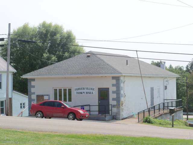
Photo: Roseohioresident, Wikimedia Commons, CC BY-SA 4.0 · Wikimedia Commons
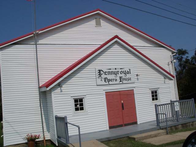
Photo: Wikimedia Commons contributor, CC BY-SA 4.0 · Wikimedia Commons
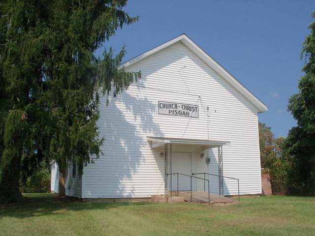
Photo: Roseohioresident, Wikimedia Commons, CC BY-SA 4.0 · Wikimedia Commons
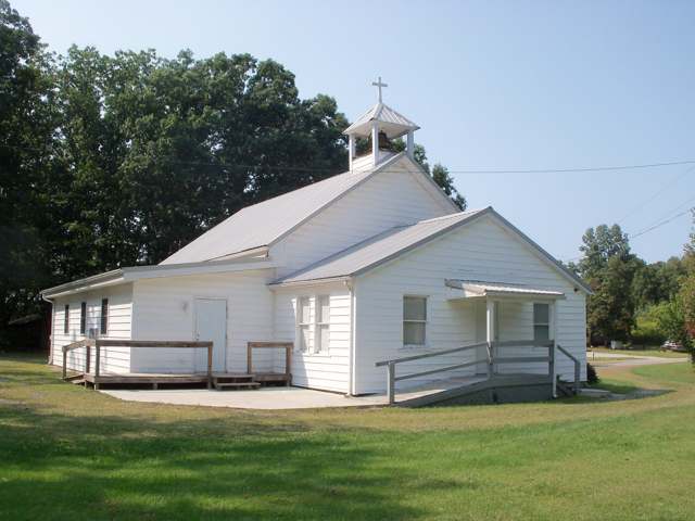
Photo: Roseohioresident, Wikimedia Commons, CC BY-SA 4.0 · Wikimedia Commons
Local history sources: en.wikipedia.org · en.wikipedia.org · archive.org · en.wikipedia.org · commons.wikimedia.org · commons.wikimedia.org
Water
Mostly private wells The water here
- Quaker City100% of residentsBarnesville Reservoirs #1, #2 & Slope Creek Reservoir
Hospitals, fire stations and more
Inside Oxford Township, Guernsey County's boundary: 2 poor-rated bridges, 42 shale and injection wells and 8 spill cases. Press a pin or a name for its whole record and its source.
Bridges rated poor (2)
-
County Rd 49 over Salt ForkPoor · built 1965
- Condition
- Poor: a deck, superstructure, substructure or culvert rated 4 or below on the 0 to 9 scale
- What it is
- Bridge
- Built
- 1965
- Length
- 16 ft
- Owner
- County
- Vehicles a day
- 367
- Coordinates
- 40.02500, -81.33000
National Bridge Inventory (source) ↗ Street map and directions ↗
-
Township Road 49 over Stream Salt ForkPoor · built 2002
- Condition
- Poor: a deck, superstructure, substructure or culvert rated 4 or below on the 0 to 9 scale
- What it is
- Bridge
- Built
- 2002
- Length
- 9 ft
- Owner
- County
- Vehicles a day
- 60
- Coordinates
- 40.01579, -81.25298
National Bridge Inventory (source) ↗ Street map and directions ↗
Source: FHWA National Bridge Inventory 2025. "Poor" means one major part rated 4 or below on the 0 to 9 scale; it calls for repair, not closing, unless the state posts or closes the bridge.
Shale and injection wells (42)
-
Andy Yoder A 1HUtica shale well
- What it is
- Utica shale well
- Drilled sideways
- Yes
- Operator
- Expand Operating Llc
- County
- Guernsey County
- API well number
- 34059243590000
- Coordinates
- 40.03391, -81.31518
ODNR oil and gas wells (source) ↗ Street map and directions ↗
The point is the surface well head (the pad); a horizontal well runs a mile or more underground from it.
-
Andy Yoder A 3HUtica shale well
- What it is
- Utica shale well
- Drilled sideways
- Yes
- Operator
- Expand Operating Llc
- County
- Guernsey County
- API well number
- 34059243580000
- Coordinates
- 40.03391, -81.31511
ODNR oil and gas wells (source) ↗ Street map and directions ↗
The point is the surface well head (the pad); a horizontal well runs a mile or more underground from it.
-
Andy Yoder A 5HUtica shale well
- What it is
- Utica shale well
- Drilled sideways
- Yes
- Operator
- Expand Operating Llc
- County
- Guernsey County
- API well number
- 34059243570100
- Coordinates
- 40.03391, -81.31504
ODNR oil and gas wells (source) ↗ Street map and directions ↗
The point is the surface well head (the pad); a horizontal well runs a mile or more underground from it.
-
Andy Yoder D 2HUtica shale well
- What it is
- Utica shale well
- Drilled sideways
- Yes
- Operator
- Expand Operating Llc
- County
- Guernsey County
- API well number
- 34059243640000
- Coordinates
- 40.03391, -81.31540
ODNR oil and gas wells (source) ↗ Street map and directions ↗
The point is the surface well head (the pad); a horizontal well runs a mile or more underground from it.
-
Andy Yoder D 4HUtica shale well
- What it is
- Utica shale well
- Drilled sideways
- Yes
- Operator
- Expand Operating Llc
- County
- Guernsey County
- API well number
- 34059243620000
- Coordinates
- 40.03391, -81.31533
ODNR oil and gas wells (source) ↗ Street map and directions ↗
The point is the surface well head (the pad); a horizontal well runs a mile or more underground from it.
-
Andy Yoder D 6HUtica shale well
- What it is
- Utica shale well
- Drilled sideways
- Yes
- Operator
- Expand Operating Llc
- County
- Guernsey County
- API well number
- 34059243630000
- Coordinates
- 40.03391, -81.31525
ODNR oil and gas wells (source) ↗ Street map and directions ↗
The point is the surface well head (the pad); a horizontal well runs a mile or more underground from it.
-
Atmos E Oxf Gr 7HUtica shale well
- What it is
- Utica shale well
- Drilled sideways
- Yes
- Operator
- Ascent Resources Utica Llc
- County
- Guernsey County
- API well number
- 34059242500000
- Coordinates
- 40.05799, -81.26663
ODNR oil and gas wells (source) ↗ Street map and directions ↗
The point is the surface well head (the pad); a horizontal well runs a mile or more underground from it.
-
Atmos W Oxf Gr 1HUtica shale well
- What it is
- Utica shale well
- Drilled sideways
- Yes
- Operator
- Ascent Resources Utica Llc
- County
- Guernsey County
- API well number
- 34059242350000
- Coordinates
- 40.05792, -81.26685
ODNR oil and gas wells (source) ↗ Street map and directions ↗
The point is the surface well head (the pad); a horizontal well runs a mile or more underground from it.
-
Atmos W Oxf Gr 3HUtica shale well
- What it is
- Utica shale well
- Drilled sideways
- Yes
- Operator
- Ascent Resources Utica Llc
- County
- Guernsey County
- API well number
- 34059242210000
- Coordinates
- 40.05794, -81.26678
ODNR oil and gas wells (source) ↗ Street map and directions ↗
The point is the surface well head (the pad); a horizontal well runs a mile or more underground from it.
-
Atmos W Oxf Gr 5HUtica shale well
- What it is
- Utica shale well
- Drilled sideways
- Yes
- Operator
- Ascent Resources Utica Llc
- County
- Guernsey County
- API well number
- 34059242340000
- Coordinates
- 40.05797, -81.26670
ODNR oil and gas wells (source) ↗ Street map and directions ↗
The point is the surface well head (the pad); a horizontal well runs a mile or more underground from it.
-
Borton A Unit 2HUtica shale well
- What it is
- Utica shale well
- Drilled sideways
- Yes
- Operator
- Expand Operating Llc
- County
- Guernsey County
- API well number
- 34059243800000
- Coordinates
- 40.05320, -81.27856
ODNR oil and gas wells (source) ↗ Street map and directions ↗
The point is the surface well head (the pad); a horizontal well runs a mile or more underground from it.
-
Borton B Unit 4HUtica shale well
- What it is
- Utica shale well
- Drilled sideways
- Yes
- Operator
- Expand Operating Llc
- County
- Guernsey County
- API well number
- 34059243930000
- Coordinates
- 40.05326, -81.27857
ODNR oil and gas wells (source) ↗ Street map and directions ↗
The point is the surface well head (the pad); a horizontal well runs a mile or more underground from it.
-
Borton C Unit 6HUtica shale well
- What it is
- Utica shale well
- Drilled sideways
- Yes
- Operator
- Expand Operating Llc
- County
- Guernsey County
- API well number
- 34059243820000
- Coordinates
- 40.05331, -81.27858
ODNR oil and gas wells (source) ↗ Street map and directions ↗
The point is the surface well head (the pad); a horizontal well runs a mile or more underground from it.
-
Borton C Unit 8HUtica shale well
- What it is
- Utica shale well
- Drilled sideways
- Yes
- Operator
- Expand Operating Llc
- County
- Guernsey County
- API well number
- 34059243810000
- Coordinates
- 40.05337, -81.27859
ODNR oil and gas wells (source) ↗ Street map and directions ↗
The point is the surface well head (the pad); a horizontal well runs a mile or more underground from it.
-
Coad Oxf Gr 2HUtica shale well
- What it is
- Utica shale well
- Drilled sideways
- Yes
- Operator
- Ascent Resources Utica Llc
- County
- Guernsey County
- API well number
- 34059244470000
- Coordinates
- 40.03631, -81.25796
ODNR oil and gas wells (source) ↗ Street map and directions ↗
The point is the surface well head (the pad); a horizontal well runs a mile or more underground from it.
-
Coad Oxf Gr 4H (2)Utica shale well
- What it is
- Utica shale well
- Drilled sideways
- Yes
- Operator
- Ascent Resources Utica Llc
- County
- Guernsey County
- API well number
- 34059244260000
- Coordinates
- 40.03626, -81.25792
ODNR oil and gas wells (source) ↗ Street map and directions ↗
The point is the surface well head (the pad); a horizontal well runs a mile or more underground from it.
-
Coad Oxf Gr 6H (4)Utica shale well
- What it is
- Utica shale well
- Drilled sideways
- Yes
- Operator
- Ascent Resources Utica Llc
- County
- Guernsey County
- API well number
- 34059243450000
- Coordinates
- 40.03622, -81.25788
ODNR oil and gas wells (source) ↗ Street map and directions ↗
The point is the surface well head (the pad); a horizontal well runs a mile or more underground from it.
-
Coad Oxf Gr 8H (6)Utica shale well
- What it is
- Utica shale well
- Drilled sideways
- Yes
- Operator
- Ascent Resources Utica Llc
- County
- Guernsey County
- API well number
- 34059244270000
- Coordinates
- 40.03617, -81.25784
ODNR oil and gas wells (source) ↗ Street map and directions ↗
The point is the surface well head (the pad); a horizontal well runs a mile or more underground from it.
-
J Bar J Oxf Gr 2HUtica shale well
- What it is
- Utica shale well
- Drilled sideways
- Yes
- Operator
- Ascent Resources Utica Llc
- County
- Guernsey County
- API well number
- 34059244480000
- Coordinates
- 40.03165, -81.26718
ODNR oil and gas wells (source) ↗ Street map and directions ↗
The point is the surface well head (the pad); a horizontal well runs a mile or more underground from it.
-
J Bar J Oxf Gr 4HUtica shale well
- What it is
- Utica shale well
- Drilled sideways
- Yes
- Operator
- Ascent Resources Utica Llc
- County
- Guernsey County
- API well number
- 34059244130000
- Coordinates
- 40.03165, -81.26711
ODNR oil and gas wells (source) ↗ Street map and directions ↗
The point is the surface well head (the pad); a horizontal well runs a mile or more underground from it.
-
J Bar J Oxf Gr 6HUtica shale well
- What it is
- Utica shale well
- Drilled sideways
- Yes
- Operator
- Ascent Resources Utica Llc
- County
- Guernsey County
- API well number
- 34059244460000
- Coordinates
- 40.03165, -81.26703
ODNR oil and gas wells (source) ↗ Street map and directions ↗
The point is the surface well head (the pad); a horizontal well runs a mile or more underground from it.
-
Karen 23-9-7 1HUtica shale well
- What it is
- Utica shale well
- Drilled sideways
- Yes
- Operator
- Gulfport Appalachia Llc
- County
- Guernsey County
- API well number
- 34059243190000
- Coordinates
- 40.02535, -81.28961
ODNR oil and gas wells (source) ↗ Street map and directions ↗
The point is the surface well head (the pad); a horizontal well runs a mile or more underground from it.
-
Karen 23-9-7 2HUtica shale well
- What it is
- Utica shale well
- Drilled sideways
- Yes
- Operator
- Gulfport Appalachia Llc
- County
- Guernsey County
- API well number
- 34059243180000
- Coordinates
- 40.02539, -81.28964
ODNR oil and gas wells (source) ↗ Street map and directions ↗
The point is the surface well head (the pad); a horizontal well runs a mile or more underground from it.
-
Karen 23-9-7 3HUtica shale well
- What it is
- Utica shale well
- Drilled sideways
- Yes
- Operator
- Gulfport Appalachia Llc
- County
- Guernsey County
- API well number
- 34059243170000
- Coordinates
- 40.02542, -81.28967
ODNR oil and gas wells (source) ↗ Street map and directions ↗
The point is the surface well head (the pad); a horizontal well runs a mile or more underground from it.
-
Karen 23-9-7 4HUtica shale well
- What it is
- Utica shale well
- Drilled sideways
- Yes
- Operator
- Gulfport Appalachia Llc
- County
- Guernsey County
- API well number
- 34059243160000
- Coordinates
- 40.02546, -81.28970
ODNR oil and gas wells (source) ↗ Street map and directions ↗
The point is the surface well head (the pad); a horizontal well runs a mile or more underground from it.
-
Posey A Up Grs 1HUtica shale well
- What it is
- Utica shale well
- Drilled sideways
- Yes
- Operator
- Expand Operating Llc
- County
- Guernsey County
- API well number
- 34059245360000
- Coordinates
- 40.02775, -81.32622
ODNR oil and gas wells (source) ↗ Street map and directions ↗
The point is the surface well head (the pad); a horizontal well runs a mile or more underground from it.
-
Posey B Up Grs 3HUtica shale well
- What it is
- Utica shale well
- Drilled sideways
- Yes
- Operator
- Expand Operating Llc
- County
- Guernsey County
- API well number
- 34059245350000
- Coordinates
- 40.02781, -81.32622
ODNR oil and gas wells (source) ↗ Street map and directions ↗
The point is the surface well head (the pad); a horizontal well runs a mile or more underground from it.
-
Posey C Up Grs 5HUtica shale well
- What it is
- Utica shale well
- Drilled sideways
- Yes
- Operator
- Expand Operating Llc
- County
- Guernsey County
- API well number
- 34059245340000
- Coordinates
- 40.02787, -81.32621
ODNR oil and gas wells (source) ↗ Street map and directions ↗
The point is the surface well head (the pad); a horizontal well runs a mile or more underground from it.
-
Tarpley Oxf Gr 1HUtica shale well
- What it is
- Utica shale well
- Drilled sideways
- Yes
- Operator
- Ascent Resources Utica Llc
- County
- Guernsey County
- API well number
- 34059245650000
- Coordinates
- 40.06394, -81.29446
ODNR oil and gas wells (source) ↗ Street map and directions ↗
The point is the surface well head (the pad); a horizontal well runs a mile or more underground from it.
-
Tarpley Oxf Gr 3HUtica shale well
- What it is
- Utica shale well
- Drilled sideways
- Yes
- Operator
- Ascent Resources Utica Llc
- County
- Guernsey County
- API well number
- 34059245640000
- Coordinates
- 40.06396, -81.29440
ODNR oil and gas wells (source) ↗ Street map and directions ↗
The point is the surface well head (the pad); a horizontal well runs a mile or more underground from it.
-
Tarpley Oxf Gr 5HUtica shale well
- What it is
- Utica shale well
- Drilled sideways
- Yes
- Operator
- Ascent Resources Utica Llc
- County
- Guernsey County
- API well number
- 34059245630000
- Coordinates
- 40.06398, -81.29433
ODNR oil and gas wells (source) ↗ Street map and directions ↗
The point is the surface well head (the pad); a horizontal well runs a mile or more underground from it.
-
Weekender 2HUtica shale well
- What it is
- Utica shale well
- Drilled sideways
- Yes
- Operator
- Expand Operating Llc
- County
- Guernsey County
- API well number
- 34059243880100
- Coordinates
- 40.05394, -81.26477
ODNR oil and gas wells (source) ↗ Street map and directions ↗
The point is the surface well head (the pad); a horizontal well runs a mile or more underground from it.
-
Weekender 4HUtica shale well
- What it is
- Utica shale well
- Drilled sideways
- Yes
- Operator
- Expand Operating Llc
- County
- Guernsey County
- API well number
- 34059243840000
- Coordinates
- 40.05398, -81.26480
ODNR oil and gas wells (source) ↗ Street map and directions ↗
The point is the surface well head (the pad); a horizontal well runs a mile or more underground from it.
-
Weekender 6HUtica shale well
- What it is
- Utica shale well
- Drilled sideways
- Yes
- Operator
- Expand Operating Llc
- County
- Guernsey County
- API well number
- 34059243890000
- Coordinates
- 40.05403, -81.26484
ODNR oil and gas wells (source) ↗ Street map and directions ↗
The point is the surface well head (the pad); a horizontal well runs a mile or more underground from it.
-
Weekender 8HUtica shale well
- What it is
- Utica shale well
- Drilled sideways
- Yes
- Operator
- Expand Operating Llc
- County
- Guernsey County
- API well number
- 34059243870000
- Coordinates
- 40.05407, -81.26488
ODNR oil and gas wells (source) ↗ Street map and directions ↗
The point is the surface well head (the pad); a horizontal well runs a mile or more underground from it.
-
Wheeler Unit 1HUtica shale well
- What it is
- Utica shale well
- Drilled sideways
- Yes
- Operator
- Expand Operating Llc
- County
- Guernsey County
- API well number
- 34059243750000
- Coordinates
- 40.03943, -81.23512
ODNR oil and gas wells (source) ↗ Street map and directions ↗
The point is the surface well head (the pad); a horizontal well runs a mile or more underground from it.
-
Wheeler Unit 3HUtica shale well
- What it is
- Utica shale well
- Drilled sideways
- Yes
- Operator
- Expand Operating Llc
- County
- Guernsey County
- API well number
- 34059243760000
- Coordinates
- 40.03938, -81.23509
ODNR oil and gas wells (source) ↗ Street map and directions ↗
The point is the surface well head (the pad); a horizontal well runs a mile or more underground from it.
-
Wheeler Unit 5HUtica shale well
- What it is
- Utica shale well
- Drilled sideways
- Yes
- Operator
- Expand Operating Llc
- County
- Guernsey County
- API well number
- 34059243740000
- Coordinates
- 40.03933, -81.23506
ODNR oil and gas wells (source) ↗ Street map and directions ↗
The point is the surface well head (the pad); a horizontal well runs a mile or more underground from it.
-
Wheeler Unit 7HUtica shale well
- What it is
- Utica shale well
- Drilled sideways
- Yes
- Operator
- Expand Operating Llc
- County
- Guernsey County
- API well number
- 34059243720000
- Coordinates
- 40.03928, -81.23502
ODNR oil and gas wells (source) ↗ Street map and directions ↗
The point is the surface well head (the pad); a horizontal well runs a mile or more underground from it.
-
Wheeler Unit 9HUtica shale well
- What it is
- Utica shale well
- Drilled sideways
- Yes
- Operator
- Expand Operating Llc
- County
- Guernsey County
- API well number
- 34059243730000
- Coordinates
- 40.03923, -81.23499
ODNR oil and gas wells (source) ↗ Street map and directions ↗
The point is the surface well head (the pad); a horizontal well runs a mile or more underground from it.
-
Yockey 18-9-7 3HUtica shale well
- What it is
- Utica shale well
- Drilled sideways
- Yes
- Operator
- Eog Ohio, Llc
- County
- Guernsey County
- API well number
- 34059242960000
- Coordinates
- 40.03111, -81.27884
ODNR oil and gas wells (source) ↗ Street map and directions ↗
The point is the surface well head (the pad); a horizontal well runs a mile or more underground from it.
-
Yockey 18-9-7 7HUtica shale well
- What it is
- Utica shale well
- Drilled sideways
- Yes
- Operator
- Eog Ohio, Llc
- County
- Guernsey County
- API well number
- 34059242970000
- Coordinates
- 40.03118, -81.27873
ODNR oil and gas wells (source) ↗ Street map and directions ↗
The point is the surface well head (the pad); a horizontal well runs a mile or more underground from it.
Source: ODNR Division of Oil and Gas Resources well inventory (September 2026): drilled Utica, Marcellus and horizontal wells and Class II injection wells not plugged. Older vertical wells are on the full map.
Spills reported since 2021 (8)
-
Other / All Other / Trade Name / Mixture / Solution Etc2025-05-18 · Oxford Twp
- Reported
- 2025-05-18
- What spilled
- Other / All Other / Trade Name / Mixture / Solution Etc
- Where
- Oxford Twp, Guernsey County
- Ohio EPA district office
- SEDO
- Ohio EPA case number
- 2505EPA0000789
Ohio EPA spill reports (source) ↗ Street map and directions ↗
-
Water (H20)2024-10-25 · Rush Twp
- Reported
- 2024-10-25
- What spilled
- Water (H20)
- Where
- Rush Twp, Tuscarawas County
- Ohio EPA district office
- SEDO
- Ohio EPA case number
- 2410EPA0001800
Ohio EPA spill reports (source) ↗ Street map and directions ↗
-
Brine De-Icing Road Use2023-07-10 · Oxford Twp
- Reported
- 2023-07-10
- What spilled
- Brine De-Icing Road Use
- Where
- Oxford Twp, Guernsey County
- Ohio EPA district office
- SEDO
- Ohio EPA case number
- 2307EPA0001145
Ohio EPA spill reports (source) ↗ Street map and directions ↗
-
Fuel Diesel / Diesel Fuel (Vehicle On Or Off Road)2023-07-06 · Oxford Twp
- Reported
- 2023-07-06
- What spilled
- Fuel Diesel / Diesel Fuel (Vehicle On Or Off Road)
- Where
- Oxford Twp, Guernsey County
- Ohio EPA district office
- SEDO
- Ohio EPA case number
- 2307EPA0001120
Ohio EPA spill reports (source) ↗ Street map and directions ↗
-
Fuel Diesel / Diesel Fuel (Vehicle On Or Off Road)2023-02-28 · Oxford Twp
- Reported
- 2023-02-28
- What spilled
- Fuel Diesel / Diesel Fuel (Vehicle On Or Off Road)
- Largest amount reported
- 40 gallons
- Where
- Oxford Twp, Guernsey County
- Ohio EPA district office
- SEDO
- Ohio EPA case number
- 2302EPA0000305
Ohio EPA spill reports (source) ↗ Street map and directions ↗
-
Fuel Diesel / Diesel Fuel (Vehicle On Or Off Road)2021-03-10 · Oxford Twp
- Reported
- 2021-03-10
- What spilled
- Fuel Diesel / Diesel Fuel (Vehicle On Or Off Road)
- Largest amount reported
- 100 gallons
- Where
- Oxford Twp, Guernsey County
- Ohio EPA district office
- SEDO
- Ohio EPA case number
- 2103EPA0000311
Ohio EPA spill reports (source) ↗ Street map and directions ↗
-
Fuel Diesel / Diesel Fuel (Vehicle On Or Off Road)2026-04-24 · Oxford Twp
- Reported
- 2026-04-24
- What spilled
- Fuel Diesel / Diesel Fuel (Vehicle On Or Off Road)
- Largest amount reported
- 30 gallons
- Where
- Oxford Twp, Guernsey County
- Ohio EPA district office
- SEDO
- Ohio EPA case number
- 2604EPA0000695
Ohio EPA spill reports (source) ↗ Street map and directions ↗
-
Fuel Diesel / Diesel Fuel (Vehicle On Or Off Road)2026-03-18 · Oxford Twp
- Reported
- 2026-03-18
- What spilled
- Fuel Diesel / Diesel Fuel (Vehicle On Or Off Road)
- Largest amount reported
- 1 gallons
- Where
- Oxford Twp, Guernsey County
- Ohio EPA district office
- SEDO
- Ohio EPA case number
- 2603EPA0000429
Ohio EPA spill reports (source) ↗ Street map and directions ↗
Source: Ohio EPA emergency response spill reports, 2021 to September 2026, one point per case where Ohio EPA placed it. A report is what the caller or responder recorded; amounts are often blank or estimated.
Its ZIP codes
Each ZIP code that touches Oxford Township, Guernsey County, with the share of its residents who live here and the same headline figures as the ZIP page.
| ZIP | Share | Water | Radon | Home value | Schools | Flood |
|---|---|---|---|---|---|---|
| 43773 Beaver Township and Quaker City | 22% | Mostly private wells | Too few radon tests | Appraisal records without year built | East Guernsey Local · 3.5 stars overall | 6.6% of residents in the 1% floodplain |
| 43778 Wills Township and Salesville | 4% | Mostly private wells | Too few radon tests | Appraisal records without year built | East Guernsey Local · 3.5 stars overall | 5.9% of residents in the 1% floodplain |
Local government
Who holds office in Oxford Township, Guernsey County, how its elections and ballot issues came out, and the state auditor's record.
Elections for office
| Date | Office | Candidates and votes |
|---|---|---|
| 2025-11-04 | Trustee | Jacob Cunningham 58, 29.15%; B. Travis McCulloch 46, 23.12%; Robert A. Oakley 36, 18.09%; Elmer Yoder Jr. 59, 29.65% |
| 2023-11-07 | Trustee | Jay McCulloch 89, 51.15%; Robert A. Oakley 85, 48.85% |
| 2023-11-07 | Fiscal Officer | Donna J. Cunningham 153, 100.0% |
Winners in bold. Results from the county board of elections' official canvass unless marked.
Auditor of State record
- No fiscal caution, watch or emergency on the Auditor of State's lists.
- Financial Audit, 2022 to 2023, released 2025-09-02
The county
Guernsey County: 14 ZIP codes, 32 cities, villages and townships, 39,085 people.
Nearby places
Quick answers
What county is Oxford Township, Ohio in?
Oxford Township, Guernsey County is a township in Guernsey County, Ohio, with 699 residents.
When was Oxford Township, Ohio founded?
Oxford Township, Guernsey County was settled 1810 (Philip Rosemond at Fletcher on Zane's Trace; Benjamin Masters had a horse mill near Middleton in 1805); laid out 1814 (Fairview, by Hugh Gilliland, March 24); 1827 (Middleton, by Benjamin Masters, September 1); incorporated April 23, 1810 (township organized). Founders on record: One of Guernsey County's five original townships; first settlers largely Irish and Scotch-Irish, joined by War of 1812 veterans. Source
How did Oxford Township, Ohio get its name?
Not found in sources checked; Oxford is one of six Ohio townships of that name, but neither Sarchet's 1911 history nor Wikipedia states why it was chosen. Source
What ZIP code is Oxford Township, Ohio?
Oxford Township, Guernsey County is served by ZIP codes 43773 and 43778; 43773 holds the largest share of its residents.
Where does Oxford Township, Ohio get its water?
The main water source for Oxford Township, Guernsey County (Quaker City): Mostly private wells.
Cite this page
Cite this page as:
Cracked Buckeye, "Oxford Township, Guernsey County", https://crackedbuckeye.com/place/oxford-township-guernsey-county/, built 2026-10-31, accessed [date].
How to cite · Report a correction · Built 2026-10-31
