Local events in Seneca Township, Noble County
Nothing is posted for Seneca Township itself yet; here is what is on within 10 miles. All local events in Seneca Township, Noble County
Know a calendar we should watch? Send the link
Checked October 20; the events page is refreshed daily.
How Seneca Township, Noble County began
Seneca Township lies in the northern part of Noble County. A Seneca Township was one of the five original townships Guernsey County erected on April 28, 1810, but it was soon broken up; in 1830 the land now in Seneca lay in Richland Township, a new Seneca was organized by 1843, and the Noble County commissioners fixed its present 24 sections on May 1, 1851. Timothy Bates, who came from Captina Creek about 1805, was probably its first permanent settler; his mill and distillery just over the present Wayne line drew customers from twenty and thirty miles, and early religious meetings were held in the distillery loft among the whisky barrels. Mount Ephraim, platted in 1838 for Ephraim Vorhies around his moss-chinked log tavern, is the township's only village. In 1872 a mound in the township (one account places it in Beaver Township), known as the Bates Mound, was dug open.
Settled about 1805 (Timothy Bates, probably the earliest permanent settler), platted Mount Ephraim, 1838, for Ephraim Vorhies, incorporated a Seneca Township erected by Guernsey County April 28, 1810; the present Seneca organized by 1843 and altered by Noble County May 1, 1851, by Guernsey County commissioners; boundaries reset by the Noble County commissioners.
Where the name comes from
The name goes back to one of the five original townships of Guernsey County, erected in 1810 and soon divided; a later township called Seneca appears on the tax duplicate by 1843. The area is drained by the Seneca Fork of Wills Creek. No source read says whether the township was named for the stream or directly for the Seneca people, and none records who chose the name.
Before the town
Henry Howe's Historical Collections records that in 1872 one of the numerous Indian mounds in the neighborhood of Seneca Township, known locally as the Bates Mound, was dug open. It held a few broken pieces of pottery, a lot of flint points, one or two stone tools and the remains of three skeletons that crumbled when exposed to the air; Howe's account, and Martin's 1904 version of it, claimed the skeletons were eight feet tall with double teeth, a kind of claim common in nineteenth-century mound reports and not supported by any measurement in the sources. Martin places the mound in Beaver Township instead. Neither source names the builders. The 1887 county history says Timothy Bates came from Captina Creek as soon as settlers dared enter the wilderness on account of the Indians.
- Bates Mound (mound) — Seneca Township according to Howe; Martin (1904) places it in Beaver Township; exact location not given, prehistoric; builders not identified in the sources; opened 1872 (archive.org)
Timeline
- — Timothy Bates and his brother Isaac came from Captina Creek, near the Ohio River, about this year and entered land on section 24.
- — Guernsey County erected Seneca as one of its five original townships; it was soon divided into new townships under other names.
- — Guernsey County erected Richland Township, which in 1830 included the land now in Seneca, and ordered an election at Samuel Leath's house on July 28.
- — The Guernsey County commissioners voted a $2 bounty for every scalp of a wolf over six months old, and many pioneers earned money from it.
- — Abraham Rich married Annie Thompson and settled in Seneca Township, after three years in Buffalo Township.
- — William Thompson presented a petition for the election of school-section trustees in township 8, range 8, which had twenty electors.
- — Timothy Bates's mill was in operation by this year, visited by settlers from many miles around.
- — Abraham Rich built a frame house, then the only building of its kind for miles; it still stood in 1887.
- — Real estate owners are recorded in what was then Richland Township of Guernsey County, the area that became Seneca Township, among them Abraham Rich, Timothy Bates, David Craft, Samuel and Hiram Danford and Aaron Vorhies.
- — Mount Ephraim was platted for Ephraim Vorhies, whose double-log tavern there was known as the Moss Tavern.
- — Crawford Glover opened the first store in Mount Ephraim, and the evangelist John Burnett and Timothy Bates began organizing a Christian church there, completed in June 1840.
- — St. Michael's Catholic church at Mount Ephraim was founded, according to Martin's 1904 history alone.
- — The Christian congregation built a hewed-log meeting-house on a lot, with graveyard, donated by Ephraim Vorhies.
- — The Methodist class at Mount Ephraim, organized before 1830, built a frame church.
- — The Noble County commissioners altered Seneca Township to its present 24 sections as part of the new county, formed from parts of Guernsey, Morgan, Monroe and Washington counties.
- — The Bates Mound was dug open, yielding pottery fragments, flint points, stone tools and three skeletons that crumbled on exposure.
- — The census counted 1,004 people in the township; Mount Ephraim had 167, against 162 in 1870.
- — The Bates Ridge union church was built for $800, free to all denominations; a Methodist class formed there after a revival that winter.
Stories
The distillery that served as a meeting-house
Timothy Bates, born in Pennsylvania in 1778, built one of the earliest mills in the county, in what is now Wayne Township, north of his Seneca land, and ran a distillery beside it. People came twenty and thirty miles for his whisky, hauling the barrels on two poles harnessed to a horse, pinned in place with wooden pegs; the rig was called cars. Bates also drove hogs to Baltimore, swimming them across the Ohio. He belonged to the Christian church and sometimes preached, and in the early years religious meetings were held in the loft of the distillery, with the whisky barrels serving as pews and pulpit. The 1887 county history remarks that the people of the time saw nothing improper in it.
A wheat field harvested by moonlight
Daniel Meade and his wife Hannah were Methodists and opposed to whisky, at a time when temperance men were rare. One year Meade resolved to get his wheat harvested without it and invited his neighbors to come help on Monday morning. Some of the neighbors, hearing of his plan, gathered on Sunday night with a supply of whisky and cut the whole field by the light of the moon. When Meade got up on Monday, his wheat was already in the shock.
Abraham Rich and the bear
Soon after Abraham Rich came to the township, a fat hog of his wandered off. Following its squeals in the evening, he found it in a ravine, alive but with part of its shoulder eaten away, and a large black bear standing near it. Rich had no gun. He and the bear looked at each other, then each walked off in a different direction. The next evening he came back armed, found the bear again and shot it as it reared to jump a fallen tree. Another winter he tracked a bear into a hollow poplar and left it there until Christmas; when he, Levi Keller and John Rich cut the tree, all three missed their first shots and killed it only after a long fight.
The Moss Tavern
Ephraim Vorhies, son of the Wayne Township pioneer John Vorhies, was the first settler near Mount Ephraim, and the village and a mound-shaped rise nearby were both named for him. Before the town was platted in 1838 he kept a tavern there in a double log house on the McConnelsville and Barnesville road, the earliest route through the township. The spaces between its logs were filled with moss instead of mortar, and it was known across the countryside as the Moss Tavern. The building still stood in 1887 as a residence. The village grew around it with a store from 1839, tobacco packing, a tannery run for about thirty years by an Englishman named Henry Steel, and Christian and Methodist churches.
Photographs
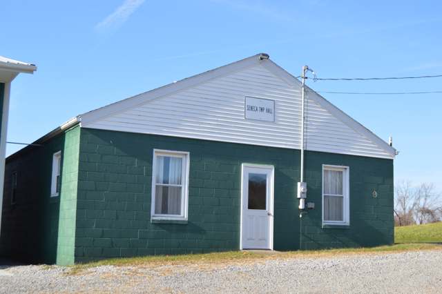
Photo: Nyttend, public domain · Wikimedia Commons
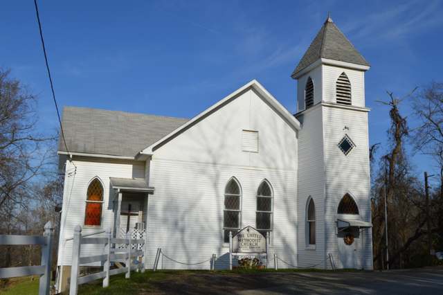
Photo: Nyttend, public domain · Wikimedia Commons
Local history sources: en.wikipedia.org · archive.org · archive.org · archive.org · archive.org · en.wikipedia.org · en.wikipedia.org · en.wikipedia.org · commons.wikimedia.org · commons.wikimedia.org
Water
Mostly private wells The water here
- Clear Water Corporation73% of residentsWolf Run Lake (primary) + Caldwell Lake (backup reservoirs)
- Byesville16% of residentslocal wells (mine-pool/groundwater under influence of surface water)
- Pleasant City, Village Of11% of residentsGroundwater wells (2 wells)
Hospitals, fire stations and more
Inside Seneca Township, Noble County's boundary: 67 shale and injection wells and 5 spill cases. Press a pin or a name for its whole record and its source.
Shale and injection wells (67)
-
Ar Miley 2HuUtica shale well
- What it is
- Utica shale well
- Drilled sideways
- Yes
- Operator
- Inr Ohio Llc
- County
- Noble County
- API well number
- 34121244100000
- Coordinates
- 39.85449, -81.45340
ODNR oil and gas wells (source) ↗ Street map and directions ↗
The point is the surface well head (the pad); a horizontal well runs a mile or more underground from it.
-
Ar Miley 5HauUtica shale well
- What it is
- Utica shale well
- Drilled sideways
- Yes
- Operator
- Inr Ohio Llc
- County
- Noble County
- API well number
- 34121243460200
- Coordinates
- 39.85455, -81.45333
ODNR oil and gas wells (source) ↗ Street map and directions ↗
The point is the surface well head (the pad); a horizontal well runs a mile or more underground from it.
-
Billy Sherman N Snc Nb 16 3HUtica shale well
- What it is
- Utica shale well
- Drilled sideways
- Yes
- Operator
- Ascent Resources Utica Llc
- County
- Noble County
- API well number
- 34121244740000
- Coordinates
- 39.84841, -81.39823
ODNR oil and gas wells (source) ↗ Street map and directions ↗
The point is the surface well head (the pad); a horizontal well runs a mile or more underground from it.
-
Billy Sherman S Snc Nb 16 1HUtica shale well
- What it is
- Utica shale well
- Drilled sideways
- Yes
- Operator
- Ascent Resources Utica Llc
- County
- Noble County
- API well number
- 34121243670100
- Coordinates
- 39.84826, -81.39813
ODNR oil and gas wells (source) ↗ Street map and directions ↗
The point is the surface well head (the pad); a horizontal well runs a mile or more underground from it.
-
Bond-Becker 1HuUtica shale well
- What it is
- Utica shale well
- Drilled sideways
- Yes
- Operator
- Inr Ohio Llc
- County
- Noble County
- API well number
- 34121245040000
- Coordinates
- 39.86509, -81.37101
ODNR oil and gas wells (source) ↗ Street map and directions ↗
The point is the surface well head (the pad); a horizontal well runs a mile or more underground from it.
-
Bond-Becker 2HuUtica shale well
- What it is
- Utica shale well
- Drilled sideways
- Yes
- Operator
- Inr Ohio Llc
- County
- Noble County
- API well number
- 34121245290000
- Coordinates
- 39.86506, -81.37097
ODNR oil and gas wells (source) ↗ Street map and directions ↗
The point is the surface well head (the pad); a horizontal well runs a mile or more underground from it.
-
Bond-Hall 1HuUtica shale well
- What it is
- Utica shale well
- Drilled sideways
- Yes
- Operator
- Inr Ohio Llc
- County
- Noble County
- API well number
- 34121245490000
- Coordinates
- 39.86503, -81.37093
ODNR oil and gas wells (source) ↗ Street map and directions ↗
The point is the surface well head (the pad); a horizontal well runs a mile or more underground from it.
-
Bond-Hall 2HuUtica shale well
- What it is
- Utica shale well
- Drilled sideways
- Yes
- Operator
- Inr Ohio Llc
- County
- Noble County
- API well number
- 34121245480000
- Coordinates
- 39.86501, -81.37089
ODNR oil and gas wells (source) ↗ Street map and directions ↗
The point is the surface well head (the pad); a horizontal well runs a mile or more underground from it.
-
Bond-Iles 1HuUtica shale well
- What it is
- Utica shale well
- Drilled sideways
- Yes
- Operator
- Inr Ohio Llc
- County
- Noble County
- API well number
- 34121245390000
- Coordinates
- 39.86490, -81.37073
ODNR oil and gas wells (source) ↗ Street map and directions ↗
The point is the surface well head (the pad); a horizontal well runs a mile or more underground from it.
-
Bond-Iles 2HuUtica shale well
- What it is
- Utica shale well
- Drilled sideways
- Yes
- Operator
- Inr Ohio Llc
- County
- Noble County
- API well number
- 34121245400000
- Coordinates
- 39.86487, -81.37069
ODNR oil and gas wells (source) ↗ Street map and directions ↗
The point is the surface well head (the pad); a horizontal well runs a mile or more underground from it.
-
Bond-Walsh 1HuUtica shale well
- What it is
- Utica shale well
- Drilled sideways
- Yes
- Operator
- Inr Ohio Llc
- County
- Noble County
- API well number
- 34121245380000
- Coordinates
- 39.86498, -81.37085
ODNR oil and gas wells (source) ↗ Street map and directions ↗
The point is the surface well head (the pad); a horizontal well runs a mile or more underground from it.
-
Bond-Walsh 2HuUtica shale well
- What it is
- Utica shale well
- Drilled sideways
- Yes
- Operator
- Inr Ohio Llc
- County
- Noble County
- API well number
- 34121245360000
- Coordinates
- 39.86496, -81.37081
ODNR oil and gas wells (source) ↗ Street map and directions ↗
The point is the surface well head (the pad); a horizontal well runs a mile or more underground from it.
-
Bond-Walsh E 1HuUtica shale well
- What it is
- Utica shale well
- Drilled sideways
- Yes
- Operator
- Inr Ohio Llc
- County
- Noble County
- API well number
- 34121245370000
- Coordinates
- 39.86493, -81.37077
ODNR oil and gas wells (source) ↗ Street map and directions ↗
The point is the surface well head (the pad); a horizontal well runs a mile or more underground from it.
-
Cynthia-Schafer 1HuUtica shale well
- What it is
- Utica shale well
- Drilled sideways
- Yes
- Operator
- Inr Ohio Llc
- County
- Noble County
- API well number
- 34121244490000
- Coordinates
- 39.88134, -81.40431
ODNR oil and gas wells (source) ↗ Street map and directions ↗
The point is the surface well head (the pad); a horizontal well runs a mile or more underground from it.
-
Cynthia-Schafer 2HuUtica shale well
- What it is
- Utica shale well
- Drilled sideways
- Yes
- Operator
- Inr Ohio Llc
- County
- Noble County
- API well number
- 34121244500000
- Coordinates
- 39.88137, -81.40427
ODNR oil and gas wells (source) ↗ Street map and directions ↗
The point is the surface well head (the pad); a horizontal well runs a mile or more underground from it.
-
Cynthia-Seneca 1HuUtica shale well
- What it is
- Utica shale well
- Drilled sideways
- Yes
- Operator
- Inr Ohio Llc
- County
- Noble County
- API well number
- 34121245160000
- Coordinates
- 39.88140, -81.40423
ODNR oil and gas wells (source) ↗ Street map and directions ↗
The point is the surface well head (the pad); a horizontal well runs a mile or more underground from it.
-
Cynthia-Seneca 2HuUtica shale well
- What it is
- Utica shale well
- Drilled sideways
- Yes
- Operator
- Inr Ohio Llc
- County
- Noble County
- API well number
- 34121245150000
- Coordinates
- 39.88140, -81.40423
ODNR oil and gas wells (source) ↗ Street map and directions ↗
The point is the surface well head (the pad); a horizontal well runs a mile or more underground from it.
-
Cynthia-Seneca 3HuUtica shale well
- What it is
- Utica shale well
- Drilled sideways
- Yes
- Operator
- Inr Ohio Llc
- County
- Noble County
- API well number
- 34121245140000
- Coordinates
- 39.88146, -81.40416
ODNR oil and gas wells (source) ↗ Street map and directions ↗
The point is the surface well head (the pad); a horizontal well runs a mile or more underground from it.
-
Justice-Vorhies 1HuUtica shale well
- What it is
- Utica shale well
- Drilled sideways
- Yes
- Operator
- Inr Ohio Llc
- County
- Noble County
- API well number
- 34121244230000
- Coordinates
- 39.88254, -81.42279
ODNR oil and gas wells (source) ↗ Street map and directions ↗
The point is the surface well head (the pad); a horizontal well runs a mile or more underground from it.
-
Justice-Vorhies 2HuUtica shale well
- What it is
- Utica shale well
- Drilled sideways
- Yes
- Operator
- Inr Ohio Llc
- County
- Noble County
- API well number
- 34121244240000
- Coordinates
- 39.88250, -81.42279
ODNR oil and gas wells (source) ↗ Street map and directions ↗
The point is the surface well head (the pad); a horizontal well runs a mile or more underground from it.
-
Justice-Vorhies 3HuUtica shale well
- What it is
- Utica shale well
- Drilled sideways
- Yes
- Operator
- Inr Ohio Llc
- County
- Noble County
- API well number
- 34121244250000
- Coordinates
- 39.88246, -81.42279
ODNR oil and gas wells (source) ↗ Street map and directions ↗
The point is the surface well head (the pad); a horizontal well runs a mile or more underground from it.
-
Krupa-Clay 1HuUtica shale well
- What it is
- Utica shale well
- Drilled sideways
- Yes
- Operator
- Inr Ohio Llc
- County
- Noble County
- API well number
- 34121246450000
- Coordinates
- 39.88461, -81.36404
ODNR oil and gas wells (source) ↗ Street map and directions ↗
The point is the surface well head (the pad); a horizontal well runs a mile or more underground from it.
-
Krupa-Clay E 1HuUtica shale well
- What it is
- Utica shale well
- Drilled sideways
- Yes
- Operator
- Inr Ohio Llc
- County
- Noble County
- API well number
- 34121246440000
- Coordinates
- 39.88466, -81.36403
ODNR oil and gas wells (source) ↗ Street map and directions ↗
The point is the surface well head (the pad); a horizontal well runs a mile or more underground from it.
-
Krupa-Doctor 1HuUtica shale well
- What it is
- Utica shale well
- Drilled sideways
- Yes
- Operator
- Inr Ohio Llc
- County
- Noble County
- API well number
- 34121246460000
- Coordinates
- 39.88453, -81.36404
ODNR oil and gas wells (source) ↗ Street map and directions ↗
The point is the surface well head (the pad); a horizontal well runs a mile or more underground from it.
-
Krupa-Doctor 2HuUtica shale well
- What it is
- Utica shale well
- Drilled sideways
- Yes
- Operator
- Inr Ohio Llc
- County
- Noble County
- API well number
- 34121246480000
- Coordinates
- 39.88457, -81.36404
ODNR oil and gas wells (source) ↗ Street map and directions ↗
The point is the surface well head (the pad); a horizontal well runs a mile or more underground from it.
-
Krupa-Gopher 1HuUtica shale well
- What it is
- Utica shale well
- Drilled sideways
- Yes
- Operator
- Inr Ohio Llc
- County
- Noble County
- API well number
- 34121246470000
- Coordinates
- 39.88449, -81.36404
ODNR oil and gas wells (source) ↗ Street map and directions ↗
The point is the surface well head (the pad); a horizontal well runs a mile or more underground from it.
-
Krupa-Watchtower 1HuUtica shale well
- What it is
- Utica shale well
- Drilled sideways
- Yes
- Operator
- Inr Ohio Llc
- County
- Noble County
- API well number
- 34121246500000
- Coordinates
- 39.88470, -81.36403
ODNR oil and gas wells (source) ↗ Street map and directions ↗
The point is the surface well head (the pad); a horizontal well runs a mile or more underground from it.
-
Miley 1HUtica shale well
- What it is
- Utica shale well
- Drilled sideways
- Yes
- Operator
- Inr Ohio Llc
- County
- Noble County
- API well number
- 34121245470100
- Coordinates
- 39.85278, -81.45743
ODNR oil and gas wells (source) ↗ Street map and directions ↗
The point is the surface well head (the pad); a horizontal well runs a mile or more underground from it.
-
Miley 4HUtica shale well · Drilling
- What it is
- Utica shale well
- Status (ODNR)
- Drilling
- Operator
- Inr Ohio Llc
- County
- Noble County
- API well number
- 34121245460000
- Coordinates
- 39.85277, -81.45733
ODNR oil and gas wells (source) ↗ Street map and directions ↗
-
Miley 5HUtica shale well · Well drilled
- What it is
- Utica shale well
- Drilled sideways
- Yes
- Status (ODNR)
- Well drilled
- Operator
- Inr Ohio Llc
- County
- Noble County
- API well number
- 34121245440000
- Coordinates
- 39.85274, -81.45761
ODNR oil and gas wells (source) ↗ Street map and directions ↗
The point is the surface well head (the pad); a horizontal well runs a mile or more underground from it.
-
Miley 6HUtica shale well · Drilling
- What it is
- Utica shale well
- Status (ODNR)
- Drilling
- Operator
- Inr Ohio Llc
- County
- Noble County
- API well number
- 34121245430000
- Coordinates
- 39.85273, -81.45755
ODNR oil and gas wells (source) ↗ Street map and directions ↗
-
Miley 7HUtica shale well
- What it is
- Utica shale well
- Drilled sideways
- Yes
- Operator
- Inr Ohio Llc
- County
- Noble County
- API well number
- 34121245420000
- Coordinates
- 39.85277, -81.45738
ODNR oil and gas wells (source) ↗ Street map and directions ↗
The point is the surface well head (the pad); a horizontal well runs a mile or more underground from it.
-
Moonstone E Snc Nb 8HUtica shale well · Well drilled
- What it is
- Utica shale well
- Drilled sideways
- Yes
- Status (ODNR)
- Well drilled
- Operator
- Ascent Resources Utica Llc
- County
- Noble County
- API well number
- 34121247110000
- Coordinates
- 39.83761, -81.38033
ODNR oil and gas wells (source) ↗ Street map and directions ↗
The point is the surface well head (the pad); a horizontal well runs a mile or more underground from it.
-
Moonstone S Snc Nb 4HUtica shale well · Well drilled
- What it is
- Utica shale well
- Drilled sideways
- Yes
- Status (ODNR)
- Well drilled
- Operator
- Ascent Resources Utica Llc
- County
- Noble County
- API well number
- 34121247090000
- Coordinates
- 39.83763, -81.38047
ODNR oil and gas wells (source) ↗ Street map and directions ↗
The point is the surface well head (the pad); a horizontal well runs a mile or more underground from it.
-
Moonstone Se Snc Nb 6HUtica shale well · Well drilled
- What it is
- Utica shale well
- Drilled sideways
- Yes
- Status (ODNR)
- Well drilled
- Operator
- Ascent Resources Utica Llc
- County
- Noble County
- API well number
- 34121247100000
- Coordinates
- 39.83761, -81.38040
ODNR oil and gas wells (source) ↗ Street map and directions ↗
The point is the surface well head (the pad); a horizontal well runs a mile or more underground from it.
-
Moonstone Sn Nbl 19 1HUtica shale well
- What it is
- Utica shale well
- Drilled sideways
- Yes
- Operator
- Ascent Resources Utica Llc
- County
- Noble County
- API well number
- 34121243960100
- Coordinates
- 39.83755, -81.38046
ODNR oil and gas wells (source) ↗ Street map and directions ↗
The point is the surface well head (the pad); a horizontal well runs a mile or more underground from it.
-
Moonstone Sn Nbl 19 3HUtica shale well
- What it is
- Utica shale well
- Drilled sideways
- Yes
- Operator
- Ascent Resources Utica Llc
- County
- Noble County
- API well number
- 34121244130000
- Coordinates
- 39.83756, -81.38053
ODNR oil and gas wells (source) ↗ Street map and directions ↗
The point is the surface well head (the pad); a horizontal well runs a mile or more underground from it.
-
Moonstone Sn Nbl 19 5HUtica shale well
- What it is
- Utica shale well
- Drilled sideways
- Yes
- Operator
- Ascent Resources Utica Llc
- County
- Noble County
- API well number
- 34121244140000
- Coordinates
- 39.83757, -81.38060
ODNR oil and gas wells (source) ↗ Street map and directions ↗
The point is the surface well head (the pad); a horizontal well runs a mile or more underground from it.
-
Moonstone Sw Snc Nb 2HUtica shale well · Well drilled
- What it is
- Utica shale well
- Drilled sideways
- Yes
- Status (ODNR)
- Well drilled
- Operator
- Ascent Resources Utica Llc
- County
- Noble County
- API well number
- 34121247080000
- Coordinates
- 39.83764, -81.38054
ODNR oil and gas wells (source) ↗ Street map and directions ↗
The point is the surface well head (the pad); a horizontal well runs a mile or more underground from it.
-
Myron 1HuUtica shale well
- What it is
- Utica shale well
- Drilled sideways
- Yes
- Operator
- Inr Ohio Llc
- County
- Noble County
- API well number
- 34121244330000
- Coordinates
- 39.88399, -81.39308
ODNR oil and gas wells (source) ↗ Street map and directions ↗
The point is the surface well head (the pad); a horizontal well runs a mile or more underground from it.
-
Myron 2HuUtica shale well
- What it is
- Utica shale well
- Drilled sideways
- Yes
- Operator
- Inr Ohio Llc
- County
- Noble County
- API well number
- 34121244320000
- Coordinates
- 39.88402, -81.39305
ODNR oil and gas wells (source) ↗ Street map and directions ↗
The point is the surface well head (the pad); a horizontal well runs a mile or more underground from it.
-
Myron 3HuUtica shale well
- What it is
- Utica shale well
- Drilled sideways
- Yes
- Operator
- Inr Ohio Llc
- County
- Noble County
- API well number
- 34121244310000
- Coordinates
- 39.88405, -81.39301
ODNR oil and gas wells (source) ↗ Street map and directions ↗
The point is the surface well head (the pad); a horizontal well runs a mile or more underground from it.
-
Myron-Frakes 1HuUtica shale well
- What it is
- Utica shale well
- Drilled sideways
- Yes
- Operator
- Inr Ohio Llc
- County
- Noble County
- API well number
- 34121244550000
- Coordinates
- 39.88392, -81.39313
ODNR oil and gas wells (source) ↗ Street map and directions ↗
The point is the surface well head (the pad); a horizontal well runs a mile or more underground from it.
-
Myron-Frakes 2HuUtica shale well
- What it is
- Utica shale well
- Drilled sideways
- Yes
- Operator
- Inr Ohio Llc
- County
- Noble County
- API well number
- 34121244540000
- Coordinates
- 39.88396, -81.39311
ODNR oil and gas wells (source) ↗ Street map and directions ↗
The point is the surface well head (the pad); a horizontal well runs a mile or more underground from it.
-
Rich-Milligan 1HuUtica shale well
- What it is
- Utica shale well
- Drilled sideways
- Yes
- Operator
- Inr Ohio Llc
- County
- Noble County
- API well number
- 34121244080000
- Coordinates
- 39.86403, -81.43084
ODNR oil and gas wells (source) ↗ Street map and directions ↗
The point is the surface well head (the pad); a horizontal well runs a mile or more underground from it.
-
Rich-Milligan 2HuUtica shale well
- What it is
- Utica shale well
- Drilled sideways
- Yes
- Operator
- Inr Ohio Llc
- County
- Noble County
- API well number
- 34121244090000
- Coordinates
- 39.86407, -81.43083
ODNR oil and gas wells (source) ↗ Street map and directions ↗
The point is the surface well head (the pad); a horizontal well runs a mile or more underground from it.
-
Rich-Milligan 3HuUtica shale well
- What it is
- Utica shale well
- Drilled sideways
- Yes
- Operator
- Inr Ohio Llc
- County
- Noble County
- API well number
- 34121244070000
- Coordinates
- 39.86411, -81.43082
ODNR oil and gas wells (source) ↗ Street map and directions ↗
The point is the surface well head (the pad); a horizontal well runs a mile or more underground from it.
-
Rich-Neuhart 3HuUtica shale well
- What it is
- Utica shale well
- Drilled sideways
- Yes
- Operator
- Inr Ohio Llc
- County
- Noble County
- API well number
- 34121244280000
- Coordinates
- 39.86423, -81.43079
ODNR oil and gas wells (source) ↗ Street map and directions ↗
The point is the surface well head (the pad); a horizontal well runs a mile or more underground from it.
-
Rich-Neuhart W 1HuUtica shale well
- What it is
- Utica shale well
- Drilled sideways
- Yes
- Operator
- Inr Ohio Llc
- County
- Noble County
- API well number
- 34121244710000
- Coordinates
- 39.86415, -81.43081
ODNR oil and gas wells (source) ↗ Street map and directions ↗
The point is the surface well head (the pad); a horizontal well runs a mile or more underground from it.
-
Rich-Neuhart W 2HuUtica shale well
- What it is
- Utica shale well
- Drilled sideways
- Yes
- Operator
- Inr Ohio Llc
- County
- Noble County
- API well number
- 34121244720000
- Coordinates
- 39.86419, -81.43080
ODNR oil and gas wells (source) ↗ Street map and directions ↗
The point is the surface well head (the pad); a horizontal well runs a mile or more underground from it.
-
Robert-Coal 2HuUtica shale well
- What it is
- Utica shale well
- Drilled sideways
- Yes
- Operator
- Inr Ohio Llc
- County
- Noble County
- API well number
- 34121244110000
- Coordinates
- 39.86194, -81.44097
ODNR oil and gas wells (source) ↗ Street map and directions ↗
The point is the surface well head (the pad); a horizontal well runs a mile or more underground from it.
-
Robert-Coal 3HuUtica shale well
- What it is
- Utica shale well
- Drilled sideways
- Yes
- Operator
- Inr Ohio Llc
- County
- Noble County
- API well number
- 34121244120000
- Coordinates
- 39.86197, -81.44094
ODNR oil and gas wells (source) ↗ Street map and directions ↗
The point is the surface well head (the pad); a horizontal well runs a mile or more underground from it.
-
Ruby Opal S Snc Nb 4HUtica shale well
- What it is
- Utica shale well
- Drilled sideways
- Yes
- Operator
- Ascent Resources Utica Llc
- County
- Noble County
- API well number
- 34121246820000
- Coordinates
- 39.83837, -81.39334
ODNR oil and gas wells (source) ↗ Street map and directions ↗
The point is the surface well head (the pad); a horizontal well runs a mile or more underground from it.
-
Ruby Opal Se Snc Nb 6HUtica shale well
- What it is
- Utica shale well
- Drilled sideways
- Yes
- Operator
- Ascent Resources Utica Llc
- County
- Noble County
- API well number
- 34121246830000
- Coordinates
- 39.83842, -81.39337
ODNR oil and gas wells (source) ↗ Street map and directions ↗
The point is the surface well head (the pad); a horizontal well runs a mile or more underground from it.
-
Ruby Opal Sn Nbl 18 1HUtica shale well
- What it is
- Utica shale well
- Drilled sideways
- Yes
- Operator
- Ascent Resources Utica Llc
- County
- Noble County
- API well number
- 34121244150000
- Coordinates
- 39.83758, -81.39294
ODNR oil and gas wells (source) ↗ Street map and directions ↗
The point is the surface well head (the pad); a horizontal well runs a mile or more underground from it.
-
Ruby Opal Sn Nbl 18 3HUtica shale well
- What it is
- Utica shale well
- Drilled sideways
- Yes
- Operator
- Ascent Resources Utica Llc
- County
- Noble County
- API well number
- 34121244190000
- Coordinates
- 39.83763, -81.39297
ODNR oil and gas wells (source) ↗ Street map and directions ↗
The point is the surface well head (the pad); a horizontal well runs a mile or more underground from it.
-
Ruby Opal Sn Nbl 18 5HUtica shale well
- What it is
- Utica shale well
- Drilled sideways
- Yes
- Operator
- Ascent Resources Utica Llc
- County
- Noble County
- API well number
- 34121244160000
- Coordinates
- 39.83768, -81.39300
ODNR oil and gas wells (source) ↗ Street map and directions ↗
The point is the surface well head (the pad); a horizontal well runs a mile or more underground from it.
-
Ruby Opal Sn Nbl 18 7HUtica shale well
- What it is
- Utica shale well
- Drilled sideways
- Yes
- Operator
- Ascent Resources Utica Llc
- County
- Noble County
- API well number
- 34121244170000
- Coordinates
- 39.83772, -81.39302
ODNR oil and gas wells (source) ↗ Street map and directions ↗
The point is the surface well head (the pad); a horizontal well runs a mile or more underground from it.
-
Ruby Opal Sn Nbl 18 9HUtica shale well
- What it is
- Utica shale well
- Drilled sideways
- Yes
- Operator
- Ascent Resources Utica Llc
- County
- Noble County
- API well number
- 34121244180100
- Coordinates
- 39.83778, -81.39306
ODNR oil and gas wells (source) ↗ Street map and directions ↗
The point is the surface well head (the pad); a horizontal well runs a mile or more underground from it.
-
Ruby Opal Sw Snc Nb 2HUtica shale well
- What it is
- Utica shale well
- Drilled sideways
- Yes
- Operator
- Ascent Resources Utica Llc
- County
- Noble County
- API well number
- 34121246810000
- Coordinates
- 39.83832, -81.39331
ODNR oil and gas wells (source) ↗ Street map and directions ↗
The point is the surface well head (the pad); a horizontal well runs a mile or more underground from it.
-
Smierciak-Law 1HuUtica shale well
- What it is
- Utica shale well
- Drilled sideways
- Yes
- Operator
- Inr Ohio Llc
- County
- Noble County
- API well number
- 34121244650000
- Coordinates
- 39.87989, -81.40856
ODNR oil and gas wells (source) ↗ Street map and directions ↗
The point is the surface well head (the pad); a horizontal well runs a mile or more underground from it.
-
Smierciak-Law 2HuUtica shale well
- What it is
- Utica shale well
- Drilled sideways
- Yes
- Operator
- Inr Ohio Llc
- County
- Noble County
- API well number
- 34121244660000
- Coordinates
- 39.87992, -81.40855
ODNR oil and gas wells (source) ↗ Street map and directions ↗
The point is the surface well head (the pad); a horizontal well runs a mile or more underground from it.
-
Wayne 2HuUtica shale well
- What it is
- Utica shale well
- Drilled sideways
- Yes
- Operator
- Inr Ohio Llc
- County
- Noble County
- API well number
- 34121243890000
- Coordinates
- 39.86814, -81.42232
ODNR oil and gas wells (source) ↗ Street map and directions ↗
The point is the surface well head (the pad); a horizontal well runs a mile or more underground from it.
-
Wayne 3HauUtica shale well
- What it is
- Utica shale well
- Drilled sideways
- Yes
- Operator
- Inr Ohio Llc
- County
- Noble County
- API well number
- 34121243870000
- Coordinates
- 39.86807, -81.42226
ODNR oil and gas wells (source) ↗ Street map and directions ↗
The point is the surface well head (the pad); a horizontal well runs a mile or more underground from it.
-
Wayne 4HuUtica shale well
- What it is
- Utica shale well
- Drilled sideways
- Yes
- Operator
- Inr Ohio Llc
- County
- Noble County
- API well number
- 34121244000000
- Coordinates
- 39.86804, -81.42223
ODNR oil and gas wells (source) ↗ Street map and directions ↗
The point is the surface well head (the pad); a horizontal well runs a mile or more underground from it.
-
Wayne-Scheetz 2HuUtica shale well
- What it is
- Utica shale well
- Drilled sideways
- Yes
- Operator
- Inr Ohio Llc
- County
- Noble County
- API well number
- 34121244270000
- Coordinates
- 39.86824, -81.42240
ODNR oil and gas wells (source) ↗ Street map and directions ↗
The point is the surface well head (the pad); a horizontal well runs a mile or more underground from it.
-
Wayne-Scheetz 3HuUtica shale well
- What it is
- Utica shale well
- Drilled sideways
- Yes
- Operator
- Inr Ohio Llc
- County
- Noble County
- API well number
- 34121244290000
- Coordinates
- 39.86821, -81.42237
ODNR oil and gas wells (source) ↗ Street map and directions ↗
The point is the surface well head (the pad); a horizontal well runs a mile or more underground from it.
Source: ODNR Division of Oil and Gas Resources well inventory (September 2026): drilled Utica, Marcellus and horizontal wells and Class II injection wells not plugged. Older vertical wells are on the full map.
Spills reported since 2021 (5)
-
Bentonite / Drilling Mud2023-11-11 · Seneca Twp
- Reported
- 2023-11-11
- What spilled
- Bentonite / Drilling Mud
- Largest amount reported
- 75 gallons
- Where
- Seneca Twp, Noble County
- Ohio EPA district office
- SEDO
- Ohio EPA case number
- 2311EPA0001928
Ohio EPA spill reports (source) ↗ Street map and directions ↗
-
Bentonite / Drilling Mud Reached water2023-11-09 · Seneca Twp
- Reported
- 2023-11-09
- What spilled
- Bentonite / Drilling Mud
- Largest amount reported
- 1,000 gallons
- Reached a waterway
- 61 - North Fork Buffalo Creek
- Where
- Seneca Twp, Noble County
- Ohio EPA district office
- SEDO
- Ohio EPA case number
- 2311EPA0001916
Ohio EPA spill reports (source) ↗ Street map and directions ↗
-
Fuel Diesel / Diesel Fuel (Vehicle On Or Off Road)2023-10-25 · Seneca Twp
- Reported
- 2023-10-25
- What spilled
- Fuel Diesel / Diesel Fuel (Vehicle On Or Off Road)
- Largest amount reported
- 200 gallons
- Where
- Seneca Twp, Noble County
- Ohio EPA district office
- SEDO
- Ohio EPA case number
- 2310EPA0001823
Ohio EPA spill reports (source) ↗ Street map and directions ↗
-
Oil Crude2022-05-30 · Summerfield
- Reported
- 2022-05-30
- What spilled
- Oil Crude
- Largest amount reported
- 1,500 gallons
- Where
- Summerfield, Noble County
- Ohio EPA district office
- SEDO
- Ohio EPA case number
- 2205EPA0000792
Ohio EPA spill reports (source) ↗ Street map and directions ↗
-
Fuel Diesel / Diesel Fuel (Vehicle On Or Off Road)2022-01-31 · Seneca Twp
- Reported
- 2022-01-31
- What spilled
- Fuel Diesel / Diesel Fuel (Vehicle On Or Off Road)
- Largest amount reported
- 28 gallons
- Where
- Seneca Twp, Noble County
- Ohio EPA district office
- SEDO
- Ohio EPA case number
- 2201EPA0000096
Ohio EPA spill reports (source) ↗ Street map and directions ↗
Source: Ohio EPA emergency response spill reports, 2021 to September 2026, one point per case where Ohio EPA placed it. A report is what the caller or responder recorded; amounts are often blank or estimated.
Its ZIP codes
Each ZIP code that touches Seneca Township, Noble County, with the share of its residents who live here and the same headline figures as the ZIP page.
| ZIP | Share | Water | Radon | Home value | Schools | Flood |
|---|---|---|---|---|---|---|
| 43779 Center Township and Sarahsville | 20% | Mostly private wells | Too few radon tests | Appraisal records without year built | Noble Local · 3.5 stars overall | 2.5% of residents in the 1% floodplain |
| 43780 Richland Township and Senecaville | 9% | Mostly private wells | 3.2 pCi/L average radon | Appraisal records without year built | Rolling Hills Local · 3.5 stars overall | 9.6% of residents in the 1% floodplain |
| 43788 Marion Township and Summerfield | 3% | Mostly private wells | Too few radon tests | Appraisal records without year built | Noble Local · 3.5 stars overall | 2.9% of residents in the 1% floodplain |
| 43772 Valley Township and Pleasant City | 1% | Mostly private wells | Too few radon tests | Appraisal records without year built | Rolling Hills Local · 3.5 stars overall | 14% of residents in the 1% floodplain |
The county
Guernsey County: 14 ZIP codes, 32 cities, villages and townships, 39,085 people.
Nearby places
Quick answers
What county is Seneca Township, Ohio in?
Seneca Township, Noble County is a township in Guernsey County, Ohio, with 423 residents.
When was Seneca Township, Ohio founded?
Seneca Township, Noble County was settled about 1805 (Timothy Bates, probably the earliest permanent settler); laid out Mount Ephraim, 1838, for Ephraim Vorhies; incorporated a Seneca Township erected by Guernsey County April 28, 1810; the present Seneca organized by 1843 and altered by Noble County May 1, 1851. Founders on record: Guernsey County commissioners; boundaries reset by the Noble County commissioners. Source
How did Seneca Township, Ohio get its name?
The name goes back to one of the five original townships of Guernsey County, erected in 1810 and soon divided; a later township called Seneca appears on the tax duplicate by 1843. Source
What ZIP code is Seneca Township, Ohio?
Seneca Township, Noble County is served by ZIP codes 43779, 43780 and 43788; 43779 holds the largest share of its residents.
Where does Seneca Township, Ohio get its water?
The main water source for Seneca Township, Noble County (Clear Water Corporation): Mostly private wells.
Cite this page
Cite this page as:
Cracked Buckeye, "Seneca Township, Noble County", https://crackedbuckeye.com/place/seneca-township-noble-county/, built 2026-10-31, accessed [date].
How to cite · Report a correction · Built 2026-10-31
