Local events in Union Township, Carroll County
Nothing is posted for Union Township itself yet; here is what is on within 20 miles. All local events in Union Township, Carroll County
Know a calendar we should watch? Send the link
Checked October 20; the events page is refreshed daily.
Lakes near Union Township, Carroll County
The history under the water: the valley before, the dam, the stories. All Ohio lakes
How Union Township, Carroll County began
Union Township, in the south-central part of Carroll County, was organized by the county commissioners in March 1833 out of the eastern 4.5 sections of the old Madison (later Lee) Township - a merger that gave the new township its name. It has never held an incorporated village of its own; its one hamlet, Petersburg, grew up around a grain mill on McGuire's Fork of Conotton Creek and never had its plat formally recorded. The township's population has swung from 889 in 1840 down to 432 in 1930 and back up to 868 by 2020, the flattest kind of rural history.
Incorporated March 1833, by Carroll County commissioners, who took 4.5 sections off the east side of Madison Township to help form it.
Where the name comes from
The township was named Union because it was pieced together, or 'united,' from parts of more than one earlier township rather than surveyed and organized on its own.
Before the town
No mound, earthwork, or named Native village has been documented specifically within Union Township; no Carroll County history file exists yet to point to beyond what is gathered here. The hamlet of Petersburg (also called Algonquin) took its post-office name from an old Indian camp site on the bank of McGuire's Fork of Conotton Creek that stood at the settlement before Euro-American platting - the clearest site-specific trace of Native presence in the township, though the mill company history that preserves it does not name a nation or date. Like the rest of Carroll County, the land was opened to survey and settlement by the Treaty of Fort McIntosh (1785), which pressured the Wyandot, Lenape (Delaware), Ojibwe, and Ottawa into ceding roughly two-thirds of present Ohio; the historic Lenape and Wyandot both hunted and traveled the Tuscarawas and Conotton valleys into the early 1800s.
Nations recorded here: Wyandot, Lenape (Delaware).
- Algonquin (Petersburg) camp site (camp) — Petersburg, on McGuire's Fork of Conotton Creek, Union Township, pre-settlement, undated (sites.rootsweb.com)
Timeline
- — George Tope, a settler from Pennsylvania, establishes the mill on McGuire's Fork of Conotton Creek that becomes the Algonquin Mill.
- — Carroll County commissioners organize Union Township out of the eastern part of Madison Township.
- — The present Algonquin Mill building is raised at Petersburg, replacing George Tope's earlier structure; it runs on water power from McGuire's Fork.
- — Joseph Tope and Cornelius Bracken plat the hamlet of Petersburg, though the plat is never formally recorded.
- — The Algonquin Mill converts from water power to steam.
- — The Algonquin Mill grinds its last batch of grain after 120 years of continuous operation.
- — The Algonquin Mill (listed as Petersburg Mill) is added to the National Register of Historic Places after its 1969 acquisition and restoration by the Carroll County Historical Society.
Stories
The mill that outlasted its own post office
George Tope built the first mill on McGuire's Fork in 1818, and the sturdier structure that replaced it about 1826 ran on the creek's own current for more than fifty years, grinding wheat, oats, corn, and buckwheat for the farms around Petersburg. At its best it turned out 25 barrels of flour in a day. When water power grew unreliable the mill switched to steam in 1880 and kept grinding for another 58 years, closing only in 1938 - a working life of 120 years under two forms of power. Its post office had been called Algonquin, after an old Indian camp on the same creek bank, and when the Carroll County Historical Society took the property over in 1969 volunteers restored it as a museum piece; it is now the centerpiece of the annual Algonquin Mill Festival, still run on the site where George Tope first set his millstones turning.
Photographs
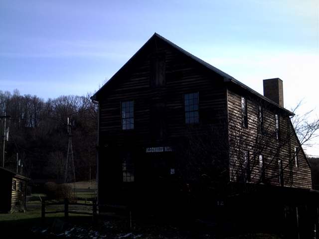
Photo: Roseohioresident, Wikimedia Commons, public domain · Wikimedia Commons
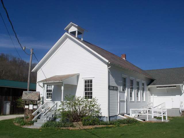
Photo: Roseohioresident, Wikimedia Commons, CC BY-SA 4.0 · Wikimedia Commons
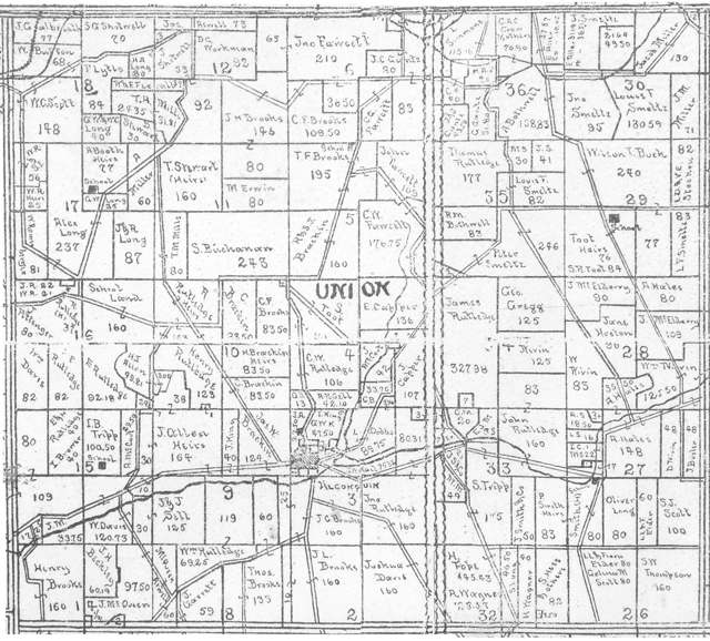
Photo: Linn Boyd Atkinson (1894 map); photographed by Roseohioresident, public domain · Wikimedia Commons
Local history sources: ohiogenealogyexpress.com · en.wikipedia.org · sites.rootsweb.com · en.wikipedia.org · en.wikipedia.org · commons.wikimedia.org · commons.wikimedia.org · commons.wikimedia.org
Historic places
1 place in Union Township, Carroll County on the National Register of Historic Places. Press a pin or a name for its whole record.
-
Petersburg MillBuilding · Carrollton · listed 1970
- Address
- 4.3 mi. S of Carrollton on OH 332
- Where
- Carrollton, Carroll County · ZIP 44615
- What it is
- Building
- Listed on the National Register
- 1970
- NRIS reference number
- 70000487
- Coordinates
- 40.51277, -81.11219
National Register file (NPS) ↗ Search Wikipedia ↗ Street map and directions ↗ On the Cracked Buckeye map
Source: National Park Service, National Register of Historic Places point file. The listing year is shown where NPS's certification date agrees with the listing's reference number. Listing recognizes significance; it does not restrict a private owner.
Water
Mostly private wells The water here
- Carrollton Village99% of residentsGroundwater wells (10 wells)
- Rockwood Park1% of residentsGroundwater wells (2 wells)
Hospitals, fire stations and more
Inside Union Township, Carroll County's boundary: 76 shale and injection wells and 2 spill cases. Press a pin or a name for its whole record and its source.
Shale and injection wells (76)
-
Brunk 32-13-5 10HUtica shale well
- What it is
- Utica shale well
- Drilled sideways
- Yes
- Operator
- Eog Ohio, Llc
- County
- Carroll County
- API well number
- 34019222300000
- Coordinates
- 40.49779, -81.07939
ODNR oil and gas wells (source) ↗ Street map and directions ↗
The point is the surface well head (the pad); a horizontal well runs a mile or more underground from it.
-
Brunk 32-13-5 1HUtica shale well
- What it is
- Utica shale well
- Drilled sideways
- Yes
- Operator
- Eog Ohio, Llc
- County
- Carroll County
- API well number
- 34019222250000
- Coordinates
- 40.49775, -81.07952
ODNR oil and gas wells (source) ↗ Street map and directions ↗
The point is the surface well head (the pad); a horizontal well runs a mile or more underground from it.
-
Brunk 32-13-5 3HUtica shale well
- What it is
- Utica shale well
- Drilled sideways
- Yes
- Operator
- Eog Ohio, Llc
- County
- Carroll County
- API well number
- 34019222260000
- Coordinates
- 40.49783, -81.07953
ODNR oil and gas wells (source) ↗ Street map and directions ↗
The point is the surface well head (the pad); a horizontal well runs a mile or more underground from it.
-
Brunk 32-13-5 5HUtica shale well
- What it is
- Utica shale well
- Drilled sideways
- Yes
- Operator
- Eog Ohio, Llc
- County
- Carroll County
- API well number
- 34019222270000
- Coordinates
- 40.49781, -81.07946
ODNR oil and gas wells (source) ↗ Street map and directions ↗
The point is the surface well head (the pad); a horizontal well runs a mile or more underground from it.
-
Brunk 32-13-5 6HUtica shale well
- What it is
- Utica shale well
- Drilled sideways
- Yes
- Operator
- Eog Ohio, Llc
- County
- Carroll County
- API well number
- 34019222280000
- Coordinates
- 40.49774, -81.07946
ODNR oil and gas wells (source) ↗ Street map and directions ↗
The point is the surface well head (the pad); a horizontal well runs a mile or more underground from it.
-
Brunk 32-13-5 8HUtica shale well
- What it is
- Utica shale well
- Drilled sideways
- Yes
- Operator
- Eog Ohio, Llc
- County
- Carroll County
- API well number
- 34019222290000
- Coordinates
- 40.49772, -81.07939
ODNR oil and gas wells (source) ↗ Street map and directions ↗
The point is the surface well head (the pad); a horizontal well runs a mile or more underground from it.
-
Cummings 17-14-6 10HUtica shale well
- What it is
- Utica shale well
- Drilled sideways
- Yes
- Operator
- Eog Ohio, Llc
- County
- Carroll County
- API well number
- 34019221470000
- Coordinates
- 40.53601, -81.14065
ODNR oil and gas wells (source) ↗ Street map and directions ↗
The point is the surface well head (the pad); a horizontal well runs a mile or more underground from it.
-
Davis Farms 2-14-6 10HUtica shale well
- What it is
- Utica shale well
- Drilled sideways
- Yes
- Operator
- Eog Ohio, Llc
- County
- Carroll County
- API well number
- 34019221910000
- Coordinates
- 40.50054, -81.10479
ODNR oil and gas wells (source) ↗ Street map and directions ↗
The point is the surface well head (the pad); a horizontal well runs a mile or more underground from it.
-
Davis Farms 2-14-6 1HUtica shale well
- What it is
- Utica shale well
- Drilled sideways
- Yes
- Operator
- Eog Ohio, Llc
- County
- Carroll County
- API well number
- 34019222890000
- Coordinates
- 40.50067, -81.10492
ODNR oil and gas wells (source) ↗ Street map and directions ↗
The point is the surface well head (the pad); a horizontal well runs a mile or more underground from it.
-
Davis Farms 2-14-6 210HUtica shale well
- What it is
- Utica shale well
- Drilled sideways
- Yes
- Operator
- Eog Ohio, Llc
- County
- Carroll County
- API well number
- 34019229480000
- Coordinates
- 40.50058, -81.10472
ODNR oil and gas wells (source) ↗ Street map and directions ↗
The point is the surface well head (the pad); a horizontal well runs a mile or more underground from it.
-
Davis Farms 2-14-6 310HUtica shale well
- What it is
- Utica shale well
- Drilled sideways
- Yes
- Operator
- Eog Ohio, Llc
- County
- Carroll County
- API well number
- 34019229490000
- Coordinates
- 40.50054, -81.10467
ODNR oil and gas wells (source) ↗ Street map and directions ↗
The point is the surface well head (the pad); a horizontal well runs a mile or more underground from it.
-
Davis Farms 2-14-6 3HUtica shale well
- What it is
- Utica shale well
- Drilled sideways
- Yes
- Operator
- Eog Ohio, Llc
- County
- Carroll County
- API well number
- 34019222580000
- Coordinates
- 40.50062, -81.10488
ODNR oil and gas wells (source) ↗ Street map and directions ↗
The point is the surface well head (the pad); a horizontal well runs a mile or more underground from it.
-
Davis Farms 2-14-6 5HUtica shale well
- What it is
- Utica shale well
- Drilled sideways
- Yes
- Operator
- Eog Ohio, Llc
- County
- Carroll County
- API well number
- 34019222480000
- Coordinates
- 40.50058, -81.10483
ODNR oil and gas wells (source) ↗ Street map and directions ↗
The point is the surface well head (the pad); a horizontal well runs a mile or more underground from it.
-
Davis Farms 2-14-6 8HUtica shale well
- What it is
- Utica shale well
- Drilled sideways
- Yes
- Operator
- Eog Ohio, Llc
- County
- Carroll County
- API well number
- 34019229410000
- Coordinates
- 40.50063, -81.10476
ODNR oil and gas wells (source) ↗ Street map and directions ↗
The point is the surface well head (the pad); a horizontal well runs a mile or more underground from it.
-
Garner 29-13-5 1HUtica shale well
- What it is
- Utica shale well
- Drilled sideways
- Yes
- Operator
- Eog Ohio, Llc
- County
- Carroll County
- API well number
- 34019225730000
- Coordinates
- 40.53388, -81.06419
ODNR oil and gas wells (source) ↗ Street map and directions ↗
The point is the surface well head (the pad); a horizontal well runs a mile or more underground from it.
-
Garner 29-13-5 3HUtica shale well
- What it is
- Utica shale well
- Drilled sideways
- Yes
- Operator
- Eog Ohio, Llc
- County
- Carroll County
- API well number
- 34019225760000
- Coordinates
- 40.53391, -81.06414
ODNR oil and gas wells (source) ↗ Street map and directions ↗
The point is the surface well head (the pad); a horizontal well runs a mile or more underground from it.
-
Garner 29-13-5 5HUtica shale well
- What it is
- Utica shale well
- Drilled sideways
- Yes
- Operator
- Eog Ohio, Llc
- County
- Carroll County
- API well number
- 34019225750000
- Coordinates
- 40.53395, -81.06409
ODNR oil and gas wells (source) ↗ Street map and directions ↗
The point is the surface well head (the pad); a horizontal well runs a mile or more underground from it.
-
Garner 29-13-5 6HUtica shale well
- What it is
- Utica shale well
- Drilled sideways
- Yes
- Operator
- Eog Ohio, Llc
- County
- Carroll County
- API well number
- 34019225740000
- Coordinates
- 40.53384, -81.06410
ODNR oil and gas wells (source) ↗ Street map and directions ↗
The point is the surface well head (the pad); a horizontal well runs a mile or more underground from it.
-
Garner 29-13-5 8HUtica shale well
- What it is
- Utica shale well
- Drilled sideways
- Yes
- Operator
- Eog Ohio, Llc
- County
- Carroll County
- API well number
- 34019225720000
- Coordinates
- 40.53388, -81.06405
ODNR oil and gas wells (source) ↗ Street map and directions ↗
The point is the surface well head (the pad); a horizontal well runs a mile or more underground from it.
-
Holmes 26-13-5 10HUtica shale well
- What it is
- Utica shale well
- Drilled sideways
- Yes
- Operator
- Eog Ohio, Llc
- County
- Carroll County
- API well number
- 34019225680000
- Coordinates
- 40.49574, -81.05964
ODNR oil and gas wells (source) ↗ Street map and directions ↗
The point is the surface well head (the pad); a horizontal well runs a mile or more underground from it.
-
Holmes 26-13-5 1HUtica shale well
- What it is
- Utica shale well
- Drilled sideways
- Yes
- Operator
- Eog Ohio, Llc
- County
- Carroll County
- API well number
- 34019225630000
- Coordinates
- 40.49577, -81.05977
ODNR oil and gas wells (source) ↗ Street map and directions ↗
The point is the surface well head (the pad); a horizontal well runs a mile or more underground from it.
-
Holmes 26-13-5 201HUtica shale well
- What it is
- Utica shale well
- Drilled sideways
- Yes
- Operator
- Eog Ohio, Llc
- County
- Carroll County
- API well number
- 34019225690000
- Coordinates
- 40.49576, -81.05984
ODNR oil and gas wells (source) ↗ Street map and directions ↗
The point is the surface well head (the pad); a horizontal well runs a mile or more underground from it.
-
Holmes 26-13-5 206HUtica shale well
- What it is
- Utica shale well
- Drilled sideways
- Yes
- Operator
- Eog Ohio, Llc
- County
- Carroll County
- API well number
- 34019225700000
- Coordinates
- 40.49568, -81.05984
ODNR oil and gas wells (source) ↗ Street map and directions ↗
The point is the surface well head (the pad); a horizontal well runs a mile or more underground from it.
-
Holmes 26-13-5 3HUtica shale well
- What it is
- Utica shale well
- Drilled sideways
- Yes
- Operator
- Eog Ohio, Llc
- County
- Carroll County
- API well number
- 34019225640000
- Coordinates
- 40.49579, -81.05970
ODNR oil and gas wells (source) ↗ Street map and directions ↗
The point is the surface well head (the pad); a horizontal well runs a mile or more underground from it.
-
Holmes 26-13-5 5HUtica shale well
- What it is
- Utica shale well
- Drilled sideways
- Yes
- Operator
- Eog Ohio, Llc
- County
- Carroll County
- API well number
- 34019225650000
- Coordinates
- 40.49581, -81.05964
ODNR oil and gas wells (source) ↗ Street map and directions ↗
The point is the surface well head (the pad); a horizontal well runs a mile or more underground from it.
-
Holmes 26-13-5 6HUtica shale well
- What it is
- Utica shale well
- Drilled sideways
- Yes
- Operator
- Eog Ohio, Llc
- County
- Carroll County
- API well number
- 34019225660000
- Coordinates
- 40.49570, -81.05978
ODNR oil and gas wells (source) ↗ Street map and directions ↗
The point is the surface well head (the pad); a horizontal well runs a mile or more underground from it.
-
Holmes 26-13-5 8HUtica shale well
- What it is
- Utica shale well
- Drilled sideways
- Yes
- Operator
- Eog Ohio, Llc
- County
- Carroll County
- API well number
- 34019225670000
- Coordinates
- 40.49572, -81.05971
ODNR oil and gas wells (source) ↗ Street map and directions ↗
The point is the surface well head (the pad); a horizontal well runs a mile or more underground from it.
-
Htf Cr Uni 10HUtica shale well
- What it is
- Utica shale well
- Drilled sideways
- Yes
- Operator
- Eog Ohio, Llc
- County
- Carroll County
- API well number
- 34019229220000
- Coordinates
- 40.54103, -81.10696
ODNR oil and gas wells (source) ↗ Street map and directions ↗
The point is the surface well head (the pad); a horizontal well runs a mile or more underground from it.
-
Htf Cr Uni 210HUtica shale well
- What it is
- Utica shale well
- Drilled sideways
- Yes
- Operator
- Eog Ohio, Llc
- County
- Carroll County
- API well number
- 34019229230000
- Coordinates
- 40.54109, -81.10694
ODNR oil and gas wells (source) ↗ Street map and directions ↗
The point is the surface well head (the pad); a horizontal well runs a mile or more underground from it.
-
Htf Cr Uni 6HUtica shale well
- What it is
- Utica shale well
- Drilled sideways
- Yes
- Operator
- Eog Ohio, Llc
- County
- Carroll County
- API well number
- 34019229200000
- Coordinates
- 40.54092, -81.10699
ODNR oil and gas wells (source) ↗ Street map and directions ↗
The point is the surface well head (the pad); a horizontal well runs a mile or more underground from it.
-
Htf Cr Uni 8HUtica shale well
- What it is
- Utica shale well
- Drilled sideways
- Yes
- Operator
- Eog Ohio, Llc
- County
- Carroll County
- API well number
- 34019229210000
- Coordinates
- 40.54098, -81.10697
ODNR oil and gas wells (source) ↗ Street map and directions ↗
The point is the surface well head (the pad); a horizontal well runs a mile or more underground from it.
-
Marsha 18-14-6 10HUtica shale well
- What it is
- Utica shale well
- Drilled sideways
- Yes
- Operator
- Eog Ohio, Llc
- County
- Carroll County
- API well number
- 34019223400000
- Coordinates
- 40.55406, -81.13448
ODNR oil and gas wells (source) ↗ Street map and directions ↗
The point is the surface well head (the pad); a horizontal well runs a mile or more underground from it.
-
Marsha 18-14-6 3HUtica shale well
- What it is
- Utica shale well
- Drilled sideways
- Yes
- Operator
- Eog Ohio, Llc
- County
- Carroll County
- API well number
- 34019223480000
- Coordinates
- 40.55413, -81.13451
ODNR oil and gas wells (source) ↗ Street map and directions ↗
The point is the surface well head (the pad); a horizontal well runs a mile or more underground from it.
-
Marsha 18-14-6 5HUtica shale well
- What it is
- Utica shale well
- Drilled sideways
- Yes
- Operator
- Eog Ohio, Llc
- County
- Carroll County
- API well number
- 34019223410000
- Coordinates
- 40.55413, -81.13444
ODNR oil and gas wells (source) ↗ Street map and directions ↗
The point is the surface well head (the pad); a horizontal well runs a mile or more underground from it.
-
Marsha 18-14-6 6HUtica shale well
- What it is
- Utica shale well
- Drilled sideways
- Yes
- Operator
- Eog Ohio, Llc
- County
- Carroll County
- API well number
- 34019222940000
- Coordinates
- 40.55406, -81.13462
ODNR oil and gas wells (source) ↗ Street map and directions ↗
The point is the surface well head (the pad); a horizontal well runs a mile or more underground from it.
-
Mitchell 34-13-5 10HUtica shale well
- What it is
- Utica shale well
- Drilled sideways
- Yes
- Operator
- Eog Ohio, Llc
- County
- Carroll County
- API well number
- 34019224300000
- Coordinates
- 40.52081, -81.08238
ODNR oil and gas wells (source) ↗ Street map and directions ↗
The point is the surface well head (the pad); a horizontal well runs a mile or more underground from it.
-
Mitchell 34-13-5 1HUtica shale well
- What it is
- Utica shale well
- Drilled sideways
- Yes
- Operator
- Eog Ohio, Llc
- County
- Carroll County
- API well number
- 34019228310000
- Coordinates
- 40.52081, -81.08255
ODNR oil and gas wells (source) ↗ Street map and directions ↗
The point is the surface well head (the pad); a horizontal well runs a mile or more underground from it.
-
Mitchell 34-13-5 3HUtica shale well
- What it is
- Utica shale well
- Drilled sideways
- Yes
- Operator
- Eog Ohio, Llc
- County
- Carroll County
- API well number
- 34019228250000
- Coordinates
- 40.52084, -81.08249
ODNR oil and gas wells (source) ↗ Street map and directions ↗
The point is the surface well head (the pad); a horizontal well runs a mile or more underground from it.
-
Mitchell 34-13-5 5HUtica shale well
- What it is
- Utica shale well
- Drilled sideways
- Yes
- Operator
- Eog Ohio, Llc
- County
- Carroll County
- API well number
- 34019228260000
- Coordinates
- 40.52087, -81.08243
ODNR oil and gas wells (source) ↗ Street map and directions ↗
The point is the surface well head (the pad); a horizontal well runs a mile or more underground from it.
-
Mitchell 34-13-5 6HUtica shale well
- What it is
- Utica shale well
- Drilled sideways
- Yes
- Operator
- Eog Ohio, Llc
- County
- Carroll County
- API well number
- 34019224330000
- Coordinates
- 40.52075, -81.08250
ODNR oil and gas wells (source) ↗ Street map and directions ↗
The point is the surface well head (the pad); a horizontal well runs a mile or more underground from it.
-
Mitchell 34-13-5 8HUtica shale well
- What it is
- Utica shale well
- Drilled sideways
- Yes
- Operator
- Eog Ohio, Llc
- County
- Carroll County
- API well number
- 34019224290000
- Coordinates
- 40.52078, -81.08244
ODNR oil and gas wells (source) ↗ Street map and directions ↗
The point is the surface well head (the pad); a horizontal well runs a mile or more underground from it.
-
Putnam 34-13-5 10HUtica shale well
- What it is
- Utica shale well
- Drilled sideways
- Yes
- Operator
- Eog Ohio, Llc
- County
- Carroll County
- API well number
- 34019222980000
- Coordinates
- 40.53062, -81.07652
ODNR oil and gas wells (source) ↗ Street map and directions ↗
The point is the surface well head (the pad); a horizontal well runs a mile or more underground from it.
-
Putnam 34-13-5 1HUtica shale well
- What it is
- Utica shale well
- Drilled sideways
- Yes
- Operator
- Eog Ohio, Llc
- County
- Carroll County
- API well number
- 34019222970000
- Coordinates
- 40.53069, -81.07662
ODNR oil and gas wells (source) ↗ Street map and directions ↗
The point is the surface well head (the pad); a horizontal well runs a mile or more underground from it.
-
Putnam 34-13-5 3HUtica shale well
- What it is
- Utica shale well
- Drilled sideways
- Yes
- Operator
- Eog Ohio, Llc
- County
- Carroll County
- API well number
- 34019222950000
- Coordinates
- 40.53069, -81.07655
ODNR oil and gas wells (source) ↗ Street map and directions ↗
The point is the surface well head (the pad); a horizontal well runs a mile or more underground from it.
-
Putnam 34-13-5 5HUtica shale well
- What it is
- Utica shale well
- Drilled sideways
- Yes
- Operator
- Eog Ohio, Llc
- County
- Carroll County
- API well number
- 34019222990000
- Coordinates
- 40.53069, -81.07648
ODNR oil and gas wells (source) ↗ Street map and directions ↗
The point is the surface well head (the pad); a horizontal well runs a mile or more underground from it.
-
Putnam 34-13-5 6HUtica shale well
- What it is
- Utica shale well
- Drilled sideways
- Yes
- Operator
- Eog Ohio, Llc
- County
- Carroll County
- API well number
- 34019223000000
- Coordinates
- 40.53063, -81.07666
ODNR oil and gas wells (source) ↗ Street map and directions ↗
The point is the surface well head (the pad); a horizontal well runs a mile or more underground from it.
-
Putnam 34-13-5 8HUtica shale well
- What it is
- Utica shale well
- Drilled sideways
- Yes
- Operator
- Eog Ohio, Llc
- County
- Carroll County
- API well number
- 34019222960000
- Coordinates
- 40.53062, -81.07659
ODNR oil and gas wells (source) ↗ Street map and directions ↗
The point is the surface well head (the pad); a horizontal well runs a mile or more underground from it.
-
Rutledge 10-14-6 10HUtica shale well
- What it is
- Utica shale well
- Drilled sideways
- Yes
- Operator
- Eog Ohio, Llc
- County
- Carroll County
- API well number
- 34019221770000
- Coordinates
- 40.52976, -81.12813
ODNR oil and gas wells (source) ↗ Street map and directions ↗
The point is the surface well head (the pad); a horizontal well runs a mile or more underground from it.
-
Rutledge 10-14-6 1HUtica shale well
- What it is
- Utica shale well
- Drilled sideways
- Yes
- Operator
- Eog Ohio, Llc
- County
- Carroll County
- API well number
- 34019221720000
- Coordinates
- 40.52982, -81.12831
ODNR oil and gas wells (source) ↗ Street map and directions ↗
The point is the surface well head (the pad); a horizontal well runs a mile or more underground from it.
-
Rutledge 10-14-6 3HUtica shale well
- What it is
- Utica shale well
- Drilled sideways
- Yes
- Operator
- Eog Ohio, Llc
- County
- Carroll County
- API well number
- 34019222380000
- Coordinates
- 40.52980, -81.12840
ODNR oil and gas wells (source) ↗ Street map and directions ↗
The point is the surface well head (the pad); a horizontal well runs a mile or more underground from it.
-
Rutledge 10-14-6 4HUtica shale well
- What it is
- Utica shale well
- Drilled sideways
- Yes
- Operator
- Eog Ohio, Llc
- County
- Carroll County
- API well number
- 34019227570000
- Coordinates
- 40.52976, -81.12835
ODNR oil and gas wells (source) ↗ Street map and directions ↗
The point is the surface well head (the pad); a horizontal well runs a mile or more underground from it.
-
Rutledge 10-14-6 5HUtica shale well
- What it is
- Utica shale well
- Drilled sideways
- Yes
- Operator
- Eog Ohio, Llc
- County
- Carroll County
- API well number
- 34019221650000
- Coordinates
- 40.52971, -81.12830
ODNR oil and gas wells (source) ↗ Street map and directions ↗
The point is the surface well head (the pad); a horizontal well runs a mile or more underground from it.
-
Rutledge 10-14-6 6HUtica shale well
- What it is
- Utica shale well
- Drilled sideways
- Yes
- Operator
- Eog Ohio, Llc
- County
- Carroll County
- API well number
- 34019221640000
- Coordinates
- 40.52974, -81.12821
ODNR oil and gas wells (source) ↗ Street map and directions ↗
The point is the surface well head (the pad); a horizontal well runs a mile or more underground from it.
-
Rutledge 10-14-6 8HUtica shale well
- What it is
- Utica shale well
- Drilled sideways
- Yes
- Operator
- Eog Ohio, Llc
- County
- Carroll County
- API well number
- 34019221760000
- Coordinates
- 40.52978, -81.12826
ODNR oil and gas wells (source) ↗ Street map and directions ↗
The point is the surface well head (the pad); a horizontal well runs a mile or more underground from it.
-
Sauers 8-14-6 10HUtica shale well
- What it is
- Utica shale well
- Drilled sideways
- Yes
- Operator
- Eog Ohio, Llc
- County
- Carroll County
- API well number
- 34019226440000
- Coordinates
- 40.50214, -81.13140
ODNR oil and gas wells (source) ↗ Street map and directions ↗
The point is the surface well head (the pad); a horizontal well runs a mile or more underground from it.
-
Sauers 8-14-6 1HUtica shale well
- What it is
- Utica shale well
- Drilled sideways
- Yes
- Operator
- Eog Ohio, Llc
- County
- Carroll County
- API well number
- 34019228810000
- Coordinates
- 40.50204, -81.13134
ODNR oil and gas wells (source) ↗ Street map and directions ↗
The point is the surface well head (the pad); a horizontal well runs a mile or more underground from it.
-
Sauers 8-14-6 201HUtica shale well
- What it is
- Utica shale well
- Drilled sideways
- Yes
- Operator
- Eog Ohio, Llc
- County
- Carroll County
- API well number
- 34019228840000
- Coordinates
- 40.50199, -81.13136
ODNR oil and gas wells (source) ↗ Street map and directions ↗
The point is the surface well head (the pad); a horizontal well runs a mile or more underground from it.
-
Sauers 8-14-6 210HUtica shale well
- What it is
- Utica shale well
- Drilled sideways
- Yes
- Operator
- Eog Ohio, Llc
- County
- Carroll County
- API well number
- 34019226430000
- Coordinates
- 40.50219, -81.13138
ODNR oil and gas wells (source) ↗ Street map and directions ↗
The point is the surface well head (the pad); a horizontal well runs a mile or more underground from it.
-
Sauers 8-14-6 3HUtica shale well
- What it is
- Utica shale well
- Drilled sideways
- Yes
- Operator
- Eog Ohio, Llc
- County
- Carroll County
- API well number
- 34019228820000
- Coordinates
- 40.50209, -81.13132
ODNR oil and gas wells (source) ↗ Street map and directions ↗
The point is the surface well head (the pad); a horizontal well runs a mile or more underground from it.
-
Sauers 8-14-6 5HUtica shale well
- What it is
- Utica shale well
- Drilled sideways
- Yes
- Operator
- Eog Ohio, Llc
- County
- Carroll County
- API well number
- 34019228830000
- Coordinates
- 40.50215, -81.13130
ODNR oil and gas wells (source) ↗ Street map and directions ↗
The point is the surface well head (the pad); a horizontal well runs a mile or more underground from it.
-
Sauers 8-14-6 6HUtica shale well
- What it is
- Utica shale well
- Drilled sideways
- Yes
- Operator
- Eog Ohio, Llc
- County
- Carroll County
- API well number
- 34019226160000
- Coordinates
- 40.50203, -81.13144
ODNR oil and gas wells (source) ↗ Street map and directions ↗
The point is the surface well head (the pad); a horizontal well runs a mile or more underground from it.
-
Sauers 8-14-6 8HUtica shale well
- What it is
- Utica shale well
- Drilled sideways
- Yes
- Operator
- Eog Ohio, Llc
- County
- Carroll County
- API well number
- 34019226450000
- Coordinates
- 40.50209, -81.13142
ODNR oil and gas wells (source) ↗ Street map and directions ↗
The point is the surface well head (the pad); a horizontal well runs a mile or more underground from it.
-
Snyder Cr Uni 1HUtica shale well
- What it is
- Utica shale well
- Drilled sideways
- Yes
- Operator
- Eog Ohio, Llc
- County
- Carroll County
- API well number
- 34019228960000
- Coordinates
- 40.55001, -81.14363
ODNR oil and gas wells (source) ↗ Street map and directions ↗
The point is the surface well head (the pad); a horizontal well runs a mile or more underground from it.
-
Snyder Cr Uni 205HUtica shale well
- What it is
- Utica shale well
- Drilled sideways
- Yes
- Operator
- Eog Ohio, Llc
- County
- Carroll County
- API well number
- 34019228990000
- Coordinates
- 40.54993, -81.14344
ODNR oil and gas wells (source) ↗ Street map and directions ↗
The point is the surface well head (the pad); a horizontal well runs a mile or more underground from it.
-
Snyder Cr Uni 3HUtica shale well
- What it is
- Utica shale well
- Drilled sideways
- Yes
- Operator
- Eog Ohio, Llc
- County
- Carroll County
- API well number
- 34019228970000
- Coordinates
- 40.54999, -81.14357
ODNR oil and gas wells (source) ↗ Street map and directions ↗
The point is the surface well head (the pad); a horizontal well runs a mile or more underground from it.
-
Snyder Cr Uni 5HUtica shale well
- What it is
- Utica shale well
- Drilled sideways
- Yes
- Operator
- Eog Ohio, Llc
- County
- Carroll County
- API well number
- 34019228980000
- Coordinates
- 40.54996, -81.14351
ODNR oil and gas wells (source) ↗ Street map and directions ↗
The point is the surface well head (the pad); a horizontal well runs a mile or more underground from it.
-
Stanton 29-13-5 10HUtica shale well
- What it is
- Utica shale well
- Drilled sideways
- Yes
- Operator
- Eog Ohio, Llc
- County
- Carroll County
- API well number
- 34019225360000
- Coordinates
- 40.53766, -81.05590
ODNR oil and gas wells (source) ↗ Street map and directions ↗
The point is the surface well head (the pad); a horizontal well runs a mile or more underground from it.
-
Stanton 29-13-5 1HUtica shale well
- What it is
- Utica shale well
- Drilled sideways
- Yes
- Operator
- Eog Ohio, Llc
- County
- Carroll County
- API well number
- 34019225310000
- Coordinates
- 40.53771, -81.05602
ODNR oil and gas wells (source) ↗ Street map and directions ↗
The point is the surface well head (the pad); a horizontal well runs a mile or more underground from it.
-
Stanton 29-13-5 3HUtica shale well
- What it is
- Utica shale well
- Drilled sideways
- Yes
- Operator
- Eog Ohio, Llc
- County
- Carroll County
- API well number
- 34019225320000
- Coordinates
- 40.53772, -81.05595
ODNR oil and gas wells (source) ↗ Street map and directions ↗
The point is the surface well head (the pad); a horizontal well runs a mile or more underground from it.
-
Stanton 29-13-5 5HUtica shale well
- What it is
- Utica shale well
- Drilled sideways
- Yes
- Operator
- Eog Ohio, Llc
- County
- Carroll County
- API well number
- 34019225330000
- Coordinates
- 40.53773, -81.05588
ODNR oil and gas wells (source) ↗ Street map and directions ↗
The point is the surface well head (the pad); a horizontal well runs a mile or more underground from it.
-
Stanton 29-13-5 6HUtica shale well
- What it is
- Utica shale well
- Drilled sideways
- Yes
- Operator
- Eog Ohio, Llc
- County
- Carroll County
- API well number
- 34019225340000
- Coordinates
- 40.53764, -81.05604
ODNR oil and gas wells (source) ↗ Street map and directions ↗
The point is the surface well head (the pad); a horizontal well runs a mile or more underground from it.
-
Stanton 29-13-5 8HUtica shale well
- What it is
- Utica shale well
- Drilled sideways
- Yes
- Operator
- Eog Ohio, Llc
- County
- Carroll County
- API well number
- 34019225350000
- Coordinates
- 40.53766, -81.05590
ODNR oil and gas wells (source) ↗ Street map and directions ↗
The point is the surface well head (the pad); a horizontal well runs a mile or more underground from it.
-
Stitt Cr Uni 1HUtica shale well
- What it is
- Utica shale well
- Drilled sideways
- Yes
- Operator
- Eog Ohio, Llc
- County
- Carroll County
- API well number
- 34019228920000
- Coordinates
- 40.54719, -81.09076
ODNR oil and gas wells (source) ↗ Street map and directions ↗
The point is the surface well head (the pad); a horizontal well runs a mile or more underground from it.
-
Stitt Cr Uni 205HUtica shale well
- What it is
- Utica shale well
- Drilled sideways
- Yes
- Operator
- Eog Ohio, Llc
- County
- Carroll County
- API well number
- 34019228950000
- Coordinates
- 40.54731, -81.09061
ODNR oil and gas wells (source) ↗ Street map and directions ↗
The point is the surface well head (the pad); a horizontal well runs a mile or more underground from it.
-
Stitt Cr Uni 3HUtica shale well
- What it is
- Utica shale well
- Drilled sideways
- Yes
- Operator
- Eog Ohio, Llc
- County
- Carroll County
- API well number
- 34019228930000
- Coordinates
- 40.54723, -81.09071
ODNR oil and gas wells (source) ↗ Street map and directions ↗
The point is the surface well head (the pad); a horizontal well runs a mile or more underground from it.
-
Stitt Cr Uni 5HUtica shale well
- What it is
- Utica shale well
- Drilled sideways
- Yes
- Operator
- Eog Ohio, Llc
- County
- Carroll County
- API well number
- 34019228940000
- Coordinates
- 40.54727, -81.09066
ODNR oil and gas wells (source) ↗ Street map and directions ↗
The point is the surface well head (the pad); a horizontal well runs a mile or more underground from it.
Source: ODNR Division of Oil and Gas Resources well inventory (September 2026): drilled Utica, Marcellus and horizontal wells and Class II injection wells not plugged. Older vertical wells are on the full map.
Spills reported since 2021 (2)
-
Natural Gas2025-10-16 · Null
- Reported
- 2025-10-16
- What spilled
- Natural Gas
- Where
- Null, Carroll County
- Ohio EPA district office
- NEDO
- Ohio EPA case number
- 2510EPA0001720
Ohio EPA spill reports (source) ↗ Street map and directions ↗
-
Brine Oil And Gas Related2025-10-08 · Null
- Reported
- 2025-10-08
- What spilled
- Brine Oil And Gas Related
- Where
- Null, Carroll County
- Ohio EPA district office
- NEDO
- Ohio EPA case number
- 2510EPA0001662
Ohio EPA spill reports (source) ↗ Street map and directions ↗
Source: Ohio EPA emergency response spill reports, 2021 to September 2026, one point per case where Ohio EPA placed it. A report is what the caller or responder recorded; amounts are often blank or estimated.
Its ZIP codes
Each ZIP code that touches Union Township, Carroll County, with the share of its residents who live here and the same headline figures as the ZIP page.
| ZIP | Share | Water | Radon | Home value | Schools | Flood |
|---|---|---|---|---|---|---|
| 44615 Carrollton | 8% | Mostly private wells | 7.9 pCi/L average radon | Median year built 1969 | Carrollton Exempted Village · 4 stars overall | 1.3% of residents in the 1% floodplain |
Local government
Who holds office in Union Township, Carroll County, how its elections and ballot issues came out, and the state auditor's record.
Auditor of State record
- No fiscal caution, watch or emergency on the Auditor of State's lists.
- Financial Audit, 2023 to 2024, released 2025-08-21
The county
Carroll County: 7 ZIP codes, 15 cities, villages and townships, 19,207 people.
Nearby places
Quick answers
What county is Union Township, Ohio in?
Union Township, Carroll County is a township in Carroll County, Ohio, with 868 residents.
When was Union Township, Ohio founded?
Union Township, Carroll County was incorporated March 1833. Founders on record: Carroll County commissioners, who took 4.5 sections off the east side of Madison Township to help form it. Source
How did Union Township, Ohio get its name?
The township was named Union because it was pieced together, or 'united,' from parts of more than one earlier township rather than surveyed and organized on its own. Source
What ZIP code is Union Township, Ohio?
Most of Union Township, Carroll County is in ZIP code 44615.
Where does Union Township, Ohio get its water?
The main water source for Union Township, Carroll County (Carrollton Village): Mostly private wells.
Cite this page
Cite this page as:
Cracked Buckeye, "Union Township, Carroll County", https://crackedbuckeye.com/place/union-township-carroll-county/, built 2026-10-31, accessed [date].
How to cite · Report a correction · Built 2026-10-31
