Local events in Brown Township, Carroll County
Brown Township itself has 1 event posted in the next 90 days; the others here are within 10 miles. All local events in Brown Township, Carroll County
Checked October 20; the events page is refreshed daily.
How Brown Township, Carroll County began
Brown Township, in the northwestern corner of Carroll County, was surveyed while still part of Stark County and organized as an independent township in 1815, taking its name from John Brown of Pekin, who built the area's first mill. Its oldest settlement, Pekin, grew up around a pioneer mill on Sandy Creek by about 1808; its largest, Malvern, began in 1834 as the village of Troy before being renamed in 1840 and became a paving-brick manufacturing center in the 1890s. In 1963 a private developer dammed Middle Run to create Lake Mohawk, a 507-acre gated-community reservoir that now straddles Brown and neighboring Harrison townships. The township today is mostly rural, drained by Sandy Creek toward the Ohio River.
Settled c. 1808 (Isaac Craig and Amos Janney build a mill at Pekin), incorporated 1815 (organized as an independent township, formerly part of Stark County), by named for John Brown of Pekin, builder of the township's first mill.
Where the name comes from
Brown Township was named for John Brown, who lived at Pekin and built the first mill in that part of Carroll County.
Before the town
No site-specific Native American history (a named village, mound, or documented encounter) has been found for Brown Township itself. The township is crossed by the historic Great Trail, the major indigenous and colonial-era overland route linking the Forks of the Ohio with Lake Erie and the interior; a 1968 Carroll County Historical Society marker near Pekin, in this township, identifies the route as 'The Great Indian Trail between Ft. Pitt and Chillicothe' and notes that Col. Henry Bouquet's 1764 expedition to free captives held by Seneca, Delaware (Lenape) and Shawnee people followed it to Coshocton. The land that became Carroll County was opened to settlement after the Lenape (Delaware), Wyandot and allied nations ceded claims in the region under the Treaty of Greenville (1795) and related treaties; no source found ties a specific village or camp to Brown Township.
Nations recorded here: Lenape (Delaware), Wyandot, Shawnee.
- The Great Trail (near Pekin) (trail) — median of Alliance Rd. NW (OH-183) at Linden Rd. NW, near Pekin, Brown Township, pre-contact through the 1760s-70s (hmdb.org)
Timeline
- — Isaac Craig and Amos Janney build a small frame mill at what becomes Pekin; it is later destroyed by flood and rebuilt as a flouring mill by David and Jacob Crumbecker.
- — Brown Township, until then part of Stark County, is organized as an independent township and holds its first election, with 29 votes cast.
- — Rev. William Hardesty plats the village of Troy, later renamed Malvern, in the township.
- — Troy is renamed Malvern.
- — Malvern incorporates as a village on May 31.
- — The Malvern Clay Company and the Canton & Malvern Fire Clay Paving Brick Company together produce roughly 16.5 million paving bricks in a single year.
- — American Realty Service Corporation dams Middle Run, a tributary of Sandy Creek, to create the 507-acre Lake Mohawk on 1,728 acres straddling Brown and Harrison townships.
Stories
A tie-breaking lottery decides the township's first justice of the peace
When Brown Township organized in 1815 and held its first election, all 29 voters in the new township turned out. The contest for justice of the peace ended in a tie, and rather than hold a runoff the township settled it by lottery drawing. James Reed won the draw and went on to hold the office for 21 years, an unusually long tenure for a pioneer township official. The episode is one of the few incidents from Brown Township's earliest organized government that survives in the written record.
From stagecoach mill town to brick capital
Malvern began as Troy in 1834, a crossroads platted by the Reverend William Hardesty, and was renamed Malvern in 1840. By the 1890s the village had become one of Ohio's early centers of paving-brick manufacture: the Malvern Clay Company and the Canton & Malvern Fire Clay Paving Brick Company together turned out about 16.5 million bricks in 1893 alone, using local clay beds. Streets, foundations and buildings still standing in the village were built from that era's output, a visible legacy of a short but intensive industrial boom.
A private lake swallows a farm valley
In 1963 the American Realty Service Corporation bought 1,728 acres along Middle Run, a small tributary of Sandy Creek south of Malvern, and dammed the stream to create Lake Mohawk, a 507-acre reservoir up to 23 feet deep, as the centerpiece of a new gated residential community. The lake and its roughly 1,700 house lots now sit astride the line between Brown and Harrison townships, a mid-20th-century development built for recreation rather than public water supply.
Photographs
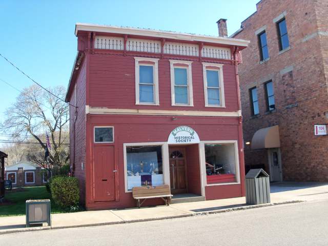
Photo: Roseohioresident, Wikimedia Commons, CC BY-SA 4.0 · Wikimedia Commons
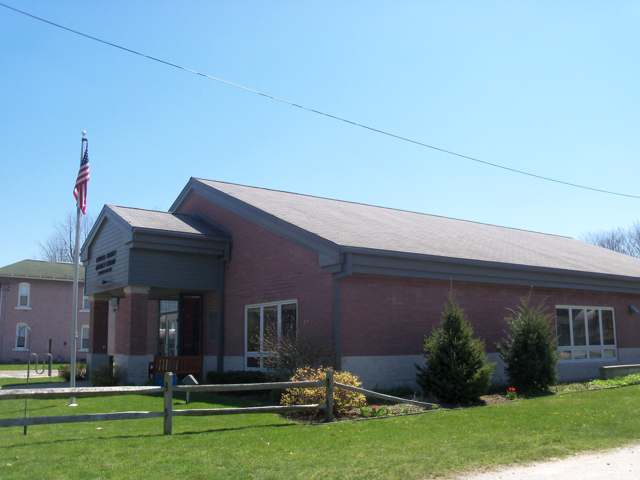
Photo: Roseohioresident, Wikimedia Commons, CC BY-SA 4.0 · Wikimedia Commons
Local history sources: ohiogenealogyexpress.com · en.wikipedia.org · en.wikipedia.org · en.wikipedia.org · en.wikipedia.org · hmdb.org · en.wikipedia.org · en.wikipedia.org
Historic places
1 place in Brown Township, Carroll County on the National Register of Historic Places. Press a pin or a name for its whole record.
-
Hull, Patrick, HouseBuilding · Oneida · listed 1982
- Address
- 8187 Blade Rd.
- Where
- Oneida, Carroll County · ZIP 44644
- What it is
- Building
- Listed on the National Register
- 1982
- NRIS reference number
- 82001362
- Coordinates
- 40.70191, -81.15157
National Register file (NPS) ↗ Search Wikipedia ↗ Street map and directions ↗ On the Cracked Buckeye map
Source: National Park Service, National Register of Historic Places point file. The listing year is shown where NPS's certification date agrees with the listing's reference number. Listing recognizes significance; it does not restrict a private owner.
Water
Eight active wells and two treatment plants feeding one distribution system, plus water bought from Malvern; public records do not say which wells feed which plant. The water here
- Aqua Ohio - Mohawk44% of residentsGroundwater wells (8 wells)
- Malvern Village36% of residentsGroundwater wells (2 wells)
- Minerva Village13% of residentsGroundwater wells (3 wells)
- Green Acres Mobile Estates3% of residentsGroundwater wells (2 wells)
- Carrollton Village2% of residentsGroundwater wells (10 wells)
- Waynesburg Village1% of residentsGroundwater wells (2 wells)
- East Canton Village1% of residentsGlacial sand-and-gravel aquifer (3 well fields)
- Premier Park Estates Llc0% of residentsGroundwater wells (1 wells)
- Canton Public Water System0% of residentsGlacial sand-and-gravel aquifer (3 well fields)
- Skyland Hills MHP0% of residentsGroundwater wells (2 wells)
- Thunderbird Terrace MHP0% of residentsGroundwater wells (3 wells)
- Louisville City0% of residentsLocal groundwater wells (Stark County)
- Rockwood Park0% of residentsGroundwater wells (2 wells)
- Magnolia Village0% of residentsGroundwater wells (3 wells)
- Pride Valley MHP0% of residentsGroundwater wells (1 wells)
Hospitals, fire stations and more
Inside Brown Township, Carroll County's boundary: 1 high-hazard dam, 1 museum, 60 shale and injection wells, 5 Toxics Release Inventory facilities and 14 spill cases. Press a pin or a name for its whole record and its source.
High-hazard dams (1)
-
Lake Mohawk Dam PoorMiddle Run · condition: poor
- Hazard class
- High: a failure would probably cost a life
- Condition
- Poor (assessed 07/23/2020)
- River or stream
- Middle Run
- Purpose
- Recreation
- Type
- Earth
- Height
- 42 ft
- Storage
- 13,119 acre-feet
- Completed
- 1963
- Owner type
- Private
- County
- Carroll County
- Nearest town (NID)
- Oneida
- Last inspection
- 07/23/2020
- Emergency action plan
- Yes
- NID ID
- OH00467
National Inventory of Dams record ↗ National Inventory of Dams (source) ↗ Street map and directions ↗
Source: U.S. Army Corps of Engineers National Inventory of Dams, August 2026. "High hazard" rates what a failure would cost downstream, not how likely one is; the condition is the state's assessment.
Museums, historical societies, gardens and zoos (1)
-
Malvern Historical SocietyHistorical society · Malvern
- What it is
- Historical society
- City
- Malvern
- Coordinates
- 40.67866, -81.19028
Search Wikipedia ↗ IMLS Museum Data Files (source) ↗ Street map and directions ↗
The museum list is IMLS's 2018 file; a museum may have closed or moved since.
Source: IMLS Museum Data Files, 2018.
Shale and injection wells (60)
-
Bowling 23-16-6 1HUtica shale well
- What it is
- Utica shale well
- Drilled sideways
- Yes
- Operator
- Eog Ohio, Llc
- County
- Carroll County
- API well number
- 34019228390000
- Coordinates
- 40.68309, -81.11622
ODNR oil and gas wells (source) ↗ Street map and directions ↗
The point is the surface well head (the pad); a horizontal well runs a mile or more underground from it.
-
Bowling 23-16-6 205HUtica shale well
- What it is
- Utica shale well
- Drilled sideways
- Yes
- Operator
- Eog Ohio, Llc
- County
- Carroll County
- API well number
- 34019228420000
- Coordinates
- 40.68309, -81.11601
ODNR oil and gas wells (source) ↗ Street map and directions ↗
The point is the surface well head (the pad); a horizontal well runs a mile or more underground from it.
-
Bowling 23-16-6 3HUtica shale well
- What it is
- Utica shale well
- Drilled sideways
- Yes
- Operator
- Eog Ohio, Llc
- County
- Carroll County
- API well number
- 34019228400000
- Coordinates
- 40.68309, -81.11615
ODNR oil and gas wells (source) ↗ Street map and directions ↗
The point is the surface well head (the pad); a horizontal well runs a mile or more underground from it.
-
Bowling 23-16-6 5HUtica shale well
- What it is
- Utica shale well
- Drilled sideways
- Yes
- Operator
- Eog Ohio, Llc
- County
- Carroll County
- API well number
- 34019228410000
- Coordinates
- 40.68309, -81.11608
ODNR oil and gas wells (source) ↗ Street map and directions ↗
The point is the surface well head (the pad); a horizontal well runs a mile or more underground from it.
-
Brown 2117 1HHorizontal shale well
- What it is
- Horizontal shale well
- Drilled sideways
- Yes
- Operator
- Eog Resources Inc.
- County
- Carroll County
- API well number
- 34019228000000
- Coordinates
- 40.68453, -81.15387
ODNR oil and gas wells (source) ↗ Street map and directions ↗
The point is the surface well head (the pad); a horizontal well runs a mile or more underground from it.
-
Casper 13HuUtica shale well
- What it is
- Utica shale well
- Drilled sideways
- Yes
- Operator
- Inr Ohio Llc
- County
- Carroll County
- API well number
- 34019229500000
- Coordinates
- 40.65350, -81.16428
ODNR oil and gas wells (source) ↗ Street map and directions ↗
The point is the surface well head (the pad); a horizontal well runs a mile or more underground from it.
-
Casper 15HuUtica shale well
- What it is
- Utica shale well
- Drilled sideways
- Yes
- Operator
- Inr Ohio Llc
- County
- Carroll County
- API well number
- 34019229510000
- Coordinates
- 40.65346, -81.16428
ODNR oil and gas wells (source) ↗ Street map and directions ↗
The point is the surface well head (the pad); a horizontal well runs a mile or more underground from it.
-
Casper 1HuUtica shale well
- What it is
- Utica shale well
- Drilled sideways
- Yes
- Operator
- Inr Ohio Llc
- County
- Carroll County
- API well number
- 34019228550000
- Coordinates
- 40.65397, -81.16431
ODNR oil and gas wells (source) ↗ Street map and directions ↗
The point is the surface well head (the pad); a horizontal well runs a mile or more underground from it.
-
Casper 3HuUtica shale well
- What it is
- Utica shale well
- Drilled sideways
- Yes
- Operator
- Inr Ohio Llc
- County
- Carroll County
- API well number
- 34019228570000
- Coordinates
- 40.65397, -81.16437
ODNR oil and gas wells (source) ↗ Street map and directions ↗
The point is the surface well head (the pad); a horizontal well runs a mile or more underground from it.
-
Casper 5HuUtica shale well
- What it is
- Utica shale well
- Drilled sideways
- Yes
- Operator
- Inr Ohio Llc
- County
- Carroll County
- API well number
- 34019228580000
- Coordinates
- 40.65397, -81.16420
ODNR oil and gas wells (source) ↗ Street map and directions ↗
The point is the surface well head (the pad); a horizontal well runs a mile or more underground from it.
-
Casper 7HuUtica shale well
- What it is
- Utica shale well
- Drilled sideways
- Yes
- Operator
- Inr Ohio Llc
- County
- Carroll County
- API well number
- 34019228590000
- Coordinates
- 40.65397, -81.16415
ODNR oil and gas wells (source) ↗ Street map and directions ↗
The point is the surface well head (the pad); a horizontal well runs a mile or more underground from it.
-
Cobalt Cbr 1AUtica shale well · Well drilled
- What it is
- Utica shale well
- Drilled sideways
- Yes
- Status (ODNR)
- Well drilled
- Operator
- Eog Resources Inc.
- County
- Carroll County
- API well number
- 34019229560000
- Coordinates
- 40.66375, -81.20825
ODNR oil and gas wells (source) ↗ Street map and directions ↗
The point is the surface well head (the pad); a horizontal well runs a mile or more underground from it.
-
Cobalt Cbr 3AUtica shale well · Well drilled
- What it is
- Utica shale well
- Drilled sideways
- Yes
- Status (ODNR)
- Well drilled
- Operator
- Eog Resources Inc.
- County
- Carroll County
- API well number
- 34019229570000
- Coordinates
- 40.66378, -81.20829
ODNR oil and gas wells (source) ↗ Street map and directions ↗
The point is the surface well head (the pad); a horizontal well runs a mile or more underground from it.
-
Cobalt Cbr 5AUtica shale well · Well drilled
- What it is
- Utica shale well
- Drilled sideways
- Yes
- Status (ODNR)
- Well drilled
- Operator
- Eog Resources Inc.
- County
- Carroll County
- API well number
- 34019229580000
- Coordinates
- 40.66381, -81.20834
ODNR oil and gas wells (source) ↗ Street map and directions ↗
The point is the surface well head (the pad); a horizontal well runs a mile or more underground from it.
-
Cobalt Cbr 7AUtica shale well · Well drilled
- What it is
- Utica shale well
- Drilled sideways
- Yes
- Status (ODNR)
- Well drilled
- Operator
- Eog Resources Inc.
- County
- Carroll County
- API well number
- 34019229590000
- Coordinates
- 40.66384, -81.20838
ODNR oil and gas wells (source) ↗ Street map and directions ↗
The point is the surface well head (the pad); a horizontal well runs a mile or more underground from it.
-
Cobalt Cbr 9AUtica shale well · Well drilled
- What it is
- Utica shale well
- Drilled sideways
- Yes
- Status (ODNR)
- Well drilled
- Operator
- Eog Resources Inc.
- County
- Carroll County
- API well number
- 34019229600000
- Coordinates
- 40.66387, -81.20843
ODNR oil and gas wells (source) ↗ Street map and directions ↗
The point is the surface well head (the pad); a horizontal well runs a mile or more underground from it.
-
Indigo Cbr 11BUtica shale well
- What it is
- Utica shale well
- Drilled sideways
- Yes
- Operator
- Eog Resources Inc.
- County
- Carroll County
- API well number
- 34019229400000
- Coordinates
- 40.68132, -81.19922
ODNR oil and gas wells (source) ↗ Street map and directions ↗
The point is the surface well head (the pad); a horizontal well runs a mile or more underground from it.
-
Indigo Cbr 1AUtica shale well
- What it is
- Utica shale well
- Drilled sideways
- Yes
- Operator
- Eog Resources Inc.
- County
- Carroll County
- API well number
- 34019229350000
- Coordinates
- 40.68126, -81.19894
ODNR oil and gas wells (source) ↗ Street map and directions ↗
The point is the surface well head (the pad); a horizontal well runs a mile or more underground from it.
-
Indigo Cbr 3AUtica shale well
- What it is
- Utica shale well
- Drilled sideways
- Yes
- Operator
- Eog Resources Inc.
- County
- Carroll County
- API well number
- 34019229360000
- Coordinates
- 40.68127, -81.19900
ODNR oil and gas wells (source) ↗ Street map and directions ↗
The point is the surface well head (the pad); a horizontal well runs a mile or more underground from it.
-
Indigo Cbr 5AUtica shale well
- What it is
- Utica shale well
- Drilled sideways
- Yes
- Operator
- Eog Resources Inc.
- County
- Carroll County
- API well number
- 34019229370000
- Coordinates
- 40.68128, -81.19905
ODNR oil and gas wells (source) ↗ Street map and directions ↗
The point is the surface well head (the pad); a horizontal well runs a mile or more underground from it.
-
Indigo Cbr 7BUtica shale well
- What it is
- Utica shale well
- Drilled sideways
- Yes
- Operator
- Eog Resources Inc.
- County
- Carroll County
- API well number
- 34019229380000
- Coordinates
- 40.68129, -81.19911
ODNR oil and gas wells (source) ↗ Street map and directions ↗
The point is the surface well head (the pad); a horizontal well runs a mile or more underground from it.
-
Indigo Cbr 9BUtica shale well
- What it is
- Utica shale well
- Drilled sideways
- Yes
- Operator
- Eog Resources Inc.
- County
- Carroll County
- API well number
- 34019229390000
- Coordinates
- 40.68131, -81.19916
ODNR oil and gas wells (source) ↗ Street map and directions ↗
The point is the surface well head (the pad); a horizontal well runs a mile or more underground from it.
-
Larke Cr Brn 10HUtica shale well
- What it is
- Utica shale well
- Drilled sideways
- Yes
- Operator
- Eog Ohio, Llc
- County
- Carroll County
- API well number
- 34019228740000
- Coordinates
- 40.66605, -81.15455
ODNR oil and gas wells (source) ↗ Street map and directions ↗
The point is the surface well head (the pad); a horizontal well runs a mile or more underground from it.
-
Larke Cr Brn 206HUtica shale well
- What it is
- Utica shale well
- Drilled sideways
- Yes
- Operator
- Eog Ohio, Llc
- County
- Carroll County
- API well number
- 34019228750000
- Coordinates
- 40.66588, -81.15456
ODNR oil and gas wells (source) ↗ Street map and directions ↗
The point is the surface well head (the pad); a horizontal well runs a mile or more underground from it.
-
Larke Cr Brn 210HUtica shale well
- What it is
- Utica shale well
- Drilled sideways
- Yes
- Operator
- Eog Ohio, Llc
- County
- Carroll County
- API well number
- 34019228760000
- Coordinates
- 40.66610, -81.15455
ODNR oil and gas wells (source) ↗ Street map and directions ↗
The point is the surface well head (the pad); a horizontal well runs a mile or more underground from it.
-
Larke Cr Brn 6HUtica shale well
- What it is
- Utica shale well
- Drilled sideways
- Yes
- Operator
- Eog Ohio, Llc
- County
- Carroll County
- API well number
- 34019228720000
- Coordinates
- 40.66594, -81.15456
ODNR oil and gas wells (source) ↗ Street map and directions ↗
The point is the surface well head (the pad); a horizontal well runs a mile or more underground from it.
-
Larke Cr Brn 8HUtica shale well
- What it is
- Utica shale well
- Drilled sideways
- Yes
- Operator
- Eog Ohio, Llc
- County
- Carroll County
- API well number
- 34019228730000
- Coordinates
- 40.66599, -81.15455
ODNR oil and gas wells (source) ↗ Street map and directions ↗
The point is the surface well head (the pad); a horizontal well runs a mile or more underground from it.
-
Navy Cbr 1AUtica shale well
- What it is
- Utica shale well
- Drilled sideways
- Yes
- Operator
- Eog Resources Inc.
- County
- Carroll County
- API well number
- 34019229040000
- Coordinates
- 40.69496, -81.19027
ODNR oil and gas wells (source) ↗ Street map and directions ↗
The point is the surface well head (the pad); a horizontal well runs a mile or more underground from it.
-
Navy Cbr 2BUtica shale well
- What it is
- Utica shale well
- Drilled sideways
- Yes
- Operator
- Eog Resources Inc.
- County
- Carroll County
- API well number
- 34019229520000
- Coordinates
- 40.69523, -81.19053
ODNR oil and gas wells (source) ↗ Street map and directions ↗
The point is the surface well head (the pad); a horizontal well runs a mile or more underground from it.
-
Navy Cbr 3AUtica shale well
- What it is
- Utica shale well
- Drilled sideways
- Yes
- Operator
- Eog Resources Inc.
- County
- Carroll County
- API well number
- 34019229050000
- Coordinates
- 40.69494, -81.19032
ODNR oil and gas wells (source) ↗ Street map and directions ↗
The point is the surface well head (the pad); a horizontal well runs a mile or more underground from it.
-
Navy Cbr 4BUtica shale well
- What it is
- Utica shale well
- Drilled sideways
- Yes
- Operator
- Eog Resources Inc.
- County
- Carroll County
- API well number
- 34019229530000
- Coordinates
- 40.69522, -81.19058
ODNR oil and gas wells (source) ↗ Street map and directions ↗
The point is the surface well head (the pad); a horizontal well runs a mile or more underground from it.
-
Navy Cbr 5AUtica shale well
- What it is
- Utica shale well
- Drilled sideways
- Yes
- Operator
- Eog Resources Inc.
- County
- Carroll County
- API well number
- 34019229060000
- Coordinates
- 40.69492, -81.19038
ODNR oil and gas wells (source) ↗ Street map and directions ↗
The point is the surface well head (the pad); a horizontal well runs a mile or more underground from it.
-
Navy Cbr 6BUtica shale well
- What it is
- Utica shale well
- Drilled sideways
- Yes
- Operator
- Eog Resources Inc.
- County
- Carroll County
- API well number
- 34019229540000
- Coordinates
- 40.69520, -81.19063
ODNR oil and gas wells (source) ↗ Street map and directions ↗
The point is the surface well head (the pad); a horizontal well runs a mile or more underground from it.
-
Navy Cbr 7AUtica shale well
- What it is
- Utica shale well
- Drilled sideways
- Yes
- Operator
- Eog Resources Inc.
- County
- Carroll County
- API well number
- 34019229070000
- Coordinates
- 40.69491, -81.19043
ODNR oil and gas wells (source) ↗ Street map and directions ↗
The point is the surface well head (the pad); a horizontal well runs a mile or more underground from it.
-
Navy Cbr 8BUtica shale well
- What it is
- Utica shale well
- Drilled sideways
- Yes
- Operator
- Eog Resources Inc.
- County
- Carroll County
- API well number
- 34019229550000
- Coordinates
- 40.69518, -81.19068
ODNR oil and gas wells (source) ↗ Street map and directions ↗
The point is the surface well head (the pad); a horizontal well runs a mile or more underground from it.
-
Navy Cbr 9AUtica shale well
- What it is
- Utica shale well
- Drilled sideways
- Yes
- Operator
- Eog Resources Inc.
- County
- Carroll County
- API well number
- 34019229080000
- Coordinates
- 40.69489, -81.19048
ODNR oil and gas wells (source) ↗ Street map and directions ↗
The point is the surface well head (the pad); a horizontal well runs a mile or more underground from it.
-
Shadow Cbr 10CUtica shale well
- What it is
- Utica shale well
- Drilled sideways
- Yes
- Operator
- Eog Resources Inc.
- County
- Carroll County
- API well number
- 34019229310000
- Coordinates
- 40.70792, -81.17846
ODNR oil and gas wells (source) ↗ Street map and directions ↗
The point is the surface well head (the pad); a horizontal well runs a mile or more underground from it.
-
Shadow Cbr 12CUtica shale well
- What it is
- Utica shale well
- Drilled sideways
- Yes
- Operator
- Eog Resources Inc.
- County
- Carroll County
- API well number
- 34019229320000
- Coordinates
- 40.70788, -81.17846
ODNR oil and gas wells (source) ↗ Street map and directions ↗
The point is the surface well head (the pad); a horizontal well runs a mile or more underground from it.
-
Shadow Cbr 6CUtica shale well
- What it is
- Utica shale well
- Drilled sideways
- Yes
- Operator
- Eog Resources Inc.
- County
- Carroll County
- API well number
- 34019229290000
- Coordinates
- 40.70801, -81.17846
ODNR oil and gas wells (source) ↗ Street map and directions ↗
The point is the surface well head (the pad); a horizontal well runs a mile or more underground from it.
-
Shadow Cbr 8CUtica shale well
- What it is
- Utica shale well
- Drilled sideways
- Yes
- Operator
- Eog Resources Inc.
- County
- Carroll County
- API well number
- 34019229300000
- Coordinates
- 40.70796, -81.17846
ODNR oil and gas wells (source) ↗ Street map and directions ↗
The point is the surface well head (the pad); a horizontal well runs a mile or more underground from it.
-
Shadow Cbr07 11AUtica shale well
- What it is
- Utica shale well
- Drilled sideways
- Yes
- Operator
- Eog Resources Inc.
- County
- Carroll County
- API well number
- 34019228700000
- Coordinates
- 40.70821, -81.17841
ODNR oil and gas wells (source) ↗ Street map and directions ↗
The point is the surface well head (the pad); a horizontal well runs a mile or more underground from it.
-
Shadow Cbr07 13AUtica shale well
- What it is
- Utica shale well
- Drilled sideways
- Yes
- Operator
- Eog Resources Inc.
- County
- Carroll County
- API well number
- 34019228710000
- Coordinates
- 40.70817, -81.17841
ODNR oil and gas wells (source) ↗ Street map and directions ↗
The point is the surface well head (the pad); a horizontal well runs a mile or more underground from it.
-
Shadow Cbr07 1AUtica shale well
- What it is
- Utica shale well
- Drilled sideways
- Yes
- Operator
- Eog Resources Inc.
- County
- Carroll County
- API well number
- 34019228650000
- Coordinates
- 40.70828, -81.17878
ODNR oil and gas wells (source) ↗ Street map and directions ↗
The point is the surface well head (the pad); a horizontal well runs a mile or more underground from it.
-
Shadow Cbr07 2BUtica shale well
- What it is
- Utica shale well
- Drilled sideways
- Yes
- Operator
- Eog Resources Inc.
- County
- Carroll County
- API well number
- 34019228850000
- Coordinates
- 40.70825, -81.17841
ODNR oil and gas wells (source) ↗ Street map and directions ↗
The point is the surface well head (the pad); a horizontal well runs a mile or more underground from it.
-
Shadow Cbr07 3AUtica shale well
- What it is
- Utica shale well
- Drilled sideways
- Yes
- Operator
- Eog Resources Inc.
- County
- Carroll County
- API well number
- 34019228660000
- Coordinates
- 40.70824, -81.17878
ODNR oil and gas wells (source) ↗ Street map and directions ↗
The point is the surface well head (the pad); a horizontal well runs a mile or more underground from it.
-
Shadow Cbr07 4BUtica shale well
- What it is
- Utica shale well
- Drilled sideways
- Yes
- Operator
- Eog Resources Inc.
- County
- Carroll County
- API well number
- 34019228860000
- Coordinates
- 40.70829, -81.17841
ODNR oil and gas wells (source) ↗ Street map and directions ↗
The point is the surface well head (the pad); a horizontal well runs a mile or more underground from it.
-
Shadow Cbr07 5AUtica shale well
- What it is
- Utica shale well
- Drilled sideways
- Yes
- Operator
- Eog Resources Inc.
- County
- Carroll County
- API well number
- 34019228670000
- Coordinates
- 40.70819, -81.17878
ODNR oil and gas wells (source) ↗ Street map and directions ↗
The point is the surface well head (the pad); a horizontal well runs a mile or more underground from it.
-
Shadow Cbr07 7AUtica shale well
- What it is
- Utica shale well
- Drilled sideways
- Yes
- Operator
- Eog Resources Inc.
- County
- Carroll County
- API well number
- 34019228680000
- Coordinates
- 40.70815, -81.17878
ODNR oil and gas wells (source) ↗ Street map and directions ↗
The point is the surface well head (the pad); a horizontal well runs a mile or more underground from it.
-
Shadow Cbr07 9AUtica shale well
- What it is
- Utica shale well
- Drilled sideways
- Yes
- Operator
- Eog Resources Inc.
- County
- Carroll County
- API well number
- 34019228690000
- Coordinates
- 40.70811, -81.17878
ODNR oil and gas wells (source) ↗ Street map and directions ↗
The point is the surface well head (the pad); a horizontal well runs a mile or more underground from it.
-
The Wright Way Cbr 10BUtica shale well · Well drilled
- What it is
- Utica shale well
- Drilled sideways
- Yes
- Status (ODNR)
- Well drilled
- Operator
- Eog Ohio, Llc
- County
- Carroll County
- API well number
- 34019229650000
- Coordinates
- 40.69059, -81.10586
ODNR oil and gas wells (source) ↗ Street map and directions ↗
The point is the surface well head (the pad); a horizontal well runs a mile or more underground from it.
-
The Wright Way Cbr 204AUtica shale well · Well drilled
- What it is
- Utica shale well
- Drilled sideways
- Yes
- Status (ODNR)
- Well drilled
- Operator
- Eog Ohio, Llc
- County
- Carroll County
- API well number
- 34019229620000
- Coordinates
- 40.69062, -81.10569
ODNR oil and gas wells (source) ↗ Street map and directions ↗
The point is the surface well head (the pad); a horizontal well runs a mile or more underground from it.
-
The Wright Way Cbr 208BUtica shale well · Well drilled
- What it is
- Utica shale well
- Drilled sideways
- Yes
- Status (ODNR)
- Well drilled
- Operator
- Eog Ohio, Llc
- County
- Carroll County
- API well number
- 34019229640000
- Coordinates
- 40.69060, -81.10580
ODNR oil and gas wells (source) ↗ Street map and directions ↗
The point is the surface well head (the pad); a horizontal well runs a mile or more underground from it.
-
The Wright Way Cbr 2AUtica shale well · Well drilled
- What it is
- Utica shale well
- Drilled sideways
- Yes
- Status (ODNR)
- Well drilled
- Operator
- Eog Ohio, Llc
- County
- Carroll County
- API well number
- 34019229610000
- Coordinates
- 40.69063, -81.10563
ODNR oil and gas wells (source) ↗ Street map and directions ↗
The point is the surface well head (the pad); a horizontal well runs a mile or more underground from it.
-
The Wright Way Cbr 6BUtica shale well · Well drilled
- What it is
- Utica shale well
- Drilled sideways
- Yes
- Status (ODNR)
- Well drilled
- Operator
- Eog Ohio, Llc
- County
- Carroll County
- API well number
- 34019229630000
- Coordinates
- 40.69061, -81.10574
ODNR oil and gas wells (source) ↗ Street map and directions ↗
The point is the surface well head (the pad); a horizontal well runs a mile or more underground from it.
-
Timberwolf Cbn16 2AUtica shale well
- What it is
- Utica shale well
- Drilled sideways
- Yes
- Operator
- Eog Resources Inc.
- County
- Carroll County
- API well number
- 34019228480000
- Coordinates
- 40.69276, -81.14654
ODNR oil and gas wells (source) ↗ Street map and directions ↗
The point is the surface well head (the pad); a horizontal well runs a mile or more underground from it.
-
Timberwolf Cbn16 4AUtica shale well
- What it is
- Utica shale well
- Drilled sideways
- Yes
- Operator
- Eog Resources Inc.
- County
- Carroll County
- API well number
- 34019228490000
- Coordinates
- 40.69276, -81.14659
ODNR oil and gas wells (source) ↗ Street map and directions ↗
The point is the surface well head (the pad); a horizontal well runs a mile or more underground from it.
-
Timberwolf Cbn16 6AUtica shale well
- What it is
- Utica shale well
- Drilled sideways
- Yes
- Operator
- Eog Resources Inc.
- County
- Carroll County
- API well number
- 34019228500000
- Coordinates
- 40.69276, -81.14676
ODNR oil and gas wells (source) ↗ Street map and directions ↗
The point is the surface well head (the pad); a horizontal well runs a mile or more underground from it.
-
Timberwolf Cbn16 8AUtica shale well
- What it is
- Utica shale well
- Drilled sideways
- Yes
- Operator
- Eog Resources Inc.
- County
- Carroll County
- API well number
- 34019228510000
- Coordinates
- 40.69276, -81.14681
ODNR oil and gas wells (source) ↗ Street map and directions ↗
The point is the surface well head (the pad); a horizontal well runs a mile or more underground from it.
-
Whitacre 26-17-7 8HUtica shale well
- What it is
- Utica shale well
- Drilled sideways
- Yes
- Operator
- Eog Resources Inc.
- County
- Carroll County
- API well number
- 34019221410000
- Coordinates
- 40.66321, -81.23114
ODNR oil and gas wells (source) ↗ Street map and directions ↗
The point is the surface well head (the pad); a horizontal well runs a mile or more underground from it.
-
Whitacre Cbn26 2AHorizontal shale well
- What it is
- Horizontal shale well
- Drilled sideways
- Yes
- Operator
- Eog Resources Inc.
- County
- Carroll County
- API well number
- 34019228100000
- Coordinates
- 40.66313, -81.23145
ODNR oil and gas wells (source) ↗ Street map and directions ↗
The point is the surface well head (the pad); a horizontal well runs a mile or more underground from it.
Source: ODNR Division of Oil and Gas Resources well inventory (September 2026): drilled Utica, Marcellus and horizontal wells and Class II injection wells not plugged. Older vertical wells are on the full map.
Facilities reporting toxic releases (5)
-
Colfor Manufacturing Inc-MalvernToxics Release Inventory · Malvern
- Address
- 3255 Alliance Rd Nw, Malvern, OH 44644
- County
- Carroll County
- Status
- Reports to the Toxics Release Inventory (active)
- EPA program ID
- 44644CLFRN3255A
- EPA registry ID
- 110000390443
EPA facility record ↗ EPA Facility Registry Service (source) ↗ Street map and directions ↗
-
Mapleton Development IncorporatedToxics Release Inventory · Minerva
- Address
- 1316 Alliance Road, Minerva, OH 44657
- County
- Carroll County
- Status
- Reports to the Toxics Release Inventory (active)
- EPA program ID
- 44657MPLTNSTATE
- EPA registry ID
- 110001619268
EPA facility record ↗ EPA Facility Registry Service (source) ↗ Street map and directions ↗
-
MetaldyneToxics Release Inventory · Minerva
- Address
- 9312 Arrow Road Northwest, Minerva, OH 44657
- County
- Carroll County
- Status
- Reports to the Toxics Release Inventory (active)
- EPA program ID
- 44657BRNSC9312A
- EPA registry ID
- 110000390586
EPA facility record ↗ EPA Facility Registry Service (source) ↗ Street map and directions ↗
-
Southern Explosives CorpToxics Release Inventory · Waynesburg
- Address
- 7249 Alliance Rd. N.W., Waynesburg, OH 44688
- County
- Carroll County
- Status
- Reports to the Toxics Release Inventory (closed)
- EPA program ID
- 44688BCKYX7249A
- EPA registry ID
- 110002316985
EPA facility record ↗ EPA Facility Registry Service (source) ↗ Street map and directions ↗
-
Summitville Tiles IncToxics Release Inventory · Minerva
- Address
- 1310 Alliance Road, Minerva, OH 44657
- County
- Carroll County
- Status
- Reports to the Toxics Release Inventory (open)
- EPA program ID
- 44657SMMTV1310A
- EPA registry ID
- 110004659904
EPA facility record ↗ EPA Facility Registry Service (source) ↗ Street map and directions ↗
Source: EPA Facility Registry Service, Toxics Release Inventory reporters. Reporting a release is required of large users of listed chemicals; it is not by itself a violation.
Spills reported since 2021 (14)
-
Sheen Rainbow / Hydrocarbon Reached water2025-07-14 · Brown Twp
- Reported
- 2025-07-14
- What spilled
- Sheen Rainbow / Hydrocarbon
- Reached a waterway
- 99 - Unnamed
- Where
- Brown Twp, Carroll County
- Ohio EPA district office
- NEDO
- Ohio EPA case number
- 2507EPA0001168
Ohio EPA spill reports (source) ↗ Street map and directions ↗
-
Oil Crude2025-03-29 · Brown Twp
- Reported
- 2025-03-29
- What spilled
- Oil Crude
- Where
- Brown Twp, Carroll County
- Ohio EPA district office
- NEDO
- Ohio EPA case number
- 2503EPA0000455
Ohio EPA spill reports (source) ↗ Street map and directions ↗
-
Bentonite / Drilling Mud2024-07-10 · Null
- Reported
- 2024-07-10
- What spilled
- Bentonite / Drilling Mud
- Largest amount reported
- 35 gallons
- Where
- Null, Carroll County
- Ohio EPA district office
- NEDO
- Ohio EPA case number
- 2407EPA0001164
Ohio EPA spill reports (source) ↗ Street map and directions ↗
-
Natural Gas Condensate / Condensate / Gas Condensate2024-05-28 · Brown Twp
- Reported
- 2024-05-28
- What spilled
- Natural Gas Condensate / Condensate / Gas Condensate
- Largest amount reported
- 2,520 gallons
- Where
- Brown Twp, Carroll County
- Ohio EPA district office
- NEDO
- Ohio EPA case number
- 2405EPA0000895
Ohio EPA spill reports (source) ↗ Street map and directions ↗
-
Oil Petroleum Not Otherwise Specified (Nos)2024-05-22 · Brown Twp
- Reported
- 2024-05-22
- What spilled
- Oil Petroleum Not Otherwise Specified (Nos)
- Where
- Brown Twp, Carroll County
- Ohio EPA district office
- NEDO
- Ohio EPA case number
- 2405EPA0000859
Ohio EPA spill reports (source) ↗ Street map and directions ↗
-
Oil Crude2024-05-20 · Brown Twp
- Reported
- 2024-05-20
- What spilled
- Oil Crude
- Where
- Brown Twp, Carroll County
- Ohio EPA district office
- NEDO
- Ohio EPA case number
- 2405EPA0000841
Ohio EPA spill reports (source) ↗ Street map and directions ↗
-
Oil Crude2024-01-16 · Brown Twp
- Reported
- 2024-01-16
- What spilled
- Oil Crude
- Where
- Brown Twp, Carroll County
- Ohio EPA district office
- NEDO
- Ohio EPA case number
- 2401EPA0000088
Ohio EPA spill reports (source) ↗ Street map and directions ↗
-
Oil Crude2023-02-16 · Brown Twp
- Reported
- 2023-02-16
- What spilled
- Oil Crude
- Where
- Brown Twp, Carroll County
- Ohio EPA district office
- NEDO
- Ohio EPA case number
- 2302EPA0000251
Ohio EPA spill reports (source) ↗ Street map and directions ↗
-
Fuel Oil/ Home Heating / Heating Oil Reached water2022-04-26 · Brown Twp
- Reported
- 2022-04-26
- What spilled
- Fuel Oil/ Home Heating / Heating Oil
- Reached a waterway
- 99 - Unnamed
- Where
- Brown Twp, Carroll County
- Ohio EPA district office
- NEDO
- Ohio EPA case number
- 2204EPA0000588
Ohio EPA spill reports (source) ↗ Street map and directions ↗
-
Oil Crude2022-03-31 · Brown Twp
- Reported
- 2022-03-31
- What spilled
- Oil Crude
- Where
- Brown Twp, Carroll County
- Ohio EPA district office
- NEDO
- Ohio EPA case number
- 2203EPA0000435
Ohio EPA spill reports (source) ↗ Street map and directions ↗
-
Oil Crude Reached water2021-08-09 · Brown Twp
- Reported
- 2021-08-09
- What spilled
- Oil Crude
- Largest amount reported
- 80 gallons
- Reached a waterway
- 99 - Unnamed
- Where
- Brown Twp, Carroll County
- Ohio EPA district office
- NEDO
- Ohio EPA case number
- 2108EPA0001212
Ohio EPA spill reports (source) ↗ Street map and directions ↗
-
Brine Oil And Gas Related2026-08-24 · Brown Twp
- Reported
- 2026-08-24
- What spilled
- Brine Oil And Gas Related; Fuel Diesel / Diesel Fuel (Vehicle On Or Off Road)
- Where
- Brown Twp, Carroll County
- Ohio EPA district office
- NEDO
- Ohio EPA case number
- 2608EPA0001590
Ohio EPA spill reports (source) ↗ Street map and directions ↗
-
Oil Crude2026-05-31 · Brown Twp
- Reported
- 2026-05-31
- What spilled
- Oil Crude
- Where
- Brown Twp, Carroll County
- Ohio EPA district office
- NEDO
- Ohio EPA case number
- 2605EPA0000950
Ohio EPA spill reports (source) ↗ Street map and directions ↗
-
Natural Gas2026-05-17 · Brown Twp
- Reported
- 2026-05-17
- What spilled
- Natural Gas
- Where
- Brown Twp, Carroll County
- Ohio EPA district office
- NEDO
- Ohio EPA case number
- 2605EPA0000821
Ohio EPA spill reports (source) ↗ Street map and directions ↗
Source: Ohio EPA emergency response spill reports, 2021 to September 2026, one point per case where Ohio EPA placed it. A report is what the caller or responder recorded; amounts are often blank or estimated.
Its ZIP codes
Each ZIP code that touches Brown Township, Carroll County, with the share of its residents who live here and the same headline figures as the ZIP page.
On the November 3, 2026 ballot
Statewide question: State Issue 3: Voter ID
Local questions for Brown Township, Carroll County, Carroll County and its school district:
- Carroll County: Renews a 1.4-mill property tax levy to maintain & operate County Home of Carroll County for 5 years, beginning in 2027.
Races, candidates and every question for an address: your ballot. County offices and judges are on your county board's sample ballot.
The county
Carroll County: 7 ZIP codes, 15 cities, villages and townships with pages here, 26,475 people (Census Bureau estimate, July 2025).
Nearby places
Quick answers
What county is Brown Township, Ohio in?
Brown Township, Carroll County is a township in Carroll County, Ohio, with 4,308 residents.
When was Brown Township, Ohio founded?
Brown Township, Carroll County was settled c. 1808 (Isaac Craig and Amos Janney build a mill at Pekin); incorporated 1815 (organized as an independent township, formerly part of Stark County). Founders on record: named for John Brown of Pekin, builder of the township's first mill. Source
How did Brown Township, Ohio get its name?
Brown Township was named for John Brown, who lived at Pekin and built the first mill in that part of Carroll County. Source
What ZIP code is Brown Township, Ohio?
Brown Township, Carroll County is served by ZIP codes 44644, 44657 and 44688; 44644 holds the largest share of its residents.
Where does Brown Township, Ohio get its water?
The main water source for Brown Township, Carroll County (Aqua Ohio - Mohawk): Eight active wells and two treatment plants feeding one distribution system, plus water bought from Malvern; public records do not say which wells feed which plant.
Cite this page
Cite this page as:
Cracked Buckeye, "Brown Township, Carroll County", https://crackedbuckeye.com/place/brown-township-carroll-county/, built 2026-11-02, accessed [date].
How to cite · Report a correction · Built 2026-11-02