Local events in Richland Township, Guernsey County
Nothing is posted for Richland Township itself yet; here is what is on within 10 miles. All local events in Richland Township, Guernsey County
Know a calendar we should watch? Send the link
Checked October 20; the events page is refreshed daily.
Lakes near Richland Township, Guernsey County
The history under the water: the valley before, the dam, the stories. All Ohio lakes
How Richland Township, Guernsey County began
Richland Township, on the south line of Guernsey County, was organized July 18, 1810, with its first election at Samuel Leath's house. Its main village, Senecaville, was platted by David Satterthwaite on July 18, 1815, beside Seneca Creek, where early settlers boiled salt from springs in a thirty-six-kettle furnace; the creek was named, Sarchet says, for the Seneca oil that seeped from it. A piece of Lore City, platted in 1903 on the Baltimore & Ohio, lies in the north. The township, crossed by Leatherwood Creek and the Cumberland branch railroad, had 2,066 residents in 2020.
Settled c. 1808-1811 (John Laughlin 1808; Satterthwaite, William Thompson and Ephraim Dilley by 1811), platted 1815 (Senecaville, July 18, David Satterthwaite); 1836 (New Gottengen, May 13); 1903 (Lore City, June 8), incorporated township organized July 18, 1810; Lore City incorporated 1906, by Pioneers from Fayette County, Pennsylvania, New Jersey and Ireland; David Satterthwaite laid out Senecaville.
Where the name comes from
No source explains the name Richland Township, one of twelve in Ohio, though the land was described as among the richest in the county. Senecaville, per a pioneer account in Sarchet's 1911 history, took its name from Seneca Creek, which was named for the Seneca oil (petroleum) that oozed on its waters; that oil was named for the Seneca nation of New York and Pennsylvania, who used it as medicine.
Before the town
No Native American site or village specific to Richland Township was found in the sources checked. Delaware, Shawnee, Wyandot, Miami, Ottawa and Mingo peoples traveled and hunted across the county generally, and a documented Delaware settlement stood on Wills Creek near Cambridge, well north of this township. The one Native link recorded in the township is its place name: Sarchet's 1911 county history says Seneca Creek, and so Senecaville, was named for Seneca oil, a petroleum the Seneca of New York and Pennsylvania used as medicine; it does not say any Seneca lived here.
- Seneca oil springs on Seneca Creek (name origin of Senecaville) (other) — Seneca Creek at Senecaville, Richland Township, name recorded in the 1800s (archive.org)
Timeline
- — John Laughlin, born in Fayette County, Pennsylvania in 1777, started west and located in Richland Township; he moved to Centre Township in 1818.
- — Richland Township was organized on July 18, with its first election held that day at the house of Samuel Leath.
- — Robert Thompson, born in 1808, was brought by his parents to Senecaville when it had only three log cabins; David Satterthwaite and William Thompson were the earliest settlers, James Richardson kept the first tavern and the first church was Presbyterian.
- — David Satterthwaite platted Senecaville on the banks of Seneca Creek on July 18 (the same day Richland's township election had been held five years earlier).
- — Samuel M. Dilley, born in New Jersey in 1794, came with a brother and settled near the site of Senecaville.
- — A post office called Senecaville opened; its first mail came on horseback from Wheeling.
- — Charles Heidelbach platted New Gottengen on the Clay Pike on May 13.
- — Senecaville postmasters in these years were J. M. Rainey under Buchanan and D. M. Bryan, called the War Postmaster, under Lincoln.
- — The Senecaville post office moved to its location of 1910; a rural route of twenty-four miles was added July 1, 1903.
- — Lore City was platted on June 8 on Leatherwood Creek across Centre and Richland townships; its first rural route began March 1, 1905.
- — Lore City was incorporated, with Roland Potts as mayor by 1910.
- — Senecaville, with 893 residents, had a national bank, grist and planing mills and four churches, in the coal belt along the Cumberland branch of the Baltimore & Ohio.
- — Senecaville Lake, a flood-control reservoir about two miles east of the village, was created.
- — Richland Township had 2,066 residents; Senecaville had 422.
Stories
Salt kettles on Seneca Creek
Robert Thompson, who came to Senecaville in 1811 as a toddler when it had three log cabins, told the local press in 1886 that salt springs lay on the edge of the creek near the Greenwood bridge. His brother William boiled salt there in a furnace of about thirty-six kettles, and Thompson doubted there were any other salt works this side of the Ohio River. People came long distances and paid three dollars a bushel. Coffee was fifty cents a pound and was used only when the preacher came, and produce went to Baltimore in huge covered wagons drawn by six horses, a journey of about three weeks each way.
Where Senecaville got its name
David Satterthwaite platted Senecaville on July 18, 1815, on Seneca Creek. Earlier accounts of the name said it honored the Seneca people who hunted the creek's fork, but the pioneer sketch in Sarchet's 1911 county history gives a different derivation: the creek was named for the springs of coal oil that oozed on its waters, and Seneca oil in turn took its name from the Seneca Indians of New York and Pennsylvania, who had used the oil for its medicinal qualities. The petroleum later became familiar to the whole country. In 1937 the valley east of the village was dammed to form Senecaville Lake.
Photographs
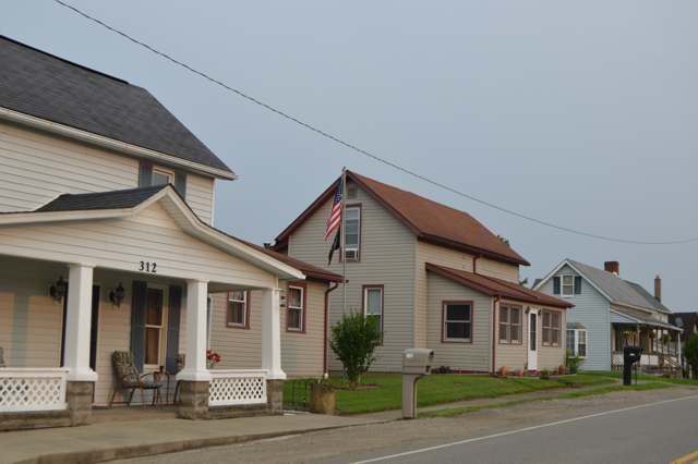
Photo: Nyttend, public domain · Wikimedia Commons
Local history sources: en.wikipedia.org · en.wikipedia.org · en.wikipedia.org · en.wikipedia.org · bettyshinn.com · archive.org · commons.wikimedia.org
Historic places
1 place in Richland Township, Guernsey County on the National Register of Historic Places. Press a pin or a name for its whole record.
-
Finley, Ebenezer, HouseBuilding · Buffalo · listed 1986
- Address
- E of Buffalo on OH 313
- Where
- Buffalo, Guernsey County · ZIP 43780
- What it is
- Building
- Listed on the National Register
- 1986
- NRIS reference number
- 86000417
- Coordinates
- 39.92453, -81.49343
National Register file (NPS) ↗ Search Wikipedia ↗ Street map and directions ↗ On the Cracked Buckeye map
Source: National Park Service, National Register of Historic Places point file. The listing year is shown where NPS's certification date agrees with the listing's reference number. Listing recognizes significance; it does not restrict a private owner.
Water
Mostly private wells The water here
- Byesville100% of residentslocal wells (mine-pool/groundwater under influence of surface water)
Hospitals, fire stations and more
Inside Richland Township, Guernsey County's boundary: 1 high-hazard dam, 1 public school, 3 poor-rated bridges, 63 shale and injection wells, 1 Toxics Release Inventory facility and 6 spill cases. Press a pin or a name for its whole record and its source.
High-hazard dams (1)
-
Senecaville DamSeneca Fork of Wills Creek · condition: not available
- Hazard class
- High: a failure would probably cost a life
- Condition
- Not Available
- River or stream
- Seneca Fork of Wills Creek
- Purpose
- Flood Risk Reduction;Fish and Wildlife Pond;Recreation
- Type
- Earth
- Height
- 45 ft
- Storage
- 88,500 acre-feet
- Completed
- 1937
- Owner type
- Federal
- County
- Guernsey County
- Nearest town (NID)
- Senecaville
- Last inspection
- 08/26/2021
- Emergency action plan
- Yes
- NID ID
- OH00013
National Inventory of Dams record ↗ National Inventory of Dams (source) ↗ Street map and directions ↗
Source: U.S. Army Corps of Engineers National Inventory of Dams, August 2026. "High hazard" rates what a failure would cost downstream, not how likely one is; the condition is the state's assessment.
Public schools (1)
-
Secrest Elementary SchoolSenecaville
- Address
- 58860 Wintergreen Rd, Senecaville, OH 43780
- Kind (NCES)
- Regular School
- Students, 2023-24
- 157
- Teachers (full-time equivalent)
- 10.5
- NCES school ID
- 390473004311
Source: NCES EDGE public school locations 2024-25 and Common Core of Data 2023-24 (type, students, teachers); Ohio School Report Cards 2025-26 (Department of Education and Workforce), matched by name within the district.
Bridges rated poor (3)
-
Service Drive over Seneca ForkPoor · built 1967
- Condition
- Poor: a deck, superstructure, substructure or culvert rated 4 or below on the 0 to 9 scale
- What it is
- Bridge
- Built
- 1967
- Length
- 20 ft
- Owner
- Other
- Vehicles a day
- 10
- Coordinates
- 39.92591, -81.44284
National Bridge Inventory (source) ↗ Street map and directions ↗
-
Township Rd 4581 over StreamPoor · built 2008
- Condition
- Poor: a deck, superstructure, substructure or culvert rated 4 or below on the 0 to 9 scale
- What it is
- Bridge
- Built
- 2008
- Length
- 7 ft
- Owner
- County
- Vehicles a day
- 209
- Coordinates
- 39.94530, -81.45491
National Bridge Inventory (source) ↗ Street map and directions ↗
-
Township Rd 741 over Leatherwood CreekPoor · built 1950
- Condition
- Poor: a deck, superstructure, substructure or culvert rated 4 or below on the 0 to 9 scale
- What it is
- Bridge
- Built
- 1950
- Length
- 15 ft
- Owner
- County
- Vehicles a day
- 96
- Coordinates
- 39.98006, -81.39586
National Bridge Inventory (source) ↗ Street map and directions ↗
Source: FHWA National Bridge Inventory 2025. "Poor" means one major part rated 4 or below on the 0 to 9 scale; it calls for repair, not closing, unless the state posts or closes the bridge.
Shale and injection wells (63)
-
Beros Ne 6HuUtica shale well
- What it is
- Utica shale well
- Drilled sideways
- Yes
- Operator
- Inr Ohio Llc
- County
- Guernsey County
- API well number
- 34059246730000
- Coordinates
- 39.96690, -81.46289
ODNR oil and gas wells (source) ↗ Street map and directions ↗
The point is the surface well head (the pad); a horizontal well runs a mile or more underground from it.
-
Beros Ne 7HuUtica shale well
- What it is
- Utica shale well
- Drilled sideways
- Yes
- Operator
- Inr Ohio Llc
- County
- Guernsey County
- API well number
- 34059246740000
- Coordinates
- 39.96690, -81.46283
ODNR oil and gas wells (source) ↗ Street map and directions ↗
The point is the surface well head (the pad); a horizontal well runs a mile or more underground from it.
-
Beros Ne Unit 5HHorizontal shale well
- What it is
- Horizontal shale well
- Drilled sideways
- Yes
- Operator
- Inr Ohio Llc
- County
- Guernsey County
- API well number
- 34059245870000
- Coordinates
- 39.96656, -81.46156
ODNR oil and gas wells (source) ↗ Street map and directions ↗
The point is the surface well head (the pad); a horizontal well runs a mile or more underground from it.
-
Beros Sc 13HuUtica shale well
- What it is
- Utica shale well
- Drilled sideways
- Yes
- Operator
- Inr Ohio Llc
- County
- Guernsey County
- API well number
- 34059247210000
- Coordinates
- 39.96666, -81.46171
ODNR oil and gas wells (source) ↗ Street map and directions ↗
The point is the surface well head (the pad); a horizontal well runs a mile or more underground from it.
-
Beros Se 14HuUtica shale well
- What it is
- Utica shale well
- Drilled sideways
- Yes
- Operator
- Inr Ohio Llc
- County
- Guernsey County
- API well number
- 34059247190000
- Coordinates
- 39.96662, -81.46171
ODNR oil and gas wells (source) ↗ Street map and directions ↗
The point is the surface well head (the pad); a horizontal well runs a mile or more underground from it.
-
Beros Se 15HuUtica shale well
- What it is
- Utica shale well
- Drilled sideways
- Yes
- Operator
- Inr Ohio Llc
- County
- Guernsey County
- API well number
- 34059247200000
- Coordinates
- 39.96657, -81.46170
ODNR oil and gas wells (source) ↗ Street map and directions ↗
The point is the surface well head (the pad); a horizontal well runs a mile or more underground from it.
-
Beros Sw Unit 12HHorizontal shale well
- What it is
- Horizontal shale well
- Drilled sideways
- Yes
- Operator
- Inr Ohio Llc
- County
- Guernsey County
- API well number
- 34059245860000
- Coordinates
- 39.96661, -81.46156
ODNR oil and gas wells (source) ↗ Street map and directions ↗
The point is the surface well head (the pad); a horizontal well runs a mile or more underground from it.
-
Dynamite 1-HUtica shale well
- What it is
- Utica shale well
- Drilled sideways
- Yes
- Operator
- Inr Ohio Llc
- County
- Guernsey County
- API well number
- 34059243360000
- Coordinates
- 39.97829, -81.42030
ODNR oil and gas wells (source) ↗ Street map and directions ↗
The point is the surface well head (the pad); a horizontal well runs a mile or more underground from it.
-
Dynamite 2-HUtica shale well
- What it is
- Utica shale well
- Drilled sideways
- Yes
- Operator
- Inr Ohio Llc
- County
- Guernsey County
- API well number
- 34059243370000
- Coordinates
- 39.97829, -81.42025
ODNR oil and gas wells (source) ↗ Street map and directions ↗
The point is the surface well head (the pad); a horizontal well runs a mile or more underground from it.
-
Dynamite 3-HUtica shale well
- What it is
- Utica shale well
- Drilled sideways
- Yes
- Operator
- Inr Ohio Llc
- County
- Guernsey County
- API well number
- 34059243380000
- Coordinates
- 39.97829, -81.42020
ODNR oil and gas wells (source) ↗ Street map and directions ↗
The point is the surface well head (the pad); a horizontal well runs a mile or more underground from it.
-
Dynamite 4-HUtica shale well
- What it is
- Utica shale well
- Drilled sideways
- Yes
- Operator
- Inr Ohio Llc
- County
- Guernsey County
- API well number
- 34059243390000
- Coordinates
- 39.97829, -81.42014
ODNR oil and gas wells (source) ↗ Street map and directions ↗
The point is the surface well head (the pad); a horizontal well runs a mile or more underground from it.
-
Dynamite 5HUtica shale well
- What it is
- Utica shale well
- Drilled sideways
- Yes
- Operator
- Inr Ohio Llc
- County
- Guernsey County
- API well number
- 34059246440000
- Coordinates
- 39.97821, -81.42025
ODNR oil and gas wells (source) ↗ Street map and directions ↗
The point is the surface well head (the pad); a horizontal well runs a mile or more underground from it.
-
Dynamite 6HUtica shale well
- What it is
- Utica shale well
- Drilled sideways
- Yes
- Operator
- Inr Ohio Llc
- County
- Guernsey County
- API well number
- 34059246450000
- Coordinates
- 39.97821, -81.42020
ODNR oil and gas wells (source) ↗ Street map and directions ↗
The point is the surface well head (the pad); a horizontal well runs a mile or more underground from it.
-
Dynamite 7HUtica shale well
- What it is
- Utica shale well
- Drilled sideways
- Yes
- Operator
- Inr Ohio Llc
- County
- Guernsey County
- API well number
- 34059245320000
- Coordinates
- 39.97830, -81.42078
ODNR oil and gas wells (source) ↗ Street map and directions ↗
The point is the surface well head (the pad); a horizontal well runs a mile or more underground from it.
-
Dynamite 8HUtica shale well
- What it is
- Utica shale well
- Drilled sideways
- Yes
- Operator
- Inr Ohio Llc
- County
- Guernsey County
- API well number
- 34059245330000
- Coordinates
- 39.97826, -81.42078
ODNR oil and gas wells (source) ↗ Street map and directions ↗
The point is the surface well head (the pad); a horizontal well runs a mile or more underground from it.
-
Dynamite 9HUtica shale well
- What it is
- Utica shale well
- Drilled sideways
- Yes
- Operator
- Inr Ohio Llc
- County
- Guernsey County
- API well number
- 34059246460000
- Coordinates
- 39.97821, -81.42030
ODNR oil and gas wells (source) ↗ Street map and directions ↗
The point is the surface well head (the pad); a horizontal well runs a mile or more underground from it.
-
Lavada Rch Gr 2HHorizontal shale well
- What it is
- Horizontal shale well
- Drilled sideways
- Yes
- Operator
- Ascent Resources Utica Llc
- County
- Guernsey County
- API well number
- 34059245990000
- Coordinates
- 39.97199, -81.41203
ODNR oil and gas wells (source) ↗ Street map and directions ↗
The point is the surface well head (the pad); a horizontal well runs a mile or more underground from it.
-
Lavada Rch Gr 4HHorizontal shale well
- What it is
- Horizontal shale well
- Drilled sideways
- Yes
- Operator
- Ascent Resources Utica Llc
- County
- Guernsey County
- API well number
- 34059246000000
- Coordinates
- 39.97204, -81.41203
ODNR oil and gas wells (source) ↗ Street map and directions ↗
The point is the surface well head (the pad); a horizontal well runs a mile or more underground from it.
-
Mohorovich E Rch Gr 2HUtica shale well
- What it is
- Utica shale well
- Drilled sideways
- Yes
- Operator
- Ascent Resources Utica Llc
- County
- Guernsey County
- API well number
- 34059244210000
- Coordinates
- 39.95470, -81.37753
ODNR oil and gas wells (source) ↗ Street map and directions ↗
The point is the surface well head (the pad); a horizontal well runs a mile or more underground from it.
-
Mohorovich E Rch Gr 3HUtica shale well
- What it is
- Utica shale well
- Drilled sideways
- Yes
- Operator
- Ascent Resources Utica Llc
- County
- Guernsey County
- API well number
- 34059244200000
- Coordinates
- 39.95474, -81.37751
ODNR oil and gas wells (source) ↗ Street map and directions ↗
The point is the surface well head (the pad); a horizontal well runs a mile or more underground from it.
-
Mohorovich E Rch Gr 4HUtica shale well
- What it is
- Utica shale well
- Drilled sideways
- Yes
- Operator
- Ascent Resources Utica Llc
- County
- Guernsey County
- API well number
- 34059244190000
- Coordinates
- 39.95478, -81.37750
ODNR oil and gas wells (source) ↗ Street map and directions ↗
The point is the surface well head (the pad); a horizontal well runs a mile or more underground from it.
-
Mohorovich W Rch Gr 14HUtica shale well
- What it is
- Utica shale well
- Drilled sideways
- Yes
- Operator
- Ascent Resources Utica Llc
- County
- Guernsey County
- API well number
- 34059244020000
- Coordinates
- 39.95471, -81.37756
ODNR oil and gas wells (source) ↗ Street map and directions ↗
The point is the surface well head (the pad); a horizontal well runs a mile or more underground from it.
-
Mohorovich W Rch Gr 1HUtica shale well
- What it is
- Utica shale well
- Drilled sideways
- Yes
- Operator
- Ascent Resources Utica Llc
- County
- Guernsey County
- API well number
- 34059243200000
- Coordinates
- 39.95466, -81.37754
ODNR oil and gas wells (source) ↗ Street map and directions ↗
The point is the surface well head (the pad); a horizontal well runs a mile or more underground from it.
-
Mohorovich W Rch Gr 8HUtica shale well
- What it is
- Utica shale well
- Drilled sideways
- Yes
- Operator
- Ascent Resources Utica Llc
- County
- Guernsey County
- API well number
- 34059244010000
- Coordinates
- 39.95467, -81.37758
ODNR oil and gas wells (source) ↗ Street map and directions ↗
The point is the surface well head (the pad); a horizontal well runs a mile or more underground from it.
-
Rector 1-HUtica shale well
- What it is
- Utica shale well
- Drilled sideways
- Yes
- Operator
- Ascent Resources Utica Llc
- County
- Guernsey County
- API well number
- 34059242730100
- Coordinates
- 39.95601, -81.39707
ODNR oil and gas wells (source) ↗ Street map and directions ↗
The point is the surface well head (the pad); a horizontal well runs a mile or more underground from it.
-
Rector C Rch Gr 11HUtica shale well
- What it is
- Utica shale well
- Drilled sideways
- Yes
- Operator
- Ascent Resources Utica Llc
- County
- Guernsey County
- API well number
- 34059243990000
- Coordinates
- 39.95609, -81.39709
ODNR oil and gas wells (source) ↗ Street map and directions ↗
The point is the surface well head (the pad); a horizontal well runs a mile or more underground from it.
-
Rector C Rch Gr 3HUtica shale well
- What it is
- Utica shale well
- Drilled sideways
- Yes
- Operator
- Ascent Resources Utica Llc
- County
- Guernsey County
- API well number
- 34059243970000
- Coordinates
- 39.95593, -81.39705
ODNR oil and gas wells (source) ↗ Street map and directions ↗
The point is the surface well head (the pad); a horizontal well runs a mile or more underground from it.
-
Rector C Rch Gr 4HUtica shale well
- What it is
- Utica shale well
- Drilled sideways
- Yes
- Operator
- Ascent Resources Utica Llc
- County
- Guernsey County
- API well number
- 34059243980000
- Coordinates
- 39.95589, -81.39704
ODNR oil and gas wells (source) ↗ Street map and directions ↗
The point is the surface well head (the pad); a horizontal well runs a mile or more underground from it.
-
Rector E Rch Gr 2HUtica shale well
- What it is
- Utica shale well
- Drilled sideways
- Yes
- Operator
- Ascent Resources Utica Llc
- County
- Guernsey County
- API well number
- 34059244000000
- Coordinates
- 39.95597, -81.39705
ODNR oil and gas wells (source) ↗ Street map and directions ↗
The point is the surface well head (the pad); a horizontal well runs a mile or more underground from it.
-
Rector E Rch Gr 6HUtica shale well
- What it is
- Utica shale well
- Drilled sideways
- Yes
- Operator
- Ascent Resources Utica Llc
- County
- Guernsey County
- API well number
- 34059245220000
- Coordinates
- 39.95605, -81.39708
ODNR oil and gas wells (source) ↗ Street map and directions ↗
The point is the surface well head (the pad); a horizontal well runs a mile or more underground from it.
-
Rubel 1HUtica shale well
- What it is
- Utica shale well
- Drilled sideways
- Yes
- Operator
- Inr Ohio Llc
- County
- Guernsey County
- API well number
- 34059245750000
- Coordinates
- 39.92890, -81.46601
ODNR oil and gas wells (source) ↗ Street map and directions ↗
The point is the surface well head (the pad); a horizontal well runs a mile or more underground from it.
-
Rubel 4HHorizontal shale well
- What it is
- Horizontal shale well
- Drilled sideways
- Yes
- Operator
- Inr Ohio Llc
- County
- Guernsey County
- API well number
- 34059246180000
- Coordinates
- 39.92900, -81.46603
ODNR oil and gas wells (source) ↗ Street map and directions ↗
The point is the surface well head (the pad); a horizontal well runs a mile or more underground from it.
-
Rubel S 10HuUtica shale well
- What it is
- Utica shale well
- Drilled sideways
- Yes
- Operator
- Inr Ohio Llc
- County
- Guernsey County
- API well number
- 34059247500000
- Coordinates
- 39.92910, -81.46636
ODNR oil and gas wells (source) ↗ Street map and directions ↗
The point is the surface well head (the pad); a horizontal well runs a mile or more underground from it.
-
Rubel S 6HuUtica shale well
- What it is
- Utica shale well
- Drilled sideways
- Yes
- Operator
- Inr Ohio Llc
- County
- Guernsey County
- API well number
- 34059247480000
- Coordinates
- 39.92918, -81.46637
ODNR oil and gas wells (source) ↗ Street map and directions ↗
The point is the surface well head (the pad); a horizontal well runs a mile or more underground from it.
-
Rubel S 8HuUtica shale well
- What it is
- Utica shale well
- Drilled sideways
- Yes
- Operator
- Inr Ohio Llc
- County
- Guernsey County
- API well number
- 34059247490000
- Coordinates
- 39.92914, -81.46636
ODNR oil and gas wells (source) ↗ Street map and directions ↗
The point is the surface well head (the pad); a horizontal well runs a mile or more underground from it.
-
Rubel W 2HuUtica shale well
- What it is
- Utica shale well
- Drilled sideways
- Yes
- Operator
- Inr Ohio Llc
- County
- Guernsey County
- API well number
- 34059246920000
- Coordinates
- 39.92942, -81.46569
ODNR oil and gas wells (source) ↗ Street map and directions ↗
The point is the surface well head (the pad); a horizontal well runs a mile or more underground from it.
-
Rubel-Dodd 5HuUtica shale well
- What it is
- Utica shale well
- Drilled sideways
- Yes
- Operator
- Inr Ohio Llc
- County
- Guernsey County
- API well number
- 34059246970000
- Coordinates
- 39.92938, -81.46568
ODNR oil and gas wells (source) ↗ Street map and directions ↗
The point is the surface well head (the pad); a horizontal well runs a mile or more underground from it.
-
Rubel-Dodd 7HuUtica shale well
- What it is
- Utica shale well
- Drilled sideways
- Yes
- Operator
- Inr Ohio Llc
- County
- Guernsey County
- API well number
- 34059246980000
- Coordinates
- 39.92934, -81.46568
ODNR oil and gas wells (source) ↗ Street map and directions ↗
The point is the surface well head (the pad); a horizontal well runs a mile or more underground from it.
-
Rubel-Dodd 9HuUtica shale well
- What it is
- Utica shale well
- Drilled sideways
- Yes
- Operator
- Inr Ohio Llc
- County
- Guernsey County
- API well number
- 34059246990000
- Coordinates
- 39.92930, -81.46567
ODNR oil and gas wells (source) ↗ Street map and directions ↗
The point is the surface well head (the pad); a horizontal well runs a mile or more underground from it.
-
Slabaugh E Rch Gr 5HUtica shale well
- What it is
- Utica shale well
- Drilled sideways
- Yes
- Operator
- Ascent Resources Utica Llc
- County
- Guernsey County
- API well number
- 34059246320000
- Coordinates
- 39.95492, -81.44158
ODNR oil and gas wells (source) ↗ Street map and directions ↗
The point is the surface well head (the pad); a horizontal well runs a mile or more underground from it.
-
Slabaugh W Rch Gr 1HUtica shale well
- What it is
- Utica shale well
- Drilled sideways
- Yes
- Operator
- Ascent Resources Utica Llc
- County
- Guernsey County
- API well number
- 34059246300000
- Coordinates
- 39.95481, -81.44159
ODNR oil and gas wells (source) ↗ Street map and directions ↗
The point is the surface well head (the pad); a horizontal well runs a mile or more underground from it.
-
Slabaugh W Rch Gr 3HUtica shale well
- What it is
- Utica shale well
- Drilled sideways
- Yes
- Operator
- Ascent Resources Utica Llc
- County
- Guernsey County
- API well number
- 34059246310000
- Coordinates
- 39.95486, -81.44159
ODNR oil and gas wells (source) ↗ Street map and directions ↗
The point is the surface well head (the pad); a horizontal well runs a mile or more underground from it.
-
Stiers 1-HUtica shale well
- What it is
- Utica shale well
- Drilled sideways
- Yes
- Operator
- Inr Ohio Llc
- County
- Guernsey County
- API well number
- 34059242420000
- Coordinates
- 39.95111, -81.43452
ODNR oil and gas wells (source) ↗ Street map and directions ↗
The point is the surface well head (the pad); a horizontal well runs a mile or more underground from it.
-
Stiers 2-HUtica shale well
- What it is
- Utica shale well
- Drilled sideways
- Yes
- Operator
- Inr Ohio Llc
- County
- Guernsey County
- API well number
- 34059242440000
- Coordinates
- 39.95115, -81.43454
ODNR oil and gas wells (source) ↗ Street map and directions ↗
The point is the surface well head (the pad); a horizontal well runs a mile or more underground from it.
-
Stiers 3-HUtica shale well
- What it is
- Utica shale well
- Drilled sideways
- Yes
- Operator
- Inr Ohio Llc
- County
- Guernsey County
- API well number
- 34059242430000
- Coordinates
- 39.95119, -81.43456
ODNR oil and gas wells (source) ↗ Street map and directions ↗
The point is the surface well head (the pad); a horizontal well runs a mile or more underground from it.
-
Stiers Sw 2HuUtica shale well
- What it is
- Utica shale well
- Drilled sideways
- Yes
- Operator
- Inr Ohio Llc
- County
- Guernsey County
- API well number
- 34059247340000
- Coordinates
- 39.95101, -81.43462
ODNR oil and gas wells (source) ↗ Street map and directions ↗
The point is the surface well head (the pad); a horizontal well runs a mile or more underground from it.
-
Stiers Sw 4HuUtica shale well
- What it is
- Utica shale well
- Drilled sideways
- Yes
- Operator
- Inr Ohio Llc
- County
- Guernsey County
- API well number
- 34059247350000
- Coordinates
- 39.95097, -81.43460
ODNR oil and gas wells (source) ↗ Street map and directions ↗
The point is the surface well head (the pad); a horizontal well runs a mile or more underground from it.
-
Stiers Sw 6HuUtica shale well
- What it is
- Utica shale well
- Drilled sideways
- Yes
- Operator
- Inr Ohio Llc
- County
- Guernsey County
- API well number
- 34059247360000
- Coordinates
- 39.95093, -81.43458
ODNR oil and gas wells (source) ↗ Street map and directions ↗
The point is the surface well head (the pad); a horizontal well runs a mile or more underground from it.
-
Stiers Sw 8HuUtica shale well
- What it is
- Utica shale well
- Drilled sideways
- Yes
- Operator
- Inr Ohio Llc
- County
- Guernsey County
- API well number
- 34059247370000
- Coordinates
- 39.95089, -81.43456
ODNR oil and gas wells (source) ↗ Street map and directions ↗
The point is the surface well head (the pad); a horizontal well runs a mile or more underground from it.
-
Stillion 8HUtica shale well
- What it is
- Utica shale well
- Drilled sideways
- Yes
- Operator
- Inr Ohio Llc
- County
- Guernsey County
- API well number
- 34059246190000
- Coordinates
- 39.95848, -81.47650
ODNR oil and gas wells (source) ↗ Street map and directions ↗
The point is the surface well head (the pad); a horizontal well runs a mile or more underground from it.
-
Stillion 9HUtica shale well
- What it is
- Utica shale well
- Drilled sideways
- Yes
- Operator
- Inr Ohio Llc
- County
- Guernsey County
- API well number
- 34059246200000
- Coordinates
- 39.95844, -81.47650
ODNR oil and gas wells (source) ↗ Street map and directions ↗
The point is the surface well head (the pad); a horizontal well runs a mile or more underground from it.
-
Stillion N 12HuUtica shale well · Well drilled
- What it is
- Utica shale well
- Drilled sideways
- Yes
- Status (ODNR)
- Well drilled
- Operator
- Inr Ohio Llc
- County
- Guernsey County
- API well number
- 34059247510000
- Coordinates
- 39.95839, -81.47655
ODNR oil and gas wells (source) ↗ Street map and directions ↗
The point is the surface well head (the pad); a horizontal well runs a mile or more underground from it.
-
Stillion N 13HuUtica shale well · Well drilled
- What it is
- Utica shale well
- Drilled sideways
- Yes
- Status (ODNR)
- Well drilled
- Operator
- Inr Ohio Llc
- County
- Guernsey County
- API well number
- 34059247520000
- Coordinates
- 39.95828, -81.47667
ODNR oil and gas wells (source) ↗ Street map and directions ↗
The point is the surface well head (the pad); a horizontal well runs a mile or more underground from it.
-
Stillion S 5HuUtica shale well · Well drilled
- What it is
- Utica shale well
- Drilled sideways
- Yes
- Status (ODNR)
- Well drilled
- Operator
- Inr Ohio Llc
- County
- Guernsey County
- API well number
- 34059247530000
- Coordinates
- 39.95827, -81.47656
ODNR oil and gas wells (source) ↗ Street map and directions ↗
The point is the surface well head (the pad); a horizontal well runs a mile or more underground from it.
-
Stillion S 7HuUtica shale well · Well drilled
- What it is
- Utica shale well
- Drilled sideways
- Yes
- Status (ODNR)
- Well drilled
- Operator
- Inr Ohio Llc
- County
- Guernsey County
- API well number
- 34059247540000
- Coordinates
- 39.95835, -81.47656
ODNR oil and gas wells (source) ↗ Street map and directions ↗
The point is the surface well head (the pad); a horizontal well runs a mile or more underground from it.
-
Stillion-Beros 1HHorizontal shale well
- What it is
- Horizontal shale well
- Drilled sideways
- Yes
- Operator
- Inr Ohio Llc
- County
- Guernsey County
- API well number
- 34059246110000
- Coordinates
- 39.95855, -81.47638
ODNR oil and gas wells (source) ↗ Street map and directions ↗
The point is the surface well head (the pad); a horizontal well runs a mile or more underground from it.
-
Stillion-Beros Nw 3HuUtica shale well
- What it is
- Utica shale well
- Drilled sideways
- Yes
- Operator
- Inr Ohio Llc
- County
- Guernsey County
- API well number
- 34059246560000
- Coordinates
- 39.95834, -81.47640
ODNR oil and gas wells (source) ↗ Street map and directions ↗
The point is the surface well head (the pad); a horizontal well runs a mile or more underground from it.
-
Stillion-Beros Nw 4HuUtica shale well
- What it is
- Utica shale well
- Drilled sideways
- Yes
- Operator
- Inr Ohio Llc
- County
- Guernsey County
- API well number
- 34059246570000
- Coordinates
- 39.95830, -81.47640
ODNR oil and gas wells (source) ↗ Street map and directions ↗
The point is the surface well head (the pad); a horizontal well runs a mile or more underground from it.
-
Stillion-Beros Sw 10HuUtica shale well
- What it is
- Utica shale well
- Drilled sideways
- Yes
- Operator
- Inr Ohio Llc
- County
- Guernsey County
- API well number
- 34059246640000
- Coordinates
- 39.95826, -81.47640
ODNR oil and gas wells (source) ↗ Street map and directions ↗
The point is the surface well head (the pad); a horizontal well runs a mile or more underground from it.
-
Stillion-Beros Sw 11HuUtica shale well
- What it is
- Utica shale well
- Drilled sideways
- Yes
- Operator
- Inr Ohio Llc
- County
- Guernsey County
- API well number
- 34059246650000
- Coordinates
- 39.95822, -81.47640
ODNR oil and gas wells (source) ↗ Street map and directions ↗
The point is the surface well head (the pad); a horizontal well runs a mile or more underground from it.
-
Wampum Rch Gr 1HUtica shale well
- What it is
- Utica shale well
- Drilled sideways
- Yes
- Operator
- Ascent Resources Utica Llc
- County
- Guernsey County
- API well number
- 34059246210000
- Coordinates
- 39.96542, -81.43715
ODNR oil and gas wells (source) ↗ Street map and directions ↗
The point is the surface well head (the pad); a horizontal well runs a mile or more underground from it.
-
Wampum Rch Gr 3HUtica shale well
- What it is
- Utica shale well
- Drilled sideways
- Yes
- Operator
- Ascent Resources Utica Llc
- County
- Guernsey County
- API well number
- 34059246220000
- Coordinates
- 39.96547, -81.43717
ODNR oil and gas wells (source) ↗ Street map and directions ↗
The point is the surface well head (the pad); a horizontal well runs a mile or more underground from it.
-
Wampum Rch Gr 5HUtica shale well
- What it is
- Utica shale well
- Drilled sideways
- Yes
- Operator
- Ascent Resources Utica Llc
- County
- Guernsey County
- API well number
- 34059246230000
- Coordinates
- 39.96552, -81.43720
ODNR oil and gas wells (source) ↗ Street map and directions ↗
The point is the surface well head (the pad); a horizontal well runs a mile or more underground from it.
Source: ODNR Division of Oil and Gas Resources well inventory (September 2026): drilled Utica, Marcellus and horizontal wells and Class II injection wells not plugged. Older vertical wells are on the full map.
Facilities reporting toxic releases (1)
-
Wampum Hardware Co.Toxics Release Inventory · Salesville
- Address
- 60711 Dynamite Rd., Salesville, OH 43778
- County
- Guernsey County
- Status
- Reports to the Toxics Release Inventory (active)
- EPA program ID
- 43780WMPMHRD1XX
- EPA registry ID
- 110000384619
EPA facility record ↗ EPA Facility Registry Service (source) ↗ Street map and directions ↗
Source: EPA Facility Registry Service, Toxics Release Inventory reporters. Reporting a release is required of large users of listed chemicals; it is not by itself a violation.
Spills reported since 2021 (6)
-
Oil Hydraulic Fluid(S) Reached water2024-07-08 · Richland Twp
- Reported
- 2024-07-08
- What spilled
- Oil Hydraulic Fluid(S)
- Reached a waterway
- 99 - Unnamed
- Where
- Richland Twp, Guernsey County
- Ohio EPA district office
- SEDO
- Ohio EPA case number
- 2407EPA0001138
Ohio EPA spill reports (source) ↗ Street map and directions ↗
-
Fuel Oil/ Home Heating / Heating Oil2024-05-31 · Richland Twp
- Reported
- 2024-05-31
- What spilled
- Fuel Oil/ Home Heating / Heating Oil
- Where
- Richland Twp, Guernsey County
- Ohio EPA district office
- SEDO
- Ohio EPA case number
- 2405EPA0000913
Ohio EPA spill reports (source) ↗ Street map and directions ↗
-
Fuel Gasoline ( 25% Ethanol Not E85)2024-05-25 · Richland Twp
- Reported
- 2024-05-25
- What spilled
- Fuel Gasoline ( 25% Ethanol Not E85)
- Where
- Richland Twp, Guernsey County
- Ohio EPA district office
- SEDO
- Ohio EPA case number
- 2405EPA0000882
Ohio EPA spill reports (source) ↗ Street map and directions ↗
-
Transmission / Steering Fluid Reached water2024-05-23 · Richland Twp
- Reported
- 2024-05-23
- What spilled
- Transmission / Steering Fluid
- Reached a waterway
- 99 - Unnamed
- Where
- Richland Twp, Guernsey County
- Ohio EPA district office
- SEDO
- Ohio EPA case number
- 2405EPA0000866
Ohio EPA spill reports (source) ↗ Street map and directions ↗
-
Fuel Diesel / Diesel Fuel (Vehicle On Or Off Road)2022-04-06 · Richland Twp
- Reported
- 2022-04-06
- What spilled
- Fuel Diesel / Diesel Fuel (Vehicle On Or Off Road)
- Where
- Richland Twp, Guernsey County
- Ohio EPA district office
- SEDO
- Ohio EPA case number
- 2204EPA0000477
Ohio EPA spill reports (source) ↗ Street map and directions ↗
-
Manure Cattle Reached water2022-03-24 · Richland Twp
- Reported
- 2022-03-24
- What spilled
- Manure Cattle
- Reached a waterway
- 99 - Unnamed
- Where
- Richland Twp, Guernsey County
- Ohio EPA district office
- SEDO
- Ohio EPA case number
- 2203EPA0000406
Ohio EPA spill reports (source) ↗ Street map and directions ↗
Source: Ohio EPA emergency response spill reports, 2021 to September 2026, one point per case where Ohio EPA placed it. A report is what the caller or responder recorded; amounts are often blank or estimated.
Its ZIP codes
Each ZIP code that touches Richland Township, Guernsey County, with the share of its residents who live here and the same headline figures as the ZIP page.
| ZIP | Share | Water | Radon | Home value | Schools | Flood |
|---|---|---|---|---|---|---|
| 43780 Richland Township and Senecaville | 51% | Mostly private wells | 3.2 pCi/L average radon | Appraisal records without year built | Rolling Hills Local · 3.5 stars overall | 9.6% of residents in the 1% floodplain |
| 43778 Wills Township and Salesville | 14% | Mostly private wells | Too few radon tests | Appraisal records without year built | East Guernsey Local · 3.5 stars overall | 5.9% of residents in the 1% floodplain |
| 43755 Madison Township and Lore City | 5% | Mostly private wells | 16.4 pCi/L average radon | Appraisal records without year built | East Guernsey Local · 3.5 stars overall | 8.1% of residents in the 1% floodplain |
| 43723 Jackson Township and Byesville | 3% | local wells (mine-pool/groundwater under influence of surface water) | 6.3 pCi/L average radon | Appraisal records without year built | Rolling Hills Local · 3.5 stars overall | 7.1% of residents in the 1% floodplain |
Local government
Who holds office in Richland Township, Guernsey County, how its elections and ballot issues came out, and the state auditor's record.
Money issues on the ballot since 2022: 4 of 4 passed.
Ballot issues
| Date | Issue | For | Against | Result |
|---|---|---|---|---|
| 2025-11-04 | Issue: Richland Township Fire - Renewal | 172 | 42 | Passed (80.37% for) |
| 2025-11-04 | Issue: Richland Township Roads - Renewal | 149 | 66 | Passed (69.3% for) |
| 2025-11-04 | Issue: Richland Township Cemetery - Renewal | 183 | 92 | Passed (66.55% for) |
| 2022-11-08 | Issue: Richland Township Fire (Excliding Senecaville and Lore City) | 471 | 173 | Passed (73.14% for) |
Elections for office
| Date | Office | Candidates and votes |
|---|---|---|
| 2025-11-04 | Trustee | John M Bates 191, 56.68%; Joseph Martin 146, 43.32% |
| 2024-03-19 | Central Comm Rep | Lori Cass 85, 48.02%; Cora Warehime 92, 51.98% |
| 2023-11-07 | Trustee Unexpired Term | John M. Bates 192, 30.24%; Danny Mallett 256, 40.31%; Michael Warner 187, 29.45% |
| 2023-11-07 | Trustee | Robert M. Lasko 503, 100.0% |
| 2023-11-07 | Fiscal Officer | Jacqueline J. Neuhart 521, 100.0% |
| 2020-03-17 | Central Committee Member (REP) | Cora Warehime 184, 100.0% |
| 2020-03-17 | Central Committee Member (DEM) | Betty Duche' 50, 100.0% |
| 2017-11-07 | Fire Protection Renewal | FOR 359, 80.13%; AGAINST 89, 19.87% |
| 2016-03-15 | Central Committee Member (REP) | Cora Warehime 198, 100.0% |
| 2016-03-15 | Central Committee Member (DEM) | Betty Duche' 82, 100.0% |
Winners in bold. Results from the county board of elections' official canvass unless marked.
Auditor of State record
- No fiscal caution, watch or emergency on the Auditor of State's lists.
- Financial Audit, 2022 to 2023, released 2025-06-03
The county
Guernsey County: 14 ZIP codes, 32 cities, villages and townships, 39,085 people.
Nearby places
Quick answers
What county is Richland Township, Ohio in?
Richland Township, Guernsey County is a township in Guernsey County, Ohio, with 1,566 residents.
When was Richland Township, Ohio founded?
Richland Township, Guernsey County was settled c. 1808-1811 (John Laughlin 1808; Satterthwaite, William Thompson and Ephraim Dilley by 1811); laid out 1815 (Senecaville, July 18, David Satterthwaite); 1836 (New Gottengen, May 13); 1903 (Lore City, June 8); incorporated township organized July 18, 1810; Lore City incorporated 1906. Founders on record: Pioneers from Fayette County, Pennsylvania, New Jersey and Ireland; David Satterthwaite laid out Senecaville. Source
What ZIP code is Richland Township, Ohio?
Richland Township, Guernsey County is served by ZIP codes 43780, 43778, 43755 and 43723; 43780 holds the largest share of its residents.
Where does Richland Township, Ohio get its water?
The main water source for Richland Township, Guernsey County (Byesville): Mostly private wells.
Cite this page
Cite this page as:
Cracked Buckeye, "Richland Township, Guernsey County", https://crackedbuckeye.com/place/richland-township-guernsey-county/, built 2026-10-31, accessed [date].
How to cite · Report a correction · Built 2026-10-31
