Local events in Center Township, Guernsey County
Nothing is posted for Center Township itself yet; here is what is on within 10 miles. All local events in Center Township, Guernsey County
Know a calendar we should watch? Send the link
Checked October 20; the events page is refreshed daily.
How Center Township, Guernsey County began
Center Township was organized in 1822 and named for lying near the geographical center of Guernsey County. It was settled from about 1808, with the Thompson family arriving from Pennsylvania in 1819-1820 and building the township's first saw and grist mill on Leatherwood Creek. It remains a farming township crossed by Leatherwood Creek, with a small portion of the village of Lore City in its southwest corner and the unincorporated community of Kipling nearby.
Settled 1808 (Stout Patterson Sr.); Thompson family 1819-1820, incorporated organized as a township, 1822, by township organized by county commissioners; no single founder.
Where the name comes from
Center Township was named for its location near the geographical center of Guernsey County.
Before the town
No Native American village, trail or mound site specific to Center Township is recorded. See the Guernsey County file for county-wide native history.
Nations recorded here: Lenape (Delaware).
Timeline
- — Stout Patterson Sr. settled in section six of what became Center Township.
- — Thomas Warne's family returns to Guernsey County and settles in Centre Township after a spell in Muskingum County.
- — William Thompson Sr. scouted land in Center Township and entered a 160-acre farm.
- — Isaac McCollum, born in New Jersey in 1802, moves into the township; his son Grey later serves in the Twelfth Ohio Infantry and spends six months in Libby prison.
- — William and Mary (Robinson) Thompson brought their family from Pennsylvania by wagon and settled on the farm their son James later worked.
- — Center Township was formally organized and named for its position near the county's geographic center.
- — Alexander Egleson, an Irishman born in 1783, settles in the township.
- — William Norris moves from Washington County, Pennsylvania, to the north part of the township.
- — Samuel Nelson and his wife from Pennsylvania settle in the township.
- — Irish immigrant John Boyd settled in the township and went on to serve 21 years as justice of the peace.
- — Henry Moss platts the village of Rigby on the northeast quarter of section 4.
- — Lore City is platted on Leatherwood Creek in both Centre and Richland townships; its post office is much older.
- — The National pike runs diagonally across the township; Centerville, platted but never important, and Craig, a hamlet of a dozen houses and a store midway between Cambridge and Washington, are its other places.
- — The census counts 1,744 people in Center Township.
Stories
The Thompsons' mill on Leatherwood Creek
In 1819 William Thompson Sr. walked into what was still mostly unbroken timber in the center of Guernsey County and liked what he saw well enough to enter 160 acres. The next spring he brought his wife Mary and the rest of the family from Pennsylvania in a wagon, a hard trip that the county's 1882 history singles out for its own telling. The family cleared the heavy timber and put in wheat, corn and oats, and within a few years built a saw and grist mill on Leatherwood Creek, the first mill of either kind in Center Township. Their farm passed to son James, who was still working it when the county history was written six decades later.
A claim to an estate in the East
Thomas and Ann Warne came from New Jersey to Ohio in 1802, settled first in Wills Township, moved to Muskingum County and in 1812 returned to Guernsey County, settling in Centre Township. Their log cabin was once surrounded by a flood, and the family was taken off on horseback. Sarchet records that Warne was drowned on a trip to Stillwater, where he had gone to raise funds to prosecute his claims to a large estate in the East. He left a large family of sons and daughters, who were highly respected in the township.
Photographs
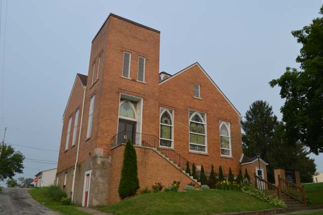
Photo: Nyttend, public domain · Wikimedia Commons
Local history sources: en.wikipedia.org · ohiogenealogyexpress.com · bettyshinn.com · commons.wikimedia.org · archive.org
Historic places
1 place in Center Township, Guernsey County on the National Register of Historic Places. Press a pin or a name for its whole record.
-
National RoadStructure · Cambridge · listed 1985
- Address
- Center Township Rd. 650
- Where
- Cambridge, Guernsey County · ZIP 43725
- What it is
- Structure
- Listed on the National Register
- 1985
- NRIS reference number
- 85001842
- Coordinates
- 40.02703, -81.50237
National Register file (NPS) ↗ Search Wikipedia ↗ Street map and directions ↗ On the Cracked Buckeye map
Source: National Park Service, National Register of Historic Places point file. The listing year is shown where NPS's certification date agrees with the listing's reference number. Listing recognizes significance; it does not restrict a private owner.
Water
Mostly private wells The water here
- Cambridge, City Of89% of residentsWills Creek via Cambridge Reservoir + Wills Creek direct intake
- Byesville4% of residentslocal wells (mine-pool/groundwater under influence of surface water)
- Western Guernsey Regional Water District4% of residentsWills Creek via Cambridge Reservoir + Wills Creek direct intake
- Guernsey Co. Water Dept.3% of residentsWills Creek via Cambridge Reservoir + Wills Creek direct intake
Hospitals, fire stations and more
Inside Center Township, Guernsey County's boundary: 33 shale and injection wells and 6 spill cases. Press a pin or a name for its whole record and its source.
Shale and injection wells (33)
-
Bo (Swiw #20) 1 InjectionInjection well (Class II)
- What it is
- Injection well (Class II)
- Operator
- Select Water Solutions, Llc
- County
- Guernsey County
- API well number
- 34059244730000
- Coordinates
- 40.02795, -81.50982
ODNR oil and gas wells (source) ↗ Street map and directions ↗
-
Clearwater 111 (Swiw #15) 1 InjectionInjection well (Class II)
- What it is
- Injection well (Class II)
- Operator
- Select Water Solutions, Llc
- County
- Guernsey County
- API well number
- 34059239860000
- Coordinates
- 40.02737, -81.51101
ODNR oil and gas wells (source) ↗ Street map and directions ↗
-
Frame 1HuUtica shale well
- What it is
- Utica shale well
- Drilled sideways
- Yes
- Operator
- Inr Ohio Llc
- County
- Guernsey County
- API well number
- 34059246680000
- Coordinates
- 39.99230, -81.46692
ODNR oil and gas wells (source) ↗ Street map and directions ↗
The point is the surface well head (the pad); a horizontal well runs a mile or more underground from it.
-
Frame 2HuUtica shale well
- What it is
- Utica shale well
- Drilled sideways
- Yes
- Operator
- Inr Ohio Llc
- County
- Guernsey County
- API well number
- 34059247330000
- Coordinates
- 39.99231, -81.46687
ODNR oil and gas wells (source) ↗ Street map and directions ↗
The point is the surface well head (the pad); a horizontal well runs a mile or more underground from it.
-
Landman Gy Cen 10HUtica shale well
- What it is
- Utica shale well
- Drilled sideways
- Yes
- Operator
- Eog Ohio, Llc
- County
- Guernsey County
- API well number
- 34059246810000
- Coordinates
- 40.06966, -81.45971
ODNR oil and gas wells (source) ↗ Street map and directions ↗
The point is the surface well head (the pad); a horizontal well runs a mile or more underground from it.
-
Landman Gy Cen 206HUtica shale well
- What it is
- Utica shale well
- Drilled sideways
- Yes
- Operator
- Eog Ohio, Llc
- County
- Guernsey County
- API well number
- 34059246820000
- Coordinates
- 40.06951, -81.45980
ODNR oil and gas wells (source) ↗ Street map and directions ↗
The point is the surface well head (the pad); a horizontal well runs a mile or more underground from it.
-
Landman Gy Cen 210Utica shale well
- What it is
- Utica shale well
- Drilled sideways
- Yes
- Operator
- Eog Ohio, Llc
- County
- Guernsey County
- API well number
- 34059246830000
- Coordinates
- 40.06971, -81.45968
ODNR oil and gas wells (source) ↗ Street map and directions ↗
The point is the surface well head (the pad); a horizontal well runs a mile or more underground from it.
-
Landman Gy Cen 310HUtica shale well
- What it is
- Utica shale well
- Drilled sideways
- Yes
- Operator
- Eog Ohio, Llc
- County
- Guernsey County
- API well number
- 34059247380000
- Coordinates
- 40.06976, -81.45974
ODNR oil and gas wells (source) ↗ Street map and directions ↗
The point is the surface well head (the pad); a horizontal well runs a mile or more underground from it.
-
Landman Gy Cen 410HUtica shale well
- What it is
- Utica shale well
- Drilled sideways
- Yes
- Operator
- Eog Ohio, Llc
- County
- Guernsey County
- API well number
- 34059247390000
- Coordinates
- 40.06971, -81.45977
ODNR oil and gas wells (source) ↗ Street map and directions ↗
The point is the surface well head (the pad); a horizontal well runs a mile or more underground from it.
-
Landman Gy Cen 510HUtica shale well
- What it is
- Utica shale well
- Drilled sideways
- Yes
- Operator
- Eog Ohio, Llc
- County
- Guernsey County
- API well number
- 34059247400000
- Coordinates
- 40.06966, -81.45980
ODNR oil and gas wells (source) ↗ Street map and directions ↗
The point is the surface well head (the pad); a horizontal well runs a mile or more underground from it.
-
Landman Gy Cen 6HUtica shale well
- What it is
- Utica shale well
- Drilled sideways
- Yes
- Operator
- Eog Ohio, Llc
- County
- Guernsey County
- API well number
- 34059246790000
- Coordinates
- 40.06956, -81.45977
ODNR oil and gas wells (source) ↗ Street map and directions ↗
The point is the surface well head (the pad); a horizontal well runs a mile or more underground from it.
-
Landman Gy Cen 8HUtica shale well
- What it is
- Utica shale well
- Drilled sideways
- Yes
- Operator
- Eog Ohio, Llc
- County
- Guernsey County
- API well number
- 34059246800000
- Coordinates
- 40.06961, -81.45974
ODNR oil and gas wells (source) ↗ Street map and directions ↗
The point is the surface well head (the pad); a horizontal well runs a mile or more underground from it.
-
Shugert Gy Cen 1HUtica shale well
- What it is
- Utica shale well
- Drilled sideways
- Yes
- Operator
- Eog Ohio, Llc
- County
- Guernsey County
- API well number
- 34059246510000
- Coordinates
- 40.04633, -81.50815
ODNR oil and gas wells (source) ↗ Street map and directions ↗
The point is the surface well head (the pad); a horizontal well runs a mile or more underground from it.
-
Shugert Gy Cen 205HUtica shale well
- What it is
- Utica shale well
- Drilled sideways
- Yes
- Operator
- Eog Ohio, Llc
- County
- Guernsey County
- API well number
- 34059246540000
- Coordinates
- 40.04648, -81.50825
ODNR oil and gas wells (source) ↗ Street map and directions ↗
The point is the surface well head (the pad); a horizontal well runs a mile or more underground from it.
-
Shugert Gy Cen 3HUtica shale well
- What it is
- Utica shale well
- Drilled sideways
- Yes
- Operator
- Eog Ohio, Llc
- County
- Guernsey County
- API well number
- 34059246520000
- Coordinates
- 40.04638, -81.50818
ODNR oil and gas wells (source) ↗ Street map and directions ↗
The point is the surface well head (the pad); a horizontal well runs a mile or more underground from it.
-
Shugert Gy Cen 505HUtica shale well
- What it is
- Utica shale well
- Drilled sideways
- Yes
- Operator
- Eog Ohio, Llc
- County
- Guernsey County
- API well number
- 34059247110000
- Coordinates
- 40.04651, -81.50817
ODNR oil and gas wells (source) ↗ Street map and directions ↗
The point is the surface well head (the pad); a horizontal well runs a mile or more underground from it.
-
Shugert Gy Cen 5HUtica shale well
- What it is
- Utica shale well
- Drilled sideways
- Yes
- Operator
- Eog Ohio, Llc
- County
- Guernsey County
- API well number
- 34059246530000
- Coordinates
- 40.04643, -81.50821
ODNR oil and gas wells (source) ↗ Street map and directions ↗
The point is the surface well head (the pad); a horizontal well runs a mile or more underground from it.
-
Sparkman Gy Cen 1HUtica shale well
- What it is
- Utica shale well
- Drilled sideways
- Yes
- Operator
- Eog Ohio, Llc
- County
- Guernsey County
- API well number
- 34059246410000
- Coordinates
- 40.01190, -81.46971
ODNR oil and gas wells (source) ↗ Street map and directions ↗
The point is the surface well head (the pad); a horizontal well runs a mile or more underground from it.
-
Sparkman Gy Cen 205HUtica shale well
- What it is
- Utica shale well
- Drilled sideways
- Yes
- Operator
- Eog Ohio, Llc
- County
- Guernsey County
- API well number
- 34059246430000
- Coordinates
- 40.01189, -81.46950
ODNR oil and gas wells (source) ↗ Street map and directions ↗
The point is the surface well head (the pad); a horizontal well runs a mile or more underground from it.
-
Sparkman Gy Cen 3HUtica shale well
- What it is
- Utica shale well
- Drilled sideways
- Yes
- Operator
- Eog Ohio, Llc
- County
- Guernsey County
- API well number
- 34059246400000
- Coordinates
- 40.01190, -81.46964
ODNR oil and gas wells (source) ↗ Street map and directions ↗
The point is the surface well head (the pad); a horizontal well runs a mile or more underground from it.
-
Sparkman Gy Cen 5HUtica shale well
- What it is
- Utica shale well
- Drilled sideways
- Yes
- Operator
- Eog Ohio, Llc
- County
- Guernsey County
- API well number
- 34059246420000
- Coordinates
- 40.01189, -81.46957
ODNR oil and gas wells (source) ↗ Street map and directions ↗
The point is the surface well head (the pad); a horizontal well runs a mile or more underground from it.
-
Striped Bass Gy Cen 10HUtica shale well
- What it is
- Utica shale well
- Drilled sideways
- Yes
- Operator
- Eog Ohio, Llc
- County
- Guernsey County
- API well number
- 34059246710000
- Coordinates
- 40.04546, -81.52070
ODNR oil and gas wells (source) ↗ Street map and directions ↗
The point is the surface well head (the pad); a horizontal well runs a mile or more underground from it.
-
Striped Bass Gy Cen 210HUtica shale well
- What it is
- Utica shale well
- Drilled sideways
- Yes
- Operator
- Eog Ohio, Llc
- County
- Guernsey County
- API well number
- 34059246720000
- Coordinates
- 40.04548, -81.52063
ODNR oil and gas wells (source) ↗ Street map and directions ↗
The point is the surface well head (the pad); a horizontal well runs a mile or more underground from it.
-
Striped Bass Gy Cen 6HUtica shale well
- What it is
- Utica shale well
- Drilled sideways
- Yes
- Operator
- Eog Ohio, Llc
- County
- Guernsey County
- API well number
- 34059246690000
- Coordinates
- 40.04542, -81.52083
ODNR oil and gas wells (source) ↗ Street map and directions ↗
The point is the surface well head (the pad); a horizontal well runs a mile or more underground from it.
-
Striped Bass Gy Cen 8HUtica shale well
- What it is
- Utica shale well
- Drilled sideways
- Yes
- Operator
- Eog Ohio, Llc
- County
- Guernsey County
- API well number
- 34059246700000
- Coordinates
- 40.04544, -81.52076
ODNR oil and gas wells (source) ↗ Street map and directions ↗
The point is the surface well head (the pad); a horizontal well runs a mile or more underground from it.
-
Sunfish Gy Cen 10HUtica shale well
- What it is
- Utica shale well
- Drilled sideways
- Yes
- Operator
- Eog Ohio, Llc
- County
- Guernsey County
- API well number
- 34059247420000
- Coordinates
- 40.02863, -81.52664
ODNR oil and gas wells (source) ↗ Street map and directions ↗
The point is the surface well head (the pad); a horizontal well runs a mile or more underground from it.
-
Sunfish Gy Cen 210HUtica shale well
- What it is
- Utica shale well
- Drilled sideways
- Yes
- Operator
- Eog Ohio, Llc
- County
- Guernsey County
- API well number
- 34059247430000
- Coordinates
- 40.02868, -81.52661
ODNR oil and gas wells (source) ↗ Street map and directions ↗
The point is the surface well head (the pad); a horizontal well runs a mile or more underground from it.
-
Sunfish Gy Cen 8HUtica shale well
- What it is
- Utica shale well
- Drilled sideways
- Yes
- Operator
- Eog Ohio, Llc
- County
- Guernsey County
- API well number
- 34059247410000
- Coordinates
- 40.02858, -81.52668
ODNR oil and gas wells (source) ↗ Street map and directions ↗
The point is the surface well head (the pad); a horizontal well runs a mile or more underground from it.
-
The Chumney Family Trust 1HUtica shale well
- What it is
- Utica shale well
- Drilled sideways
- Yes
- Operator
- Geopetro Llc
- County
- Guernsey County
- API well number
- 34059242190100
- Coordinates
- 40.01190, -81.46494
ODNR oil and gas wells (source) ↗ Street map and directions ↗
The point is the surface well head (the pad); a horizontal well runs a mile or more underground from it.
-
Wagner Gy Cen 10HUtica shale well
- What it is
- Utica shale well
- Drilled sideways
- Yes
- Operator
- Eog Ohio, Llc
- County
- Guernsey County
- API well number
- 34059246770000
- Coordinates
- 40.05944, -81.48632
ODNR oil and gas wells (source) ↗ Street map and directions ↗
The point is the surface well head (the pad); a horizontal well runs a mile or more underground from it.
-
Wagner Gy Cen 210HUtica shale well
- What it is
- Utica shale well
- Drilled sideways
- Yes
- Operator
- Eog Ohio, Llc
- County
- Guernsey County
- API well number
- 34059246780000
- Coordinates
- 40.05944, -81.48624
ODNR oil and gas wells (source) ↗ Street map and directions ↗
The point is the surface well head (the pad); a horizontal well runs a mile or more underground from it.
-
Wagner Gy Cen 6HUtica shale well
- What it is
- Utica shale well
- Drilled sideways
- Yes
- Operator
- Eog Ohio, Llc
- County
- Guernsey County
- API well number
- 34059246750000
- Coordinates
- 40.05944, -81.48646
ODNR oil and gas wells (source) ↗ Street map and directions ↗
The point is the surface well head (the pad); a horizontal well runs a mile or more underground from it.
-
Wagner Gy Cen 8HUtica shale well
- What it is
- Utica shale well
- Drilled sideways
- Yes
- Operator
- Eog Ohio, Llc
- County
- Guernsey County
- API well number
- 34059246760000
- Coordinates
- 40.05944, -81.48639
ODNR oil and gas wells (source) ↗ Street map and directions ↗
The point is the surface well head (the pad); a horizontal well runs a mile or more underground from it.
Source: ODNR Division of Oil and Gas Resources well inventory (September 2026): drilled Utica, Marcellus and horizontal wells and Class II injection wells not plugged. Older vertical wells are on the full map.
Spills reported since 2021 (6)
-
Other / All Other / Trade Name / Mixture / Solution Etc Reached water2025-04-07 · Null
- Reported
- 2025-04-07
- What spilled
- Other / All Other / Trade Name / Mixture / Solution Etc
- Reached a waterway
- 99 - Unnamed
- Where
- Null, Guernsey County
- Ohio EPA district office
- SEDO
- Ohio EPA case number
- 2504EPA0000521
Ohio EPA spill reports (source) ↗ Street map and directions ↗
-
Other / All Other / Trade Name / Mixture / Solution Etc2024-08-12 · Center Twp
- Reported
- 2024-08-12
- What spilled
- Other / All Other / Trade Name / Mixture / Solution Etc
- Where
- Center Twp, Guernsey County
- Ohio EPA district office
- SEDO
- Ohio EPA case number
- 2408EPA0001397
Ohio EPA spill reports (source) ↗ Street map and directions ↗
-
Oil Petroleum Not Otherwise Specified (Nos)2024-03-08 · Center Twp
- Reported
- 2024-03-08
- What spilled
- Oil Petroleum Not Otherwise Specified (Nos)
- Where
- Center Twp, Guernsey County
- Ohio EPA district office
- SEDO
- Ohio EPA case number
- 2403EPA0000371
Ohio EPA spill reports (source) ↗ Street map and directions ↗
-
Fuel Diesel / Diesel Fuel (Vehicle On Or Off Road)2024-01-02 · Center Twp
- Reported
- 2024-01-02
- What spilled
- Fuel Diesel / Diesel Fuel (Vehicle On Or Off Road)
- Where
- Center Twp, Guernsey County
- Ohio EPA district office
- SEDO
- Ohio EPA case number
- 2401EPA0000002
Ohio EPA spill reports (source) ↗ Street map and directions ↗
-
Material Unknown2021-04-09 · Center Twp
- Reported
- 2021-04-09
- What spilled
- Material Unknown
- Where
- Center Twp, Guernsey County
- Ohio EPA district office
- SEDO
- Ohio EPA case number
- 2104EPA0000495
Ohio EPA spill reports (source) ↗ Street map and directions ↗
-
Antifreeze Vehicle Cooling Reached water2026-09-03 · Center Twp
- Reported
- 2026-09-03
- What spilled
- Antifreeze Vehicle Cooling; Oil Motor / Lube Oil / Vehicle
- Reached a waterway
- 30 - Leatherwood Creek
- Where
- Center Twp, Guernsey County
- Ohio EPA district office
- SEDO
- Ohio EPA case number
- 2609EPA0001647
Ohio EPA spill reports (source) ↗ Street map and directions ↗
Source: Ohio EPA emergency response spill reports, 2021 to September 2026, one point per case where Ohio EPA placed it. A report is what the caller or responder recorded; amounts are often blank or estimated.
Its ZIP codes
Each ZIP code that touches Center Township, Guernsey County, with the share of its residents who live here and the same headline figures as the ZIP page.
| ZIP | Share | Water | Radon | Home value | Schools | Flood |
|---|---|---|---|---|---|---|
| 43750 Center Township and Kipling | 100% | Mostly private wells | Too few radon tests | Appraisal records without year built | Rolling Hills Local · 3.5 stars overall | 9.0% of residents in the 1% floodplain |
| 43755 Madison Township and Lore City | 16% | Mostly private wells | 16.4 pCi/L average radon | Appraisal records without year built | East Guernsey Local · 3.5 stars overall | 8.1% of residents in the 1% floodplain |
| 43725 Cambridge | 6% | Wills Creek, impounded in the Cambridge (Wills Creek) Reservoir northwest of the city, with a supplemental direct Wills Creek intake | 6.7 pCi/L average radon | Appraisal records without year built | Cambridge City · 2.5 stars overall | 7.1% of residents in the 1% floodplain |
| 43780 Richland Township and Senecaville | 2% | Mostly private wells | 3.2 pCi/L average radon | Appraisal records without year built | Rolling Hills Local · 3.5 stars overall | 9.6% of residents in the 1% floodplain |
Local government
Who holds office in Center Township, Guernsey County, how its elections and ballot issues came out, and the state auditor's record.
Money issues on the ballot since 2022: 2 of 2 passed.
Ballot issues
| Date | Issue | For | Against | Result |
|---|---|---|---|---|
| 2022-11-08 | Issue: Center Township Fire | 498 | 136 | Passed (78.55% for) |
| 2022-11-08 | Issue: Center Township Roads | 473 | 159 | Passed (74.84% for) |
Elections for office
| Date | Office | Candidates and votes |
|---|---|---|
| 2025-11-04 | Trustee | Jeffery Bridgeman 174, 33.46%; Doug Dodd 177, 34.04%; Rick Nealey 169, 32.5% |
| 2024-03-19 | B Central Comm Rep | Ralph M. Ray 103, 100.0% |
| 2024-03-19 | A Central Comm Rep | Colleen Wheatley 116, 100.0% |
| 2024-03-19 | A Central Comm Dem | Andrew J. Warhola, Jr. 19, 100.0% |
| 2023-11-07 | Trustee | Jeffery Bridgeman 257, 45.25%; Scott E. Buxton 311, 54.75% |
| 2023-11-07 | Fiscal Officer | Kathy J. Doutt 484, 100.0% |
| 2020-03-17 | B Central Committee Member (REP) | No Candidate Filed 0 |
| 2020-03-17 | B Central Committee Member (DEM) | No Candidate Filed 0 |
| 2020-03-17 | A Central Committee Member (REP) | No Candidate Filed 0 |
| 2020-03-17 | A Central Committee Member (DEM) | Andrew J. Warhola, Jr. 22, 100.0% |
| 2017-11-07 | Twp Including Lore City Fire Protection | FOR 371, 83.37%; AGAINST 74, 16.63% |
| 2017-11-07 | Excluding Lore City Road Maintenance Renewal | FOR 336, 77.42%; AGAINST 98, 22.58% |
| 2016-03-15 | B Central Committee Member (REP) | No Valid Petition Filed 0 |
| 2016-03-15 | B Central Committee Member (DEM) | No Valid Petition Filed 0 |
| 2016-03-15 | A Central Committee Member (REP) | Kenneth Larrick 153, 100.0% |
| 2016-03-15 | A Central Committee Member (DEM) | No Valid Petition Filed 0 |
Winners in bold. Results from the county board of elections' official canvass unless marked.
The county
Guernsey County: 14 ZIP codes, 32 cities, villages and townships, 39,085 people.
Nearby places
Quick answers
What county is Center Township, Ohio in?
Center Township, Guernsey County is a township in Guernsey County, Ohio, with 1,656 residents.
When was Center Township, Ohio founded?
Center Township, Guernsey County was settled 1808 (Stout Patterson Sr.); Thompson family 1819-1820; incorporated organized as a township, 1822. Founders on record: township organized by county commissioners; no single founder. Source
How did Center Township, Ohio get its name?
Center Township was named for its location near the geographical center of Guernsey County. Source
What ZIP code is Center Township, Ohio?
Center Township, Guernsey County is served by ZIP codes 43750, 43755 and 43725; 43750 holds the largest share of its residents.
Where does Center Township, Ohio get its water?
The main water source for Center Township, Guernsey County (Cambridge, City Of): Mostly private wells.
Cite this page
Cite this page as:
Cracked Buckeye, "Center Township, Guernsey County", https://crackedbuckeye.com/place/center-township-guernsey-county/, built 2026-10-31, accessed [date].
How to cite · Report a correction · Built 2026-10-31
