Local events in Londonderry Township, Guernsey County
Nothing is posted for Londonderry Township itself yet; here is what is on within 20 miles. All local events in Londonderry Township, Guernsey County
Know a calendar we should watch? Send the link
Checked October 20; the events page is refreshed daily.
How Londonderry Township, Guernsey County began
Londonderry Township, the extreme northeastern township of Guernsey County, was ordered formed on June 3, 1816, from parts of Madison and Oxford townships. Its settlement began in 1802 on the road Edward Carpenter had cut in 1801 from Stillwater toward Cambridge, and Robert Wilkin, who came from the north of Ireland in 1807, laid out the village of Londonderry in 1815 and named it, with the settlers who followed him, for the Irish city. A Friends meeting was organized near Smyrna in 1819 and an Irish schoolmaster opened the first school about the same time. The township stayed a farming and grazing district of 36 sections; the village never grew beyond a hamlet with a post office and a store.
Settled 1802 (Edward Carpenter; one account says 1807), platted August 19, 1815 (village of Londonderry, by Robert Wilkin), incorporated June 3, 1816 (ordered formed), by Formed from parts of Madison and Oxford townships.
Where the name comes from
Robert Wilkin, the original proprietor, came from the north of Ireland in 1807, and many settlers followed him from there. When the town was laid out in 1815 they called it Londonderry, in honor of, or for some supposed resemblance to, the Irish city of that name; the township organized the next year shares the name.
Before the town
The 1895 county record states that the township lies in the Seven Ranges, whose Native title it says was extinguished by the Treaty of Fort Stanwix in 1784, and that the land office at Steubenville opened the land to entry in 1801. No Native village, trail or mound within the township is named in the 1882, 1895 or 1911 county histories.
- Treaty of Fort Stanwix (treaty) — covered the Seven Ranges, which include Londonderry Township, 1784 (archive.org)
Timeline
- — Edward Carpenter, son of the builder of Carpenter's Fort above Warrenton, contracted for $300 to cut eighteen miles of the road west from Big Stillwater to within seven or eight miles of Cambridge; it passed through the site of Londonderry.
- — Edward Carpenter and his wife, Catherine DeLong, settled in the township, according to the 1882 history; the 1895 record says he moved to the site in 1807.
- — Robert Wilkin came from the north of Ireland and settled on the site of the future village.
- — George Smith came with his father, who had entered land near Smyrna, when settlers' cabins were three or four miles apart and the country was covered with dense woods.
- — Robert Wilkin platted the village of Londonderry on August 19, on section 20 in the northern part of the township; it never grew beyond a hamlet with a post office, a store and a few houses.
- — The August 1815 plat laid out fifty-six lots around a ten-rod square called the Diamond, which could no longer be seen by 1895.
- — Guernsey County commissioners ordered Londonderry Township formed from parts of Madison and Oxford townships, in June.
- — A society of Friends (Quakers) was organized a half mile south of Smyrna; its log meetinghouse burned in the winter of 1856-57, was replaced with a small frame building, and a larger church went up in 1880.
- — About 1819 or 1820 the settlers hired Robert Jamison, an Irish schoolmaster, to teach the township's first school; Carpenter paid him thirty-six dollars a quarter.
- — The township had 1,629 residents; by 1880 it had 1,320.
- — In July the Union troops pursuing Morgan's raiders rode through Antrim and Londonderry to Smyrna in rain and darkness.
Stories
Deer, bears and wolf bounties
When Edward Carpenter moved his family to the site of Londonderry, his son Edward was five years old and the land was an almost unbroken wilderness. The 1895 county record says deer, bears, wolves and turkeys were the family's main food for some years. In the fall and winter of 1812 Carpenter killed thirty-five deer, and his son George killed forty-four deer and a bear. Wolves were numerous enough that the federal government paid a four-dollar bounty on a scalp and the county two dollars, and trapping them became a business. Carpenter's quarter section was still owned by his son Edward in 1895.
A township pieced from two others
Londonderry Township was pieced together in June 1816 from parts of Madison and Oxford townships. The 1911 county history says the early settlers included Cornelius Duddall, James McCoy, Henry Dillon, Anthony Arnold, Edward Carpenter, Mathew Law and George Anderson, and that a Friends meeting was organized there in 1819. The 1895 record credits the Irish and Scotch Presbyterians who followed Robert Wilkin with shaping the community for generations. The Londonderry Methodist Church and the Londonderry Reformed Presbyterian Cemetery still mark the township's nineteenth-century religious life.
Photographs
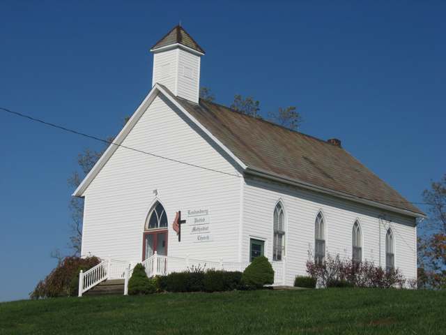
Photo: Wikimedia Commons contributor, public domain · Wikimedia Commons
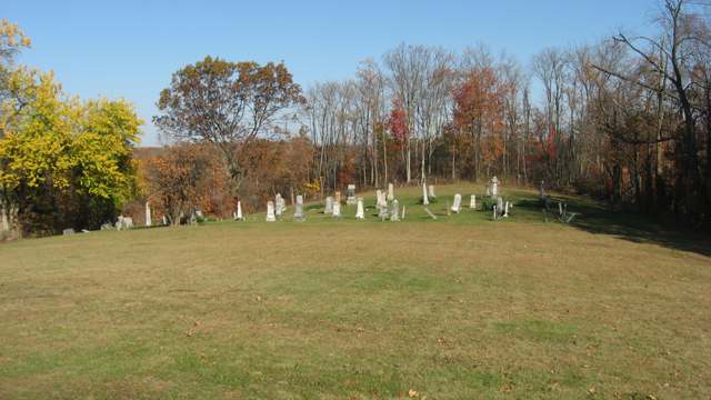
Photo: Wikimedia Commons contributor, public domain · Wikimedia Commons
Local history sources: en.wikipedia.org · archive.org · en.wikipedia.org · commons.wikimedia.org · archive.org · ohiogenealogyexpress.com · archive.org · archive.org · archive.org · ohiogenealogyexpress.com · archive.org
Water
Mostly private wells The water here
- Freeport Village61% of residentsGroundwater wells (5 wells)
- Quaker City30% of residentsBarnesville Reservoirs #1, #2 & Slope Creek Reservoir
- Flushing Village7% of residentsOhio River valley aquifer (wells)
- HCWSD-piedmont2% of residentsGroundwater wells (1 wells)
Hospitals, fire stations and more
Inside Londonderry Township, Guernsey County's boundary: 2 poor-rated bridges, 109 shale and injection wells and 8 spill cases. Press a pin or a name for its whole record and its source.
Bridges rated poor (2)
-
County Rd 967 over Skull ForkPoor · built 1974
- Condition
- Poor: a deck, superstructure, substructure or culvert rated 4 or below on the 0 to 9 scale
- What it is
- Bridge
- Built
- 1974
- Length
- 7 ft
- Owner
- County
- Vehicles a day
- 51
- Coordinates
- 40.08697, -81.27856
National Bridge Inventory (source) ↗ Street map and directions ↗
-
Township Rd 9672 over StreamPoor · built 1920
- Condition
- Poor: a deck, superstructure, substructure or culvert rated 4 or below on the 0 to 9 scale
- What it is
- Bridge
- Built
- 1920
- Length
- 8 ft
- Owner
- County
- Vehicles a day
- 97
- Coordinates
- 40.10788, -81.24732
National Bridge Inventory (source) ↗ Street map and directions ↗
Source: FHWA National Bridge Inventory 2025. "Poor" means one major part rated 4 or below on the 0 to 9 scale; it calls for repair, not closing, unless the state posts or closes the bridge.
Shale and injection wells (109)
-
Abe Troyer 10HUtica shale well
- What it is
- Utica shale well
- Drilled sideways
- Yes
- Operator
- Expand Operating Llc
- County
- Guernsey County
- API well number
- 34059244110000
- Coordinates
- 40.08480, -81.26473
ODNR oil and gas wells (source) ↗ Street map and directions ↗
The point is the surface well head (the pad); a horizontal well runs a mile or more underground from it.
-
Abe Troyer 2HUtica shale well
- What it is
- Utica shale well
- Drilled sideways
- Yes
- Operator
- Expand Operating Llc
- County
- Guernsey County
- API well number
- 34059244080000
- Coordinates
- 40.08468, -81.26496
ODNR oil and gas wells (source) ↗ Street map and directions ↗
The point is the surface well head (the pad); a horizontal well runs a mile or more underground from it.
-
Abe Troyer 4HUtica shale well
- What it is
- Utica shale well
- Drilled sideways
- Yes
- Operator
- Expand Operating Llc
- County
- Guernsey County
- API well number
- 34059244120000
- Coordinates
- 40.08471, -81.26490
ODNR oil and gas wells (source) ↗ Street map and directions ↗
The point is the surface well head (the pad); a horizontal well runs a mile or more underground from it.
-
Abe Troyer 6HUtica shale well
- What it is
- Utica shale well
- Drilled sideways
- Yes
- Operator
- Expand Operating Llc
- County
- Guernsey County
- API well number
- 34059244090000
- Coordinates
- 40.08474, -81.26484
ODNR oil and gas wells (source) ↗ Street map and directions ↗
The point is the surface well head (the pad); a horizontal well runs a mile or more underground from it.
-
Abe Troyer 8HUtica shale well
- What it is
- Utica shale well
- Drilled sideways
- Yes
- Operator
- Expand Operating Llc
- County
- Guernsey County
- API well number
- 34059244100000
- Coordinates
- 40.08477, -81.26479
ODNR oil and gas wells (source) ↗ Street map and directions ↗
The point is the surface well head (the pad); a horizontal well runs a mile or more underground from it.
-
Betts Lnd Gr 2HUtica shale well
- What it is
- Utica shale well
- Drilled sideways
- Yes
- Operator
- Ascent Resources Utica Llc
- County
- Guernsey County
- API well number
- 34059244820000
- Coordinates
- 40.11156, -81.24949
ODNR oil and gas wells (source) ↗ Street map and directions ↗
The point is the surface well head (the pad); a horizontal well runs a mile or more underground from it.
-
Betts Lnd Gr 4HUtica shale well
- What it is
- Utica shale well
- Drilled sideways
- Yes
- Operator
- Ascent Resources Utica Llc
- County
- Guernsey County
- API well number
- 34059244830000
- Coordinates
- 40.11152, -81.26022
ODNR oil and gas wells (source) ↗ Street map and directions ↗
The point is the surface well head (the pad); a horizontal well runs a mile or more underground from it.
-
Betts Lnd Gr 6HUtica shale well
- What it is
- Utica shale well
- Drilled sideways
- Yes
- Operator
- Ascent Resources Utica Llc
- County
- Guernsey County
- API well number
- 34059244840000
- Coordinates
- 40.11147, -81.26019
ODNR oil and gas wells (source) ↗ Street map and directions ↗
The point is the surface well head (the pad); a horizontal well runs a mile or more underground from it.
-
Betts N Lnd Gr 5HUtica shale well
- What it is
- Utica shale well
- Drilled sideways
- Yes
- Operator
- Ascent Resources Utica Llc
- County
- Guernsey County
- API well number
- 34059245800000
- Coordinates
- 40.11131, -81.26007
ODNR oil and gas wells (source) ↗ Street map and directions ↗
The point is the surface well head (the pad); a horizontal well runs a mile or more underground from it.
-
Betts Ne Lnd Gr 7HUtica shale well
- What it is
- Utica shale well
- Drilled sideways
- Yes
- Operator
- Ascent Resources Utica Llc
- County
- Guernsey County
- API well number
- 34059245790000
- Coordinates
- 40.11127, -81.26003
ODNR oil and gas wells (source) ↗ Street map and directions ↗
The point is the surface well head (the pad); a horizontal well runs a mile or more underground from it.
-
Betts Nw Lnd Gr 1HUtica shale well
- What it is
- Utica shale well
- Drilled sideways
- Yes
- Operator
- Ascent Resources Utica Llc
- County
- Guernsey County
- API well number
- 34059245780000
- Coordinates
- 40.11141, -81.26014
ODNR oil and gas wells (source) ↗ Street map and directions ↗
The point is the surface well head (the pad); a horizontal well runs a mile or more underground from it.
-
Betts Nw Lnd Gr 3HUtica shale well
- What it is
- Utica shale well
- Drilled sideways
- Yes
- Operator
- Ascent Resources Utica Llc
- County
- Guernsey County
- API well number
- 34059245810000
- Coordinates
- 40.11136, -81.26010
ODNR oil and gas wells (source) ↗ Street map and directions ↗
The point is the surface well head (the pad); a horizontal well runs a mile or more underground from it.
-
Bilinovich E Lnd Gr 6HUtica shale well
- What it is
- Utica shale well
- Drilled sideways
- Yes
- Operator
- Ascent Resources Utica Llc
- County
- Guernsey County
- API well number
- 34059245660000
- Coordinates
- 40.08746, -81.30262
ODNR oil and gas wells (source) ↗ Street map and directions ↗
The point is the surface well head (the pad); a horizontal well runs a mile or more underground from it.
-
Bilinovich E Lnd Gr 8HUtica shale well
- What it is
- Utica shale well
- Drilled sideways
- Yes
- Operator
- Ascent Resources Utica Llc
- County
- Guernsey County
- API well number
- 34059245690000
- Coordinates
- 40.08747, -81.30255
ODNR oil and gas wells (source) ↗ Street map and directions ↗
The point is the surface well head (the pad); a horizontal well runs a mile or more underground from it.
-
Bilinovich W Lnd Gr 2HUtica shale well
- What it is
- Utica shale well
- Drilled sideways
- Yes
- Operator
- Ascent Resources Utica Llc
- County
- Guernsey County
- API well number
- 34059245670000
- Coordinates
- 40.08744, -81.30276
ODNR oil and gas wells (source) ↗ Street map and directions ↗
The point is the surface well head (the pad); a horizontal well runs a mile or more underground from it.
-
Bilinovich W Lnd Gr 4HUtica shale well
- What it is
- Utica shale well
- Drilled sideways
- Yes
- Operator
- Ascent Resources Utica Llc
- County
- Guernsey County
- API well number
- 34059245680000
- Coordinates
- 40.08745, -81.30269
ODNR oil and gas wells (source) ↗ Street map and directions ↗
The point is the surface well head (the pad); a horizontal well runs a mile or more underground from it.
-
Black Racer S Lnd Gr 2HHorizontal shale well
- What it is
- Horizontal shale well
- Drilled sideways
- Yes
- Operator
- Ascent Resources Utica Llc
- County
- Guernsey County
- API well number
- 34059246120000
- Coordinates
- 40.09419, -81.28438
ODNR oil and gas wells (source) ↗ Street map and directions ↗
The point is the surface well head (the pad); a horizontal well runs a mile or more underground from it.
-
Black Racer S Lnd Gr 4HHorizontal shale well
- What it is
- Horizontal shale well
- Drilled sideways
- Yes
- Operator
- Ascent Resources Utica Llc
- County
- Guernsey County
- API well number
- 34059246130000
- Coordinates
- 40.09417, -81.28431
ODNR oil and gas wells (source) ↗ Street map and directions ↗
The point is the surface well head (the pad); a horizontal well runs a mile or more underground from it.
-
Black Racer W Lnd Gr 1HUtica shale well
- What it is
- Utica shale well
- Drilled sideways
- Yes
- Operator
- Ascent Resources Utica Llc
- County
- Guernsey County
- API well number
- 34059245280000
- Coordinates
- 40.09423, -81.28453
ODNR oil and gas wells (source) ↗ Street map and directions ↗
The point is the surface well head (the pad); a horizontal well runs a mile or more underground from it.
-
Black Racer W Lnd Gr 3HUtica shale well
- What it is
- Utica shale well
- Drilled sideways
- Yes
- Operator
- Ascent Resources Utica Llc
- County
- Guernsey County
- API well number
- 34059245290000
- Coordinates
- 40.09421, -81.28446
ODNR oil and gas wells (source) ↗ Street map and directions ↗
The point is the surface well head (the pad); a horizontal well runs a mile or more underground from it.
-
Black Racer W Lnd Gr 9HUtica shale well
- What it is
- Utica shale well
- Drilled sideways
- Yes
- Operator
- Ascent Resources Utica Llc
- County
- Guernsey County
- API well number
- 34059245110000
- Coordinates
- 40.09339, -81.29204
ODNR oil and gas wells (source) ↗ Street map and directions ↗
The point is the surface well head (the pad); a horizontal well runs a mile or more underground from it.
-
Caston Land Gr 6HUtica shale well
- What it is
- Utica shale well
- Drilled sideways
- Yes
- Operator
- Ascent Resources Utica Llc
- County
- Guernsey County
- API well number
- 34059244060000
- Coordinates
- 40.13427, -81.32754
ODNR oil and gas wells (source) ↗ Street map and directions ↗
The point is the surface well head (the pad); a horizontal well runs a mile or more underground from it.
-
Caston Lnd Gr 2HUtica shale well
- What it is
- Utica shale well
- Drilled sideways
- Yes
- Operator
- Ascent Resources Utica Llc
- County
- Guernsey County
- API well number
- 34059243770000
- Coordinates
- 40.13430, -81.32768
ODNR oil and gas wells (source) ↗ Street map and directions ↗
The point is the surface well head (the pad); a horizontal well runs a mile or more underground from it.
-
Caston Lnd Gr 4HUtica shale well
- What it is
- Utica shale well
- Drilled sideways
- Yes
- Operator
- Ascent Resources Utica Llc
- County
- Guernsey County
- API well number
- 34059244070000
- Coordinates
- 40.13429, -81.32761
ODNR oil and gas wells (source) ↗ Street map and directions ↗
The point is the surface well head (the pad); a horizontal well runs a mile or more underground from it.
-
Caston Lnd Gr 8HUtica shale well
- What it is
- Utica shale well
- Drilled sideways
- Yes
- Operator
- Ascent Resources Utica Llc
- County
- Guernsey County
- API well number
- 34059244050000
- Coordinates
- 40.13425, -81.32747
ODNR oil and gas wells (source) ↗ Street map and directions ↗
The point is the surface well head (the pad); a horizontal well runs a mile or more underground from it.
-
Caston Ne Lnd Gr 5HUtica shale well
- What it is
- Utica shale well
- Drilled sideways
- Yes
- Operator
- Ascent Resources Utica Llc
- County
- Guernsey County
- API well number
- 34059246340000
- Coordinates
- 40.13430, -81.32738
ODNR oil and gas wells (source) ↗ Street map and directions ↗
The point is the surface well head (the pad); a horizontal well runs a mile or more underground from it.
-
Caston Ne Lnd Gr 7HUtica shale well
- What it is
- Utica shale well
- Drilled sideways
- Yes
- Operator
- Ascent Resources Utica Llc
- County
- Guernsey County
- API well number
- 34059246330000
- Coordinates
- 40.13428, -81.32731
ODNR oil and gas wells (source) ↗ Street map and directions ↗
The point is the surface well head (the pad); a horizontal well runs a mile or more underground from it.
-
Caston Nw Lnd Gr 1HUtica shale well
- What it is
- Utica shale well
- Drilled sideways
- Yes
- Operator
- Ascent Resources Utica Llc
- County
- Guernsey County
- API well number
- 34059246280000
- Coordinates
- 40.13434, -81.32751
ODNR oil and gas wells (source) ↗ Street map and directions ↗
The point is the surface well head (the pad); a horizontal well runs a mile or more underground from it.
-
Caston Nw Lnd Gr 3HUtica shale well
- What it is
- Utica shale well
- Drilled sideways
- Yes
- Operator
- Ascent Resources Utica Llc
- County
- Guernsey County
- API well number
- 34059246290000
- Coordinates
- 40.13432, -81.32744
ODNR oil and gas wells (source) ↗ Street map and directions ↗
The point is the surface well head (the pad); a horizontal well runs a mile or more underground from it.
-
Donna E Lnd Gr 10HUtica shale well
- What it is
- Utica shale well
- Drilled sideways
- Yes
- Operator
- Ascent Resources Utica Llc
- County
- Guernsey County
- API well number
- 34059244310000
- Coordinates
- 40.12463, -81.25267
ODNR oil and gas wells (source) ↗ Street map and directions ↗
The point is the surface well head (the pad); a horizontal well runs a mile or more underground from it.
-
Donna E Lnd Gr 8HUtica shale well
- What it is
- Utica shale well
- Drilled sideways
- Yes
- Operator
- Ascent Resources Utica Llc
- County
- Guernsey County
- API well number
- 34059244320000
- Coordinates
- 40.12465, -81.25276
ODNR oil and gas wells (source) ↗ Street map and directions ↗
The point is the surface well head (the pad); a horizontal well runs a mile or more underground from it.
-
Donna N Lnd Gr 5HUtica shale well
- What it is
- Utica shale well
- Drilled sideways
- Yes
- Operator
- Ascent Resources Utica Llc
- County
- Guernsey County
- API well number
- 34059246370000
- Coordinates
- 40.12446, -81.25294
ODNR oil and gas wells (source) ↗ Street map and directions ↗
The point is the surface well head (the pad); a horizontal well runs a mile or more underground from it.
-
Donna N Lnd Gr 7HUtica shale well
- What it is
- Utica shale well
- Drilled sideways
- Yes
- Operator
- Ascent Resources Utica Llc
- County
- Guernsey County
- API well number
- 34059246380000
- Coordinates
- 40.12450, -81.25290
ODNR oil and gas wells (source) ↗ Street map and directions ↗
The point is the surface well head (the pad); a horizontal well runs a mile or more underground from it.
-
Donna Ne Lnd Gr 9HUtica shale well
- What it is
- Utica shale well
- Drilled sideways
- Yes
- Operator
- Ascent Resources Utica Llc
- County
- Guernsey County
- API well number
- 34059246390000
- Coordinates
- 40.12455, -81.25285
ODNR oil and gas wells (source) ↗ Street map and directions ↗
The point is the surface well head (the pad); a horizontal well runs a mile or more underground from it.
-
Donna Nw Lnd Gr 1HUtica shale well
- What it is
- Utica shale well
- Drilled sideways
- Yes
- Operator
- Ascent Resources Utica Llc
- County
- Guernsey County
- API well number
- 34059246350000
- Coordinates
- 40.12437, -81.25302
ODNR oil and gas wells (source) ↗ Street map and directions ↗
The point is the surface well head (the pad); a horizontal well runs a mile or more underground from it.
-
Donna Nw Lnd Gr 3HUtica shale well
- What it is
- Utica shale well
- Drilled sideways
- Yes
- Operator
- Ascent Resources Utica Llc
- County
- Guernsey County
- API well number
- 34059246360000
- Coordinates
- 40.12441, -81.25298
ODNR oil and gas wells (source) ↗ Street map and directions ↗
The point is the surface well head (the pad); a horizontal well runs a mile or more underground from it.
-
Donna W Lnd Gr 2HUtica shale well
- What it is
- Utica shale well
- Drilled sideways
- Yes
- Operator
- Ascent Resources Utica Llc
- County
- Guernsey County
- API well number
- 34059244280000
- Coordinates
- 40.12460, -81.25280
ODNR oil and gas wells (source) ↗ Street map and directions ↗
The point is the surface well head (the pad); a horizontal well runs a mile or more underground from it.
-
Donna W Lnd Gr 4HUtica shale well
- What it is
- Utica shale well
- Drilled sideways
- Yes
- Operator
- Ascent Resources Utica Llc
- County
- Guernsey County
- API well number
- 34059244290000
- Coordinates
- 40.12454, -81.25275
ODNR oil and gas wells (source) ↗ Street map and directions ↗
The point is the surface well head (the pad); a horizontal well runs a mile or more underground from it.
-
Donna W Lnd Gr 6HUtica shale well
- What it is
- Utica shale well
- Drilled sideways
- Yes
- Operator
- Ascent Resources Utica Llc
- County
- Guernsey County
- API well number
- 34059244330000
- Coordinates
- 40.12459, -81.25271
ODNR oil and gas wells (source) ↗ Street map and directions ↗
The point is the surface well head (the pad); a horizontal well runs a mile or more underground from it.
-
Gil Ne Lnd Gr 3HUtica shale well
- What it is
- Utica shale well
- Drilled sideways
- Yes
- Operator
- Ascent Resources Utica Llc
- County
- Guernsey County
- API well number
- 34059245080000
- Coordinates
- 40.09339, -81.29225
ODNR oil and gas wells (source) ↗ Street map and directions ↗
The point is the surface well head (the pad); a horizontal well runs a mile or more underground from it.
-
Gil Ne Lnd Gr 5HUtica shale well
- What it is
- Utica shale well
- Drilled sideways
- Yes
- Operator
- Ascent Resources Utica Llc
- County
- Guernsey County
- API well number
- 34059245090000
- Coordinates
- 40.09339, -81.29218
ODNR oil and gas wells (source) ↗ Street map and directions ↗
The point is the surface well head (the pad); a horizontal well runs a mile or more underground from it.
-
Gil Ne Lnd Gr 7HUtica shale well
- What it is
- Utica shale well
- Drilled sideways
- Yes
- Operator
- Ascent Resources Utica Llc
- County
- Guernsey County
- API well number
- 34059245100000
- Coordinates
- 40.09339, -81.29211
ODNR oil and gas wells (source) ↗ Street map and directions ↗
The point is the surface well head (the pad); a horizontal well runs a mile or more underground from it.
-
Gil Nw Lnd Gr 1HUtica shale well
- What it is
- Utica shale well
- Drilled sideways
- Yes
- Operator
- Ascent Resources Utica Llc
- County
- Guernsey County
- API well number
- 34059245070000
- Coordinates
- 40.09339, -81.29232
ODNR oil and gas wells (source) ↗ Street map and directions ↗
The point is the surface well head (the pad); a horizontal well runs a mile or more underground from it.
-
Gilcher N Lnd Gr 1HUtica shale well
- What it is
- Utica shale well
- Drilled sideways
- Yes
- Operator
- Ascent Resources Utica Llc
- County
- Guernsey County
- API well number
- 34059245540000
- Coordinates
- 40.10114, -81.28744
ODNR oil and gas wells (source) ↗ Street map and directions ↗
The point is the surface well head (the pad); a horizontal well runs a mile or more underground from it.
-
Gilcher S Lnd Gr 2HUtica shale well
- What it is
- Utica shale well
- Drilled sideways
- Yes
- Operator
- Ascent Resources Utica Llc
- County
- Guernsey County
- API well number
- 34059245610000
- Coordinates
- 40.10114, -81.28736
ODNR oil and gas wells (source) ↗ Street map and directions ↗
The point is the surface well head (the pad); a horizontal well runs a mile or more underground from it.
-
Gilcher S Lnd Gr 4HUtica shale well
- What it is
- Utica shale well
- Drilled sideways
- Yes
- Operator
- Ascent Resources Utica Llc
- County
- Guernsey County
- API well number
- 34059245600000
- Coordinates
- 40.10114, -81.28729
ODNR oil and gas wells (source) ↗ Street map and directions ↗
The point is the surface well head (the pad); a horizontal well runs a mile or more underground from it.
-
Gilcher S Lnd Gr 6HUtica shale well
- What it is
- Utica shale well
- Drilled sideways
- Yes
- Operator
- Ascent Resources Utica Llc
- County
- Guernsey County
- API well number
- 34059245590000
- Coordinates
- 40.10114, -81.28722
ODNR oil and gas wells (source) ↗ Street map and directions ↗
The point is the surface well head (the pad); a horizontal well runs a mile or more underground from it.
-
Gingerich N Lnd Gr 1HUtica shale well · Drilling
- What it is
- Utica shale well
- Drilled sideways
- Yes
- Status (ODNR)
- Drilling
- Operator
- Ascent Resources Utica Llc
- County
- Guernsey County
- API well number
- 34059247160000
- Coordinates
- 40.08922, -81.32700
ODNR oil and gas wells (source) ↗ Street map and directions ↗
The point is the surface well head (the pad); a horizontal well runs a mile or more underground from it.
-
Gingerich N Lnd Gr 3HUtica shale well · Drilling
- What it is
- Utica shale well
- Drilled sideways
- Yes
- Status (ODNR)
- Drilling
- Operator
- Ascent Resources Utica Llc
- County
- Guernsey County
- API well number
- 34059247170000
- Coordinates
- 40.08927, -81.32700
ODNR oil and gas wells (source) ↗ Street map and directions ↗
The point is the surface well head (the pad); a horizontal well runs a mile or more underground from it.
-
Gingerich N Lnd Gr 5HUtica shale well · Drilling
- What it is
- Utica shale well
- Drilled sideways
- Yes
- Status (ODNR)
- Drilling
- Operator
- Ascent Resources Utica Llc
- County
- Guernsey County
- API well number
- 34059247180000
- Coordinates
- 40.08933, -81.32700
ODNR oil and gas wells (source) ↗ Street map and directions ↗
The point is the surface well head (the pad); a horizontal well runs a mile or more underground from it.
-
Gingerich S Lnd Gr 2HUtica shale well
- What it is
- Utica shale well
- Drilled sideways
- Yes
- Operator
- Ascent Resources Utica Llc
- County
- Guernsey County
- API well number
- 34059245370000
- Coordinates
- 40.08904, -81.32700
ODNR oil and gas wells (source) ↗ Street map and directions ↗
The point is the surface well head (the pad); a horizontal well runs a mile or more underground from it.
-
Gingerich S Lnd Gr 4HUtica shale well
- What it is
- Utica shale well
- Drilled sideways
- Yes
- Operator
- Ascent Resources Utica Llc
- County
- Guernsey County
- API well number
- 34059245380000
- Coordinates
- 40.08909, -81.32700
ODNR oil and gas wells (source) ↗ Street map and directions ↗
The point is the surface well head (the pad); a horizontal well runs a mile or more underground from it.
-
Gingerich S Lnd Gr 6HUtica shale well
- What it is
- Utica shale well
- Drilled sideways
- Yes
- Operator
- Ascent Resources Utica Llc
- County
- Guernsey County
- API well number
- 34059245390000
- Coordinates
- 40.08915, -81.32700
ODNR oil and gas wells (source) ↗ Street map and directions ↗
The point is the surface well head (the pad); a horizontal well runs a mile or more underground from it.
-
Henry Lnd Gr 2HUtica shale well
- What it is
- Utica shale well
- Drilled sideways
- Yes
- Operator
- Ascent Resources Utica Llc
- County
- Guernsey County
- API well number
- 34059245720000
- Coordinates
- 40.12771, -81.29029
ODNR oil and gas wells (source) ↗ Street map and directions ↗
The point is the surface well head (the pad); a horizontal well runs a mile or more underground from it.
-
Henry Lnd Gr 4HUtica shale well
- What it is
- Utica shale well
- Drilled sideways
- Yes
- Operator
- Ascent Resources Utica Llc
- County
- Guernsey County
- API well number
- 34059245730000
- Coordinates
- 40.12776, -81.29025
ODNR oil and gas wells (source) ↗ Street map and directions ↗
The point is the surface well head (the pad); a horizontal well runs a mile or more underground from it.
-
Henry Lnd Gr 6HUtica shale well
- What it is
- Utica shale well
- Drilled sideways
- Yes
- Operator
- Ascent Resources Utica Llc
- County
- Guernsey County
- API well number
- 34059245740000
- Coordinates
- 40.12781, -81.29021
ODNR oil and gas wells (source) ↗ Street map and directions ↗
The point is the surface well head (the pad); a horizontal well runs a mile or more underground from it.
-
Hoop Lnd Gr 1HUtica shale well
- What it is
- Utica shale well
- Drilled sideways
- Yes
- Operator
- Ascent Resources Utica Llc
- County
- Guernsey County
- API well number
- 34059244390000
- Coordinates
- 40.16938, -81.32675
ODNR oil and gas wells (source) ↗ Street map and directions ↗
The point is the surface well head (the pad); a horizontal well runs a mile or more underground from it.
-
Hoop Lnd Gr 2HUtica shale well
- What it is
- Utica shale well
- Drilled sideways
- Yes
- Operator
- Ascent Resources Utica Llc
- County
- Guernsey County
- API well number
- 34059244430000
- Coordinates
- 40.16940, -81.32670
ODNR oil and gas wells (source) ↗ Street map and directions ↗
The point is the surface well head (the pad); a horizontal well runs a mile or more underground from it.
-
Hoop Lnd Gr 3HUtica shale well
- What it is
- Utica shale well
- Drilled sideways
- Yes
- Operator
- Ascent Resources Utica Llc
- County
- Guernsey County
- API well number
- 34059244440000
- Coordinates
- 40.16943, -81.32666
ODNR oil and gas wells (source) ↗ Street map and directions ↗
The point is the surface well head (the pad); a horizontal well runs a mile or more underground from it.
-
Hoop Lnd Gr 4HUtica shale well
- What it is
- Utica shale well
- Drilled sideways
- Yes
- Operator
- Ascent Resources Utica Llc
- County
- Guernsey County
- API well number
- 34059244420000
- Coordinates
- 40.16945, -81.32662
ODNR oil and gas wells (source) ↗ Street map and directions ↗
The point is the surface well head (the pad); a horizontal well runs a mile or more underground from it.
-
Hoop Lnd Gr 5HUtica shale well
- What it is
- Utica shale well
- Drilled sideways
- Yes
- Operator
- Ascent Resources Utica Llc
- County
- Guernsey County
- API well number
- 34059244410000
- Coordinates
- 40.16948, -81.32658
ODNR oil and gas wells (source) ↗ Street map and directions ↗
The point is the surface well head (the pad); a horizontal well runs a mile or more underground from it.
-
Lake E Lnd Gr 6HUtica shale well
- What it is
- Utica shale well
- Drilled sideways
- Yes
- Operator
- Ascent Resources Utica Llc
- County
- Guernsey County
- API well number
- 34059243780000
- Coordinates
- 40.14835, -81.29734
ODNR oil and gas wells (source) ↗ Street map and directions ↗
The point is the surface well head (the pad); a horizontal well runs a mile or more underground from it.
-
Lake Lnd Gr 4HUtica shale well
- What it is
- Utica shale well
- Drilled sideways
- Yes
- Operator
- Ascent Resources Utica Llc
- County
- Guernsey County
- API well number
- 34059243790000
- Coordinates
- 40.14840, -81.29735
ODNR oil and gas wells (source) ↗ Street map and directions ↗
The point is the surface well head (the pad); a horizontal well runs a mile or more underground from it.
-
Lake West Lnd Gr 2HUtica shale well
- What it is
- Utica shale well
- Drilled sideways
- Yes
- Operator
- Ascent Resources Utica Llc
- County
- Guernsey County
- API well number
- 34059243460100
- Coordinates
- 40.14846, -81.29737
ODNR oil and gas wells (source) ↗ Street map and directions ↗
The point is the surface well head (the pad); a horizontal well runs a mile or more underground from it.
-
Lawson Lnd Gr 2HUtica shale well
- What it is
- Utica shale well
- Drilled sideways
- Yes
- Operator
- Ascent Resources Utica Llc
- County
- Guernsey County
- API well number
- 34059243910000
- Coordinates
- 40.12789, -81.29622
ODNR oil and gas wells (source) ↗ Street map and directions ↗
The point is the surface well head (the pad); a horizontal well runs a mile or more underground from it.
-
Lawson Lnd Gr 4HUtica shale well
- What it is
- Utica shale well
- Drilled sideways
- Yes
- Operator
- Ascent Resources Utica Llc
- County
- Guernsey County
- API well number
- 34059243440000
- Coordinates
- 40.12783, -81.29621
ODNR oil and gas wells (source) ↗ Street map and directions ↗
The point is the surface well head (the pad); a horizontal well runs a mile or more underground from it.
-
Lawson Lnd Gr 6HUtica shale well
- What it is
- Utica shale well
- Drilled sideways
- Yes
- Operator
- Ascent Resources Utica Llc
- County
- Guernsey County
- API well number
- 34059243920000
- Coordinates
- 40.12778, -81.29620
ODNR oil and gas wells (source) ↗ Street map and directions ↗
The point is the surface well head (the pad); a horizontal well runs a mile or more underground from it.
-
Leila N Lnd Gr 5HUtica shale well
- What it is
- Utica shale well
- Drilled sideways
- Yes
- Operator
- Ascent Resources Utica Llc
- County
- Guernsey County
- API well number
- 34059247310000
- Coordinates
- 40.16429, -81.25396
ODNR oil and gas wells (source) ↗ Street map and directions ↗
The point is the surface well head (the pad); a horizontal well runs a mile or more underground from it.
-
Leila Ne Lnd Gr 7HUtica shale well
- What it is
- Utica shale well
- Drilled sideways
- Yes
- Operator
- Ascent Resources Utica Llc
- County
- Guernsey County
- API well number
- 34059247320000
- Coordinates
- 40.16435, -81.25396
ODNR oil and gas wells (source) ↗ Street map and directions ↗
The point is the surface well head (the pad); a horizontal well runs a mile or more underground from it.
-
Leila Nw Lnd Gr 1HUtica shale well
- What it is
- Utica shale well
- Drilled sideways
- Yes
- Operator
- Ascent Resources Utica Llc
- County
- Guernsey County
- API well number
- 34059247250000
- Coordinates
- 40.16418, -81.25397
ODNR oil and gas wells (source) ↗ Street map and directions ↗
The point is the surface well head (the pad); a horizontal well runs a mile or more underground from it.
-
Leila W Lnd Gr 3HUtica shale well
- What it is
- Utica shale well
- Drilled sideways
- Yes
- Operator
- Ascent Resources Utica Llc
- County
- Guernsey County
- API well number
- 34059247300000
- Coordinates
- 40.16424, -81.25396
ODNR oil and gas wells (source) ↗ Street map and directions ↗
The point is the surface well head (the pad); a horizontal well runs a mile or more underground from it.
-
Miller 1-25HUtica shale well
- What it is
- Utica shale well
- Drilled sideways
- Yes
- Operator
- Gulfport Appalachia Llc
- County
- Guernsey County
- API well number
- 34059242230000
- Coordinates
- 40.12855, -81.31093
ODNR oil and gas wells (source) ↗ Street map and directions ↗
The point is the surface well head (the pad); a horizontal well runs a mile or more underground from it.
-
Miller 2-25HUtica shale well
- What it is
- Utica shale well
- Drilled sideways
- Yes
- Operator
- Gulfport Appalachia Llc
- County
- Guernsey County
- API well number
- 34059242910100
- Coordinates
- 40.12860, -81.31093
ODNR oil and gas wells (source) ↗ Street map and directions ↗
The point is the surface well head (the pad); a horizontal well runs a mile or more underground from it.
-
Miller 3-25HUtica shale well
- What it is
- Utica shale well
- Drilled sideways
- Yes
- Operator
- Gulfport Appalachia Llc
- County
- Guernsey County
- API well number
- 34059242900000
- Coordinates
- 40.12864, -81.31093
ODNR oil and gas wells (source) ↗ Street map and directions ↗
The point is the surface well head (the pad); a horizontal well runs a mile or more underground from it.
-
Raber E Lnd Gr 10HUtica shale well
- What it is
- Utica shale well
- Drilled sideways
- Yes
- Operator
- Ascent Resources Utica Llc
- County
- Guernsey County
- API well number
- 34059245030000
- Coordinates
- 40.08606, -81.33872
ODNR oil and gas wells (source) ↗ Street map and directions ↗
The point is the surface well head (the pad); a horizontal well runs a mile or more underground from it.
-
Raber E Lnd Gr 12HUtica shale well
- What it is
- Utica shale well
- Drilled sideways
- Yes
- Operator
- Ascent Resources Utica Llc
- County
- Guernsey County
- API well number
- 34059245050000
- Coordinates
- 40.08602, -81.33867
ODNR oil and gas wells (source) ↗ Street map and directions ↗
The point is the surface well head (the pad); a horizontal well runs a mile or more underground from it.
-
Raber E Lnd Gr 8HUtica shale well
- What it is
- Utica shale well
- Drilled sideways
- Yes
- Operator
- Ascent Resources Utica Llc
- County
- Guernsey County
- API well number
- 34059245040000
- Coordinates
- 40.08610, -81.33877
ODNR oil and gas wells (source) ↗ Street map and directions ↗
The point is the surface well head (the pad); a horizontal well runs a mile or more underground from it.
-
Raber W Lnd Gr 2HUtica shale well
- What it is
- Utica shale well
- Drilled sideways
- Yes
- Operator
- Ascent Resources Utica Llc
- County
- Guernsey County
- API well number
- 34059245000000
- Coordinates
- 40.08621, -81.33893
ODNR oil and gas wells (source) ↗ Street map and directions ↗
The point is the surface well head (the pad); a horizontal well runs a mile or more underground from it.
-
Raber W Lnd Gr 4HUtica shale well
- What it is
- Utica shale well
- Drilled sideways
- Yes
- Operator
- Ascent Resources Utica Llc
- County
- Guernsey County
- API well number
- 34059245010000
- Coordinates
- 40.08617, -81.33888
ODNR oil and gas wells (source) ↗ Street map and directions ↗
The point is the surface well head (the pad); a horizontal well runs a mile or more underground from it.
-
Raber W Lnd Gr 6HUtica shale well
- What it is
- Utica shale well
- Drilled sideways
- Yes
- Operator
- Ascent Resources Utica Llc
- County
- Guernsey County
- API well number
- 34059245020000
- Coordinates
- 40.08613, -81.33883
ODNR oil and gas wells (source) ↗ Street map and directions ↗
The point is the surface well head (the pad); a horizontal well runs a mile or more underground from it.
-
Ripley 1-26HUtica shale well
- What it is
- Utica shale well
- Drilled sideways
- Yes
- Operator
- Gulfport Appalachia Llc
- County
- Guernsey County
- API well number
- 34059242200000
- Coordinates
- 40.14463, -81.30515
ODNR oil and gas wells (source) ↗ Street map and directions ↗
The point is the surface well head (the pad); a horizontal well runs a mile or more underground from it.
-
Ripley 2-26HUtica shale well
- What it is
- Utica shale well
- Drilled sideways
- Yes
- Operator
- Gulfport Appalachia Llc
- County
- Guernsey County
- API well number
- 34059243030000
- Coordinates
- 40.14465, -81.30520
ODNR oil and gas wells (source) ↗ Street map and directions ↗
The point is the surface well head (the pad); a horizontal well runs a mile or more underground from it.
-
Ripley 3-26HUtica shale well
- What it is
- Utica shale well
- Drilled sideways
- Yes
- Operator
- Gulfport Appalachia Llc
- County
- Guernsey County
- API well number
- 34059243020000
- Coordinates
- 40.14467, -81.30524
ODNR oil and gas wells (source) ↗ Street map and directions ↗
The point is the surface well head (the pad); a horizontal well runs a mile or more underground from it.
-
Ripley 4-26HUtica shale well
- What it is
- Utica shale well
- Drilled sideways
- Yes
- Operator
- Gulfport Appalachia Llc
- County
- Guernsey County
- API well number
- 34059243010000
- Coordinates
- 40.14470, -81.30529
ODNR oil and gas wells (source) ↗ Street map and directions ↗
The point is the surface well head (the pad); a horizontal well runs a mile or more underground from it.
-
Skull Fork N Lnd Gr 5HUtica shale well
- What it is
- Utica shale well
- Drilled sideways
- Yes
- Operator
- Ascent Resources Utica Llc
- County
- Guernsey County
- API well number
- 34059246600000
- Coordinates
- 40.15845, -81.26294
ODNR oil and gas wells (source) ↗ Street map and directions ↗
The point is the surface well head (the pad); a horizontal well runs a mile or more underground from it.
-
Skull Fork Ne Lnd Gr 7HUtica shale well
- What it is
- Utica shale well
- Drilled sideways
- Yes
- Operator
- Ascent Resources Utica Llc
- County
- Guernsey County
- API well number
- 34059246610000
- Coordinates
- 40.15840, -81.26297
ODNR oil and gas wells (source) ↗ Street map and directions ↗
The point is the surface well head (the pad); a horizontal well runs a mile or more underground from it.
-
Skull Fork Nw Lnd Gr 1HUtica shale well
- What it is
- Utica shale well
- Drilled sideways
- Yes
- Operator
- Ascent Resources Utica Llc
- County
- Guernsey County
- API well number
- 34059246630000
- Coordinates
- 40.15854, -81.26287
ODNR oil and gas wells (source) ↗ Street map and directions ↗
The point is the surface well head (the pad); a horizontal well runs a mile or more underground from it.
-
Skull Fork S Lnd Gr 4HUtica shale well
- What it is
- Utica shale well
- Drilled sideways
- Yes
- Operator
- Ascent Resources Utica Llc
- County
- Guernsey County
- API well number
- 34059247010000
- Coordinates
- 40.15936, -81.26239
ODNR oil and gas wells (source) ↗ Street map and directions ↗
The point is the surface well head (the pad); a horizontal well runs a mile or more underground from it.
-
Skull Fork S Lnd Gr 6HUtica shale well
- What it is
- Utica shale well
- Drilled sideways
- Yes
- Operator
- Ascent Resources Utica Llc
- County
- Guernsey County
- API well number
- 34059247020000
- Coordinates
- 40.15931, -81.26243
ODNR oil and gas wells (source) ↗ Street map and directions ↗
The point is the surface well head (the pad); a horizontal well runs a mile or more underground from it.
-
Skull Fork Se Lnd Gr 8HUtica shale well
- What it is
- Utica shale well
- Drilled sideways
- Yes
- Operator
- Ascent Resources Utica Llc
- County
- Guernsey County
- API well number
- 34059247030000
- Coordinates
- 40.15926, -81.26246
ODNR oil and gas wells (source) ↗ Street map and directions ↗
The point is the surface well head (the pad); a horizontal well runs a mile or more underground from it.
-
Skull Fork Sw Lnd Gr 2HUtica shale well
- What it is
- Utica shale well
- Drilled sideways
- Yes
- Operator
- Ascent Resources Utica Llc
- County
- Guernsey County
- API well number
- 34059247000000
- Coordinates
- 40.15941, -81.26236
ODNR oil and gas wells (source) ↗ Street map and directions ↗
The point is the surface well head (the pad); a horizontal well runs a mile or more underground from it.
-
Skull Fork W Lnd Gr 3HUtica shale well
- What it is
- Utica shale well
- Drilled sideways
- Yes
- Operator
- Ascent Resources Utica Llc
- County
- Guernsey County
- API well number
- 34059246620000
- Coordinates
- 40.15849, -81.26290
ODNR oil and gas wells (source) ↗ Street map and directions ↗
The point is the surface well head (the pad); a horizontal well runs a mile or more underground from it.
-
Thomas Ne Lnd Gr 5HUtica shale well
- What it is
- Utica shale well
- Drilled sideways
- Yes
- Operator
- Ascent Resources Utica Llc
- County
- Guernsey County
- API well number
- 34059245530000
- Coordinates
- 40.09516, -81.30784
ODNR oil and gas wells (source) ↗ Street map and directions ↗
The point is the surface well head (the pad); a horizontal well runs a mile or more underground from it.
-
Thomas Nw Lnd Gr 1HUtica shale well
- What it is
- Utica shale well
- Drilled sideways
- Yes
- Operator
- Ascent Resources Utica Llc
- County
- Guernsey County
- API well number
- 34059245510000
- Coordinates
- 40.09505, -81.30809
ODNR oil and gas wells (source) ↗ Street map and directions ↗
The point is the surface well head (the pad); a horizontal well runs a mile or more underground from it.
-
Thomas Nw Lnd Gr 3HUtica shale well
- What it is
- Utica shale well
- Drilled sideways
- Yes
- Operator
- Ascent Resources Utica Llc
- County
- Guernsey County
- API well number
- 34059245520000
- Coordinates
- 40.09511, -81.30797
ODNR oil and gas wells (source) ↗ Street map and directions ↗
The point is the surface well head (the pad); a horizontal well runs a mile or more underground from it.
-
Thomas S Lnd Gr 2HUtica shale well
- What it is
- Utica shale well
- Drilled sideways
- Yes
- Operator
- Ascent Resources Utica Llc
- County
- Guernsey County
- API well number
- 34059245480000
- Coordinates
- 40.09508, -81.30803
ODNR oil and gas wells (source) ↗ Street map and directions ↗
The point is the surface well head (the pad); a horizontal well runs a mile or more underground from it.
-
Thomas S Lnd Gr 4HUtica shale well
- What it is
- Utica shale well
- Drilled sideways
- Yes
- Operator
- Ascent Resources Utica Llc
- County
- Guernsey County
- API well number
- 34059245490000
- Coordinates
- 40.09513, -81.30790
ODNR oil and gas wells (source) ↗ Street map and directions ↗
The point is the surface well head (the pad); a horizontal well runs a mile or more underground from it.
-
Thomas S Lnd Gr 6HUtica shale well
- What it is
- Utica shale well
- Drilled sideways
- Yes
- Operator
- Ascent Resources Utica Llc
- County
- Guernsey County
- API well number
- 34059245500000
- Coordinates
- 40.09519, -81.30778
ODNR oil and gas wells (source) ↗ Street map and directions ↗
The point is the surface well head (the pad); a horizontal well runs a mile or more underground from it.
-
Troyer E Lnd Gr 11HUtica shale well
- What it is
- Utica shale well
- Drilled sideways
- Yes
- Operator
- Ascent Resources Utica Llc
- County
- Guernsey County
- API well number
- 34059244740000
- Coordinates
- 40.08977, -81.26058
ODNR oil and gas wells (source) ↗ Street map and directions ↗
The point is the surface well head (the pad); a horizontal well runs a mile or more underground from it.
-
Troyer E Lnd Gr 7HUtica shale well
- What it is
- Utica shale well
- Drilled sideways
- Yes
- Operator
- Ascent Resources Utica Llc
- County
- Guernsey County
- API well number
- 34059244650000
- Coordinates
- 40.08986, -81.26046
ODNR oil and gas wells (source) ↗ Street map and directions ↗
The point is the surface well head (the pad); a horizontal well runs a mile or more underground from it.
-
Troyer E Lnd Gr 9HUtica shale well
- What it is
- Utica shale well
- Drilled sideways
- Yes
- Operator
- Ascent Resources Utica Llc
- County
- Guernsey County
- API well number
- 34059244660000
- Coordinates
- 40.08983, -81.26056
ODNR oil and gas wells (source) ↗ Street map and directions ↗
The point is the surface well head (the pad); a horizontal well runs a mile or more underground from it.
-
Troyer W Lnd Gr 1HUtica shale well
- What it is
- Utica shale well
- Drilled sideways
- Yes
- Operator
- Ascent Resources Utica Llc
- County
- Guernsey County
- API well number
- 34059244920000
- Coordinates
- 40.08993, -81.26051
ODNR oil and gas wells (source) ↗ Street map and directions ↗
The point is the surface well head (the pad); a horizontal well runs a mile or more underground from it.
-
Troyer W Lnd Gr 3HUtica shale well
- What it is
- Utica shale well
- Drilled sideways
- Yes
- Operator
- Ascent Resources Utica Llc
- County
- Guernsey County
- API well number
- 34059244930000
- Coordinates
- 40.08988, -81.26054
ODNR oil and gas wells (source) ↗ Street map and directions ↗
The point is the surface well head (the pad); a horizontal well runs a mile or more underground from it.
-
Troyer W Lnd Gr 5HUtica shale well
- What it is
- Utica shale well
- Drilled sideways
- Yes
- Operator
- Ascent Resources Utica Llc
- County
- Guernsey County
- API well number
- 34059244900000
- Coordinates
- 40.08991, -81.26044
ODNR oil and gas wells (source) ↗ Street map and directions ↗
The point is the surface well head (the pad); a horizontal well runs a mile or more underground from it.
-
Wagler 1HUtica shale well
- What it is
- Utica shale well
- Drilled sideways
- Yes
- Operator
- Ascent Resources Utica Llc
- County
- Guernsey County
- API well number
- 34059243680000
- Coordinates
- 40.16614, -81.31181
ODNR oil and gas wells (source) ↗ Street map and directions ↗
The point is the surface well head (the pad); a horizontal well runs a mile or more underground from it.
-
Wagler 2HUtica shale well
- What it is
- Utica shale well
- Drilled sideways
- Yes
- Operator
- Ascent Resources Utica Llc
- County
- Guernsey County
- API well number
- 34059243860000
- Coordinates
- 40.16616, -81.31187
ODNR oil and gas wells (source) ↗ Street map and directions ↗
The point is the surface well head (the pad); a horizontal well runs a mile or more underground from it.
-
Wagler Lnd Gr 3HUtica shale well
- What it is
- Utica shale well
- Drilled sideways
- Yes
- Operator
- Ascent Resources Utica Llc
- County
- Guernsey County
- API well number
- 34059245460000
- Coordinates
- 40.14825, -81.29731
ODNR oil and gas wells (source) ↗ Street map and directions ↗
The point is the surface well head (the pad); a horizontal well runs a mile or more underground from it.
-
Wagler Lnd Gr 5HUtica shale well
- What it is
- Utica shale well
- Drilled sideways
- Yes
- Operator
- Ascent Resources Utica Llc
- County
- Guernsey County
- API well number
- 34059245470000
- Coordinates
- 40.14830, -81.29733
ODNR oil and gas wells (source) ↗ Street map and directions ↗
The point is the surface well head (the pad); a horizontal well runs a mile or more underground from it.
-
Wagler Lnd Gr 6HUtica shale well
- What it is
- Utica shale well
- Drilled sideways
- Yes
- Operator
- Ascent Resources Utica Llc
- County
- Guernsey County
- API well number
- 34059244400000
- Coordinates
- 40.16946, -81.32655
ODNR oil and gas wells (source) ↗ Street map and directions ↗
The point is the surface well head (the pad); a horizontal well runs a mile or more underground from it.
Source: ODNR Division of Oil and Gas Resources well inventory (September 2026): drilled Utica, Marcellus and horizontal wells and Class II injection wells not plugged. Older vertical wells are on the full map.
Spills reported since 2021 (8)
-
Material Unknown2025-12-17 · Londonderry Twp
- Reported
- 2025-12-17
- What spilled
- Material Unknown
- Where
- Londonderry Twp, Guernsey County
- Ohio EPA district office
- SEDO
- Ohio EPA case number
- 2512EPA0002011
Ohio EPA spill reports (source) ↗ Street map and directions ↗
-
Oil Crude2025-10-25 · Londonderry Twp
- Reported
- 2025-10-25
- What spilled
- Oil Crude; Natural Gas; Oil Petroleum Not Otherwise Specified (Nos)
- Where
- Londonderry Twp, Guernsey County
- Ohio EPA district office
- SEDO
- Ohio EPA case number
- 2510EPA0001751
Ohio EPA spill reports (source) ↗ Street map and directions ↗
-
Contaminated Water2025-04-17 · Londonderry Twp
- Reported
- 2025-04-17
- What spilled
- Contaminated Water
- Largest amount reported
- 24 gallons
- Where
- Londonderry Twp, Guernsey County
- Ohio EPA district office
- SEDO
- Ohio EPA case number
- 2504EPA0000585
Ohio EPA spill reports (source) ↗ Street map and directions ↗
-
Brine Oil And Gas Related2024-08-02 · Londonderry Twp
- Reported
- 2024-08-02
- What spilled
- Brine Oil And Gas Related
- Where
- Londonderry Twp, Guernsey County
- Ohio EPA district office
- SEDO
- Ohio EPA case number
- 2408EPA0001334
Ohio EPA spill reports (source) ↗ Street map and directions ↗
-
Fuel Diesel / Diesel Fuel (Vehicle On Or Off Road)2024-07-11 · Londonderry Twp
- Reported
- 2024-07-11
- What spilled
- Fuel Diesel / Diesel Fuel (Vehicle On Or Off Road)
- Where
- Londonderry Twp, Guernsey County
- Ohio EPA district office
- SEDO
- Ohio EPA case number
- 2407EPA0001171
Ohio EPA spill reports (source) ↗ Street map and directions ↗
-
Brine Oil And Gas Related2024-06-25 · Londonderry Twp
- Reported
- 2024-06-25
- What spilled
- Brine Oil And Gas Related; Natural Gas Condensate / Condensate / Gas Condensate
- Largest amount reported
- 210 gallons
- Where
- Londonderry Twp, Guernsey County
- Ohio EPA district office
- SEDO
- Ohio EPA case number
- 2406EPA0001066
Ohio EPA spill reports (source) ↗ Street map and directions ↗
-
Brine Oil And Gas Related2022-01-05 · Londonderry Twp
- Reported
- 2022-01-05
- What spilled
- Brine Oil And Gas Related
- Largest amount reported
- 2,940 gallons
- Where
- Londonderry Twp, Guernsey County
- Ohio EPA district office
- SEDO
- Ohio EPA case number
- 2201EPA0000013
Ohio EPA spill reports (source) ↗ Street map and directions ↗
-
Material Undetermined / Other2021-08-14 · Londonderry Twp
- Reported
- 2021-08-14
- What spilled
- Material Undetermined / Other
- Where
- Londonderry Twp, Guernsey County
- Ohio EPA district office
- SEDO
- Ohio EPA case number
- 2108EPA0001256
Ohio EPA spill reports (source) ↗ Street map and directions ↗
Source: Ohio EPA emergency response spill reports, 2021 to September 2026, one point per case where Ohio EPA placed it. A report is what the caller or responder recorded; amounts are often blank or estimated.
Its ZIP codes
Each ZIP code that touches Londonderry Township, Guernsey County, with the share of its residents who live here and the same headline figures as the ZIP page.
| ZIP | Share | Water | Radon | Home value | Schools | Flood |
|---|---|---|---|---|---|---|
| 43983 Flushing Township and Piedmont | 23% | Mostly private wells | 9.2 pCi/L average radon | Median year built 1965 | Barnesville Exempted Village · 4 stars overall | 0.0% of residents in the 1% floodplain |
| 43973 Londonderry Township and Freeport | 22% | Mostly private wells | 6.8 pCi/L average radon | Median year built 1977 | Harrison Hills City · 3 stars overall | 6.8% of residents in the 1% floodplain |
| 43773 Beaver Township and Quaker City | 6% | Mostly private wells | Too few radon tests | Appraisal records without year built | East Guernsey Local · 3.5 stars overall | 6.6% of residents in the 1% floodplain |
The county
Harrison County: 10 ZIP codes, 26 cities, villages and townships, 15,422 people.
Nearby places
Quick answers
What county is Londonderry Township, Ohio in?
Londonderry Township, Guernsey County is a township in Harrison County, Ohio, with 710 residents.
When was Londonderry Township, Ohio founded?
Londonderry Township, Guernsey County was settled 1802 (Edward Carpenter; one account says 1807); laid out August 19, 1815 (village of Londonderry, by Robert Wilkin); incorporated June 3, 1816 (ordered formed). Founders on record: Formed from parts of Madison and Oxford townships. Source
How did Londonderry Township, Ohio get its name?
Robert Wilkin, the original proprietor, came from the north of Ireland in 1807, and many settlers followed him from there. Source
What ZIP code is Londonderry Township, Ohio?
Londonderry Township, Guernsey County is served by ZIP codes 43983, 43973 and 43773; 43983 holds the largest share of its residents.
Where does Londonderry Township, Ohio get its water?
The main water source for Londonderry Township, Guernsey County (Freeport Village): Mostly private wells.
Cite this page
Cite this page as:
Cracked Buckeye, "Londonderry Township, Guernsey County", https://crackedbuckeye.com/place/londonderry-township-guernsey-county/, built 2026-10-31, accessed [date].
How to cite · Report a correction · Built 2026-10-31
