Local events in Salt Creek Township, Pickaway County
Nothing is posted for Salt Creek Township itself yet; here is what is on within 10 miles. All local events in Salt Creek Township, Pickaway County
Know a calendar we should watch? Send the link
Checked October 20; the events page is refreshed daily.
How Salt Creek Township, Pickaway County began
Salt Creek Township, in the county's southeastern corner along the Hocking County line, was carved from territory taken out of Fairfield County when Pickaway County was formed in 1810, and squatters had already worked its rich bottomland along Salt Creek before the government put the land up for sale in 1801. Tarlton, first platted as Newellstown in 1801 by Benjamin Newell, grew up on the old road from Kentucky to the seat of government, where Andrew Jackson and Henry Clay were both remembered stopping on their travels. An undisturbed Adena burial mound, the Horn Mound, still stands southeast of Tarlton. On the township's western edge, near the boundary with Pickaway Township, the hamlet of Leistville kept a post office from 1846 to 1902, and a separate, shorter-lived post office literally named Camp Charlotte operated nearby from 1851 to 1867 (the record does not make clear whether it and Leistville were truly two offices), a name recalling Lord Dunmore's 1774 treaty encampment, whose own site the county history places just across the line in neighboring Pickaway Township.
Settled before 1801 (squatters along Salt Creek, ahead of the government land sale), incorporated 1810, formed with Pickaway County from territory taken out of Fairfield County.
Where the name comes from
Both the 1880 and 1906 county histories state only that Salt Creek, the township's principal stream, 'gives its name to the township,' without explaining why the creek itself is called Salt. No source consulted describes a salt spring, salt lick, or salt works anywhere in the township, despite a search of both county histories for those terms; the connection between the creek's name and any salt source worked by Native people or early settlers could not be confirmed.
Before the town
No source consulted names a historic Native American village, trail, or treaty event within Salt Creek Township itself. One prehistoric site is documented: the Horn Mound, an Adena-culture burial mound at the junction of Armstrong and Moccasin roads southeast of Tarlton, listed on the National Register of Historic Places in 1974 and described as appearing 'virtually undisturbed by human exploration.' The township's western edge, near the hamlet of Leistville, lies close to the Pickaway Plains, the documented core of Shawnee settlement in the 1770s and the site of Lord Dunmore's War's Camp Charlotte encampment of October 1774; a post office actually named Camp Charlotte operated in this vicinity from 1851 to 1867, but the 1906 county history places the encampment's own physical site across the township line in Pickaway Township, section 12, not within Salt Creek Township. That fuller Native history is covered in the Pickaway Township file; no county-level file yet exists for Pickaway County to point to for the wider picture.
Nations recorded here: Adena culture.
- Horn Mound (mound) — junction of Armstrong and Moccasin roads, southeast of Tarlton, Adena (en.wikipedia.org)
Timeline
- — Squatters including Alexander Berry, John May, Conrad Kline, Matthias Hedges, Andrew Bussard, Christopher Myers, Jacob Sayler Sr. and George Pontious settle along Salt Creek ahead of the government land sale.
- — Benjamin Newell lays out the village of Newellstown, later renamed Tarlton, on Salt Creek; the same spring John Shoemaker, from Berks County, Pennsylvania, becomes the first man to enter land in the township at the government sale.
- — John Shoemaker's land patent, dated April 20, is issued over the signatures of Thomas Jefferson as president and James Madison as secretary of state.
- — Abraham Barnet erects a sawmill on Salt Creek at Tarlton; George Wolf buys the property in 1815 and adds a flouring mill.
- — The last bear killed in Pickaway County is shot in Salt Creek Township by Jonathan Dreisbach and John Reichelderfer, who fire on the treed animal simultaneously.
- — The Ohio Legislature, on March 7, attaches the part of Adelphi lying within Salt Creek Township to Ross County.
- — A post office named Leistville is established in the township, on its western edge near the Pickaway Township line.
- — A separate post office named Camp Charlotte, recalling Lord Dunmore's 1774 encampment nearby, operates in the vicinity.
- — St. Jacob's Evangelical Lutheran Church is organized at Tarlton on November 8, formalizing a Lutheran society that had worshiped there since about 1807.
- — The Leistville post office, in operation since 1846, is discontinued.
- — The Horn Mound, southeast of Tarlton, is listed on the National Register of Historic Places on August 7.
Stories
Newellstown Becomes Tarlton
Benjamin Newell laid out the village that would become Tarlton in 1801, and for years it was known simply as Newellstown after him. The first building was Christopher Myers's log cabin, and the first tavern was kept by John Shoemaker in his own log dwelling, but the village's real importance came from its position on the old road east from Kentucky. According to the 1906 county history, both Andrew Jackson and Henry Clay stopped in the village on their way to the seat of government, drawn by the same road that carried the ordinary traffic of settlers and traders through the township. A post office had opened at Tarlton before the War of 1812, and the road that made the town matter continued to carry travelers through it for decades after Newell's name was dropped from the map.
A Post Office Named for an Old Camp
Near the western edge of Salt Creek Township, not far from where Lord Dunmore's army made peace with the Shawnee and Mingo in October 1774, two small post offices kept the memory of that encounter alive in different ways. Leistville, named for the pioneer preacher Jacob Leist who settled there and preached for decades, ran a post office from 1846 until 1902. A separate office, named outright Camp Charlotte after Dunmore's treaty encampment, operated nearby from 1851 to 1867, though whether it was truly separate from Leistville's office is not clear. The 1906 county history locates the actual camp itself on Scippo Creek in section 12 of neighboring Pickaway Township, so the post office bearing its name sat, like Leistville, just across the line from the ground it commemorated.
Photographs
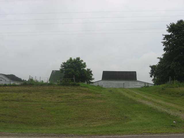
Photo: Nyttend, public domain · Wikimedia Commons
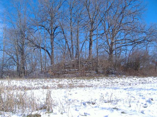
Photo: Aesopposea, via Wikimedia Commons, CC BY-SA 3.0 · Wikimedia Commons
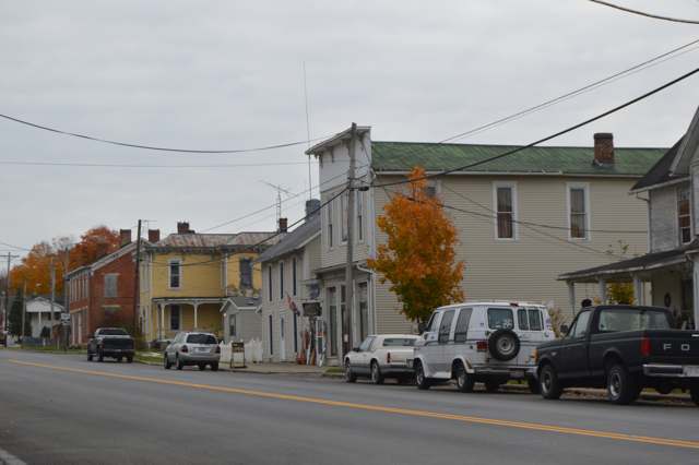
Photo: Nyttend, public domain · Wikimedia Commons
Local history sources: archive.org · en.wikipedia.org · en.wikipedia.org · en.wikipedia.org · postalhistory.com · en.wikipedia.org · commons.wikimedia.org · commons.wikimedia.org · commons.wikimedia.org
Water
Eight wells in the buried Teays River Aquifer, in the Scioto valley north of Chillicothe The water here
- Circleville City37% of residentsScioto River valley aquifer (sand & gravel wells)
- Ross County Water Co. Inc29% of residentsTeays Valley Aquifer (buried valley groundwater)
- Kingston Village18% of residentsTeays Valley Aquifer (buried valley groundwater)
- Laurelville, Vlg Of8% of residentsGroundwater wells (2 wells)
- Earnhart Hill Water District6% of residentsScioto River valley (Teays) aquifer wells
- Amanda Village2% of residentsGroundwater wells (3 wells)
- South Bloomfield Village0% of residentsGroundwater wells (3 wells)
Hospitals, fire stations and more
Inside Salt Creek Township, Pickaway County's boundary: 1 fire or EMS station, 2 spill cases and 1 mound or earthwork. Press a pin or a name for its whole record and its source.
Fire and EMS stations (1)
-
Saltcreek - Tarlton Volunteer Fire Department Station 2Kingston
- Address
- 29836 Jackson Road, Kingston, OH 45644
- Coordinates
- 39.48853, -82.82064
USGS National Map structures (source) ↗ Street map and directions ↗
Source: USGS National Map structures (most Ohio records last updated 2019 to 2022), checked against the Columbus and Cleveland station lists. The department that answers a call is set by jurisdiction and mutual aid, not by distance.
Spills reported since 2021 (2)
-
Fuel Ethanol / E85 / Ethyl / Gasohol (Denatured)2025-03-30 · Salt Creek Twp
- Reported
- 2025-03-30
- What spilled
- Fuel Ethanol / E85 / Ethyl / Gasohol (Denatured); Fuel Diesel / Diesel Fuel (Vehicle On Or Off Road)
- Where
- Salt Creek Twp, Pickaway County
- Ohio EPA district office
- CDO
- Ohio EPA case number
- 2503EPA0000461
Ohio EPA spill reports (source) ↗ Street map and directions ↗
-
Material Blue2024-06-29 · Salt Creek Twp
- Reported
- 2024-06-29
- What spilled
- Material Blue
- Where
- Salt Creek Twp, Pickaway County
- Ohio EPA district office
- CDO
- Ohio EPA case number
- 2406EPA0001093
Ohio EPA spill reports (source) ↗ Street map and directions ↗
Source: Ohio EPA emergency response spill reports, 2021 to September 2026, one point per case where Ohio EPA placed it. A report is what the caller or responder recorded; amounts are often blank or estimated.
Mounds and earthworks (1)
-
Horn MoundMound · Adena culture (about 800 BC-AD 100)
- What it is
- Mound
- Age
- Adena culture (about 800 BC-AD 100)
- Where
- junction of Armstrong and Moccasin roads, southeast of Tarlton, Salt Creek Township, Pickaway County
- County
- Pickaway County
- Named in the history of
- Tarlton (village), Salt Creek Township, Pickaway County
- Map point
- from the site's Wikipedia article
Wikipedia article (point and source) ↗ Street map and directions ↗
Many mounds stand on private land; visit only those open to the public.
Source: the History records' native sites, each placed by its own Wikipedia article; sites no article places are named on the History card but not pinned.
Its ZIP codes
Each ZIP code that touches Salt Creek Township, Pickaway County, with the share of its residents who live here and the same headline figures as the ZIP page.
| ZIP | Share | Water | Radon | Home value | Schools | Flood |
|---|---|---|---|---|---|---|
| 45644 Kingston | 16% | Eight wells in the buried Teays River Aquifer, in the Scioto valley north of Chillicothe | 3.6 pCi/L average radon | Median year built 1980 | Zane Trace Local · 3 stars overall | 0.2% of residents in the 1% floodplain |
| 43135 Perry Township and Laurelville | 16% | Mostly private wells | 4.7 pCi/L average radon | Median year built 1989 | Logan Elm Local · 3.5 stars overall | 6.3% of residents in the 1% floodplain |
| 43113 Circleville | 4% | Sand-and-gravel wells in the Scioto River valley aquifer at the city's Island Road well field/treatment plant site, just east of the river. | 8.0 pCi/L average radon | Median year built 1967 | Circleville City · 3 stars overall | 7.0% of residents in the 1% floodplain |
| 43102 Clearcreek Township and Amanda | 3% | Mostly private wells | 6.5 pCi/L average radon | Median year built 1979 | Amanda-Clearcreek Local · 3 stars overall | 1.4% of residents in the 1% floodplain |
Local government
Who holds office in Salt Creek Township, Pickaway County, how its elections and ballot issues came out, and the state auditor's record.
Elections for office
| Date | Office | Candidates and votes |
|---|---|---|
| 2023-11-07 | Township Trustee | Scott D. Arnett 375, 44.91%; Bret Imler 460, 55.09% |
| 2017-11-07 | Township Trustee | Glenn D. Arledge II 238, 21.12%; Jim Fox 302, 26.8%; Kelly Toole 165, 14.64%; Dale Valentine 422, 37.44% |
Winners in bold. Results from the county board of elections' official canvass unless marked.
Auditor of State record
- No fiscal caution, watch or emergency on the Auditor of State's lists.
- Agreed Upon Procedures, 2023 to 2024, released 2026-05-07
- Special Audit, 2024, released 2026-03-05
The county
Pickaway County: 8 ZIP codes, 22 cities, villages and townships, 56,176 people.
Nearby places
Quick answers
What county is Salt Creek Township, Ohio in?
Salt Creek Township, Pickaway County is a township in Pickaway County, Ohio, with 2,473 residents.
When was Salt Creek Township, Ohio founded?
Salt Creek Township, Pickaway County was settled before 1801 (squatters along Salt Creek, ahead of the government land sale); incorporated 1810, formed with Pickaway County from territory taken out of Fairfield County. Source
How did Salt Creek Township, Ohio get its name?
Both the 1880 and 1906 county histories state only that Salt Creek, the township's principal stream, 'gives its name to the township,' without explaining why the creek itself is called Salt. Source
What ZIP code is Salt Creek Township, Ohio?
Salt Creek Township, Pickaway County is served by ZIP codes 45644, 43135, 43113 and 43102; 45644 holds the largest share of its residents.
Where does Salt Creek Township, Ohio get its water?
The main water source for Salt Creek Township, Pickaway County (Circleville City): Eight wells in the buried Teays River Aquifer, in the Scioto valley north of Chillicothe.
Cite this page
Cite this page as:
Cracked Buckeye, "Salt Creek Township, Pickaway County", https://crackedbuckeye.com/place/salt-creek-township-pickaway-county/, built 2026-10-31, accessed [date].
How to cite · Report a correction · Built 2026-10-31
