Local events in Wayne Township, Fayette County
Nothing is posted for Wayne Township itself yet; here is what is on within 20 miles. All local events in Wayne Township, Fayette County
Know a calendar we should watch? Send the link
Checked October 20; the events page is refreshed daily.
How Wayne Township, Fayette County began
Wayne Township, in the southeast corner of Fayette County against Ross County, is named for General Anthony Wayne and was one of the county's six original townships in 1810. Because pioneers crossed into it from the older Ross County settlements, it claims the county's first permanent settler, a Virginian named Wolf who built a cabin by a spring on the North Fork of Paint Creek about 1796. Settlers who came to Indian Creek in the 1800s found a Miami winter camp of several hundred people nearby. Mills rose at Rock Mills on Paint Creek from 1817, Noah Hukill kept a well-known tavern on the Chillicothe road, and Good Hope, surveyed in 1849 on Indian Creek around the relocated Good Hope Baptist meeting house, became the township's village and railroad station. Greenfield, which shares its ZIP code, is a separate village in Highland and Ross counties.
Settled c. 1796, incorporated 1810 (original township), by a settler named Wolf, from Virginia (first permanent settler).
Where the name comes from
Named for General Anthony Wayne, the Revolutionary War officer whose 1794 victory at Fallen Timbers led to the Treaty of Greenville that opened much of Ohio, including Fayette County, to American settlement. Ohio has 20 townships carrying his name.
Before the town
Wayne Township has the county's fullest record of historic Native neighbors. The 1881 history, from the recollection of a granddaughter of the settler Heath (or Scott) family on Indian Creek, says the Miami had a camping ground near the mouth of Indian Creek, about four hundred yards from the family's cabin, where five to six hundred people wintered; when Hamilton Rodgers settled at the creek's mouth in 1808, huts could be seen in every direction. The same account tells of the killing of a camp member by a white hunter named Harrod, which brought the settlement near to violence; of a man called Wild Duck, who killed his wife, a chief's daughter, and was taken by the chief up the creek to the 'Cedar Hole' and not seen again; and of a white captive named Sallie who had grown up in the band and married the chief's son. The 1872 pioneer record describes an earthwork on John DeWitte's farm on Turkey Run - a flat-topped mound it gives as about 100 feet high and a mile around, with a pool on its west side - and records the tradition that it had been the camp of 'Big John and his war tribe'; its dimensions suggest a natural hill used as a site, and it has not been surveyed. That record also names among the township's first ministers Dr. George Zimmerman, 'a half Shawnee Indian and a successful doctor.' Jackson Mound, the county's one listed mound, is in Madison Township to the north. The land was ceded under the 1795 Treaty of Greenville.
Nations recorded here: Miami, Shawnee, Wyandot, Lenape (Delaware), Ottawa, Mingo (Seneca-Cayuga), Adena culture.
- Miami winter camp at the mouth of Indian Creek (camp) — near the mouth of Indian Creek, about 400 yards from the Heath cabin (land later owned by William Rodgers), historic, about 1800-1812 (archive.org)
- 'Cedar Hole' (other) — up Indian Creek from the Miami camp, historic (archive.org)
- DeWitte farm earthwork (earthwork) — John DeWitte's farm on Turkey Run, beside the old DeWitte cemetery, unknown; tradition of a historic camp (archive.org)
Timeline
- — The Treaty of Greenville, following General Anthony Wayne's victory at Fallen Timbers, cedes most of what becomes southern and eastern Ohio, including the future Fayette County, to the United States — the general for whom this township is later named.
- — A Virginian named Wolf settles by a spring on the North Fork of Paint Creek near the Ross County line, the first permanent settler in the township and the county; a chimney on his cabin was later seen dated 1800.
- — William Harper and Nancy Faris Harper arrive from Berkeley County, Virginia, with eight children; their son Robert, born February 22, 1806, is by 1881 the oldest living person born in the county.
- — John DeWitte, who had come to Old Town in Ross County in 1796, buys 1,000 acres on Turkey Run.
- — Benjamin Davis, from the Carolinas by way of Highland County, takes up 300 acres of the Griffith survey, No. 738.
- — Samuel Sollars of Allegheny County, Pennsylvania, brings his family by three-horse wagon to 450 acres of the C. Wallace survey, No. 7577, then part of Ross County.
- — Hamilton Rodgers and his family of ten settle at the mouth of Indian Creek, where Indian huts stand in every direction.
- — Wayne is one of the six original townships laid out when Fayette County is organized from Ross and Highland counties.
- — Stephen Yeoman and his sons, from New York, buy the 1,400-acre Bibb survey on Paint Creek; James Yeoman moves there in October.
- — In the fall Walter and James Yeoman build a log-and-earth dam and a log saw and grist mill on Paint Creek, the start of Rock Mills; customers sometimes wait a week for their turn.
- — Paint Creek Baptist Church is organized; in 1840 it hosts the Scioto Predestinarian Baptist Association, then eighteen churches and 545 members.
- — A Baptist meeting house is built two miles northwest of the later site of Good Hope.
- — Wayne Township contains one gristmill and two sawmills.
- — Nine members excluded in an 1832 split over missions organize the Good Hope Baptist Church; its meeting house was later moved to the site around which the village of Good Hope grew.
- — Rev. John Cadwallader begins preaching for the German Baptists (Dunkards) in a new school house in the Hukill neighborhood.
- — On November 1 Benjamin Nelson and John L. Burnett survey the village of Good Hope, thirty lots, for proprietors Robert Harper and James Sargent.
- — The Good Hope Methodist Episcopal church is dedicated September 9; the congregation builds a cross-shaped church with a 67-foot tower in 1880-81.
- — The Good Hope Methodist circuit is organized September 24, taking in Good Hope, Sugar Grove, Cochran and Martinsburg.
- — N. A. Divines becomes Good Hope postmaster and serves thirty-three years, until April 10, 1914.
- — J. W. Rife and Son establish a drain-tile factory and saw-mill at Good Hope (about 1906).
- — Good Hope has about 250 people, a bank, grain elevator, broom factory and Methodist and Baptist brick churches.
Stories
The Miami camp on Indian Creek
In the last years of the 1700s George Heath and his wife Anna, from Kentucky, settled on Indian Creek, about four hundred yards from a camping ground where five to six hundred Miami spent the winters. The camp was generally peaceful. Then a white man named Harrod shot one of its members while hunting and hid the body under logs; when it was found, a man the settlers called Wild Duck came to the Heath cabin with his knife drawn, asking for Heath, who had gone to the mill at Frankfort. The next morning the two met near the house and argued for more than an hour before laying down their weapons; the Heaths nonetheless moved to Frankfort for a time, Mrs. Heath burying her tableware in the garden before they left. The account, given in 1881 by the Heaths' granddaughter, says Harrod was later captured in Ross County and burned at the stake near Harrod's Creek, after which the camp made no further trouble. It also records that a white woman named Sallie, captured as a child, had grown up in the band, married the chief's son, and often came to the Heath cabin to bake bread at the fireplace.
Oats and Whisky
For years Wayne Township had no tavern; travelers slept in whatever cabin they reached and were seldom allowed to pay. As traffic on the state roads grew before the railroads, Noah Hukill opened his house on the Washington and Chillicothe road to the public. His first sign read 'Oats and Whisky,' his second 'Inn by N. Hukill,' and his third 'Independence, Peace and Plenty.' The drivers of twenty teams and wagons are said to have stopped there in a single night, and the house was remembered as quiet and orderly though it sold liquor. By 1881 it had long been closed, and the township had no hotel until the railroad reached Good Hope.
Rock Mills
In 1815 Stephen Yeoman and his sons, from New York, bought the 1,400-acre Bibb survey on Paint Creek, and in the fall of 1817 Walter and James Yeoman dammed the creek, then no more than twenty feet wide, with logs and dirt. Their log mill sawed lumber and ground grain, and though it could grind a hundred bushels a day, customers sometimes waited a week for their turn. James Yeoman ran it until his death in 1825. William McConnell later replaced the log building, and a store, built by Ira Yeoman in 1848, and a blacksmith shop grew up around it. The settlement, also called Rockville, took both names from its rocky ground, where limestone was quarried across the creek; later owners never matched the trade of the first mill.
Photographs
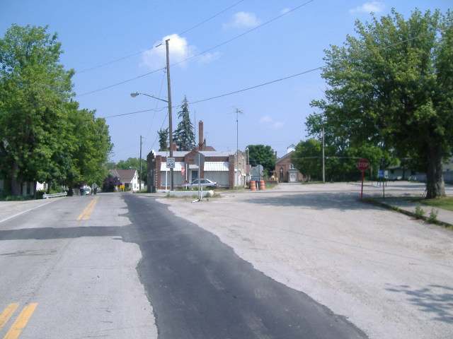
Photo: Aesopposea, CC BY-SA 3.0 · Wikimedia Commons
Local history sources: en.wikipedia.org · en.wikipedia.org · en.wikipedia.org · en.wikipedia.org · en.wikipedia.org · en.wikipedia.org · archive.org · archive.org · archive.org · archive.org · archive.org · archive.org · archive.org · archive.org · archive.org · archive.org · archive.org · archive.org · archive.org · archive.org · archive.org · archive.org · archive.org · archive.org · archive.org · archive.org · archive.org · commons.wikimedia.org
Water
Four wells behind the plant on the north end and two or three on the farm next to the YMCA; the city's CCRs say six supply wells in all. Water drawn from Paint Creek fills the city's own reservoir system; about two-thirds of demand is Paint Creek surface water and about one-third comes from the well field, which is used year-round, not only as backup. The water here
- Washington Court House75% of residentsPaint Creek (Washington C.H. Reservoirs) + wells
- Greenfield Village17% of residentsGroundwater wells (8 wells)
- Ross County Water Co. Inc4% of residentsTeays Valley Aquifer (buried valley groundwater)
- New Holland Village3% of residentsGroundwater wells (2 wells)
- Fayette County - culpepper Subdivision0% of residentsPaint Creek (Washington C.H. Reservoirs) + wells
Hospitals, fire stations and more
Inside Wayne Township, Fayette County's boundary: 1 fire or EMS station, 1 private school, 1 poor-rated bridge and 1 spill case. Press a pin or a name for its whole record and its source.
Fire and EMS stations (1)
-
Wayne Township Fire Rescue Station 200Greenfield
- Address
- 7218 State Highway 753 North, Greenfield, OH 45123
- Coordinates
- 39.44703, -83.36505
USGS National Map structures (source) ↗ Street map and directions ↗
Source: USGS National Map structures (most Ohio records last updated 2019 to 2022), checked against the Columbus and Cleveland station lists. The department that answers a call is set by jurisdiction and mutual aid, not by distance.
Private schools (1)
-
Sacred Heart AcademyPrivate, Catholic · Washington Court House
- Address
- 4818 Washington Good Hope Rd, Washington Court House, OH 43160
- Kind
- Catholic
- Students, 2023-24
- 6
- Teachers (full-time equivalent)
- 2.3
- Students per teacher
- 2.6087
- Phone
- (231) 645-0648
- NCES private school ID
- A2302254
Source: NCES Private School Survey 2023-24.
Bridges rated poor (1)
-
SR 753 over Indian CreekPoor · built 1962
- Condition
- Poor: a deck, superstructure, substructure or culvert rated 4 or below on the 0 to 9 scale
- What it is
- Bridge
- Built
- 1962
- Length
- 18 ft
- Owner
- State
- Vehicles a day
- 2,577
- Coordinates
- 39.44801, -83.36648
National Bridge Inventory (source) ↗ Street map and directions ↗
Source: FHWA National Bridge Inventory 2025. "Poor" means one major part rated 4 or below on the 0 to 9 scale; it calls for repair, not closing, unless the state posts or closes the bridge.
Spills reported since 2021 (1)
-
Fuel Diesel / Diesel Fuel (Vehicle On Or Off Road)2026-02-21 · Wayne Twp
- Reported
- 2026-02-21
- What spilled
- Fuel Diesel / Diesel Fuel (Vehicle On Or Off Road)
- Largest amount reported
- 20 gallons
- Where
- Wayne Twp, Fayette County
- Ohio EPA district office
- SWDO
- Ohio EPA case number
- 2602EPA0000222
Ohio EPA spill reports (source) ↗ Street map and directions ↗
Source: Ohio EPA emergency response spill reports, 2021 to September 2026, one point per case where Ohio EPA placed it. A report is what the caller or responder recorded; amounts are often blank or estimated.
Its ZIP codes
Each ZIP code that touches Wayne Township, Fayette County, with the share of its residents who live here and the same headline figures as the ZIP page.
Local government
Who holds office in Wayne Township, Fayette County, how its elections and ballot issues came out, and the state auditor's record.
Money issues on the ballot since 2021: 1 of 1 passed; of those asking for new or higher taxes, 1 of 1.
Ballot issues
| Date | Issue | For | Against | Result |
|---|---|---|---|---|
| 2021-11-02 | Issue: Wayne Township (Additional) - Cemetery, .25 Mill, 5 years (0.25 mills, additional) | 178 | 114 | Passed (60.96% for) |
Elections for office
| Date | Office | Candidates and votes |
|---|---|---|
| 2021-11-02 | Township Trustee | Kyle S. Hoppes 210, 52.9%; Jarrod Posey 187, 47.1% |
| 2019-11-05 | Township Trustee | David Batson 121, 100.0% |
| 2019-11-05 | Township Fiscal Officer | Cindy Seaton 114, 100.0% |
Winners in bold. Results from the county board of elections' official canvass unless marked.
The county
Fayette County: 4 ZIP codes, 10 cities, villages and townships, 26,068 people.
Nearby places
Quick answers
What county is Wayne Township, Ohio in?
Wayne Township, Fayette County is a township in Fayette County, Ohio, with 1,341 residents.
When was Wayne Township, Ohio founded?
Wayne Township, Fayette County was settled c. 1796; incorporated 1810 (original township). Founders on record: a settler named Wolf, from Virginia (first permanent settler). Source
How did Wayne Township, Ohio get its name?
Named for General Anthony Wayne, the Revolutionary War officer whose 1794 victory at Fallen Timbers led to the Treaty of Greenville that opened much of Ohio, including Fayette County, to American settlement. Source
What ZIP code is Wayne Township, Ohio?
Wayne Township, Fayette County is served by ZIP codes 43160, 43145 and 45123; 43160 holds the largest share of its residents.
Where does Wayne Township, Ohio get its water?
The main water source for Wayne Township, Fayette County (Washington Court House): Four wells behind the plant on the north end and two or three on the farm next to the YMCA; the city's CCRs say six supply wells in all. Water drawn from Paint Creek fills the city's own reservoir system; about two-thirds of demand is Paint Creek surface water and about one-third comes from the well field, which is used year-round, not only as backup.
Cite this page
Cite this page as:
Cracked Buckeye, "Wayne Township, Fayette County", https://crackedbuckeye.com/place/wayne-township-fayette-county/, built 2026-10-31, accessed [date].
How to cite · Report a correction · Built 2026-10-31
