Local events in Springfield
231 events in the next 90 days from 10 public calendars. All local events in Springfield
Checked October 20; the events page is refreshed daily.
Lakes near Springfield
The history under the water: the valley before, the dam, the stories. All Ohio lakes
Deep dives about Springfield
Long reads built from maps, newspapers and public records. All deep dives
- Flock Cameras in OhioAbout 6,900 mapped plate readers in 80 Ohio counties: who runs them, who searched the data, the case for and against, and the bills before the legislature.
- Ohio State FairThe Ohio State Fair began in Cincinnati in 1850, moved among ten Ohio cities, then settled in 1886 on the Columbus fairgrounds it still uses.
Notable people from Springfield
Ohioans tied to this place, each with a sourced profile. All notable Ohioans
 John Legend1978-Springfield-born singer, songwriter and pianist of 'Ordinary People' and 'All of...
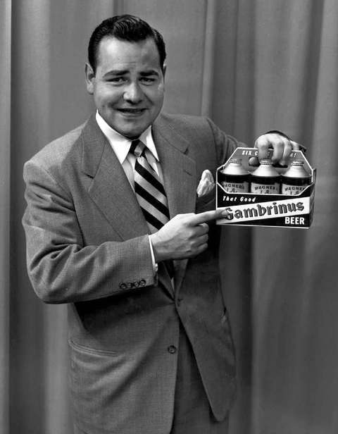 Jonathan Winters1925-2013Dayton-born improvisational comedian of Maude Frickert and Elwood P. Suggins, wh...
 Lillian Gish1893-1993Springfield-born star of D. W. Griffith's silent films, whose screen and stage c...
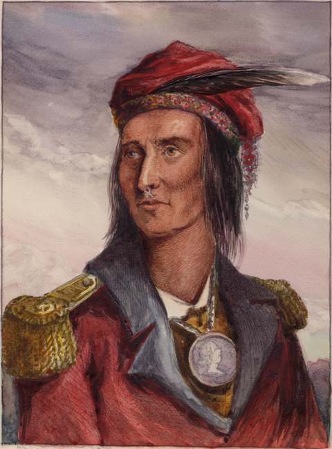 Tecumseh1768-1813Shawnee leader born in the Ohio country who organized a confederation of nations...
History from Springfield
People and inventions tied to this place, each with its sources. All people · All inventions
Videos about Springfield
Short videos we made from the old maps and records. All videos
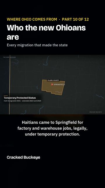
How Springfield began
Springfield was laid out in 1801 by James Demint, a Kentucky teamster, on the Mad River a few miles from Piqua (Pekowi), the large Shawnee town George Rogers Clark's militia destroyed in the Battle of Piqua on August 8, 1780. It became the seat of Clark County in 1818 and, after the National Road reached it in 1838, grew into one of the nation's leading centers of farm-machinery manufacturing, earning the nickname "The Champion City" for the reapers and mowers built by William Whiteley's Champion works and the Warder, Bushnell & Glessner Company, later folded into International Harvester. The city is home to Wittenberg University, founded by Lutheran ministers in 1845, and to Frank Lloyd Wright's only Prairie-style house in Ohio, the 1908 Westcott House. Twentieth-century Springfield also carries a harder record: three documented race riots (1904, 1906, 1921) and a Ku Klux Klan parade photographed downtown in 1923. Its population peaked near 82,000 in 1960 and stood at about 58,700 in 2020.
Settled 1801, platted 1801, by James Demint.
Where the name comes from
James Demint named the new town after Springfield, Massachusetts. Springfield became the seat of newly formed Clark County in 1818, beating the rival site of New Boston by two votes.
Before the town
Three to seven miles west of the site Demint later platted stood Piqua (also written Peckuwe, Pekowi, Peckowee, or Pickaway), the capital town of the Shawnee Pekowi and Kispoko septs, on the Mad River in what is now Bethel Township, Clark County, with a reported population around 3,000. This is a different, earlier place than the present city of Piqua on the Great Miami River in Miami County: after this town was destroyed, Shawnee survivors moved north and founded Upper and Lower Piqua at that later site. On August 8, 1780, General George Rogers Clark led about 970 Kentucky militia against the Ohio Shawnee town in retaliation for Henry Bird's raids into Kentucky that summer; his force, using artillery fired from the bluffs above the village, drove off Shawnee defenders under Chief Black Hoof (with allied Lenape, Wyandot, and Mingo warriors also present) and burned the town and roughly 500 acres of corn. It is remembered as the largest engagement of the American Revolution fought west of the Alleghenies, with Clark's own casualties later estimated far higher than his contemporary reports. The Ohio lands including the Piqua site were ceded to the United States by the Treaty of Greenville in 1795, six years before Demint founded Springfield; the site of the Shawnee town is preserved today as George Rogers Clark Memorial Park, marked by historical markers placed by the Ohio Revolutionary Memorial Commission (1953), the Clark County Historical Society (1969), the Lagonda Chapter of the Daughters of the American Revolution (1976), and the Springfield and Clark County Revolutionary War Bicentennial Committee (1980).
Nations recorded here: Shawnee, Lenape (Delaware), Wyandot, Mingo (Seneca-Cayuga).
- Piqua (Peckuwe/Pekowi) and the Battle of Piqua (battle) — Bethel Township, Clark County, on the Mad River, now George Rogers Clark Memorial Park, Shawnee town destroyed August 8, 1780 (en.wikipedia.org)
Timeline
- — George Rogers Clark's Kentucky militia destroys the Shawnee town of Piqua (Pekowi) on the Mad River a few miles from the future Springfield, in what is remembered as the largest Revolutionary War battle fought west of the Alleghenies.
- — The Treaty of Greenville cedes the land that includes the Piqua site and the future Springfield to the United States.
- — James Demint, a former Kentucky teamster, lays out Springfield on the Mad River and names it for Springfield, Massachusetts.
- — Clark County is formed from parts of Champaign, Madison, and Greene counties, and Springfield is chosen county seat over New Boston by two votes.
- — The National Road is extended to Springfield, briefly making it the road's western terminus and giving the city the nickname "Town at the End of the Pike."
- — Ministers of the English Evangelical Lutheran Synod of Ohio, led by Rev. Ezra Keller, found Wittenberg College in Springfield to train English-speaking clergy, naming it for the German university where Martin Luther posted his theses.
- — Benjamin H. Warder co-founds Warder, Brokaw & Child, the firm that paid $30,000 for rights to William Whiteley's combined reaper and mower, "The Champion," the start of Springfield's farm-machinery industry.
- — William Whiteley launches the Champion Reaper and Mower Works in Springfield; within a generation his shop grows into a giant manufacturing trust.
- — Warder's firm reorganizes as Warder, Mitchell & Co. with John J. Glessner and Asa S. Bushnell as junior partners; after Ross Mitchell's 1880 retirement it becomes Warder, Bushnell & Glessner Co.
- — Edward Wren and a partner named Kinnane open a dry-goods store on South Limestone Street, Springfield's first department store, which grows into the Edward Wren Company.
- — Springfield builds its first public water system.
- — The Kelly Springfield Tire Company is established in the city.
- — The Warder, Bushnell & Glessner Champion works and other Springfield harvester makers are absorbed into the newly formed International Harvester Company; the city becomes known as "The Champion City."
- — On January 15, educator A.B. Graham organizes what is recognized as the first 4-H club in the basement of the Clark County Courthouse in Springfield.
- — On March 7, a mob of more than 1,000 white residents lynches Richard Dixon, a Black man accused of killing a police officer, in one of Ohio's documented early-20th-century mob killings.
- — On February 26, a riot destroys much of the Levee, a Black neighborhood, leaving nearly 100 people homeless.
- — Burton J. and Orpha Westcott commission Frank Lloyd Wright to design their home on East High Street, Wright's only Prairie School house built in Ohio.
- — On September 8, a Ku Klux Klan parade moves through downtown Springfield; the Library of Congress holds a photograph of the march.
- — Crowell-Collier Publishing, descended from P.P. Mast's 1877 Farm & Fireside magazine, closes its Springfield operation.
- — The city builds the Eagle City Road water treatment plant, replacing the older Pumphouse Road facility.
- — Springfield's population peaks at just over 82,000 in the U.S. Census.
- — The Westcott House and the East High Street Historic District are both listed on the National Register of Historic Places.
Stories
The Champion City
Springfield's rise as a manufacturing town was built on the Champion: Benjamin Warder, whose firm dated from 1850, paid $30,000 for the rights to William Whiteley's new combined reaper and mower, "The Champion." Whiteley opened his own Champion Reaper and Mower Works in 1855. Warder's firm went through several names, Warder, Mitchell & Co., then Warder, Bushnell & Glessner Co. after John Glessner and Asa Bushnell joined as partners, competing directly with Whiteley's own company across town. By 1880 Whiteley's company was said to be turning out more farm machinery than every factory in Chicago combined, and its East Street works in Springfield was called the second-largest industrial building under one roof in the world, behind only the Krupp works in Germany. The rival firms were folded into the new International Harvester Company in 1902, and by 1908 the two-millionth Champion machine had rolled out the door. The nickname "The Champion City" stuck to Springfield long after the reaper works themselves faded.
Two towns named Piqua
Long before Demint's Springfield existed, the Mad River valley a few miles to the west held Piqua, also spelled Peckuwe or Pekowi, the principal town of the Shawnee Pekowi and Kispoko divisions and home to roughly 3,000 people. On August 8, 1780, General George Rogers Clark marched nearly a thousand Kentucky militia north in retaliation for a Shawnee-led raid on Kentucky settlements that summer. Using artillery hauled up to the bluffs overlooking the village, Clark's men drove off the Shawnee defenders under Chief Black Hoof and burned the town and its cornfields. It was the largest land battle of the American Revolution fought west of the Appalachians. The Shawnee survivors did not disappear; they moved north to the Great Miami River and built new towns they also called Piqua, which grew into the present city of Piqua in Miami County. The two places share a name and a people but are not the same town, and the older one, destroyed in 1780, sits within what is now Clark County, marked today by George Rogers Clark Memorial Park.
A college named for Luther's town
In 1845, a group of Lutheran ministers who had broken from the German-language Ohio synod founded a new college in Springfield with a deliberate mission: to teach in English and "Americanize" a new generation of Lutheran clergy, in contrast to Columbus's German-speaking Capital University. The Reverend Ezra Keller was its principal founder and first president. They named the school Wittenberg, after the German town where Martin Luther nailed his Ninety-five Theses to a church door in 1517. Classes began in a donated church building with eight students, one professor, and two tutors; by the end of that first year enrollment had grown to seventy-one. Wittenberg College, later Wittenberg University, has occupied its hilltop campus on the city's north side ever since, and Myers Hall, its first building, was listed on the National Register of Historic Places in 1975.
The Town at the End of the Pike
The National Road, the country's first federally funded highway, reached Springfield in 1838, and for a time the city was its western terminus, before construction pushed on toward Indiana. Stagecoaches, freight wagons, and drovers moving livestock all funneled through Springfield on the turnpike, and the road's arrival gave the young county seat the nickname "Town at the End of the Pike." The same corridor that carried the National Road later carried railroads west from the city, cementing Springfield's place as a transportation crossroads between Columbus and Dayton, a role the modern route of U.S. 40 still traces through the middle of town.
Kinnane and Wren's dry goods store
On April 4, 1877, Edward Wren, an Irish immigrant, opened a dry-goods store with a partner named Kinnane in the Commercial Building on South Limestone Street. It was Springfield's first true department store, and under Wren's name alone it grew over the following decades into a downtown institution, eventually moving into the 1893 Bushnell Building on East Main Street in 1939. The company stayed locally owned until 1952, when it joined the Allied Stores chain; in 1984 it merged with Indianapolis's William H. Block Co. and was renamed Block's, closing for good in 1987. The company's earlier home, the 1924 Edward Wren Company Building downtown, was listed on the National Register of Historic Places in 2016.
Wright's only Prairie house in Ohio
In 1908, Burton J. Westcott, treasurer of the American Seeding Machine Company, and his wife Orpha commissioned Frank Lloyd Wright to design their home on East High Street. It became the only Prairie School house Wright built in Ohio, with the low horizontal lines, deep eaves, and art-glass windows characteristic of his early work. The house passed out of Westcott family hands and was carved up into apartments for decades before a nonprofit foundation undertook a five-year, $5.8 million restoration, reopening it as a house museum on October 15, 2005, with Westcott grandchildren in attendance. It was listed on the National Register of Historic Places in 1974.
The first 4-H club
On January 15, 1902, Clark County school superintendent A.B. Graham organized a boys' and girls' agricultural and domestic-science club in the basement of the Clark County Courthouse in Springfield. It grew, alongside similar clubs organizing elsewhere in the Midwest at the same time, into the national 4-H youth organization, built around the four-leaf clover pledge of head, heart, hands, and health. Springfield's claim as birthplace was long a matter of local pride rather than settled record, but in 2023 the Library of Congress formally recognized the city's 1902 club as 4-H's origin point.
A city with three race riots
Springfield's early-20th-century growth ran alongside recurring racial violence against its Black residents. On March 7, 1904, a mob of more than a thousand white residents seized and lynched Richard Dixon, who was accused of killing a police officer, an act that drew national newspaper coverage. Less than two years later, on February 26, 1906, a mob burned and wrecked much of the Levee, a Black neighborhood near the rail yards, leaving close to 100 people homeless. A third episode of unrest in 1921 was reported by the New York Times to have left 14 people dead. Together the three episodes are part of the same wave of racial violence that struck other Ohio and Midwestern industrial cities in the period, and Springfield's are among the better documented.
The Klan marches downtown, 1923
On September 8, 1923, the Ku Klux Klan staged a parade through downtown Springfield. A photograph of the march, taken by a photographer named Weber and now held by the Library of Congress, survives as one of the clearest pieces of documentary evidence of organized Klan activity in the city during the 1920s national resurgence of the group, which at its peak that decade claimed several million members nationwide and held mass rallies elsewhere in Ohio, including at Buckeye Lake in Licking County.
From wells to Eagle City Road
Springfield built its first public water system in 1882, more than eighty years after Demint founded the town, drawing on the Mad River watershed and local groundwater. The system was rebuilt and expanded repeatedly over the next century as the city's population and its farm-machinery industry grew; the pumping station on Pumphouse Road served the city for decades before it was replaced in 1958 by the Eagle City Road Water Treatment Plant, which still draws groundwater from the underlying aquifer and treats it to a peak capacity of about 36 million gallons a day.
Photographs
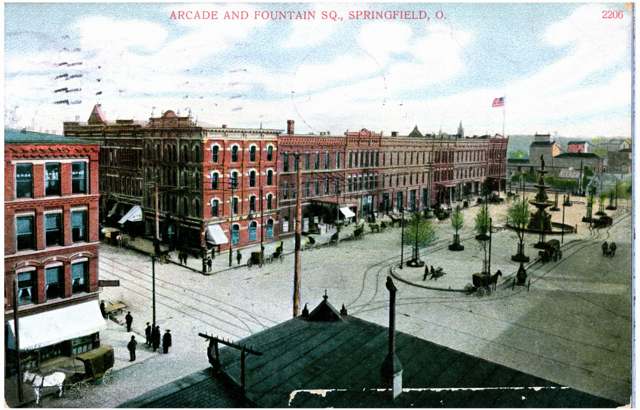
Photo: Columbus Metropolitan Library, via Digital Public Library of America, no known copyright restrictions · Wikimedia Commons
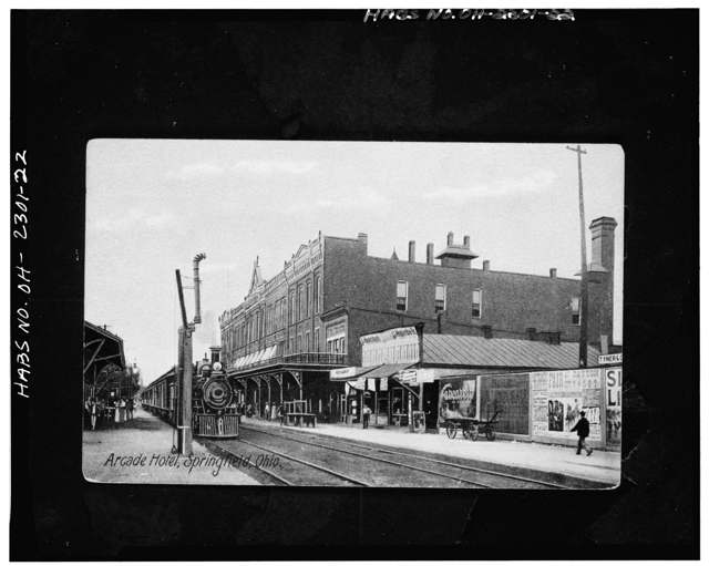
Photo: Clark County Historical Society, documented by the Historic American Buildings Survey (HABS), Library of Congress, public domain · Wikimedia Commons
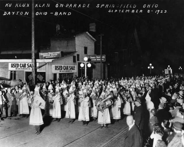
Photo: Photographer Weber; U.S. Library of Congress, Prints and Photographs Division (digital ID cph.3b27153), public domain · Wikimedia Commons
Local history sources: en.wikipedia.org · en.wikipedia.org · en.wikipedia.org · en.wikipedia.org · en.wikipedia.org · en.wikipedia.org · clark.osu.edu · humphrysfamilytree.com · springfieldohio.gov · hmdb.org · commons.wikimedia.org · commons.wikimedia.org · commons.wikimedia.org
Historic places
25 places in Springfield on the National Register of Historic Places. Press a pin or a name for its whole record.
-
Arcade HotelBuilding · Springfield · listed 1974
- Address
- Fountain Ave. and High St.
- Where
- Springfield, Clark County · ZIP 45502
- What it is
- Building
- Listed on the National Register
- 1974
- NRIS reference number
- 74001410
- Coordinates
- 39.92268, -83.80999
National Register file (NPS) ↗ Search Wikipedia ↗ Street map and directions ↗ On the Cracked Buckeye map
-
Bookwalter, Francis, HouseBuilding · Springfield · listed 1980
- Address
- 611 S. Fountain Ave.
- Where
- Springfield, Clark County · ZIP 45506
- What it is
- Building
- Listed on the National Register
- 1980
- NRIS reference number
- 80002954
- Coordinates
- 39.91725, -83.81094
National Register file (NPS) ↗ Search Wikipedia ↗ Street map and directions ↗ On the Cracked Buckeye map
-
East High Street DistrictHistoric district · Springfield · listed 1974
- Address
- Roughly bounded by E. High, S. Sycamore, and Walnut Sts.
- Where
- Springfield, Clark County · ZIP 45505
- What it is
- Historic district
- Listed on the National Register
- 1974
- NRIS reference number
- 74001412
- Coordinates
- 39.92174, -83.79650
National Register file (NPS) ↗ Search Wikipedia ↗ Street map and directions ↗ On the Cracked Buckeye map
-
Edward Wren Company BuildingBuilding · Springfield · listed 2016
- Address
- 31--37 High St.
- Where
- Springfield, Clark County · ZIP 45505
- What it is
- Building
- Listed on the National Register
- 2016
- NRIS reference number
- 16000844
- Coordinates
- 39.92104, -83.80889
National Register file (NPS) ↗ Search Wikipedia ↗ Street map and directions ↗ On the Cracked Buckeye map
-
Lagonda Club BuildingBuilding · Springfield · listed 1975
- Address
- NW corner of High and Spring Sts.
- Where
- Springfield, Clark County · ZIP 45502
- What it is
- Building
- Listed on the National Register
- 1975
- NRIS reference number
- 75001342
- Coordinates
- 39.92344, -83.80838
National Register file (NPS) ↗ Search Wikipedia ↗ Street map and directions ↗ On the Cracked Buckeye map
-
Lagonda National BankBuilding · Springfield
- Address
- 2 E. Main St.
- Where
- Springfield, Clark County · ZIP 45502
- What it is
- Building
- Latest NPS certification action
- 2017
- NRIS reference number
- 100001267
- Coordinates
- 39.92278, -83.80994
National Register file (NPS) ↗ Search Wikipedia ↗ Street map and directions ↗ On the Cracked Buckeye map
-
Main Street BuildingsBuilding · Springfield · listed 1979
- Address
- 6--14 E. Main St.
- Where
- Springfield, Clark County · ZIP 45502
- What it is
- Building
- Listed on the National Register
- 1979
- NRIS reference number
- 79001790
- Coordinates
- 39.92458, -83.80960
National Register file (NPS) ↗ Search Wikipedia ↗ Street map and directions ↗ On the Cracked Buckeye map
-
Main Street Buildings (Boundary Increase)Building · Springfield · listed 2000
- Address
- 14 E. Main St.
- Where
- Springfield, Clark County · ZIP 45505
- What it is
- Building
- Listed on the National Register
- 2000
- NRIS reference number
- 00000749
- Coordinates
- 39.89803, -83.80851
National Register file (NPS) ↗ Search Wikipedia ↗ Street map and directions ↗ On the Cracked Buckeye map
-
Masonic TempleBuilding · Springfield · listed 2008
- Address
- 125 W. High St.
- Where
- Springfield, Clark County · ZIP 45502
- What it is
- Building
- Listed on the National Register
- 2008
- NRIS reference number
- 08001195
- Coordinates
- 39.92321, -83.81328
National Register file (NPS) ↗ Search Wikipedia ↗ Street map and directions ↗ On the Cracked Buckeye map
-
Municipal BuildingBuilding · Springfield · listed 1973
- Address
- S. Fountain Ave. between High and Washington Sts.
- Where
- Springfield, Clark County · ZIP 45502
- What it is
- Building
- Listed on the National Register
- 1973
- NRIS reference number
- 73001394
- Coordinates
- 39.92310, -83.81118
National Register file (NPS) ↗ Search Wikipedia ↗ Street map and directions ↗ On the Cracked Buckeye map
-
Myers Daily MarketBuilding · Springfield
- Address
- 101 S Fountain Ave.
- Where
- Springfield, Clark County · ZIP 45506
- What it is
- Building
- Latest NPS certification action
- 2018
- NRIS reference number
- 100002119
- Coordinates
- 39.92113, -83.81072
National Register file (NPS) ↗ Search Wikipedia ↗ Street map and directions ↗ On the Cracked Buckeye map
-
Myers HallBuilding · Springfield · listed 1975
- Address
- Wittenberg Ave. and Ward St.
- Where
- Springfield, Clark County · ZIP 45504
- What it is
- Building
- Listed on the National Register
- 1975
- NRIS reference number
- 75001343
- Coordinates
- 39.93475, -83.81388
National Register file (NPS) ↗ Search Wikipedia ↗ Street map and directions ↗ On the Cracked Buckeye map
-
Pennsylvania HouseBuilding · Springfield · listed 1973
- Address
- 1311 W. Main St.
- Where
- Springfield, Clark County · ZIP 45506
- What it is
- Building
- Listed on the National Register
- 1973
- NRIS reference number
- 73001396
- Coordinates
- 39.92554, -83.83259
National Register file (NPS) ↗ Search Wikipedia ↗ Street map and directions ↗ On the Cracked Buckeye map
-
Pringle--Patric HouseBuilding · Springfield · listed 1997
- Address
- 1314-1316 E. High St.
- Where
- Springfield, Clark County · ZIP 45505
- What it is
- Building
- Listed on the National Register
- 1997
- NRIS reference number
- 97001547
- Coordinates
- 39.92118, -83.79004
National Register file (NPS) ↗ Search Wikipedia ↗ Street map and directions ↗ On the Cracked Buckeye map
-
Reeser, C. A., HouseBuilding · Springfield · listed 1980
- Address
- 1425 Innisfallen Ave.
- Where
- Springfield, Clark County · ZIP 45506
- What it is
- Building
- Listed on the National Register
- 1980
- NRIS reference number
- 80002957
- Coordinates
- 39.91423, -83.83526
National Register file (NPS) ↗ Search Wikipedia ↗ Street map and directions ↗ On the Cracked Buckeye map
-
Shawnee HotelBuilding · Springfield · listed 1985
- Address
- Main and Limestone Sts.
- Where
- Springfield, Clark County · ZIP 45502
- What it is
- Building
- Listed on the National Register
- 1985
- NRIS reference number
- 85003044
- Coordinates
- 39.92464, -83.80703
National Register file (NPS) ↗ Search Wikipedia ↗ Street map and directions ↗ On the Cracked Buckeye map
-
Springfield Metallic Casket CompanyBuilding · Springfield · listed 2016
- Address
- 105 N. Center St.
- Where
- Springfield, Clark County · ZIP 45502
- What it is
- Building
- Listed on the National Register
- 2016
- NRIS reference number
- 16000040
- Coordinates
- 39.92466, -83.81195
National Register file (NPS) ↗ Search Wikipedia ↗ Street map and directions ↗ On the Cracked Buckeye map
-
St. John's Evangelical Lutheran ChurchBuilding · Springfield · listed 2006
- Address
- 27 N. Wittenberg Ave.
- Where
- Springfield, Clark County · ZIP 45504
- What it is
- Building
- Listed on the National Register
- 2006
- NRIS reference number
- 06000485
- Coordinates
- 39.92581, -83.81436
National Register file (NPS) ↗ Search Wikipedia ↗ Street map and directions ↗ On the Cracked Buckeye map
-
St. Joseph Roman Catholic ChurchBuilding · Springfield · listed 1982
- Address
- 802 Kenton St.
- Where
- Springfield, Clark County · ZIP 45505
- What it is
- Building
- Listed on the National Register
- 1982
- NRIS reference number
- 82003552
- Coordinates
- 39.91586, -83.79778
National Register file (NPS) ↗ Search Wikipedia ↗ Street map and directions ↗ On the Cracked Buckeye map
-
St. Raphael ChurchBuilding · Springfield · listed 1976
- Address
- 225 E. High St.
- Where
- Springfield, Clark County · ZIP 45505
- What it is
- Building
- Listed on the National Register
- 1976
- NRIS reference number
- 76001381
- Coordinates
- 39.92286, -83.80637
National Register file (NPS) ↗ Search Wikipedia ↗ Street map and directions ↗ On the Cracked Buckeye map
-
Tecumseh BuildingBuilding · Springfield · listed 2000
- Address
- 34 W. High St.
- Where
- Springfield, Clark County · ZIP 45502
- What it is
- Building
- Listed on the National Register
- 2000
- NRIS reference number
- 00001555
- Coordinates
- 39.92374, -83.81097
National Register file (NPS) ↗ Search Wikipedia ↗ Street map and directions ↗ On the Cracked Buckeye map
-
Third Presbyterian ChurchBuilding · Springfield · listed 1980
- Address
- 714 N. Limestone St.
- Where
- Springfield, Clark County · ZIP 45503
- What it is
- Building
- Listed on the National Register
- 1980
- NRIS reference number
- 80002958
- Coordinates
- 39.93287, -83.80561
National Register file (NPS) ↗ Search Wikipedia ↗ Street map and directions ↗ On the Cracked Buckeye map
-
Thomas Manufacturing Company WarehouseBuilding · Springfield · listed 2001
- Address
- 360 S. Limestone St.
- Where
- Springfield, Clark County · ZIP 45505
- What it is
- Building
- Listed on the National Register
- 2001
- NRIS reference number
- 01000055
- Coordinates
- 39.92020, -83.80837
National Register file (NPS) ↗ Search Wikipedia ↗ Street map and directions ↗ On the Cracked Buckeye map
-
Warder Public LibraryBuilding · Springfield · listed 1978
- Address
- E. High and Spring Sts.
- Where
- Springfield, Clark County · ZIP 45502
- What it is
- Building
- Listed on the National Register
- 1978
- NRIS reference number
- 78002019
- Coordinates
- 39.92275, -83.80718
National Register file (NPS) ↗ Search Wikipedia ↗ Street map and directions ↗ On the Cracked Buckeye map
-
Westcott HouseBuilding · Springfield · listed 1974
- Address
- 1340 E. High St.
- Where
- Springfield, Clark County · ZIP 45505
- What it is
- Building
- Listed on the National Register
- 1974
- NRIS reference number
- 74001413
- Coordinates
- 39.92166, -83.78918
National Register file (NPS) ↗ Search Wikipedia ↗ Street map and directions ↗ On the Cracked Buckeye map
Source: National Park Service, National Register of Historic Places point file. The listing year is shown where NPS's certification date agrees with the listing's reference number. Listing recognizes significance; it does not restrict a private owner.
Water
Groundwater from 12 wells along Eagle City Road in the Mad River buried-valley aquifer, pumped to the adjacent treatment plant The water here
- Springfield City88% of residentsMad River Buried Valley Aquifer (12 wells)
- Clark County Northridge9% of residentsMad River Buried Valley Aquifer (12 wells)
- Enon Village1% of residentsGroundwater wells (4 wells)
- Clark County Limecrest1% of residentsMad River Buried Valley Aquifer (12 wells)
- Clark County Lawrenceville0% of residentsGroundwater wells (2 wells)
- Greenlawn Condos0% of residentsGroundwater wells (2 wells)
- Chateau Estates MHP0% of residentsGroundwater wells (2 wells)
- North Hampton Village0% of residentsGroundwater wells (2 wells)
- Rolling Terrace MHP0% of residentsGroundwater wells (2 wells)
Hospitals, fire stations and more
Inside Springfield's boundary: 4 hospitals, 3 health centers, 2 dialysis centers, 9 nursing homes, 7 fire and EMS stations, 2 colleges, 1 power plant, 22 public schools, 5 private schools, 1 poor-rated bridge, 5 libraries, 6 museums, 5 police stations, 2 public charging sites, 6 Superfund sites, 25 Toxics Release Inventory facilities, 2 stations and terminals and 34 spill cases. Press a pin or a name for its whole record and its source.
Hospitals (4)
-
Mental Health Services for Clark County, IncPsychiatric hospital · Springfield
- What it is
- Psychiatric hospital
- Address
- 474 N Yellow Springs Street, Springfield, OH 45504
- County
- Clark County
- Beds
- 16
- Ownership
- Non-profit
- Medicare overall rating
- not rated
- Emergency department (Medicare)
- No
- Medicare reports it as
- Mental Health Services for Clark and Madison Cos
- Phone
- (937) 399-9500
- Medicare ID
- 364040
Medicare Care Compare ↗ Where HIFLD got this record ↗ HIFLD hospitals (source) ↗ Street map and directions ↗
-
Mercy Health Fountian Medical CampusGeneral hospital · Springfield
- What it is
- General hospital
- Address
- 100 W Mccreight Ave, Springfield, OH 45504
- County
- Clark County
- Ownership
- Proprietary
Hospital's website ↗ Where HIFLD got this record ↗ HIFLD hospitals (source) ↗ Street map and directions ↗
-
Mercy Health Springfield Regional Medical CenterGeneral hospital · Springfield
- What it is
- General hospital
- Address
- 100 Medical Center Drive, Springfield, OH 45504
- County
- Clark County
- Beds
- 647
- Helipad
- Yes
- Ownership
- Non-profit
- Medicare overall rating
- 4 of 5 stars
- Emergency department (Medicare)
- Yes
- Medicare reports it as
- Springfield Regional Medical Center
- Phone
- (937) 523-5500
- Medicare ID
- 360086
Medicare Care Compare ↗ Where HIFLD got this record ↗ HIFLD hospitals (source) ↗ Street map and directions ↗
-
Ohio Valley Medical CenterSpecialty hospital · Springfield
- What it is
- Specialty hospital
- Address
- 100 West Main Street, Springfield, OH 45502
- County
- Clark County
- Beds
- 24
- Ownership
- Proprietary
- Medicare overall rating
- not rated
- Emergency department (Medicare)
- No
- Medicare reports it as
- Ohio Valley Surgical Hospital
- Phone
- (937) 521-3900
- Medicare ID
- 360355
Medicare Care Compare ↗ Hospital's website ↗ Where HIFLD got this record ↗ HIFLD hospitals (source) ↗ Street map and directions ↗
Source: HIFLD hospitals inventory via FEMA (closed hospitals it still lists left out, hospitals opened since added), with Medicare Care Compare ratings matched by name and address.
Community health centers (3)
-
James E. Sheehan Health BusHealth center · Springfield
- Run by
- a federally qualified health center
- Setting
- Clinic
- City
- Springfield
- Coordinates
- 39.91681, -83.80958
Find a Health Center (HRSA) ↗ HRSA data (source) ↗ Street map and directions ↗
-
Rocking Horse CenterHealth center · Springfield
- Run by
- a federally qualified health center
- Setting
- Clinic
- City
- Springfield
- Coordinates
- 39.91681, -83.80958
Find a Health Center (HRSA) ↗ HRSA data (source) ↗ Street map and directions ↗
-
Rocking Horse Center - Mulberry TerraceHealth center · Springfield
- Run by
- a federally qualified health center
- Setting
- Clinic
- City
- Springfield
- Coordinates
- 39.92013, -83.81344
Find a Health Center (HRSA) ↗ HRSA data (source) ↗ Street map and directions ↗
Source: HRSA health center service delivery sites, active, September 2026 (school-based sites left out). Health centers see patients whether or not they have insurance, with fees on a sliding scale.
Dialysis centers (2)
-
Davita Midwest Springfield DialysisDialysis · Springfield
- Address
- 2200 N Limestone Street Suite 104, Springfield, OH 45503
- Dialysis stations
- 21
- Medicare star rating
- 3 of 5 stars
- Services
- in-center hemodialysis, peritoneal dialysis
- Shift starting after 5 pm
- Yes
- Ownership
- for profit
- Chain
- DaVita
- Medicare certified since
- 1998-03-27
- Phone
- (937) 390-3125
- Medicare ID
- 362592
Medicare Care Compare ↗ CMS dialysis facility list (source) ↗ Street map and directions ↗
-
Davita National Trail DialysisDialysis · Springfield
- Address
- 171 S Tuttle Road, Springfield, OH 45505
- Dialysis stations
- 17
- Medicare star rating
- 3 of 5 stars
- Services
- in-center hemodialysis, peritoneal dialysis
- Shift starting after 5 pm
- Yes
- Ownership
- for profit
- Chain
- DaVita
- Medicare certified since
- 2012-02-08
- Phone
- (937) 328-7399
- Medicare ID
- 362780
Medicare Care Compare ↗ CMS dialysis facility list (source) ↗ Street map and directions ↗
Source: CMS dialysis facility list, September 2026, geocoded with the Census Bureau batch geocoder (an address it could not place sits at its ZIP center).
Nursing homes (9)
-
Allen View Healthcare Center1 of 5 stars · Springfield
- Address
- 2615 Derr Road, Springfield, OH 45503
- Certified beds
- 124
- Residents on an average day
- 102
- Medicare overall rating
- 1 of 5 stars
- Health inspections
- 1 of 5 stars
- Staffing
- 2 of 5 stars
- Quality measures
- 4 of 5 stars
- Penalties since 2023
- none
- Ownership
- For profit - Corporation
- Chain
- COMMUNICARE HEALTH
- Takes
- Medicare and Medicaid
- Phone
- (937) 390-0005
- Medicare ID
- 365514
Medicare Care Compare ↗ CMS nursing home data (source) ↗ Street map and directions ↗
-
Arbors at Springfield2 of 5 stars · Springfield
- Address
- 1600 Saint Paris Pike, Springfield, OH 45504
- Certified beds
- 46
- Residents on an average day
- 32
- Medicare overall rating
- 2 of 5 stars
- Health inspections
- 2 of 5 stars
- Staffing
- 2 of 5 stars
- Quality measures
- 4 of 5 stars
- Penalties since 2023
- 1 fine totalling $18,000 (latest 2025-11-19)
- Ownership
- For profit - Corporation
- Chain
- ARBORS AT OHIO
- Takes
- Medicare and Medicaid
- Phone
- (937) 399-8131
- Medicare ID
- 365527
Medicare Care Compare ↗ CMS nursing home data (source) ↗ Street map and directions ↗
-
Aventura at Oakwood Village1 of 5 stars · Springfield
- Address
- 1500 Villa Road, Springfield, OH 45503
- Certified beds
- 116
- Residents on an average day
- 103
- Medicare overall rating
- 1 of 5 stars
- Health inspections
- 2 of 5 stars
- Staffing
- 1 of 5 stars
- Quality measures
- 3 of 5 stars
- Penalties since 2023
- none
- Ownership
- For profit - Limited Liability company
- Chain
- AVENTURA HEALTH GROUP
- Continuing care retirement community
- Yes
- Takes
- Medicare and Medicaid
- Phone
- (937) 390-9000
- Medicare ID
- 365917
Medicare Care Compare ↗ CMS nursing home data (source) ↗ Street map and directions ↗
-
Good Shepherd Village Special focus2 of 5 stars · Springfield
- Address
- 422 North Burnett Road, Springfield, OH 45503
- Certified beds
- 81
- Residents on an average day
- 58
- Medicare overall rating
- 2 of 5 stars
- Health inspections
- 1 of 5 stars
- Staffing
- 3 of 5 stars
- Quality measures
- 5 of 5 stars
- Penalties since 2023
- 1 payment denial (latest 2025-05-01)
- Special focus facility
- SFF Candidate
- Ownership
- For profit - Corporation
- Chain
- AOM HEALTHCARE
- Takes
- Medicare and Medicaid
- Phone
- (937) 322-1911
- Medicare ID
- 366236
Medicare Care Compare ↗ CMS nursing home data (source) ↗ Street map and directions ↗
-
Northwood Skilled Nursing and Rehabilitation2 of 5 stars · Springfield
- Address
- 2000 Villa Road, Springfield, OH 45503
- Certified beds
- 85
- Residents on an average day
- 67
- Medicare overall rating
- 2 of 5 stars
- Health inspections
- 2 of 5 stars
- Staffing
- 1 of 5 stars
- Quality measures
- 5 of 5 stars
- Penalties since 2023
- 2 fines totalling $34,976 (latest 2024-06-20)
- Ownership
- For profit - Corporation
- Chain
- MICHAEL SLYK
- Takes
- Medicare and Medicaid
- Phone
- (937) 399-7195
- Medicare ID
- 365684
Medicare Care Compare ↗ CMS nursing home data (source) ↗ Street map and directions ↗
-
Southbrook Healthcare Center3 of 5 stars · Springfield
- Address
- 2299 S Yellow Springs Street, Springfield, OH 45506
- Certified beds
- 98
- Residents on an average day
- 82
- Medicare overall rating
- 3 of 5 stars
- Health inspections
- 2 of 5 stars
- Staffing
- 2 of 5 stars
- Quality measures
- 5 of 5 stars
- Penalties since 2023
- none
- Ownership
- For profit - Limited Liability company
- Chain
- COMMUNICARE HEALTH
- Takes
- Medicare and Medicaid
- Phone
- (937) 322-3436
- Medicare ID
- 365424
- Map point
- the ZIP's center (the address did not geocode)
Medicare Care Compare ↗ CMS nursing home data (source) ↗ Street map and directions ↗
-
Springfield Masonic Community4 of 5 stars · Springfield
- Address
- 3 Masonic Drive, Springfield, OH 45501
- Certified beds
- 84
- Residents on an average day
- 79
- Medicare overall rating
- 4 of 5 stars
- Health inspections
- 3 of 5 stars
- Staffing
- 5 of 5 stars
- Quality measures
- 4 of 5 stars
- Penalties since 2023
- none
- Ownership
- Non profit - Corporation
- Continuing care retirement community
- Yes
- Takes
- Medicare and Medicaid
- Phone
- (937) 525-3000
- Medicare ID
- 366116
Medicare Care Compare ↗ CMS nursing home data (source) ↗ Street map and directions ↗
-
Springfield Nursing & Independent Living1 of 5 stars · Springfield
- Address
- 404 E Mccreight Ave, Springfield, OH 45503
- Certified beds
- 90
- Residents on an average day
- 58
- Medicare overall rating
- 1 of 5 stars
- Health inspections
- 1 of 5 stars
- Staffing
- 2 of 5 stars
- Quality measures
- 4 of 5 stars
- Penalties since 2023
- 1 fine totalling $85,067, 1 payment denial (latest 2024-05-22)
- Ownership
- For profit - Corporation
- Takes
- Medicare and Medicaid
- Phone
- (937) 399-8311
- Medicare ID
- 366099
Medicare Care Compare ↗ CMS nursing home data (source) ↗ Street map and directions ↗
-
Wooded Glen5 of 5 stars · Springfield
- Address
- 2900 Bechtle Avenue, Springfield, OH 45504
- Certified beds
- 54
- Residents on an average day
- 52
- Medicare overall rating
- 5 of 5 stars
- Health inspections
- 5 of 5 stars
- Staffing
- 3 of 5 stars
- Quality measures
- 4 of 5 stars
- Penalties since 2023
- none
- Ownership
- For profit - Corporation
- Chain
- TRILOGY HEALTH SERVICES
- Continuing care retirement community
- Yes
- Takes
- Medicare and Medicaid
- Phone
- (937) 342-1460
- Medicare ID
- 366461
Medicare Care Compare ↗ CMS nursing home data (source) ↗ Street map and directions ↗
Source: CMS Care Compare nursing home provider and penalties files; Medicare star ratings run 1 to 5.
Fire and EMS stations (7)
-
Springfield Fire and Rescue Division Station 1 HeadquartersSpringfield
- Address
- 350 North Fountain Avenue, Springfield, OH 45504
- Coordinates
- 39.92894, -83.80939
USGS National Map structures (source) ↗ Street map and directions ↗
-
Springfield Fire and Rescue Division Station 4Springfield
- Address
- 1565 Lagonda Avenue, Springfield, OH 45503
- Coordinates
- 39.93263, -83.78486
USGS National Map structures (source) ↗ Street map and directions ↗
-
Springfield Fire and Rescue Division Station 5Springfield
- Address
- 50 North Thompson Avenue, Springfield, OH 45504
- Coordinates
- 39.92798, -83.83852
USGS National Map structures (source) ↗ Street map and directions ↗
-
Springfield Fire and Rescue Division Station 6Springfield
- Address
- 3925 South Charleston Pike, Springfield, OH 45502
- Coordinates
- 39.90862, -83.73623
USGS National Map structures (source) ↗ Street map and directions ↗
-
Springfield Fire and Rescue Division Station 7Springfield
- Address
- 437 East Home Road, Springfield, OH 45503
- Coordinates
- 39.95267, -83.79956
USGS National Map structures (source) ↗ Street map and directions ↗
-
Springfield Fire and Rescue Division Station 8Springfield
- Address
- 2040 South Limestone Street, Springfield, OH 45505
- Coordinates
- 39.89868, -83.81058
USGS National Map structures (source) ↗ Street map and directions ↗
-
Springfield Fire Rescue Division Station 3Springfield
- Address
- 1401 Selma Road, Springfield, OH 45505
- Coordinates
- 39.90739, -83.79294
USGS National Map structures (source) ↗ Street map and directions ↗
Source: USGS National Map structures (most Ohio records last updated 2019 to 2022), checked against the Columbus and Cleveland station lists. The department that answers a call is set by jurisdiction and mutual aid, not by distance.
Colleges (2)
-
Clark State CollegePublic community or technical college · Springfield
- What it is
- Public community or technical college
- City
- Springfield
- Students, 2023-24 (12-month count)
- 6,711
- Tuition and fees, in state
- $4,200
- Tuition and fees, out of state
- $7,809
- Graduation rate
- 25% (all programs, within 150% of normal time) (a class of 215)
- IPEDS unit ID
- 201973
College Navigator (NCES) ↗ IPEDS data (source) ↗ Street map and directions ↗
-
Wittenberg UniversityPrivate nonprofit college · Springfield
- What it is
- Private nonprofit college
- City
- Springfield
- Students, 2023-24 (12-month count)
- 1,372
- Tuition and fees, in state
- $44,602
- Graduation rate
- 54% of bachelor's students, within six years (a class of 537)
- IPEDS unit ID
- 206525
College Navigator (NCES) ↗ IPEDS data (source) ↗ Street map and directions ↗
Source: NCES IPEDS 2024 directory, 2023-24 enrollment and tuition, graduation rates for the 2017 (four-year) and 2020 (two-year) entering classes.
Power plants (1)
-
Springfield Solar LLCSolar · 2 MW
- Capacity
- 2 MW
- Main source
- Solar
- Technology
- Solar Photovoltaic
- Operator
- Laurel Capital Partners
- Sector
- IPP Non-CHP
- Where
- Springfield, Clark County
- Generating units
- 1
- Built
- 2012
- EIA plant code
- 59545
EIA plant page ↗ EIA-860 (source) ↗ Street map and directions ↗
Source: EIA-860 power plant inventory via HIFLD (February 2025), with plant codes, units and years from EIA-860 2025.
Public schools (22)
-
Buckeye Community School - SpringfieldSpringfield
- Address
- 14 N Yellow Springs St, Springfield, OH 45504
- NCES school ID
- 391007310909
-
Clark Early Learning CenterSpringfield
- Address
- 1500 W Jefferson St, Springfield, OH 45506
- Kind (NCES)
- Regular School
- Students, 2023-24
- 417
- Teachers (full-time equivalent)
- 34
- NCES school ID
- 390448105635
-
Cliff Park High SchoolSpringfield
- Address
- 821 N Limestone St, Springfield, OH 45503
- Kind (NCES)
- Regular School
- Students, 2023-24
- 360
- Teachers (full-time equivalent)
- 10
- NCES school ID
- 390010003820
-
Fulton Elementary School3 of 5 stars · Springfield
- Address
- 631 S Yellow Springs St, Springfield, OH 45506
- School district
- Springfield City School District
- Kind (NCES)
- Regular School
- Students, 2023-24
- 424
- Teachers (full-time equivalent)
- 26
- Report card, 2025-26
- 3 of 5 stars
- Performance index
- 44.1%
- Ohio building IRN
- 012740
- NCES school ID
- 390448101684
NCES school record ↗ Ohio School Report Card ↗ Street map and directions ↗
-
Global Impact STEM AcademySpringfield
- Address
- 700 S Limestone St Ste B, Springfield, OH 45505
- Kind (NCES)
- Regular School
- Students, 2023-24
- 687
- Teachers (full-time equivalent)
- 30.53
- NCES school ID
- 390153505818
-
Hayward Middle School3 of 5 stars · Springfield
- Address
- 1700 Clifton Ave, Springfield, OH 45505
- School district
- Springfield City School District
- Kind (NCES)
- Regular School
- Students, 2023-24
- 375
- Teachers (full-time equivalent)
- 28
- Report card, 2025-26
- 3 of 5 stars
- Performance index
- 45%
- Ohio building IRN
- 015735
- NCES school ID
- 390448101686
NCES school record ↗ Ohio School Report Card ↗ Street map and directions ↗
-
Kenton Elementary School3 of 5 stars · Springfield
- Address
- 731 E Home Rd, Springfield, OH 45503
- School district
- Springfield City School District
- Kind (NCES)
- Regular School
- Students, 2023-24
- 468
- Teachers (full-time equivalent)
- 28
- Report card, 2025-26
- 3 of 5 stars
- Performance index
- 62.9%
- Ohio building IRN
- 018820
- NCES school ID
- 390448101689
NCES school record ↗ Ohio School Report Card ↗ Street map and directions ↗
-
Kenwood Elementary2.5 of 5 stars · Springfield
- Address
- 1421 Nagley St, Springfield, OH 45505
- School district
- Springfield City School District
- Kind (NCES)
- Regular School
- Students, 2023-24
- 358
- Teachers (full-time equivalent)
- 25
- Report card, 2025-26
- 2.5 of 5 stars
- Performance index
- 50.8%
- Ohio building IRN
- 018895
- NCES school ID
- 390448101690
NCES school record ↗ Ohio School Report Card ↗ Street map and directions ↗
-
Lagonda Elementary School2.5 of 5 stars · Springfield
- Address
- 800 E McCreight Ave, Springfield, OH 45503
- School district
- Springfield City School District
- Kind (NCES)
- Regular School
- Students, 2023-24
- 412
- Teachers (full-time equivalent)
- 23
- Report card, 2025-26
- 2.5 of 5 stars
- Performance index
- 57.3%
- Ohio building IRN
- 019430
- NCES school ID
- 390448101691
NCES school record ↗ Ohio School Report Card ↗ Street map and directions ↗
-
Lincoln Elementary School3 of 5 stars · Springfield
- Address
- 1500 Tibbetts Ave, Springfield, OH 45505
- School district
- Springfield City School District
- Kind (NCES)
- Regular School
- Students, 2023-24
- 394
- Teachers (full-time equivalent)
- 25
- Report card, 2025-26
- 3 of 5 stars
- Performance index
- 44.2%
- Ohio building IRN
- 020792
- NCES school ID
- 390448101692
NCES school record ↗ Ohio School Report Card ↗ Street map and directions ↗
-
Mann Elementary School3 of 5 stars · Springfield
- Address
- 521 Mount Joy St, Springfield, OH 45505
- School district
- Springfield City School District
- Kind (NCES)
- Regular School
- Students, 2023-24
- 415
- Teachers (full-time equivalent)
- 27
- Report card, 2025-26
- 3 of 5 stars
- Performance index
- 49.8%
- Ohio building IRN
- 022459
- NCES school ID
- 390448101693
NCES school record ↗ Ohio School Report Card ↗ Street map and directions ↗
-
Perrin Woods Elementary School2.5 of 5 stars · Springfield
- Address
- 431 W John St, Springfield, OH 45506
- School district
- Springfield City School District
- Kind (NCES)
- Regular School
- Students, 2023-24
- 345
- Teachers (full-time equivalent)
- 25
- Report card, 2025-26
- 2.5 of 5 stars
- Performance index
- 52.6%
- Ohio building IRN
- 029652
- NCES school ID
- 390448101696
NCES school record ↗ Ohio School Report Card ↗ Street map and directions ↗
-
Roosevelt Middle School2.5 of 5 stars · Springfield
- Address
- 721 E Home Rd, Springfield, OH 45503
- School district
- Springfield City School District
- Kind (NCES)
- Regular School
- Students, 2023-24
- 376
- Teachers (full-time equivalent)
- 33
- Report card, 2025-26
- 2.5 of 5 stars
- Performance index
- 51.6%
- Ohio building IRN
- 032540
- NCES school ID
- 390448101697
NCES school record ↗ Ohio School Report Card ↗ Street map and directions ↗
-
Schaefer Middle School2.5 of 5 stars · Springfield
- Address
- 147 S Fostoria Ave, Springfield, OH 45505
- School district
- Springfield City School District
- Kind (NCES)
- Regular School
- Students, 2023-24
- 264
- Teachers (full-time equivalent)
- 28
- Report card, 2025-26
- 2.5 of 5 stars
- Performance index
- 45.3%
- Ohio building IRN
- 033704
- NCES school ID
- 390448101698
NCES school record ↗ Ohio School Report Card ↗ Street map and directions ↗
-
Snowhill Elementary School3.5 of 5 stars · Springfield
- Address
- 531 W Harding Rd, Springfield, OH 45504
- School district
- Springfield City School District
- Kind (NCES)
- Regular School
- Students, 2023-24
- 426
- Teachers (full-time equivalent)
- 27
- Report card, 2025-26
- 3.5 of 5 stars
- Performance index
- 70%
- Ohio building IRN
- 034801
- NCES school ID
- 390448101699
NCES school record ↗ Ohio School Report Card ↗ Street map and directions ↗
-
Snyder Park Elementary School2.5 of 5 stars · Springfield
- Address
- 1600 Maiden Ln, Springfield, OH 45504
- School district
- Springfield City School District
- Kind (NCES)
- Regular School
- Students, 2023-24
- 332
- Teachers (full-time equivalent)
- 26
- Report card, 2025-26
- 2.5 of 5 stars
- Performance index
- 53.5%
- Ohio building IRN
- 034827
- NCES school ID
- 390448101700
NCES school record ↗ Ohio School Report Card ↗ Street map and directions ↗
-
Springfield City Online3 of 5 stars · Springfield
- Address
- 601 Selma Rd, Springfield, OH 45505
- School district
- Springfield City School District
- Kind (NCES)
- Regular School
- Students, 2023-24
- 46
- Report card, 2025-26
- 3 of 5 stars
- Four-year graduation rate
- 64.3%
- Ohio building IRN
- 019761
- NCES school ID
- 390448106070
NCES school record ↗ Ohio School Report Card ↗ Street map and directions ↗
-
Springfield High School3 of 5 stars · Springfield
- Address
- 701 E Home Rd, Springfield, OH 45503
- School district
- Springfield City School District
- Kind (NCES)
- Regular School
- Students, 2023-24
- 1,602
- Teachers (full-time equivalent)
- 110
- Report card, 2025-26
- 3 of 5 stars
- Performance index
- 59.5%
- Four-year graduation rate
- 87%
- Ohio building IRN
- 035527
- NCES school ID
- 390448101701
NCES school record ↗ Ohio School Report Card ↗ Street map and directions ↗
-
Springfield Preparatory and Fitness AcademySpringfield
- Address
- 1615 Selma Rd, Springfield, OH 45505
- Kind (NCES)
- Regular School
- Students, 2023-24
- 156
- Teachers (full-time equivalent)
- 22
- NCES school ID
- 390055105263
-
Springfield School of Innovation3 of 5 stars · Springfield
- Address
- 601 Selma Rd, Springfield, OH 45505
- School district
- Springfield City School District
- Kind (NCES)
- Regular School
- Students, 2023-24
- 161
- Teachers (full-time equivalent)
- 18
- Report card, 2025-26
- 3 of 5 stars
- Performance index
- 67.2%
- Four-year graduation rate
- 86.1%
- Ohio building IRN
- 010421
- NCES school ID
- 390448100117
NCES school record ↗ Ohio School Report Card ↗ Street map and directions ↗
-
Springfield Sports AcademySpringfield
- Address
- 501 S Wittenberg Ave, Springfield, OH 45506
- Kind (NCES)
- Regular School
- Students, 2023-24
- 78
- Teachers (full-time equivalent)
- 5
- NCES school ID
- 391005710875
-
Springfield-Clark CountySpringfield
- Address
- 1901 Selma Rd, Springfield, OH 45505
- Kind (NCES)
- Career and Technical School
- Students, 2023-24
- 704
- Teachers (full-time equivalent)
- 56
- NCES school ID
- 390515304089
Source: NCES EDGE public school locations 2024-25 and Common Core of Data 2023-24 (type, students, teachers); Ohio School Report Cards 2025-26 (Department of Education and Workforce), matched by name within the district.
Private schools (5)
-
Catholic CentralPrivate, Catholic · Springfield
- Address
- 1200 E High St, Springfield, OH 45505
- Kind
- Catholic
- Students, 2023-24
- 420
- Teachers (full-time equivalent)
- 40.5
- Students per teacher
- 10.3704
- Phone
- (937) 325-9204
- NCES private school ID
- 01056278
-
Central Catholic Elementary/Middle SchoolPrivate, Catholic · Springfield
- Address
- 1200 E High St, Springfield, OH 45505
- Kind
- Catholic
- Students, 2023-24
- 310
- Teachers (full-time equivalent)
- 27
- Students per teacher
- 11.4815
- Phone
- (937) 325-9204
- NCES private school ID
- A2301931
-
Emmanuel Christian AcademyPrivate, conservative Christian · Springfield
- Address
- 2177 Emmanuel Way, Springfield, OH 45502
- Kind
- conservative Christian
- Students, 2023-24
- 342
- Teachers (full-time equivalent)
- 41.3
- Students per teacher
- 8.28087
- Phone
- (937) 390-3777
- NCES private school ID
- A9903454
-
Gods Teen SchoolPrivate, conservative Christian · Springfield
- Address
- 32 Buxton Ave, Springfield, OH 45505
- Kind
- conservative Christian
- Students, 2023-24
- 59
- Teachers (full-time equivalent)
- 1
- Students per teacher
- 59
- Phone
- (937) 717-0826
- NCES private school ID
- A2302021
-
Ridgewood SchoolPrivate, nonsectarian · Springfield
- Address
- 2420 Saint Paris Pike, Springfield, OH 45504
- Kind
- nonsectarian
- Students, 2023-24
- 129
- Teachers (full-time equivalent)
- 11.3
- Students per teacher
- 11.4159
- Phone
- (937) 399-8900
- NCES private school ID
- 01063886
Source: NCES Private School Survey 2023-24.
Bridges rated poor (1)
-
Oakdale Road over Belmont CreekPoor · built 1970
- Condition
- Poor: a deck, superstructure, substructure or culvert rated 4 or below on the 0 to 9 scale
- What it is
- Culvert
- Built
- 1970
- Length
- 8 ft
- Owner
- City
- Vehicles a day
- 8,355
- Coordinates
- 39.94637, -83.77690
National Bridge Inventory (source) ↗ Street map and directions ↗
Source: FHWA National Bridge Inventory 2025. "Poor" means one major part rated 4 or below on the 0 to 9 scale; it calls for repair, not closing, unless the state posts or closes the bridge.
Public libraries (5)
-
Clark County Public LibraryCentral library · Springfield
- Address
- 201 S. Fountain Ave., Springfield, OH 45506
- What it is
- Central library
- Library system
- Clark County Public Library
- Open
- 3,276 hours a year, 52 weeks
- Building
- 59,689 sq ft
- System's visits, FY2024
- 348,868
- System's loans, FY2024
- 747,099
- People the system serves
- 129,685
- Phone
- (937) 328-6903
IMLS Public Libraries Survey (source) ↗ Street map and directions ↗
-
Clark County Public Library (Springfield)Bookmobile stop · Springfield
- Address
- 201 S. Fountain Ave., Springfield, OH 45501
- What it is
- Bookmobile stop
- Library system
- Clark County Public Library
- Open
- 3,276 hours a year, 52 weeks
- System's visits, FY2024
- 348,868
- System's loans, FY2024
- 747,099
- People the system serves
- 129,685
- Phone
- (937) 322-2821
IMLS Public Libraries Survey (source) ↗ Street map and directions ↗
-
Park BranchBranch · Springfield
- Address
- 1119 Bechtle Ave., Springfield, OH 45504
- What it is
- Branch
- Library system
- Clark County Public Library
- Open
- 2,808 hours a year, 52 weeks
- Building
- 6,000 sq ft
- System's visits, FY2024
- 348,868
- System's loans, FY2024
- 747,099
- People the system serves
- 129,685
- Phone
- (937) 322-2498
IMLS Public Libraries Survey (source) ↗ Street map and directions ↗
-
Southgate Branch LibraryBranch · Springfield
- Address
- 1863 S. Limestone St., Springfield, OH 45505
- What it is
- Branch
- Library system
- Clark County Public Library
- Open
- 2,808 hours a year, 52 weeks
- Building
- 6,000 sq ft
- System's visits, FY2024
- 348,868
- System's loans, FY2024
- 747,099
- People the system serves
- 129,685
- Phone
- (937) 322-2226
IMLS Public Libraries Survey (source) ↗ Street map and directions ↗
-
Tuttle Branch LibraryBranch · Springfield
- Address
- 191 South Tuttle Road, Springfield, OH 45502
- What it is
- Branch
- Library system
- Clark County Public Library
- Open
- 162 hours a year, 3 weeks
- Building
- 4,500 sq ft
- System's visits, FY2024
- 348,868
- System's loans, FY2024
- 747,099
- People the system serves
- 129,685
- Phone
- (937) 328-0201
IMLS Public Libraries Survey (source) ↗ Street map and directions ↗
Source: IMLS Public Libraries Survey FY2024 (outlets and their systems). Any Ohio resident can get a free card at any Ohio public library.
Museums, historical societies, gardens and zoos (6)
-
Hollandia Botanical GardensArboretum or botanical garden · Springfield
- What it is
- Arboretum or botanical garden
- City
- Springfield
- Coordinates
- 39.93173, -83.80613
Search Wikipedia ↗ IMLS Museum Data Files (source) ↗ Street map and directions ↗
The museum list is IMLS's 2018 file; a museum may have closed or moved since.
-
Ohio Basketball MuseumMuseum · Springfield
- What it is
- Museum
- City
- Springfield
- Coordinates
- 39.97551, -83.76878
Search Wikipedia ↗ IMLS Museum Data Files (source) ↗ Street map and directions ↗
The museum list is IMLS's 2018 file; a museum may have closed or moved since.
-
South Fountain PreservationHistorical society · Springfield
- What it is
- Historical society
- City
- Springfield
- Coordinates
- 39.92639, -83.80819
Search Wikipedia ↗ IMLS Museum Data Files (source) ↗ Street map and directions ↗
The museum list is IMLS's 2018 file; a museum may have closed or moved since.
-
Springfield Museum Of ArtArt museum · Springfield
- What it is
- Art museum
- City
- Springfield
- Coordinates
- 39.92949, -83.81194
Search Wikipedia ↗ IMLS Museum Data Files (source) ↗ Street map and directions ↗
The museum list is IMLS's 2018 file; a museum may have closed or moved since.
-
Wescott House FoundationHistorical society · Springfield
- What it is
- Historical society
- City
- Springfield
- Coordinates
- 39.92639, -83.80819
Search Wikipedia ↗ IMLS Museum Data Files (source) ↗ Street map and directions ↗
The museum list is IMLS's 2018 file; a museum may have closed or moved since.
-
Westcott HouseHistorical society · Springfield
- What it is
- Historical society
- City
- Springfield
- Coordinates
- 39.92220, -83.78899
Search Wikipedia ↗ IMLS Museum Data Files (source) ↗ Street map and directions ↗
The museum list is IMLS's 2018 file; a museum may have closed or moved since.
Source: IMLS Museum Data Files, 2018.
Police stations (5)
-
Clark County Sheriff's OfficeSpringfield
- Address
- 120 North Fountain Avenue, Springfield, OH 45502
- Coordinates
- 39.92649, -83.80961
USGS National Map structures (source) ↗ Street map and directions ↗
-
Springfield Police DepartmentSpringfield
- Address
- 130 North Fountain Avenue, Springfield, OH 45502
- Coordinates
- 39.92678, -83.80949
USGS National Map structures (source) ↗ Street map and directions ↗
-
Springfield Police Department East SubstationSpringfield
- Address
- 3925 South Charleston Pike, Springfield, OH 45502
- Coordinates
- 39.90854, -83.73587
USGS National Map structures (source) ↗ Street map and directions ↗
-
Springfield Police Department South SubstationSpringfield
- Address
- 17 West Johnny Lytle Avenue, Springfield, OH 45506
- Coordinates
- 39.91006, -83.81241
USGS National Map structures (source) ↗ Street map and directions ↗
-
Wittenberg University Police DivisionSpringfield
- Address
- Campus Drive, Springfield, OH 45504
- Coordinates
- 39.93379, -83.81608
USGS National Map structures (source) ↗ Street map and directions ↗
Source: USGS National Map structures, police stations, corrected and completed by hand (September 2026). The department that answers a call is set by jurisdiction, not by distance.
Public EV charging (2)
-
JEFF WYLER POWER LINK DC fast1 DC fast · Springfield
- Address
- 1501 Hillcrest Avenue, Springfield, OH 45504
- Ports
- 1 DC fast
- Plugs
- CCS, CHAdeMO
- Network
- ChargePoint Network
- Hours
- 24 hours daily
- Phone
- 888-758-4389
Station Locator (NREL) ↗ Alternative Fuels Data Center (source) ↗ Street map and directions ↗
-
Springfield, OH Rechargery @ Sheetz - Titus Rd DC fast10 DC fast · Springfield
- Address
- 1751 Titus Rd, Springfield, OH 45502
- Ports
- 10 DC fast
- Plugs
- CCS, Tesla (NACS)
- Network
- IONNA
- Hours
- 24 hours daily
- Phone
- 833-466-2474
Station Locator (NREL) ↗ Alternative Fuels Data Center (source) ↗ Street map and directions ↗
Source: NREL Alternative Fuels Data Center station list (May 2026), public and open stations, the posts at one address counted as one site.
Superfund sites (6)
-
Carey Electronics Radium SiteSuperfund program · Springfield
- Address
- 1880 Clifton Ave, Springfield, OH 45505
- County
- Clark County
- Status
- Superfund program site, not on the National Priorities List
- EPA program ID
- OHSFN0507797
- EPA registry ID
- 110004734681
EPA facility record ↗ EPA Facility Registry Service (source) ↗ Street map and directions ↗
-
Cassilly Street Mercury SiteSuperfund program · Springfield
- Address
- 371 East Cassilly Street, Springfield, OH 45503
- County
- Clark County
- Status
- Superfund program site, not on the National Priorities List
- EPA program ID
- OHN000510611
- EPA registry ID
- 110043696952
EPA facility record ↗ EPA Facility Registry Service (source) ↗ Street map and directions ↗
-
Osterlen Mercury SpillSuperfund program · Springfield
- Address
- 1918 Mechanicsburg Road, Springfield, OH 45503
- County
- Clark County
- Status
- Superfund program site, not on the National Priorities List
- EPA program ID
- OHN000509128
- EPA registry ID
- 110017866077
EPA facility record ↗ EPA Facility Registry Service (source) ↗ Street map and directions ↗
-
Santoro Metals Fire ErSuperfund program · Springfield
- Address
- 820 Sherman Ave, Springfield, OH 45503
- County
- -- Not Defined -- County
- Status
- Superfund program site, not on the National Priorities List
- EPA program ID
- OHN000522266
- EPA registry ID
- 110072166961
EPA facility record ↗ EPA Facility Registry Service (source) ↗ Street map and directions ↗
-
Springfield Armature WorksSuperfund program · Springfield
- Address
- 1514 West Main Street, Springfield, OH 45504
- County
- Clark County
- Status
- Superfund program site, not on the National Priorities List
- EPA program ID
- OH0001276948
- EPA registry ID
- 110009320421
EPA facility record ↗ EPA Facility Registry Service (source) ↗ Street map and directions ↗
-
Springfield Mercury SiteSuperfund program · Springfield
- Address
- 1002 Park Avenue, Springfield, OH 45503
- County
- Clark County
- Status
- Superfund program site, not on the National Priorities List
- EPA program ID
- OH0002093102
- EPA registry ID
- 110009304190
EPA facility record ↗ EPA Facility Registry Service (source) ↗ Street map and directions ↗
Source: EPA Facility Registry Service, Superfund (SEMS) and National Priorities List sites. Many program sites were assessed and needed no cleanup.
Facilities reporting toxic releases (25)
-
Akzo Nobel Coatings, Inc.Toxics Release Inventory · Springfield
- Address
- 1550 Progress Drive, Springfield, OH 45505
- County
- Clark County
- Status
- Reports to the Toxics Release Inventory (active)
- EPA program ID
- 45505KZCTN1550P
- EPA registry ID
- 110000395037
EPA facility record ↗ EPA Facility Registry Service (source) ↗ Street map and directions ↗
-
Armoloy of Ohio IncToxics Release Inventory · Springfield
- Address
- 1950 E. Leffel Lane, Springfield, OH 45505
- County
- Clark County
- Status
- Reports to the Toxics Release Inventory (active)
- EPA program ID
- 45505RMLYF195EL
- EPA registry ID
- 110001630290
EPA facility record ↗ EPA Facility Registry Service (source) ↗ Street map and directions ↗
-
Cascade Corp (0812100207)Toxics Release Inventory · Springfield
- Address
- 2501 Sheridan Ave, Springfield, OH 45505
- County
- Clark County
- Status
- Reports to the Toxics Release Inventory (active)
- EPA program ID
- 45505CSCDC2501S
- EPA registry ID
- 110000395019
EPA facility record ↗ EPA Facility Registry Service (source) ↗ Street map and directions ↗
-
Certified Heat Treating LlcToxics Release Inventory · Springfield
- Address
- 1807 W. Pleasant St., Springfield, OH 45506
- County
- Clark County
- Status
- Reports to the Toxics Release Inventory (active)
- EPA program ID
- 45506HTTRT1807W
- EPA registry ID
- 110000395064
EPA facility record ↗ EPA Facility Registry Service (source) ↗ Street map and directions ↗
-
Champion CoToxics Release Inventory · Springfield
- Address
- 400 Harrison St., Springfield, OH 45505
- County
- Clark County
- Status
- Reports to the Toxics Release Inventory (active)
- EPA program ID
- 45505THCHM400HA
- EPA registry ID
- 110000395055
EPA facility record ↗ EPA Facility Registry Service (source) ↗ Street map and directions ↗
-
Cooper Energy ServicesToxics Release Inventory · Springfield
- Address
- 1401 Sheridan Avenue, Springfield, OH 45505
- County
- Clark County
- Status
- Reports to the Toxics Release Inventory (active)
- EPA program ID
- 45505JXSPR1401S
- EPA registry ID
- 110000823413
EPA facility record ↗ EPA Facility Registry Service (source) ↗ Street map and directions ↗
-
D & H Manufacturers IncToxics Release Inventory · Springfield
- Address
- 1601 Sheridan Ave, Springfield, OH 45505
- County
- Clark County
- Status
- Reports to the Toxics Release Inventory (active)
- EPA program ID
- 45505DHMNF1601S
- EPA registry ID
- 110000701580
EPA facility record ↗ EPA Facility Registry Service (source) ↗ Street map and directions ↗
-
Dfa Dairy Brands Fluid, Llc Dba Reiter DairyToxics Release Inventory · Springfield
- Address
- 1961 Commerce Circle, Springfield, OH 45504
- County
- Clark County
- Status
- Reports to the Toxics Release Inventory (active)
- EPA program ID
- 45504RTRDR1961C
- EPA registry ID
- 110000562294
EPA facility record ↗ EPA Facility Registry Service (source) ↗ Street map and directions ↗
-
Dole Fresh Vegetables, Inc.Toxics Release Inventory · Springfield
- Address
- 600 Benjamin Drive, Springfield, OH 45502
- County
- Clark County
- Status
- Reports to the Toxics Release Inventory (active)
- EPA program ID
- 45502DLFRS600BE
- EPA registry ID
- 110000556540
EPA facility record ↗ EPA Facility Registry Service (source) ↗ Street map and directions ↗
-
Fuel Systems - SpringfieldToxics Release Inventory · Springfield
- Address
- 1600 E Pleasant Ave, Springfield, OH 45505
- County
- Clark County
- Status
- Reports to the Toxics Release Inventory (active)
- EPA program ID
- 45505SNYDR1600E
- EPA registry ID
- 110004627128
EPA facility record ↗ EPA Facility Registry Service (source) ↗ Street map and directions ↗
-
Glasgo Plastics IncToxics Release Inventory · Springfield
- Address
- 34 North Isabell St, Springfield, OH 45504
- County
- Clark County
- Status
- Reports to the Toxics Release Inventory (active)
- EPA program ID
- 45504GLSGP34NIS
- EPA registry ID
- 110027373152
EPA facility record ↗ EPA Facility Registry Service (source) ↗ Street map and directions ↗
-
Holophane Co Springfield PlantToxics Release Inventory · Springfield
- Address
- 1608 S. Yellow Springs St., Springfield, OH 45506
- County
- Clark County
- Status
- Reports to the Toxics Release Inventory (active)
- EPA program ID
- 45506HLPHN1068S
- EPA registry ID
- 110002114042
EPA facility record ↗ EPA Facility Registry Service (source) ↗ Street map and directions ↗
-
International Steel Wool CorpToxics Release Inventory · Springfield
- Address
- 1805 Commerce Rd., Springfield, OH 45504
- County
- Clark County
- Status
- Reports to the Toxics Release Inventory (active)
- EPA program ID
- 45504NTRNT1805C
- EPA registry ID
- 110000394984
EPA facility record ↗ EPA Facility Registry Service (source) ↗ Street map and directions ↗
-
Itt JabscoToxics Release Inventory · Springfield
- Address
- 501 W. Liberty St., Springfield, OH 45506
- County
- Clark County
- Status
- Reports to the Toxics Release Inventory (active)
- EPA program ID
- 45506TTJBS501WE
- EPA registry ID
- 110000395082
EPA facility record ↗ EPA Facility Registry Service (source) ↗ Street map and directions ↗
-
Jms CompositesToxics Release Inventory · Springfield
- Address
- 3240 E. National Rd., Springfield, OH 45505
- County
- Clark County
- Status
- Reports to the Toxics Release Inventory (active)
- EPA program ID
- 45505GLSGP3240E
- EPA registry ID
- 110057480444
EPA facility record ↗ EPA Facility Registry Service (source) ↗ Street map and directions ↗
-
KonecranesToxics Release Inventory · Springfield
- Address
- 4505 Gateway Blvd, Springfield, OH 45502
- County
- Clark County
- Status
- Reports to the Toxics Release Inventory (active)
- EPA program ID
- 4550WKNCRN455GA
- EPA registry ID
- 110043670729
EPA facility record ↗ EPA Facility Registry Service (source) ↗ Street map and directions ↗
-
Metaltek Industries, Inc.Toxics Release Inventory · Springfield
- Address
- 829 Pauline Street, Springfield, OH 45503
- County
- Clark County
- Status
- Reports to the Toxics Release Inventory (active)
- EPA program ID
- 45503SPRNG829PA
- EPA registry ID
- 110009428360
EPA facility record ↗ EPA Facility Registry Service (source) ↗ Street map and directions ↗
-
National Oilwell Varco (0812100350)Toxics Release Inventory · Springfield
- Address
- 1895 West Jefferson Street, Springfield, OH 45506
- County
- Clark County
- Status
- Reports to the Toxics Release Inventory (active)
- EPA program ID
- 45506MYNPR1895W
- EPA registry ID
- 110000395073
EPA facility record ↗ EPA Facility Registry Service (source) ↗ Street map and directions ↗
-
O.S. Kelly Company (0812100276)Toxics Release Inventory · Springfield
- Address
- 318 East North St, Springfield, OH 45503
- County
- Clark County
- Status
- Reports to the Toxics Release Inventory (active)
- EPA program ID
- 45503SKLLY318EA
- EPA registry ID
- 110000394975
EPA facility record ↗ EPA Facility Registry Service (source) ↗ Street map and directions ↗
-
Parker TrutecToxics Release Inventory · Springfield
- Address
- 4700 Gateway Blvd, Springfield, OH 45502
- County
- Clark County
- Status
- Reports to the Toxics Release Inventory (active)
- EPA program ID
- 45502TRTCN4700G
- EPA registry ID
- 110000394966
EPA facility record ↗ EPA Facility Registry Service (source) ↗ Street map and directions ↗
-
Rawac Plating CompanyToxics Release Inventory · Springfield
- Address
- 125 N. Bell Ave., Springfield, OH 45504
- County
- Clark County
- Status
- Reports to the Toxics Release Inventory (active)
- EPA program ID
- 45504RWCPL125NO
- EPA registry ID
- 110000395000
EPA facility record ↗ EPA Facility Registry Service (source) ↗ Street map and directions ↗
-
Teikuro CorpToxics Release Inventory · Springfield
- Address
- 4500 Gateway Blvd., Springfield, OH 45502
- County
- Clark County
- Status
- Reports to the Toxics Release Inventory (open)
- EPA program ID
- 45502TKRCR4500G
- EPA registry ID
- 110001240050
EPA facility record ↗ EPA Facility Registry Service (source) ↗ Street map and directions ↗
-
Topre America CorporationToxics Release Inventory · Springfield
- Address
- 2069 Lagonda Ave, Springfield, OH 45503
- County
- Clark County
- Status
- Reports to the Toxics Release Inventory (closed)
- EPA program ID
- 45503NVSTR2069L
- EPA registry ID
- 110001619491
EPA facility record ↗ EPA Facility Registry Service (source) ↗ Street map and directions ↗
-
Vico ManufacturingToxics Release Inventory · Springfield
- Address
- 2105 Sheridan Ave., Springfield, OH 45505
- County
- Clark County
- Status
- Reports to the Toxics Release Inventory (active)
- EPA program ID
- 45501VCMFG2105S
- EPA registry ID
- 110002114024
EPA facility record ↗ EPA Facility Registry Service (source) ↗ Street map and directions ↗
-
Vining IndToxics Release Inventory · Springfield
- Address
- 625 Burt Street, Springfield, OH 45505
- County
- Clark County
- Status
- Reports to the Toxics Release Inventory (active)
- EPA program ID
- 45505VNNGN625BU
- EPA registry ID
- 110001629300
EPA facility record ↗ EPA Facility Registry Service (source) ↗ Street map and directions ↗
Source: EPA Facility Registry Service, Toxics Release Inventory reporters. Reporting a release is required of large users of listed chemicals; it is not by itself a violation.
Stations and terminals (2)
-
1129 Sunset AveIntercity bus stop · Greyhound Lines
- What it is
- Intercity bus stop
- Operator
- Greyhound Lines
- City
- Springfield
- Coordinates
- 39.90570, -83.79300
BTS Intermodal Passenger Connectivity Database (source) ↗ Street map and directions ↗
-
curbside bus stopIntercity bus stop · Springfield
- What it is
- Intercity bus stop
- City
- Springfield
- Coordinates
- 39.89476, -83.81130
BTS Intermodal Passenger Connectivity Database (source) ↗ Street map and directions ↗
Source: BTS Intermodal Passenger Connectivity Database and National Transit Map (2025). Bus stops are counted on the card and drawn on the full map.
Spills reported since 2021 (34)
-
Fuel Diesel / Diesel Fuel (Vehicle On Or Off Road)2025-09-04 · Springfield
- Reported
- 2025-09-04
- What spilled
- Fuel Diesel / Diesel Fuel (Vehicle On Or Off Road)
- Largest amount reported
- 60 gallons
- Where
- Springfield, Clark County
- Ohio EPA district office
- SWDO
- Ohio EPA case number
- 2509EPA0001495
Ohio EPA spill reports (source) ↗ Street map and directions ↗
-
Oil Transformer Non Pcb2025-08-15 · Springfield
- Reported
- 2025-08-15
- What spilled
- Oil Transformer Non Pcb
- Largest amount reported
- 450 gallons
- Where
- Springfield, Clark County
- Ohio EPA district office
- SWDO
- Ohio EPA case number
- 2508EPA0001369
Ohio EPA spill reports (source) ↗ Street map and directions ↗
-
Fuel Diesel / Diesel Fuel (Vehicle On Or Off Road)2025-08-05 · Springfield
- Reported
- 2025-08-05
- What spilled
- Fuel Diesel / Diesel Fuel (Vehicle On Or Off Road)
- Where
- Springfield, Clark County
- Ohio EPA district office
- SWDO
- Ohio EPA case number
- 2508EPA0001319
Ohio EPA spill reports (source) ↗ Street map and directions ↗
-
Waste Water2025-07-30 · Springfield
- Reported
- 2025-07-30
- What spilled
- Waste Water
- Largest amount reported
- 1,400 gallons
- Where
- Springfield, Clark County
- Ohio EPA district office
- SWDO
- Ohio EPA case number
- 2507EPA0001286
Ohio EPA spill reports (source) ↗ Street map and directions ↗
-
Oil Hydraulic Fluid(S)2025-05-14 · Springfield
- Reported
- 2025-05-14
- What spilled
- Oil Hydraulic Fluid(S)
- Where
- Springfield, Clark County
- Ohio EPA district office
- SWDO
- Ohio EPA case number
- 2505EPA0000763
Ohio EPA spill reports (source) ↗ Street map and directions ↗
-
Grain (All Types) Agricultural2025-05-13 · Springfield
- Reported
- 2025-05-13
- What spilled
- Grain (All Types) Agricultural
- Where
- Springfield, Clark County
- Ohio EPA district office
- SWDO
- Ohio EPA case number
- 2505EPA0000755
Ohio EPA spill reports (source) ↗ Street map and directions ↗
-
Fuel Diesel / Diesel Fuel (Vehicle On Or Off Road)2025-04-23 · Springfield
- Reported
- 2025-04-23
- What spilled
- Fuel Diesel / Diesel Fuel (Vehicle On Or Off Road)
- Largest amount reported
- 25 gallons
- Where
- Springfield, Clark County
- Ohio EPA district office
- SWDO
- Ohio EPA case number
- 2504EPA0000620
Ohio EPA spill reports (source) ↗ Street map and directions ↗
-
Fuel Diesel / Diesel Fuel (Vehicle On Or Off Road)2025-04-22 · Springfield
- Reported
- 2025-04-22
- What spilled
- Fuel Diesel / Diesel Fuel (Vehicle On Or Off Road)
- Largest amount reported
- 40 gallons
- Where
- Springfield, Clark County
- Ohio EPA district office
- SWDO
- Ohio EPA case number
- 2504EPA0000610
Ohio EPA spill reports (source) ↗ Street map and directions ↗
-
Fuel Diesel / Diesel Fuel (Vehicle On Or Off Road)2025-03-25 · Springfield Twp
- Reported
- 2025-03-25
- What spilled
- Fuel Diesel / Diesel Fuel (Vehicle On Or Off Road)
- Where
- Springfield Twp, Clark County
- Ohio EPA district office
- SWDO
- Ohio EPA case number
- 2503EPA0000424
Ohio EPA spill reports (source) ↗ Street map and directions ↗
-
Anhydrous Ammonia (Nh3)2024-12-11 · Springfield
- Reported
- 2024-12-11
- What spilled
- Anhydrous Ammonia (Nh3)
- Where
- Springfield, Clark County
- Ohio EPA district office
- SWDO
- Ohio EPA case number
- 2412EPA0001999
Ohio EPA spill reports (source) ↗ Street map and directions ↗
-
Fat(S) / Oil / Grease / Tallow Food Types (Fog)2024-09-06 · Springfield
- Reported
- 2024-09-06
- What spilled
- Fat(S) / Oil / Grease / Tallow Food Types (Fog)
- Largest amount reported
- 40 gallons
- Where
- Springfield, Clark County
- Ohio EPA district office
- SWDO
- Ohio EPA case number
- 2409EPA0001534
Ohio EPA spill reports (source) ↗ Street map and directions ↗
-
Oil Transformer Non Pcb2024-08-12 · Springfield
- Reported
- 2024-08-12
- What spilled
- Oil Transformer Non Pcb
- Largest amount reported
- 45 gallons
- Where
- Springfield, Clark County
- Ohio EPA district office
- SWDO
- Ohio EPA case number
- 2408EPA0001395
Ohio EPA spill reports (source) ↗ Street map and directions ↗
-
Oil Transformer Non Pcb2024-07-19 · Springfield
- Reported
- 2024-07-19
- What spilled
- Oil Transformer Non Pcb
- Largest amount reported
- 80 gallons
- Where
- Springfield, Clark County
- Ohio EPA district office
- SWDO
- Ohio EPA case number
- 2407EPA0001233
Ohio EPA spill reports (source) ↗ Street map and directions ↗
-
Natural Gas2024-05-22 · Springfield
- Reported
- 2024-05-22
- What spilled
- Natural Gas
- Where
- Springfield, Clark County
- Ohio EPA district office
- SWDO
- Ohio EPA case number
- 2405EPA0000860
Ohio EPA spill reports (source) ↗ Street map and directions ↗
-
Natural Gas2024-05-13 · Springfield
- Reported
- 2024-05-13
- What spilled
- Natural Gas
- Where
- Springfield, Clark County
- Ohio EPA district office
- SWDO
- Ohio EPA case number
- 2405EPA0000798
Ohio EPA spill reports (source) ↗ Street map and directions ↗
-
Oil Motor / Lube Oil / Vehicle2024-04-04 · Springfield
- Reported
- 2024-04-04
- What spilled
- Oil Motor / Lube Oil / Vehicle
- Largest amount reported
- 100 gallons
- Where
- Springfield, Clark County
- Ohio EPA district office
- SWDO
- Ohio EPA case number
- 2404EPA0000530
Ohio EPA spill reports (source) ↗ Street map and directions ↗
-
Oil Transformer Non Pcb2024-02-28 · Springfield
- Reported
- 2024-02-28
- What spilled
- Oil Transformer Non Pcb
- Largest amount reported
- 15 gallons
- Where
- Springfield, Clark County
- Ohio EPA district office
- SWDO
- Ohio EPA case number
- 2402EPA0000308
Ohio EPA spill reports (source) ↗ Street map and directions ↗
-
Oxygen (O2)2023-09-26 · Springfield
- Reported
- 2023-09-26
- What spilled
- Oxygen (O2)
- Where
- Springfield, Clark County
- Ohio EPA district office
- SWDO
- Ohio EPA case number
- 2309EPA0001668
Ohio EPA spill reports (source) ↗ Street map and directions ↗
-
Asphalt / Bitumen Reached water2023-06-06 · Springfield
- Reported
- 2023-06-06
- What spilled
- Asphalt / Bitumen; Sewage Human
- Reached a waterway
- 99 - Unnamed
- Where
- Springfield, Clark County
- Ohio EPA district office
- SWDO
- Ohio EPA case number
- 2306EPA0000932
Ohio EPA spill reports (source) ↗ Street map and directions ↗
-
Fuel Diesel / Diesel Fuel (Vehicle On Or Off Road)2023-04-05 · Springfield
- Reported
- 2023-04-05
- What spilled
- Fuel Diesel / Diesel Fuel (Vehicle On Or Off Road)
- Largest amount reported
- 100 gallons
- Where
- Springfield, Champaign County
- Ohio EPA district office
- SWDO
- Ohio EPA case number
- 2304EPA0000515
Ohio EPA spill reports (source) ↗ Street map and directions ↗
-
Material Undetermined / Other2023-03-30 · Springfield
- Reported
- 2023-03-30
- What spilled
- Material Undetermined / Other
- Where
- Springfield, Clark County
- Ohio EPA district office
- SWDO
- Ohio EPA case number
- 2303EPA0000483
Ohio EPA spill reports (source) ↗ Street map and directions ↗
-
Material White Reached water2023-02-07 · Springfield
- Reported
- 2023-02-07
- What spilled
- Material White
- Reached a waterway
- 99 - Unnamed
- Where
- Springfield, Clark County
- Ohio EPA district office
- SWDO
- Ohio EPA case number
- 2302EPA0000183
Ohio EPA spill reports (source) ↗ Street map and directions ↗
-
Other / All Other / Trade Name / Mixture / Solution Etc2022-11-26 · Springfield
- Reported
- 2022-11-26
- What spilled
- Other / All Other / Trade Name / Mixture / Solution Etc
- Where
- Springfield, Clark County
- Ohio EPA district office
- SWDO
- Ohio EPA case number
- 2211EPA0001752
Ohio EPA spill reports (source) ↗ Street map and directions ↗
-
Fuel Diesel / Diesel Fuel (Vehicle On Or Off Road)2022-10-27 · Springfield
- Reported
- 2022-10-27
- What spilled
- Fuel Diesel / Diesel Fuel (Vehicle On Or Off Road)
- Largest amount reported
- 50 gallons
- Where
- Springfield, Clark County
- Ohio EPA district office
- SWDO
- Ohio EPA case number
- 2210EPA0001607
Ohio EPA spill reports (source) ↗ Street map and directions ↗
-
Fuel Gasoline ( 25% Ethanol Not E85)2022-09-16 · Springfield
- Reported
- 2022-09-16
- What spilled
- Fuel Gasoline ( 25% Ethanol Not E85)
- Where
- Springfield, Clark County
- Ohio EPA district office
- SWDO
- Ohio EPA case number
- 2209EPA0001419
Ohio EPA spill reports (source) ↗ Street map and directions ↗
-
Oil Transformer Non Pcb2022-06-02 · Springfield
- Reported
- 2022-06-02
- What spilled
- Oil Transformer Non Pcb
- Largest amount reported
- 50 gallons
- Where
- Springfield, Clark County
- Ohio EPA district office
- SWDO
- Ohio EPA case number
- 2206EPA0000815
Ohio EPA spill reports (source) ↗ Street map and directions ↗
-
Fuel Diesel / Diesel Fuel (Vehicle On Or Off Road)2022-05-12 · Springfield
- Reported
- 2022-05-12
- What spilled
- Fuel Diesel / Diesel Fuel (Vehicle On Or Off Road)
- Where
- Springfield, Clark County
- Ohio EPA district office
- SWDO
- Ohio EPA case number
- 2205EPA0000690
Ohio EPA spill reports (source) ↗ Street map and directions ↗
-
Oil Hydraulic Fluid(S) Reached water2022-03-26 · Springfield
- Reported
- 2022-03-26
- What spilled
- Oil Hydraulic Fluid(S); Fuel Diesel / Diesel Fuel (Vehicle On Or Off Road)
- Reached a waterway
- 12 - Mad River
- Where
- Springfield, Clark County
- Ohio EPA district office
- SWDO
- Ohio EPA case number
- 2203EPA0000418
Ohio EPA spill reports (source) ↗ Street map and directions ↗
-
Ammonia (Nh3)2022-03-21 · Springfield
- Reported
- 2022-03-21
- What spilled
- Ammonia (Nh3)
- Where
- Springfield, Clark County
- Ohio EPA district office
- SWDO
- Ohio EPA case number
- 2203EPA0000374
Ohio EPA spill reports (source) ↗ Street map and directions ↗
-
Oil Transformer Non Pcb2021-11-21 · Springfield
- Reported
- 2021-11-21
- What spilled
- Oil Transformer Non Pcb
- Largest amount reported
- 20 gallons
- Where
- Springfield, Clark County
- Ohio EPA district office
- SWDO
- Ohio EPA case number
- 2111EPA0001767
Ohio EPA spill reports (source) ↗ Street map and directions ↗
-
Oil Transformer Non Pcb2026-08-14 · Springfield
- Reported
- 2026-08-14
- What spilled
- Oil Transformer Non Pcb
- Largest amount reported
- 30 gallons
- Where
- Springfield, Clark County
- Ohio EPA district office
- SWDO
- Ohio EPA case number
- 2608EPA0001500
Ohio EPA spill reports (source) ↗ Street map and directions ↗
-
Fuel Diesel / Diesel Fuel (Vehicle On Or Off Road)2026-07-24 · Springfield Twp
- Reported
- 2026-07-24
- What spilled
- Fuel Diesel / Diesel Fuel (Vehicle On Or Off Road)
- Where
- Springfield Twp, Clark County
- Ohio EPA district office
- SWDO
- Ohio EPA case number
- 2607EPA0001348
Ohio EPA spill reports (source) ↗ Street map and directions ↗
-
Oil Hydraulic Fluid(S)2026-06-16 · Springfield
- Reported
- 2026-06-16
- What spilled
- Oil Hydraulic Fluid(S)
- Largest amount reported
- 55 gallons
- Where
- Springfield, Clark County
- Ohio EPA district office
- SWDO
- Ohio EPA case number
- 2606EPA0001071
Ohio EPA spill reports (source) ↗ Street map and directions ↗
-
Anhydrous Ammonia (Nh3)2026-03-11 · Springfield
- Reported
- 2026-03-11
- What spilled
- Anhydrous Ammonia (Nh3)
- Where
- Springfield, Clark County
- Ohio EPA district office
- SWDO
- Ohio EPA case number
- 2603EPA0000357
Ohio EPA spill reports (source) ↗ Street map and directions ↗
Source: Ohio EPA emergency response spill reports, 2021 to September 2026, one point per case where Ohio EPA placed it. A report is what the caller or responder recorded; amounts are often blank or estimated.
Its ZIP codes
Each ZIP code that touches Springfield, with the share of its residents who live here and the same headline figures as the ZIP page.
Local government
Who holds office in Springfield, how its elections and ballot issues came out, and the state auditor's record.
Who holds office
| Office | Name | Party | Term ends | Contact |
|---|---|---|---|---|
| Mayor | Rob Rue | 2027-12-31 | 937-324-7341 · rrue@springfieldohio.gov · website | |
| Assistant Mayor | Tracey Tackett | 2027-12-31 | 937-324-7341 · ttackett@springfieldohio.gov · website | |
| City Commissioner | Chris Wallace | 2029-12-30 | 937-324-7341 · cwallace@springfieldohio.gov · website | |
| City Commissioner | Andy Rigsbee | 2029-12-30 | 937-324-7341 · arigsbee@springfieldohio.gov · website | |
| City Commissioner | Larry Ricketts | 2029-12-30 | 937-324-7341 · lricketts@springfieldohio.gov · website |
Roster as of 2026-09-18: county board of elections.
Money issues on the ballot since 2018: 1 of 2 passed.
Ballot issues
| Date | Issue | For | Against | Result |
|---|---|---|---|---|
| 2021-05-04 | Issue: Springfield City Income Tax | 1,810 | 821 | Passed (68.8% for) |
| 2020-03-17 | Issue 6: City 26 Local Option | 211 | 49 | Passed (81.15% for) |
| 2018-11-06 | Issue 8: Springfield Water Supply | 7,310 | 8,473 | Failed (46.32% for) |
Elections for office
| Date | Office | Candidates and votes |
|---|---|---|
| 2019-11-05 | Mayor | Warren R. Copeland 3,277, 74.34%; Write-in 1,131, 25.66% |
| 2019-11-05 | City Commission | Kevin O'Neill 3,603, 100.0% |
Winners in bold. Results from the county board of elections' official canvass unless marked.
Auditor of State record
- No fiscal caution, watch or emergency on the Auditor of State's lists.
- Financial Health Indicators (the Auditor of State's 17 measures; critical / cautionary / positive): 2019 0 / 2 / 14; 2020 0 / 3 / 13; 2021 0 / 2 / 14; 2022 1 / 3 / 12; 2023 0 / 1 / 15; 2024 0 / 3 / 12.
- Financial Audit, 2023, released 2026-02-24
- OP&F Examination, 2023, released 2025-03-20
The county
Clark County: 15 ZIP codes, 19 cities, villages and townships, 135,514 people.
Nearby places
Rain and snow
How much has actually fallen on Springfield, day by day, from 1893 to now. Daily totals, not averages.
- rain, last 30 days
- 2.35 in
- 2026-09-30 to 2026-10-29
- rain so far in 2026
- 40.4 in
- 5.5 in above normal for the date
- snow so far in 2026
- 19.3 in
- a normal year brings 17.0 in
- a normal year
- 40.7 in
- average of 30 years, 1991-2020
| Month | Rain (in) | Snow (in) | Days counted |
|---|---|---|---|
| October 2026 | 2.35 | — | 29 |
| September 2026 | 4.15 | — | 30 |
| August 2026 | 5.86 | — | 31 |
| July 2026 | 2.31 | — | 31 |
| June 2026 | 3.26 | — | 30 |
| May 2026 | 8.99 | — | 31 |
| April 2026 | 2.78 | — | 30 |
| March 2026 | 7.46 | 1.1 | 31 |
| February 2026 | 1.88 | 4.2 | 28 |
| January 2026 | 1.39 | 14.0 | 31 |
| December 2025 | 2.22 | 8.5 | 31 |
| November 2025 | 2.01 | 1.8 | 30 |
| Wettest year | 2011 — 61.1 in |
|---|---|
| Driest year | 1934 — 23.7 in |
| Snowiest year | 1910 — 65.5 in |
| Wettest day on record | 26 June 1971 — 6.03 in |
| Heaviest snowfall in a day | 17 February 1910 — 14.49 in |
| Deepest snow on the ground | 1 February 1978 — 22.01 in |
Almost every day here is a measurement: 95% of them come from a rain gauge standing inside Springfield itself.
48,097 days of records, 1893-01-01 to 2026-10-29. Source: NOAA NCEI GHCN-Daily, 3,240 gauges in and around Ohio. A day is "gauged" when a gauge standing inside the boundary reported it, and the value is the mean of those gauges. Otherwise it is interpolated by inverse distance from every gauge reporting within 50 miles. Nothing is carried forward, back-filled or smoothed. Against NOAA nClimDiv county monthly precipitation over 136,848 complete county-months (checked 2026-10-31): correlation 0.9515, median absolute difference 0.217 in a month. Built 2026-10-31 from the Cracked Buckeye precipitation archive. Snow is the softer number — snowfall is measured by hand with a ruler, no agency publishes a gridded county snowfall series, and blowing snow defeats every observer.
Environmental permits and filings
What Ohio EPA has on file for Springfield: permits, inspections, violations, cleanups and the state loans behind sewer and water work. Every line links to the agency's own document.
- facilities and sites on file
- 247
- those placed on the map inside Springfield
| Program | Facilities and sites |
|---|---|
| Hazardous waste | 58 |
| Voluntary cleanup | 53 |
| Air pollution | 39 |
| State sewer loans | 22 |
| Wastewater and stormwater discharge | 17 |
| Site assessment | 11 |
| State water loans | 10 |
| Public drinking water | 9 |
| Sewer and water-line construction | 7 |
| Contaminated-site cleanup | 6 |
| Composting | 4 |
| Source-water protection | 3 |
| 6 smaller programs |
| Date | Facility or site | What |
|---|---|---|
| CLARK COUNTY NORTHRIDGE 1 PWS | Public drinking water plan | |
| WERNER ENTERPRISES INC | Air pollution report | |
| FQ REAL ESTATE LLC | Air pollution report | |
| TEIKURO CORP | Air pollution report | |
| THE OS KELLY COMPANY | Air pollution report | |
| NORTH HAMPTON VILLAGE PWS | Public drinking water compliance letter | |
| SPRINGFIELD CITY PWS | State water loans | |
| CLARK COUNTY PARK LAYNE PWS | State water loans | |
| NORTH HAMPTON VILLAGE PWS | Public drinking water notice of violation | |
| CLARK COUNTY NORTHRIDGE 1 PWS | Public drinking water compliance letter | |
| SYCAMORE RIDGE PHASE 3 | Wastewater and stormwater discharge permit | |
| CLARK COUNTY NORTHRIDGE 1 PWS | Public drinking water notice of violation | |
| GREATER EUCLID AREA PROPERTY, SPRINGFIELD | Voluntary cleanup inspection | |
| NORTH HAMPTON VILLAGE PWS | Public drinking water notice of violation | |
| WOEBER MUSTARD MFG CO | Air pollution permit | |
| SIMS AND MURRY MARATHON PWS | Source-water protection report | |
| CLARK COUNTY NORTHRIDGE 1 PWS | Public drinking water letter | |
| SPRINGFIELD CITY PWS | State water loans | |
| GREATER EUCLID AREA PROPERTY, SPRINGFIELD | Voluntary cleanup inspection | |
| CASCADE CORP | Hazardous waste inspection | |
| MEADOWS RESTAURANT-MOTEL PWS | Source-water protection report | |
| CLARK COUNTY PARK LAYNE PWS | State water loans | |
| WOEBER MUSTARD MFG CO | Air pollution inspection | |
| GREATER EUCLID AREA PROPERTY SPRINGFIELD | Voluntary cleanup compliance letter | |
| SPRINGFIELD CITY PWS | State water loans |
Source: Ohio EPA eDocument portal (edocpub.epa.ohio.gov), indexed 2026-10-14. Facilities are placed on the map from Ohio EPA's own map layers, EPA's Facility Registry, coordinates written in the filings, or a geocoded street address. A permit filed under a private person's name (most are household septic systems) is counted but never named, placed or linked; licenses for individual workers and open-burning notices are left out entirely.
Quick answers
What county is Springfield, Ohio in?
Springfield is a city in Clark County, Ohio, with 59,005 residents.
When was Springfield, Ohio founded?
Springfield was settled 1801; laid out 1801. Founders on record: James Demint. Source
How did Springfield, Ohio get its name?
James Demint named the new town after Springfield, Massachusetts. Source
What ZIP code is Springfield, Ohio?
Springfield is served by ZIP codes 45505, 45506, 45503, 45504 and 45502; 45505 holds the largest share of its residents.
Where does Springfield, Ohio get its water?
The main water source for Springfield (Springfield City): Groundwater from 12 wells along Eagle City Road in the Mad River buried-valley aquifer, pumped to the adjacent treatment plant.
Cite this page
Cite this page as:
Cracked Buckeye, "Springfield, Clark County", https://crackedbuckeye.com/place/springfield/, built 2026-10-31, accessed [date].
How to cite · Report a correction · Built 2026-10-31
