Local events in Salt Creek Township, Hocking County
Nothing is posted for Salt Creek Township itself yet; here is what is on within 20 miles. All local events in Salt Creek Township, Hocking County
Know a calendar we should watch? Send the link
Checked October 20; the events page is refreshed daily.
How Salt Creek Township, Hocking County began
Salt Creek Township occupies the southwestern corner of Hocking County, bordering Perry, Laurel, and Benton townships within the county and touching Vinton and Ross counties, with 1,117 residents at the 2020 census across 42.11 square miles. It is named for Salt Creek and the salt production once carried out along it, one of five identically named townships in Ohio. The township holds four sites on the National Register of Historic Places, all prehistoric earthworks or mounds near the village of Laurelville: Davis Works, the George Deffenbaugh Mound, the Karshner Mound, and the Edith Ross Mound. The famous Cedar Falls and Rock House features of Hocking Hills State Park are not in this township; Cedar Falls sits well to the northeast near South Bloomingville, and the GNIS "Cedar Falls" and "Rockhouse" postal names tied to this township's ZIP codes appear to be separate, smaller place names rather than the park landmarks. No municipality lies within the township.
Where the name comes from
Salt Creek Township was named from the creek that runs through it and the salt production once associated with that creek. It is one of five townships in Ohio named Salt Creek.
Before the town
Salt Creek Township contains four National Register-listed prehistoric earthwork and mound sites, all located near Laurelville. The Karshner Mound, a large (100-foot diameter, 28-foot-high) burial mound on a terrace above Salt Creek, is attributed to the Adena culture (c. 1000 BC - AD 400) on the basis of its form and streamside placement; it has never been excavated. The George Deffenbaugh Mound, a smaller conical Adena mound northeast of Laurelville, was partially dug into before 1941. The nearby Edith Ross Mound is a burial mound of uncertain builders - possibly Adena, Hopewell, or Fort Ancient, with an estimated construction date anywhere from 1000 BC to AD 1000 - and has not been systematically excavated either. Davis Works, listed in 1974, is a hilltop prehistoric earthwork site in the southwestern quarter of Section 8. Together these sites indicate sustained Adena and possibly later Woodland-period use of the Salt Creek valley for burial and ceremonial purposes, though none has been fully studied. Do not confuse the famous Cedar Falls or Rock House rock shelter of Hocking Hills State Park with this township: Cedar Falls lies near South Bloomingville, evidently in Benton Township, well northeast of Salt Creek Township, and neither feature is documented as being within it.
Nations recorded here: Adena culture, Hopewell culture, Fort Ancient culture.
- Karshner Mound (mound) — Terrace above Salt Creek, near Laurelville, Salt Creek Township, Adena, c. 1000 BC - AD 400 (en.wikipedia.org)
- George Deffenbaugh Mound (mound) — Ridgeline northeast of Laurelville, Salt Creek Township, Adena, c. 1000 BC - AD 400 (en.wikipedia.org)
- Edith Ross Mound (mound) — Near Laurelville, Salt Creek Township, Uncertain: Adena, Hopewell, or Fort Ancient, c. 1000 BC - AD 1000 (en.wikipedia.org)
- Davis Works (earthwork) — Southwestern quarter of Section 8, Town 11, Range 19, Salt Creek Township, Prehistoric, culture not specified in source (en.wikipedia.org)
Timeline
- — Adena people build the Karshner and George Deffenbaugh mounds along Salt Creek.
- — Hocking County, containing Salt Creek Township, is organized from parts of Athens, Fairfield, and Ross counties.
- — The county road tax on real estate totals $87, divided among Falls, Starr, Eagle and Salt Creek townships, with Salt Creek paying $18.37 of it.
- — Salt Creek Township asks to vote for trustees for its sixteenth section, the school lands.
- — The Hocking County commissioners number the townships and order township 11 and part of 12, range 19, with township 11, range 18, to form Salt Creek Township as No. 6.
- — Six sections of Eagle Township are added to Salt Creek, giving it forty-two sections, six more than a congressional township.
- — The commissioners set township 11 of range 18 off from Salt Creek as Benton Township, No. 12.
- — Salt Creek has 821 people, ranking fourth in the county; it has 1,094 in 1860, 1,179 in 1870 and 1,486 in 1880, a growth of about 26 percent in the last decade.
- — Reuben Wise opens the township's first store, a country store later kept by M. D. Davis; Joseph Poling starts another at the junction of the Salt Creek and Pike Run roads in 1875.
- — Bethel Church of the United Brethren is organized by ten members on Big Pine Creek and builds in 1853; Zion Church of the same denomination is organized in 1855 with ten members near the center of the township.
- — D. L. Davis builds the township's first blacksmith shop on section 15 near the Haynes post office; there are three shops by 1883.
- — The township's only post office is established near the confluence of Big Pine and Salt creeks with D. L. Davis as postmaster, first called Pineville and renamed Haynes for the neighborhood.
- — The Methodist Episcopal church on section 34 is organized and its building erected the same year.
- — The township has eight school districts, each with a schoolhouse, supported by a township tax of $1,039.95, and a railroad through the Salt Creek valley has been surveyed and partly graded.
- — The George Deffenbaugh Mound is partially dug into, with a hole sunk from crest to base.
- — Edith Ross Mound listed on the National Register of Historic Places.
- — Davis Works, George Deffenbaugh Mound, and Karshner Mound all listed on the National Register of Historic Places.
- — Township population recorded as 1,117 at the U.S. Census.
Stories
The undisturbed mound above Salt Creek
On a terrace overlooking Salt Creek near Laurelville sits a burial mound 100 feet across and 28 feet high, one of the largest in Ohio to survive intact since white settlement. Archaeologists attribute it to the Adena culture, who built it sometime between roughly 1000 BC and AD 400, based on its size, shape, and placement above a small stream, a pattern seen repeatedly at other Adena sites. The mound sits in a farm field that has reportedly never been plowed, and vegetation growing on its slopes has helped prevent erosion. No excavation has ever taken place there, meaning whatever burials, tools, or offerings it holds remain exactly where they were left. It was added to the National Register of Historic Places in 1974 specifically because of that untouched potential.
Not the famous Cedar Falls
GNIS place-name data for this township carries the name "Cedar Falls" tied to a Hocking County ZIP code, which invites confusion with the well-known Cedar Falls waterfall inside Hocking Hills State Park. That waterfall sits near South Bloomingville, which the available sources place in Benton Township, not Salt Creek Township, well to the northeast of Salt Creek's southwestern-corner location bordering Ross and Vinton counties. The postal names attached to this township likely mark smaller, separate localities that share a ZIP code region rather than the park landmarks themselves. Nothing we found ties the park's Cedar Falls or Rock House to Salt Creek Township, and no claim to that effect should be made without a direct source.
No rock house, no ash cave, no road to hell
The 1883 history of the Hocking Valley admits that Salt Creek Township cannot boast of a rock house, an ash cave or a road to hell, the wonders of its neighbors to the northeast. Its scenery partakes of theirs all the same, with a portion of the stream called Queer Creek within its borders. The historian judged the township's industry and sobriety more than a balance for what it lacked, and said they would refute any charge of containing a road to hell in any sense. Its first settlers were Daniel Karshner, Moses and Thomas Wiggins and William Hoover, who came about the time of the first flood of emigration to the Ohio Company's purchase. Lemuel Wiggins built the first sawmill on the bank of Salt Creek and later turned it into a grist mill; by 1883 the township had no manufacturing establishment at all.
Photographs
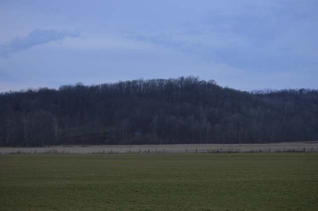
Photo: Nyttend, public domain · Wikimedia Commons
Local history sources: en.wikipedia.org · en.wikipedia.org · en.wikipedia.org · en.wikipedia.org · en.wikipedia.org · en.wikipedia.org · en.wikipedia.org · en.wikipedia.org · commons.wikimedia.org · commons.wikimedia.org · archive.org
Water
Mostly private wells The water here
- Laurelville, Vlg Of51% of residentsGroundwater wells (2 wells)
- Ross County Water Co. Inc49% of residentsTeays Valley Aquifer (buried valley groundwater)
Hospitals, fire stations and more
Inside Salt Creek Township, Hocking County's boundary: 1 poor-rated bridge, 5 spill cases and 1 mound or earthwork. Press a pin or a name for its whole record and its source.
Bridges rated poor (1)
-
SR 56 over Coonrod CreekPoor · built 1930
- Condition
- Poor: a deck, superstructure, substructure or culvert rated 4 or below on the 0 to 9 scale
- What it is
- Bridge
- Built
- 1930
- Length
- 8 ft
- Owner
- State
- Vehicles a day
- 1,012
- Coordinates
- 39.42063, -82.66424
National Bridge Inventory (source) ↗ Street map and directions ↗
Source: FHWA National Bridge Inventory 2025. "Poor" means one major part rated 4 or below on the 0 to 9 scale; it calls for repair, not closing, unless the state posts or closes the bridge.
Spills reported since 2021 (5)
-
Other / All Other / Trade Name / Mixture / Solution Etc Reached water2024-09-20 · Salt Creek Twp
- Reported
- 2024-09-20
- What spilled
- Other / All Other / Trade Name / Mixture / Solution Etc
- Reached a waterway
- 37 - Salt Creek
- Where
- Salt Creek Twp, Hocking County
- Ohio EPA district office
- SEDO
- Ohio EPA case number
- 2409EPA0001611
Ohio EPA spill reports (source) ↗ Street map and directions ↗
-
Oil Hydraulic Fluid(S) Reached water2024-07-18 · Salt Creek Twp
- Reported
- 2024-07-18
- What spilled
- Oil Hydraulic Fluid(S)
- Largest amount reported
- 1 gallons
- Reached a waterway
- 37 - Salt Creek
- Where
- Salt Creek Twp, Hocking County
- Ohio EPA district office
- SEDO
- Ohio EPA case number
- 2407EPA0001228
Ohio EPA spill reports (source) ↗ Street map and directions ↗
-
Natural Gas2022-10-04 · Salt Creek Twp
- Reported
- 2022-10-04
- What spilled
- Natural Gas
- Where
- Salt Creek Twp, Hocking County
- Ohio EPA district office
- SEDO
- Ohio EPA case number
- 2210EPA0001505
Ohio EPA spill reports (source) ↗ Street map and directions ↗
-
Oil Transformer Non Pcb2022-02-04 · Salt Creek Twp
- Reported
- 2022-02-04
- What spilled
- Oil Transformer Non Pcb
- Where
- Salt Creek Twp, Hocking County
- Ohio EPA district office
- SEDO
- Ohio EPA case number
- 2202EPA0000134
Ohio EPA spill reports (source) ↗ Street map and directions ↗
-
Oil Hydraulic Fluid(S)2021-05-18 · Salt Creek Twp
- Reported
- 2021-05-18
- What spilled
- Oil Hydraulic Fluid(S)
- Where
- Salt Creek Twp, Hocking County
- Ohio EPA district office
- SEDO
- Ohio EPA case number
- 2105EPA0000697
Ohio EPA spill reports (source) ↗ Street map and directions ↗
Source: Ohio EPA emergency response spill reports, 2021 to September 2026, one point per case where Ohio EPA placed it. A report is what the caller or responder recorded; amounts are often blank or estimated.
Mounds and earthworks (1)
-
Karshner MoundMound · Adena culture
- What it is
- Mound
- Age
- Adena culture, c. 1000 BC - AD 400
- Where
- second terrace above Salt Creek, near Laurelville, Hocking County
- County
- Hocking County
- Named in the history of
- Laurelville (village), Salt Creek Township
- Map point
- from the site's Wikipedia article
Wikipedia article (point and source) ↗ Street map and directions ↗
Many mounds stand on private land; visit only those open to the public.
Source: the History records' native sites, each placed by its own Wikipedia article; sites no article places are named on the History card but not pinned.
Its ZIP codes
Each ZIP code that touches Salt Creek Township, Hocking County, with the share of its residents who live here and the same headline figures as the ZIP page.
| ZIP | Share | Water | Radon | Home value | Schools | Flood |
|---|---|---|---|---|---|---|
| 43152 Benton Township and South Bloomingville | 26% | Mostly private wells | Too few radon tests | Median year built 1989 | Logan-Hocking Local · 3.5 stars overall | 6.9% of residents in the 1% floodplain |
| 43135 Perry Township and Laurelville | 20% | Mostly private wells | 4.7 pCi/L average radon | Median year built 1989 | Logan Elm Local · 3.5 stars overall | 6.3% of residents in the 1% floodplain |
Local government
Who holds office in Salt Creek Township, Hocking County, how its elections and ballot issues came out, and the state auditor's record.
Money issues on the ballot since 2018: 2 of 2 passed.
Ballot issues
| Date | Issue | For | Against | Result |
|---|---|---|---|---|
| 2021-11-02 | Issue: Salt Creek Township Road Improvement | 151 | 71 | Passed (68.02% for), unofficial |
| 2018-11-06 | Issue: Salt Creek Township 1 mill Add (1.0 mills) | 227 | 180 | Passed (55.77% for) |
| 2017-11-07 | Issue: Salt Creek Twp Fire Protection | 183 | 82 | Passed (69.06% for) |
Elections for office
| Date | Office | Candidates and votes |
|---|---|---|
| 2021-11-02 | Trustee (unofficial count) | Timothy W. Hartley 123, 43.31%; Doug Willard 161, 56.69% |
| 2019-11-05 | Trustee | Daron M Myers 122, 100.0% |
| 2019-11-05 | Fiscal Officer | Mak Maxson Seifert 116, 100.0% |
| 2015-11-03 | Township Trustee | Daron Myers 192, 65.31%; Bill Stout 102, 34.69% |
| 2015-11-03 | Township Fiscal Officer | Makiah Maxson 240, 100.0% |
Winners in bold. Results from the county board of elections' official canvass unless marked.
Auditor of State record
- No fiscal caution, watch or emergency on the Auditor of State's lists.
- Agreed Upon Procedures, 2023 to 2024, released 2025-12-23
The county
Hocking County: 8 ZIP codes, 13 cities, villages and townships, 27,033 people.
Nearby places
Quick answers
What county is Salt Creek Township, Ohio in?
Salt Creek Township, Hocking County is a township in Hocking County, Ohio, with 1,117 residents.
How did Salt Creek Township, Ohio get its name?
Salt Creek Township was named from the creek that runs through it and the salt production once associated with that creek. Source
What ZIP code is Salt Creek Township, Ohio?
Salt Creek Township, Hocking County is served by ZIP codes 43152 and 43135; 43152 holds the largest share of its residents.
Where does Salt Creek Township, Ohio get its water?
The main water source for Salt Creek Township, Hocking County (Laurelville, Vlg Of): Mostly private wells.
Cite this page
Cite this page as:
Cracked Buckeye, "Salt Creek Township, Hocking County", https://crackedbuckeye.com/place/salt-creek-township-hocking-county/, built 2026-10-31, accessed [date].
How to cite · Report a correction · Built 2026-10-31
