Local events in Rutland Township, Meigs County
Nothing is posted for Rutland Township itself yet; here is what is on within 20 miles. All local events in Rutland Township, Meigs County
Know a calendar we should watch? Send the link
Checked October 20; the events page is refreshed daily.
How Rutland Township, Meigs County began
Rutland Township was partitioned from Salisbury Township in 1812, when the surveyed land of Township 6, Range 14 of the Ohio Company's Purchase held enough settlers to justify a government of its own -- the first four of them, Connecticut men who arrived in 1803, having taken up land nine years before the township existed. It became part of Meigs County in 1819 and today holds the small village of Rutland and the unincorporated community of Langsville. Farm families here sent volunteers into General Edward W. Tupper's brigade during the War of 1812, and a local family's chance, friendly encounter with a group of Native visitors during a Sunday service became one of the township's best-remembered pioneer-era stories. Rutland Township remains rural, with 2,137 residents recorded in the 2020 census.
Settled 1803, incorporated 1812, by Joel Higley Jr., James E. Phelps, Daniel Rathburn and Benjamin Williams, all originally of Granby, Connecticut, who settled the area in 1803, nine years before the township was organized.
Where the name comes from
No known source we consulted gives an explicit origin for the name Rutland. It is the only township named Rutland statewide in Ohio; the earliest documented settlers came from Granby, Connecticut, a region with no place called Rutland, so the name's source is not established.
Before the town
The one specific, dated account of Native Americans in Rutland Township comes from the township's own pioneer-history record: sometime between about 1804 and 1808, a family in Rutland was holding a Sunday religious service in their home -- ordinary practice before dedicated churches existed here -- when a party of Native visitors, tribal affiliation not recorded, appeared outside and looked in through cracks in the door and the log walls. The startled settlers sent men out to investigate and found the visitors peaceful; they asked for johnny-cake, were given it, and left on good terms. A local resident, Milo Higley, later commemorated the episode in a song. No named village, camp, trail or treaty site has been documented within the township itself beyond this encounter. Rutland lies within land the United States treated as ceded by the Treaty of Fort McIntosh (1785) and Treaty of Fort Harmar (1789), agreements the Shawnee and Miami disputed until the Treaty of Greenville (1795). See the Meigs County history for the fuller treaty record.
Nations recorded here: Shawnee, Wyandot, Mingo (Seneca-Cayuga).
- Rutland Sunday-service encounter (other) — A settler's home in Rutland, exact site not recorded, c. 1804-1808 (meigs.ohgenweb.org)
Timeline
- — Joel Higley Jr., James E. Phelps, Daniel Rathburn and Benjamin Williams, all from Granby, Connecticut, settle in what will become Rutland Township, nine years before the township is organized.
- — A party of Native visitors interrupts a Sunday home religious service in Rutland; after an initial scare, settlers give them johnny-cake and the encounter ends peacefully.
- — Rutland Township is organized out of Salisbury Township's territory, covering Township 6, Range 14 of the Ohio Company's Purchase; the formation reflects local population growth rather than the outbreak of the War of 1812 that same year.
- — General Edward W. Tupper raises a brigade of roughly 1,000 volunteers from Gallia County and the surrounding region for the Northwest campaign of the War of 1812; men from the Rutland area serve in it.
- — Rutland Township, along with the rest of the area, becomes part of the newly formed Meigs County.
- — Two survivors of the Army of the Northwest's War of 1812 campaign, John Woodard and Elihu Higley, are recorded still living in Rutland Township.
- — The Leading Creek Conservancy District is formed under Ohio Revised Code Chapter 6101 to clean small streams and develop a potable water system for rural residents of Rutland, Langsville and the surrounding area.
- — The Leading Creek Conservancy District holds an unconditional Ohio EPA operating license with three Class 1 licensed operators, drawing from four wells on Watson Grove Road near Cheshire in adjoining Gallia County.
Stories
Johnny-cake for a Sunday visit
In the years right after the first Connecticut families settled Rutland, home worship was the only kind available -- no church building yet stood anywhere nearby. During one such Sunday service, held as always in a settler's cabin, a party of Native visitors came up quietly and peered in through the cracks in the door and between the logs of the walls. For a moment the small congregation was alarmed; then a few of the men stepped outside to see who it was, and found the visitors entirely peaceful. All they wanted was johnny-cake, the cornmeal bread that was a pioneer kitchen staple, and the settlers had plenty to share. The visitors ate and left on friendly terms, and the moment stuck in local memory long enough that Milo Higley, from one of the township's founding families, later turned it into a song -- a rare glimpse, in the township's own record, of ordinary contact between the area's Native and settler populations in the years just after Ohio statehood.
A brigade raised for the Northwest, and the men who outlived it
When the War of 1812 broke out, Meigs County's river townships were still barely a decade settled, but General Edward W. Tupper raised roughly 1,000 volunteers from Gallia County and the surrounding region -- Rutland was then part of Gallia County -- to serve in the Army of the Northwest's campaign against British and allied forces. It was, by the local histories, a matter of civic pride more than urgent necessity: Rutland Township's own organization that same year had nothing to do with the war and everything to do with population growth along Leading Creek. Decades later, in 1876, the township's own records still noted two living veterans of that Army of the Northwest campaign, John Woodard and Elihu Higley, among its oldest residents -- men who had watched the raw township of 1812 grow into a settled farming community by the time of the nation's centennial.
Photographs
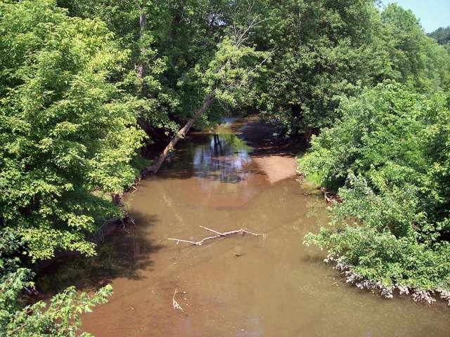
Photo: Tim Kiser (Malepheasant), CC BY-SA 3.0 · Wikimedia Commons
Local history sources: en.wikipedia.org · meigs.ohgenweb.org · meigs.ohgenweb.org · en.wikipedia.org · lccdwater.com · commons.wikimedia.org
Water
Groundwater wells (4 wells) The water here
- Leading Creek Conservancy District71% of residentsGroundwater wells (4 wells)
- Middleport Village25% of residentsGroundwater wells (3 wells)
- Pomeroy Village4% of residentsGroundwater wells (2 wells)
- Syracuse Village0% of residentsGroundwater wells (2 wells)
Hospitals, fire stations and more
Inside Rutland Township, Meigs County's boundary: 2 public schools, 1 poor-rated bridge, 1 shale or injection well and 2 spill cases. Press a pin or a name for its whole record and its source.
Public schools (2)
-
Meigs Intermediate School2 of 5 stars · Middleport
- Address
- 36871 State Route 124, Middleport, OH 45760
- School district
- Meigs Local School District
- Kind (NCES)
- Regular School
- Students, 2023-24
- 346
- Teachers (full-time equivalent)
- 20
- Report card, 2025-26
- 2 of 5 stars
- Performance index
- 65.6%
- Ohio building IRN
- 000105
- NCES school ID
- 390485204639
NCES school record ↗ Ohio School Report Card ↗ Street map and directions ↗
-
Meigs Primary School3 of 5 stars · Middleport
- Address
- 36871 State Route 124, Middleport, OH 45760
- School district
- Meigs Local School District
- Kind (NCES)
- Regular School
- Students, 2023-24
- 383
- Teachers (full-time equivalent)
- 21
- Report card, 2025-26
- 3 of 5 stars
- Ohio building IRN
- 000102
- NCES school ID
- 390485204638
NCES school record ↗ Ohio School Report Card ↗ Street map and directions ↗
Source: NCES EDGE public school locations 2024-25 and Common Core of Data 2023-24 (type, students, teachers); Ohio School Report Cards 2025-26 (Department of Education and Workforce), matched by name within the district.
Bridges rated poor (1)
-
C352 Paulins Hill over Leading CreekPoor · built 1956
- Condition
- Poor: a deck, superstructure, substructure or culvert rated 4 or below on the 0 to 9 scale
- What it is
- Bridge
- Built
- 1956
- Length
- 32 ft
- Owner
- County
- Vehicles a day
- 276
- Coordinates
- 39.01274, -82.13779
National Bridge Inventory (source) ↗ Street map and directions ↗
Source: FHWA National Bridge Inventory 2025. "Poor" means one major part rated 4 or below on the 0 to 9 scale; it calls for repair, not closing, unless the state posts or closes the bridge.
Shale and injection wells (1)
-
Leland Clonch & Retha (Swiw # 2) 1 InjectionInjection well (Class II)
- What it is
- Injection well (Class II)
- Operator
- J D Drilling Company
- County
- Meigs County
- API well number
- 34105227380000
- Coordinates
- 39.05322, -82.09560
ODNR oil and gas wells (source) ↗ Street map and directions ↗
Source: ODNR Division of Oil and Gas Resources well inventory (September 2026): drilled Utica, Marcellus and horizontal wells and Class II injection wells not plugged. Older vertical wells are on the full map.
Spills reported since 2021 (2)
-
Oil Petroleum Not Otherwise Specified (Nos)2025-07-01 · Rutland Twp
- Reported
- 2025-07-01
- What spilled
- Oil Petroleum Not Otherwise Specified (Nos)
- Where
- Rutland Twp, Meigs County
- Ohio EPA district office
- SEDO
- Ohio EPA case number
- 2507EPA0001097
Ohio EPA spill reports (source) ↗ Street map and directions ↗
-
Oil Crude Reached water2023-06-14 · Rutland Twp
- Reported
- 2023-06-14
- What spilled
- Oil Crude
- Reached a waterway
- 99 - Unnamed
- Where
- Rutland Twp, Meigs County
- Ohio EPA district office
- SEDO
- Ohio EPA case number
- 2306EPA0000989
Ohio EPA spill reports (source) ↗ Street map and directions ↗
Source: Ohio EPA emergency response spill reports, 2021 to September 2026, one point per case where Ohio EPA placed it. A report is what the caller or responder recorded; amounts are often blank or estimated.
Its ZIP codes
Each ZIP code that touches Rutland Township, Meigs County, with the share of its residents who live here and the same headline figures as the ZIP page.
| ZIP | Share | Water | Radon | Home value | Schools | Flood |
|---|---|---|---|---|---|---|
| 45775 Rutland Township and Rutland | 63% | Groundwater wells (4 wells) | Too few radon tests | No homes in the parcel records | Meigs Local · 2.5 stars overall | 7.6% of residents in the 1% floodplain |
| 45760 Middleport | 17% | Municipal wellfield of three wells feeding the village's water treatment plant (recorded by EPA as WTP 2 and WTP 3 units at one site) | Too few radon tests | Median year built 1982 | Meigs Local · 2.5 stars overall | 46% of residents in the 1% floodplain |
| 45741 Salem Township and Langsville | 9% | Groundwater wells (4 wells) | Too few radon tests | No homes in the parcel records | Meigs Local · 2.5 stars overall | 3.6% of residents in the 1% floodplain |
| 45769 Pomeroy | 3% | Groundwater wells (2 wells) | Too few radon tests | Parcel list only | Meigs Local · 2.5 stars overall | 4.5% of residents in the 1% floodplain |
Local government
Who holds office in Rutland Township, Meigs County, how its elections and ballot issues came out, and the state auditor's record.
Money issues on the ballot since 2020: 3 of 3 passed.
Ballot issues
| Date | Issue | For | Against | Result |
|---|---|---|---|---|
| 2021-11-02 | Issue: Rutland Twp. Roads Levy Renewal - 2.16mills/5yrs (2.16 mills, renewal) | 189 | 100 | Passed (65.4% for) |
| 2021-11-02 | Issue: Rutland Twp. Cemetery Levy Renewal - 1mill/5yrs (1.0 mills, renewal) | 202 | 86 | Passed (70.14% for) |
| 2020-11-03 | Issue: Proposed Tax Levy - Renewal - Rutland Township - Fire protection - 1 mill. 5 years (1.0 mills, renewal) | 713 | 291 | Passed (71.02% for) |
| 2020-11-03 | Issue: Local Liquor Option - Rutland Township - Langsville Gas and Grocery | 265 | 166 | Passed (61.48% for) |
Elections for office
| Date | Office | Candidates and votes |
|---|---|---|
| 2021-11-02 | Township Trustee | David E. Davis 196, 49.37%; Steve Lambert 201, 50.63% |
| 2019-11-05 | Township Trustee | Joe Bolin 375, 100.0% |
| 2019-11-05 | Township Fiscal Officer | Opal L. Dyer 335, 100.0% |
Winners in bold. Results from the county board of elections' official canvass unless marked.
Auditor of State record
- No fiscal caution, watch or emergency on the Auditor of State's lists.
- Agreed Upon Procedures, 2022 to 2023, released 2025-04-03
The county
Meigs County: 12 ZIP codes, 16 cities, villages and townships, 20,189 people.
Nearby places
Quick answers
What county is Rutland Township, Ohio in?
Rutland Township, Meigs County is a township in Meigs County, Ohio, with 1,710 residents.
When was Rutland Township, Ohio founded?
Rutland Township, Meigs County was settled 1803; incorporated 1812. Founders on record: Joel Higley Jr., James E. Phelps, Daniel Rathburn and Benjamin Williams, all originally of Granby, Connecticut, who settled the area in 1803, nine years before the township was organized. Source
How did Rutland Township, Ohio get its name?
No known source we consulted gives an explicit origin for the name Rutland. Source
What ZIP code is Rutland Township, Ohio?
Rutland Township, Meigs County is served by ZIP codes 45775, 45760, 45741 and 45769; 45775 holds the largest share of its residents.
Where does Rutland Township, Ohio get its water?
The main water source for Rutland Township, Meigs County (Leading Creek Conservancy District): Groundwater wells (4 wells).
Cite this page
Cite this page as:
Cracked Buckeye, "Rutland Township, Meigs County", https://crackedbuckeye.com/place/rutland-township-meigs-county/, built 2026-10-31, accessed [date].
How to cite · Report a correction · Built 2026-10-31
