Water system
Leading Creek Conservancy District
EPA ID OH5300012 · Meigs County · 6,663 people served
Leading Creek Conservancy District treats its own water from Groundwater wells (4 wells).
The system's record
- Active wells
- 4
- Serves
- 6,663 people · Meigs County
- EPA ID
- OH5300012
About this area's water
Did you know
- The district's wells are not in the county it mostly serves: all four are in Gallia County, on Watson Grove Rd. near Cheshire, pumping the Ohio River Valley Aquifer to customers in Meigs County and beyond.
- Nearly all of the district's disinfection by-product load is a single compound — bromoform measured 44.9 ppb out of 48.9 ppb of total trihalomethanes in 2025, the fingerprint of a bromide-rich groundwater source.
- The water is very hard: the CCR reports 21 grains per gallon, roughly 360 mg/L as calcium carbonate, and the district does not soften it.
- It is a conservancy district, not a village or county utility — created in the late 1960s under the same Ohio law used to organize flood-control districts, originally chartered to clean small streams as well as to pipe…
- The board of directors meets on the fourth Tuesday of each month at the water office on Corn Hollow Road, and the district runs its system with three Class 1 Ohio EPA licensed operators.
Source: lccdwater.comdata.epa.gov
History3
- 1960sLeading Creek Conservancy District formed in the late 1960s under Ohio Revised Code Chapter 6101, originally to clean small streams and to develop a potable water system for rural residents…
- 2025District held an unconditional Ohio EPA license to operate, with three Class 1 licensed operators and two licensed backflow-prevention technicians; no monitoring, MCL or treatment-technique…
- 2026Boil advisory issued and then lifted on September 3-4, 2026 for SR 689 north of North Run Road, North Run Road, Cottrill Road, Cone Road, Laurel Road, Darst Road, Point Rock and Castor Cemetery.
Source: lccdwater.comlccdwater.com
Treatment & pressure
How it is treated
Four groundwater wells on Watson Grove Rd. near Cheshire in Gallia County, drawing the Ohio River Valley Aquifer. Treatment is chemical rather than filtration-based: chlorine for disinfection, orthophosphate for corrosion control (to limit lead and copper leaching from customer plumbing), and…
Source: lccdwater.com
Water pressure
not published — no distribution pressure figure appears in the district's CCR, rate schedule or website.
What it costs
$11.50 per 1,000 gallons
Typical household bill about $62 a month for water.
Published rate schedule: $38.53 minimum bill including the first 2,000 gallons, then $11.50 per 1,000 gallons for 2,001-5,000; $10.30 for 5,001-11,000; $8.65 for 11,001-21,000…
Source: lccdwater.com
Water quality & impurities10
| Contaminant | Level | Limit | Year |
|---|---|---|---|
| Total trihalomethanes (TTHM) Range 43.6-48.9 ppb; the highest-loaded regulated contaminant in the system, at about 61% of the MCL. | 48.9 ppb | 80 (MCL) | 2025 |
| Bromoform Range 41.3-44.9 ppb. Bromoform accounts for nearly all of the district's 48.9 ppb of total trihalomethanes, a signature… | 44.9 ppb | none… | 2025 |
| Haloacetic acids (HAA5) Range 8.1-18.4 ppb. | 18.4 ppb | 60 (MCL) | 2025 |
| Total chlorine Range 0.3-1.9 ppm. | 1.9 ppm | 4 (MRDL) | 2025 |
| Fluoride Range 0.6-1.30 ppm; fluoride is deliberately injected by the district. | 1.08 ppm | 4 (MCL) | 2024 |
| Nitrate Well below the MCL, but Ohio EPA's source water assessment cites man-made nitrate in the treated water as one of the… | 0.677 ppm | 10 (MCL) | 2025 |
| Arsenic Range 0-3.51 ppb. Note that the CCR table transposes the arsenic MCL and MCLG columns (it prints MCLG 10 / MCL 0); the… | 3.51 ppb | 10 (MCL) | 2024 |
| Chromium Range 0-1.91 ppb. | 1.91 ppb | 100 (MCL) | 2024 |
| Selenium Range 0-1.38 ppb. | 1.38 ppb | 50 (MCL) | 2024 |
| Barium Range 0-0.039 ppm. | 0.039 ppm | 2 (MCL) | 2024 |
Source: lccdwater.com
EPA compliance record
Lead at the tap: 90th-percentile result 0 ppb in 2025 (action level 15 ppb).
EPA health-based violations since 2015:
- 2024Lead and Copper Rule (lead) · treatment technique violation · returned to compliance
6 violations of any kind logged since 2020, 5 of them paperwork (monitoring, reporting, public notice or consumer report).
Supply stress
Ohio EPA's source water assessment rates the district's aquifer as highly susceptible to contamination, for three stated reasons: a relatively thin protective clay layer over the aquifer, significant potential contaminant sources inside the protection area, and the presence of man-made contaminants (nitrates) in the treated water. That…
Sewers
Sanitary
None. Leading Creek Conservancy District is a water-only utility: its 2025 CCR states that although it remains a conservancy district formed under ORC 6101 with authority for a wide range of services, its sole function at this time is providing potable water. No sanitary sewer provider for Rutland, Langsville or Wilkesville was…
Source: lccdwater.com
Sourcesverified
Compiled from the utility's own reports and public records, then independently re-checked against primary sources.
Main supplier in 3 ZIP codes
Serves
Main water supplier in 4 ZIP codes
- 45775 · Rutland Township and Rutland98% of residents
- 45741 · Salem Township and Langsville91% of residents
- 45695 · Vinton Township and Wilkesville50% of residents
- 45686 · Huntington Township and Vinton11% of residents
Also present in 3 more ZIP codes
- 45760 · Middleport24% of residents
- 45769 · Pomeroy23% of residents
- 45710 · Lee Township and Albany5% of residents
Population-weighted resident shares; a ZIP code can have more than one system on record. Recomputed from each ZIP's own system list, not from the map's cached footprint.
Buys from · Sells to
Leading Creek Conservancy District does not buy water from another system on record; it treats its own source water.
No other system is on record buying water from Leading Creek Conservancy District.
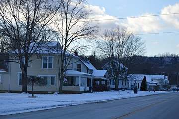
Photograph
On the map
Show this system's territory on the map — 7 ZIP codes in all.
Sources
U.S. EPA SDWIS and Community Water System Service Area Boundaries (v3, 2026), Ohio EPA primacy data, 2020 census blocks: the system serving most residents, traced through purchases to the treating utility; Ohio EPA 2023 Sewer and Water Rate Survey (Ohio State, May 2025) for household bills; Ohio EPA DEFA loan awards since 2016 for the loans paragraph · EPA SDWIS · EPA service area boundaries · Ohio EPA drinking water · Ohio EPA rate survey
Notable facts: lccdwater.com, data.epa.gov
History: lccdwater.com, lccdwater.com
Water quality: lccdwater.com
Planned work: lccdwater.com
Capital projects: lccdwater.com, lccdwater.com
Rates: lccdwater.com
Sewers: lccdwater.com
Treatment: lccdwater.com
Supply stress: lccdwater.com, wwwapp.epa.ohio.gov, lccdwater.com