Local events in Pomeroy
Pomeroy itself has 1 event posted in the next 90 days; the others here are within 20 miles. All local events in Pomeroy
Checked October 20; the events page is refreshed daily.
Notable people from Pomeroy
Ohioans tied to this place, each with a sourced profile. All notable Ohioans
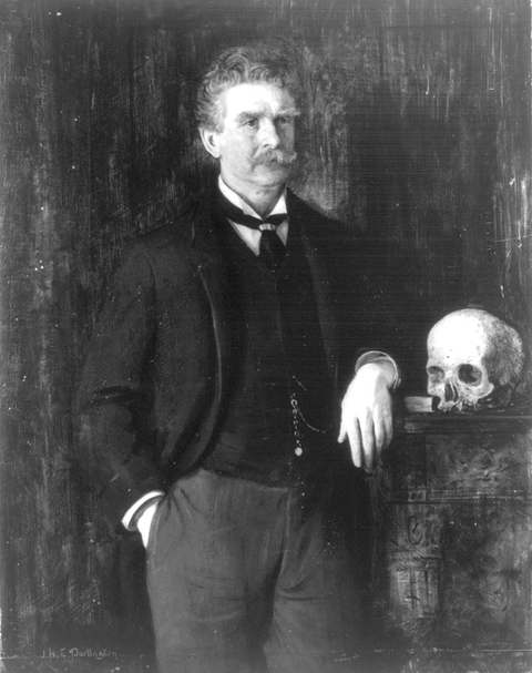
History from Pomeroy
People and inventions tied to this place, each with its sources. All people · All inventions
How Pomeroy began
Pomeroy was founded around 1804 when Samuel Wyllys Pomeroy, a Boston merchant, bought land here from the Ohio Company; the settlement grew slowly under the name Nyesville until Pomeroy and his sons and sons-in-law organized a coal-mining company in the 1830s and built the town on it. Coal and, after 1848, brine-well salt made it a 19th-century river-trade hub, with a downtown squeezed onto a narrow shelf between the Ohio River and a steep hillside, giving Pomeroy its distinctive stepped, terraced streets and a courthouse with entrances on three different levels. It was incorporated in 1840 and became the Meigs County seat in 1841. Repeated floods (1884, 1913, 1937) and the postwar decline of coal and salt shrank the town from a mid-19th-century peak of roughly 6,000 people to 1,573 at the 2020 census.
Settled 1804-1806, incorporated 1840, by Samuel Wyllys Pomeroy and Samuel Ervin.
Where the name comes from
The village was first called Nyesville, after Nial Nye, who ran a tavern, mill and wharf-boat there from 1826. It was renamed for Samuel Wyllys Pomeroy, the Boston merchant and land speculator whose family developed the surrounding coal lands in the 1830s.
Before the town
No Native American village, trail or burial site has been documented within Pomeroy's own village limits in the sources we checked. A National Register site called 'Mound Cemetery Mound' is sometimes tied to Pomeroy's ZIP code, but that Adena burial mound is actually located north of the separate community of Chester, in Chester Township, several miles from the village. The county as a whole held numerous Adena-era burial mounds, many destroyed by early settlers digging for relics, and the land was claimed by the United States from the Wyandot, Lenape (Delaware), Shawnee and other nations of the Northwest Territory confederation through the Treaty of Fort Harmar (1789) and, more fully, the Treaty of Greenville (1795); Pomeroy sits within the area the Ohio Company purchased from Congress in 1787, on the American side of the pre-1795 frontier along the Ohio River.
Nations recorded here: Wyandot, Shawnee, Lenape (Delaware), Adena culture.
Timeline
- — Samuel Wyllys Pomeroy, a Boston merchant, purchased land from the Ohio Company along the Ohio River at the site that would become Pomeroy.
- — David Bradshaw opened the first coal bank in the Pomeroy area, beginning coal mining that would dominate the local economy for over a century.
- — A post office opened under the name Nyesville, the settlement's original name.
- — The Pomeroy company built the steam towboat Condor, one of the first coal-fired (rather than wood-fired) boats on the Ohio River, able to tow loaded coal barges to Cincinnati and back on a weekly run.
- — The village of Pomeroy was incorporated.
- — Pomeroy became the seat of Meigs County.
- — Salt production began after brine was struck in deep coal-company wells, adding a second extractive industry to the local economy.
- — One of the village's most disastrous floods struck Pomeroy; a fire the same year was one of several that destroyed its old wooden buildings.
- — A major Ohio River flood hit Pomeroy, one of the most disastrous in its history.
- — The Ohio River flood of 1937, one of the most disastrous on record for the entire Ohio Valley, devastated Pomeroy along with other river towns.
- — Coal and salt production in the Pomeroy area were not resumed after World War II, leading to sustained economic and population decline.
- — The Pomeroy Historic District, covering the village's 19th-century downtown, was added to the National Register of Historic Places; a boundary increase was added later.
Stories
A courthouse built into a cliff
Pomeroy's downtown sits on a shelf so narrow between the Ohio River and the hillside behind it that the streets had to be terraced, one above another, up the slope. The Meigs County Courthouse, built in 1848 in the Greek Revival style and enlarged with wings along the hillside in 1877, was built directly into that hillside: because of the grade, the building has entrances on three different ground-level floors, a detail that got it featured in Ripley's Believe It or Not! The same terraced, stair-stepped layout still defines the whole historic district today.
The Condor and the coal boom
In 1833 Samuel Pomeroy organized a mining company with his two sons and two sons-in-law and began working the coal seams along the river in earnest; by the mid-1830s the operation employed about 200 men, many of them Welsh immigrants experienced in mining, and pulled roughly two million bushels of coal a year out of the hillsides. At Coalport, just below the town, miners drove horizontal shafts more than a hundred feet above the river and let gravity carry loaded coal cars down a series of graded tracks to the water. In 1835-36 the company built the steamboat Condor, one of the first towboats on the Ohio River to burn coal instead of wood, and used it to tow barges of Pomeroy coal down to Cincinnati and back every week, burning about 2,000 bushels a trip. The town grew from twelve families in 1834 to roughly 1,600 people by 1846 on the strength of that trade.
When the war ended, so did the work
Coal and the salt wells that were sunk into the coal-company's shafts after 1848 kept Pomeroy's economy running for more than a century, surviving the floods of 1884, 1913 and 1937 that repeatedly swamped the low riverside downtown. World War II gave the mines and salt works one last surge of demand. But when the war ended, coal and salt production in the Pomeroy area was not resumed, and the village's population, which had peaked near 6,500 in 1860, went into a decline that has continued for eighty years, leaving a 2020 population of 1,573 in a downtown built for a city several times that size.
Photographs
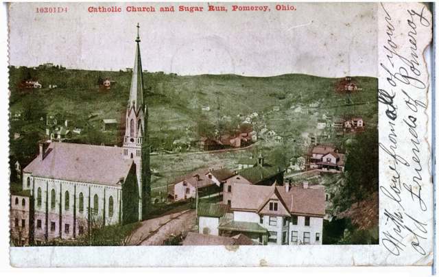
Photo: Columbus Metropolitan Library, via Digital Public Library of America / Ohio Digital Network, public domain · Wikimedia Commons
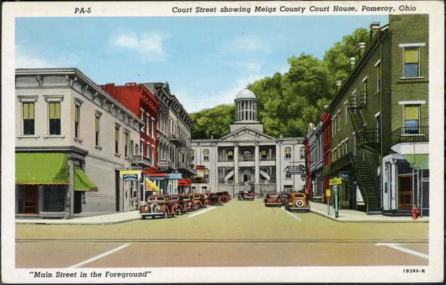
Photo: Columbus Metropolitan Library, via Digital Public Library of America, no known copyright restrictions · Wikimedia Commons
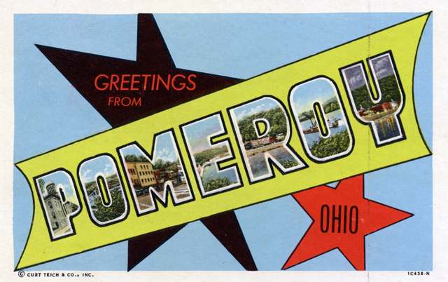
Photo: Steven R. Shook collection, via Flickr, CC BY 2.0 · Wikimedia Commons

Photo: w_lemay, via Flickr, CC BY-SA 2.0 · Wikimedia Commons
Local history sources: en.wikipedia.org · en.wikipedia.org · meigs.ohgenweb.org · en.wikipedia.org · en.wikipedia.org · en.wikipedia.org · en.wikipedia.org · data.epa.gov · en.wikipedia.org · commons.wikimedia.org · commons.wikimedia.org · commons.wikimedia.org · commons.wikimedia.org
Historic places
1 place in Pomeroy on the National Register of Historic Places. Press a pin or a name for its whole record.
-
Pomeroy Historic District (Boundary Increase)Historic district · Pomeroy · listed 1980
- Address
- Second St.
- Where
- Pomeroy, Meigs County · ZIP 45769
- What it is
- Historic district
- Listed on the National Register
- 1980
- NRIS reference number
- 80004248
- Coordinates
- 39.02795, -82.03335
National Register file (NPS) ↗ Search Wikipedia ↗ Street map and directions ↗ On the Cracked Buckeye map
Source: National Park Service, National Register of Historic Places point file. The listing year is shown where NPS's certification date agrees with the listing's reference number. Listing recognizes significance; it does not restrict a private owner.
Water
Groundwater wells (2 wells) The water here
- Pomeroy Village55% of residentsGroundwater wells (2 wells)
- Leading Creek Conservancy District41% of residentsGroundwater wells (4 wells)
- Middleport Village2% of residentsGroundwater wells (3 wells)
- Syracuse Village2% of residentsGroundwater wells (2 wells)
Hospitals, fire stations and more
Inside Pomeroy's boundary: 1 fire or EMS station, 1 library, 1 museum, 2 police stations and 3 spill cases. Press a pin or a name for its whole record and its source.
Fire and EMS stations (1)
-
Pomeroy Fire DepartmentPomeroy
- Address
- 125 Butternut Avenue, Pomeroy, OH 45769
- Coordinates
- 39.02793, -82.03650
USGS National Map structures (source) ↗ Street map and directions ↗
Source: USGS National Map structures (most Ohio records last updated 2019 to 2022), checked against the Columbus and Cleveland station lists. The department that answers a call is set by jurisdiction and mutual aid, not by distance.
Public libraries (1)
-
Meigs County District Public LibraryCentral library · Pomeroy
- Address
- 216 W Main St, Pomeroy, OH 45769
- What it is
- Central library
- Library system
- Meigs County District Public Library
- Open
- 3,484 hours a year, 52 weeks
- Building
- 10,244 sq ft
- System's visits, FY2024
- 127,296
- System's loans, FY2024
- 151,566
- People the system serves
- 22,210
- Phone
- (740) 992-5813
IMLS Public Libraries Survey (source) ↗ Street map and directions ↗
Source: IMLS Public Libraries Survey FY2024 (outlets and their systems). Any Ohio resident can get a free card at any Ohio public library.
Museums, historical societies, gardens and zoos (1)
-
Meigs County MuseumMuseum · Pomeroy
- What it is
- Museum
- City
- Pomeroy
- Coordinates
- 39.02906, -82.03976
Search Wikipedia ↗ IMLS Museum Data Files (source) ↗ Street map and directions ↗
The museum list is IMLS's 2018 file; a museum may have closed or moved since.
Source: IMLS Museum Data Files, 2018.
Police stations (2)
-
Meigs County Sheriff's OfficePomeroy
- Address
- 104 East 2nd Street, Pomeroy, OH 45769
- Coordinates
- 39.02788, -82.03349
USGS National Map structures (source) ↗ Street map and directions ↗
-
Pomeroy Police DepartmentPomeroy
- Address
- 660 East Main Street Suite A, Pomeroy, OH 45769
- Coordinates
- 39.03094, -82.01636
USGS National Map structures (source) ↗ Street map and directions ↗
Source: USGS National Map structures, police stations, corrected and completed by hand (September 2026). The department that answers a call is set by jurisdiction, not by distance.
Spills reported since 2021 (3)
-
Orphan Drum(S)2023-07-21 · Pomeroy
- Reported
- 2023-07-21
- What spilled
- Orphan Drum(S)
- Largest amount reported
- 55 gallons
- Where
- Pomeroy, Meigs County
- Ohio EPA district office
- SEDO
- Ohio EPA case number
- 2307EPA0001236
Ohio EPA spill reports (source) ↗ Street map and directions ↗
-
Drum(S)2023-07-05 · Pomeroy
- Reported
- 2023-07-05
- What spilled
- Drum(S)
- Largest amount reported
- 55 gallons
- Where
- Pomeroy, Meigs County
- Ohio EPA district office
- SEDO
- Ohio EPA case number
- 2307EPA0001097
Ohio EPA spill reports (source) ↗ Street map and directions ↗
-
Material White2023-02-27 · Pomeroy
- Reported
- 2023-02-27
- What spilled
- Material White
- Where
- Pomeroy, Meigs County
- Ohio EPA district office
- SEDO
- Ohio EPA case number
- 2302EPA0000300
Ohio EPA spill reports (source) ↗ Street map and directions ↗
Source: Ohio EPA emergency response spill reports, 2021 to September 2026, one point per case where Ohio EPA placed it. A report is what the caller or responder recorded; amounts are often blank or estimated.
Its ZIP codes
Each ZIP code that touches Pomeroy, with the share of its residents who live here and the same headline figures as the ZIP page.
| ZIP | Share | Water | Radon | Home value | Schools | Flood |
|---|---|---|---|---|---|---|
| 45769 Pomeroy | 26% | Groundwater wells (2 wells) | Too few radon tests | Parcel list only | Meigs Local · 2.5 stars overall | 4.5% of residents in the 1% floodplain |
| 45760 Middleport | 1% | Municipal wellfield of three wells feeding the village's water treatment plant (recorded by EPA as WTP 2 and WTP 3 units at one site) | Too few radon tests | Median year built 1982 | Meigs Local · 2.5 stars overall | 46% of residents in the 1% floodplain |
Local government
Who holds office in Pomeroy, how its elections and ballot issues came out, and the state auditor's record.
Money issues on the ballot since 2019: 4 of 5 passed; of those asking for new or higher taxes, 1 of 1.
Ballot issues
| Date | Issue | For | Against | Result |
|---|---|---|---|---|
| 2021-11-02 | Issue: Pomeroy Village Electric Aggregation Resolution | 58 | 75 | Failed (43.61% for) |
| 2020-11-03 | Issue: Proposed Tax Levy - Renewal - Pomeroy Village - Current expenses - 1 mill. 5 years (1.0 mills, renewal) | 326 | 241 | Passed (57.5% for) |
| 2020-11-03 | Issue: Proposed Tax Levy - Additional - Pomeroy Village - Police protection - 3 mill. 5 years (3.0 mills, additional) | 285 | 275 | Passed (50.89% for) |
| 2020-11-03 | Issue: Proposed Tax Levy - Renewal - Pomeroy Village - Fire protection - 2 mill. 5 years (2.0 mills, renewal) | 390 | 175 | Passed (69.03% for) |
| 2020-11-03 | Issue: Proposed Tax Levy - Renewal - Pomeroy Village - Cemetery maintenance - 1 mill. 5 years (1.0 mills, renewal) | 325 | 238 | Passed (57.73% for) |
| 2019-11-05 | Issue: Pomeroy Village Add 3 Mill Current Exp (3.0 mills) | 99 | 149 | Failed (39.92% for) |
Elections for office
| Date | Office | Candidates and votes |
|---|---|---|
| 2021-11-02 | Member of Council | Nicholas Alan Michael 82, 33.74%; Philip M. Ohlinger 81, 33.33%; Victor Young III 80, 32.92% |
| 2019-11-05 | Mayor | Don M. Anderson 208, 100.0% |
| 2019-11-05 | Council | Maureen Hennessy 195, 100.0% |
Winners in bold. Results from the county board of elections' official canvass unless marked.
The county
Meigs County: 12 ZIP codes, 16 cities, villages and townships, 20,189 people.
Nearby places
Rain and snow
How much has actually fallen on Pomeroy, day by day, from 1890 to now. Daily totals, not averages.
- rain, last 30 days
- 1.44 in
- 2026-09-30 to 2026-10-29
- rain so far in 2026
- 45.6 in
- 8.6 in above normal for the date
- snow so far in 2026
- 15.6 in
- a normal year brings 15.1 in
- a normal year
- 44.0 in
- average of 30 years, 1991-2020
| Month | Rain (in) | Snow (in) | Days counted |
|---|---|---|---|
| October 2026 | 1.44 | — | 29 |
| September 2026 | 9.55 | — | 30 |
| August 2026 | 9.28 | — | 31 |
| July 2026 | 3.73 | — | 31 |
| June 2026 | 4.94 | — | 30 |
| May 2026 | 5.97 | — | 31 |
| April 2026 | 2.40 | — | 30 |
| March 2026 | 5.28 | 3.6 | 31 |
| February 2026 | 0.91 | 4.1 | 28 |
| January 2026 | 2.14 | 7.9 | 31 |
| December 2025 | 1.85 | 7.7 | 31 |
| November 2025 | 3.04 | 0.5 | 30 |
| Wettest year | 1890 — 63.1 in |
|---|---|
| Driest year | 1894 — 24.0 in |
| Snowiest year | 1910 — 53.5 in |
| Wettest day on record | 9 September 2004 — 4.14 in |
| Heaviest snowfall in a day | 14 March 1993 — 16.22 in |
| Deepest snow on the ground | 27 November 1950 — 20.78 in |
Mostly estimated. Only 11% of these days come from a gauge standing inside Pomeroy - the rest are worked out from the nearest gauges around it, so read them as close estimates rather than readings.
49,832 days of records, 1890-01-01 to 2026-10-29. Source: NOAA NCEI GHCN-Daily, 3,240 gauges in and around Ohio. A day is "gauged" when a gauge standing inside the boundary reported it, and the value is the mean of those gauges. Otherwise it is interpolated by inverse distance from every gauge reporting within 50 miles. Nothing is carried forward, back-filled or smoothed. Against NOAA nClimDiv county monthly precipitation over 136,848 complete county-months (checked 2026-10-31): correlation 0.9515, median absolute difference 0.217 in a month. Built 2026-10-31 from the Cracked Buckeye precipitation archive. Snow is the softer number — snowfall is measured by hand with a ruler, no agency publishes a gridded county snowfall series, and blowing snow defeats every observer.
Environmental permits and filings
What Ohio EPA has on file for Pomeroy: permits, inspections, violations, cleanups and the state loans behind sewer and water work. Every line links to the agency's own document.
- facilities and sites on file
- 27
- those placed on the map inside Pomeroy
| Program | Facilities and sites |
|---|---|
| State water loans | 9 |
| State sewer loans | 8 |
| Hazardous waste | 4 |
| Contaminated-site cleanup | 2 |
| Air pollution | 1 |
| Public drinking water | 1 |
| Scrap tires | 1 |
| Wastewater and stormwater discharge | 1 |
| Date | Facility or site | What |
|---|---|---|
| POMEROY VILLAGE PWS | Public drinking water notice of violation | |
| POMEROY WTP | Public drinking water notice of violation | |
| POMEROY VILLAGE PWS | Public drinking water inspection | |
| CHESTER TOWNSHIP SR 248 | Scrap tires cleanup response | |
| CHESTER TOWNSHIP SR 248 | Scrap tires cleanup response | |
| POMEROY VILLAGE PWS | Public drinking water notice of violation | |
| CHESTER TOWNSHIP SR 248 | Scrap tires cleanup response | |
| POMEROY VILLAGE PWS | Public drinking water compliance letter | |
| POMEROY VILLAGE PWS | Public drinking water inspection | |
| ANDERSON MCDANIEL FUNERAL HOME INC | Air pollution permit | |
| POMEROY VILLAGE PWS | Public drinking water inspection | |
| POMEROY VILLAGE PWS | Public drinking water compliance letter | |
| POMEROY VILLAGE PWS | Public drinking water report | |
| POMEROY VILLAGE PWS | Public drinking water notice of violation | |
| POMEROY VILLAGE PWS | Public drinking water inspection | |
| POMEROY VILLAGE PWS | State water loans | |
| POMEROY VILLAGE PWS | Public drinking water report | |
| POMEROY VILLAGE PWS | Public drinking water report | |
| POMEROY VILLAGE PWS | State water loans | |
| POMEROY VILLAGE PWS | Public drinking water plan | |
| POMEROY VILLAGE PWS | State water loans | |
| POMEROY VILLAGE PWS | Public drinking water report | |
| POMEROY VILLAGE PWS | State water loans | |
| CHESTER TOWNSHIP SR 248 | Scrap tires cleanup response | |
| POMEROY VILLAGE PWS | Public drinking water notice of violation |
Source: Ohio EPA eDocument portal (edocpub.epa.ohio.gov), indexed 2026-10-14. Facilities are placed on the map from Ohio EPA's own map layers, EPA's Facility Registry, coordinates written in the filings, or a geocoded street address. A permit filed under a private person's name (most are household septic systems) is counted but never named, placed or linked; licenses for individual workers and open-burning notices are left out entirely.
Quick answers
What county is Pomeroy, Ohio in?
Pomeroy is a village in Meigs County, Ohio, with 1,573 residents.
When was Pomeroy, Ohio founded?
Pomeroy was settled 1804-1806; incorporated 1840. Founders on record: Samuel Wyllys Pomeroy and Samuel Ervin. Source
How did Pomeroy, Ohio get its name?
The village was first called Nyesville, after Nial Nye, who ran a tavern, mill and wharf-boat there from 1826. Source
What ZIP code is Pomeroy, Ohio?
Most of Pomeroy is in ZIP code 45769.
Where does Pomeroy, Ohio get its water?
The main water source for Pomeroy (Pomeroy Village): Groundwater wells (2 wells).
Cite this page
Cite this page as:
Cracked Buckeye, "Pomeroy, Meigs County", https://crackedbuckeye.com/place/pomeroy/, built 2026-10-31, accessed [date].
How to cite · Report a correction · Built 2026-10-31
