Local events in Washington Township, Guernsey County
Nothing is posted for Washington Township itself yet; here is what is on within 20 miles. All local events in Washington Township, Guernsey County
Know a calendar we should watch? Send the link
Checked October 20; the events page is refreshed daily.
How Washington Township, Guernsey County began
Washington Township was organized in 1823 in the northeastern part of Guernsey County, one of forty-three townships of that name in Ohio. Levi Williams, whose family the 1882 county history counts among the township's settlers, had come to Stillwater in Belmont County in 1796 and in 1800 made the first clearing at the site of the town of Washington, now Old Washington in neighboring Wills Township. North Salem, an unincorporated crossroads community, held a post office from 1854 to 1906. The township remains rural today, with visible Amish farms along State Route 258 and no incorporated village of its own.
Incorporated organized as a township, 1823.
Where the name comes from
The township carries the name Washington, shared with forty-two other townships across Ohio; no source consulted gives a specific naming story for this township beyond the common practice of honoring George Washington.
Before the town
No Native American village, trail or site specific to Washington Township was found in the sources checked. The county-wide record places Native towns at Old Town (above Byesville), the Fish Basket (north of Cambridge), Salt Fork Creek, Indian Camp Run and Bird's Run, none of which fall within this township's bounds; Delaware, Shawnee, Seneca and Mingo people fished and camped generally across the county's streams.
Nations recorded here: Lenape (Delaware), Shawnee, Mingo (Seneca-Cayuga).
Timeline
- — Levi Williams, whose family the 1882 county history counts among Washington Township's settlers, first settled at Stillwater in Belmont County.
- — Land later worked by the Spencer family was entered (formally claimed) by Nathan Spencer's father.
- — Washington Township was organized.
- — Robert Vance arrived and settled in the township.
- — The Basil Longworth family settled in the township.
- — A post office was established at North Salem, within the township.
- — The North Salem post office closed.
Stories
A road before the National Road
Long before the National Road reached Guernsey County, the father of early settler John Williams helped cut a road from Wheeling to Zanesville through what became Washington Township, according to the 1882 county history. That older track predates the more famous federal highway and shows how the township's earliest travel corridors formed well ahead of formal organization in 1823 — settlers like Levi Williams, who had made the first clearing at the site of the town of Washington as early as 1800, were already moving through the area on paths cut by hand.
North Salem's half-century as a post town
North Salem never grew beyond an unincorporated crossroads, but it held its own post office from 1854 until 1906, over half a century of mail service for the farms around it. Like many small Guernsey County post offices of the era, its closing in the early twentieth century reflects the same consolidation that ended most rural Ohio post offices once free rural delivery reached the countryside.
Photographs
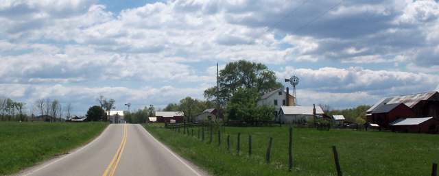
Photo: Roseohioresident, CC BY-SA 4.0 · Wikimedia Commons
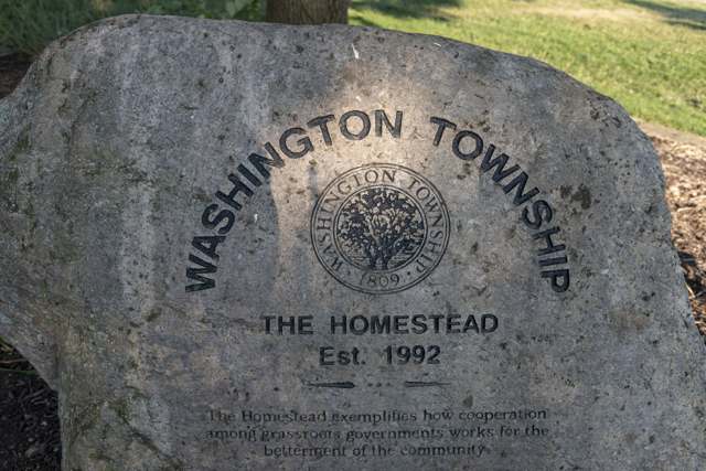
Photo: Sixflashphoto, CC BY-SA 4.0 · Wikimedia Commons
Local history sources: en.wikipedia.org · ohiogenealogyexpress.com · en.wikipedia.org · ohiogenealogy.org · commons.wikimedia.org · commons.wikimedia.org
Water
Mostly private wells The water here
- Freeport Village100% of residentsGroundwater wells (5 wells)
Hospitals, fire stations and more
Inside Washington Township, Guernsey County's boundary: 2 poor-rated bridges, 19 shale and injection wells and 3 spill cases. Press a pin or a name for its whole record and its source.
Bridges rated poor (2)
-
Township Rd. 8772 over Sugartree ForkPoor · built 1930
- Condition
- Poor: a deck, superstructure, substructure or culvert rated 4 or below on the 0 to 9 scale
- What it is
- Bridge
- Built
- 1930
- Length
- 8 ft
- Owner
- County
- Vehicles a day
- 239
- Coordinates
- 40.17410, -81.36013
National Bridge Inventory (source) ↗ Street map and directions ↗
-
TR 8729 over Sugartree ForkPoor · built 1950
- Condition
- Poor: a deck, superstructure, substructure or culvert rated 4 or below on the 0 to 9 scale
- What it is
- Bridge
- Built
- 1950
- Length
- 12 ft
- Owner
- County
- Vehicles a day
- 96
- Coordinates
- 40.14286, -81.39458
National Bridge Inventory (source) ↗ Street map and directions ↗
Source: FHWA National Bridge Inventory 2025. "Poor" means one major part rated 4 or below on the 0 to 9 scale; it calls for repair, not closing, unless the state posts or closes the bridge.
Shale and injection wells (19)
-
Brown 1-HUtica shale well
- What it is
- Utica shale well
- Drilled sideways
- Yes
- Operator
- Ascent Resources Utica Llc
- County
- Guernsey County
- API well number
- 34059243130100
- Coordinates
- 40.18242, -81.41337
ODNR oil and gas wells (source) ↗ Street map and directions ↗
The point is the surface well head (the pad); a horizontal well runs a mile or more underground from it.
-
Circle Oaks Se Wsg Gr 4HUtica shale well
- What it is
- Utica shale well
- Drilled sideways
- Yes
- Operator
- Ascent Resources Utica Llc
- County
- Guernsey County
- API well number
- 34059247230000
- Coordinates
- 40.17712, -81.34802
ODNR oil and gas wells (source) ↗ Street map and directions ↗
The point is the surface well head (the pad); a horizontal well runs a mile or more underground from it.
-
Circle Oaks Se Wsg Gr 6HUtica shale well
- What it is
- Utica shale well
- Drilled sideways
- Yes
- Operator
- Ascent Resources Utica Llc
- County
- Guernsey County
- API well number
- 34059247240000
- Coordinates
- 40.17712, -81.34795
ODNR oil and gas wells (source) ↗ Street map and directions ↗
The point is the surface well head (the pad); a horizontal well runs a mile or more underground from it.
-
Circle Oaks Sw Wsg Gr 2HUtica shale well
- What it is
- Utica shale well
- Drilled sideways
- Yes
- Operator
- Ascent Resources Utica Llc
- County
- Guernsey County
- API well number
- 34059247220000
- Coordinates
- 40.17712, -81.34809
ODNR oil and gas wells (source) ↗ Street map and directions ↗
The point is the surface well head (the pad); a horizontal well runs a mile or more underground from it.
-
Cooper E Wsg Gr 12HUtica shale well
- What it is
- Utica shale well
- Drilled sideways
- Yes
- Operator
- Ascent Resources Utica Llc
- County
- Guernsey County
- API well number
- 34059247060000
- Coordinates
- 40.16341, -81.40511
ODNR oil and gas wells (source) ↗ Street map and directions ↗
The point is the surface well head (the pad); a horizontal well runs a mile or more underground from it.
-
Cooper S Wsg Gr 8HUtica shale well
- What it is
- Utica shale well
- Drilled sideways
- Yes
- Operator
- Ascent Resources Utica Llc
- County
- Guernsey County
- API well number
- 34059247040000
- Coordinates
- 40.16346, -81.40524
ODNR oil and gas wells (source) ↗ Street map and directions ↗
The point is the surface well head (the pad); a horizontal well runs a mile or more underground from it.
-
Cooper Se Wsg Gr 10HUtica shale well
- What it is
- Utica shale well
- Drilled sideways
- Yes
- Operator
- Ascent Resources Utica Llc
- County
- Guernsey County
- API well number
- 34059247050000
- Coordinates
- 40.16344, -81.40518
ODNR oil and gas wells (source) ↗ Street map and directions ↗
The point is the surface well head (the pad); a horizontal well runs a mile or more underground from it.
-
Jackalope Ne Wsg Gr 5HUtica shale well
- What it is
- Utica shale well
- Drilled sideways
- Yes
- Operator
- Ascent Resources Utica Llc
- County
- Guernsey County
- API well number
- 34059246090000
- Coordinates
- 40.16761, -81.36222
ODNR oil and gas wells (source) ↗ Street map and directions ↗
The point is the surface well head (the pad); a horizontal well runs a mile or more underground from it.
-
Jackalope Nw Wsg Gr 1HUtica shale well
- What it is
- Utica shale well
- Drilled sideways
- Yes
- Operator
- Ascent Resources Utica Llc
- County
- Guernsey County
- API well number
- 34059246050000
- Coordinates
- 40.16758, -81.36201
ODNR oil and gas wells (source) ↗ Street map and directions ↗
The point is the surface well head (the pad); a horizontal well runs a mile or more underground from it.
-
Jackalope Nw Wsg Gr 3HUtica shale well
- What it is
- Utica shale well
- Drilled sideways
- Yes
- Operator
- Ascent Resources Utica Llc
- County
- Guernsey County
- API well number
- 34059246070000
- Coordinates
- 40.16763, -81.36206
ODNR oil and gas wells (source) ↗ Street map and directions ↗
The point is the surface well head (the pad); a horizontal well runs a mile or more underground from it.
-
Jackalope S Wsg Gr 4HHorizontal shale well
- What it is
- Horizontal shale well
- Drilled sideways
- Yes
- Operator
- Ascent Resources Utica Llc
- County
- Guernsey County
- API well number
- 34059246080000
- Coordinates
- 40.16771, -81.36197
ODNR oil and gas wells (source) ↗ Street map and directions ↗
The point is the surface well head (the pad); a horizontal well runs a mile or more underground from it.
-
Jackalope Se Wsg Gr 6HHorizontal shale well
- What it is
- Horizontal shale well
- Drilled sideways
- Yes
- Operator
- Ascent Resources Utica Llc
- County
- Guernsey County
- API well number
- 34059246100000
- Coordinates
- 40.16781, -81.36202
ODNR oil and gas wells (source) ↗ Street map and directions ↗
The point is the surface well head (the pad); a horizontal well runs a mile or more underground from it.
-
Jackalope Sw Wsg Gr 2HHorizontal shale well
- What it is
- Horizontal shale well
- Drilled sideways
- Yes
- Operator
- Ascent Resources Utica Llc
- County
- Guernsey County
- API well number
- 34059246060000
- Coordinates
- 40.16760, -81.36192
ODNR oil and gas wells (source) ↗ Street map and directions ↗
The point is the surface well head (the pad); a horizontal well runs a mile or more underground from it.
-
Lodge Ne Wsg Gr 5HUtica shale well
- What it is
- Utica shale well
- Drilled sideways
- Yes
- Operator
- Ascent Resources Utica Llc
- County
- Guernsey County
- API well number
- 34059246490000
- Coordinates
- 40.16407, -81.35105
ODNR oil and gas wells (source) ↗ Street map and directions ↗
The point is the surface well head (the pad); a horizontal well runs a mile or more underground from it.
-
Lodge Ne Wsg Gr 7HUtica shale well
- What it is
- Utica shale well
- Drilled sideways
- Yes
- Operator
- Ascent Resources Utica Llc
- County
- Guernsey County
- API well number
- 34059246500000
- Coordinates
- 40.16403, -81.35100
ODNR oil and gas wells (source) ↗ Street map and directions ↗
The point is the surface well head (the pad); a horizontal well runs a mile or more underground from it.
-
Lodge Nw Wsg Gr 1HUtica shale well
- What it is
- Utica shale well
- Drilled sideways
- Yes
- Operator
- Ascent Resources Utica Llc
- County
- Guernsey County
- API well number
- 34059246470000
- Coordinates
- 40.16414, -81.35116
ODNR oil and gas wells (source) ↗ Street map and directions ↗
The point is the surface well head (the pad); a horizontal well runs a mile or more underground from it.
-
Lodge Nw Wsg Gr 3HUtica shale well
- What it is
- Utica shale well
- Drilled sideways
- Yes
- Operator
- Ascent Resources Utica Llc
- County
- Guernsey County
- API well number
- 34059246480000
- Coordinates
- 40.16410, -81.35111
ODNR oil and gas wells (source) ↗ Street map and directions ↗
The point is the surface well head (the pad); a horizontal well runs a mile or more underground from it.
-
Miller Farms E Wsg Gr 6HUtica shale well
- What it is
- Utica shale well
- Drilled sideways
- Yes
- Operator
- Ascent Resources Utica Llc
- County
- Guernsey County
- API well number
- 34059245310000
- Coordinates
- 40.17487, -81.38047
ODNR oil and gas wells (source) ↗ Street map and directions ↗
The point is the surface well head (the pad); a horizontal well runs a mile or more underground from it.
-
Miller Farms E Wsg Gr 8HUtica shale well
- What it is
- Utica shale well
- Drilled sideways
- Yes
- Operator
- Ascent Resources Utica Llc
- County
- Guernsey County
- API well number
- 34059245300000
- Coordinates
- 40.17490, -81.38041
ODNR oil and gas wells (source) ↗ Street map and directions ↗
The point is the surface well head (the pad); a horizontal well runs a mile or more underground from it.
Source: ODNR Division of Oil and Gas Resources well inventory (September 2026): drilled Utica, Marcellus and horizontal wells and Class II injection wells not plugged. Older vertical wells are on the full map.
Spills reported since 2021 (3)
-
Fuel Diesel / Diesel Fuel (Vehicle On Or Off Road)2025-05-29 · Washington Twp
- Reported
- 2025-05-29
- What spilled
- Fuel Diesel / Diesel Fuel (Vehicle On Or Off Road)
- Largest amount reported
- 50 gallons
- Where
- Washington Twp, Guernsey County
- Ohio EPA district office
- SEDO
- Ohio EPA case number
- 2505EPA0000870
Ohio EPA spill reports (source) ↗ Street map and directions ↗
-
Oil Crude2021-08-10 · Washington Twp
- Reported
- 2021-08-10
- What spilled
- Oil Crude
- Where
- Washington Twp, Guernsey County
- Ohio EPA district office
- SEDO
- Ohio EPA case number
- 2108EPA0001223
Ohio EPA spill reports (source) ↗ Street map and directions ↗
-
Material Unknown2026-04-02 · Washington Twp
- Reported
- 2026-04-02
- What spilled
- Material Unknown
- Where
- Washington Twp, Guernsey County
- Ohio EPA district office
- SEDO
- Ohio EPA case number
- 2604EPA0000560
Ohio EPA spill reports (source) ↗ Street map and directions ↗
Source: Ohio EPA emergency response spill reports, 2021 to September 2026, one point per case where Ohio EPA placed it. A report is what the caller or responder recorded; amounts are often blank or estimated.
Its ZIP codes
Each ZIP code that touches Washington Township, Guernsey County, with the share of its residents who live here and the same headline figures as the ZIP page.
| ZIP | Share | Water | Radon | Home value | Schools | Flood |
|---|---|---|---|---|---|---|
| 43973 Londonderry Township and Freeport | 15% | Mostly private wells | 6.8 pCi/L average radon | Median year built 1977 | Harrison Hills City · 3 stars overall | 6.8% of residents in the 1% floodplain |
| 43749 Monroe Township and Kimbolton | 6% | Mostly private wells | 16.3 pCi/L average radon | Appraisal records without year built | Cambridge City · 2.5 stars overall | 6.3% of residents in the 1% floodplain |
| 43837 Port Washington | 3% | Mostly private wells | 18.6 pCi/L average radon | Median year built 1972 | Indian Valley Local · 4.5 stars overall | 2.8% of residents in the 1% floodplain |
Local government
Who holds office in Washington Township, Guernsey County, how its elections and ballot issues came out, and the state auditor's record.
Ballot issues
| Date | Issue | For | Against | Result |
|---|---|---|---|---|
| 2024-11-05 | Issue: WASHINGTON TOWNSHIP EMS | 177 | 79 | Passed (69.14% for) |
Elections for office
| Date | Office | Candidates and votes |
|---|---|---|
| 2023-11-07 | Township Trustee | Kris Dickey 89, 52.98%; Kevin (GRN) 79, 47.02% |
| 2023-11-07 | Township Trustee | Adam Dunlap 73, 25.89%; Benjamin T. Hodkinson 88, 31.21%; Nathan Peters 121, 42.91% |
| 2023-11-07 | Township Fiscal Officer | Margene Angelozzi 111, 60.66%; Donna J. Carpenter 72, 39.34% |
| 2021-11-02 | . Trustee (unofficial count) | Lucas Pulley 50, 41.67%; Scott Reynolds 70, 58.33% |
| 2019-11-05 | Township Fiscal Officer | Donna Jean Carpenter 70, 100.0% |
| 2019-11-05 | . Trustee | Robert R. Stewart 67, 100.0% |
| 2017-11-07 | Township Trustee | Douglas Crabtree 103, 52.55%; Scott Reynolds 93, 47.45% |
| 2015-11-03 | Township Trustee | Robert R. Stewart 167, 100.0% |
| 2015-11-03 | Township Fiscal Officer | Donna Carpenter 157, 100.0% |
Winners in bold. Results from the county board of elections' official canvass unless marked.
Auditor of State record
- No fiscal caution, watch or emergency on the Auditor of State's lists.
- Financial Audit, 2022 to 2023, released 2025-06-17
The county
Harrison County: 10 ZIP codes, 26 cities, villages and townships, 15,422 people.
Nearby places
Quick answers
What county is Washington Township, Ohio in?
Washington Township, Guernsey County is a township in Harrison County, Ohio, with 478 residents.
When was Washington Township, Ohio founded?
Washington Township, Guernsey County was incorporated organized as a township, 1823. Source
How did Washington Township, Ohio get its name?
The township carries the name Washington, shared with forty-two other townships across Ohio; no source consulted gives a specific naming story for this township beyond the common practice of honoring George Washington. Source
What ZIP code is Washington Township, Ohio?
Washington Township, Guernsey County is served by ZIP codes 43973, 43749 and 43837; 43973 holds the largest share of its residents.
Where does Washington Township, Ohio get its water?
The main water source for Washington Township, Guernsey County (Freeport Village): Mostly private wells.
Cite this page
Cite this page as:
Cracked Buckeye, "Washington Township, Guernsey County", https://crackedbuckeye.com/place/washington-township-guernsey-county/, built 2026-10-31, accessed [date].
How to cite · Report a correction · Built 2026-10-31
