Jefferson Township, Montgomery County
Township · Montgomery County · 5,934 residents
Local events in Jefferson Township, Montgomery County
Nothing is posted for Jefferson Township itself yet; here is what is on within 10 miles. All local events in Jefferson Township, Montgomery County
Know a calendar we should watch? Send the link
Checked October 20; the events page is refreshed daily.
How Jefferson Township, Montgomery County began
Jefferson Township was organized June 10, 1805, cut from the older German Township in central Montgomery County. By 1833 it was a working farm township with three gristmills, three sawmills and eight distilleries turning its grain and timber into flour, lumber and whiskey. It never incorporated a county-seat-style village of its own; its population lives today in the unincorporated places Drexel and New Chicago and in the portions of Moraine and West Carrollton that lie within its borders; it borders Trotwood to the north and Dayton to the northeast. The township remains, in effect, Dayton's near southwest edge: suburbanized, cut through by rail and highway, with little of its farm-township fabric left standing above ground.
Settled c. 1800 (John Gripe, on Big Bear Creek near what became Liberty), incorporated 1805-06-10, by organized from German Township.
Where the name comes from
The 1882 History of Montgomery County states the naming plainly: 'The appellation was given it in honor of Thomas Jefferson, one of the signers of the Declaration of Independence and the third President of the United States.' This resolves the gap left by Wikipedia, which gave only the general pattern of Ohio townships named for presidents and Founders without confirming it for this specific township.
Before the town
No site-specific Native American history — a named village, trail, mound, or documented encounter located within Jefferson Township itself — is found in the sources searched. The broader Great Miami valley in which the township sits was Miami and Shawnee country through the mid-to-late 1700s; nearby Miamisburg (immediately south of the township) held one of the largest Adena mounds in Ohio, and the Treaty of Greenville (August 3, 1795), concluded at Fort Greenville roughly 30 miles northwest, ceded most of the future state of Ohio, including this ground, to the United States, ending organized Native occupation of the area ahead of the wave of settlement that produced Jefferson Township in 1805. This paragraph is deliberately general; a township-specific claim was not found and none is asserted here.
Nations recorded here: Miami, Shawnee.
Timeline
- — Jefferson Township is organized out of German Township in Montgomery County.
- — John Gripe, the earliest settler the 1882 county history could identify, built his cabin along Big Bear Creek near the future site of Liberty; about the same time Virginians named Miller and Gingerick, brothers-in-law, also settled along the creek.
- — Jacob Mullendore, a Virginian, settled in the township and during the War of 1812 hauled flour to the soldiers at Greenville; Michael Myers settled within the township's present limits the following year.
- — Michael Moyer settled in Section 27 and, per the 1804 tax duplicate, was taxed that year on 614 acres of land there; Michael Weaver, of Pennsylvania, settled the same year on Little Bear Creek, where his son Peter later built, at age nineteen, what the 1882 county history calls the first windmill ever put up in Ohio.
- — Henry Weaver built the township's first saw and grist mills on Big Bear Creek in Section 18; the grist-mill's water-wheel was built by Martin Saylor, and the mills were later rebuilt by 'Uncle Abe' Weaver, who ran them for years afterward.
- — The township's first schoolhouse was built near the future village of Gettersburg, at the intersection of the Farmersville and Germantown pikes, and taught by a Mr. Brown.
- — Lutheran and German Reformed settlers jointly built the township's first meeting-house, a hewed-log union church known as Salem Church, in the eastern part of Section 28; it stood until replaced by a brick church on the same ground in 1860.
- — The town of Liberty was platted in December on land owned by Peter [surname illegible in the 1882 county history], in originally seventy-two lots, though several cabins had already clustered at the site for years beforehand; William Brown, a bachelor, had already opened the township's first store there around 1809.
- — The township contains three gristmills, three sawmills and eight distilleries, according to the source cited by Wikipedia's article on the township.
- — The village of Gettersburg, on Big Bear Creek, took its name from Jacob Getter, who owned the site and began selling lots there; John Snepp, Sr. later made an addition to the village, and its post office was not established until October 1879, with George Winder as postmaster.
- — St. Peter's Evangelical Lutheran Church was organized and its house built; members had previously worshiped at Providence Church in neighboring Perry Township before the distance for the township's own congregation prompted a separate church.
Stories
A table built around a tree stump
Henry Hepner, a blacksmith who came to the area from Virginia in 1806, first built a rude cabin just over the line in Jackson Township before purchasing land of his own in Jefferson and building again. The 1882 county history preserves one detail of his first cabin: a huge oak stood on the chosen building site, and rather than clear it away entirely, Hepner felled the tree but left the stump at a carefully judged height, dressed it, and raised his cabin around it so that the stump itself became his family's table. 'It was the table of that home for years,' the historian writes, and though it lacked the polish of 'the covered tables of to-day,' it wore, in his words, 'an air of solidity that was charming' -- an old frontier proof, he adds, that necessity is the mother of invention. Hepner made his own knives and forks by hand and served the surrounding settlements as their blacksmith for years; he died at seventy-three, his wife living to ninety-seven.
Photographs
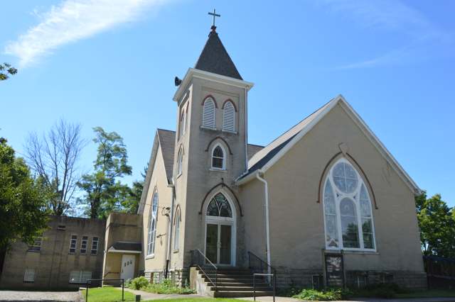
Photo: Nyttend, Public domain · Wikimedia Commons
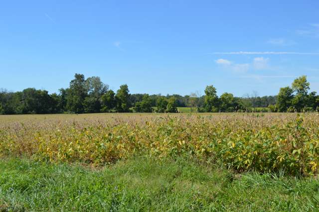
Photo: Nyttend, Public domain · Wikimedia Commons
Local history sources: en.wikipedia.org · en.wikipedia.org · en.wikipedia.org · en.wikipedia.org · en.wikipedia.org · en.wikipedia.org · hmdb.org · hmdb.org · commons.wikimedia.org · commons.wikimedia.org · commons.wikimedia.org · archive.org
Water
Mad River Well Field wells along the Mad River east of Dayton, refilled by river water let into recharge lagoons The water here
- Dayton Public Water System58% of residentsGreat Miami Buried Valley Aquifer wells (recharged by Great Miami & Mad Rivers)
- Montgomery County Water Services 228% of residentsGreat Miami Buried Valley Aquifer wells (recharged by Great Miami & Mad Rivers)
- New Lebanon Village6% of residentsGroundwater wells (3 wells)
- Germantown City4% of residentsGroundwater wells (4 wells)
- Trotwood City3% of residentsGreat Miami Buried Valley Aquifer wells (recharged by Great Miami & Mad Rivers)
- Voyager Village MHP1% of residentsGroundwater wells (2 wells)
- Farmersville Village0% of residentsGroundwater wells (2 wells)
- Jefferson Regional Water Authority0% of residentsGroundwater wells (2 wells)
- Southwest Regional Water District0% of residentsGreat Miami Buried Valley Aquifer (wells)
Hospitals, fire stations and more
Inside Jefferson Township, Montgomery County's boundary: 3 fire and EMS stations, 2 public schools, 2 poor-rated bridges, 1 police station, 1 Toxics Release Inventory facility and 5 spill cases. Press a pin or a name for its whole record and its source.
Fire and EMS stations (3)
-
Jefferson Township Fire Department Station 2Dayton
- Address
- 1525 Kimmel Lane, Dayton, OH 45418
- Coordinates
- 39.72362, -84.27610
USGS National Map structures (source) ↗ Street map and directions ↗
-
Jefferson Township Fire Department Station 3Dayton
- Address
- 7828 Dayton Liberty Road, Dayton, OH 45418
- Coordinates
- 39.71995, -84.32484
USGS National Map structures (source) ↗ Street map and directions ↗
-
Jefferson Township Fire Department Station 60Dayton
- Address
- 1 Business Park Drive, Dayton, OH 45427
- Coordinates
- 39.74588, -84.28780
USGS National Map structures (source) ↗ Street map and directions ↗
Source: USGS National Map structures (most Ohio records last updated 2019 to 2022), checked against the Columbus and Cleveland station lists. The department that answers a call is set by jurisdiction and mutual aid, not by distance.
Public schools (2)
-
Blairwood Elementary School2.5 of 5 stars · Dayton
- Address
- 1241 Blairwood Ave, Dayton, OH 45417
- School district
- Jefferson Township Local School District
- Kind (NCES)
- Regular School
- Students, 2023-24
- 141
- Teachers (full-time equivalent)
- 10
- Report card, 2025-26
- 2.5 of 5 stars
- Performance index
- 49.2%
- Ohio building IRN
- 002824
- NCES school ID
- 390486803344
NCES school record ↗ Ohio School Report Card ↗ Street map and directions ↗
-
Jefferson Jr./Sr. High School3.5 of 5 stars · Dayton
- Address
- 2701 S Union Rd, Dayton, OH 45417
- School district
- Jefferson Township Local School District
- Kind (NCES)
- Regular School
- Students, 2023-24
- 100
- Teachers (full-time equivalent)
- 8
- Report card, 2025-26
- 3.5 of 5 stars
- Performance index
- 60.3%
- Four-year graduation rate
- 71.4%
- Ohio building IRN
- 018150
- NCES school ID
- 390486803345
NCES school record ↗ Ohio School Report Card ↗ Street map and directions ↗
Source: NCES EDGE public school locations 2024-25 and Common Core of Data 2023-24 (type, students, teachers); Ohio School Report Cards 2025-26 (Department of Education and Workforce), matched by name within the district.
Bridges rated poor (2)
-
Diamond Mill C217 over Bear CreekPoor · built 1957
- Condition
- Poor: a deck, superstructure, substructure or culvert rated 4 or below on the 0 to 9 scale
- What it is
- Bridge
- Built
- 1957
- Length
- 20 ft
- Owner
- County
- Vehicles a day
- 2,651
- Coordinates
- 39.73665, -84.36649
National Bridge Inventory (source) ↗ Street map and directions ↗
-
Forney Road T0042 over Little Bear CreekPoor · built 1992
- Condition
- Poor: a deck, superstructure, substructure or culvert rated 4 or below on the 0 to 9 scale
- What it is
- Bridge
- Built
- 1992
- Length
- 28 ft
- Owner
- County
- Vehicles a day
- 60
- Coordinates
- 39.72031, -84.33446
National Bridge Inventory (source) ↗ Street map and directions ↗
Source: FHWA National Bridge Inventory 2025. "Poor" means one major part rated 4 or below on the 0 to 9 scale; it calls for repair, not closing, unless the state posts or closes the bridge.
Police stations (1)
-
Montgomery County Sheriff - Jefferson Township SubstationDayton
- Address
- 555 Infirmary Road, Dayton, OH 45427
- Coordinates
- 39.73795, -84.28179
USGS National Map structures (source) ↗ Street map and directions ↗
Source: USGS National Map structures, police stations, corrected and completed by hand (September 2026). The department that answers a call is set by jurisdiction, not by distance.
Facilities reporting toxic releases (1)
-
Valicor Environmental Services LlcToxics Release Inventory · Dayton
- Address
- 300 Cherokee Dr, Dayton, OH 45417
- County
- Montgomery County
- Status
- Reports to the Toxics Release Inventory (open)
- EPA program ID
- 45427PRMFX300SW
- EPA registry ID
- 110042041581
EPA facility record ↗ EPA Facility Registry Service (source) ↗ Street map and directions ↗
Source: EPA Facility Registry Service, Toxics Release Inventory reporters. Reporting a release is required of large users of listed chemicals; it is not by itself a violation.
Spills reported since 2021 (5)
-
Material Gray2025-08-26 · Dayton
- Reported
- 2025-08-26
- What spilled
- Material Gray
- Where
- Dayton, Montgomery County
- Ohio EPA district office
- SWDO
- Ohio EPA case number
- 2508EPA0001451
Ohio EPA spill reports (source) ↗ Street map and directions ↗
-
Fuel Diesel / Diesel Fuel (Vehicle On Or Off Road)2024-04-16 · Jefferson Twp
- Reported
- 2024-04-16
- What spilled
- Fuel Diesel / Diesel Fuel (Vehicle On Or Off Road)
- Where
- Jefferson Twp, Montgomery County
- Ohio EPA district office
- SWDO
- Ohio EPA case number
- 2404EPA0000627
Ohio EPA spill reports (source) ↗ Street map and directions ↗
-
Fuel Diesel / Diesel Fuel (Vehicle On Or Off Road)2023-05-02 · Jefferson Twp
- Reported
- 2023-05-02
- What spilled
- Fuel Diesel / Diesel Fuel (Vehicle On Or Off Road)
- Largest amount reported
- 60 gallons
- Where
- Jefferson Twp, Montgomery County
- Ohio EPA district office
- SWDO
- Ohio EPA case number
- 2305EPA0000710
Ohio EPA spill reports (source) ↗ Street map and directions ↗
-
Oil Motor / Lube Oil / Vehicle2023-04-28 · Jefferson Twp
- Reported
- 2023-04-28
- What spilled
- Oil Motor / Lube Oil / Vehicle
- Largest amount reported
- 55 gallons
- Where
- Jefferson Twp, Montgomery County
- Ohio EPA district office
- SWDO
- Ohio EPA case number
- 2304EPA0000684
Ohio EPA spill reports (source) ↗ Street map and directions ↗
-
Oil Motor / Lube Oil / Vehicle Reached water2022-08-23 · Jefferson Twp
- Reported
- 2022-08-23
- What spilled
- Oil Motor / Lube Oil / Vehicle
- Largest amount reported
- 1 gallons
- Reached a waterway
- 57 - Little Bear Creek
- Where
- Jefferson Twp, Montgomery County
- Ohio EPA district office
- SWDO
- Ohio EPA case number
- 2208EPA0001295
Ohio EPA spill reports (source) ↗ Street map and directions ↗
Source: Ohio EPA emergency response spill reports, 2021 to September 2026, one point per case where Ohio EPA placed it. A report is what the caller or responder recorded; amounts are often blank or estimated.
Its ZIP codes
Each ZIP code that touches Jefferson Township, Montgomery County, with the share of its residents who live here and the same headline figures as the ZIP page.
| ZIP | Share | Water | Radon | Home value | Schools | Flood |
|---|---|---|---|---|---|---|
| 45417 Dayton | 17% | Mad River Well Field wells along the Mad River east of Dayton, refilled by river water let into recharge lagoons | 3.7 pCi/L average radon | Median year built 1950 | Dayton City · 2 stars overall | 0.4% of residents in the 1% floodplain |
| 45345 New Lebanon | 8% | Groundwater wells (3 wells) | 5.6 pCi/L average radon | Median year built 1962 | New Lebanon Local · 3 stars overall | 0.5% of residents in the 1% floodplain |
| 45327 Germantown | 4% | Groundwater wells (4 wells) | 6.8 pCi/L average radon | Median year built 1968 | Valley View Local · 4 stars overall | 9.9% of residents in the 1% floodplain |
| 45325 Jackson Township and Farmersville | 2% | Mostly private wells | 5.5 pCi/L average radon | Median year built 1960 | Valley View Local · 4 stars overall | 3.6% of residents in the 1% floodplain |
Local government
Who holds office in Jefferson Township, Montgomery County, how its elections and ballot issues came out, and the state auditor's record.
Money issues on the ballot since 2025: 0 of 4 passed; of those asking for new or higher taxes, 0 of 1.
Ballot issues
| Date | Issue | For | Against | Result |
|---|---|---|---|---|
| 2026-05-05 | Issue: Jefferson Township LSD - 1.25% Income Tax - Con't period of time | 342 | 672 | Failed (33.73% for) |
| 2025-11-04 | Issue: Jefferson Township Roads and Bridges - Additional 6 mils - 5yrs (6.0 mills, additional) | 454 | 739 | Failed (38.06% for), unofficial |
| 2025-11-04 | Issue: Jefferson Township LSD - 1% Income Tax - 3 yrs | 507 | 758 | Failed (40.08% for), unofficial |
| 2025-05-06 | Issue: Jefferson Township LSD - 1.5% Income Tax - Cont. Period of Time | 196 | 435 | Failed (31.06% for), unofficial |
Elections for office
| Date | Office | Candidates and votes |
|---|---|---|
| 2025-11-04 | Trustee (unofficial count) | Sheila Back 744, 57.14%; Vera Powell 558, 42.86% |
Winners in bold. Results from the county board of elections' official canvass unless marked.
Auditor of State record
- No fiscal caution, watch or emergency on the Auditor of State's lists.
- Financial Audit, 2024, released 2026-07-07
- Financial Audit, 2023, released 2025-06-26
- Financial Audit, 2022, released 2024-12-05
The county
Montgomery County: 33 ZIP codes, 27 cities, villages and townships, 531,614 people.
Nearby places
Quick answers
What county is Jefferson Township, Ohio in?
Jefferson Township, Montgomery County is a township in Montgomery County, Ohio, with 5,934 residents.
When was Jefferson Township, Ohio founded?
Jefferson Township, Montgomery County was settled c. 1800 (John Gripe, on Big Bear Creek near what became Liberty); incorporated 1805-06-10. Founders on record: organized from German Township. Source
How did Jefferson Township, Ohio get its name?
The 1882 History of Montgomery County states the naming plainly: 'The appellation was given it in honor of Thomas Jefferson, one of the signers of the Declaration of Independence and the third President of the United States.' This resolves the gap left by Wikipedia, which gave only the general pattern of Ohio townships named for presidents and Founders without confirming it for this specific township. Source
What ZIP code is Jefferson Township, Ohio?
Jefferson Township, Montgomery County is served by ZIP codes 45417, 45345, 45327 and 45325; 45417 holds the largest share of its residents.
Where does Jefferson Township, Ohio get its water?
The main water source for Jefferson Township, Montgomery County (Dayton Public Water System): Mad River Well Field wells along the Mad River east of Dayton, refilled by river water let into recharge lagoons.
Cite this page
Cite this page as:
Cracked Buckeye, "Jefferson Township, Montgomery County", https://crackedbuckeye.com/place/jefferson-township-montgomery-county/, built 2026-10-31, accessed [date].
How to cite · Report a correction · Built 2026-10-31
