Local events in Germantown
Nothing is posted for Germantown itself yet; here is what is on within 10 miles. All local events in Germantown
Know a calendar we should watch? Send the link
Checked October 20; the events page is refreshed daily.
How Germantown began
Germantown was founded in 1814 when Philip Gunckel, a member of a group of German-speaking families who had migrated from Berks County, Pennsylvania, laid out the town on the Twin Creek in what is now German Township. Gunckel gave the plat an unusual wagon-wheel alley system radiating between Mulberry and Walnut and Warren and Market streets, a layout that still defines the downtown. The city was incorporated in 1833 and grew around milling, distilling and, later, small manufacturing on Twin Creek. Its 19th-century commercial core, the Gunckel Town Plan Historic District, was listed on the National Register of Historic Places in 1976, and several individual buildings in and around the city carry their own National Register listings. Today Germantown (population 5,792-5,796) is a small city in southwestern Montgomery County retaining an unusually intact historic downtown.
Settled 1804 (area first settled), platted 1814, incorporated 1833, by Philip Gunckel, with German-speaking families from Berks County, Pennsylvania.
Where the name comes from
The town was named for the German-speaking settlers, led by Philip Gunckel, who founded it after migrating from Berks County, Pennsylvania.
Before the town
No source found documents a Native American village, trail, mound or treaty boundary specific to the city of Germantown itself. The broader Montgomery County Wikipedia article contains no Native American history beyond a school mascot reference. Montgomery County lies in the Great Miami valley, historically within the range of the Shawnee and Miami (Myaamia) peoples and covered by the 1795 Treaty of Greenville land cession, but no site-specific claim for Germantown or German Township can be documented from the sources reviewed here.
Timeline
- — German-speaking families from Berks County, Pennsylvania begin settling the area that would become Germantown.
- — Philip Gunckel lays out the town plat on Twin Creek, using a distinctive wagon-wheel system of alleys between Mulberry, Walnut, Warren and Market streets.
- — Germantown is incorporated as a town.
- — The Mudlick Distillery is established in Germantown; it was later considered one of the largest whiskey distilleries in the country, producing about 30 barrels a day.
- — Shuey's Mill is listed on the National Register of Historic Places.
- — The Koehne-Poast Farm, spanning German Township and the edge of Germantown, is listed on the National Register of Historic Places.
- — The David Rohr Mansion and Carriage House in Germantown is listed on the National Register of Historic Places.
- — The Gunckel Town Plan Historic District, Germantown's historic downtown, is listed on the National Register of Historic Places.
- — Emmanuel's Evangelical Lutheran Church at 30 W. Warren St. in Germantown is listed on the National Register of Historic Places.
Stories
A wheel of alleys
When Philip Gunckel platted Germantown in 1814, he broke from the standard grid used by most Ohio town founders. Instead he ran a set of alleys radiating outward like the spokes of a wagon wheel through the blocks bounded by Mulberry and Walnut streets on one axis and Warren and Market streets on the other. The layout survived intact enough that it became the organizing feature of the Gunckel Town Plan Historic District, listed on the National Register of Historic Places in 1976.
The Mudlick Distillery
By the mid-19th century, Germantown's economy had grown around Twin Creek milling and, notably, whiskey. The Mudlick Distillery, founded in 1847, became one of the town's signature industries, at one point turning out roughly 30 barrels of whiskey a day and ranking, by local reputation, among the largest distilleries in the country. The distillery's rise reflects the broader pattern of small Ohio milling towns in this period, where grain, water power and rail or wagon access to larger markets combined to build outsized local industries around otherwise modest farm towns.
Photographs
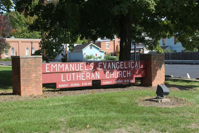
Photo: Pjsham (Wikimedia Commons), CC BY-SA 3.0 · Wikimedia Commons
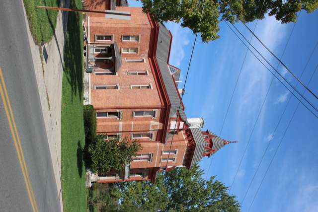
Photo: Pjsham (Wikimedia Commons), CC BY-SA 3.0 · Wikimedia Commons
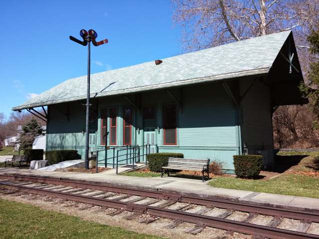
Photo: J Flerchinger (Wikimedia Commons), CC BY-SA 4.0 · Wikimedia Commons
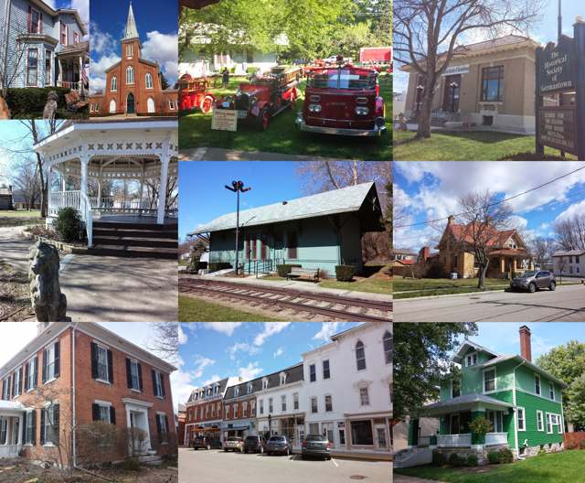
Photo: J Flerchinger (Wikimedia Commons), CC BY-SA 4.0 · Wikimedia Commons
Local history sources: en.wikipedia.org · en.wikipedia.org · en.wikipedia.org · en.wikipedia.org · commons.wikimedia.org · commons.wikimedia.org · commons.wikimedia.org · commons.wikimedia.org · commons.wikimedia.org
Historic places
4 places in Germantown on the National Register of Historic Places. Press a pin or a name for its whole record.
-
Emmanuel's Evangelical Lutheran ChurchBuilding · Germantown · listed 1990
- Address
- 30 W. Warren St.
- Where
- Germantown, Montgomery County · ZIP 45327
- What it is
- Building
- Listed on the National Register
- 1990
- NRIS reference number
- 90001292
- Coordinates
- 39.62776, -84.37147
National Register file (NPS) ↗ Search Wikipedia ↗ Street map and directions ↗ On the Cracked Buckeye map
-
Koehne--Poast FarmBuilding · Germantown · listed 1977
- Address
- W of Germantown off OH 725
- Where
- Germantown, Montgomery County · ZIP 45327
- What it is
- Building
- Listed on the National Register
- 1977
- NRIS reference number
- 77001079
- Coordinates
- 39.62493, -84.38556
National Register file (NPS) ↗ Search Wikipedia ↗ Street map and directions ↗ On the Cracked Buckeye map
-
Rohr, David, Mansion And Carriage HouseBuilding · Germantown · listed 1978
- Address
- Astoria Rd. and OH 725
- Where
- Germantown, Montgomery County · ZIP 45327
- What it is
- Building
- Listed on the National Register
- 1978
- NRIS reference number
- 78002149
- Coordinates
- 39.62239, -84.38496
National Register file (NPS) ↗ Search Wikipedia ↗ Street map and directions ↗ On the Cracked Buckeye map
-
Shuey's MillBuilding · Germantown · listed 1975
- Address
- Main St.
- Where
- Germantown, Montgomery County · ZIP 45327
- What it is
- Building
- Listed on the National Register
- 1975
- NRIS reference number
- 75001508
- Coordinates
- 39.62080, -84.37022
National Register file (NPS) ↗ Search Wikipedia ↗ Street map and directions ↗ On the Cracked Buckeye map
Source: National Park Service, National Register of Historic Places point file. The listing year is shown where NPS's certification date agrees with the listing's reference number. Listing recognizes significance; it does not restrict a private owner.
Water
Groundwater wells (4 wells) The water here
- Germantown City96% of residentsGroundwater wells (4 wells)
- Southwest Regional Water District4% of residentsGreat Miami Buried Valley Aquifer (wells)
Hospitals, fire stations and more
Inside Germantown's boundary: 1 nursing home, 1 fire or EMS station, 3 public schools, 1 library, 2 museums, 1 police station and 4 spill cases. Press a pin or a name for its whole record and its source.
Nursing homes (1)
-
Astoria Health & Rehab Center5 of 5 stars · Germantown
- Address
- 300 Astoria Road, Germantown, OH 45327
- Certified beds
- 50
- Residents on an average day
- 43
- Medicare overall rating
- 5 of 5 stars
- Health inspections
- 5 of 5 stars
- Staffing
- 1 of 5 stars
- Quality measures
- 5 of 5 stars
- Penalties since 2023
- none
- Ownership
- For profit - Corporation
- Chain
- SABER HEALTHCARE GROUP
- Takes
- Medicare and Medicaid
- Phone
- (937) 855-2363
- Medicare ID
- 366291
Medicare Care Compare ↗ CMS nursing home data (source) ↗ Street map and directions ↗
Source: CMS Care Compare nursing home provider and penalties files; Medicare star ratings run 1 to 5.
Fire and EMS stations (1)
-
Germantown Fire Department Station 63Germantown
- Address
- 75 North Walnut Street, Germantown, OH 45327
- Coordinates
- 39.62597, -84.37388
USGS National Map structures (source) ↗ Street map and directions ↗
Source: USGS National Map structures (most Ohio records last updated 2019 to 2022), checked against the Columbus and Cleveland station lists. The department that answers a call is set by jurisdiction and mutual aid, not by distance.
Public schools (3)
-
Valley View Local SchoolsGermantown
- Address
- 59 Peffley St, Germantown, OH 45327
- Kind (NCES)
- Regular School
- Students, 2023-24
- 0
- NCES school ID
- 390487410862
-
Valley View PreSchoolGermantown
- Address
- 64 Comstock St, Germantown, OH 45327
- NCES school ID
- 390487410923
-
Valley View Primary SchoolGermantown
- Address
- 110 Comstock St, Germantown, OH 45327
- Kind (NCES)
- Regular School
- Students, 2023-24
- 532
- Teachers (full-time equivalent)
- 30
- NCES school ID
- 390487403384
Source: NCES EDGE public school locations 2024-25 and Common Core of Data 2023-24 (type, students, teachers); Ohio School Report Cards 2025-26 (Department of Education and Workforce), matched by name within the district.
Public libraries (1)
-
Germantown Public LibraryCentral library · Germantown
- Address
- 51 N. Plum St., Germantown, OH 45327
- What it is
- Central library
- Library system
- Germantown Public Library
- Open
- 3,106 hours a year, 52 weeks
- Building
- 10,546 sq ft
- System's visits, FY2024
- 52,000
- People the system serves
- 10,975
- Phone
- (937) 855-4001
IMLS Public Libraries Survey (source) ↗ Street map and directions ↗
Source: IMLS Public Libraries Survey FY2024 (outlets and their systems). Any Ohio resident can get a free card at any Ohio public library.
Museums, historical societies, gardens and zoos (2)
-
Historical Society GermantownHistorical society · Germantown
- What it is
- Historical society
- City
- Germantown
- Coordinates
- 39.62591, -84.37100
Search Wikipedia ↗ IMLS Museum Data Files (source) ↗ Street map and directions ↗
The museum list is IMLS's 2018 file; a museum may have closed or moved since.
-
Veterans Memorial MuseumHistory museum · Germantown
- What it is
- History museum
- City
- Germantown
- Coordinates
- 39.62348, -84.37047
Search Wikipedia ↗ IMLS Museum Data Files (source) ↗ Street map and directions ↗
The museum list is IMLS's 2018 file; a museum may have closed or moved since.
Source: IMLS Museum Data Files, 2018.
Police stations (1)
-
Germantown Police DepartmentGermantown
- Address
- 75 North Walnut Street, Germantown, OH 45327
- Coordinates
- 39.62597, -84.37365
USGS National Map structures (source) ↗ Street map and directions ↗
Source: USGS National Map structures, police stations, corrected and completed by hand (September 2026). The department that answers a call is set by jurisdiction, not by distance.
Spills reported since 2021 (4)
-
Fuel Diesel / Diesel Fuel (Vehicle On Or Off Road)2025-01-24 · Germantown
- Reported
- 2025-01-24
- What spilled
- Fuel Diesel / Diesel Fuel (Vehicle On Or Off Road)
- Largest amount reported
- 40 gallons
- Where
- Germantown, Montgomery County
- Ohio EPA district office
- SWDO
- Ohio EPA case number
- 2501EPA0000095
Ohio EPA spill reports (source) ↗ Street map and directions ↗
-
Other / All Other / Trade Name / Mixture / Solution Etc2024-12-21 · Germantown
- Reported
- 2024-12-21
- What spilled
- Other / All Other / Trade Name / Mixture / Solution Etc
- Where
- Germantown, Montgomery County
- Ohio EPA district office
- SWDO
- Ohio EPA case number
- 2412EPA0002059
Ohio EPA spill reports (source) ↗ Street map and directions ↗
-
Material White Reached water2023-08-31 · Germantown
- Reported
- 2023-08-31
- What spilled
- Material White
- Reached a waterway
- 57 - Little Twin Creek
- Where
- Germantown, Montgomery County
- Ohio EPA district office
- SWDO
- Ohio EPA case number
- 2308EPA0001542
Ohio EPA spill reports (source) ↗ Street map and directions ↗
-
Sheen Rainbow / Hydrocarbon Reached water2023-08-29 · Germantown
- Reported
- 2023-08-29
- What spilled
- Sheen Rainbow / Hydrocarbon
- Reached a waterway
- 57 - Little Twin Creek
- Where
- Germantown, Montgomery County
- Ohio EPA district office
- SWDO
- Ohio EPA case number
- 2308EPA0001524
Ohio EPA spill reports (source) ↗ Street map and directions ↗
Source: Ohio EPA emergency response spill reports, 2021 to September 2026, one point per case where Ohio EPA placed it. A report is what the caller or responder recorded; amounts are often blank or estimated.
Its ZIP codes
Each ZIP code that touches Germantown, with the share of its residents who live here and the same headline figures as the ZIP page.
| ZIP | Share | Water | Radon | Home value | Schools | Flood |
|---|---|---|---|---|---|---|
| 45327 Germantown | 61% | Groundwater wells (4 wells) | 6.8 pCi/L average radon | Median year built 1968 | Valley View Local · 4 stars overall | 9.9% of residents in the 1% floodplain |
Local government
Who holds office in Germantown, how its elections and ballot issues came out, and the state auditor's record.
Elections for office
| Date | Office | Candidates and votes |
|---|---|---|
| 2025-11-04 | Mayor (unofficial count) | Terry Johnson 692, 100.0% |
| 2025-11-04 | Council Member (unofficial count) | Michael T. Kuhn 539, 25.08%; Rick Matheson 306, 14.24%; Rob Rettich 549, 25.55%; J. Brian Wafzig 523, 24.34%; Curtis Woodbury 232, 10.8% |
Winners in bold. Results from the county board of elections' official canvass unless marked.
Auditor of State record
- No fiscal caution, watch or emergency on the Auditor of State's lists.
- Financial Health Indicators (the Auditor of State's 17 measures; critical / cautionary / positive): 2020 3 / 4 / 8; 2021 0 / 0 / 15; 2022 0 / 0 / 15; 2023 0 / 1 / 14; 2024 0 / 0 / 15; 2025 1 / 2 / 11.
- Financial Audit, 2023 to 2024, released 2025-07-10
The county
Montgomery County: 33 ZIP codes, 27 cities, villages and townships, 531,614 people.
Nearby places
Rain and snow
How much has actually fallen on Germantown, day by day, from 1893 to now. Daily totals, not averages.
- rain, last 30 days
- 1.12 in
- 2026-09-29 to 2026-10-28
- rain so far in 2026
- 52.3 in
- 17.1 in above normal for the date
- snow so far in 2026
- 16.6 in
- a normal year brings 13.2 in
- a normal year
- 41.8 in
- average of 30 years, 1991-2020
| Month | Rain (in) | Snow (in) | Days counted |
|---|---|---|---|
| October 2026 | 1.12 | — | 28 |
| September 2026 | 5.30 | — | 30 |
| August 2026 | 15.82 | — | 31 |
| July 2026 | 2.05 | — | 31 |
| June 2026 | 4.27 | — | 30 |
| May 2026 | 7.29 | — | 31 |
| April 2026 | 4.25 | — | 30 |
| March 2026 | 7.50 | 0.2 | 31 |
| February 2026 | 3.17 | 2.7 | 28 |
| January 2026 | 1.55 | 13.6 | 31 |
| December 2025 | 2.29 | 9.3 | 31 |
| November 2025 | 2.67 | 1.8 | 30 |
| Wettest year | 2011 — 64.7 in |
|---|---|
| Driest year | 1934 — 23.0 in |
| Snowiest year | 1910 — 55.6 in |
| Wettest day on record | 6 October 1910 — 5.12 in |
| Heaviest snowfall in a day | 23 March 1968 — 9.52 in |
| Deepest snow on the ground | 16 January 1982 — 21.96 in |
Mostly estimated. Only 2% of these days come from a gauge standing inside Germantown - the rest are worked out from the nearest gauges around it, so read them as close estimates rather than readings.
48,661 days of records, 1893-01-01 to 2026-10-28. Source: NOAA NCEI GHCN-Daily, 3,240 gauges in and around Ohio. A day is "gauged" when a gauge standing inside the boundary reported it, and the value is the mean of those gauges. Otherwise it is interpolated by inverse distance from every gauge reporting within 50 miles. Nothing is carried forward, back-filled or smoothed. Against NOAA nClimDiv county monthly precipitation over 136,848 complete county-months (checked 2026-10-31): correlation 0.9515, median absolute difference 0.217 in a month. Built 2026-10-31 from the Cracked Buckeye precipitation archive. Snow is the softer number — snowfall is measured by hand with a ruler, no agency publishes a gridded county snowfall series, and blowing snow defeats every observer.
Environmental permits and filings
What Ohio EPA has on file for Germantown: permits, inspections, violations, cleanups and the state loans behind sewer and water work. Every line links to the agency's own document.
- facilities and sites on file
- 12
- those placed on the map inside Germantown
| Program | Facilities and sites |
|---|---|
| State water loans | 5 |
| Air pollution | 2 |
| Hazardous waste | 2 |
| Public drinking water | 2 |
| Wastewater and stormwater discharge | 1 |
| Date | Facility or site | What |
|---|---|---|
| GERMANTOWN CITY PWS | Public drinking water plan | |
| GERMANTOWN CITY PWS | Public drinking water inspection | |
| GERMANTOWN CITY PWS | Public drinking water plan | |
| GERMANTOWN CITY PWS | Public drinking water plan | |
| GERMANTOWN CITY PWS | Public drinking water inspection | |
| GERMANTOWN CITY PWS | Public drinking water inspection | |
| ROUTE 4 HOLINESS PENTECOSTAL PWS | Public drinking water violation resolved | |
| ROUTE 4 HOLINESS PENTECOSTAL PWS | Public drinking water inspection | |
| GERMANTOWN CITY PWS | Public drinking water compliance letter | |
| GERMANTOWN CITY PWS | Public drinking water report | |
| GERMANTOWN CITY PWS | State water loans | |
| GERMANTOWN CITY PWS | Public drinking water compliance letter | |
| GERMANTOWN CITY PWS | State water loans | |
| COMMUNITY HARVEST CHURCH | Wastewater and stormwater discharge permit | |
| GERMANTOWN CITY PWS | State water loans | |
| GERMANTOWN CITY PWS | State water loans | |
| GERMANTOWN CITY PWS | State water loans | |
| GERMANTOWN CITY PWS | Public drinking water compliance letter | |
| GERMANTOWN CITY PWS | State water loans | |
| GERMANTOWN CITY PWS | Public drinking water report | |
| GERMANTOWN CITY PWS | State water loans | |
| GERMANTOWN CITY PWS | State water loans | |
| GERMANTOWN CITY PWS | State water loans | |
| GERMANTOWN CITY PWS | Public drinking water compliance letter | |
| GERMANTOWN CITY PWS | Public drinking water permit |
Source: Ohio EPA eDocument portal (edocpub.epa.ohio.gov), indexed 2026-10-14. Facilities are placed on the map from Ohio EPA's own map layers, EPA's Facility Registry, coordinates written in the filings, or a geocoded street address. A permit filed under a private person's name (most are household septic systems) is counted but never named, placed or linked; licenses for individual workers and open-burning notices are left out entirely.
Quick answers
What county is Germantown, Ohio in?
Germantown is a city in Montgomery County, Ohio, with 5,792 residents.
When was Germantown, Ohio founded?
Germantown was settled 1804 (area first settled); laid out 1814; incorporated 1833. Founders on record: Philip Gunckel, with German-speaking families from Berks County, Pennsylvania. Source
How did Germantown, Ohio get its name?
The town was named for the German-speaking settlers, led by Philip Gunckel, who founded it after migrating from Berks County, Pennsylvania. Source
What ZIP code is Germantown, Ohio?
Most of Germantown is in ZIP code 45327.
Where does Germantown, Ohio get its water?
The main water source for Germantown (Germantown City): Groundwater wells (4 wells).
Cite this page
Cite this page as:
Cracked Buckeye, "Germantown, Montgomery County", https://crackedbuckeye.com/place/germantown/, built 2026-10-31, accessed [date].
How to cite · Report a correction · Built 2026-10-31
