ZIP code 45327: Germantown
Montgomery County · 9,388 residents
Groundwater wells (4 wells). Germantown City. The water here
45327 in 10 facts
The 10 things that stand out about this ZIP against the other 1,232 in Ohio, each with its source.
- Where the water comes from Where the water here comes from: Groundwater wells (4 wells). Source: EPA SDWIS
- Local history 1804 The town here was settled around 1804, earlier than 65% of the Ohio ZIPs with a researched town. Source: Ohio History Connection
- Climate 10 in Winters run less snowy here: 10 inches of snow a year on average, less than 96% of Ohio ZIPs. Source: NOAA climate normals
- Police 0.2 mi This ZIP sits close to a police station: the nearest is 0.2 miles away, closer than 94% of Ohio ZIPs. Source: USGS structures service
- Disinfection byproducts 10 µg/L Disinfection byproducts run lower than most here: 10 µg/L of total trihalomethanes in the latest yearly average (the limit is 80), lower than 92% of Ohio ZIPs with a result. Source: EPA Six-Year Review 4 compliance monitoring data
- Libraries 0.3 mi This ZIP sits close to a public library: the nearest is 0.3 miles away, closer than 90% of Ohio ZIPs. Source: IMLS Public Libraries Survey
- Sewage plants 1 quarters The nearest sewage plant has a better record than most: in violation 1 of the last 12 quarters, fewer than 86% of Ohio ZIPs' nearest plants. Source: EPA ECHO
- Nursing homes 0.6 mi This ZIP sits close to a nursing home: the nearest certified nursing home is 0.6 miles away, closer than 87% of Ohio ZIPs. Source: CMS Care Compare data
- Oil and gas wells 0 This ZIP has few oil and gas wells: 0 counted by ODNR, fewer than 77% of Ohio ZIPs. Source: ODNR oil and gas
- Flood 9.9% Flood exposure runs high here: 9.9% of residents live in FEMA's 1% annual chance floodplain, more than 88% of Ohio ZIPs. Source: FEMA flood hazard layer
Local events in 45327
Nothing is posted for ZIP 45327 itself yet; here is what is on within 10 miles. All local events in 45327
Know a calendar we should watch? Send the link
Checked October 20; the events page is refreshed daily.
Your ballot
Who represents 45327, and what is on its ballot for the November 3, 2026 general election.
| Chamber | District | Member | Party |
|---|---|---|---|
| U.S. House | District 10 (99% of residents) | — | — |
| U.S. House | District 8 (1% of residents) | — | — |
| U.S. House | District 1 (0% of residents) | — | — |
| Ohio Senate | District 5 (94% of residents) | Stephen A. Huffman | R |
| Ohio Senate | District 6 (4% of residents) | Willis E. Blackshear Jr. | D |
| Ohio House | District 40 (94% of residents) | Rodney Creech | R |
| Ohio House | District 37 (4% of residents) | Tom Young | R |
U.S. House districts were redrawn for 2026 (Ohio Redistricting Commission, October 31, 2025). The district shown is the one on the November 3, 2026 ballot, which may differ from the district of your current representative.
This ZIP code is split between districts. Your street address decides which one is on your ballot; your county board of elections' sample ballot shows it.
Statewide races:
- Attorney General of Ohio: Keith Faber (Republican) · John Kulewicz (Democratic)
- Auditor of State of Ohio: Annette Blackwell (Democratic) · Frank LaRose (Republican)
- Governor of Ohio: Amy Acton (Democratic) · Don Kissick (Libertarian) · Vivek Ramaswamy (Republican)
- Secretary of State of Ohio: Tom Pruss (Libertarian) · Allison Russo (Democratic) · Robert Sprague (Republican)
- Justice of the Supreme Court (Full term commencing 1-1-2027): Dan Hawkins (Republican) · Marilyn Zayas (Democratic)
- Justice of the Supreme Court (Full term commencing 1-2-2027): Jennifer L. Brunner (Democratic) · Colleen O'Donnell (Republican)
- Treasurer of State of Ohio: Jay Edwards (Republican) · Seth Walsh (Democratic)
- U.S. Senator from Ohio: Sherrod Brown (Democratic) · Jon Husted (Republican) · Greg Levy (Other-party candidate) · Bill Redpath (Libertarian)
45327's district races:
- Ohio State Representative, District 37: Tom Herner (Democratic) · Tom Young (Republican)
- Ohio State Representative, District 40: Rodney Creech (Republican) · Timothy Hornbacker (Democratic) · Joshua Umbaugh (Libertarian)
- Ohio State Senator, District 5: Jeffrey Harris (Democratic) · Phil Plummer (Republican)
- U.S. Representative, Ohio's 10th District: Kristina Knickerbocker (Democratic) · Thomas McMasters (Libertarian) · Michael Turner (Republican)
| Jurisdiction | Type | Question |
|---|---|---|
| German Township | Tax Levy (Renewal) | Renews a 1-mill property tax levy for the provide & maintain senior citizens services or facilities of German Township for 5 years, beginning in 2027. |
| Jackson Township | Tax Levy (Additional) | Authorizes an additional 2-mill property tax levy for the parks & recreation of Jackson Township for 10 years, beginning in 2026. |
| Jefferson Township | Tax Levy (Additional) | Authorizes an additional 3-mill property tax levy for the current expenses of Jefferson Township for 5 years, beginning in 2026. |
Matched to this ZIP by jurisdiction name: German Township, German Township Township, Germantown, Germantown City, Gratis Township, Gratis Township Township, Jackson Township, Jackson Township Township, Jefferson Township, Jefferson Township Township, Madison Township, Madison Township Township.
Last day of early in-person voting — 2026-11-01. Early in-person voting at county boards of elections ends on Sunday, November 1; the hours that day are 1 p.m. to 5 p.m. in the table above. By October 29, nearly 1.3 million Ohioans had already voted early in person or returned absentee ballots (Journal-News; Signal Ohio's counts from the Secretary of State's daily absentee file add to 1,289,090). The 2022 midterm saw 1.47 million early votes, then a record.
Where does the tap water come from?
Where the tap water comes from and what is in it: the lake, river, reservoir or aquifer behind every tap, the plant that treats it, and what the compliance record and the lab results say about it.
Where the water comes from
Groundwater (wells)Groundwater wells (4 wells)Germantown City
Source: U.S. EPA SDWIS and Community Water System Service Area Boundaries (v3, 2026), Ohio EPA primacy data, 2020 census blocks: the system serving most residents, traced through purchases to the treating utility; Ohio EPA 2023 Sewer and Water… · EPA SDWIS · EPA service area boundaries · Ohio EPA drinking water · Ohio EPA rate survey
Elevation 675–1,038 ft, averaging 841 ft · Germantown 698–847 ft, averaging 770 · Montgomery County 665–1,097 ft (USGS 3DEP)
Germantown City is owned by a local government, with 2,357 service connections serving 5,547 people. Office: 937-855-7255 (SDWIS).
EPA modeled the service boundary of Germantown City (random forest) rather than drawing it from the utility's map, so its edges are approximate.
Bills, 2023: a household using 5,000 gallons a month paid about $432 a year for water ($36 a month; $284 at 2,500 gallons, $655 at 8,000) and about $631 a year for sewer (Ohio EPA rate survey, inside-city rates).
Ohio EPA loans since 2016 for projects inside this ZIP: $4.3 million across 5 projects (drinking water $4.3M); largest: Water Tower and Telemetry Replacement (Germantown, 2020, $2.7M); High Service Area Water Tower Rehab (Germantown, 2025, $606K); Fire Hydrant and Valve Replacement, Phase 1 (Germantown, 2024, $540K).
- Active wells
- 4
- Serves
- 5,547 people · Montgomery County
- EPA ID
- OH5701012
About this area's water
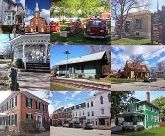
Did you know
- Germantown's four wells sit in Kercher Park, and the water table they tap stands only 8.5 to 11 feet below the ground surface — shallow enough that Ohio EPA lists the shallowness itself as a reason the supply is rated…
- In Ohio's 2023 statewide PFAS testing, none of the six PFAS compounds sampled were detected in Germantown's finished drinking water.
- The city's newest water tower was deliberately built smaller than the one it replaced — 500,000 gallons instead of 750,000 — because a taller column of water would have pushed pressure too high for downtown and the…
- The downtown alley layout, the Gunckel Town Plan laid out by founder Philip Gunckel in 1814, has been on the National Register of Historic Places since 1976.
- The Mudlick Distillery, established in Germantown in 1847, turned out 30 barrels of whiskey a day and was considered the largest in the country for many years.
History6
- 1804Settled by German-speaking families from Berks County, Pennsylvania.
- 1814Philip Gunckel laid out the original town plan, including the distinctive wagon-wheel alley layout of the downtown.
- 1833Germantown incorporated; it operates as a city today.
- 1976The Gunckel Town Plan Historic District, with much of its 19th and early 20th century building stock intact, placed on the National Register of Historic Places.
- 1981Weaver Road water storage standpipe built — an upper tank of 270,000 gallons over a lower tank of 675,000 gallons, 945,000 gallons in all.
- 1997City developed a source water protection plan mapping Germantown's source water protection area.
Treatment & pressure
How it is treated
Four production wells in Kercher Park, on the south side of the city, draw from sand-and-gravel units of the Great Miami (Buried Miami) Valley Aquifer System underlying Twin Creek. Depth to ground water in these wells is only 8.5 to 11 feet — that is the depth of the water table, not the depth of…
Source: germantown.oh.usgermantown.oh.us
Water pressure
No psi figures are published, but Ohio EPA's 2020 Limited Environmental Review describes the distribution system as two pressure zones: an upper zone serving much of the city, now…
Source: germantown.oh.us
What it costs
Germantown publishes no water or sewer rate schedule. The Utilities & Streets page carries only bill-pay links, utility application and termination forms, backflow test forms and…
Water quality & impurities10
| Contaminant | Level | Limit | Year |
|---|---|---|---|
| Nitrate Single sample, no range reported. About a third of the limit; the source is flagged as susceptible to nitrate because… | 3.29 ppm | 10 | 2025 |
| Fluoride Range 0.38-1.33 ppm; naturally occurring plus water additive. | 1.14 ppm | 4 | 2025 |
| Barium Range 0.097-0.097 ppm. Naturally occurring, well below the limit. | 0.097 ppm | 2 | 2024 |
| Total Chlorine Range 0.50-0.80 ppm; disinfectant residual. | 0.63 ppm | 4 (MRDL) | 2025 |
| Total Trihalomethanes (TTHM) Range 1.8-9.1 ppb — about a ninth of the limit, typical of a groundwater source. | 9.1 ppb | 80 | 2025 |
| Lead Zero of 20 samples exceeded the action level. | 0.80 (90th… ppb | 15 (Action… | 2025 |
| Copper Zero of 20 samples exceeded the action level. | 0.132 (90th… ppm | 1.3 (Action… | 2025 |
| Chloroform Range 0.4-3.4 ppb; chlorination byproduct, no federal standard. | 3.4 ppb | unregulated | 2025 |
| Bromodichloromethane Range 0.8-2.8 ppb; chlorination byproduct. | 2.8 ppb | unregulated | 2025 |
| Dibromochloromethane Range 1.0-2.3 ppb; chlorination byproduct. | 2.3 ppb | unregulated | 2025 |
Source: germantown.oh.us
EPA compliance record
Lead at the tap: 90th-percentile result 0.8 ppb in 2025 (action level 15 ppb).
EPA record: no health-based violations since 2015.
1 violation of any kind logged since 2020: 1 for a report, record or notice that was missing, late or incomplete (the yearly water quality report, a public notice, lead line records).
Projects & plans2
Recent and current work
- Water Tower and Telemetry (SCADA) Replacement · $2.3 million · 2020
Financed by an Ohio EPA Water Supply Revolving Loan Account loan (FS390387) at the 1% hardship interest rate over 30 years, saving the city roughly $672,000… - Water Service Line Material Inventory · 2024 · completed
Published under the Lead and Copper Rule Revisions and linked from both the 2025 water quality report and the Utilities & Streets page, alongside a public…
Supply stress
Ohio EPA's 2003 susceptibility analysis rates Germantown's source as highly susceptible to contamination for four stated reasons: the shallowness of the water table (ground water stands only 8.5 to 11 feet down in the production wells), the lack of any low-permeability layer overlying the sand and gravel, numerous potential contaminant…
Source: germantown.oh.usgermantown.oh.us
Sewers
Sanitary
The city's Water & Sanitary Sewer division, under the Director of Public Service, bills water and sewer together on a single utility bill that also carries trash and a separate 'sewer & water debt' charge. No wastewater treatment plant name, design capacity, receiving stream, or CSO/consent-decree status is published on the city's…
Storm
A separate Street & Storm Sewer division is listed among the city's departments. No stormwater utility fee, drainage plan, or documented flooding problem was found.
Source: germantown.oh.usgermantown.oh.us
Sourcesverified
Compiled from the utility's own reports and public records, then independently re-checked against primary sources.
Water systems in this ZIP
- Germantown City59% of residentsGroundwater wells (4 wells)
- Southwest Regional Water District3% of residentsGreat Miami Buried Valley Aquifer (wells)
38% of residents live outside every mapped system, most likely on private wells.
Source: U.S. EPA SDWIS and Community Water System Service Area Boundaries (v3, 2026), Ohio EPA primacy data, 2020 census blocks: the system serving most residents, traced through purchases to the treating utility; Ohio EPA 2023 Sewer and Water Rate Survey (Ohio State, May 2025) for household bills; Ohio EPA DEFA loan awards since 2016 for the loans paragraph · EPA SDWIS · EPA service area boundaries · Ohio EPA drinking water · Ohio EPA rate survey
Infrastructure in this ZIP
17.1 mi of highway (SR 725, SR 4, SR 123) · 3.78 mi of railroad (CSX) · 4.97 mi of gas transmission pipeline (Texas Eastern (Enbridge)) · 10.4 mi of electric transmission line (AES Ohio (DP&L), Duke Energy) · 3 airfields or heliports (Jims, Hummel, Farpoint Airfield) · 1 dam (Germantown Dam) · 1 substation · 8 grade crossings (Great River Railroad, Germantown Rail Siding) · 6 registered towers · 1 public EV charger listing · 1 fire or EMS station · 2 police stations · 1 post office · 1 USGS stream gauge (Twin Creek near Germantown OH) · 1 water tower or tank in OpenStreetMap · 4.79 mi of trail and bike route · 40 bridges and culverts in the inventory · 5 sites with underground fuel tanks in use · 2 quarries or pits (Weidle Sand & Gravel, Germantown Plant #21) · 4 source water protection zones (Germantown City PWS, Nnck Marathon, Ignited Church) · 5 stormwater (MS4) permit areas (City of Germantown, City of Carlisle, Miami Township) · 120 biosolids application fields (sludge from Montgomery Co Eastern Regional WRF, Montgomery Co Western Regional WRF, Dayton WWTP) · 2 mining permit areas (Hollingshead Materials (permit IM-2203), Eagle Materials (permit IM-0360)) · 1 traffic signal.
Draw them24 layers on the mapIntakes and plants
Groundwater (wells)Groundwater wells (4 wells)Germantown City
Source: U.S. EPA SDWIS and Community Water System Service Area Boundaries (v3, 2026), Ohio EPA primacy data, 2020 census blocks: the system serving most residents, traced through purchases to the treating utility; Ohio EPA 2023 Sewer and Water… · EPA SDWIS · Ohio EPA source water protection
Full detail
Loading the full detail… Or open it on the map.
Violations
No health-based violations since 2015No health-based violations since 2015Germantown City · lead 0.8 ppb (2025) · 1 of any kind since 2020
Source: EPA SDWIS (Envirofacts, pulled September 2026): health-based violations since 2015, all violations since 2020, lead and copper 90th-percentile results, for the system serving most of the ZIP · EPA SDWIS (Envirofacts) · EPA ECHO
Full detail
Loading the full detail… Or open it on the map.
Disinfection byproducts
Under 20 µg/L TTHMTTHM 10 µg/L (2019)Germantown City · HAA5 3 · worst year 10
Source: EPA Six-Year Review 4 compliance monitoring data, 2012 to 2019: total trihalomethanes and haloacetic acids (HAA5) sampled in the distribution system, nitrate, arsenic, combined radium, gross alpha and uranium at entry points; yearly means…
Full detail
Loading the full detail… Or open it on the map.
PFAS
No PFAS detectedNo PFAS detectedGermantown City · UCMR 5, 3 samples · Ohio EPA 2020
Source: EPA UCMR 5 occurrence data (final release, August 2026: 29 PFAS and lithium at 347 Ohio systems) and Ohio EPA statewide PFAS sampling 2019 to 2021 (1,479 systems), for the system serving most of each ZIP; Ohio EPA water treatment plant… · Ohio EPA PFAS
Full detail
Loading the full detail… Or open it on the map.
Lead
Under 5 ppbLead 0.8 ppb at the 90th-percentile tapGermantown City · period ending 2025-12 · 0 of 2,360 service lines lead or galvanized
Source: SDWIS lead and copper 90th-percentile tap results (Envirofacts) and EPA's service line inventory dashboard (2026 Q2 submissions), for the system serving most of each ZIP; Ohio Department of Health high-risk ZIP code list for childhood… · ODH childhood lead testing · ODH high-risk ZIP list (CCBH PDF) · Ohio EPA lead and copper · H2Ohio
Full detail
Loading the full detail… Or open it on the map.
Fluoride and treatment
FluoridatedFluoridatedGermantown City · chlorine disinfection
Source: CDC My Water's Fluoride (fluoridation status of each system as reported by the Ohio Department of Health, fetched 2026-09-10); SDWIS treatment table (Envirofacts): each system's registered treatment steps, inherited from the supplier for… · EPA SDWIS search
Full detail
Loading the full detail… Or open it on the map.
Algal toxins
No dataGroundwater system, not monitored for algal toxins
Source: Ohio EPA public water system harmful algal bloom monitoring (geo.epa.ohio.gov DrinkingWater/HAB): microcystin results in raw and treated water since 2016 for surface-water systems, for the system serving most of each ZIP · Ohio EPA HAB information for public water systems
Full detail
Loading the full detail… Or open it on the map.
Groundwater
DRASTIC index under 100DRASTIC 90 · Limestone and Shale878 well logs · median 88 ft deep · 6 karst and spring points
Source: ODNR Division of Geological Survey: DRASTIC groundwater vulnerability polygon at each ZIP's population center, mapped karst features, and the state water well log inventory (about 655,000 logs) counted inside each ZIP; ODNR glacial… · ODNR Geological Survey · Ohio EPA GIS services · USGS water data
Full detail
Loading the full detail… Or open it on the map.
Aquifer
10 to 30%17% sensitive geologic settingkarst-prone bedrock at the center · 2% wellhead protection
Source: Ohio EPA Sensitive Geologic Settings (geology/Geology layer 0) intersected with ZCTA polygons; ODNR karst geology at the ZIP center (layer 7, point query) and karst and spring points (layer 5); Ohio EPA source water protection areas… · Ohio EPA geology layers · Ohio EPA source water protection (SWAP) · ODNR Geological Survey
Full detail
Loading the full detail… Or open it on the map.
Sewage plants
1 to 3 quarters with a violationFarmersville Wwtp · 4.4 mi1 of 12 quarters in violation · 0.22 MGD
Source: EPA ECHO Clean Water Act facilities, Ohio NPDES permits with a publicly owned treatment works component, plants of 0.1 MGD or more or designated major: nearest plant, design flow, significant-noncompliance status, quarters in… · EPA ECHO · EPA CSO inventory · Ohio EPA GIS services · EPA Facility Finder
Full detail
Loading the full detail… Or open it on the map.
Stream health
Under a quarter of the land drains to impaired streams17% of the land drains to streams failing aquatic lifeTown of Germantown-Twin Creek · bacteria (pathogens), unknown cause
Source: EPA ATTAINS, Ohio 2024 Integrated Report assessment units (1,545 watershed polygons) overlaid on ZCTAs in Albers equal-area with the Lake Erie units clipped out: share of land in units not supporting aquatic life, recreation, fish… · EPA ATTAINS · Ohio integrated report · Ohio sport fish advisory · Ohio EPA advisory map
Full detail
Loading the full detail… Or open it on the map.
Watershed
Drains to the Ohio RiverLower Great Miami, Indiana, Ohio subbasinTown of Germantown-Twin Creek · drains to the Ohio River
Source: USGS Watershed Boundary Dataset: HUC-8 subbasins by resident share (2020 census blocks) and the HUC-12 subwatershed at each ZIP's population-weighted center with its downstream chain; USGS county water use 2015 (Dieter and others 2018) for… · USGS watershed boundaries · EPA EnviroAtlas · Ohio EPA 401 map · ODNR Water Withdrawal Atlas (archived copy) · USGS county water use 2015 · ODNR H2Ohio projects · ODNR Lake Erie Coastal Management Area · Ohio EPA source water protection (SWAP) · Ohio EPA nine-element plans · Ohio EPA 319, GLRI and SWIF project lists · Ohio EPA chloride reduction grants · NOAA Lake Erie water levels
Full detail
Loading the full detail… Or open it on the map.
Home
The houses themselves and what they cost: who lives in them, what a typical one looks like down to the parcel record, how much new housing has gone up, and what a household pays in property tax.
Homes and income
$175,000 to $250,000Median home $218,900household income $94,741 · rent $980 · 83% own
Source: Census ACS 2020-2024 5-year by ZCTA: median home value, median gross rent, median household income, owner share, median year built; Eviction Lab tract estimates 2016 to 2018 (Gromis and others 2022), population-weighted to ZIPs; HUD fiscal… · Census ACS · Eviction Lab · HUD data · IRS ZIP statistics · Mapping Inequality · HUD eGIS open data · FDIC BankFind · NCUA call report data
Full detail
Loading the full detail… Or open it on the map.
House by house
1960 to 1979Median year built 19683,609 homes · $194K median appraised
Source: Residential parcels (Ohio land-use classes 500 to 599, apartments 401 to 403, farmhouses) placed in ZIPs by scripts/join_parcels.py on 2026-09-15, the houses loading on demand; county auditors' appraisal records, house by house (year… · Montgomery County Auditor · Butler County Auditor · OGRIP Ohio Statewide Parcels · Warren County Auditor
Full detail
Loading the full detail… Or open it on the map.
Building permits
15 to 30144 housing units permitted 2016 to 2025Germantown · 25.9 per 1,000 residents · 3 in 2025
Source: Census Bureau Building Permits Survey, annual place files 2016 to 2025: new privately owned housing units, buildings and construction value authorized by each Ohio permit office, given to each ZIP through the jurisdiction where most of its… · Census building permits
Full detail
Loading the full detail… Or open it on the map.
Home prices
100 to 150%+104% in ten years+54% in five · +3% in 2025
Source: FHFA House Price Index, annual five-digit ZIP all-transactions series (repeat sales and refinance appraisals of conforming-mortgage homes, developmental, not seasonally adjusted): ten-, five- and one-year changes and the level against… · FHFA house price index · Zillow research data · Realtor.com data
Full detail
Loading the full detail… Or open it on the map.
School tax
25 to 30 mills27.3 effective school millsValley View Local · about $1,908 a year on a $200,000 home
Source: Ohio Department of Taxation, Aggregate Property Tax Rates by School District, tax year 2025 (DTE 515), joined by IRN and weighted by each ZIP's residents in every district; school levies only; Ohio Department of Taxation The Finder rate… · Ohio tax data series · The Finder
Full detail
Loading the full detail… Or open it on the map.
Utilities and getting around
The companies and networks that keep a house running and a resident moving: electric, gas, phone and internet service, and the roads, transit, rail and airports around it.
Electric
AES OhioAES OhioInvestor-owned utility
Source: PUCO certified electric territories via ODOT plus HIFLD municipal systems (EIA-861) with ODOT corporate limits; EIA-861 reliability (outages), sales to ultimate customers (residential prices and bills), net metering and advanced meters by… · PUCO electricity · ODOT territories service · EIA-861 · DOE LEAD Tool · HIFLD retail service territories
Full detail
Loading the full detail… Or open it on the map.
Gas
CenterPoint Energy OhioCenterPoint Energy OhioPUCO-regulated utility · 50% of homes heat with utility gas
Source: PUCO 2026 county map of gas distribution companies, HIFLD/EIA-176 territory polygons, ACS 2020-2024 heating fuel · PUCO natural gas · HIFLD
Full detail
Loading the full detail… Or open it on the map.
Power plants
5 to 10 milesYankee Street · 9.3 migas, 128 MW · 2 plants within 10 miles
Power plants within 10 miles
-
O H HutchingsNatural gas · 25 MW · 4.7 mi
- Capacity
- 25 MW
- Main source
- Natural gas
- Technology
- Natural Gas Fired Combustion Turbine
- Operator
- Kimura Power LLC
- Sector
- IPP Non-CHP
- Where
- Miamisburg, Montgomery County
- Generating units
- 1
- Built
- 1968
- EIA plant code
- 2848
EIA plant page ↗ EIA-860 (source) ↗ Street map and directions ↗
-
Yankee Street 100 MW or moreNatural gas · 128 MW · 9.3 mi
- Capacity
- 128 MW
- By fuel
- natural gas 127 MW, solar 1 MW
- Main source
- Natural gas
- Technology
- Natural Gas Fired Combustion Turbine; Solar Photovoltaic;
- Operator
- Kimura Power LLC
- Sector
- IPP Non-CHP
- Where
- Centerville, Montgomery County
- Generating units
- 8
- Built
- 1969 (first unit); newest unit 2010
- EIA plant code
- 2854
EIA plant page ↗ EIA-860 (source) ↗ Street map and directions ↗
Source: EIA-860 power plant inventory via HIFLD (February 2025), with plant codes, units and years from EIA-860 2025. Miles are straight-line from the ZIP's population-weighted center, as the card above measures them.
Source: EIA-860 power plant inventory via HIFLD (202 Ohio plants, February 2025): nearest plant, nearest plant of 100 MW or more, plants and capacity by fuel within 10 miles; USGS U.S. Wind Turbine Database (June 2026) and U.S. Large-Scale Solar… · EIA-860 · HIFLD · USGS wind turbines · USGS solar · NRC emergency planning zones
Full detail
Loading the full detail… Or open it on the map.
Pipelines
Half a mile to 1 mileNearest transmission line 0.8 miTexas Eastern Trans Co (interstate) · 5 mi of pipe in the ZIP
Source: EIA natural gas interstate and intrastate transmission pipelines via Esri's Federal User Community copy on ArcGIS Online (data last updated July 2025; 1,239 segments in and around Ohio): miles inside each ZIP by operator, distance from the… · EIA U.S. Energy Atlas · ArcGIS Online item
Full detail
Loading the full detail… Or open it on the map.
Phone
Independent local companiesConsolidated Communications CCIIncumbent telephone company
Source: PUCO Telecom map service, layer 7 ILEC Company Service Area (incumbent local exchange carriers, fetched 2026-09-08) by resident share of 2020 census blocks · PUCO telephone
Full detail
Loading the full detail… Or open it on the map.
Internet
2 to 5% lack it96% can get 100/20 Mbpsfiber 9% · cable 74% · 4,074 locations · 2% unserved
Source: FCC Broadband Data Collection, June 2024, fixed availability by H3 hexagon (Esri Living Atlas, Ohio subset); Census ACS 2020-2024 table B28002 internet subscriptions; Ookla Open Data fixed speed tests 2025 Q2 by tile, averaged inside the… · FCC broadband map · Ookla open data · Census ACS
Full detail
Loading the full detail… Or open it on the map.
Cell signal
5G nearly everywhere5G on 100% of the land4G or better 100% · AT&T 100% · T-Mobile 100% · Verizon 100%
Source: FCC Mobile Broadband Data Collection, carrier-reported 4G LTE and 5G coverage by H3 hexagon (Esri Living Atlas layer last updated 24 November 2025, most likely the June 30, 2025 filing round), fetched 2026-09-08; FCC Antenna Structure… · FCC broadband map · FCC antenna registration · Ookla open data
Full detail
Loading the full detail… Or open it on the map.
EV chargers
5 to 10 milesFast charger 7.5 mi: Pilot Travel Center 91 public station in the ZIP (2 Level 2, 0 DC fast ports) · 2 within 5 miles of its center
Public EV charging inside ZIP 45327, and the nearest outside it
-
MVRPC(EV#27)2 Level 2 · Germantown · 2.7 mi
- Address
- 6910 Boomershine Road, Germantown, OH 45327
- Ports
- 2 Level 2
- Plugs
- J1772
- Network
- Blink Network
- Hours
- 24 hours daily
- Phone
- 888-998-2546
Station Locator (NREL) ↗ Alternative Fuels Data Center (source) ↗ Street map and directions ↗
-
MIAMISBURG 14 Level 2 · Miamisburg · 4.7 mi
- Address
- 1 Water Street, Miamisburg, OH 45342
- Ports
- 4 Level 2
- Plugs
- J1772
- Network
- ChargePoint Network
- Hours
- 24 hours daily
- Phone
- 888-758-4389
Station Locator (NREL) ↗ Alternative Fuels Data Center (source) ↗ Street map and directions ↗
Source: NREL Alternative Fuels Data Center station list (May 2026), public and open stations, the posts at one address counted as one site. Miles are straight-line from the ZIP's population-weighted center.
Source: NREL Alternative Fuels Data Center station list as of May 29, 2026 (USDOT BTS copy: 2,136 Ohio electric stations, of which the 1,850 public and open are used, NREL restricted-access records such as dealer-service and hotel-guest chargers… · Alternative Fuels Data Center · BTS Alternative Fueling Stations (NTAD)
Full detail
Loading the full detail… Or open it on the map.
Transit
No transit stop within half a mile of anyone0% within half a mile of a stop0 stops in the ZIP
None inside the ZIP; the nearest station or terminal
-
Curbside bus stop in front of TargetIntercity bus stop · Dayton · 8.7 mi
- What it is
- Intercity bus stop
- City
- Dayton
- Coordinates
- 39.63270, -84.21360
BTS Intermodal Passenger Connectivity Database (source) ↗ Street map and directions ↗
Source: BTS Intermodal Passenger Connectivity Database and National Transit Map (2025). Bus stops are counted on the card and drawn on the full map. Miles are straight-line from the ZIP's population-weighted center.
Source: USDOT BTS National Transit Map stops (National Transportation Atlas Database, 2025 vintage, fetched September 2026), plus the Springfield, Lancaster-Fairfield, Knox County Transit, WayGo and BGSU Shuttle GTFS feeds: share of residents… · BTS National Transit Map · BTS transportation atlas · Springfield City Area Transit GTFS feed · Lancaster-Fairfield Public Transit GTFS feed · Knox County Transit GTFS feed · WayGo GTFS feed · BGSU Shuttle GTFS feed
Full detail
Loading the full detail… Or open it on the map.
Walkability
Least walkable (1 to 5.75)Walkability 5.5 of 208 intersections per square mile · 0% near transit
Source: EPA National Walkability Index (Smart Location Database 3.0, 2021) by block group, population-weighted to ZIPs through 2020 census block points; car-free household share from Census ACS 2020 to 2024 table B25044, or where missing the Smart… · EPA walkability index · Smart Location Database · Census ACS
Full detail
Loading the full detail… Or open it on the map.
Rail crossings
4 to 108 public crossings0 gated · up to 3 trains a day · Great River Railroad
Source: FRA Grade Crossing Inventory (current records, Ohio): open at-grade crossings inside each ZIP, gates, trains a day at the busiest, timetable speed, railroads; nearest crossing to the population-weighted center; FRA highway-rail grade… · FRA crossing inventory (Form 71, current) · FRA crossing incidents (Form 57) · FRA rail equipment accidents (Form 54) · FRA safety data · DOT open data
Full detail
Loading the full detail… Or open it on the map.
Bridges
Under 5% of bridges poor40 bridges, 1 rated poortypical build year 1984 · busiest SR-4, 12,401 vehicles a day
Bridges rated poor inside ZIP 45327
-
Germantown Middle over Shawnee CreekPoor · built 1982 · 1.6 mi
- Condition
- Poor: a deck, superstructure, substructure or culvert rated 4 or below on the 0 to 9 scale
- What it is
- Bridge
- Built
- 1982
- Length
- 14 ft
- Owner
- County
- Vehicles a day
- 791
- Coordinates
- 39.60404, -84.37782
National Bridge Inventory (source) ↗ Street map and directions ↗
Source: FHWA National Bridge Inventory 2025. "Poor" means one major part rated 4 or below on the 0 to 9 scale; it calls for repair, not closing, unless the state posts or closes the bridge. Miles are straight-line from the ZIP's population-weighted center.
Source: FHWA National Bridge Inventory 2025 (26,713 Ohio structures; 26,616 fall inside a ZIP area and are counted, the other 97 land outside every ZIP polygon): bridges inside each ZIP, poor-condition ratings, ages, traffic · FHWA bridge inventory · ODOT TIMS bridge inventory (live)
Full detail
Loading the full detail… Or open it on the map.
Traffic
5,000 to 20,00013,430 vehicles a day on SR 4451 trucks · 200K vehicle-miles a day inside the ZIP
Source: ODOT traffic count segments (2025 annual average daily traffic by road segment, ODOT Transportation Information Mapping System): segments assigned to the ZIP holding their midpoint; NHTSA Fatality Analysis Reporting System 2020 to 2024… · ODOT TIMS traffic count segments · NHTSA FARS
Full detail
Loading the full detail… Or open it on the map.
Airports and Amtrak
15 to 30 milesDAY · 20.7 miJames M Cox Dayton International · Amtrak at Cincinnati 36.8 mi
Source: FAA airport facilities (NASR landing-facility record) and Amtrak stations via USDOT BTS National Transportation Atlas Database, fetched September 2026: nearest airport with scheduled airline service (Part 139 class I), nearest public-use… · BTS transportation atlas
Full detail
Loading the full detail… Or open it on the map.
Land, air and risk
The ground itself and what can go wrong on it: radon, flood risk, air quality, old mines and wells, and the parks, wetlands and open land still left.
Radon
4 to 8 pCi/L6.8 pCi/L average radon320 tests · 46% above 4 pCi/L · median 3.5
Source: Ohio Department of Health radon test results by ZIP code since 2010 (pre-mitigation), ZIPs with five or more tests · ODH radon program
Full detail
Loading the full detail… Or open it on the map.
Flood
5 to 10%9.9% of residents in the 1% floodplain7% of the land is floodplain, 1% more in the 0.2% zone · zone AE
Source: FEMA National Flood Hazard Layer, flood hazard zones, fetched 2026-09-08; OpenFEMA NFIP redacted claims for Ohio (frozen June 2026), by reported ZIP; USGS NWIS annual peak flows for the nearest active stream gauge; NOAA Atlas 14… · FEMA flood hazard layer · FEMA Map Service Center · OpenFEMA · NOAA Atlas 14 · USGS stream gauges
Full detail
Loading the full detail… Or open it on the map.
Hazard risk
60 to 80Risk score 62 · higher than about 62% of US tractsLandslide 86 · Drought 81
Source: FEMA National Risk Index, census tracts, December 2025 release, population-weighted to ZIPs · FEMA National Risk Index · NRI census tract layer (ArcGIS)
Full detail
Loading the full detail… Or open it on the map.
Climate
Under 20 inches of snow a year10" of snow a year · 52.7°F averageJanuary low 20° · July high 86° · 42" of precipitation
Source: NOAA NCEI 1991-2020 U.S. Climate Normals, annual and monthly, 261 Ohio stations; each ZIP takes the nearest station reporting each element from its population-weighted center; U.S. Drought Monitor weekly county statistics 2000 to 2026… · NOAA climate normals · NOAA climate at a glance · U.S. Drought Monitor
Full detail
Loading the full detail… Or open it on the map.
Air
8.5 to 9PM2.5 8.8 µg/m³ at Ohio Bell, 9.5 miozone 67 ppb at Middletown Airport · Montgomery County median AQI 46
Source: EPA Air Quality System 2025 annual summaries: nearest PM2.5 and ozone monitors from each ZIP's population-weighted center, county AQI day counts; EPA ECHO Clean Air Act permitted sources in Ohio (air_rest_services, September 2026); EPA… · EPA air data files · EPA AirToxScreen · EPA Green Book · EPA ECHO
Full detail
Loading the full detail… Or open it on the map.
Toxic sites
3 to 8 milesNearest NPL site 4.8 mi: Mound Plant (USDOE)0 toxic-release reporters · 0 Superfund program sites in the ZIP
Source: EPA Facility Registry Service: Superfund NPL and SEMS sites, Toxics Release Inventory reporters (EPA geoplatform), fetched 2026-09-08; the nearest NPL site also considers sites in PA, WV, KY, IN and MI within about 20 miles of the border… · EPA Facility Registry · EPA Superfund sites · Ohio EPA cleanup sites · EPA UST Finder · EPA ECHO
Full detail
Loading the full detail… Or open it on the map.
Toxic releases
No dataNo TRI-reporting facility
Source: EPA Toxics Release Inventory basic data files, Ohio, reporting years 2020 to 2024 (2024 shown, 2020 for the trend); facilities placed in the ZCTA holding their coordinates; dioxin rows reported in grams left out of pound totals · EPA TRI data files
Full detail
Loading the full detail… Or open it on the map.
Dams
3 to 55 high-hazard dams within 10 milesNearest: Germantown Dam, 1.6 mi, condition fair
High-hazard dams within 10 miles
-
Germantown DamTwin Creek · condition: fair · 1.6 mi
- Hazard class
- High: a failure would probably cost a life
- Condition
- Fair (assessed 04/27/2021)
- River or stream
- Twin Creek
- Purpose
- Flood Risk Reduction
- Type
- Earth
- Height
- 107 ft
- Storage
- 142,000 acre-feet
- Completed
- 1922
- Owner type
- Local Government
- County
- Montgomery County
- Nearest town (NID)
- Germantown
- Last inspection
- 04/27/2021
- Emergency action plan
- Yes
- NID ID
- OH00425
National Inventory of Dams record ↗ National Inventory of Dams (source) ↗ Street map and directions ↗
-
Charylie's Lake DamTributary To Great Miami River · condition: fair · 4.6 mi
- Hazard class
- High: a failure would probably cost a life
- Condition
- Fair (assessed 06/03/2021)
- River or stream
- Tributary To Great Miami River
- Purpose
- Recreation
- Type
- Earth
- Height
- 29 ft
- Storage
- 46 acre-feet
- Completed
- 1963
- Owner type
- Private
- County
- Butler County
- Nearest town (NID)
- Poast Town
- Last inspection
- 06/03/2021
- Emergency action plan
- No
- NID ID
- OH00177
National Inventory of Dams record ↗ National Inventory of Dams (source) ↗ Street map and directions ↗
-
Paradise Lakes - North Lake DamTributary To Elk Creek · condition: fair · 7.1 mi
- Hazard class
- High: a failure would probably cost a life
- Condition
- Fair (assessed 04/22/2021)
- River or stream
- Tributary To Elk Creek
- Purpose
- Recreation
- Type
- Earth
- Height
- 32 ft
- Storage
- 93 acre-feet
- Completed
- 1946
- Owner type
- Private
- County
- Preble County
- Nearest town (NID)
- Greenbush
- Last inspection
- 04/22/2021
- Emergency action plan
- No
- NID ID
- OH00154
National Inventory of Dams record ↗ National Inventory of Dams (source) ↗ Street map and directions ↗
-
Paradise Lakes - South Lake Dam PoorTributary To Elk Creek · condition: poor · 7.2 mi
- Hazard class
- High: a failure would probably cost a life
- Condition
- Poor (assessed 04/22/2021)
- River or stream
- Tributary To Elk Creek
- Purpose
- Recreation
- Type
- Earth
- Height
- 40 ft
- Storage
- 87 acre-feet
- Completed
- 1946
- Owner type
- Private
- County
- Preble County
- Nearest town (NID)
- Greenbush
- Last inspection
- 04/22/2021
- Emergency action plan
- No
- NID ID
- OH00155
National Inventory of Dams record ↗ National Inventory of Dams (source) ↗ Street map and directions ↗
-
Remick Lake Dam PoorTributary To Clear Creek · condition: poor · 8.7 mi
- Hazard class
- High: a failure would probably cost a life
- Condition
- Poor (assessed 05/06/2021)
- River or stream
- Tributary To Clear Creek
- Purpose
- Recreation
- Type
- Earth
- Height
- 29 ft
- Storage
- 44 acre-feet
- Completed
- 1966
- Owner type
- Private
- County
- Warren County
- Nearest town (NID)
- Springboro
- Last inspection
- 05/06/2021
- Emergency action plan
- Yes
- NID ID
- OH02594
National Inventory of Dams record ↗ National Inventory of Dams (source) ↗ Street map and directions ↗
Source: U.S. Army Corps of Engineers National Inventory of Dams, August 2026. "High hazard" rates what a failure would cost downstream, not how likely one is; the condition is the state's assessment. Miles are straight-line from the ZIP's population-weighted center, as the card above measures them.
Source: U.S. Army Corps of Engineers National Inventory of Dams (1,376 Ohio dams, August 2026; 26 Corps levees and dikes counted with their parent dam): high-hazard dams near each ZIP's population-weighted center, with the state's condition… · National Inventory of Dams
Full detail
Loading the full detail… Or open it on the map.
Disasters
3 to 55 tornado tracks within 5 miles since 19500 rated F2/EF2+ · 16 federal declarations for Montgomery County · 1 quake M2+ within 25 mi
Source: NOAA Storm Prediction Center tornado database 1950-2025 (tracks within 5 miles of each ZIP's population-weighted center), OpenFEMA disaster declarations by county since 1956, USGS earthquake catalog M2+ since 1970 within 25 miles… · NOAA SPC tornado data · OpenFEMA · USGS earthquakes · NOAA storm events · IEM warning archive
Full detail
Loading the full detail… Or open it on the map.
Spills
5 to 1410 spills reported since 2021mostly diesel and fuel oil · 2 reached water
Spills reported since 2021 inside ZIP 45327
-
Sheen Rainbow / Hydrocarbon Reached water2023-08-29 · Germantown · 0.6 mi
- Reported
- 2023-08-29
- What spilled
- Sheen Rainbow / Hydrocarbon
- Reached a waterway
- 57 - Little Twin Creek
- Where
- Germantown, Montgomery County
- Ohio EPA district office
- SWDO
- Ohio EPA case number
- 2308EPA0001524
Ohio EPA spill reports (source) ↗ Street map and directions ↗
-
Material White Reached water2023-08-31 · Germantown · 0.7 mi
- Reported
- 2023-08-31
- What spilled
- Material White
- Reached a waterway
- 57 - Little Twin Creek
- Where
- Germantown, Montgomery County
- Ohio EPA district office
- SWDO
- Ohio EPA case number
- 2308EPA0001542
Ohio EPA spill reports (source) ↗ Street map and directions ↗
-
Oil Motor / Lube Oil / Vehicle2024-06-06 · German Twp · 1.2 mi
- Reported
- 2024-06-06
- What spilled
- Oil Motor / Lube Oil / Vehicle
- Where
- German Twp, Montgomery County
- Ohio EPA district office
- SWDO
- Ohio EPA case number
- 2406EPA0000949
Ohio EPA spill reports (source) ↗ Street map and directions ↗
-
Fuel Diesel / Diesel Fuel (Vehicle On Or Off Road)2021-09-28 · German Twp · 1.3 mi
- Reported
- 2021-09-28
- What spilled
- Fuel Diesel / Diesel Fuel (Vehicle On Or Off Road)
- Largest amount reported
- 75 gallons
- Where
- German Twp, Montgomery County
- Ohio EPA district office
- SWDO
- Ohio EPA case number
- 2109EPA0001531
Ohio EPA spill reports (source) ↗ Street map and directions ↗
-
Asphalt / Bitumen2025-09-23 · German Twp · 1.5 mi
- Reported
- 2025-09-23
- What spilled
- Asphalt / Bitumen
- Largest amount reported
- 30 gallons
- Where
- German Twp, Montgomery County
- Ohio EPA district office
- SWDO
- Ohio EPA case number
- 2509EPA0001586
Ohio EPA spill reports (source) ↗ Street map and directions ↗
-
Fertilizer(S) Nos (Not Specified)2024-03-27 · German Twp · 1.5 mi
- Reported
- 2024-03-27
- What spilled
- Fertilizer(S) Nos (Not Specified)
- Where
- German Twp, Montgomery County
- Ohio EPA district office
- SWDO
- Ohio EPA case number
- 2403EPA0000482
Ohio EPA spill reports (source) ↗ Street map and directions ↗
-
Fuel Diesel / Diesel Fuel (Vehicle On Or Off Road)2025-01-24 · Germantown · 2.1 mi
- Reported
- 2025-01-24
- What spilled
- Fuel Diesel / Diesel Fuel (Vehicle On Or Off Road)
- Largest amount reported
- 40 gallons
- Where
- Germantown, Montgomery County
- Ohio EPA district office
- SWDO
- Ohio EPA case number
- 2501EPA0000095
Ohio EPA spill reports (source) ↗ Street map and directions ↗
-
Other / All Other / Trade Name / Mixture / Solution Etc2024-12-21 · Germantown · 2.1 mi
- Reported
- 2024-12-21
- What spilled
- Other / All Other / Trade Name / Mixture / Solution Etc
- Where
- Germantown, Montgomery County
- Ohio EPA district office
- SWDO
- Ohio EPA case number
- 2412EPA0002059
Ohio EPA spill reports (source) ↗ Street map and directions ↗
-
Fuel Oil/ Home Heating / Heating Oil2025-01-23 · German Twp · 3.4 mi
- Reported
- 2025-01-23
- What spilled
- Fuel Oil/ Home Heating / Heating Oil
- Largest amount reported
- 78 gallons
- Where
- German Twp, Montgomery County
- Ohio EPA district office
- SWDO
- Ohio EPA case number
- 2501EPA0000092
Ohio EPA spill reports (source) ↗ Street map and directions ↗
-
Fuel Diesel / Diesel Fuel (Vehicle On Or Off Road)2024-04-16 · Jefferson Twp · 3.6 mi
- Reported
- 2024-04-16
- What spilled
- Fuel Diesel / Diesel Fuel (Vehicle On Or Off Road)
- Where
- Jefferson Twp, Montgomery County
- Ohio EPA district office
- SWDO
- Ohio EPA case number
- 2404EPA0000627
Ohio EPA spill reports (source) ↗ Street map and directions ↗
-
Fuel Diesel / Diesel Fuel (Vehicle On Or Off Road)2023-05-02 · Jefferson Twp · 3.7 mi
- Reported
- 2023-05-02
- What spilled
- Fuel Diesel / Diesel Fuel (Vehicle On Or Off Road)
- Largest amount reported
- 60 gallons
- Where
- Jefferson Twp, Montgomery County
- Ohio EPA district office
- SWDO
- Ohio EPA case number
- 2305EPA0000710
Ohio EPA spill reports (source) ↗ Street map and directions ↗
Source: Ohio EPA emergency response spill reports, 2021 to September 2026, one point per case where Ohio EPA placed it. A report is what the caller or responder recorded; amounts are often blank or estimated. Miles are straight-line from the ZIP's population-weighted center.
Source: Ohio EPA emergency response spill reports (geo.epa.ohio.gov EmergResponse/Spills2_OpenData): cases with a location inside each ZIP, 2021 to date · Ohio EPA spills data · Ohio EPA Office of Emergency Response
Full detail
Loading the full detail… Or open it on the map.
Oil and gas wells
No oil or gas well in the ZIP0 wells in the ZIP0 producing · 0 shale · 0 orphan · nearest 4.54 mi
Source: ODNR Division of Oil and Gas Resources public well inventory (242,324 well heads, fetched 2026-09-08): wells inside each ZIP by status, horizontal shale wells, injection wells, orphan-program wells · ODNR oil and gas · ODNR GIS services
Full detail
Loading the full detail… Or open it on the map.
Abandoned mines
No mapped underground mineNo mapped minenearest mapped non-coal mine 18.2 mi
Source: ODNR Mines of Ohio: abandoned underground coal and industrial-mineral mines mapped before 1977 (5,116 polygons), overlaid on ZCTAs in Albers equal-area: share of each ZCTA's total area (land plus inland water) over a mapped mine; ODNR… · ODNR mines of Ohio · ODNR Geological Survey
Full detail
Loading the full detail… Or open it on the map.
Soils
Very limitedMiamian silt loam, 12 to 18 percent slopes, erodedseptic very limited · well drained
Source: USDA NRCS SSURGO via Soil Data Access: the soil map unit under each ZIP's population-weighted center with its dominant component, drainage, hydric and farmland class, flooding, and the Ohio septic and basement interpretation ratings… · USDA Soil Data Access · Web Soil Survey · Open-Meteo elevation
Full detail
Loading the full detail… Or open it on the map.
Parks
5 to 15%8.2% public land · 2,511 acresGermantown Metropark · Sycamore State Park 11.2 mi
Source: USGS Protected Areas Database 4.1 (Ohio state package, flattened combined layer, open-access fee, designation and easement polygons plus the six ODNR state parks PAD-US codes closed by default: Buckeye Lake, Forked Run, Hueston Woods, Lake… · USGS PAD-US · ODNR GIS services
Full detail
Loading the full detail… Or open it on the map.
Wetlands
Under 1% of the land0.8% wetland · 232 acrespond 127 · forested/shrub wetland 85 · emergent wetland 19
Source: USFWS National Wetlands Inventory, Ohio geodatabase (imagery mostly 2004 to 2007, Lake Erie basin 2021), freshwater wetlands and ponds clipped to each ZIP (lakes and rivers excluded); Ohio EPA potential high-quality vernal pools… · USFWS wetlands inventory · Ohio EPA GIS services
Full detail
Loading the full detail… Or open it on the map.
Land cover
5% to 15%11% developed · 20% tree canopycropland 51% · forest 24% · pasture 13%
Source: National Land Cover Database, 2021 edition (USGS and the MRLC consortium; MRLC has since published Annual NLCD and annual tree canopy through 2025, not yet pulled here): land cover, percent impervious surface and tree canopy at 30 m… · NLCD · USDA Cropland Data Layer · ODNR pre-settlement vegetation
Full detail
Loading the full detail… Or open it on the map.
People and health
Who lives here and how well: education, jobs, health and life expectancy, and how far the nearest hospital, police station or grocery store sits.
People
25 to 40%26.8% bachelor's or higher94.4% white · 0.6% Black · 1.8% Hispanic · 0.1% Asian · 0.7% foreign-born
Source: Census ACS 2020-2024 5-year by ZCTA: educational attainment (B15003), race and Hispanic origin (B03002), nativity (B05002), veterans (B21001); IRS Statistics of Income county migration flows 2022 to 2023 for the county; Census Bureau… · Census ACS · Census population estimates · IRS migration data · USDA ERS county codes · USDA ERS commuting area codes · 2020 Census redistricting data · Census SAIPE · IRS exempt organizations
Full detail
Loading the full detail… Or open it on the map.
Jobs
0.25 to 0.61,394 jobs · 4,257 employed residentsHotels and restaurants leads · residents mostly work in Miamisburg (45342)
Source: Census LEHD LODES 8, 2023, all jobs: workplace and residence counts by census block summed into ZCTAs (workplace-only blocks by block-group or tract majority), origin-destination flows for where residents work; Census ZIP Code Business… · Census LEHD · BLS local unemployment · BLS QCEW · BEA county GDP · USAspending · OSHA enforcement data · Census ZIP Business Patterns · Census ACS · USDA ERS county typology · CDFI Fund Opportunity Zones
Full detail
Loading the full detail… Or open it on the map.
Economic history
Groundwater (wells)Groundwater wells (4 wells)Germantown City
Source: Historical economic data: Census Bureau historical county population via the NBER mirror (1900) and Census Bureau population estimates (current and peak), Census County Business Patterns, USDA Census of Agriculture, FHFA House Price Index… · FRED (Federal Reserve Bank of St. Louis) · Census County Business Patterns · USDA Census of Agriculture · FHFA House Price Index · BEA GDP by county · Census American Community Survey · IPUMS NHGIS historical census · Zillow Home Value Index
Full detail
Loading the full detail… Or open it on the map.
Upward mobility
40th to 45thPercentile rank 43income rank at 35 for children of low-income parents · 0.27% incarcerated in 2010
Source: Opportunity Atlas (Chetty, Friedman, Hendren, Jones and Porter, Census Bureau): tract outcomes for children born 1978 to 1983, population-weighted to ZIPs through 2020 census blocks · Opportunity Atlas · Opportunity Insights data
Full detail
Loading the full detail… Or open it on the map.
Social vulnerability
20th to 40th percentile36th percentile of Ohio tractssocioeconomic 34 · household 41 · minority status 19 · housing and transport 51
Source: CDC/ATSDR Social Vulnerability Index 2022 by census tract (percentile ranks among Ohio tracts), population-weighted to ZIPs through 2020 census blocks · CDC/ATSDR SVI
Full detail
Loading the full detail… Or open it on the map.
Health
16 to 20%17.2% in fair or poor healthobesity 33.9% · diabetes 12.2% · smoking 13.9% · depression 26.6%
Source: CDC PLACES 2025 release, ZCTA model-based estimates of adult health (BRFSS 2023, ACS): fair or poor health, obesity, diabetes, smoking, depression, lack of health insurance among adults 18-64 and more; County Health Rankings 2025… · CDC PLACES · County Health Rankings · CDC overdose data · NCI cancer profiles · HRSA data
Full detail
Loading the full detail… Or open it on the map.
Life expectancy
79 to 8279.2 years life expectancy8 tracts, from 74.6 to 82.3
Source: CDC/NCHS U.S. Small-area Life Expectancy Estimates Project (USALEEP, deaths 2010-2015, 2010 census tracts) weighted into ZIPs by 2020 block population · CDC USALEEP
Full detail
Loading the full detail… Or open it on the map.
Hospitals
6 to 10 milesSycamore Medical Center · 6.8 miMiamisburg · 154 beds · 3 within 10 miles
The nearest hospitals
-
Sycamore Medical CenterGeneral hospital · Miamisburg · 6.8 mi
- What it is
- General hospital
- Address
- 4000 Miamisburg-Centerville Road, Miamisburg, OH 45342
- County
- Montgomery County
- Beds
- 154
- Helipad
- Yes
- Ownership
- Non-profit
- Medicare overall rating
- 4 of 5 stars
- Emergency department (Medicare)
- Yes
- Medicare reports it as
- Kettering Health Miamisburg
- Phone
- (937) 866-0551
- Medicare ID
- 360239
Medicare Care Compare ↗ Where HIFLD got this record ↗ HIFLD hospitals (source) ↗ Street map and directions ↗
-
Pam Specialty Hospital of DaytonGeneral hospital · Miamisburg · 6.8 mi
- What it is
- General hospital
- Address
- 4000 Miamisburg Centerville Rd, Miamisburg, OH 45342
- County
- Montgomery County
- Beds
- 44
- Helipad
- Yes
- Ownership
- Proprietary
- Phone
- (937) 384-8300
Where HIFLD got this record ↗ HIFLD hospitals (source) ↗ Street map and directions ↗
-
Pam Health Rehabilitation Hospital of MiamisburgCritical access hospital · Miamisburg · 7.1 mi
- What it is
- Critical access hospital
- Address
- 2310 Crosspointe Drive, Miamisburg, OH 45342
- County
- Montgomery County
- Beds
- 62
- Ownership
- Proprietary
- Phone
- (937) 617-0566
Where HIFLD got this record ↗ HIFLD hospitals (source) ↗ Street map and directions ↗
Source: HIFLD hospitals inventory via FEMA (closed hospitals it still lists left out, hospitals opened since added), with Medicare Care Compare ratings matched by name and address. Miles are straight-line from the ZIP's population-weighted center, as the card above measures them.
The nearest health centers
-
Centerpoint Health Suite DHealth center · Franklin · 7.1 mi
- Run by
- a federally qualified health center
- Setting
- Clinic
- City
- Franklin
- Coordinates
- 39.55627, -84.28038
Find a Health Center (HRSA) ↗ HRSA data (source) ↗ Street map and directions ↗
-
Community Health Centers of Greater Dayton - Alex Central Health CenterHealth center · Miamisburg · 7.1 mi
- Run by
- a federally qualified health center
- Setting
- Clinic
- City
- Miamisburg
- Coordinates
- 39.64154, -84.24423
Find a Health Center (HRSA) ↗ HRSA data (source) ↗ Street map and directions ↗
Source: HRSA health center service delivery sites, active, September 2026 (school-based sites left out). Health centers see patients whether or not they have insurance, with fees on a sliding scale. Miles are straight-line from the ZIP's population-weighted center, as the card above measures them.
The nearest dialysis center
-
Davita Miamisburg DialysisDialysis · Miamisburg · 7.1 mi
- Address
- 290 Alexandersville Dialysis, Miamisburg, OH 45342
- Dialysis stations
- 1
- Medicare star rating
- 4 of 5 stars
- Services
- in-center hemodialysis, peritoneal dialysis
- Shift starting after 5 pm
- Yes
- Ownership
- for profit
- Chain
- DaVita
- Medicare certified since
- 2012-10-10
- Phone
- (937) 865-0633
- Medicare ID
- 362785
Medicare Care Compare ↗ CMS dialysis facility list (source) ↗ Street map and directions ↗
Source: CMS dialysis facility list, September 2026, geocoded with the Census Bureau batch geocoder (an address it could not place sits at its ZIP center). Miles are straight-line from the ZIP's population-weighted center, as the card above measures them.
Source: Nearest hospital: miles from each ZIP's population-weighted center to the nearest open general or critical-access hospital in Ohio, or, within 40 miles of the state line in Indiana, Kentucky, West Virginia, Pennsylvania and Michigan, the… · CMS Care Compare data · HIFLD · HRSA data · CMS NPI files
Full detail
Loading the full detail… Or open it on the map.
Nursing homes
Under 1 mileASTORIA HEALTH & REHAB CENTER · 0.6 mi5 of 5 stars · 50 beds · 2 within 5 miles
Nursing homes within 3 miles, and the nearest beyond
-
Astoria Health & Rehab Center5 of 5 stars · Germantown · 0.6 mi
- Address
- 300 Astoria Road, Germantown, OH 45327
- Certified beds
- 50
- Residents on an average day
- 43
- Medicare overall rating
- 5 of 5 stars
- Health inspections
- 5 of 5 stars
- Staffing
- 1 of 5 stars
- Quality measures
- 5 of 5 stars
- Penalties since 2023
- none
- Ownership
- For profit - Corporation
- Chain
- SABER HEALTHCARE GROUP
- Takes
- Medicare and Medicaid
- Phone
- (937) 855-2363
- Medicare ID
- 366291
Medicare Care Compare ↗ CMS nursing home data (source) ↗ Street map and directions ↗
-
Carlisle Manor Health Care Inc4 of 5 stars · Carlisle · 4.3 mi
- Address
- 730 Hillcrest Drive, Carlisle, OH 45005
- Certified beds
- 48
- Residents on an average day
- 44
- Medicare overall rating
- 4 of 5 stars
- Health inspections
- 4 of 5 stars
- Staffing
- 1 of 5 stars
- Quality measures
- 5 of 5 stars
- Penalties since 2023
- none
- Ownership
- For profit - Corporation
- Chain
- EMBASSY HEALTHCARE
- Takes
- Medicare and Medicaid
- Phone
- (937) 746-2662
- Medicare ID
- 366043
Medicare Care Compare ↗ CMS nursing home data (source) ↗ Street map and directions ↗
-
Kingston of Miamisburg4 of 5 stars · Miamisburg · 6.1 mi
- Address
- 1120 South Dunaway Street, Miamisburg, OH 45342
- Certified beds
- 113
- Residents on an average day
- 88
- Medicare overall rating
- 4 of 5 stars
- Health inspections
- 4 of 5 stars
- Staffing
- 2 of 5 stars
- Quality measures
- 4 of 5 stars
- Penalties since 2023
- none
- Ownership
- For profit - Corporation
- Chain
- KINGSTON HEALTHCARE
- Takes
- Medicare and Medicaid
- Phone
- (937) 247-6004
- Medicare ID
- 365984
Medicare Care Compare ↗ CMS nursing home data (source) ↗ Street map and directions ↗
Source: CMS Care Compare nursing home provider and penalties files; Medicare star ratings run 1 to 5. Miles are straight-line from the ZIP's population-weighted center, as the card above measures them.
Source: CMS Care Compare nursing home provider file (922 Ohio homes), addresses geocoded with the Census Bureau batch geocoder (67 unmatched placed at their ZIP center); CMS penalties file (fines and payment denials since 2023, matched by name and… · CMS Care Compare data
Full detail
Loading the full detail… Or open it on the map.
Crime
1 to 2.51.0 violent offenses per 1,000Germantown Police · 8.3 property per 1,000 · 12 months · 2% of property cleared
Source: FBI Crime Data Explorer NIBRS incident files for Ohio, 2024 (2023 file for the trend), as downloaded in September 2026; the FBI keeps accepting agency revisions after release, so an agency's live Explorer totals for the same year can… · FBI Crime Data Explorer · USGS structures service
Full detail
Loading the full detail… Or open it on the map.
Police
Under 1 mileGermantown Police Department · 0.2 mi2 stations within 3 miles · post office 0.5 mi
Police stations within 3 miles
-
Germantown Police DepartmentGermantown · 0.2 mi
- Address
- 75 North Walnut Street, Germantown, OH 45327
- Coordinates
- 39.62597, -84.37365
USGS National Map structures (source) ↗ Street map and directions ↗
-
German Township Police DepartmentGermantown · 1.5 mi
- Address
- 12102 State Highway 725, Germantown, OH 45327
- Coordinates
- 39.62282, -84.40384
USGS National Map structures (source) ↗ Street map and directions ↗
Source: USGS National Map structures, police stations, corrected and completed by hand (September 2026). The department that answers a call is set by jurisdiction, not by distance. Miles are straight-line from the ZIP's population-weighted center, as the card above measures them.
Source: USGS National Map structures: police stations (772 Ohio points: the inventory's 731 less 4 closed or duplicate records, with 4 wrong names corrected, plus 45 departments and sheriff's offices it lacks, placed from OpenStreetMap or the… · USGS structures service · OpenStreetMap · Census Bureau geocoder
Full detail
Loading the full detail… Or open it on the map.
Fire and EMS
Under 1 mileGermantown Fire Department Station 63 · 0.2 mi1 station within 3 miles, 15 within 8
Fire and EMS stations within 3 miles, and the nearest beyond
-
Germantown Fire Department Station 63Germantown · 0.2 mi
- Address
- 75 North Walnut Street, Germantown, OH 45327
- Coordinates
- 39.62597, -84.37388
USGS National Map structures (source) ↗ Street map and directions ↗
-
Franklin Township Fire Department Station 20Franklin · 4.4 mi
- Address
- 7901 Keays Road, Franklin, OH 45005
- Coordinates
- 39.56891, -84.34512
USGS National Map structures (source) ↗ Street map and directions ↗
-
Carlisle Fire DepartmentCarlisle · 4.5 mi
- Address
- 367 Lincoln Drive, Carlisle, OH 45005
- Coordinates
- 39.58435, -84.31329
USGS National Map structures (source) ↗ Street map and directions ↗
Source: USGS National Map structures (most Ohio records last updated 2019 to 2022), checked against the Columbus and Cleveland station lists. The department that answers a call is set by jurisdiction and mutual aid, not by distance. Miles are straight-line from the ZIP's population-weighted center, as the card above measures them.
Source: USGS National Map structures inventory (fire and EMS stations; most Ohio records last updated 2019 to 2022): 1,772 Ohio stations after removing duplicate records and checking Columbus- and Cleveland-area stations against the cities'… · USGS structures service · Columbus fire stations · Cleveland fire stations
Full detail
Loading the full detail… Or open it on the map.
Libraries
Under 1 mileGermantown Public Library · 0.3 mi1 within 3 miles, 4 within 8
Public libraries within 3 miles, and the nearest beyond
-
Germantown Public LibraryCentral library · Germantown · 0.3 mi
- Address
- 51 N. Plum St., Germantown, OH 45327
- What it is
- Central library
- Library system
- Germantown Public Library
- Open
- 3,106 hours a year, 52 weeks
- Building
- 10,546 sq ft
- System's visits, FY2024
- 52,000
- People the system serves
- 10,975
- Phone
- (937) 855-4001
IMLS Public Libraries Survey (source) ↗ Street map and directions ↗
-
Miamisburg Branch LibraryBranch · Miamisburg · 5.1 mi
- Address
- 545 E. Linden Ave., Miamisburg, OH 45342
- What it is
- Branch
- Library system
- Dayton Metro Library
- Open
- 3,042 hours a year, 52 weeks
- Building
- 16,147 sq ft
- System's visits, FY2024
- 1,987,700
- System's loans, FY2024
- 4,831,439
- People the system serves
- 452,238
- Phone
- (937) 463-2665
IMLS Public Libraries Survey (source) ↗ Street map and directions ↗
Source: IMLS Public Libraries Survey FY2024 (outlets and their systems). Any Ohio resident can get a free card at any Ohio public library. Miles are straight-line from the ZIP's population-weighted center, as the card above measures them.
Museums, historical societies, gardens and zoos inside ZIP 45327
-
Historical Society GermantownHistorical society · Germantown · 0.3 mi
- What it is
- Historical society
- City
- Germantown
- Coordinates
- 39.62591, -84.37100
Search Wikipedia ↗ IMLS Museum Data Files (source) ↗ Street map and directions ↗
The museum list is IMLS's 2018 file; a museum may have closed or moved since.
-
Veterans Memorial MuseumHistory museum · Germantown · 0.4 mi
- What it is
- History museum
- City
- Germantown
- Coordinates
- 39.62348, -84.37047
Search Wikipedia ↗ IMLS Museum Data Files (source) ↗ Street map and directions ↗
The museum list is IMLS's 2018 file; a museum may have closed or moved since.
Source: IMLS Museum Data Files, 2018. Miles are straight-line from the ZIP's population-weighted center.
Source: IMLS Public Libraries Survey FY2024 outlet and system files (720 open Ohio central libraries and branches of 251 systems, plus 62 bookmobiles); straight-line miles from each ZIP's population-weighted center to the nearest Ohio library… · IMLS Public Libraries Survey · IMLS Museum Data Files
Full detail
Loading the full detail… Or open it on the map.
Groceries
No residents in a flagged tractNo residents in a low-income, low-access tract71% over 1 mile from a supermarket · 5% of households on SNAP (ACS)
Source: USDA Food Access Research Atlas 2019 Large Retailer Access Map (2010 tracts, ERS's name for the file since July 2026) weighted by 2020 block population: distance to the nearest supermarket and low-income low-access flags; Census ACS… · USDA ERS Large Retailer Access Map · USDA SNAP retailers · Census ACS
Full detail
Loading the full detail… Or open it on the map.
History, schools and government
How the place began, who governs it now, and the schools that serve it, from the district boundary to its state report card.
Local history
1800 to 1814Germantown · settled 1804first settled, platted or incorporated (earliest year recorded)
Source: Local history researched from Wikipedia, the 1880 county histories on archive.org, Ohio History Connection, National Register listings, Ohio historical markers, local historical societies and Wikimedia Commons, one file per municipality… · Ohio History Connection · Internet Archive (county histories) · Wikimedia Commons · Remarkable Ohio (historical markers)
Full detail
Loading the full detail… Or open it on the map.
Historic places
3 to 65 listed historic placesEmmanuel's Evangelical Lutheran Church
-
Emmanuel's Evangelical Lutheran ChurchBuilding · Germantown · listed 1990
- Address
- 30 W. Warren St.
- Where
- Germantown, Montgomery County · ZIP 45327
- What it is
- Building
- Listed on the National Register
- 1990
- NRIS reference number
- 90001292
- Coordinates
- 39.62776, -84.37147
National Register file (NPS) ↗ Search Wikipedia ↗ Street map and directions ↗ On the Cracked Buckeye map
-
Koehne--Poast FarmBuilding · Germantown · listed 1977
- Address
- W of Germantown off OH 725
- Where
- Germantown, Montgomery County · ZIP 45327
- What it is
- Building
- Listed on the National Register
- 1977
- NRIS reference number
- 77001079
- Coordinates
- 39.62493, -84.38556
National Register file (NPS) ↗ Search Wikipedia ↗ Street map and directions ↗ On the Cracked Buckeye map
-
Rohr, David, Mansion And Carriage HouseBuilding · Germantown · listed 1978
- Address
- Astoria Rd. and OH 725
- Where
- Germantown, Montgomery County · ZIP 45327
- What it is
- Building
- Listed on the National Register
- 1978
- NRIS reference number
- 78002149
- Coordinates
- 39.62239, -84.38496
National Register file (NPS) ↗ Search Wikipedia ↗ Street map and directions ↗ On the Cracked Buckeye map
-
Shuey's MillBuilding · Germantown · listed 1975
- Address
- Main St.
- Where
- Germantown, Montgomery County · ZIP 45327
- What it is
- Building
- Listed on the National Register
- 1975
- NRIS reference number
- 75001508
- Coordinates
- 39.62080, -84.37022
National Register file (NPS) ↗ Search Wikipedia ↗ Street map and directions ↗ On the Cracked Buckeye map
-
Stump, John, House And MillBuilding · Germantown · listed 1975
- Address
- SW of Germantown at jct. of Signal and Oxford Rds.
- Where
- Germantown, Montgomery County · ZIP 45327
- What it is
- Building
- Listed on the National Register
- 1975
- NRIS reference number
- 75001509
- Coordinates
- 39.61730, -84.39074
National Register file (NPS) ↗ Search Wikipedia ↗ Street map and directions ↗ On the Cracked Buckeye map
Source: National Park Service, National Register of Historic Places point file. The listing year is shown where NPS's certification date agrees with the listing's reference number. Listing recognizes significance; it does not restrict a private owner.
See them on the full map · every historic place in Montgomery County
Source: National Park Service, National Register of Historic Places point file (3,286 points for 3,232 of Ohio's roughly 4,200 listings; listings without a point are not counted, and a listing with several points is counted once); listings inside… · National Register data · USGS GNIS
Full detail
Loading the full detail… Or open it on the map.
Schools
369 local school districtsValley View LocalLocal school district
Public schools inside ZIP 45327
-
Valley View Primary SchoolGermantown · 0.2 mi
- Address
- 110 Comstock St, Germantown, OH 45327
- Kind (NCES)
- Regular School
- Students, 2023-24
- 532
- Teachers (full-time equivalent)
- 30
- NCES school ID
- 390487403384
-
Valley View PreSchoolGermantown · 0.3 mi
- Address
- 64 Comstock St, Germantown, OH 45327
- NCES school ID
- 390487410923
-
Valley View Local SchoolsGermantown · 0.3 mi
- Address
- 59 Peffley St, Germantown, OH 45327
- Kind (NCES)
- Regular School
- Students, 2023-24
- 0
- NCES school ID
- 390487410862
-
Valley View Elementary School4 of 5 stars · Germantown · 2.1 mi
- Address
- 6057 Farmersville Germantn Pik, Germantown, OH 45327
- School district
- Valley View Local School District
- Kind (NCES)
- Regular School
- Students, 2023-24
- 494
- Teachers (full-time equivalent)
- 25
- Report card, 2025-26
- 4 of 5 stars
- Performance index
- 82.3%
- Ohio building IRN
- 011395
- NCES school ID
- 390487403383
NCES school record ↗ Ohio School Report Card ↗ Street map and directions ↗
-
Valley View Middle School2.5 of 5 stars · Germantown · 2.1 mi
- Address
- 6057 Farmersville Germantown P, Germantown, OH 45327
- School district
- Valley View Local School District
- Kind (NCES)
- Regular School
- Students, 2023-24
- 253
- Teachers (full-time equivalent)
- 16
- Report card, 2025-26
- 2.5 of 5 stars
- Performance index
- 72.4%
- Ohio building IRN
- 013367
- NCES school ID
- 390487403385
NCES school record ↗ Ohio School Report Card ↗ Street map and directions ↗
-
Valley View High School4.5 of 5 stars · Germantown · 2.1 mi
- Address
- 6057 Farmersville Germantn Pik, Germantown, OH 45327
- School district
- Valley View Local School District
- Kind (NCES)
- Regular School
- Students, 2023-24
- 476
- Teachers (full-time equivalent)
- 30
- Report card, 2025-26
- 4.5 of 5 stars
- Performance index
- 86.4%
- Four-year graduation rate
- 96.7%
- Ohio building IRN
- 038174
- NCES school ID
- 390487403386
NCES school record ↗ Ohio School Report Card ↗ Street map and directions ↗
Source: NCES EDGE public school locations 2024-25 and Common Core of Data 2023-24 (type, students, teachers); Ohio School Report Cards 2025-26 (Department of Education and Workforce), matched by name within the district. Miles are straight-line from the ZIP's population-weighted center.
Private schools inside ZIP 45327
-
Germantown Christian SchoolPrivate, conservative Christian · Germantown · 1.5 mi
- Address
- 9440 Eby Rd, Germantown, OH 45327
- Kind
- conservative Christian
- Students, 2023-24
- 205
- Teachers (full-time equivalent)
- 23.9
- Students per teacher
- 8.57741
- Phone
- (937) 855-7334
- NCES private school ID
- A0304094
Source: NCES Private School Survey 2023-24. Miles are straight-line from the ZIP's population-weighted center.
Source: Ohio school district boundaries (U.S. Census Bureau TIGER/Line school districts, as of January 1, 2026) by resident share; NCES EDGE 2024-25 school buildings; NCES Private School Survey 2023-24 public-use file (schools inside the ZIP by… · ODOT GIS · NCES EDGE · NCES Common Core of Data · NCES private schools · Census SAIPE · Census school finances (F-33)
Full detail
Loading the full detail… Or open it on the map.
School ratings
4 stars4 stars overallValley View Local · performance index 81% of the year's maximum · 96.7% graduate in four years
Source: Ohio School Report Cards 2024-2025 (Department of Education and Workforce): district overall and component star ratings, performance index, graduation rates, spending per pupil and teacher measures, for the district holding the largest… · Ohio school report cards
Full detail
Loading the full detail… Or open it on the map.
Colleges
3 to 8 milesMiami University-Middletown · 7.3 miMiddletown · 2 campuses within 10 miles
The nearest colleges
-
Miami University-MiddletownPublic university · Middletown · 7.3 mi
- What it is
- Public university
- City
- Middletown
- Students, 2023-24 (12-month count)
- 1,526
- Tuition and fees, in state
- $7,278
- Tuition and fees, out of state
- $18,847
- Graduation rate
- 24% of bachelor's students, within six years (a class of 258)
- IPEDS unit ID
- 204015
College Navigator (NCES) ↗ IPEDS data (source) ↗ Street map and directions ↗
-
Dayton Barber CollegeFor-profit two-year college · Miamisburg · 8.2 mi
- What it is
- For-profit two-year college
- City
- Miamisburg
- Students, 2023-24 (12-month count)
- 111
- Graduation rate
- 69% within three years (a class of 45)
- IPEDS unit ID
- 202453
College Navigator (NCES) ↗ IPEDS data (source) ↗ Street map and directions ↗
-
Creative Images Institute of Cosmetology-South DaytonFor-profit two-year college · Dayton · 10.8 mi
- What it is
- For-profit two-year college
- City
- Dayton
- Students, 2023-24 (12-month count)
- 115
- Graduation rate
- 84% within three years (a class of 55)
- IPEDS unit ID
- 444051
College Navigator (NCES) ↗ IPEDS data (source) ↗ Street map and directions ↗
Source: NCES IPEDS 2024 directory, 2023-24 enrollment and tuition, graduation rates for the 2017 (four-year) and 2020 (two-year) entering classes. Miles are straight-line from the ZIP's population-weighted center, as the card above measures them.
Source: NCES IPEDS: 2024 institutional directory (269 active Ohio institutions with coordinates, less the administrative units and the colleges that have closed since; plus 145 in Indiana, Kentucky, West Virginia, Pennsylvania and Michigan within… · NCES IPEDS
Full detail
Loading the full detail… Or open it on the map.
Local government
255 citiesGermantown (city)61% of residents, then German Township, Montgomery County
Source: ODOT municipal corporation and township boundaries by resident share of 2020 census blocks; Ohio EPA grants awarded in 2025 (OEPA_Achievements, MapServer layer 8); Auditor of State unauditable entities list · ODOT GIS · Auditor of State · Ohio EPA grants (OEPA_Achievements)
Full detail
Loading the full detail… Or open it on the map.
Representatives
OH-10 · Mike Turner (R)Senate 5 Stephen A. Huffman · House 40 Rodney Creech
Source: ODOT TIMS Boundaries US_House_District, Ohio_Senate_District and Ohio_House_District (fetched 2026-09-08) by resident share of 2020 census blocks; members from the U.S. House, Ohio Senate and Ohio House directories, September 2026 · U.S. House · Ohio Senate · Ohio House · ODOT GIS
Full detail
Loading the full detail… Or open it on the map.
Rain and snow
How much has actually fallen on 45327 (Germantown), day by day, from 1893 to now. Daily totals, not averages.
- rain, last 30 days
- 1.12 in
- 2026-09-30 to 2026-10-29
- rain so far in 2026
- 50.8 in
- 15.4 in above normal for the date
- snow so far in 2026
- 16.4 in
- a normal year brings 14.1 in
- a normal year
- 41.9 in
- average of 30 years, 1991-2020
| Month | Rain (in) | Snow (in) | Days counted |
|---|---|---|---|
| October 2026 | 1.12 | — | 29 |
| September 2026 | 5.18 | — | 30 |
| August 2026 | 14.61 | — | 31 |
| July 2026 | 1.99 | — | 31 |
| June 2026 | 4.20 | — | 30 |
| May 2026 | 7.47 | — | 31 |
| April 2026 | 4.31 | — | 30 |
| March 2026 | 7.36 | 0.3 | 31 |
| February 2026 | 2.92 | 2.7 | 28 |
| January 2026 | 1.58 | 13.4 | 31 |
| December 2025 | 2.45 | 9.0 | 31 |
| November 2025 | 2.67 | 1.7 | 30 |
| Wettest year | 2011 — 65.0 in |
|---|---|
| Driest year | 1934 — 21.3 in |
| Snowiest year | 1910 — 58.1 in |
| Wettest day on record | 6 October 1910 — 4.99 in |
| Heaviest snowfall in a day | 15 January 1918 — 10.00 in |
| Deepest snow on the ground | 15 January 1918 — 17.99 in |
38% of these days are measurements from a gauge inside 45327 (Germantown); the rest are estimated from the nearest gauges around it.
48,662 days of records, 1893-01-01 to 2026-10-29. Source: NOAA NCEI GHCN-Daily, 3,240 gauges in and around Ohio. A day is "gauged" when a gauge standing inside the boundary reported it, and the value is the mean of those gauges. Otherwise it is interpolated by inverse distance from every gauge reporting within 50 miles. Nothing is carried forward, back-filled or smoothed. Against NOAA nClimDiv county monthly precipitation over 136,848 complete county-months (checked 2026-10-31): correlation 0.9515, median absolute difference 0.217 in a month. Built 2026-10-31 from the Cracked Buckeye precipitation archive. Snow is the softer number — snowfall is measured by hand with a ruler, no agency publishes a gridded county snowfall series, and blowing snow defeats every observer.
Environmental permits and filings
What Ohio EPA has on file for 45327 (Germantown): permits, inspections, violations, cleanups and the state loans behind sewer and water work. Every line links to the agency's own document.
- facilities and sites on file
- 25
- those placed on the map inside 45327 (Germantown)
| Program | Facilities and sites |
|---|---|
| Air pollution | 6 |
| Public drinking water | 5 |
| State water loans | 5 |
| Hazardous waste | 3 |
| Wastewater and stormwater discharge | 3 |
| Source-water protection | 2 |
| Construction-debris landfills | 1 |
| Date | Facility or site | What |
|---|---|---|
| HOLLINGSHEAD MATERIALS, LLC | Construction-debris landfills report | |
| CRAKCERJAK CORNER PWS | Public drinking water notice of violation | |
| CRAKCERJAK CORNER PWS | Public drinking water inspection | |
| GERMANTOWN CITY PWS | Public drinking water plan | |
| GERMANTOWN CITY PWS | Public drinking water inspection | |
| GERMANTOWN DAM AUXILIARY SPILLWAY | Wastewater and stormwater discharge permit | |
| GERMANTOWN CITY PWS | Public drinking water plan | |
| GERMANTOWN CITY PWS | Public drinking water plan | |
| GERMANTOWN CITY PWS | Public drinking water inspection | |
| ASTORIA ROAD | Wastewater and stormwater discharge permit | |
| ASTORIA ROAD | Wastewater and stormwater discharge permit | |
| GERMANTOWN CITY PWS | Public drinking water inspection | |
| HOLLINGSHEAD MATERIALS, LLC | Construction-debris landfills inspection | |
| HOLLINGSHEAD MATERIALS, LLC | Construction-debris landfills report | |
| GERMANTOWN CITY PWS | Public drinking water compliance letter | |
| CRAKCERJAK CORNER PWS | Public drinking water monitoring results | |
| CRAKCERJAK CORNER PWS | Public drinking water violation resolved | |
| CRAKCERJAK CORNER PWS | Public drinking water inspection | |
| GERMANTOWN CITY PWS | Public drinking water report | |
| JAMAICA RUN GOLF CLUB PWS | Public drinking water director's orders | |
| CRAKCERJAK CORNER PWS | Public drinking water notice of violation | |
| JAMAICA RUN GOLF CLUB PWS | Public drinking water inspection | |
| JAMAICA RUN GOLF CLUB PWS | Public drinking water inspection | |
| JAMAICA RUN GOLF CLUB PWS | Public drinking water notice of violation | |
| CRAKCERJAK CORNER PWS | Public drinking water notice of violation |
Source: Ohio EPA eDocument portal (edocpub.epa.ohio.gov), indexed 2026-10-14. Facilities are placed on the map from Ohio EPA's own map layers, EPA's Facility Registry, coordinates written in the filings, or a geocoded street address. A permit filed under a private person's name (most are household septic systems) is counted but never named, placed or linked; licenses for individual workers and open-burning notices are left out entirely.
Around here
Places in this ZIP
- Germantowncity61% of residents
- German Townshiptownship30% of residents
- Jefferson Townshiptownship4% of residents
- Madison Townshiptownship2% of residents
- Jackson Townshiptownship2% of residents
- Gratis Townshiptownship1% of residents
School districts
ZIP codes next door
The county
Montgomery County: 33 ZIP codes, 27 cities, villages and townships, 531,614 people. The county in numbers.
On the map
Infrastructure layers for this ZIP have not been compiled yet. Open this ZIP on the map to see what is drawn nearby.
Quick answers
What city is ZIP code 45327?
ZIP code 45327 is the Germantown, Ohio post office area in Montgomery County, home to 9,388 residents. Of its residents, 61% live in the city of Germantown, 30% in German Township and 4% in Jefferson Township.
What county is ZIP code 45327 in?
ZIP code 45327 lies mostly in Montgomery County, Ohio, and reaches into Butler County, Preble County.
Where does the tap water in ZIP code 45327 come from?
Groundwater wells (4 wells). Germantown City.
What school district is ZIP code 45327 in?
ZIP code 45327 is in the Valley View Local School District.
Cite and data
Cite this page as:
Cracked Buckeye, "45327 · Germantown, Montgomery County", https://crackedbuckeye.com/zip/45327/, built 2026-10-31, accessed [date].
How to cite · Report a correction · Built 2026-10-31
