Local events in Farmersville
Nothing is posted for Farmersville itself yet; here is what is on within 10 miles. All local events in Farmersville
Know a calendar we should watch? Send the link
Checked October 20; the events page is refreshed daily.
How Farmersville began
Farmersville was platted in 1832 by store and tavern owner Oliver Dalrymple, who named it for the farmers who worked the surrounding land; the village was incorporated by special act of the Ohio legislature on March 7, 1845 (one later source gives 1849), and a post office opened in 1833 and ran for over a century and a half. It grew slowly through the nineteenth and early twentieth centuries as a farm-trade town in Jackson Township, with the usual small-town mix of grocers, blacksmiths, shoe shops and hotels, and later a spoke-and-handle factory and a chicken-and-steer-feed mill. Its best-known landmark was never a building but a field: from the 1930s to the 1950s, resident Winter Zellar 'Zero' Swartsel turned his farm outside the village into the 'Bottle Farm,' a folk-art attraction of glass, bells and found objects that drew visitors from across the country. Farmersville remains a small village of under a thousand people southwest of Dayton.
Platted 1832, incorporated 1845-03-07 (Village of Farmersville website; Wikipedia gives 1849), by Oliver Dalrymple, store and tavern proprietor.
Where the name comes from
Dalrymple named the village 'in honor of his friends and neighbors who were tillers of the soil' -- the farmers of the surrounding district.
Before the town
No mound, village, trail or treaty site specific to Farmersville was found in the sources checked. The village's own history page notes only that early farming families such as the Gables and the Hoops 'shared the region with Shawnee Indians,' without naming a specific site, encounter or date.
Nations recorded here: Shawnee.
Timeline
- — Oliver Dalrymple platted the village of Farmersville.
- — A post office opened at Farmersville; it remained in operation past 2000.
- — Farmersville was incorporated as a village by special act of the Ohio General Assembly.
- — The village's population reached 794 at that year's count, its high point in the nineteenth century.
- — Farmersville's census recorded 440 residents; the village's business district that era included four grocers, three carriage shops, three blacksmiths, four shoe shops, two hotels, a restaurant and two cigar manufacturers, and around this time a spoke-and-handle factory was built.
- — A mill producing chicken and steer feed began operating in the village.
- — Farmersville native Winter Zellar (Zero) Swartsel built the 'Bottle Farm,' a folk-art landscape of glassware, bells and found materials on his property outside the village, drawing visitors from every U.S. state except Delaware.
- — Swartsel died and willed his land to the community, becoming the Farmersville-Jackson Township Joint Recreation Park.
- — A state historical marker for the Bottle Farm and Swartsel was erected by a local Boy Scout Eagle project (Troop 409) with the Ohio Historical Society.
Stories
Winter Zero's Bottle Farm
Winter Zellar Swartsel, born in Farmersville in 1876 to a family descended from the township's original settlers, spent his later years turning his farm on the edge of the village into a folk-art spectacle known as the Bottle Farm. He covered the property in sculptures built from glass bottles, bells, iron bed frames, wood scraps and whatever else came to hand, giving his largest bottle-glass works titles like 'Kindly Light' and 'Full Measure.' On Sundays, loudspeakers on the farm played 'The Old Rugged Cross' out over the fields, and bells hung on grazing sheep added to what Swartsel called the restful noise of the place. Word spread well beyond Montgomery County, and by the account preserved on his historical marker, visitors came from every state except Delaware to see it. When Swartsel died in 1953, he left the land to the community, and it became the Farmersville-Jackson Township Joint Recreation Park -- a playground and ballfields now standing where the bottles once hung.
Photographs
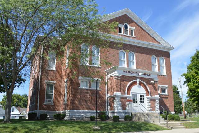
Photo: Nyttend (own work), public domain · Wikimedia Commons
Local history sources: en.wikipedia.org · farmersville.us · remarkableohio.org · findagrave.com · commons.wikimedia.org · commons.wikimedia.org
Water
Mostly private wells The water here
- Farmersville Village100% of residentsGroundwater wells (2 wells)
Hospitals, fire stations and more
Inside Farmersville's boundary: 1 fire or EMS station, 1 museum, 1 police station and 1 spill case. Press a pin or a name for its whole record and its source.
Fire and EMS stations (1)
-
Farmersville Fire DepartmentFarmersville
- Address
- 207 North Elm Street, Farmersville, OH 45325
- Coordinates
- 39.68230, -84.42372
USGS National Map structures (source) ↗ Street map and directions ↗
Source: USGS National Map structures (most Ohio records last updated 2019 to 2022), checked against the Columbus and Cleveland station lists. The department that answers a call is set by jurisdiction and mutual aid, not by distance.
Museums, historical societies, gardens and zoos (1)
-
Farmersville Historical SocietyHistorical society · Farmersville
- What it is
- Historical society
- City
- Farmersville
- Coordinates
- 39.68049, -84.42509
Search Wikipedia ↗ IMLS Museum Data Files (source) ↗ Street map and directions ↗
The museum list is IMLS's 2018 file; a museum may have closed or moved since.
Source: IMLS Museum Data Files, 2018.
Police stations (1)
-
Jackson Township Police DepartmentFarmersville
- Address
- 49 East Walnut Street, Farmersville, OH 45325
- Coordinates
- 39.68062, -84.42554
USGS National Map structures (source) ↗ Street map and directions ↗
Source: USGS National Map structures, police stations, corrected and completed by hand (September 2026). The department that answers a call is set by jurisdiction, not by distance.
Spills reported since 2021 (1)
-
Manure Nos (Not Specified)2021-06-15 · Farmersville
- Reported
- 2021-06-15
- What spilled
- Manure Nos (Not Specified)
- Where
- Farmersville, Montgomery County
- Ohio EPA district office
- SWDO
- Ohio EPA case number
- 2106EPA0000864
Ohio EPA spill reports (source) ↗ Street map and directions ↗
Source: Ohio EPA emergency response spill reports, 2021 to September 2026, one point per case where Ohio EPA placed it. A report is what the caller or responder recorded; amounts are often blank or estimated.
Its ZIP codes
Each ZIP code that touches Farmersville, with the share of its residents who live here and the same headline figures as the ZIP page.
| ZIP | Share | Water | Radon | Home value | Schools | Flood |
|---|---|---|---|---|---|---|
| 45325 Jackson Township and Farmersville | 38% | Mostly private wells | 5.5 pCi/L average radon | Median year built 1960 | Valley View Local · 4 stars overall | 3.6% of residents in the 1% floodplain |
Local government
Who holds office in Farmersville, how its elections and ballot issues came out, and the state auditor's record.
Auditor of State record
- No fiscal caution, watch or emergency on the Auditor of State's lists.
- Financial Audit, 2022 to 2023, released 2025-03-11
The county
Montgomery County: 33 ZIP codes, 27 cities, villages and townships, 531,614 people.
Nearby places
Rain and snow
How much has actually fallen on Farmersville, day by day, from 1893 to now. Daily totals, not averages.
- rain, last 30 days
- 0.85 in
- 2026-09-30 to 2026-10-29
- rain so far in 2026
- 49.2 in
- 14.0 in above normal for the date
- snow so far in 2026
- 16.7 in
- a normal year brings 14.7 in
- a normal year
- 41.7 in
- average of 30 years, 1991-2020
| Month | Rain (in) | Snow (in) | Days counted |
|---|---|---|---|
| October 2026 | 0.85 | — | 29 |
| September 2026 | 4.99 | — | 30 |
| August 2026 | 12.99 | — | 31 |
| July 2026 | 2.91 | — | 31 |
| June 2026 | 4.06 | — | 30 |
| May 2026 | 8.45 | — | 31 |
| April 2026 | 3.79 | — | 30 |
| March 2026 | 6.80 | 0.3 | 31 |
| February 2026 | 2.68 | 3.0 | 28 |
| January 2026 | 1.64 | 13.3 | 31 |
| December 2025 | 2.05 | 8.6 | 31 |
| November 2025 | 2.39 | 1.8 | 30 |
| Wettest year | 2011 — 58.4 in |
|---|---|
| Driest year | 1934 — 23.1 in |
| Snowiest year | 1917 — 39.5 in |
| Wettest day on record | 14 September 1979 — 4.20 in |
| Heaviest snowfall in a day | 11 January 1895 — 10.00 in |
| Deepest snow on the ground | 17 January 1918 — 17.76 in |
Estimated, not measured. No rain gauge has ever stood inside Farmersville, so every figure here is worked out from the gauges around it - the nearest ones weighted most. Treat them as close estimates rather than readings.
48,635 days of records, 1893-01-01 to 2026-10-29. Source: NOAA NCEI GHCN-Daily, 3,240 gauges in and around Ohio. A day is "gauged" when a gauge standing inside the boundary reported it, and the value is the mean of those gauges. Otherwise it is interpolated by inverse distance from every gauge reporting within 50 miles. Nothing is carried forward, back-filled or smoothed. Against NOAA nClimDiv county monthly precipitation over 136,848 complete county-months (checked 2026-10-31): correlation 0.9515, median absolute difference 0.217 in a month. Built 2026-10-31 from the Cracked Buckeye precipitation archive. Snow is the softer number — snowfall is measured by hand with a ruler, no agency publishes a gridded county snowfall series, and blowing snow defeats every observer.
Quick answers
What county is Farmersville, Ohio in?
Farmersville is a village in Montgomery County, Ohio, with 975 residents.
When was Farmersville, Ohio founded?
Farmersville was laid out 1832; incorporated 1845-03-07 (Village of Farmersville website; Wikipedia gives 1849). Founders on record: Oliver Dalrymple, store and tavern proprietor. Source
How did Farmersville, Ohio get its name?
Dalrymple named the village 'in honor of his friends and neighbors who were tillers of the soil' -- the farmers of the surrounding district. Source
What ZIP code is Farmersville, Ohio?
Most of Farmersville is in ZIP code 45325.
Where does Farmersville, Ohio get its water?
The main water source for Farmersville (Farmersville Village): Mostly private wells.
Cite this page
Cite this page as:
Cracked Buckeye, "Farmersville, Montgomery County", https://crackedbuckeye.com/place/farmersville/, built 2026-10-31, accessed [date].
How to cite · Report a correction · Built 2026-10-31
