Local events in Brimfield Township, Portage County
19 events in the next 90 days from 2 public calendars. All local events in Brimfield Township, Portage County
Checked October 20; the events page is refreshed daily.
How Brimfield Township, Portage County began
Brimfield Township, surveyed as Town 2, Range 9 of the Connecticut Western Reserve, was owned by absentee proprietors John Wyles of Hartford and Israel Thorndike of Boston, who visited together in 1816 to divide the land but never lived there themselves; John Boosinger, arriving from Ravenna that June, was the first permanent settler. Organized in 1818 as 'Thorndike,' the swampy, heavily wooded township went through a run of unofficial nicknames — Swamptown, Beartown, Greenbriar, Wylestown — before residents settled on Brimfield, honoring John Wyles Jr.'s Massachusetts hometown, reportedly after Charles Curtiss's Charlestown Township had already claimed a barrel of whisky as the price of a name. By the 1880s it was the county's largest wool-producing and shipping township. A post office ran from the mid-1830s to 1907. Today the township, its residents mostly sharing ZIP codes with neighboring Kent and Ravenna, has 11,317 residents (2020) and is largely a farm-and-suburban township bordering Kent on its east side.
Settled June 1816 (John Boosinger, first permanent settler, from Ravenna), incorporated 1818, organized as Thorndike Township; renamed Brimfield after residents' petition, by Proprietors Israel Thorndike (Boston) and John Wyles (Hartford, Connecticut), whose agent and Israel's nephew Henry Thorndike led settlement; John Boosinger, first permanent settler.
Where the name comes from
The township was first organized in 1818 as Thorndike, for proprietor Israel Thorndike of Boston, but was known informally by a series of nicknames reflecting its swampy, wooded terrain — Swamptown, Beartown, Greenbriar and Wylestown — before residents petitioned for the name Brimfield, honoring John Wyles Jr., who had inherited his father's land interests in the township and lived in Brimfield, Massachusetts. The 1885 county history adds that Thorndike had first offered a public-square plat at the Center if the town were named for him, then reneged on deeding the ground, prompting the switch to Brimfield.
Before the town
No Native American village, camp or mound site specific to Brimfield Township is documented in the sources consulted, and the township is not among those the 1957 county history 'Portage Heritage' lists as holding recorded prehistoric sites. For the county's broader Native history.
Timeline
- — When Portage County is organized, the future Brimfield Township is still part of the larger original Franklin Township.
- — Proprietors Israel Thorndike and John Wyles visit the township together to divide their landholdings, Thorndike taking the north half and Wyles the south; settlement begins under Thorndike's nephew and agent, Henry Thorndike, and John Boosinger of Ravenna becomes the first permanent settler that June, settling on Lot 39 where he would live sixty years.
- — Deacon Alpheus Andrews moves in from Rootstown after hearing Thorndike promised 80 acres to the township's first-born child; the child dies before birth registration was complete and Andrews settles for 40 acres instead.
- — The township organizes as Thorndike Township in the spring, with 13 votes cast electing 11 officers; Israel and Edward Thorndike start a short-lived nail factory a mile and a half west of the Center the same year.
- — The first school opens December 22 in Jeremiah Moulton's own house, attended mostly by children of four families.
- — The first Presbyterian church organizes with seven members; the first marriage in the township, Abner H. Lanphare and Sophia Moulton, takes place July 4.
- — William Sessions opens the township's first store.
- — A post office is established with Constant Chapman as first postmaster (Wikipedia gives 1834 for the post office's opening; the 1885 county history gives 1835 and names the first postmaster, so both dates are recorded here).
- n.d. — Residents petition to rename the township Brimfield, after John Wyles Jr.'s hometown of Brimfield, Massachusetts, retiring earlier informal names including Swamptown, Beartown, Greenbriar and Wylestown.
- — The township post office, open since the mid-1830s, closes.
Stories
Swamptown becomes Brimfield
When proprietors Israel Thorndike of Boston and John Wyles of Hartford came out together in 1816 to divide up the township's land, neither owner had any intention of living on it themselves; the actual settling was left to Thorndike's nephew Henry and John Boosinger, a young man from Ravenna who arrived that June and stayed sixty years. The land they organized in 1818 as Thorndike Township turned out to be low, wooded and wet enough that settlers rarely called it by its official name at all — Swamptown, Beartown and Greenbriar were all in local use at one point or another, along with Wylestown, honoring the other proprietor's family. Thorndike himself had offered to donate a public square at the Center if residents would keep his name, but backed out of deeding the land once the agreement was struck, so citizens petitioned instead for Brimfield, honoring John Wyles Jr., who had inherited his father's interest in the land and lived in the Massachusetts town of that name. The swampy character that produced all those nicknames outlasted them, but by the 1880s the reputation had inverted: Brimfield's drained swampland had become some of the best grazing in the county, and the township was its largest wool-producing and shipping center, with dealer Reuben Brobst alone handling over 100,000 pounds some seasons.
A deacon's race for a prize child
In January 1817, word reached Rootstown that agent Henry Thorndike, anxious to see his new township fill up with settlers, had offered 80 acres of land to whichever family produced the first child born within its bounds. Deacon Alpheus Andrews, hearing the offer and having reason to believe his own household might soon qualify, wasted no time: he moved his family straight into the township, and sure enough, on April 17 the expected child arrived. But the timing worked against him — by the time he went to claim the prize, the infant had already died, and Thorndike, whether from grief or a stickler's reading of his own offer, would only compromise on 40 acres instead of the promised 80. Andrews took the smaller grant and lived out his life on it, the story of the deacon's race for a squatter's prize settling into local memory alongside the township's swampier nicknames as one more sign of how eagerly a Western Reserve landowner would work to fill an empty map.
Photographs
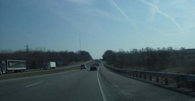
Photo: Nyttend, via Wikimedia Commons, public domain · Wikimedia Commons
Local history sources: en.wikipedia.org · archive.org · archive.org · en.wikipedia.org · genealogytrails.com
Water
Groundwater wells (13+) of the Breakneck Creek Wellfield, tapping a shallow buried-valley aquifer close to the city's Water Treatment Plant; one well (No. 13) taps a sandstone bedrock formation The water here
- Kent City78% of residentsBreakneck Creek Wellfield, Buried Valley Aquifer
- Ravenna City7% of residentsLake Hodgson
- Akron City4% of residentsLake Rockwell (Cuyahoga River impoundment)
- Aqua Ohio - Beechcrest4% of residentsBuried valley/sandstone aquifer wells (12 county wells)
- Tallmadge City2% of residentsLake Rockwell (Cuyahoga River impoundment)
- Portage County Water Resources1% of residentsBuried valley/sandstone aquifer wells (12 county wells)
- Beechwood Island Estates1% of residentsGroundwater wells (2 wells)
- Meadow Creek Condo Assoc1% of residentsGroundwater wells (2 wells)
- Fairlane Water Co.0% of residentsGroundwater wells (2 wells)
- Portage County Wr - Rivermoor0% of residentsGroundwater wells (2 wells)
- Fox Run Estates0% of residentsGroundwater wells (2 wells)
- Maple Del Manor Llc0% of residentsGroundwater wells (2 wells)
- Birchwood Manor Mhc New0% of residentsGroundwater wells (1 wells)
- Stark County Water District0% of residentsWells in Tuscarawas Valley sand & gravel aquifer
- Ranch Club Estates Water Association0% of residentsGroundwater wells (2 wells)
- Orchard Estates I Mhc, Llc0% of residentsBuried valley/sandstone aquifer wells (12 county wells)
Hospitals, fire stations and more
Inside Brimfield Township, Portage County's boundary: 2 nursing homes, 1 fire or EMS station, 1 high-hazard dam, 3 public schools, 1 private school, 1 library, 1 police station, 1 public charging site, 1 shale or injection well, 1 Toxics Release Inventory facility and 15 spill cases. Press a pin or a name for its whole record and its source.
Nursing homes (2)
-
Altercare Post-Acute Rehab Center5 of 5 stars · Kent
- Address
- 1463 Tallmadge Road, Kent, OH 44240
- Certified beds
- 79
- Residents on an average day
- 72
- Medicare overall rating
- 5 of 5 stars
- Health inspections
- 5 of 5 stars
- Staffing
- 3 of 5 stars
- Quality measures
- 5 of 5 stars
- Penalties since 2023
- none
- Ownership
- For profit - Corporation
- Chain
- ALTERCARE
- Takes
- Medicare and Medicaid
- Phone
- (330) 296-6415
- Medicare ID
- 365300
Medicare Care Compare ↗ CMS nursing home data (source) ↗ Street map and directions ↗
-
Tamarack Ridge Health and Rehabilitation5 of 5 stars · Kent
- Address
- 5113 State Route 43, Kent, OH 44240
- Certified beds
- 96
- Residents on an average day
- 92
- Medicare overall rating
- 5 of 5 stars
- Health inspections
- 4 of 5 stars
- Staffing
- 3 of 5 stars
- Quality measures
- 5 of 5 stars
- Penalties since 2023
- none
- Ownership
- For profit - Corporation
- Chain
- FOUNDATIONS HEALTH SOLUTIONS
- Takes
- Medicare and Medicaid
- Phone
- (330) 593-5300
- Medicare ID
- 366497
Medicare Care Compare ↗ CMS nursing home data (source) ↗ Street map and directions ↗
Source: CMS Care Compare nursing home provider and penalties files; Medicare star ratings run 1 to 5.
Fire and EMS stations (1)
-
Brimfield Fire DepartmentKent
- Address
- 1333 Tallmadge Road, Kent, OH 44240
- Coordinates
- 41.10086, -81.34587
USGS National Map structures (source) ↗ Street map and directions ↗
Source: USGS National Map structures (most Ohio records last updated 2019 to 2022), checked against the Columbus and Cleveland station lists. The department that answers a call is set by jurisdiction and mutual aid, not by distance.
High-hazard dams (1)
-
Brimfield Lake Dam PoorTributary To Plum Creek · condition: poor
- Hazard class
- High: a failure would probably cost a life
- Condition
- Poor (assessed 12/01/2021)
- River or stream
- Tributary To Plum Creek
- Purpose
- Recreation
- Type
- Earth
- Height
- 16 ft
- Storage
- 227 acre-feet
- Completed
- 1959
- Owner type
- Private
- County
- Portage County
- Nearest town (NID)
- Kent
- Last inspection
- 12/01/2021
- Emergency action plan
- Yes
- NID ID
- OH02286
National Inventory of Dams record ↗ National Inventory of Dams (source) ↗ Street map and directions ↗
Source: U.S. Army Corps of Engineers National Inventory of Dams, August 2026. "High hazard" rates what a failure would cost downstream, not how likely one is; the condition is the state's assessment.
Public schools (3)
-
Brimfield Elementary School3.5 of 5 stars · Kent
- Address
- 4170 State Route 43, Kent, OH 44240
- School district
- Field Local School District
- Kind (NCES)
- Regular School
- Students, 2023-24
- 520
- Teachers (full-time equivalent)
- 28.5
- Report card, 2025-26
- 3.5 of 5 stars
- Performance index
- 79.9%
- Ohio building IRN
- 003616
- NCES school ID
- 390491903524
NCES school record ↗ Ohio School Report Card ↗ Street map and directions ↗
-
Field High School3 of 5 stars · Mogadore
- Address
- 2900 State Route 43, Mogadore, OH 44260
- School district
- Field Local School District
- Kind (NCES)
- Regular School
- Students, 2023-24
- 537
- Teachers (full-time equivalent)
- 25.86
- Report card, 2025-26
- 3 of 5 stars
- Performance index
- 79.7%
- Four-year graduation rate
- 94%
- Ohio building IRN
- 011551
- NCES school ID
- 390491903525
NCES school record ↗ Ohio School Report Card ↗ Street map and directions ↗
-
Field Middle School3 of 5 stars · Mogadore
- Address
- 1379 Saxe Rd, Mogadore, OH 44260
- School district
- Field Local School District
- Kind (NCES)
- Regular School
- Students, 2023-24
- 456
- Teachers (full-time equivalent)
- 27.75
- Report card, 2025-26
- 3 of 5 stars
- Performance index
- 77.7%
- Ohio building IRN
- 011569
- NCES school ID
- 390491903526
NCES school record ↗ Ohio School Report Card ↗ Street map and directions ↗
Source: NCES EDGE public school locations 2024-25 and Common Core of Data 2023-24 (type, students, teachers); Ohio School Report Cards 2025-26 (Department of Education and Workforce), matched by name within the district.
Private schools (1)
-
Heritage Baptist AcademyPrivate, conservative Christian · Mogadore
- Address
- 77 Saxe Rd, Mogadore, OH 44260
- Kind
- conservative Christian
- Students, 2023-24
- 18
- Teachers (full-time equivalent)
- 2.6
- Students per teacher
- 6.92308
- Phone
- (330) 628-9559
- NCES private school ID
- A2302053
Source: NCES Private School Survey 2023-24.
Public libraries (1)
-
Brimfield LibraryBranch · Brimfield
- Address
- 4286 Kelso Drive, Brimfield, OH 44240
- What it is
- Branch
- Library system
- Portage County District Library
- Open
- 2,496 hours a year, 52 weeks
- Building
- 4,374 sq ft
- System's visits, FY2024
- 110,916
- System's loans, FY2024
- 409,503
- People the system serves
- 106,087
- Phone
- (330) 442-4441
IMLS Public Libraries Survey (source) ↗ Street map and directions ↗
Source: IMLS Public Libraries Survey FY2024 (outlets and their systems). Any Ohio resident can get a free card at any Ohio public library.
Police stations (1)
-
Brimfield Township Police DepartmentKent
- Address
- 1287 Tallmadge Road, Kent, OH 44240
- Coordinates
- 41.10044, -81.34719
USGS National Map structures (source) ↗ Street map and directions ↗
Source: USGS National Map structures, police stations, corrected and completed by hand (September 2026). The department that answers a call is set by jurisdiction, not by distance.
Public EV charging (1)
-
Meijer Brimfield Twp, OH #317 DC fast4 DC fast · Kent
- Address
- 247 Tallmadge Rd., Kent, OH 44240
- Ports
- 4 DC fast
- Plugs
- CCS
- Network
- eVgo Network
- Hours
- 24 hours daily
- Phone
- 877-455-3833
Station Locator (NREL) ↗ Alternative Fuels Data Center (source) ↗ Street map and directions ↗
Source: NREL Alternative Fuels Data Center station list (May 2026), public and open stations, the posts at one address counted as one site.
Shale and injection wells (1)
-
Plum Creek {Swiw #26} 1 InjectionInjection well (Class II)
- What it is
- Injection well (Class II)
- Operator
- Duck Creek Energy Inc
- County
- Portage County
- API well number
- 34133236140000
- Coordinates
- 41.10514, -81.35823
ODNR oil and gas wells (source) ↗ Street map and directions ↗
Source: ODNR Division of Oil and Gas Resources well inventory (September 2026): drilled Utica, Marcellus and horizontal wells and Class II injection wells not plugged. Older vertical wells are on the full map.
Facilities reporting toxic releases (1)
-
Bang Printing of Ohio Dba Hess Print Solutions (1667000047)Toxics Release Inventory · Kent
- Address
- 3765 Sunnybrook Road, Kent, OH 44240
- County
- Portage County
- Status
- Reports to the Toxics Release Inventory (active)
- EPA program ID
- 44240HSSPR3765S
- EPA registry ID
- 110004635306
EPA facility record ↗ EPA Facility Registry Service (source) ↗ Street map and directions ↗
Source: EPA Facility Registry Service, Toxics Release Inventory reporters. Reporting a release is required of large users of listed chemicals; it is not by itself a violation.
Spills reported since 2021 (15)
-
Sodium Hypochlorite (Naclo)2025-04-24 · Brimfield Twp
- Reported
- 2025-04-24
- What spilled
- Sodium Hypochlorite (Naclo)
- Largest amount reported
- 15 gallons
- Where
- Brimfield Twp, Portage County
- Ohio EPA district office
- NEDO
- Ohio EPA case number
- 2504EPA0000630
Ohio EPA spill reports (source) ↗ Street map and directions ↗
-
Sewage Human Reached water2024-06-05 · Brimfield Twp
- Reported
- 2024-06-05
- What spilled
- Sewage Human
- Reached a waterway
- 67 - Plum Creek
- Where
- Brimfield Twp, Portage County
- Ohio EPA district office
- NEDO
- Ohio EPA case number
- 2406EPA0000942
Ohio EPA spill reports (source) ↗ Street map and directions ↗
-
Oil Transformer Non Pcb2024-05-31 · Brimfield Twp
- Reported
- 2024-05-31
- What spilled
- Oil Transformer Non Pcb
- Largest amount reported
- 40 gallons
- Where
- Brimfield Twp, Portage County
- Ohio EPA district office
- NEDO
- Ohio EPA case number
- 2405EPA0000915
Ohio EPA spill reports (source) ↗ Street map and directions ↗
-
Fuel Diesel / Diesel Fuel (Vehicle On Or Off Road)2024-01-17 · Brimfield Twp
- Reported
- 2024-01-17
- What spilled
- Fuel Diesel / Diesel Fuel (Vehicle On Or Off Road)
- Largest amount reported
- 100 gallons
- Where
- Brimfield Twp, Portage County
- Ohio EPA district office
- NEDO
- Ohio EPA case number
- 2401EPA0000091
Ohio EPA spill reports (source) ↗ Street map and directions ↗
-
Fuel Diesel / Diesel Fuel (Vehicle On Or Off Road)2023-10-13 · Brimfield Twp
- Reported
- 2023-10-13
- What spilled
- Fuel Diesel / Diesel Fuel (Vehicle On Or Off Road)
- Largest amount reported
- 18 gallons
- Where
- Brimfield Twp, Portage County
- Ohio EPA district office
- NEDO
- Ohio EPA case number
- 2310EPA0001763
Ohio EPA spill reports (source) ↗ Street map and directions ↗
-
Oil Transformer Non Pcb2023-03-26 · Brimfield Twp
- Reported
- 2023-03-26
- What spilled
- Oil Transformer Non Pcb
- Where
- Brimfield Twp, Portage County
- Ohio EPA district office
- NEDO
- Ohio EPA case number
- 2303EPA0000451
Ohio EPA spill reports (source) ↗ Street map and directions ↗
-
Fuel Gasoline ( 25% Ethanol Not E85)2023-01-18 · Brimfield Twp
- Reported
- 2023-01-18
- What spilled
- Fuel Gasoline ( 25% Ethanol Not E85)
- Largest amount reported
- 15 gallons
- Where
- Brimfield Twp, Portage County
- Ohio EPA district office
- NEDO
- Ohio EPA case number
- 2301EPA0000091
Ohio EPA spill reports (source) ↗ Street map and directions ↗
-
Other / All Other / Trade Name / Mixture / Solution Etc2022-11-01 · Brimfield Twp
- Reported
- 2022-11-01
- What spilled
- Other / All Other / Trade Name / Mixture / Solution Etc
- Where
- Brimfield Twp, Portage County
- Ohio EPA district office
- NEDO
- Ohio EPA case number
- 2211EPA0001632
Ohio EPA spill reports (source) ↗ Street map and directions ↗
-
Fuel Diesel / Diesel Fuel (Vehicle On Or Off Road)2022-07-01 · Brimfield Twp
- Reported
- 2022-07-01
- What spilled
- Fuel Diesel / Diesel Fuel (Vehicle On Or Off Road)
- Largest amount reported
- 100 gallons
- Where
- Brimfield Twp, Portage County
- Ohio EPA district office
- NEDO
- Ohio EPA case number
- 2207EPA0000994
Ohio EPA spill reports (source) ↗ Street map and directions ↗
-
Sheen Rainbow / Hydrocarbon2022-03-17 · Brimfield Twp
- Reported
- 2022-03-17
- What spilled
- Sheen Rainbow / Hydrocarbon
- Where
- Brimfield Twp, Summit County
- Ohio EPA district office
- NEDO
- Ohio EPA case number
- 2203EPA0000354
Ohio EPA spill reports (source) ↗ Street map and directions ↗
-
Fuel Diesel / Diesel Fuel (Vehicle On Or Off Road) Reached water2021-07-03 · Brimfield Twp
- Reported
- 2021-07-03
- What spilled
- Fuel Diesel / Diesel Fuel (Vehicle On Or Off Road)
- Reached a waterway
- 99 - Unnamed
- Where
- Brimfield Twp, Portage County
- Ohio EPA district office
- NEDO
- Ohio EPA case number
- 2107EPA0000989
Ohio EPA spill reports (source) ↗ Street map and directions ↗
-
Oil Petroleum Not Otherwise Specified (Nos) Reached water2021-06-13 · Brimfield Twp
- Reported
- 2021-06-13
- What spilled
- Oil Petroleum Not Otherwise Specified (Nos)
- Reached a waterway
- 99 - Unnamed
- Where
- Brimfield Twp, Portage County
- Ohio EPA district office
- NEDO
- Ohio EPA case number
- 2106EPA0000851
Ohio EPA spill reports (source) ↗ Street map and directions ↗
-
Fuel Diesel / Diesel Fuel (Vehicle On Or Off Road)2026-07-20 · Palmyra Twp
- Reported
- 2026-07-20
- What spilled
- Fuel Diesel / Diesel Fuel (Vehicle On Or Off Road)
- Largest amount reported
- 50 gallons
- Where
- Palmyra Twp, Portage County
- Ohio EPA district office
- NEDO
- Ohio EPA case number
- 2607EPA0001323
Ohio EPA spill reports (source) ↗ Street map and directions ↗
-
Fuel Gasoline ( 25% Ethanol Not E85)2026-06-21 · Brimfield Twp
- Reported
- 2026-06-21
- What spilled
- Fuel Gasoline ( 25% Ethanol Not E85)
- Where
- Brimfield Twp, Portage County
- Ohio EPA district office
- NEDO
- Ohio EPA case number
- 2606EPA0001120
Ohio EPA spill reports (source) ↗ Street map and directions ↗
-
Fuel Diesel / Diesel Fuel (Vehicle On Or Off Road)2026-06-11 · Brimfield Twp
- Reported
- 2026-06-11
- What spilled
- Fuel Diesel / Diesel Fuel (Vehicle On Or Off Road)
- Largest amount reported
- 75 gallons
- Where
- Brimfield Twp, Portage County
- Ohio EPA district office
- NEDO
- Ohio EPA case number
- 2606EPA0001034
Ohio EPA spill reports (source) ↗ Street map and directions ↗
Source: Ohio EPA emergency response spill reports, 2021 to September 2026, one point per case where Ohio EPA placed it. A report is what the caller or responder recorded; amounts are often blank or estimated.
Its ZIP codes
Each ZIP code that touches Brimfield Township, Portage County, with the share of its residents who live here and the same headline figures as the ZIP page.
Local government
Who holds office in Brimfield Township, Portage County, how its elections and ballot issues came out, and the state auditor's record.
Auditor of State record
- No fiscal caution, watch or emergency on the Auditor of State's lists.
- Financial Audit, 2023, released 2026-03-17
- Financial Audit, 2021 to 2022, released 2025-06-10
The county
Portage County: 15 ZIP codes, 29 cities, villages and townships, 169,745 people.
Nearby places
Quick answers
What county is Brimfield Township, Ohio in?
Brimfield Township, Portage County is a township in Portage County, Ohio, with 11,317 residents.
When was Brimfield Township, Ohio founded?
Brimfield Township, Portage County was settled June 1816 (John Boosinger, first permanent settler, from Ravenna); incorporated 1818, organized as Thorndike Township; renamed Brimfield after residents' petition. Founders on record: Proprietors Israel Thorndike (Boston) and John Wyles (Hartford, Connecticut), whose agent and Israel's nephew Henry Thorndike led settlement; John Boosinger, first permanent settler. Source
How did Brimfield Township, Ohio get its name?
The township was first organized in 1818 as Thorndike, for proprietor Israel Thorndike of Boston, but was known informally by a series of nicknames reflecting its swampy, wooded terrain — Swamptown, Beartown, Greenbriar and Wylestown — before residents petitioned for the name Brimfield, honoring John Wyles Jr., who had inherited his father's land interests in the township and lived in Brimfield, Massachusetts. Source
What ZIP code is Brimfield Township, Ohio?
Brimfield Township, Portage County is served by ZIP codes 44240, 44260 and 44266; 44240 holds the largest share of its residents.
Where does Brimfield Township, Ohio get its water?
The main water source for Brimfield Township, Portage County (Kent City): Groundwater wells (13+) of the Breakneck Creek Wellfield, tapping a shallow buried-valley aquifer close to the city's Water Treatment Plant; one well (No. 13) taps a sandstone bedrock formation.
Cite this page
Cite this page as:
Cracked Buckeye, "Brimfield Township, Portage County", https://crackedbuckeye.com/place/brimfield-township-portage-county/, built 2026-10-31, accessed [date].
How to cite · Report a correction · Built 2026-10-31
