Local events in Kent
23 events in the next 90 days from 5 public calendars. All local events in Kent
Checked October 20; the events page is refreshed daily.
Deep dives about Kent
Long reads built from maps, newspapers and public records. All deep dives
Notable people from Kent
Ohioans tied to this place, each with a sourced profile. All notable Ohioans
 Carl E. Walz1955-Cleveland-born Air Force flight test engineer and physicist who flew four missio...
 Chrissie Hynde1951-Akron-born singer, guitarist and songwriter who founded the Pretenders in London...
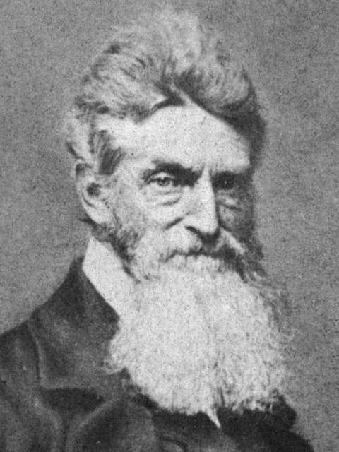 John Brown1800-1859Abolitionist raised in Hudson, Summit County, who worked as a tanner and wool gr...
History from Kent
People and inventions tied to this place, each with its sources. All people · All inventions
How Kent began
Kent began as Franklin Mills in November 1805, when John and Sally Haymaker settled on the Cuyahoga River at a set of falls suited to milling. Abolitionist John Brown ran a tannery there with Zenas Kent from 1835 to 1839, and the town was renamed Kent in 1864 for Zenas's son Marvin, who brought the Atlantic and Great Western Railroad's repair shops to town; it incorporated in 1867. A 1908 factory fire cleared the site that in 1910 became Kent State Normal School, which grew into Kent State University, and on May 4, 1970 the campus became the scene of the Kent State shootings, when Ohio National Guardsmen killed four student protesters. Today Kent, ZIP 44240/44243, is Portage County's largest city at 28,247 residents (2020), still anchored by the university.
Settled November 1805 (John and Sally Haymaker), incorporated May 6, 1867, as Kent (renamed from Franklin Mills in 1864), by John and Sally Haymaker; renaming led by the Kent family.
Where the name comes from
The town was first called Franklin Mills for the mills the Haymaker family and later settlers built on the Cuyahoga River falls. It was renamed Kent in 1864 to honor Marvin Kent, a local businessman whose father Zenas Kent had partnered with John Brown in a tannery there; Marvin Kent secured the Atlantic and Great Western Railroad's repair shops for the town, and the community took his name at incorporation in 1867.
Before the town
No named Native American village is documented within the present city of Kent itself, but the site carried significance before American settlement: a rock outcrop on the Cuyahoga River just above the town, called Standing Rock, is remembered in Portage County local history as a place where Native leaders held councils, and a Wikimedia Commons postcard titled 'Standing Rock, Kent, Ohio' attests to its continued local memory into the early 20th century. The Cuyahoga River itself, which the falls at Kent sit on, was the eastern boundary of Native land under the Treaty of Greenville (1795), so this stretch of river marked the edge of the treaty line before American settlement began in 1805. The county's broader Native history includes the Whittlesey culture, the Seneca village of Big Son in nearby Streetsboro Township, and the area's treaties.
- Standing Rock (other) — on the Cuyahoga River above Kent, remembered as a Native council site; still named on early-20th-century postcards (archive.org)
Timeline
- — John and Sally Haymaker settle on the Cuyahoga River in November, at falls later developed for milling; the settlement becomes known as Franklin Mills.
- — Abolitionist John Brown partners with Zenas Kent to run a tannery on the Cuyahoga at Franklin Mills, which serves as an Underground Railroad stop.
- — Franklin Mills is renamed Kent, honoring Marvin Kent, who secures the Atlantic and Great Western Railroad's repair shops for the town.
- — Kent incorporates as a village/town on May 6.
- — A Victorian-style jailhouse is built on Day Street near downtown Kent; it is later listed on the National Register of Historic Places and relocated to Fred Fuller Park in 1999.
- — A fire destroys the Seneca Chain Company's factory building, clearing the site later used for the state normal school.
- — Kent State Normal School is founded on the former factory site.
- — The school becomes Kent State College in 1929 and Kent State University in 1935.
- — On May 4, Ohio Army National Guard troops fire on Kent State students protesting the Vietnam War's expansion into Cambodia, killing four and wounding nine.
- — The Kent State shooting site is designated a National Historic Landmark in December.
Stories
A tannery, an abolitionist, and a family name
In the mid-1830s the small mill town on the Cuyahoga River known as Franklin Mills drew a partnership between local businessman Zenas Kent and a younger tanner named John Brown, who would later lead the raid on Harpers Ferry. From 1835 to 1839 the two ran a tannery together on the river, and the operation is remembered locally as a stop on the Underground Railroad, part of the antislavery network that moved escaped enslaved people north toward Lake Erie and Canada. The partnership ended before Brown's more famous chapters began, but the Kent family's standing in the town only grew: in 1864 Zenas's son Marvin Kent persuaded the Atlantic and Great Western Railroad to locate its repair shops in the town, a coup significant enough that Franklin Mills renamed itself Kent in his honor, formalizing the change at incorporation in 1867.
May 4, 1970
By 1970 the former mill town had grown around Kent State University into a city of some 28,000 people. On May 4 that year, after days of unrest following President Nixon's announcement that the Vietnam War would expand into Cambodia, Ohio Army National Guard troops fired into a crowd of student protesters and bystanders on the Kent State campus. Four students — Allison Krause, Jeffrey Miller, Sandra Scheuer and William Schroeder — were killed, and nine others were wounded, one permanently paralyzed. The shootings, captured in photographs that circulated worldwide, became one of the defining images of the era's antiwar movement and a lasting flashpoint in debates over the treatment of campus protest; in December 2016 the site of the shootings was designated a National Historic Landmark.
Photographs
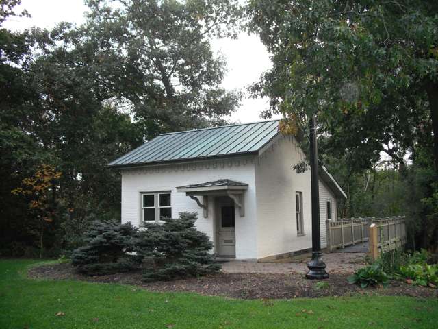
Photo: Wikimedia Commons user SLBurnell, CC BY-SA 3.0 · Wikimedia Commons
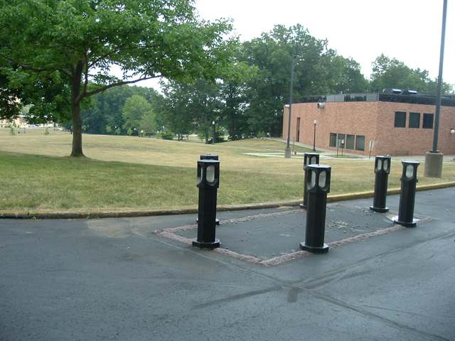
Photo: Photographer M. Stewart, released public domain by uploader Mws77, public domain · Wikimedia Commons
Local history sources: en.wikipedia.org · archive.org · en.wikipedia.org · commons.wikimedia.org · commons.wikimedia.org · commons.wikimedia.org · commons.wikimedia.org
Historic places
11 places in Kent on the National Register of Historic Places. Press a pin or a name for its whole record.
-
Davey, John, HouseBuilding · Kent · listed 1975
- Address
- 338 Woodard St.
- Where
- Kent, Portage County · ZIP 44240
- What it is
- Building
- Listed on the National Register
- 1975
- NRIS reference number
- 75001524
- Coordinates
- 41.15879, -81.36514
National Register file (NPS) ↗ Search Wikipedia ↗ Street map and directions ↗ On the Cracked Buckeye map
-
Ferrey, Aaron, HouseBuilding · Kent · listed 1974
- Address
- 5058 Sunny Brook Rd.
- Where
- Kent, Portage County · ZIP 44240
- What it is
- Building
- Listed on the National Register
- 1974
- NRIS reference number
- 74001605
- Coordinates
- 41.12735, -81.36508
National Register file (NPS) ↗ Search Wikipedia ↗ Street map and directions ↗ On the Cracked Buckeye map
-
Franklin HotelBuilding · Kent · listed 2013
- Address
- 176 E. Main St.
- Where
- Kent, Portage County · ZIP 44240
- What it is
- Building
- Listed on the National Register
- 2013
- NRIS reference number
- 12000802
- Coordinates
- 41.15360, -81.35667
National Register file (NPS) ↗ Search Wikipedia ↗ Street map and directions ↗ On the Cracked Buckeye map
-
Franklin Township HallBuilding · Kent · listed 1975
- Address
- 218 Gougler Ave.
- Where
- Kent, Portage County · ZIP 44240
- What it is
- Building
- Listed on the National Register
- 1975
- NRIS reference number
- 75001525
- Coordinates
- 41.15520, -81.36035
National Register file (NPS) ↗ Search Wikipedia ↗ Street map and directions ↗ On the Cracked Buckeye map
-
Gross, L.N., Company BuildingBuilding · Kent · listed 2016
- Address
- 315 Gougler Ave.
- Where
- Kent, Portage County · ZIP 44240
- What it is
- Building
- Listed on the National Register
- 2016
- NRIS reference number
- 16000598
- Coordinates
- 41.15435, -81.35984
National Register file (NPS) ↗ Search Wikipedia ↗ Street map and directions ↗ On the Cracked Buckeye map
-
Hopkins, Benjamin F., Stone BuildingBuilding · Kent · listed 1982
- Address
- Standing Rock Cemetery
- Where
- Kent, Portage County · ZIP 44240
- What it is
- Building
- Listed on the National Register
- 1982
- NRIS reference number
- 82003633
- Coordinates
- 41.16540, -81.35290
National Register file (NPS) ↗ Search Wikipedia ↗ Street map and directions ↗ On the Cracked Buckeye map
-
Kent Industrial DistrictHistoric district · Kent · listed 1974
- Address
- Roughly bounded by Main, River, and S. Franklin Sts. and S property line of Portage Co.
- Where
- Kent, Portage County · ZIP 44240
- What it is
- Historic district
- Listed on the National Register
- 1974
- NRIS reference number
- 74001603
- Coordinates
- 41.15313, -81.35998
National Register file (NPS) ↗ Search Wikipedia ↗ Street map and directions ↗ On the Cracked Buckeye map
-
Kent JailBuilding · Kent · listed 2001
- Address
- 947 Middlebury Rd.
- Where
- Kent, Portage County · ZIP 44240
- What it is
- Building
- Listed on the National Register
- 2001
- NRIS reference number
- 01000895
- Coordinates
- 41.15013, -81.36831
National Register file (NPS) ↗ Search Wikipedia ↗ Street map and directions ↗ On the Cracked Buckeye map
-
Kent, Charles HouseBuilding · Kent · listed 1978
- Address
- 125 N. Pearl St.
- Where
- Kent, Portage County · ZIP 44240
- What it is
- Building
- Listed on the National Register
- 1978
- NRIS reference number
- 78002174
- Coordinates
- 41.15428, -81.36547
National Register file (NPS) ↗ Search Wikipedia ↗ Street map and directions ↗ On the Cracked Buckeye map
-
Masonic TempleBuilding · Kent · listed 1974
- Address
- 409 W. Main St.
- Where
- Kent, Portage County · ZIP 44240
- What it is
- Building
- Listed on the National Register
- 1974
- NRIS reference number
- 74001604
- Coordinates
- 41.15411, -81.36285
National Register file (NPS) ↗ Search Wikipedia ↗ Street map and directions ↗ On the Cracked Buckeye map
-
Ohio State Normal College At KentBuilding · Kent · listed 1975
- Address
- Hilltop Dr. on Kent State University campus
- Where
- Kent, Portage County · ZIP 44240
- What it is
- Building
- Listed on the National Register
- 1975
- NRIS reference number
- 75001526
- Coordinates
- 41.15172, -81.34782
National Register file (NPS) ↗ Search Wikipedia ↗ Street map and directions ↗ On the Cracked Buckeye map
Source: National Park Service, National Register of Historic Places point file. The listing year is shown where NPS's certification date agrees with the listing's reference number. Listing recognizes significance; it does not restrict a private owner.
Water
Groundwater wells (13+) of the Breakneck Creek Wellfield, tapping a shallow buried-valley aquifer close to the city's Water Treatment Plant; one well (No. 13) taps a sandstone bedrock formation The water here
- Kent City94% of residentsBreakneck Creek Wellfield, Buried Valley Aquifer
- Aqua Ohio - Beechcrest3% of residentsBuried valley/sandstone aquifer wells (12 county wells)
- Portage County Water Resources1% of residentsBuried valley/sandstone aquifer wells (12 county wells)
- Beechwood Island Estates1% of residentsGroundwater wells (2 wells)
- Akron City1% of residentsLake Rockwell (Cuyahoga River impoundment)
- Meadow Creek Condo Assoc1% of residentsGroundwater wells (2 wells)
Hospitals, fire stations and more
Inside Kent's boundary: 1 health center, 2 dialysis centers, 1 nursing home, 2 fire and EMS stations, 1 college, 1 power plant, 6 public schools, 2 private schools, 5 poor-rated bridges, 1 library, 8 museums, 2 police stations, 17 public charging sites, 4 Superfund sites, 9 Toxics Release Inventory facilities and 15 spill cases. Press a pin or a name for its whole record and its source.
Community health centers (1)
-
AxessPointe Community Health Centers/KentHealth center · Kent
- Run by
- a federally qualified health center
- Setting
- Clinic
- City
- Kent
- Coordinates
- 41.15528, -81.35993
Find a Health Center (HRSA) ↗ HRSA data (source) ↗ Street map and directions ↗
Source: HRSA health center service delivery sites, active, September 2026 (school-based sites left out). Health centers see patients whether or not they have insurance, with fees on a sliding scale.
Dialysis centers (2)
-
Fmc - Portage County Kidney CenterDialysis · Kent
- Address
- 401 Devon Place Ste 100, Kent, OH 44240
- Dialysis stations
- 16
- Medicare star rating
- 2 of 5 stars
- Services
- in-center hemodialysis
- Ownership
- for profit
- Chain
- Fresenius Medical Care
- Medicare certified since
- 1994-12-13
- Phone
- (330) 677-0880
- Medicare ID
- 362537
Medicare Care Compare ↗ CMS dialysis facility list (source) ↗ Street map and directions ↗
-
Usrc Kent DialysisDialysis · Kent
- Address
- 1720 East Main Street, Kent, OH 44240
- Dialysis stations
- 13
- Medicare star rating
- 1 of 5 stars
- Services
- in-center hemodialysis, peritoneal dialysis
- Ownership
- for profit
- Chain
- US Renal Care, Inc.
- Medicare certified since
- 2017-02-09
- Phone
- (330) 346-0467
- Medicare ID
- 362853
Medicare Care Compare ↗ CMS dialysis facility list (source) ↗ Street map and directions ↗
Source: CMS dialysis facility list, September 2026, geocoded with the Census Bureau batch geocoder (an address it could not place sits at its ZIP center).
Nursing homes (1)
-
Majestic Care of Kent2 of 5 stars · Kent
- Address
- 1290 Fairchild Avenue, Kent, OH 44240
- Certified beds
- 74
- Residents on an average day
- 52
- Medicare overall rating
- 2 of 5 stars
- Health inspections
- 1 of 5 stars
- Staffing
- 2 of 5 stars
- Quality measures
- 5 of 5 stars
- Penalties since 2023
- none
- Ownership
- For profit - Limited Liability company
- Chain
- MAJESTIC CARE
- Takes
- Medicare and Medicaid
- Phone
- (330) 678-4912
- Medicare ID
- 365834
Medicare Care Compare ↗ CMS nursing home data (source) ↗ Street map and directions ↗
Source: CMS Care Compare nursing home provider and penalties files; Medicare star ratings run 1 to 5.
Fire and EMS stations (2)
-
Kent Fire Department Station 1Kent
- Address
- 320 South Depeyster Street, Kent, OH 44240
- Coordinates
- 41.15100, -81.35689
USGS National Map structures (source) ↗ Street map and directions ↗
-
Kent Fire Department Station 2Kent
- Address
- 418 North Mantua Street, Kent, OH 44240
- Coordinates
- 41.15765, -81.36084
USGS National Map structures (source) ↗ Street map and directions ↗
Source: USGS National Map structures (most Ohio records last updated 2019 to 2022), checked against the Columbus and Cleveland station lists. The department that answers a call is set by jurisdiction and mutual aid, not by distance.
Colleges (1)
-
Kent State University at KentPublic university · Kent
- What it is
- Public university
- City
- Kent
- Students, 2023-24 (12-month count)
- 32,919
- Tuition and fees, in state
- $12,846
- Tuition and fees, out of state
- $22,316
- Graduation rate
- 65% of bachelor's students, within six years (a class of 4,232)
- IPEDS unit ID
- 203517
College Navigator (NCES) ↗ IPEDS data (source) ↗ Street map and directions ↗
Source: NCES IPEDS 2024 directory, 2023-24 enrollment and tuition, graduation rates for the 2017 (four-year) and 2020 (two-year) entering classes.
Power plants (1)
-
Summit Street Power PlantNatural gas · 12 MW
- Capacity
- 12 MW
- Main source
- Natural gas
- Technology
- Natural Gas Fired Combustion Turbine
- Operator
- Kent State University
- Sector
- Commercial CHP
- Where
- Kent, Portage County
- Generating units
- 2
- Built
- 2003 (first unit); newest unit 2004
- EIA plant code
- 58140
EIA plant page ↗ EIA-860 (source) ↗ Street map and directions ↗
Source: EIA-860 power plant inventory via HIFLD (February 2025), with plant codes, units and years from EIA-860 2025.
Public schools (6)
-
Davey Elementary School4.5 of 5 stars · Kent
- Address
- 196 N Prospect St, Kent, OH 44240
- School district
- Kent City School District
- Kind (NCES)
- Regular School
- Students, 2023-24
- 445
- Teachers (full-time equivalent)
- 49
- Report card, 2025-26
- 4.5 of 5 stars
- Performance index
- 83.3%
- Ohio building IRN
- 005504
- NCES school ID
- 390441601081
NCES school record ↗ Ohio School Report Card ↗ Street map and directions ↗
-
Holden Elementary School4.5 of 5 stars · Kent
- Address
- 132 W School St, Kent, OH 44240
- School district
- Kent City School District
- Kind (NCES)
- Regular School
- Students, 2023-24
- 229
- Teachers (full-time equivalent)
- 22.98
- Report card, 2025-26
- 4.5 of 5 stars
- Performance index
- 84.7%
- Ohio building IRN
- 016535
- NCES school ID
- 390441601084
NCES school record ↗ Ohio School Report Card ↗ Street map and directions ↗
-
Longcoy Elementary School4 of 5 stars · Kent
- Address
- 1069 Elno Ave, Kent, OH 44240
- School district
- Kent City School District
- Kind (NCES)
- Regular School
- Students, 2023-24
- 279
- Teachers (full-time equivalent)
- 32.56
- Report card, 2025-26
- 4 of 5 stars
- Performance index
- 77.9%
- Ohio building IRN
- 021311
- NCES school ID
- 390441601085
NCES school record ↗ Ohio School Report Card ↗ Street map and directions ↗
-
Stanton Middle School4 of 5 stars · Kent
- Address
- 1175 Hudson Rd, Kent, OH 44240
- School district
- Kent City School District
- Kind (NCES)
- Regular School
- Students, 2023-24
- 655
- Teachers (full-time equivalent)
- 93.24
- Report card, 2025-26
- 4 of 5 stars
- Performance index
- 80.4%
- Ohio building IRN
- 137273
- NCES school ID
- 390441602601
NCES school record ↗ Ohio School Report Card ↗ Street map and directions ↗
-
Theodore Roosevelt High School5 of 5 stars · Kent
- Address
- 1400 N Mantua St, Kent, OH 44240
- School district
- Kent City School District
- Kind (NCES)
- Regular School
- Students, 2023-24
- 1,256
- Teachers (full-time equivalent)
- 137
- Report card, 2025-26
- 5 of 5 stars
- Performance index
- 87%
- Four-year graduation rate
- 97.3%
- Ohio building IRN
- 032508
- NCES school ID
- 390441601086
NCES school record ↗ Ohio School Report Card ↗ Street map and directions ↗
-
Walls Elementary School3.5 of 5 stars · Kent
- Address
- 900 Doramor St, Kent, OH 44240
- School district
- Kent City School District
- Kind (NCES)
- Regular School
- Students, 2023-24
- 354
- Teachers (full-time equivalent)
- 35
- Report card, 2025-26
- 3.5 of 5 stars
- Performance index
- 77.8%
- Ohio building IRN
- 039032
- NCES school ID
- 390441601087
NCES school record ↗ Ohio School Report Card ↗ Street map and directions ↗
Source: NCES EDGE public school locations 2024-25 and Common Core of Data 2023-24 (type, students, teachers); Ohio School Report Cards 2025-26 (Department of Education and Workforce), matched by name within the district.
Private schools (2)
-
Ksu Child Development CenterPrivate, nonsectarian · Kent
- Address
- 775 Loop Rd, Kent, OH 44242
- Kind
- nonsectarian
- Students, 2023-24
- 21
- Teachers (full-time equivalent)
- 2.4
- Students per teacher
- 8.75
- Phone
- (330) 672-2559
- NCES private school ID
- A0307864
-
St Patrick Elementary SchoolPrivate, Catholic · Kent
- Address
- 127 Portage St, Kent, OH 44240
- Kind
- Catholic
- Students, 2023-24
- 199
- Teachers (full-time equivalent)
- 18.6
- Students per teacher
- 10.6989
- Phone
- (330) 673-7232
- NCES private school ID
- 01062474
Source: NCES Private School Survey 2023-24.
Bridges rated poor (5)
-
Howe Road over Plum CreekPoor · built 1963
- Condition
- Poor: a deck, superstructure, substructure or culvert rated 4 or below on the 0 to 9 scale
- What it is
- Bridge
- Built
- 1963
- Length
- 13 ft
- Owner
- County
- Vehicles a day
- 2,020
- Coordinates
- 41.11778, -81.36722
National Bridge Inventory (source) ↗ Street map and directions ↗
-
Stow Street over Cuyahoga RiverPoor · built 1987
- Condition
- Poor: a deck, superstructure, substructure or culvert rated 4 or below on the 0 to 9 scale
- What it is
- Bridge
- Built
- 1987
- Length
- 43 ft
- Owner
- County
- Vehicles a day
- 7,742
- Coordinates
- 41.15056, -81.36222
National Bridge Inventory (source) ↗ Street map and directions ↗
-
Sunny Brook Road over Plum CreekPoor · built 1940
- Condition
- Poor: a deck, superstructure, substructure or culvert rated 4 or below on the 0 to 9 scale
- What it is
- Bridge
- Built
- 1940
- Length
- 12 ft
- Owner
- County
- Vehicles a day
- 794
- Coordinates
- 41.12653, -81.36616
National Bridge Inventory (source) ↗ Street map and directions ↗
-
Sunrise Boulivard over Fish CreekPoor · built 1968
- Condition
- Poor: a deck, superstructure, substructure or culvert rated 4 or below on the 0 to 9 scale
- What it is
- Bridge
- Built
- 1968
- Length
- 13 ft
- Owner
- City
- Vehicles a day
- 150
- Coordinates
- 41.15655, -81.38927
National Bridge Inventory (source) ↗ Street map and directions ↗
-
West Main Street over Cuyahoga River & Csxt RrPoor · built 1876
- Condition
- Poor: a deck, superstructure, substructure or culvert rated 4 or below on the 0 to 9 scale
- What it is
- Bridge
- Built
- 1876
- Length
- 76 ft
- Owner
- County
- Vehicles a day
- 12,977
- Coordinates
- 41.15389, -81.35944
National Bridge Inventory (source) ↗ Street map and directions ↗
Source: FHWA National Bridge Inventory 2025. "Poor" means one major part rated 4 or below on the 0 to 9 scale; it calls for repair, not closing, unless the state posts or closes the bridge.
Public libraries (1)
-
Kent Free LibraryCentral library · Kent
- Address
- 312 W. Main St., Kent, OH 44240
- What it is
- Central library
- Library system
- Kent Free Library
- Open
- 3,588 hours a year, 52 weeks
- Building
- 75,000 sq ft
- System's visits, FY2024
- 149,240
- System's loans, FY2024
- 554,391
- People the system serves
- 33,725
- Phone
- (330) 673-4414
IMLS Public Libraries Survey (source) ↗ Street map and directions ↗
Source: IMLS Public Libraries Survey FY2024 (outlets and their systems). Any Ohio resident can get a free card at any Ohio public library.
Museums, historical societies, gardens and zoos (8)
-
Gallery In The School Of ArtArt museum · Kent
- What it is
- Art museum
- City
- Kent
- Coordinates
- 41.15360, -81.34993
Search Wikipedia ↗ IMLS Museum Data Files (source) ↗ Street map and directions ↗
The museum list is IMLS's 2018 file; a museum may have closed or moved since.
-
Kelso HouseHistorical society · Kent
- What it is
- Historical society
- City
- Kent
- Coordinates
- 41.14485, -81.35231
Search Wikipedia ↗ IMLS Museum Data Files (source) ↗ Street map and directions ↗
The museum list is IMLS's 2018 file; a museum may have closed or moved since.
-
Kenneth Berger Hearing Aid Museum & ArchiveMuseum · Kent
- What it is
- Museum
- City
- Kent
- Coordinates
- 41.15360, -81.34993
Search Wikipedia ↗ IMLS Museum Data Files (source) ↗ Street map and directions ↗
The museum list is IMLS's 2018 file; a museum may have closed or moved since.
-
Kent Historical SocietyHistorical society · Kent
- What it is
- Historical society
- City
- Kent
- Coordinates
- 41.15386, -81.35595
Search Wikipedia ↗ IMLS Museum Data Files (source) ↗ Street map and directions ↗
The museum list is IMLS's 2018 file; a museum may have closed or moved since.
-
Kent State University MuseumMuseum · Kent
- What it is
- Museum
- City
- Kent
- Coordinates
- 41.15360, -81.34993
Search Wikipedia ↗ IMLS Museum Data Files (source) ↗ Street map and directions ↗
The museum list is IMLS's 2018 file; a museum may have closed or moved since.
-
Kent State University PlanetariumScience or technology museum · Kent
- What it is
- Science or technology museum
- City
- Kent
- Coordinates
- 41.15360, -81.34993
Search Wikipedia ↗ IMLS Museum Data Files (source) ↗ Street map and directions ↗
The museum list is IMLS's 2018 file; a museum may have closed or moved since.
-
Northeastern Ohio Railroad Historical SocietyHistorical society · Kent
- What it is
- Historical society
- City
- Kent
- Coordinates
- 41.14485, -81.35231
Search Wikipedia ↗ IMLS Museum Data Files (source) ↗ Street map and directions ↗
The museum list is IMLS's 2018 file; a museum may have closed or moved since.
-
William H. Eells Art GalleryArt museum · Kent
- What it is
- Art museum
- City
- Kent
- Coordinates
- 41.15360, -81.34993
Search Wikipedia ↗ IMLS Museum Data Files (source) ↗ Street map and directions ↗
The museum list is IMLS's 2018 file; a museum may have closed or moved since.
Source: IMLS Museum Data Files, 2018.
Police stations (2)
-
Kent Police DepartmentKent
- Address
- 301 South Depeyster Street, Kent, OH 44240
- Coordinates
- 41.15156, -81.35604
USGS National Map structures (source) ↗ Street map and directions ↗
-
Kent State University Police DepartmentKent
- Address
- 530 East Summit Street, Kent, OH 44242
- Coordinates
- 41.15046, -81.34998
USGS National Map structures (source) ↗ Street map and directions ↗
Source: USGS National Map structures, police stations, corrected and completed by hand (September 2026). The department that answers a call is set by jurisdiction, not by distance.
Public EV charging (17)
-
CITY OF KENT CITY HALL 1 N2 Level 2 · Kent
- Address
- 319 S Water St, Kent, OH 44240
- Ports
- 2 Level 2
- Plugs
- J1772
- Network
- ChargePoint Network
- Hours
- 24 hours daily
- Phone
- 888-758-4389
Station Locator (NREL) ↗ Alternative Fuels Data Center (source) ↗ Street map and directions ↗
-
CITY OF KENT CITY HALL 2 S2 Level 2 · Kent
- Address
- 319 South Water Street, Kent, OH 44240
- Ports
- 2 Level 2
- Plugs
- J1772
- Network
- ChargePoint Network
- Hours
- 24 hours daily
- Phone
- 888-758-4389
Station Locator (NREL) ↗ Alternative Fuels Data Center (source) ↗ Street map and directions ↗
-
Harbourt Hall Parking Lot1 Level 2 · Kent
- Address
- 625 Loop Rd, Kent, OH 44243
- Ports
- 1 Level 2
- Plugs
- J1772
- Network
- Non-Networked
- Hours
- 24 hours daily; 4 hour limit
- Price
- $1.25 per hour
- Phone
- 330-672-4432
Station Locator (NREL) ↗ Alternative Fuels Data Center (source) ↗ Street map and directions ↗
-
KCG PARKING STATION 23 Level 2 · Kent
- Address
- 201 E Erie St, Kent, OH 44240
- Ports
- 3 Level 2
- Plugs
- J1772
- Network
- ChargePoint Network
- Hours
- 24 hours daily
- Phone
- 888-758-4389
Station Locator (NREL) ↗ Alternative Fuels Data Center (source) ↗ Street map and directions ↗
-
KENT STATE R4 PERF ARTS2 Level 2 · Kent
- Address
- 1325 Theatre Dr, Kent, OH 44243
- Ports
- 2 Level 2
- Plugs
- J1772
- Network
- ChargePoint Network
- Hours
- 24 hours daily
- Phone
- 888-758-4389
Station Locator (NREL) ↗ Alternative Fuels Data Center (source) ↗ Street map and directions ↗
-
KENT STATE R7 BOWMAN HALL2 Level 2 · Kent
- Address
- 850 Lester A Lefton Esplanade, Kent, OH 44240
- Ports
- 2 Level 2
- Plugs
- J1772
- Network
- ChargePoint Network
- Hours
- 24 hours daily
- Phone
- 888-758-4389
Station Locator (NREL) ↗ Alternative Fuels Data Center (source) ↗ Street map and directions ↗
-
KENT STATE R8 ATB2 Level 2 · Kent
- Address
- 1411 E Summit St, Kent, OH 44243
- Ports
- 2 Level 2
- Plugs
- J1772
- Network
- ChargePoint Network
- Hours
- 24 hours daily
- Phone
- 888-758-4389
Station Locator (NREL) ↗ Alternative Fuels Data Center (source) ↗ Street map and directions ↗
-
KENT STATE R9 IAB2 Level 2 · Kent
- Address
- 332 S Lincoln St, Kent, OH 44242
- Ports
- 2 Level 2
- Plugs
- J1772
- Network
- ChargePoint Network
- Hours
- 24 hours daily
- Phone
- 888-758-4389
Station Locator (NREL) ↗ Alternative Fuels Data Center (source) ↗ Street map and directions ↗
-
Kent State University - Heer Hall1 Level 2 · Kent
- Address
- 635 Loop Rd, Kent, OH 44242
- Ports
- 1 Level 2
- Plugs
- J1772
- Network
- Non-Networked
- Hours
- 24 hours daily; see front desk to access; maximum session time of 4 hours
- Price
- $1.00 per hour
- Phone
- 330-672-4432
Station Locator (NREL) ↗ Alternative Fuels Data Center (source) ↗ Street map and directions ↗
-
Kent State University - Lot R-191 Level 2 · Kent
- Address
- Art Annex, Kent, OH 44243
- Ports
- 1 Level 2
- Plugs
- J1772
- Network
- Non-Networked
- Hours
- 24 hours daily
- Price
- $1.25 per hour; Max 4 hours
- Phone
- 330-672-4432
Station Locator (NREL) ↗ Alternative Fuels Data Center (source) ↗ Street map and directions ↗
-
Kent State University - Student Center1 Level 2 · Kent
- Address
- 1075 Risman Dr, Kent, OH 44242
- Ports
- 1 Level 2
- Plugs
- J1772
- Network
- Non-Networked
- Hours
- 24 hours daily; maximum session time of 4 hours; pay lot
- Price
- Free
- Phone
- 330-672-4432
Station Locator (NREL) ↗ Alternative Fuels Data Center (source) ↗ Street map and directions ↗
-
Klaben Chrysler Jeep Dodge Ram DCFC DC fast2 DC fast · 4 Level 2 · Kent
- Address
- 1106 West Main Street, Kent, OH 44240
- Ports
- 2 DC fast · 4 Level 2
- Plugs
- CCS, J1772
- Network
- Blink Network
- Hours
- 24 hours daily
- Phone
- 888-998-2546
Station Locator (NREL) ↗ Alternative Fuels Data Center (source) ↗ Street map and directions ↗
-
Klaben CJDR Service Building2 Level 2 · Kent
- Address
- 1338 West Main Street, Kent, OH 44240
- Ports
- 2 Level 2
- Plugs
- J1772
- Network
- Blink Network
- Hours
- 24 hours daily
- Phone
- 888-998-2546
Station Locator (NREL) ↗ Alternative Fuels Data Center (source) ↗ Street map and directions ↗
-
Klaben Ford Island DC fast4 DC fast · 4 Level 2 · Kent
- Address
- 1091 West Main Street, Kent, OH 44240
- Ports
- 4 DC fast · 4 Level 2
- Plugs
- CCS, J1772
- Network
- Blink Network
- Hours
- 24 hours daily
- Phone
- 888-998-2546
Station Locator (NREL) ↗ Alternative Fuels Data Center (source) ↗ Street map and directions ↗
-
Klaben Ford Sales Building - Series4 Level 2 · Kent
- Address
- 1089 West Main Street, Kent, OH 44240
- Ports
- 4 Level 2
- Plugs
- J1772
- Network
- Blink Network
- Hours
- 24 hours daily
- Phone
- 888-998-2546
Station Locator (NREL) ↗ Alternative Fuels Data Center (source) ↗ Street map and directions ↗
-
Quick Lane Tire & Auto Center DCFC DC fast2 DC fast · 2 Level 2 · Kent
- Address
- 1080 West Main Street, Kent, OH 44240
- Ports
- 2 DC fast · 2 Level 2
- Plugs
- CCS, J1772
- Network
- Blink Network
- Hours
- 24 hours daily
- Phone
- 888-998-2546
Station Locator (NREL) ↗ Alternative Fuels Data Center (source) ↗ Street map and directions ↗
-
UU Church of Kent Hobbs Hall1 Level 2 · Kent
- Address
- 217 North Mantua Street, Kent, OH 44240
- Ports
- 1 Level 2
- Plugs
- J1772
- Network
- Blink Network
- Hours
- 24 hours daily
- Price
- $0.00-$2.00/Hr Variable Parking Fee
- Phone
- 888-998-2546
Station Locator (NREL) ↗ Alternative Fuels Data Center (source) ↗ Street map and directions ↗
Source: NREL Alternative Fuels Data Center station list (May 2026), public and open stations, the posts at one address counted as one site.
Superfund sites (4)
-
Holden School Vapor IntrusionSuperfund program · Kent
- Address
- 132 West School Street, Kent, OH 44240
- County
- Portage County
- Status
- Superfund program site, not on the National Priorities List
- EPA program ID
- OHN000510648
- EPA registry ID
- 110043993426
EPA facility record ↗ EPA Facility Registry Service (source) ↗ Street map and directions ↗
-
Jerry's Professional CleanersSuperfund program · Kent
- Address
- 1002 Franklin Ave, Kent, OH 44240
- County
- Portage County
- Status
- Superfund program site, not on the National Priorities List
- EPA program ID
- OHN000510524
- EPA registry ID
- 110006215407
EPA facility record ↗ EPA Facility Registry Service (source) ↗ Street map and directions ↗
-
Old Kent City DumpSuperfund program · Franklin Township
- Address
- Brady Lake Road, Franklin Township, OH 44240
- County
- Portage County
- Status
- Superfund program site, not on the National Priorities List
- EPA program ID
- OHD981795560
- EPA registry ID
- 110009304948
EPA facility record ↗ EPA Facility Registry Service (source) ↗ Street map and directions ↗
-
Tompkins CorpSuperfund program · Kent
- Address
- 1313 Middlebury Rd, Kent, OH 44240
- County
- Portage County
- Status
- Superfund program site, not on the National Priorities List
- EPA program ID
- OHD041643479
- EPA registry ID
- 110004609610
EPA facility record ↗ EPA Facility Registry Service (source) ↗ Street map and directions ↗
Source: EPA Facility Registry Service, Superfund (SEMS) and National Priorities List sites. Many program sites were assessed and needed no cleanup.
Facilities reporting toxic releases (9)
-
Ametek Lamb Electric Div.Toxics Release Inventory · Kent
- Address
- 627 Lake Street, Kent, OH 44240
- County
- Portage County
- Status
- Reports to the Toxics Release Inventory (active)
- EPA program ID
- 44240MTKLM627LA
- EPA registry ID
- 110001629710
EPA facility record ↗ EPA Facility Registry Service (source) ↗ Street map and directions ↗
-
Fontaine Trailer CompanyToxics Release Inventory · Kent
- Address
- 1400 Fairchild Ave., Kent, OH 44240
- County
- Portage County
- Status
- Reports to the Toxics Release Inventory (active)
- EPA program ID
- 44240RVNSN1400F
- EPA registry ID
- 110000388713
EPA facility record ↗ EPA Facility Registry Service (source) ↗ Street map and directions ↗
-
Kent Elastomer Products, Inc.Toxics Release Inventory · Kent
- Address
- 1500 St. Clair Ave., Kent, OH 44240
- County
- Portage County
- Status
- Reports to the Toxics Release Inventory (active)
- EPA program ID
- 44240KNTLT1500S
- EPA registry ID
- 110002111358
EPA facility record ↗ EPA Facility Registry Service (source) ↗ Street map and directions ↗
-
Land O'Lakes KentToxics Release Inventory · Kent
- Address
- 2001 Mogadore Rd., Kent, OH 44240
- County
- Portage County
- Status
- Reports to the Toxics Release Inventory (active)
- EPA program ID
- 44240LNDLK2001M
- EPA registry ID
- 110000388697
EPA facility record ↗ EPA Facility Registry Service (source) ↗ Street map and directions ↗
-
Polymerics IncToxics Release Inventory · Kent
- Address
- 1540 Saint Clair Avenue, Kent, OH 44240
- County
- Portage County
- Status
- Reports to the Toxics Release Inventory (active)
- EPA program ID
- 44240PLYMR1540S
- EPA registry ID
- 110000388704
EPA facility record ↗ EPA Facility Registry Service (source) ↗ Street map and directions ↗
-
R. B. & W. Corp.Toxics Release Inventory · Kent
- Address
- 800 Mogadore Rd, Kent, OH 44240
- County
- Portage County
- Status
- Reports to the Toxics Release Inventory (active)
- EPA program ID
- 44240RBWCR800MO
- EPA registry ID
- 110000893329
EPA facility record ↗ EPA Facility Registry Service (source) ↗ Street map and directions ↗
-
Smithers-Oasis U.S.A. (1667040037)Toxics Release Inventory · Kent
- Address
- 919 Marvin Street, Kent, OH 44240
- County
- Portage County
- Status
- Reports to the Toxics Release Inventory (active)
- EPA program ID
- 44240SMTHR919MA
- EPA registry ID
- 110000388731
EPA facility record ↗ EPA Facility Registry Service (source) ↗ Street map and directions ↗
-
Star of The West Milling Company of OhioToxics Release Inventory · Kent
- Address
- 162 N. Water St., Kent, OH 44240
- County
- Portage County
- Status
- Reports to the Toxics Release Inventory (active)
- EPA program ID
- 44240WLLMS162NW
- EPA registry ID
- 110000755166
EPA facility record ↗ EPA Facility Registry Service (source) ↗ Street map and directions ↗
-
The Shelley CompanyToxics Release Inventory · Kent
- Address
- 1181 Cherry St, Kent, OH 44240
- County
- Portage County
- Status
- Reports to the Toxics Release Inventory
- EPA program ID
- TRI_OFFSITE_2064
- EPA registry ID
- 110070691430
EPA facility record ↗ EPA Facility Registry Service (source) ↗ Street map and directions ↗
Source: EPA Facility Registry Service, Toxics Release Inventory reporters. Reporting a release is required of large users of listed chemicals; it is not by itself a violation.
Spills reported since 2021 (15)
-
Sodium (Na)2025-11-13 · Kent
- Reported
- 2025-11-13
- What spilled
- Sodium (Na)
- Where
- Kent, Portage County
- Ohio EPA district office
- NEDO
- Ohio EPA case number
- 2511EPA0001857
Ohio EPA spill reports (source) ↗ Street map and directions ↗
-
Asphalt / Bitumen2025-04-22 · Kent
- Reported
- 2025-04-22
- What spilled
- Asphalt / Bitumen
- Where
- Kent, Portage County
- Ohio EPA district office
- NEDO
- Ohio EPA case number
- 2504EPA0000612
Ohio EPA spill reports (source) ↗ Street map and directions ↗
-
Oil Hydraulic Fluid(S)2025-04-22 · Kent
- Reported
- 2025-04-22
- What spilled
- Oil Hydraulic Fluid(S)
- Largest amount reported
- 30 gallons
- Where
- Kent, Portage County
- Ohio EPA district office
- NEDO
- Ohio EPA case number
- 2504EPA0000606
Ohio EPA spill reports (source) ↗ Street map and directions ↗
-
Sheen Rainbow / Hydrocarbon2025-03-29 · Kent
- Reported
- 2025-03-29
- What spilled
- Sheen Rainbow / Hydrocarbon
- Where
- Kent, Portage County
- Ohio EPA district office
- NEDO
- Ohio EPA case number
- 2503EPA0000459
Ohio EPA spill reports (source) ↗ Street map and directions ↗
-
Drum(S) Reached water2024-03-08 · Kent
- Reported
- 2024-03-08
- What spilled
- Drum(S); Oil Petroleum Not Otherwise Specified (Nos)
- Largest amount reported
- 55 gallons
- Reached a waterway
- 67 - Cuyahoga River
- Where
- Kent, Portage County
- Ohio EPA district office
- NEDO
- Ohio EPA case number
- 2403EPA0000369
Ohio EPA spill reports (source) ↗ Street map and directions ↗
-
Fuel Gasoline ( 25% Ethanol Not E85)2023-10-29 · Kent
- Reported
- 2023-10-29
- What spilled
- Fuel Gasoline ( 25% Ethanol Not E85)
- Where
- Kent, Portage County
- Ohio EPA district office
- NEDO
- Ohio EPA case number
- 2310EPA0001851
Ohio EPA spill reports (source) ↗ Street map and directions ↗
-
Other / All Other / Trade Name / Mixture / Solution Etc2023-07-05 · Kent
- Reported
- 2023-07-05
- What spilled
- Other / All Other / Trade Name / Mixture / Solution Etc
- Where
- Kent, Portage County
- Ohio EPA district office
- NEDO
- Ohio EPA case number
- 2307EPA0001098
Ohio EPA spill reports (source) ↗ Street map and directions ↗
-
Oil Hydraulic Fluid(S)2023-01-06 · Kent
- Reported
- 2023-01-06
- What spilled
- Oil Hydraulic Fluid(S)
- Largest amount reported
- 100 gallons
- Where
- Kent, Portage County
- Ohio EPA district office
- NEDO
- Ohio EPA case number
- 2301EPA0000032
Ohio EPA spill reports (source) ↗ Street map and directions ↗
-
Runoff Nos (Not Specified)2022-12-02 · Kent
- Reported
- 2022-12-02
- What spilled
- Runoff Nos (Not Specified)
- Where
- Kent, Portage County
- Ohio EPA district office
- NEDO
- Ohio EPA case number
- 2212EPA0001783
Ohio EPA spill reports (source) ↗ Street map and directions ↗
-
Fish Kill Reached water2022-08-07 · Kent
- Reported
- 2022-08-07
- What spilled
- Fish Kill
- Reached a waterway
- 67 - Cuyahoga River
- Where
- Kent, Portage County
- Ohio EPA district office
- NEDO
- Ohio EPA case number
- 2208EPA0001190
Ohio EPA spill reports (source) ↗ Street map and directions ↗
-
Oil Hydraulic Fluid(S)2022-06-10 · Kent
- Reported
- 2022-06-10
- What spilled
- Oil Hydraulic Fluid(S)
- Largest amount reported
- 25 gallons
- Where
- Kent, Portage County
- Ohio EPA district office
- NEDO
- Ohio EPA case number
- 2206EPA0000873
Ohio EPA spill reports (source) ↗ Street map and directions ↗
-
Oil Motor / Lube Oil / Vehicle2022-03-08 · Kent
- Reported
- 2022-03-08
- What spilled
- Oil Motor / Lube Oil / Vehicle
- Where
- Kent, Portage County
- Ohio EPA district office
- NEDO
- Ohio EPA case number
- 2203EPA0000295
Ohio EPA spill reports (source) ↗ Street map and directions ↗
-
Oil Transformer Non Pcb2022-02-23 · Kent
- Reported
- 2022-02-23
- What spilled
- Oil Transformer Non Pcb
- Largest amount reported
- 20 gallons
- Where
- Kent, Portage County
- Ohio EPA district office
- NEDO
- Ohio EPA case number
- 2202EPA0000237
Ohio EPA spill reports (source) ↗ Street map and directions ↗
-
Sheen Rainbow / Hydrocarbon Reached water2022-02-16 · Kent
- Reported
- 2022-02-16
- What spilled
- Sheen Rainbow / Hydrocarbon
- Reached a waterway
- 67 - Fish Creek
- Where
- Kent, Portage County
- Ohio EPA district office
- NEDO
- Ohio EPA case number
- 2202EPA0000182
Ohio EPA spill reports (source) ↗ Street map and directions ↗
-
Oil Hydraulic Fluid(S)2026-05-15 · Kent
- Reported
- 2026-05-15
- What spilled
- Oil Hydraulic Fluid(S)
- Where
- Kent, Portage County
- Ohio EPA district office
- NEDO
- Ohio EPA case number
- 2605EPA0000811
Ohio EPA spill reports (source) ↗ Street map and directions ↗
Source: Ohio EPA emergency response spill reports, 2021 to September 2026, one point per case where Ohio EPA placed it. A report is what the caller or responder recorded; amounts are often blank or estimated.
Its ZIP codes
Each ZIP code that touches Kent, with the share of its residents who live here and the same headline figures as the ZIP page.
Local government
Who holds office in Kent, how its elections and ballot issues came out, and the state auditor's record.
Auditor of State record
- No fiscal caution, watch or emergency on the Auditor of State's lists.
- Financial Health Indicators (the Auditor of State's 17 measures; critical / cautionary / positive): 2020 1 / 0 / 16; 2021 0 / 1 / 16; 2022 0 / 3 / 14; 2023 0 / 2 / 15; 2024 0 / 1 / 16; 2025 1 / 2 / 14.
- Financial Audit, 2025, released 2026-08-27
- Financial Audit, 2024, released 2025-09-02
- Financial Audit, 2023, released 2024-07-25
The county
Portage County: 15 ZIP codes, 29 cities, villages and townships, 169,745 people.
Nearby places
Rain and snow
How much has actually fallen on Kent, day by day, from 1893 to now. Daily totals, not averages.
- rain, last 30 days
- 0.68 in
- 2026-09-30 to 2026-10-29
- rain so far in 2026
- 38.3 in
- 2.8 in above normal for the date
- snow so far in 2026
- 24.2 in
- a normal year brings 45.9 in
- a normal year
- 41.6 in
- average of 30 years, 1991-2020
| Month | Rain (in) | Snow (in) | Days counted |
|---|---|---|---|
| October 2026 | 0.68 | — | 29 |
| September 2026 | 2.66 | — | 30 |
| August 2026 | 5.34 | — | 31 |
| July 2026 | 8.30 | — | 31 |
| June 2026 | 2.35 | — | 30 |
| May 2026 | 5.51 | 0.0 | 31 |
| April 2026 | 6.75 | 0.0 | 30 |
| March 2026 | 4.46 | 0.9 | 31 |
| February 2026 | 0.71 | 3.0 | 28 |
| January 2026 | 1.49 | 20.2 | 31 |
| December 2025 | 2.01 | 12.1 | 31 |
| November 2025 | 1.17 | 2.0 | 30 |
| Wettest year | 1959 — 55.3 in |
|---|---|
| Driest year | 1934 — 25.1 in |
| Snowiest year | 2010 — 104.5 in |
| Wettest day on record | 13 September 1979 — 5.34 in |
| Heaviest snowfall in a day | 2 December 1974 — 16.97 in |
| Deepest snow on the ground | 2 December 1974 — 21.66 in |
Mostly estimated. Only 8% of these days come from a gauge standing inside Kent - the rest are worked out from the nearest gauges around it, so read them as close estimates rather than readings.
48,863 days of records, 1893-01-01 to 2026-10-29. Source: NOAA NCEI GHCN-Daily, 3,240 gauges in and around Ohio. A day is "gauged" when a gauge standing inside the boundary reported it, and the value is the mean of those gauges. Otherwise it is interpolated by inverse distance from every gauge reporting within 50 miles. Nothing is carried forward, back-filled or smoothed. Against NOAA nClimDiv county monthly precipitation over 136,848 complete county-months (checked 2026-10-31): correlation 0.9515, median absolute difference 0.217 in a month. Built 2026-10-31 from the Cracked Buckeye precipitation archive. Snow is the softer number — snowfall is measured by hand with a ruler, no agency publishes a gridded county snowfall series, and blowing snow defeats every observer.
Environmental permits and filings
What Ohio EPA has on file for Kent: permits, inspections, violations, cleanups and the state loans behind sewer and water work. Every line links to the agency's own document.
- facilities and sites on file
- 65
- those placed on the map inside Kent
| Program | Facilities and sites |
|---|---|
| Hazardous waste | 22 |
| Air pollution | 16 |
| Voluntary cleanup | 10 |
| Wastewater and stormwater discharge | 4 |
| Contaminated-site cleanup | 3 |
| Public drinking water | 3 |
| State sewer loans | 2 |
| Wetland and stream fill | 2 |
| Medical waste | 1 |
| Site assessment | 1 |
| Underground injection wells | 1 |
| Date | Facility or site | What |
|---|---|---|
| FORMER DAVEY DRILL COMPANY PROPERTY | Voluntary cleanup technical help | |
| SMITHERS-OASIS CO | Air pollution permit | |
| FURUKAWA ROCK DRILL USA INC | Air pollution report | |
| AQUA OHIO - BEECHCREST PWS | Public drinking water compliance letter | |
| AQUA OHIO - BEECHCREST PWS | Public drinking water plan | |
| DELETE-AQUA OHIO - BEECHCREST PWS | Public drinking water plan | |
| FORMER DAVEY DRILL COMPANY PROPERTY | Voluntary cleanup technical help | |
| SMITHERS-OASIS CO | Air pollution permit | |
| SMITHERS-OASIS CO | Air pollution permit | |
| CLUBHOUSE PWS | Public drinking water inspection | |
| AQUA OHIO - BEECHCREST PWS | Public drinking water report | |
| POLYMERICS INC | Air pollution report | |
| SMITHERS-OASIS CO | Air pollution permit | |
| AQUA OHIO - BEECHCREST PWS | Public drinking water report | |
| AQUA OHIO - BEECHCREST PWS | Public drinking water withdrawn | |
| SHEETZ STORE #452 | Wastewater and stormwater discharge permit | |
| OAK HAVEN RESIDENTIAL DEVELOPMENT | Wetland and stream fill permit | |
| FORMER LAMSON & SESSIONS COMPANY | Voluntary cleanup technical help | |
| OAK HAVEN RESIDENTIAL DEVELOPMENT | Wetland and stream fill permit | |
| AQUA OHIO - BEECHCREST PWS | Public drinking water inspection | |
| OAK HAVEN RESIDENTIAL DEVELOPMENT | Wetland and stream fill permit | |
| OAK HAVEN RESIDENTIAL DEVELOPMENT | Wetland and stream fill permit | |
| CAMPUS CENTER DRIVE PARCEL | Wetland and stream fill permit | |
| FORMER LAMSON & SESSIONS COMPANY | Voluntary cleanup technical help | |
| KENT STATE UNIVERSITY HEATING PLANT | Air pollution inspection |
Source: Ohio EPA eDocument portal (edocpub.epa.ohio.gov), indexed 2026-10-14. Facilities are placed on the map from Ohio EPA's own map layers, EPA's Facility Registry, coordinates written in the filings, or a geocoded street address. A permit filed under a private person's name (most are household septic systems) is counted but never named, placed or linked; licenses for individual workers and open-burning notices are left out entirely.
Quick answers
What county is Kent, Ohio in?
Kent is a city in Portage County, Ohio, with 28,247 residents.
When was Kent, Ohio founded?
Kent was settled November 1805 (John and Sally Haymaker); incorporated May 6, 1867, as Kent (renamed from Franklin Mills in 1864). Founders on record: John and Sally Haymaker; renaming led by the Kent family. Source
How did Kent, Ohio get its name?
The town was first called Franklin Mills for the mills the Haymaker family and later settlers built on the Cuyahoga River falls. Source
What ZIP code is Kent, Ohio?
Kent is served by ZIP codes 44243 and 44240; 44243 holds the largest share of its residents.
Where does Kent, Ohio get its water?
The main water source for Kent (Kent City): Groundwater wells (13+) of the Breakneck Creek Wellfield, tapping a shallow buried-valley aquifer close to the city's Water Treatment Plant; one well (No. 13) taps a sandstone bedrock formation.
Cite this page
Cite this page as:
Cracked Buckeye, "Kent, Portage County", https://crackedbuckeye.com/place/kent/, built 2026-10-31, accessed [date].
How to cite · Report a correction · Built 2026-10-31
