Local events in Zanesville
47 events in the next 90 days from 6 public calendars. All local events in Zanesville
Checked October 20; the events page is refreshed daily.
Lakes near Zanesville
The history under the water: the valley before, the dam, the stories. All Ohio lakes
Deep dives about Zanesville
Long reads built from maps, newspapers and public records. All deep dives
- Columbus Day in OhioColumbus Day in Ohio: state law, how the capital got its name in 1812, Ohio's statues and cities, and what the record shows about Columbus.
- Ohio State FairThe Ohio State Fair began in Cincinnati in 1850, moved among ten Ohio cities, then settled in 1886 on the Columbus fairgrounds it still uses.
Notable people from Zanesville
Ohioans tied to this place, each with a sourced profile. All notable Ohioans
History from Zanesville
People and inventions tied to this place, each with its sources. All people · All inventions
Videos about Zanesville
Short videos we made from the old maps and records. All videos

How Zanesville began
Zanesville grew up where the Licking River meets the Muskingum, at the point where Ebenezer Zane's 1797 trail (Zane's Trace) crossed the Muskingum by ferry. Zane granted the crossing tract to his son-in-law John McIntire, who platted the town in 1799; it was renamed for Zane in 1801. It served as Ohio's second state capital from 1810 to 1812, before the seat moved back to Chillicothe and then permanently to Columbus. Through the nineteenth and early twentieth centuries the city built an industrial base on iron, glass and especially art pottery, and it is known today for its distinctive Y-shaped bridge over the river confluence, which has been rebuilt several times since 1814.
Settled 1797, platted 1799, by John McIntire, on land granted by his father-in-law Ebenezer Zane.
Where the name comes from
The town was first called Westbourne, then renamed Zanesville in 1801 for Ebenezer Zane (1747-1811), who blazed Zane's Trace, the pioneer road authorized by Congress in 1796 to connect Wheeling, Virginia (now West Virginia) to Limestone (Maysville), Kentucky, through the Ohio wilderness. Zane received three sections of land at the river crossings he improved, including the tract at the Muskingum-Licking confluence, which he passed to his son-in-law John McIntire to develop.
Before the town
Zanesville sits at a river confluence that was crossed by Native trails long before Zane's Trace followed the same corridor; the Muskingum valley below the city was flint-quarrying and mound-building country for the Adena and Hopewell cultures, and the historic Shawnee towns known as Wakatomika stood a short distance upriver near present-day Dresden in the same county. No specific village site has been documented within the city of Zanesville itself in the sources checked. Muskingum County's fuller Native American record includes the Lenape trade town called Muskingum, the Wakatomika towns, mounds, and the treaty cessions that opened the area to settlement.
Nations recorded here: Shawnee, Lenape (Delaware), Wyandot, Mingo, Adena culture, Hopewell culture.
Timeline
- — Congress authorizes Ebenezer Zane to open a pioneer road (Zane's Trace) from Wheeling to Limestone, Kentucky, paid for with land grants at the three river crossings, including the Muskingum.
- — Zane grants his Muskingum River crossing tract to son-in-law John McIntire, who establishes a ferry and an inn.
- — McIntire has the town platted at the ferry crossing.
- — The town, formerly called Westbourne, is renamed Zanesville.
- — Muskingum County is organized on March 1 with Zanesville as its seat.
- — Zanesville becomes Ohio's second state capital, using a statehouse built in 1809, after the legislature votes to move the seat of government from Chillicothe.
- — The state capital returns to Chillicothe; it moves permanently to Columbus in 1816.
- — The first Y-Bridge is built across the confluence of the Licking and Muskingum rivers, allowing traffic to cross both rivers and reach all three landings without a second crossing.
- — A third, covered wooden Y-Bridge is completed; it stands until 1900.
- — The city has seven iron foundries, a cotton mill, five flour mills, four sawmills, two oil works and a paper mill.
- — A new steel and concrete Y-Bridge opens; it is listed on the National Register of Historic Places in 1973.
- — The Great Flood of 1913 sends the Muskingum River 27 feet above flood stage through downtown Zanesville in early April.
- — Samuel A. Weller's Zanesville pottery works becomes, by his own and trade claims, the largest pottery manufacturer in the world; more than a dozen art-pottery firms (Weller, Roseville, J.B. Owens and others) operate in and around the city in the first half of the twentieth century.
- — In October, dozens of exotic animals are released from a private farm outside Zanesville, drawing national coverage as the 'Zanesville animal escape.'
Stories
A bridge shaped like the rivers it crosses
Where the Licking River joins the Muskingum at Zanesville, the confluence forms a natural Y, and for two centuries the city has crossed it with a bridge built to match. The first Y-Bridge went up in 1814, giving travelers on Zane's Trace and later the National Road a way to reach any of the three banks without a second crossing. It was rebuilt in wood in 1819 and again, as a covered bridge, in 1832; that version lasted until 1900. The bridge built in 1902 in steel and concrete carried U.S. Route 40 and was added to the National Register of Historic Places in 1973; it was itself replaced by the current structure built to the same Y plan. Amelia Earhart is remembered locally as having called Zanesville the country's most recognizable city from the air because of the bridge's shape, and the Y-Bridge remains the detail most people associate with the city.
Two years as Ohio's capital
When Ohio's General Assembly went looking for a more central seat of government than Chillicothe, Zanesville made its case and won: the legislature met in a statehouse built in the town in 1809, and Zanesville served as the state capital from 1810 to 1812. The arrangement did not last. In 1812 the legislature voted to move the capital back to Chillicothe, and in 1816 it settled permanently on the new town of Columbus, platted for the purpose at the Scioto-Olentangy forks. Zanesville's two years as capital are a minor footnote in Ohio's early political history, but the town kept its role as county seat and its position on the National Road, and it grew through the nineteenth century on trade and manufacturing rather than government.
The pottery capital
By the early twentieth century Zanesville had become one of the country's centers of art pottery, built on the region's good clay deposits and river transport. Samuel A. Weller built his company into, by 1910s trade claims, the largest pottery manufacturer in the world, and Roseville Pottery, J.B. Owens, and the American Encaustic Tiling Company (which put up its Muskingum riverbank plant in 1893) operated alongside it. More than a dozen potteries ran in Zanesville in the first half of the twentieth century, and Weller and Roseville ware from this period is still collected nationally.
Photographs

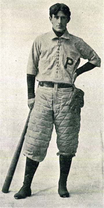
Photo: Fuller and Harmount, via Library of Congress Prints and Photographs Division, public domain · Wikimedia Commons
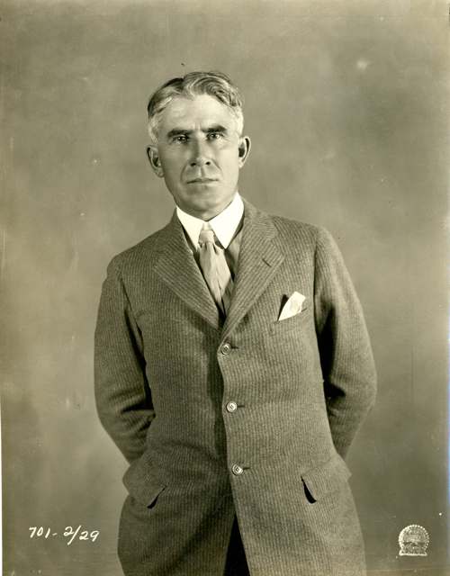
Photo: J. Willis Sayre Collection of Theatrical Photographs, University of Washington Special Collections, public domain · Wikimedia Commons
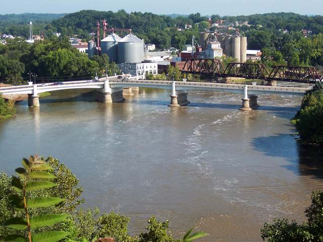
Photo: Toni Leland, via Wikimedia Commons, CC BY-SA 4.0 · Wikimedia Commons
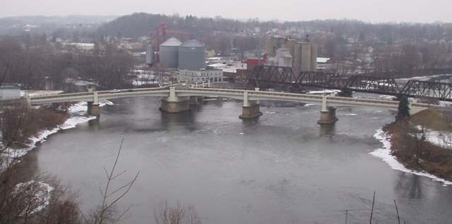
Photo: MauriceJFox3, via Wikimedia Commons, CC BY-SA 3.0 · Wikimedia Commons
Local history sources: en.wikipedia.org · ohiohistorycentral.org · en.wikipedia.org · npgallery.nps.gov · mrcc.illinois.edu · en.wikipedia.org · en.wikipedia.org · commons.wikimedia.org · commons.wikimedia.org · commons.wikimedia.org · commons.wikimedia.org
Historic places
40 places in Zanesville on the National Register of Historic Places. Press a pin or a name for its whole record.
-
Adena Court ApartmentsBuilding · Zanesville · listed 1980
- Address
- 41 S. 4th St.
- Where
- Zanesville, Muskingum County · ZIP 43701
- What it is
- Building
- Listed on the National Register
- 1980
- NRIS reference number
- 80003190
- Coordinates
- 39.93940, -82.00784
National Register file (NPS) ↗ Search Wikipedia ↗ Street map and directions ↗ On the Cracked Buckeye map
-
Alameda ApartmentsBuilding · Zanesville · listed 1982
- Address
- 7th St.
- Where
- Zanesville, Muskingum County · ZIP 43701
- What it is
- Building
- Listed on the National Register
- 1982
- NRIS reference number
- 82003623
- Coordinates
- 39.94439, -82.00393
National Register file (NPS) ↗ Search Wikipedia ↗ Street map and directions ↗ On the Cracked Buckeye map
-
Arlington HotelBuilding · Zanesville · listed 1982
- Address
- 722 Main St.
- Where
- Zanesville, Muskingum County · ZIP 43701
- What it is
- Building
- Listed on the National Register
- 1982
- NRIS reference number
- 82001482
- Coordinates
- 39.93998, -82.00363
National Register file (NPS) ↗ Search Wikipedia ↗ Street map and directions ↗ On the Cracked Buckeye map
-
Baker Brothers Wholesale GroceryBuilding · Zanesville
- Address
- 8-12 East Main St.
- Where
- Zanesville, Muskingum County · ZIP 43701
- What it is
- Building
- Latest NPS certification action
- 2023
- NRIS reference number
- 100009004
- Coordinates
- 39.94009, -82.01188
National Register file (NPS) ↗ Search Wikipedia ↗ Street map and directions ↗ On the Cracked Buckeye map
-
Black-Elliott BlockBuilding · Zanesville · listed 1979
- Address
- 525 Main St.
- Where
- Zanesville, Muskingum County · ZIP 43701
- What it is
- Building
- Listed on the National Register
- 1979
- NRIS reference number
- 79001914
- Coordinates
- 39.94032, -82.00575
National Register file (NPS) ↗ Search Wikipedia ↗ Street map and directions ↗ On the Cracked Buckeye map
-
Blocksom-Rolls HouseBuilding · Zanesville · listed 1979
- Address
- 960 Eastman St.
- Where
- Zanesville, Muskingum County · ZIP 43701
- What it is
- Building
- Listed on the National Register
- 1979
- NRIS reference number
- 79001915
- Coordinates
- 39.94289, -81.99946
National Register file (NPS) ↗ Search Wikipedia ↗ Street map and directions ↗ On the Cracked Buckeye map
-
Brendel, Charles, HouseBuilding · Zanesville · listed 1980
- Address
- 427 Wayne Ave.
- Where
- Zanesville, Muskingum County · ZIP 43701
- What it is
- Building
- Listed on the National Register
- 1980
- NRIS reference number
- 80003191
- Coordinates
- 39.93386, -82.00261
National Register file (NPS) ↗ Search Wikipedia ↗ Street map and directions ↗ On the Cracked Buckeye map
-
Christman, Nicholas, HouseBuilding · Zanesville · listed 1978
- Address
- 532 Wayne Ave.
- Where
- Zanesville, Muskingum County · ZIP 43701
- What it is
- Building
- Listed on the National Register
- 1978
- NRIS reference number
- 78002159
- Coordinates
- 39.93099, -82.00116
National Register file (NPS) ↗ Search Wikipedia ↗ Street map and directions ↗ On the Cracked Buckeye map
-
Clossman Hardware StoreBuilding · Zanesville · listed 1980
- Address
- 621-623 Main St.
- Where
- Zanesville, Muskingum County · ZIP 43701
- What it is
- Building
- Listed on the National Register
- 1980
- NRIS reference number
- 80003192
- Coordinates
- 39.94015, -82.00481
National Register file (NPS) ↗ Search Wikipedia ↗ Street map and directions ↗ On the Cracked Buckeye map
-
Crescent HillBuilding · Dresden · listed 1986
- Address
- 44 W. Fifth St.
- Where
- Dresden, Muskingum County · ZIP 43701
- What it is
- Building
- Listed on the National Register
- 1986
- NRIS reference number
- 86000034
- Coordinates
- 39.94223, -82.01373
National Register file (NPS) ↗ Search Wikipedia ↗ Street map and directions ↗ On the Cracked Buckeye map
-
Emery, Abram, HouseBuilding · Zanesville
- Address
- 413 Pershing Rd.
- Where
- Zanesville, Muskingum County · ZIP 43701
- What it is
- Building
- Latest NPS certification action
- 2016
- NRIS reference number
- 78002160
- Coordinates
- 39.92531, -82.01185
National Register file (NPS) ↗ Search Wikipedia ↗ Street map and directions ↗ On the Cracked Buckeye map
-
Gorsuch, Ernest J., HouseBuilding · Zanesville · listed 1980
- Address
- 1869 Norwood Blvd.
- Where
- Zanesville, Muskingum County · ZIP 43701
- What it is
- Building
- Listed on the National Register
- 1980
- NRIS reference number
- 80003193
- Coordinates
- 39.96303, -82.00514
National Register file (NPS) ↗ Search Wikipedia ↗ Street map and directions ↗ On the Cracked Buckeye map
-
Grant SchoolBuilding · Zanesville
- Address
- Off U.S. 22
- Where
- Zanesville, Muskingum County · ZIP 43701
- What it is
- Building
- Latest NPS certification action
- 2023
- NRIS reference number
- 80003194
- Coordinates
- 39.91869, -82.00613
National Register file (NPS) ↗ Search Wikipedia ↗ Street map and directions ↗ On the Cracked Buckeye map
-
Harper-Cosgrave BlockBuilding · Zanesville · listed 1980
- Address
- N. 3rd St.
- Where
- Zanesville, Muskingum County · ZIP 43701
- What it is
- Building
- Listed on the National Register
- 1980
- NRIS reference number
- 80003195
- Coordinates
- 39.94173, -82.00881
National Register file (NPS) ↗ Search Wikipedia ↗ Street map and directions ↗ On the Cracked Buckeye map
-
Harris, William B., HouseBuilding · Zanesville · listed 1978
- Address
- 1320 Newman Dr.
- Where
- Zanesville, Muskingum County · ZIP 43701
- What it is
- Building
- Listed on the National Register
- 1978
- NRIS reference number
- 78002161
- Coordinates
- 39.94008, -81.99099
National Register file (NPS) ↗ Search Wikipedia ↗ Street map and directions ↗ On the Cracked Buckeye map
-
Johnston-Crossland HouseBuilding · Zanesville · listed 1982
- Address
- N. 7th St.
- Where
- Zanesville, Muskingum County · ZIP 43701
- What it is
- Building
- Listed on the National Register
- 1982
- NRIS reference number
- 82003625
- Coordinates
- 39.94330, -82.00415
National Register file (NPS) ↗ Search Wikipedia ↗ Street map and directions ↗ On the Cracked Buckeye map
-
Kearns, George and Edward, HousesBuilding · Zanesville · listed 1979
- Address
- 306 and 320 Luck Ave.
- Where
- Zanesville, Muskingum County · ZIP 43701
- What it is
- Building
- Listed on the National Register
- 1979
- NRIS reference number
- 79001917
- Coordinates
- 39.93517, -82.01784
National Register file (NPS) ↗ Search Wikipedia ↗ Street map and directions ↗ On the Cracked Buckeye map
-
Lafayette Lodge No. 79Building · Zanesville · listed 1978
- Address
- 333 Market St.
- Where
- Zanesville, Muskingum County · ZIP 43701
- What it is
- Building
- Listed on the National Register
- 1978
- NRIS reference number
- 78002163
- Coordinates
- 39.94219, -82.00765
National Register file (NPS) ↗ Search Wikipedia ↗ Street map and directions ↗ On the Cracked Buckeye map
-
Lash, William D., HouseBuilding · Zanesville · listed 1978
- Address
- 2261 Dresden Rd.
- Where
- Zanesville, Muskingum County · ZIP 43701
- What it is
- Building
- Listed on the National Register
- 1978
- NRIS reference number
- 78002164
- Coordinates
- 39.96554, -82.00623
National Register file (NPS) ↗ Search Wikipedia ↗ Street map and directions ↗ On the Cracked Buckeye map
-
Lilienthal BuildingBuilding · Zanesville · listed 1980
- Address
- 44 S. 6th St.
- Where
- Zanesville, Muskingum County · ZIP 43701
- What it is
- Building
- Listed on the National Register
- 1980
- NRIS reference number
- 80003196
- Coordinates
- 39.93906, -82.00549
National Register file (NPS) ↗ Search Wikipedia ↗ Street map and directions ↗ On the Cracked Buckeye map
-
Lind ArcadeBuilding · Zanesville · listed 1982
- Address
- 48 N. 5th St.
- Where
- Zanesville, Muskingum County · ZIP 43701
- What it is
- Building
- Listed on the National Register
- 1982
- NRIS reference number
- 82003626
- Coordinates
- 39.94032, -82.00598
National Register file (NPS) ↗ Search Wikipedia ↗ Street map and directions ↗ On the Cracked Buckeye map
-
Masonic Temple BuildingBuilding · Zanesville · listed 1990
- Address
- 36--42 N. Fourth St.
- Where
- Zanesville, Muskingum County · ZIP 43701
- What it is
- Building
- Listed on the National Register
- 1990
- NRIS reference number
- 90000756
- Coordinates
- 39.94103, -82.00669
National Register file (NPS) ↗ Search Wikipedia ↗ Street map and directions ↗ On the Cracked Buckeye map
-
McClelland, Harry S., HouseBuilding · Zanesville · listed 1980
- Address
- 908 Laurel Ave.
- Where
- Zanesville, Muskingum County · ZIP 43701
- What it is
- Building
- Listed on the National Register
- 1980
- NRIS reference number
- 80003197
- Coordinates
- 39.95429, -82.01508
National Register file (NPS) ↗ Search Wikipedia ↗ Street map and directions ↗ On the Cracked Buckeye map
-
Muskingum County Courthouse And JailBuilding · Zanesville · listed 1973
- Address
- 4th and Main Sts.
- Where
- Zanesville, Muskingum County · ZIP 43701
- What it is
- Building
- Listed on the National Register
- 1973
- NRIS reference number
- 73001515
- Coordinates
- 39.94058, -82.00704
National Register file (NPS) ↗ Search Wikipedia ↗ Street map and directions ↗ On the Cracked Buckeye map
-
Muskingum River Lock No. 10 And CanalHistoric district · Zanesville · listed 1978
- Address
- N bank of Muskingum River, N of RR bridge S to lock terminals
- Where
- Zanesville, Muskingum County · ZIP 43701
- What it is
- Historic district
- Listed on the National Register
- 1978
- NRIS reference number
- 78002165
- Coordinates
- 39.94454, -82.01751
National Register file (NPS) ↗ Search Wikipedia ↗ Street map and directions ↗ On the Cracked Buckeye map
-
Ohio Power CompanyBuilding · Zanesville · listed 1980
- Address
- 604 Main St.
- Where
- Zanesville, Muskingum County · ZIP 43701
- What it is
- Building
- Listed on the National Register
- 1980
- NRIS reference number
- 80003198
- Coordinates
- 39.94897, -82.00540
National Register file (NPS) ↗ Search Wikipedia ↗ Street map and directions ↗ On the Cracked Buckeye map
-
Pioneer SchoolBuilding · Zanesville
- Address
- 952 East Main St.
- Where
- Zanesville, Muskingum County · ZIP 43701
- What it is
- Building
- Latest NPS certification action
- 2023
- NRIS reference number
- 100008741
- Coordinates
- 39.93937, -82.00123
National Register file (NPS) ↗ Search Wikipedia ↗ Street map and directions ↗ On the Cracked Buckeye map
-
Seborn, Frederick Augustus, HouseBuilding · Zanesville · listed 1978
- Address
- 1115--1119 Maysville Pike
- Where
- Zanesville, Muskingum County · ZIP 43701
- What it is
- Building
- Listed on the National Register
- 1978
- NRIS reference number
- 78002166
- Coordinates
- 39.92082, -82.00991
National Register file (NPS) ↗ Search Wikipedia ↗ Street map and directions ↗ On the Cracked Buckeye map
-
Smith, William R., HouseBuilding · Zanesville · listed 1982
- Address
- 920 Marietta St.
- Where
- Zanesville, Muskingum County · ZIP 43701
- What it is
- Building
- Listed on the National Register
- 1982
- NRIS reference number
- 82003627
- Coordinates
- 39.93620, -82.00241
National Register file (NPS) ↗ Search Wikipedia ↗ Street map and directions ↗ On the Cracked Buckeye map
-
St. James Episcopal ChurchBuilding · Zanesville · listed 1978
- Address
- 155 N. 6th St.
- Where
- Zanesville, Muskingum County · ZIP 43701
- What it is
- Building
- Listed on the National Register
- 1978
- NRIS reference number
- 78002167
- Coordinates
- 39.94311, -82.00532
National Register file (NPS) ↗ Search Wikipedia ↗ Street map and directions ↗ On the Cracked Buckeye map
-
St. John's Lutheran ChurchBuilding · Zanesville · listed 1982
- Address
- Market and N. 7th Sts.
- Where
- Zanesville, Muskingum County · ZIP 43701
- What it is
- Building
- Listed on the National Register
- 1982
- NRIS reference number
- 82001484
- Coordinates
- 39.94204, -82.00413
National Register file (NPS) ↗ Search Wikipedia ↗ Street map and directions ↗ On the Cracked Buckeye map
-
St. Nicholas's Catholic ChurchBuilding · Zanesville · listed 1975
- Address
- 925 Main St.
- Where
- Zanesville, Muskingum County · ZIP 43701
- What it is
- Building
- Listed on the National Register
- 1975
- NRIS reference number
- 75001512
- Coordinates
- 39.93924, -82.01707
National Register file (NPS) ↗ Search Wikipedia ↗ Street map and directions ↗ On the Cracked Buckeye map
-
St. Thomas Aquinas ChurchBuilding · Zanesville · listed 1980
- Address
- 130 N. 5th St.
- Where
- Zanesville, Muskingum County · ZIP 43701
- What it is
- Building
- Listed on the National Register
- 1980
- NRIS reference number
- 80003199
- Coordinates
- 39.94301, -82.00649
National Register file (NPS) ↗ Search Wikipedia ↗ Street map and directions ↗ On the Cracked Buckeye map
-
Tannehill, Capt. James Boggs, HouseBuilding · Zanesville · listed 1979
- Address
- 367 Taylor St
- Where
- Zanesville, Muskingum County · ZIP 43701
- What it is
- Building
- Listed on the National Register
- 1979
- NRIS reference number
- 79001921
- Coordinates
- 39.96754, -82.00404
National Register file (NPS) ↗ Search Wikipedia ↗ Street map and directions ↗ On the Cracked Buckeye map
-
US Post Office and Federal Building--ZanesvilleBuilding · Zanesville · listed 1988
- Address
- 65 S. Fifth St.
- Where
- Zanesville, Muskingum County · ZIP 43701
- What it is
- Building
- Listed on the National Register
- 1988
- NRIS reference number
- 88000071
- Coordinates
- 39.93923, -82.00690
National Register file (NPS) ↗ Search Wikipedia ↗ Street map and directions ↗ On the Cracked Buckeye map
-
West ViewBuilding · Zanesville · listed 1982
- Address
- 444 Sunkel Blvd.
- Where
- Zanesville, Muskingum County · ZIP 43701
- What it is
- Building
- Listed on the National Register
- 1982
- NRIS reference number
- 82003628
- Coordinates
- 39.96410, -82.00668
National Register file (NPS) ↗ Search Wikipedia ↗ Street map and directions ↗ On the Cracked Buckeye map
-
Wiles, Perry, Grocery CompanyBuilding · Zanesville · listed 1980
- Address
- 32--36 N. 3rd St.
- Where
- Zanesville, Muskingum County · ZIP 43701
- What it is
- Building
- Listed on the National Register
- 1980
- NRIS reference number
- 80003200
- Coordinates
- 39.94083, -82.00880
National Register file (NPS) ↗ Search Wikipedia ↗ Street map and directions ↗ On the Cracked Buckeye map
-
Y BridgeStructure · Zanesville · listed 1973
- Address
- At foot of Main St., over the Licking and Muskingum rivers
- Where
- Zanesville, Muskingum County · ZIP 43701
- What it is
- Structure
- Listed on the National Register
- 1973
- NRIS reference number
- 73001516
- Coordinates
- 39.94043, -82.01324
National Register file (NPS) ↗ Search Wikipedia ↗ Street map and directions ↗ On the Cracked Buckeye map
-
Zanesville YMCABuilding · Zanesville
- Address
- 34 S. Fifth St.
- Where
- Zanesville, Muskingum County · ZIP 43701
- What it is
- Building
- Latest NPS certification action
- 2023
- NRIS reference number
- 83002018
- Coordinates
- 39.93905, -82.00643
National Register file (NPS) ↗ Search Wikipedia ↗ Street map and directions ↗ On the Cracked Buckeye map
-
Zanesville YWCABuilding · Zanesville · listed 1978
- Address
- 49 N. 6th St.
- Where
- Zanesville, Muskingum County · ZIP 43701
- What it is
- Building
- Listed on the National Register
- 1978
- NRIS reference number
- 78002168
- Coordinates
- 39.94131, -82.00529
National Register file (NPS) ↗ Search Wikipedia ↗ Street map and directions ↗ On the Cracked Buckeye map
Source: National Park Service, National Register of Historic Places point file. The listing year is shown where NPS's certification date agrees with the listing's reference number. Listing recognizes significance; it does not restrict a private owner.
Water
Wells in the eastern floodplain of the Muskingum River along Lewis Drive/SR 666 (Riverside Park well field, reportedly in use since about 1917), adjacent to the treatment plant on Buckeye Drive The water here
- Zanesville68% of residentsMuskingum River valley aquifer (wells)
- Muskingum County Water - Se20% of residentsMuskingum River buried valley aquifer (wells near Duncan Falls)
- South Zanesville6% of residentsGroundwater wells (2 wells)
- Maysville Regional Water5% of residentsMuskingum River buried valley aquifer (wells near Duncan Falls)
- Greenlawn Estates MHP1% of residentsMuskingum River buried valley aquifer (wells near Duncan Falls)
Hospitals, fire stations and more
Inside Zanesville's boundary: 1 hospital, 3 health centers, 5 nursing homes, 3 fire and EMS stations, 2 colleges, 6 public schools, 3 private schools, 1 library, 4 museums, 1 police station, 4 public charging sites, 3 Superfund sites, 14 Toxics Release Inventory facilities, 1 station or terminal and 22 spill cases. Press a pin or a name for its whole record and its source.
Hospitals (1)
-
Genesis Healthcare System Trauma level IIIGeneral hospital · Zanesville
- What it is
- General hospital
- Address
- 2951 Maple Avenue, Zanesville, OH 43701
- County
- Muskingum County
- Beds
- 321
- Trauma center
- Level IIi
- Helipad
- Yes
- Ownership
- Non-profit
- Medicare overall rating
- 5 of 5 stars
- Emergency department (Medicare)
- Yes
- Medicare reports it as
- Genesis Hospital
- Phone
- (740) 454-4354
- Medicare ID
- 360039
Medicare Care Compare ↗ Where HIFLD got this record ↗ HIFLD hospitals (source) ↗ Street map and directions ↗
Source: HIFLD hospitals inventory via FEMA (closed hospitals it still lists left out, hospitals opened since added), with Medicare Care Compare ratings matched by name and address.
Community health centers (3)
-
Muskingum Valley Health Center - AdministrationHealth center · Zanesville
- Run by
- a federally qualified health center
- Setting
- Clinic
- City
- Zanesville
- Coordinates
- 39.93919, -82.00675
Find a Health Center (HRSA) ↗ HRSA data (source) ↗ Street map and directions ↗
-
Muskingum Valley Health CentersHealth center · Zanesville
- Run by
- a federally qualified health center
- Setting
- Clinic
- City
- Zanesville
- Coordinates
- 39.92443, -82.00732
Find a Health Center (HRSA) ↗ HRSA data (source) ↗ Street map and directions ↗
-
MUSKINGUM VALLEY HEALTH CENTERSHealth center · Zanesville
- Run by
- a federally qualified health center
- Setting
- Clinic
- City
- Zanesville
- Coordinates
- 39.95293, -82.01268
Find a Health Center (HRSA) ↗ HRSA data (source) ↗ Street map and directions ↗
Source: HRSA health center service delivery sites, active, September 2026 (school-based sites left out). Health centers see patients whether or not they have insurance, with fees on a sliding scale.
Nursing homes (5)
-
Altercare Zanesville Inc.2 of 5 stars · Zanesville
- Address
- 4200 Harrington Drive, Zanesville, OH 43701
- Certified beds
- 99
- Residents on an average day
- 93
- Medicare overall rating
- 2 of 5 stars
- Health inspections
- 2 of 5 stars
- Staffing
- 2 of 5 stars
- Quality measures
- 4 of 5 stars
- Penalties since 2023
- 2 fines totalling $198,156, 1 payment denial (latest 2024-12-10)
- Ownership
- For profit - Corporation
- Chain
- ALTERCARE
- Takes
- Medicare and Medicaid
- Phone
- (740) 452-4351
- Medicare ID
- 366429
Medicare Care Compare ↗ CMS nursing home data (source) ↗ Street map and directions ↗
-
Continuing Healthcare at Cedar Hill2 of 5 stars · Zanesville
- Address
- 1136 Adair Avenue, Zanesville, OH 43701
- Certified beds
- 90
- Residents on an average day
- 77
- Medicare overall rating
- 2 of 5 stars
- Health inspections
- 2 of 5 stars
- Staffing
- 2 of 5 stars
- Quality measures
- 4 of 5 stars
- Penalties since 2023
- 2 fines totalling $30,227 (latest 2024-07-30)
- Ownership
- For profit - Corporation
- Chain
- CERTUS HEALTHCARE
- Takes
- Medicare and Medicaid
- Phone
- (740) 454-6823
- Medicare ID
- 366286
Medicare Care Compare ↗ CMS nursing home data (source) ↗ Street map and directions ↗
-
Continuing Healthcare at Willow Haven1 of 5 stars · Zanesville
- Address
- 1020 Taylor Street, Zanesville, OH 43701
- Certified beds
- 81
- Residents on an average day
- 72
- Medicare overall rating
- 1 of 5 stars
- Health inspections
- 1 of 5 stars
- Staffing
- 2 of 5 stars
- Quality measures
- 4 of 5 stars
- Penalties since 2023
- none
- Ownership
- For profit - Corporation
- Chain
- CERTUS HEALTHCARE
- Takes
- Medicare and Medicaid
- Phone
- (740) 454-9747
- Medicare ID
- 366244
Medicare Care Compare ↗ CMS nursing home data (source) ↗ Street map and directions ↗
-
Oaks at Bethesda The5 of 5 stars · Zanesville
- Address
- 2971 Maple Avenue, Zanesville, OH 43701
- Certified beds
- 55
- Residents on an average day
- 51
- Medicare overall rating
- 5 of 5 stars
- Health inspections
- 4 of 5 stars
- Staffing
- 4 of 5 stars
- Quality measures
- 5 of 5 stars
- Penalties since 2023
- none
- Ownership
- For profit - Corporation
- Chain
- TRILOGY HEALTH SERVICES
- Takes
- Medicare and Medicaid
- Phone
- (740) 452-3800
- Medicare ID
- 366413
Medicare Care Compare ↗ CMS nursing home data (source) ↗ Street map and directions ↗
-
The Oaks Rehabilitation and Healthcare Center1 of 5 stars · Zanesville
- Address
- 3291 Northpointe Drive, Zanesville, OH 43701
- Certified beds
- 75
- Residents on an average day
- 72
- Medicare overall rating
- 1 of 5 stars
- Health inspections
- 2 of 5 stars
- Staffing
- 1 of 5 stars
- Quality measures
- 4 of 5 stars
- Penalties since 2023
- 2 fines totalling $54,030 (latest 2025-07-29)
- Ownership
- For profit - Limited Liability company
- Chain
- TRILOGY HEALTH SERVICES
- Takes
- Medicare and Medicaid
- Phone
- (740) 452-3000
- Medicare ID
- 366051
Medicare Care Compare ↗ CMS nursing home data (source) ↗ Street map and directions ↗
Source: CMS Care Compare nursing home provider and penalties files; Medicare star ratings run 1 to 5.
Fire and EMS stations (3)
-
Zanesville Fire Department Central StationZanesville
- Address
- 332 South Street, Zanesville, OH 43701
- Coordinates
- 39.93811, -82.00828
USGS National Map structures (source) ↗ Street map and directions ↗
-
Zanesville Fire Department Station 2Zanesville
- Address
- 731 Eppley Avenue, Zanesville, OH 43701
- Coordinates
- 39.91965, -82.01661
USGS National Map structures (source) ↗ Street map and directions ↗
-
Zanesville Fire Department Station 3Zanesville
- Address
- 714 Leonard Avenue, Zanesville, OH 43701
- Coordinates
- 39.97049, -82.01145
USGS National Map structures (source) ↗ Street map and directions ↗
Source: USGS National Map structures (most Ohio records last updated 2019 to 2022), checked against the Columbus and Cleveland station lists. The department that answers a call is set by jurisdiction and mutual aid, not by distance.
Colleges (2)
-
Ohio University-Zanesville CampusPublic university · Zanesville
- What it is
- Public university
- City
- Zanesville
- Students, 2023-24 (12-month count)
- 3,430
- Tuition and fees, in state
- $6,178
- Tuition and fees, out of state
- $9,170
- Graduation rate
- 20% of bachelor's students, within six years (a class of 172)
- IPEDS unit ID
- 204866
College Navigator (NCES) ↗ IPEDS data (source) ↗ Street map and directions ↗
-
Zane State CollegePublic community or technical college · Zanesville
- What it is
- Public community or technical college
- City
- Zanesville
- Students, 2023-24 (12-month count)
- 2,045
- Tuition and fees, in state
- $5,856
- Tuition and fees, out of state
- $11,466
- Graduation rate
- 53% (all programs, within 150% of normal time) (a class of 202)
- IPEDS unit ID
- 204255
College Navigator (NCES) ↗ IPEDS data (source) ↗ Street map and directions ↗
Source: NCES IPEDS 2024 directory, 2023-24 enrollment and tuition, graduation rates for the 2017 (four-year) and 2020 (two-year) entering classes.
Public schools (6)
-
John McIntire Elementary School3.5 of 5 stars · Zanesville
- Address
- 1275 Roosevelt Ave, Zanesville, OH 43701
- School district
- Zanesville City School District
- Kind (NCES)
- Regular School
- Students, 2023-24
- 593
- Teachers (full-time equivalent)
- 36
- Report card, 2025-26
- 3.5 of 5 stars
- Performance index
- 75.2%
- Ohio building IRN
- 025973
- NCES school ID
- 390451702104
NCES school record ↗ Ohio School Report Card ↗ Street map and directions ↗
-
Zane Grey Elementary School3 of 5 stars · Zanesville
- Address
- 711 Fess St, Zanesville, OH 43701
- School district
- Zanesville City School District
- Kind (NCES)
- Regular School
- Students, 2023-24
- 938
- Teachers (full-time equivalent)
- 56.25
- Report card, 2025-26
- 3 of 5 stars
- Performance index
- 62.4%
- Ohio building IRN
- 041582
- NCES school ID
- 390451702110
NCES school record ↗ Ohio School Report Card ↗ Street map and directions ↗
-
Zanesville Community High SchoolZanesville
- Address
- 920 Moxahala Ave, Zanesville, OH 43701
- Kind (NCES)
- Regular School
- Students, 2023-24
- 158
- NCES school ID
- 390131405407
-
Zanesville High School3 of 5 stars · Zanesville
- Address
- 1701 Blue Ave, Zanesville, OH 43701
- School district
- Zanesville City School District
- Kind (NCES)
- Regular School
- Students, 2023-24
- 653
- Teachers (full-time equivalent)
- 39
- Report card, 2025-26
- 3 of 5 stars
- Performance index
- 67.6%
- Four-year graduation rate
- 97.4%
- Ohio building IRN
- 042598
- NCES school ID
- 390451702111
NCES school record ↗ Ohio School Report Card ↗ Street map and directions ↗
-
Zanesville Middle School2.5 of 5 stars · Zanesville
- Address
- 1429 Blue Ave, Zanesville, OH 43701
- School district
- Zanesville City School District
- Kind (NCES)
- Regular School
- Students, 2023-24
- 436
- Teachers (full-time equivalent)
- 31.1
- Report card, 2025-26
- 2.5 of 5 stars
- Performance index
- 64.4%
- Ohio building IRN
- 032581
- NCES school ID
- 390451702107
NCES school record ↗ Ohio School Report Card ↗ Street map and directions ↗
-
Zanesville Online Academy3 of 5 stars · Zanesville
- Address
- 956 Moxahala Ave, Zanesville, OH 43701
- School district
- Zanesville City School District
- Report card, 2025-26
- 3 of 5 stars
- Performance index
- 33.7%
- Ohio building IRN
- 021591
- NCES school ID
- 390451710913
NCES school record ↗ Ohio School Report Card ↗ Street map and directions ↗
Source: NCES EDGE public school locations 2024-25 and Common Core of Data 2023-24 (type, students, teachers); Ohio School Report Cards 2025-26 (Department of Education and Workforce), matched by name within the district.
Private schools (3)
-
Anchor Christian AcademyPrivate, religious, independent · Zanesville
- Address
- 1365 Chamberlin St, Zanesville, OH 43701
- Kind
- religious, independent
- Students, 2023-24
- 59
- Teachers (full-time equivalent)
- 9.8
- Students per teacher
- 6.02041
- Phone
- (174) 067-2311
- NCES private school ID
- A2301884
-
Bishop Fenwick SchoolPrivate, Catholic · Zanesville
- Address
- 1030 E Main St, Zanesville, OH 43701
- Kind
- Catholic
- Students, 2023-24
- 287
- Teachers (full-time equivalent)
- 26
- Students per teacher
- 11.0385
- Phone
- (740) 454-9731
- NCES private school ID
- 01059858
-
Bishop Rosecrans High SchoolPrivate, Catholic · Zanesville
- Address
- 1040 E Main St, Zanesville, OH 43701
- Kind
- Catholic
- Students, 2023-24
- 148
- Teachers (full-time equivalent)
- 14.8
- Students per teacher
- 10
- Phone
- (740) 454-9731
- NCES private school ID
- 01059869
Source: NCES Private School Survey 2023-24.
Public libraries (1)
-
Muskingum County Library SystemCentral library · Zanesville
- Address
- 220 N. Fifth St., Zanesville, OH 43701
- What it is
- Central library
- Library system
- Muskingum County Library System
- Open
- 2,130 hours a year, 51 weeks
- Building
- 44,240 sq ft
- System's visits, FY2024
- 214,604
- System's loans, FY2024
- 486,677
- People the system serves
- 86,410
- Phone
- (740) 453-0391
IMLS Public Libraries Survey (source) ↗ Street map and directions ↗
Source: IMLS Public Libraries Survey FY2024 (outlets and their systems). Any Ohio resident can get a free card at any Ohio public library.
Museums, historical societies, gardens and zoos (4)
-
Brighton Historic AssociationHistorical society · Zanesville
- What it is
- Historical society
- City
- Zanesville
- Coordinates
- 39.94082, -82.00678
Search Wikipedia ↗ IMLS Museum Data Files (source) ↗ Street map and directions ↗
The museum list is IMLS's 2018 file; a museum may have closed or moved since.
-
Mission Oaks GardensArboretum or botanical garden · Zanesville
- What it is
- Arboretum or botanical garden
- City
- Zanesville
- Coordinates
- 39.94082, -82.00678
Search Wikipedia ↗ IMLS Museum Data Files (source) ↗ Street map and directions ↗
The museum list is IMLS's 2018 file; a museum may have closed or moved since.
-
Pioneer & Historical Society Of Muskingum CountyHistorical society · Zanesville
- What it is
- Historical society
- City
- Zanesville
- Coordinates
- 39.93154, -82.00708
Search Wikipedia ↗ IMLS Museum Data Files (source) ↗ Street map and directions ↗
The museum list is IMLS's 2018 file; a museum may have closed or moved since.
-
Pure Center [Putnam Underground Railroad Education Center]History museum · Zanesville
- What it is
- History museum
- City
- Zanesville
- Coordinates
- 39.93038, -82.00812
Search Wikipedia ↗ IMLS Museum Data Files (source) ↗ Street map and directions ↗
The museum list is IMLS's 2018 file; a museum may have closed or moved since.
Source: IMLS Museum Data Files, 2018.
Police stations (1)
-
Zanesville Police DepartmentZanesville
- Address
- 332 South Street, Zanesville, OH 43701
- Coordinates
- 39.93839, -82.00848
USGS National Map structures (source) ↗ Street map and directions ↗
Source: USGS National Map structures, police stations, corrected and completed by hand (September 2026). The department that answers a call is set by jurisdiction, not by distance.
Public EV charging (4)
-
Dutro Ford DC fast6 DC fast · Zanesville
- Address
- 132 S 5th St, Zanesville, OH 43701
- Ports
- 6 DC fast
- Plugs
- CCS
- Network
- FORD_CHARGE
- Hours
- 24 hours daily
- Phone
- 888-357-1009
Station Locator (NREL) ↗ Alternative Fuels Data Center (source) ↗ Street map and directions ↗
-
JEFF DRENNEN CADILLAC OF ZANESVILLE DC fast1 DC fast · ZANESVILLE
- Address
- 3625 MAPLE AVE, ZANESVILLE, OH 43701
- Ports
- 1 DC fast
- Plugs
- CCS
- Network
- EV Connect
- Hours
- 24 hours daily
- Phone
- 866-816-7584
Station Locator (NREL) ↗ Alternative Fuels Data Center (source) ↗ Street map and directions ↗
-
MCLS MUSKINGUM L2 EV DC fast1 DC fast · 2 Level 2 · Zanesville
- Address
- 220 N 5th St, Zanesville, OH 43701
- Ports
- 1 DC fast · 2 Level 2
- Plugs
- CCS, CHAdeMO, J1772
- Network
- ChargePoint Network
- Hours
- 24 hours daily
- Phone
- 888-758-4389
Station Locator (NREL) ↗ Alternative Fuels Data Center (source) ↗ Street map and directions ↗
-
Steak 'n Shake - Tesla Supercharger DC fast8 DC fast · Zanesville
- Address
- 914 Zane St, Zanesville, OH 43701
- Ports
- 8 DC fast
- Plugs
- Tesla (NACS)
- Network
- Tesla
- Hours
- 24 hours daily
- Price
- $0.53 per kWh
- Phone
- 877-798-3752
Station Locator (NREL) ↗ Alternative Fuels Data Center (source) ↗ Street map and directions ↗
Source: NREL Alternative Fuels Data Center station list (May 2026), public and open stations, the posts at one address counted as one site.
Superfund sites (3)
-
Essex InternationalSuperfund program · Zanesville
- Address
- Ceramic Ave, Zanesville, OH 43701
- County
- Muskingum County
- Status
- Superfund program site, not on the National Priorities List
- EPA program ID
- OHD001176759
- EPA registry ID
- 110009304207
EPA facility record ↗ EPA Facility Registry Service (source) ↗ Street map and directions ↗
-
Lear Corp NPLSuperfund, NPL · Zanesville
- Address
- 2200 Linden Ave, Zanesville, OH 43701
- County
- Muskingum County
- Status
- On the National Priorities List
- EPA program ID
- OHD980794598
- EPA registry ID
- 110000384478
EPA facility record ↗ EPA Facility Registry Service (source) ↗ Street map and directions ↗
-
Zanesville City LandfillSuperfund program · Zanesville
- Address
- Buckeye Drive, Zanesville, OH 43701
- County
- Muskingum County
- Status
- Superfund program site, not on the National Priorities List
- EPA program ID
- OH0000206813
- EPA registry ID
- 110009323393
EPA facility record ↗ EPA Facility Registry Service (source) ↗ Street map and directions ↗
Source: EPA Facility Registry Service, Superfund (SEMS) and National Priorities List sites. Many program sites were assessed and needed no cleanup.
Facilities reporting toxic releases (14)
-
Anchor Glass Container CorpToxics Release Inventory · Zanesville
- Address
- 1555 Fairview Rd., Zanesville, OH 43701
- County
- Muskingum County
- Status
- Reports to the Toxics Release Inventory (active)
- EPA program ID
- 43701NCHRG1555F
- EPA registry ID
- 110000384469
EPA facility record ↗ EPA Facility Registry Service (source) ↗ Street map and directions ↗
-
Anchor Glass Container Corp Zanesville Mould DivToxics Release Inventory · Zanesville
- Address
- 126 Muskingum Ave., Zanesville, OH 43701
- County
- Muskingum County
- Status
- Reports to the Toxics Release Inventory (active)
- EPA program ID
- 43702NCHRG126MU
- EPA registry ID
- 110002109913
EPA facility record ↗ EPA Facility Registry Service (source) ↗ Street map and directions ↗
-
B.E. Products, Inc.Toxics Release Inventory · Zanesville
- Address
- 40 North 2Nd Street, Zanesville, OH 43701
- County
- Muskingum County
- Status
- Reports to the Toxics Release Inventory (active)
- EPA program ID
- 43701BLLSG40NOR
- EPA registry ID
- 110000384432
EPA facility record ↗ EPA Facility Registry Service (source) ↗ Street map and directions ↗
-
Clay City Beverage IncToxics Release Inventory · Zanesville
- Address
- 335 N. 6Th St., Zanesville, OH 43701
- County
- Muskingum County
- Status
- Reports to the Toxics Release Inventory (active)
- EPA program ID
- 43701CLYCT335NO
- EPA registry ID
- 110002109904
EPA facility record ↗ EPA Facility Registry Service (source) ↗ Street map and directions ↗
-
Cleveland-Cliffs Steel Corporation - Zanesville WorksToxics Release Inventory · Zanesville
- Address
- 1724 Linden Avenue, Zanesville, OH 43701
- County
- Muskingum County
- Status
- Reports to the Toxics Release Inventory (active)
- EPA program ID
- 43701RMCDV1724L
- EPA registry ID
- 110000384487
EPA facility record ↗ EPA Facility Registry Service (source) ↗ Street map and directions ↗
-
Gnb IncToxics Release Inventory · Zanesville
- Address
- 1606 Moxahala Ave, Zanesville, OH 43701
- County
- Muskingum County
- Status
- Reports to the Toxics Release Inventory (active)
- EPA program ID
- 43701GNBNC1606M
- EPA registry ID
- 110001622637
EPA facility record ↗ EPA Facility Registry Service (source) ↗ Street map and directions ↗
-
Lear CorpToxics Release Inventory · Zanesville
- Address
- 2200 Linden Ave, Zanesville, OH 43701
- County
- Muskingum County
- Status
- Reports to the Toxics Release Inventory (closed)
- EPA program ID
- 43701NTDTC2200L
- EPA registry ID
- 110000384478
EPA facility record ↗ EPA Facility Registry Service (source) ↗ Street map and directions ↗
-
Lear Corp.Toxics Release Inventory · Zanesville
- Address
- 51 Ceramic Ave, Zanesville, OH 43701
- County
- Muskingum County
- Status
- Reports to the Toxics Release Inventory (active)
- EPA program ID
- 43702NTDTCCERAM
- EPA registry ID
- 110000591574
EPA facility record ↗ EPA Facility Registry Service (source) ↗ Street map and directions ↗
-
Mcgraw - Edison Power Systems, Div. CoopToxics Release Inventory · Zanesville
- Address
- 1510 Pershing Road, Zanesville, OH 43701
- County
- Muskingum County
- Status
- Reports to the Toxics Release Inventory (active)
- EPA program ID
- 43701MCGRW1510P
- EPA registry ID
- 110001622600
EPA facility record ↗ EPA Facility Registry Service (source) ↗ Street map and directions ↗
-
Nestle Purina PetcareToxics Release Inventory · Zanesville
- Address
- 22 1St Street, Zanesville, OH 43701
- County
- Muskingum County
- Status
- Reports to the Toxics Release Inventory (active)
- EPA program ID
- 4370WNSTLPPBX38
- EPA registry ID
- 110067124962
EPA facility record ↗ EPA Facility Registry Service (source) ↗ Street map and directions ↗
-
Nestle Purina PetcareToxics Release Inventory · Zanesville
- Address
- 7 Main St., Zanesville, OH 43701
- County
- Muskingum County
- Status
- Reports to the Toxics Release Inventory (open)
- EPA program ID
- 43701BNCPT7MAIN
- EPA registry ID
- 110000384441
EPA facility record ↗ EPA Facility Registry Service (source) ↗ Street map and directions ↗
-
Nestle Purina Petcare CoToxics Release Inventory · Zanesville
- Address
- 7 Main St, Zanesville, OH 43702
- County
- Muskingum County
- Status
- Reports to the Toxics Release Inventory
- EPA program ID
- 4370WNSTLP7MAIN
- EPA registry ID
- 110064315316
EPA facility record ↗ EPA Facility Registry Service (source) ↗ Street map and directions ↗
-
Owens Brockway Glass Containers - Plant No 12Toxics Release Inventory · Zanesville
- Address
- 1700 State St, Zanesville, OH 43701
- County
- Muskingum County
- Status
- Reports to the Toxics Release Inventory (active)
- EPA program ID
- 43701WNSBR1700S
- EPA registry ID
- 110000384496
EPA facility record ↗ EPA Facility Registry Service (source) ↗ Street map and directions ↗
-
Worthington Foods, Inc. (0660010264)Toxics Release Inventory · Zanesville
- Address
- 1675 Fairview Road, Zanesville, OH 43701
- County
- Muskingum County
- Status
- Reports to the Toxics Release Inventory (active)
- EPA program ID
- 43701KLLGG1675F
- EPA registry ID
- 110000555113
EPA facility record ↗ EPA Facility Registry Service (source) ↗ Street map and directions ↗
Source: EPA Facility Registry Service, Toxics Release Inventory reporters. Reporting a release is required of large users of listed chemicals; it is not by itself a violation.
Stations and terminals (1)
-
224 Main StIntercity bus stop · Greyhound Lines
- What it is
- Intercity bus stop
- Operator
- Greyhound Lines
- City
- Zanesville
- Coordinates
- 39.94020, -82.01000
BTS Intermodal Passenger Connectivity Database (source) ↗ Street map and directions ↗
Source: BTS Intermodal Passenger Connectivity Database and National Transit Map (2025). Bus stops are counted on the card and drawn on the full map.
Spills reported since 2021 (22)
-
Methyl Alcohol / Methanol / Naphtha (Ch3Oh)2025-12-16 · Zanesville
- Reported
- 2025-12-16
- What spilled
- Methyl Alcohol / Methanol / Naphtha (Ch3Oh); Fuel Jet / Kerosene (All)
- Where
- Zanesville, Muskingum County
- Ohio EPA district office
- SEDO
- Ohio EPA case number
- 2512EPA0002010
Ohio EPA spill reports (source) ↗ Street map and directions ↗
-
Fuel Diesel / Diesel Fuel (Vehicle On Or Off Road)2025-09-26 · Zanesville
- Reported
- 2025-09-26
- What spilled
- Fuel Diesel / Diesel Fuel (Vehicle On Or Off Road)
- Where
- Zanesville, Muskingum County
- Ohio EPA district office
- SEDO
- Ohio EPA case number
- 2509EPA0001605
Ohio EPA spill reports (source) ↗ Street map and directions ↗
-
Fuel Diesel / Diesel Fuel (Vehicle On Or Off Road)2025-08-28 · Zanesville
- Reported
- 2025-08-28
- What spilled
- Fuel Diesel / Diesel Fuel (Vehicle On Or Off Road)
- Largest amount reported
- 300 gallons
- Where
- Zanesville, Muskingum County
- Ohio EPA district office
- SEDO
- Ohio EPA case number
- 2508EPA0001460
Ohio EPA spill reports (source) ↗ Street map and directions ↗
-
Fuel Diesel / Diesel Fuel (Vehicle On Or Off Road)2025-06-22 · Zanesville
- Reported
- 2025-06-22
- What spilled
- Fuel Diesel / Diesel Fuel (Vehicle On Or Off Road)
- Where
- Zanesville, Muskingum County
- Ohio EPA district office
- SEDO
- Ohio EPA case number
- 2506EPA0001030
Ohio EPA spill reports (source) ↗ Street map and directions ↗
-
Propylene Glycol (C3H8O2)2024-10-17 · Zanesville
- Reported
- 2024-10-17
- What spilled
- Propylene Glycol (C3H8O2)
- Where
- Zanesville, Muskingum County
- Ohio EPA district office
- SEDO
- Ohio EPA case number
- 2410EPA0001760
Ohio EPA spill reports (source) ↗ Street map and directions ↗
-
Material Undetermined / Other2024-09-25 · Zanesville
- Reported
- 2024-09-25
- What spilled
- Material Undetermined / Other
- Where
- Zanesville, Muskingum County
- Ohio EPA district office
- SEDO
- Ohio EPA case number
- 2409EPA0001639
Ohio EPA spill reports (source) ↗ Street map and directions ↗
-
Oil Petroleum Not Otherwise Specified (Nos)2024-04-26 · Zanesville
- Reported
- 2024-04-26
- What spilled
- Oil Petroleum Not Otherwise Specified (Nos)
- Where
- Zanesville, Muskingum County
- Ohio EPA district office
- SEDO
- Ohio EPA case number
- 2404EPA0000693
Ohio EPA spill reports (source) ↗ Street map and directions ↗
-
Fuel Diesel / Diesel Fuel (Vehicle On Or Off Road)2023-10-03 · Zanesville
- Reported
- 2023-10-03
- What spilled
- Fuel Diesel / Diesel Fuel (Vehicle On Or Off Road)
- Largest amount reported
- 200 gallons
- Where
- Zanesville, Muskingum County
- Ohio EPA district office
- SEDO
- Ohio EPA case number
- 2310EPA0001711
Ohio EPA spill reports (source) ↗ Street map and directions ↗
-
Oil Transformer Non Pcb2023-05-19 · Zanesville
- Reported
- 2023-05-19
- What spilled
- Oil Transformer Non Pcb
- Largest amount reported
- 25 gallons
- Where
- Zanesville, Muskingum County
- Ohio EPA district office
- SEDO
- Ohio EPA case number
- 2305EPA0000822
Ohio EPA spill reports (source) ↗ Street map and directions ↗
-
Sheen Rainbow / Hydrocarbon Reached water2022-12-10 · Zanesville
- Reported
- 2022-12-10
- What spilled
- Sheen Rainbow / Hydrocarbon
- Reached a waterway
- Muskingum River
- Where
- Zanesville, Muskingum County
- Ohio EPA district office
- SEDO
- Ohio EPA case number
- 2212EPA0001832
Ohio EPA spill reports (source) ↗ Street map and directions ↗
-
Oil Transformer Non Pcb2022-12-10 · Zanesville
- Reported
- 2022-12-10
- What spilled
- Oil Transformer Non Pcb
- Largest amount reported
- 273 gallons
- Where
- Zanesville, Muskingum County
- Ohio EPA district office
- SEDO
- Ohio EPA case number
- 2212EPA0001831
Ohio EPA spill reports (source) ↗ Street map and directions ↗
-
Material White Reached water2022-06-29 · Zanesville
- Reported
- 2022-06-29
- What spilled
- Material White
- Reached a waterway
- 60 - Joes Run
- Where
- Zanesville, Muskingum County
- Ohio EPA district office
- SEDO
- Ohio EPA case number
- 2206EPA0000981
Ohio EPA spill reports (source) ↗ Street map and directions ↗
-
Fuel Diesel / Diesel Fuel (Vehicle On Or Off Road)2022-05-16 · Zanesville
- Reported
- 2022-05-16
- What spilled
- Fuel Diesel / Diesel Fuel (Vehicle On Or Off Road)
- Where
- Zanesville, Muskingum County
- Ohio EPA district office
- SEDO
- Ohio EPA case number
- 2205EPA0000713
Ohio EPA spill reports (source) ↗ Street map and directions ↗
-
Fuel Diesel / Diesel Fuel (Vehicle On Or Off Road) Reached water2022-01-04 · Zanesville
- Reported
- 2022-01-04
- What spilled
- Fuel Diesel / Diesel Fuel (Vehicle On Or Off Road)
- Largest amount reported
- 400 gallons
- Reached a waterway
- 60 - Muskingum River
- Where
- Zanesville, Muskingum County
- Ohio EPA district office
- SEDO
- Ohio EPA case number
- 2201EPA0000007
Ohio EPA spill reports (source) ↗ Street map and directions ↗
-
Oil Vegetable / Bio2021-12-10 · Zanesville
- Reported
- 2021-12-10
- What spilled
- Oil Vegetable / Bio
- Largest amount reported
- 2 gallons
- Where
- Zanesville, Muskingum County
- Ohio EPA district office
- SEDO
- Ohio EPA case number
- 2112EPA0001838
Ohio EPA spill reports (source) ↗ Street map and directions ↗
-
Fuel Diesel / Diesel Fuel (Vehicle On Or Off Road) Reached water2021-07-01 · Zanesville
- Reported
- 2021-07-01
- What spilled
- Fuel Diesel / Diesel Fuel (Vehicle On Or Off Road)
- Reached a waterway
- 60 - Muskingum River
- Where
- Zanesville, Muskingum County
- Ohio EPA district office
- SEDO
- Ohio EPA case number
- 2107EPA0000972
Ohio EPA spill reports (source) ↗ Street map and directions ↗
-
Fuel Diesel / Diesel Fuel (Vehicle On Or Off Road)2021-06-10 · Zanesville
- Reported
- 2021-06-10
- What spilled
- Fuel Diesel / Diesel Fuel (Vehicle On Or Off Road)
- Largest amount reported
- 40 gallons
- Where
- Zanesville, Muskingum County
- Ohio EPA district office
- SEDO
- Ohio EPA case number
- 2106EPA0000827
Ohio EPA spill reports (source) ↗ Street map and directions ↗
-
Oil Hydraulic Fluid(S) Reached water2021-02-01 · Zanesville
- Reported
- 2021-02-01
- What spilled
- Oil Hydraulic Fluid(S)
- Largest amount reported
- 40 gallons
- Reached a waterway
- 99 - Unnamed
- Where
- Zanesville, Muskingum County
- Ohio EPA district office
- SEDO
- Ohio EPA case number
- 2102EPA0000143
Ohio EPA spill reports (source) ↗ Street map and directions ↗
-
Oil Crude2026-08-28 · Zanesville
- Reported
- 2026-08-28
- What spilled
- Oil Crude
- Where
- Zanesville, Muskingum County
- Ohio EPA district office
- SEDO
- Ohio EPA case number
- 2608EPA0001613
Ohio EPA spill reports (source) ↗ Street map and directions ↗
-
Ammonia (Nh3)2026-08-04 · Zanesville
- Reported
- 2026-08-04
- What spilled
- Ammonia (Nh3)
- Where
- Zanesville, Muskingum County
- Ohio EPA district office
- SEDO
- Ohio EPA case number
- 2608EPA0001421
Ohio EPA spill reports (source) ↗ Street map and directions ↗
-
Grease / Non Food Types2026-07-26 · Zanesville
- Reported
- 2026-07-26
- What spilled
- Grease / Non Food Types
- Where
- Zanesville, Muskingum County
- Ohio EPA district office
- SEDO
- Ohio EPA case number
- 2607EPA0001365
Ohio EPA spill reports (source) ↗ Street map and directions ↗
-
Fuel Diesel / Diesel Fuel (Vehicle On Or Off Road)2026-04-13 · Zanesville
- Reported
- 2026-04-13
- What spilled
- Fuel Diesel / Diesel Fuel (Vehicle On Or Off Road)
- Largest amount reported
- 150 gallons
- Where
- Zanesville, Muskingum County
- Ohio EPA district office
- SEDO
- Ohio EPA case number
- 2604EPA0000621
Ohio EPA spill reports (source) ↗ Street map and directions ↗
Source: Ohio EPA emergency response spill reports, 2021 to September 2026, one point per case where Ohio EPA placed it. A report is what the caller or responder recorded; amounts are often blank or estimated.
Its ZIP codes
Each ZIP code that touches Zanesville, with the share of its residents who live here and the same headline figures as the ZIP page.
| ZIP | Share | Water | Radon | Home value | Schools | Flood |
|---|---|---|---|---|---|---|
| 43701 Zanesville | 44% | Wells in the eastern floodplain of the Muskingum River along Lewis Drive/SR 666 (Riverside Park well field, reportedly in use since about 1917), adjacent to the treatment plant on Buckeye Drive | 6.5 pCi/L average radon | Appraisal records without year built | Zanesville City · 3 stars overall | 1.2% of residents in the 1% floodplain |
Local government
Who holds office in Zanesville, how its elections and ballot issues came out, and the state auditor's record.
Elections for office
| Date | Office | Candidates and votes |
|---|---|---|
| 2021-11-02 | President Of Council | Dan Vincent (Rep) 1,635, 100.0% |
| 2021-11-02 | Council at Large | Ann Gildow (Rep) 1,350, 24.85%; Rob Sharrer (Rep) 1,200, 22.09%; Joey Pennybaker Osborn (Rep) 1,166, 21.47%; Al Zakany, II (Dem) 915, 16.84%; Kyle Johnson (Dem) 801, 14.75% |
| 2021-11-02 | City Council Third Ward | Todd E. Ware (Dem) 135, 100.0% |
| 2021-11-02 | City Council Sixth Ward | Andy Roberts (Rep) 446, 100.0% |
| 2021-11-02 | City Council Second Ward | Jan Bradshaw (Dem) 160, 100.0% |
| 2021-11-02 | City Council Fourth Ward | Brad Wolfe (Dem) 213, 100.0% |
| 2021-11-02 | City Council First Ward | Mark Baker (Rep) 172, 100.0% |
| 2021-11-02 | City Council Fifth Ward | Steven Foreman (Rep) 415, 100.0% |
| 2019-11-05 | President Of Council | Daniel M. Vincent (Rep) 2,852, 100.0% |
| 2019-11-05 | City Council Third Ward | Todd E. Ware (Dem) 265, 100.0% |
| 2019-11-05 | City Council Sixth Ward | Andrew Roberts (Rep) 772, 100.0% |
| 2019-11-05 | City Council Second Ward | Jan Bradshaw (Dem) 323, 100.0% |
| 2019-11-05 | City Council Fourth Ward | Sandy Gentry (Dem) 378, 100.0% |
| 2019-11-05 | City Council First Ward | Mark Baker (Rep) 276, 100.0% |
| 2019-11-05 | City Council Fifth Ward | Steven Foreman (Rep) 768, 100.0% |
Winners in bold. Results from the county board of elections' official canvass unless marked.
Auditor of State record
- No fiscal caution, watch or emergency on the Auditor of State's lists.
- Financial Health Indicators (the Auditor of State's 17 measures; critical / cautionary / positive): 2020 1 / 4 / 12; 2021 0 / 2 / 15; 2022 0 / 4 / 13; 2023 0 / 2 / 15; 2024 1 / 4 / 12; 2025 0 / 3 / 13.
- Financial Audit, 2024, released 2026-01-20
- Financial Audit, 2023, released 2024-10-01
The county
Muskingum County: 17 ZIP codes, 38 cities, villages and townships, 91,875 people.
Nearby places
Rain and snow
How much has actually fallen on Zanesville, day by day, from 1887 to now. Daily totals, not averages.
- rain, last 30 days
- 1.09 in
- 2026-09-30 to 2026-10-29
- rain so far in 2026
- 47.0 in
- 12.4 in above normal for the date
- snow so far in 2026
- 20.6 in
- a normal year brings 20.9 in
- a normal year
- 40.6 in
- average of 30 years, 1991-2020
| Month | Rain (in) | Snow (in) | Days counted |
|---|---|---|---|
| October 2026 | 1.09 | — | 29 |
| September 2026 | 5.73 | — | 30 |
| August 2026 | 11.34 | — | 31 |
| July 2026 | 4.50 | — | 31 |
| June 2026 | 4.10 | — | 30 |
| May 2026 | 6.90 | — | 31 |
| April 2026 | 3.22 | — | 30 |
| March 2026 | 7.35 | 3.1 | 31 |
| February 2026 | 1.31 | 2.7 | 28 |
| January 2026 | 1.45 | 14.7 | 31 |
| December 2025 | 1.98 | 10.2 | 31 |
| November 2025 | 2.23 | 0.3 | 30 |
| Wettest year | 2018 — 55.1 in |
|---|---|
| Driest year | 1930 — 19.9 in |
| Snowiest year | 1910 — 61.8 in |
| Wettest day on record | 14 July 1913 — 6.70 in |
| Heaviest snowfall in a day | 4 April 1987 — 12.85 in |
| Deepest snow on the ground | 16 January 1968 — 20.46 in |
43% of these days are measurements from a gauge inside Zanesville; the rest are estimated from the nearest gauges around it.
49,729 days of records, 1887-08-01 to 2026-10-29. Source: NOAA NCEI GHCN-Daily, 3,240 gauges in and around Ohio. A day is "gauged" when a gauge standing inside the boundary reported it, and the value is the mean of those gauges. Otherwise it is interpolated by inverse distance from every gauge reporting within 50 miles. Nothing is carried forward, back-filled or smoothed. Against NOAA nClimDiv county monthly precipitation over 136,848 complete county-months (checked 2026-10-31): correlation 0.9515, median absolute difference 0.217 in a month. Built 2026-10-31 from the Cracked Buckeye precipitation archive. Snow is the softer number — snowfall is measured by hand with a ruler, no agency publishes a gridded county snowfall series, and blowing snow defeats every observer.
Environmental permits and filings
What Ohio EPA has on file for Zanesville: permits, inspections, violations, cleanups and the state loans behind sewer and water work. Every line links to the agency's own document.
- facilities and sites on file
- 193
- those placed on the map inside Zanesville
| Program | Facilities and sites |
|---|---|
| Hazardous waste | 66 |
| Wastewater and stormwater discharge | 43 |
| Sewer and water-line construction | 25 |
| Air pollution | 20 |
| State water loans | 8 |
| Medical waste | 6 |
| State sewer loans | 6 |
| Wetland and stream fill | 5 |
| Contaminated-site cleanup | 3 |
| Landfills | 2 |
| Scrap tires | 2 |
| Site assessment | 2 |
| 5 smaller programs |
| Date | Facility or site | What |
|---|---|---|
| Y-CITY CREMATORY DBA BOLIN-DIERKES FUNERAL HOME & CREMA | Air pollution report | |
| KEYSTONE COOPERATIVE INC- ZANESVILLE | Air pollution report | |
| RIVER TRACE DEVELOPMENT | Wetland and stream fill permit | |
| RIVER TRACE DEVELOPMENT | Wetland and stream fill permit | |
| CLEVELAND-CLIFFS STEEL CORPORATION - ZANESVILLE WORKS | Hazardous waste report | |
| RIVER TRACE DEVELOPMENT | Wetland and stream fill permit | |
| ZANESVILLE PWS | Source-water protection report | |
| ZANESVILLE PHASE 10 | Wastewater and stormwater discharge permit | |
| FAMILY HEALTHCARE PARTNERS | Medical waste registration | |
| KEEGAN KROSSING CONDOMINIUMS | Wastewater and stormwater discharge permit | |
| ZANESVILLE PWS | State water loans | |
| MENARDS RETAIL STORE - ZANESVILLE | Wastewater and stormwater discharge permit | |
| ZANESVILLE WWTP | Wastewater and stormwater discharge monitoring results | |
| ZANESVILLE WWTP | Wastewater and stormwater discharge report | |
| WABASH VALLEY PRODUCE INC (FORMERLY BE PRODUCTS INC) | Air pollution report | |
| OWENS BROCKWAY GLASS CONTAINERS PLANT NO 12 | Air pollution inspection | |
| ZANESVILLE PWS | State water loans | |
| ZANESVILLE PWS | State water loans | |
| MUSKINGUM IRON & METAL CO | Air pollution report | |
| OLDE TOWNE CLEANERS INC | Air pollution report | |
| ECONOMY LINEN & TOWEL SERVICE | Air pollution report | |
| FARM SUPPLY CENTER INC | Air pollution report | |
| ENGLEFIELD OIL CO | Air pollution report | |
| FEDEX FREIGHT INC - ZZV | Air pollution report | |
| BOCOOK APARTMENTS | Wastewater and stormwater discharge permit |
Source: Ohio EPA eDocument portal (edocpub.epa.ohio.gov), indexed 2026-10-14. Facilities are placed on the map from Ohio EPA's own map layers, EPA's Facility Registry, coordinates written in the filings, or a geocoded street address. A permit filed under a private person's name (most are household septic systems) is counted but never named, placed or linked; licenses for individual workers and open-burning notices are left out entirely.
Quick answers
What county is Zanesville, Ohio in?
Zanesville is a city in Muskingum County, Ohio, with 24,601 residents.
When was Zanesville, Ohio founded?
Zanesville was settled 1797; laid out 1799. Founders on record: John McIntire, on land granted by his father-in-law Ebenezer Zane. Source
How did Zanesville, Ohio get its name?
The town was first called Westbourne, then renamed Zanesville in 1801 for Ebenezer Zane (1747-1811), who blazed Zane's Trace, the pioneer road authorized by Congress in 1796 to connect Wheeling, Virginia (now West Virginia) to Limestone (Maysville), Kentucky, through the Ohio wilderness. Source
What ZIP code is Zanesville, Ohio?
Most of Zanesville is in ZIP code 43701.
Where does Zanesville, Ohio get its water?
The main water source for Zanesville (Zanesville): Wells in the eastern floodplain of the Muskingum River along Lewis Drive/SR 666 (Riverside Park well field, reportedly in use since about 1917), adjacent to the treatment plant on Buckeye Drive.
Cite this page
Cite this page as:
Cracked Buckeye, "Zanesville, Muskingum County", https://crackedbuckeye.com/place/zanesville/, built 2026-10-31, accessed [date].
How to cite · Report a correction · Built 2026-10-31
