Local events in Riverside
Riverside itself has 4 events posted in the next 90 days; the others here are within 10 miles. All local events in Riverside
Checked October 20; the events page is refreshed daily.
Deep dives about Riverside
Long reads built from maps, newspapers and public records. All deep dives
How Riverside began
Riverside is a modern city on the northeast edge of Dayton, incorporated on January 1, 1995 after the 1994 merger of Mad River Township with its enclosed villages; a 1940 census enumeration district already shows a 'Riverside Village' inside Mad River Township, so the place-name predates the 1990s consolidation by decades. The city's six disconnected sections and irregular boundary are a direct legacy of that patchwork township-and-village history. It sits along the Mad River above its confluence with the Great Miami. Today Riverside is a built-out Dayton suburb of about 24,500 people bordering Wright-Patterson Air Force Base.
Settled 1796 (within the bounds of the future Mad River Township, by three members of the party that founded Dayton the same year), incorporated 1995-01-01, by Merger of Mad River Township with the villages inside it; Riverside is described in Wikipedia's geography section as formed by the 1994 township merger.
Where the name comes from
Not documented in the sources checked. Riverside's current Wikipedia article gives no etymology, and the name was already in use in 1940 for a 'Riverside Village' within Mad River Township (per a 1940 U.S. Census enumeration-district description found via a Wikimedia Commons census-document search), well before the 1994-1995 incorporation of the present city. The commonly repeated claim that Riverside was formed in 1988 from a merger of 'Belmont' and 'Lincoln Park Manor' could not be verified in Wikipedia, Ohio History Central, or a general web search; it is not included here as fact. What is documented is the 1994 Mad River Township merger and the January 1, 1995 incorporation.
Before the town
No site-specific Native American history (a named village, trail, or mound) for the Riverside/Mad River Township area itself was found in the sources checked. The general region is well within the Fort Ancient culture's territory: the Mad River and Great Miami valleys around Dayton hosted Fort Ancient villages (roughly AD 1000-1750), the best-documented nearby example being SunWatch Indian Village on the Great Miami River in Dayton, a few miles downstream of Riverside. By the 1700s the wider Mad River valley lay within land used by Shawnee and other Ohio Country nations before the Treaty of Greenville (1795) opened it to U.S. settlement. None of the county-level sites reviewed falls inside Riverside's own boundary.
Nations recorded here: Shawnee, Fort Ancient culture.
Timeline
- — Of the colonists who left Cincinnati by boat and flat-boat in March 1796 and reached the mouth of the Mad River that April to found Dayton, three -- William Hamer, William Gahagan and James Morris -- settled within what later became Mad River Township (the territory that in 1994 was consolidated into the present city of Riverside), rather than in Dayton itself. Hamer traveled overland from Cincinnati with a wagon and pair of horses, his wife Mary, six children and two friends, Jonathan and Edward Mercer.
- — Mad River Township was formally cut off from Dayton Township on May 24, with its boundaries as they would remain for over a century; the first township election was held four days later, May 28, at John Cox's tavern in Section 27 on the Dayton-Xenia road, a building the 1882 county history reports was 'still in a fair state of preservation.'
- — Daniel Beckel platted a town called Oakland within Mad River Township on July 27, 1854, with additions by Beckel and J. P. Ohmer in 1856 and 1857; the 1882 county history notes it 'has never existed except on paper,' one of several paper towns platted on speculation in the township that never built up. The nearby hamlet of Harshmanville, named for the locally prominent Harshman family, was the closest thing to an actual village the township possessed at the time.
- — A U.S. Census enumeration district already describes a 'Riverside Village' inside Mad River Township, northwest of the Erie Railroad and outside the Dayton city line — the Riverside name predates the modern city by more than 50 years.
- — Riverside merges with the surrounding Mad River Township, consolidating the township's villages into one governmental unit.
- — The City of Riverside is formally incorporated.
- — Riverside's population jumps from 1,471 (1990) to 23,545 (2000), a roughly 1,500% increase, reflecting the absorption of the township's existing villages and subdivisions into the new city rather than new growth alone.
Stories
Tadmor, the crossroads the dam emptied
North of Dayton on the Great Miami River, in what is now Taylorsville MetroPark, stood the small town of Tadmor, on the original line of the National Road. The Taylorsville area was once one of the busiest crossroads in the country, where the National Road, the Great Miami River, the Miami and Erie Canal and the railroads met. Tadmor came through the Great Dayton Flood of March 1913 with damage but with its covered bridge over the river intact, and because traffic still moved through the town, its people stayed. What emptied Tadmor was flood control: when the National Road was rerouted over the new Taylorsville Dam, the town's future dimmed and everybody left. Very little of it survives, and the site is reached today by trail inside Taylorsville MetroPark.
Photographs
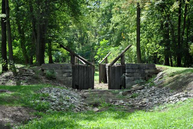
Photo: Wdzinc, Wikimedia Commons, CC BY-SA 3.0 · Wikimedia Commons
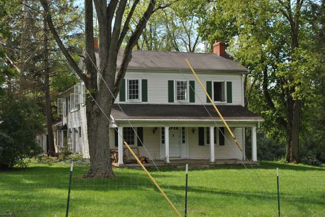
Photo: Wdzinc, Wikimedia Commons, CC BY-SA 3.0 · Wikimedia Commons
Local history sources: blog.jimgrey.net · en.wikipedia.org · en.wikipedia.org · en.wikipedia.org · metroparks.org · en.wikipedia.org · commons.wikimedia.org · commons.wikimedia.org · commons.wikimedia.org · archive.org
Water
Groundwater wells in three county-owned well fields — Beaver Valley Road, Shakertown Road, and Valley Springs/Hilltop Road — all pumping to and blended at the Northwest Regional Water Treatment Plant on Beaver Valley Rd in Beavercreek The water here
- Greene County - northwest Reg Water35% of residentsLittle Miami River Buried Valley Aquifer (2 wellfields, Beavercreek area)
- Dayton Public Water System24% of residentsGreat Miami Buried Valley Aquifer wells (recharged by Great Miami & Mad Rivers)
- Montgomery County Water Services 123% of residentsGreat Miami Buried Valley Aquifer wells (recharged by Great Miami & Mad Rivers)
- Huber Heights Public Water System15% of residentsGreat Miami Buried Valley Aquifer (wells)
- Montgomery County Water Services 23% of residentsGreat Miami Buried Valley Aquifer wells (recharged by Great Miami & Mad Rivers)
- Wright-patterson Afb Area A0% of residentsGreat Miami/Mad River Buried Valley Aquifer (base wells, Area A)
Hospitals, fire stations and more
Inside Riverside's boundary: 2 fire and EMS stations, 9 public schools, 3 private schools, 2 poor-rated bridges, 2 museums, 1 police station, 3 public charging sites, 4 Superfund sites, 2 Toxics Release Inventory facilities and 10 spill cases. Press a pin or a name for its whole record and its source.
Fire and EMS stations (2)
-
Riverside Fire Department Station 5Dayton
- Address
- 1791 Harshman Road, Dayton, OH 45424
- Coordinates
- 39.79372, -84.12851
USGS National Map structures (source) ↗ Street map and directions ↗
-
Riverside Fire Department Station 6Dayton
- Address
- 1081 Spinning Road, Dayton, OH 45432
- Coordinates
- 39.74939, -84.11118
USGS National Map structures (source) ↗ Street map and directions ↗
Source: USGS National Map structures (most Ohio records last updated 2019 to 2022), checked against the Columbus and Cleveland station lists. The department that answers a call is set by jurisdiction and mutual aid, not by distance.
Public schools (9)
-
Beverly Gardens Elementary School4 of 5 stars · Dayton
- Address
- 5555 Enright Ave, Dayton, OH 45431
- School district
- Mad River Local School District
- Kind (NCES)
- Regular School
- Students, 2023-24
- 366
- Teachers (full-time equivalent)
- 20
- Report card, 2025-26
- 4 of 5 stars
- Performance index
- 82%
- Ohio building IRN
- 002667
- NCES school ID
- 390487003356
NCES school record ↗ Ohio School Report Card ↗ Street map and directions ↗
-
Brantwood Elementary School3 of 5 stars · Dayton
- Address
- 4350 Schwinn Dr, Dayton, OH 45404
- School district
- Mad River Local School District
- Kind (NCES)
- Regular School
- Students, 2023-24
- 346
- Teachers (full-time equivalent)
- 19
- Report card, 2025-26
- 3 of 5 stars
- Performance index
- 79.7%
- Ohio building IRN
- 003442
- NCES school ID
- 390487003357
NCES school record ↗ Ohio School Report Card ↗ Street map and directions ↗
-
Eastmont Elementary SchoolDayton
- Address
- 1480 Edendale Rd, Dayton, OH 45432
- Kind (NCES)
- Regular School
- Students, 2023-24
- 374
- Teachers (full-time equivalent)
- 22
- NCES school ID
- 390438400786
-
Mad River Early Childhood CenterDayton
- Address
- 801 Old Harshman Rd, Dayton, OH 45431
- Kind (NCES)
- Regular School
- Students, 2023-24
- 128
- Teachers (full-time equivalent)
- 6
- NCES school ID
- 390487005500
-
Mad River Middle School3 of 5 stars · Dayton
- Address
- 1801 Harshman Rd, Dayton, OH 45424
- School district
- Mad River Local School District
- Kind (NCES)
- Regular School
- Students, 2023-24
- 556
- Teachers (full-time equivalent)
- 31.85
- Report card, 2025-26
- 3 of 5 stars
- Performance index
- 68.6%
- Ohio building IRN
- 043398
- NCES school ID
- 390487003363
NCES school record ↗ Ohio School Report Card ↗ Street map and directions ↗
-
Saville Elementary School3.5 of 5 stars · Dayton
- Address
- 5800 Burkhardt Rd, Dayton, OH 45431
- School district
- Mad River Local School District
- Kind (NCES)
- Regular School
- Students, 2023-24
- 381
- Teachers (full-time equivalent)
- 22
- Report card, 2025-26
- 3.5 of 5 stars
- Performance index
- 77.8%
- Ohio building IRN
- 033647
- NCES school ID
- 390487003362
NCES school record ↗ Ohio School Report Card ↗ Street map and directions ↗
-
Spinning Hills Middle School (5-6)4 of 5 stars · Dayton
- Address
- 5001 Eastman Ave, Dayton, OH 45432
- School district
- Mad River Local School District
- Kind (NCES)
- Regular School
- Students, 2023-24
- 521
- Teachers (full-time equivalent)
- 28
- Report card, 2025-26
- 4 of 5 stars
- Performance index
- 75.7%
- Ohio building IRN
- 021931
- NCES school ID
- 390487003359
NCES school record ↗ Ohio School Report Card ↗ Street map and directions ↗
-
Stebbins High School3.5 of 5 stars · Dayton
- Address
- 1900 Harshman Rd, Dayton, OH 45424
- School district
- Mad River Local School District
- Kind (NCES)
- Regular School
- Students, 2023-24
- 1,119
- Teachers (full-time equivalent)
- 60.64
- Report card, 2025-26
- 3.5 of 5 stars
- Performance index
- 70.7%
- Four-year graduation rate
- 89.4%
- Ohio building IRN
- 035956
- NCES school ID
- 390487003364
NCES school record ↗ Ohio School Report Card ↗ Street map and directions ↗
-
Virginia Stevenson Elementary School2.5 of 5 stars · Dayton
- Address
- 805 Old Harshman Rd, Dayton, OH 45431
- School district
- Mad River Local School District
- Kind (NCES)
- Regular School
- Students, 2023-24
- 306
- Teachers (full-time equivalent)
- 18
- Report card, 2025-26
- 2.5 of 5 stars
- Performance index
- 71.6%
- Ohio building IRN
- 015461
- NCES school ID
- 390487003358
NCES school record ↗ Ohio School Report Card ↗ Street map and directions ↗
Source: NCES EDGE public school locations 2024-25 and Common Core of Data 2023-24 (type, students, teachers); Ohio School Report Cards 2025-26 (Department of Education and Workforce), matched by name within the district.
Private schools (3)
-
Carroll High SchoolPrivate, Catholic · Dayton
- Address
- 4524 Linden Ave, Dayton, OH 45432
- Kind
- Catholic
- Students, 2023-24
- 703
- Teachers (full-time equivalent)
- 52.3
- Students per teacher
- 13.4417
- Phone
- (937) 253-8188
- NCES private school ID
- 01056879
-
East Dayton Christian SchoolPrivate, conservative Christian · Dayton
- Address
- 999 Spinning Rd, Dayton, OH 45431
- Kind
- conservative Christian
- Students, 2023-24
- 373
- Teachers (full-time equivalent)
- 28.6
- Students per teacher
- 13.042
- Phone
- (937) 252-5400
- NCES private school ID
- A9105190
-
St Helen SchoolPrivate, Catholic · Dayton
- Address
- 5086 Burkhardt Rd, Dayton, OH 45431
- Kind
- Catholic
- Students, 2023-24
- 380
- Teachers (full-time equivalent)
- 22
- Students per teacher
- 17.2727
- Phone
- (937) 256-1761
- NCES private school ID
- 01055864
Source: NCES Private School Survey 2023-24.
Bridges rated poor (2)
-
Renfield Drive over StreamPoor · built 1976
- Condition
- Poor: a deck, superstructure, substructure or culvert rated 4 or below on the 0 to 9 scale
- What it is
- Bridge
- Built
- 1976
- Length
- 10 ft
- Owner
- City
- Vehicles a day
- 135
- Coordinates
- 39.82155, -84.12142
National Bridge Inventory (source) ↗ Street map and directions ↗
-
Woodman M0074 over Lilly CreekPoor · built 1961
- Condition
- Poor: a deck, superstructure, substructure or culvert rated 4 or below on the 0 to 9 scale
- What it is
- Culvert
- Built
- 1961
- Length
- 18 ft
- Owner
- County
- Vehicles a day
- 27,017
- Coordinates
- 39.76099, -84.12075
National Bridge Inventory (source) ↗ Street map and directions ↗
Source: FHWA National Bridge Inventory 2025. "Poor" means one major part rated 4 or below on the 0 to 9 scale; it calls for repair, not closing, unless the state posts or closes the bridge.
Museums, historical societies, gardens and zoos (2)
-
National Dirt Late Model Hall Of FameMuseum · Dayton
- What it is
- Museum
- City
- Dayton
- Coordinates
- 39.80788, -84.11910
Search Wikipedia ↗ IMLS Museum Data Files (source) ↗ Street map and directions ↗
The museum list is IMLS's 2018 file; a museum may have closed or moved since.
-
Riverside Historical SocietyHistorical society · Riverside
- What it is
- Historical society
- City
- Riverside
- Coordinates
- 39.76708, -84.12512
Search Wikipedia ↗ IMLS Museum Data Files (source) ↗ Street map and directions ↗
The museum list is IMLS's 2018 file; a museum may have closed or moved since.
Source: IMLS Museum Data Files, 2018.
Police stations (1)
-
Riverside Police DepartmentDayton
- Address
- 1791 Harshman Road, Dayton, OH 45424
- Coordinates
- 39.79355, -84.12843
USGS National Map structures (source) ↗ Street map and directions ↗
Source: USGS National Map structures, police stations, corrected and completed by hand (September 2026). The department that answers a call is set by jurisdiction, not by distance.
Public EV charging (3)
-
MVRPC(EV#22)2 Level 2 · Dayton
- Address
- Old Harshman Road, Dayton, OH 45431
- Ports
- 2 Level 2
- Plugs
- J1772
- Network
- Blink Network
- Hours
- 24 hours daily
- Phone
- 888-998-2546
Station Locator (NREL) ↗ Alternative Fuels Data Center (source) ↗ Street map and directions ↗
-
National Museum of the US Air Force4 Level 2 · Dayton
- Address
- 1100 Spaatz St, Dayton, OH 45431
- Ports
- 4 Level 2
- Plugs
- J1772
- Network
- Non-Networked
- Hours
- Museum business hours
- Price
- Free
- Phone
- 937-255-3286
Station Locator (NREL) ↗ Alternative Fuels Data Center (source) ↗ Street map and directions ↗
-
Wright Point Office Park2 Level 2 · Riverside
- Address
- 5200 Springfield St, Riverside, OH 45431
- Ports
- 2 Level 2
- Plugs
- J1772
- Network
- Non-Networked
- Hours
- 7am-7pm M-F; 8am-12pm Sat
- Price
- Free
- Phone
- 937-233-1801
Station Locator (NREL) ↗ Alternative Fuels Data Center (source) ↗ Street map and directions ↗
Source: NREL Alternative Fuels Data Center station list (May 2026), public and open stations, the posts at one address counted as one site.
Superfund sites (4)
-
Mullins Rubber Products Inc NPLSuperfund, NPL · Dayton
- Address
- 2949 Valley Pike, Dayton, OH 45404
- County
- Montgomery County
- Status
- On the National Priorities List
- EPA program ID
- OHN000510489
- EPA registry ID
- 110006289140
EPA facility record ↗ EPA Facility Registry Service (source) ↗ Street map and directions ↗
-
Page Manor Shopping PlazaSuperfund program · Riverside
- Address
- 5570 Airway Road, Riverside, OH 45431
- County
- Montgomery County
- Status
- Superfund program site, not on the National Priorities List
- EPA program ID
- OHN000506400
- EPA registry ID
- 110071102054
EPA facility record ↗ EPA Facility Registry Service (source) ↗ Street map and directions ↗
-
Springfield Street Voc Plume SiteSuperfund program · Dayton
- Address
- 1009 Planters Avenue, Dayton, OH 45431
- County
- Montgomery County
- Status
- Superfund program site, not on the National Priorities List
- EPA program ID
- OHN000510062
- EPA registry ID
- 110024425077
EPA facility record ↗ EPA Facility Registry Service (source) ↗ Street map and directions ↗
-
Stebbins High SchoolSuperfund program · Dayton
- Address
- 1900 Harshman Rd, Dayton, OH 45424
- County
- Montgomery County
- Status
- Superfund program site, not on the National Priorities List
- EPA program ID
- OHN000508258
- EPA registry ID
- 110022179042
EPA facility record ↗ EPA Facility Registry Service (source) ↗ Street map and directions ↗
Source: EPA Facility Registry Service, Superfund (SEMS) and National Priorities List sites. Many program sites were assessed and needed no cleanup.
Facilities reporting toxic releases (2)
-
Former Dap PltToxics Release Inventory · Dayton
- Address
- 5300 Huberville Road, Dayton, OH 45431
- County
- Montgomery County
- Status
- Reports to the Toxics Release Inventory (active)
- EPA program ID
- 45431DPNCX5300H
- EPA registry ID
- 110002317056
EPA facility record ↗ EPA Facility Registry Service (source) ↗ Street map and directions ↗
-
Mullins Rubber Products IncToxics Release Inventory · Dayton
- Address
- 2949 Valley Pike, Dayton, OH 45404
- County
- Montgomery County
- Status
- Reports to the Toxics Release Inventory (active)
- EPA program ID
- 45404MLLNS2949V
- EPA registry ID
- 110006289140
EPA facility record ↗ EPA Facility Registry Service (source) ↗ Street map and directions ↗
Source: EPA Facility Registry Service, Toxics Release Inventory reporters. Reporting a release is required of large users of listed chemicals; it is not by itself a violation.
Spills reported since 2021 (10)
-
Oil Hydraulic Fluid(S)2025-12-09 · Riverside
- Reported
- 2025-12-09
- What spilled
- Oil Hydraulic Fluid(S); Fuel Diesel / Diesel Fuel (Vehicle On Or Off Road)
- Largest amount reported
- 50 gallons
- Where
- Riverside, Montgomery County
- Ohio EPA district office
- SWDO
- Ohio EPA case number
- 2512EPA0001970
Ohio EPA spill reports (source) ↗ Street map and directions ↗
-
Fuel Diesel / Diesel Fuel (Vehicle On Or Off Road)2025-09-23 · Riverside
- Reported
- 2025-09-23
- What spilled
- Fuel Diesel / Diesel Fuel (Vehicle On Or Off Road)
- Where
- Riverside, Montgomery County
- Ohio EPA district office
- SWDO
- Ohio EPA case number
- 2509EPA0001590
Ohio EPA spill reports (source) ↗ Street map and directions ↗
-
Water (H20)2025-04-23 · Riverside
- Reported
- 2025-04-23
- What spilled
- Water (H20)
- Where
- Riverside, Montgomery County
- Ohio EPA district office
- SWDO
- Ohio EPA case number
- 2504EPA0000624
Ohio EPA spill reports (source) ↗ Street map and directions ↗
-
Fuel Diesel / Diesel Fuel (Vehicle On Or Off Road)2024-07-23 · Dayton
- Reported
- 2024-07-23
- What spilled
- Fuel Diesel / Diesel Fuel (Vehicle On Or Off Road)
- Where
- Dayton, Montgomery County
- Ohio EPA district office
- SWDO
- Ohio EPA case number
- 2407EPA0001259
Ohio EPA spill reports (source) ↗ Street map and directions ↗
-
Material Undetermined / Other2023-04-13 · Riverside
- Reported
- 2023-04-13
- What spilled
- Material Undetermined / Other
- Where
- Riverside, Montgomery County
- Ohio EPA district office
- SWDO
- Ohio EPA case number
- 2304EPA0000582
Ohio EPA spill reports (source) ↗ Street map and directions ↗
-
Fat(S) / Oil / Grease / Tallow Food Types (Fog)2022-11-16 · Riverside
- Reported
- 2022-11-16
- What spilled
- Fat(S) / Oil / Grease / Tallow Food Types (Fog)
- Largest amount reported
- 1 gallons
- Where
- Riverside, Montgomery County
- Ohio EPA district office
- SWDO
- Ohio EPA case number
- 2211EPA0001704
Ohio EPA spill reports (source) ↗ Street map and directions ↗
-
Chemical(S) Unk2022-08-09 · Riverside
- Reported
- 2022-08-09
- What spilled
- Chemical(S) Unk
- Where
- Riverside, Montgomery County
- Ohio EPA district office
- SWDO
- Ohio EPA case number
- 2208EPA0001207
Ohio EPA spill reports (source) ↗ Street map and directions ↗
-
Mercury / Quicksilver (Hg)2022-06-02 · Wright Patterson
- Reported
- 2022-06-02
- What spilled
- Mercury / Quicksilver (Hg)
- Where
- Wright Patterson, Montgomery County
- Ohio EPA district office
- SWDO
- Ohio EPA case number
- 2206EPA0000811
Ohio EPA spill reports (source) ↗ Street map and directions ↗
-
Oil Petroleum Not Otherwise Specified (Nos)2021-05-14 · Riverside
- Reported
- 2021-05-14
- What spilled
- Oil Petroleum Not Otherwise Specified (Nos)
- Largest amount reported
- 40 gallons
- Where
- Riverside, Montgomery County
- Ohio EPA district office
- SWDO
- Ohio EPA case number
- 2105EPA0000673
Ohio EPA spill reports (source) ↗ Street map and directions ↗
-
Oil Hydraulic Fluid(S)2021-01-29 · Riverside
- Reported
- 2021-01-29
- What spilled
- Oil Hydraulic Fluid(S)
- Largest amount reported
- 100 gallons
- Where
- Riverside, Montgomery County
- Ohio EPA district office
- SWDO
- Ohio EPA case number
- 2101EPA0000129
Ohio EPA spill reports (source) ↗ Street map and directions ↗
Source: Ohio EPA emergency response spill reports, 2021 to September 2026, one point per case where Ohio EPA placed it. A report is what the caller or responder recorded; amounts are often blank or estimated.
Its ZIP codes
Each ZIP code that touches Riverside, with the share of its residents who live here and the same headline figures as the ZIP page.
Local government
Who holds office in Riverside, how its elections and ballot issues came out, and the state auditor's record.
Elections for office
| Date | Office | Candidates and votes |
|---|---|---|
| 2025-11-04 | Council Member (unofficial count) | Mike Denning 1,305, 15.86%; Brenda Fry 1,578, 19.18%; Steve Gaby 1,834, 22.29%; Angel R. Patterson 1,849, 22.47%; Freda Patterson 1,663, 20.21% |
Winners in bold. Results from the county board of elections' official canvass unless marked.
Auditor of State record
- No fiscal caution, watch or emergency on the Auditor of State's lists.
- Financial Health Indicators (the Auditor of State's 17 measures; critical / cautionary / positive): 2020 5 / 3 / 9; 2021 5 / 3 / 9; 2022 5 / 3 / 9; 2023 3 / 1 / 13; 2024 2 / 0 / 15; 2025 3 / 0 / 13.
- Financial Audit, 2024, released 2026-01-13
- Compliance Examination, 2024, released 2025-08-21
- Financial Audit, 2023, released 2024-10-10
The county
Greene County: 17 ZIP codes, 23 cities, villages and townships, 178,891 people.
Nearby places
Rain and snow
How much has actually fallen on Riverside, day by day, from 1893 to now. Daily totals, not averages.
- rain, last 30 days
- 0.84 in
- 2026-09-30 to 2026-10-29
- rain so far in 2026
- 45.0 in
- 8.9 in above normal for the date
- snow so far in 2026
- 13.9 in
- a normal year brings 17.5 in
- a normal year
- 42.4 in
- average of 30 years, 1991-2020
| Month | Rain (in) | Snow (in) | Days counted |
|---|---|---|---|
| October 2026 | 0.84 | — | 29 |
| September 2026 | 4.78 | — | 30 |
| August 2026 | 10.74 | — | 31 |
| July 2026 | 2.75 | — | 31 |
| June 2026 | 3.14 | — | 30 |
| May 2026 | 8.48 | — | 31 |
| April 2026 | 3.83 | — | 30 |
| March 2026 | 6.70 | 0.3 | 31 |
| February 2026 | 2.38 | 1.1 | 28 |
| January 2026 | 1.30 | 12.5 | 31 |
| December 2025 | 2.00 | 7.2 | 31 |
| November 2025 | 2.06 | 3.8 | 30 |
| Wettest year | 2011 — 61.0 in |
|---|---|
| Driest year | 1934 — 24.0 in |
| Snowiest year | 1978 — 41.1 in |
| Wettest day on record | 18 July 1931 — 4.30 in |
| Heaviest snowfall in a day | 17 February 1910 — 10.51 in |
| Deepest snow on the ground | 27 January 1978 — 19.39 in |
Mostly estimated. Only 4% of these days come from a gauge standing inside Riverside - the rest are worked out from the nearest gauges around it, so read them as close estimates rather than readings.
46,366 days of records, 1893-06-02 to 2026-10-29. Source: NOAA NCEI GHCN-Daily, 3,240 gauges in and around Ohio. A day is "gauged" when a gauge standing inside the boundary reported it, and the value is the mean of those gauges. Otherwise it is interpolated by inverse distance from every gauge reporting within 50 miles. Nothing is carried forward, back-filled or smoothed. Against NOAA nClimDiv county monthly precipitation over 136,848 complete county-months (checked 2026-10-31): correlation 0.9515, median absolute difference 0.217 in a month. Built 2026-10-31 from the Cracked Buckeye precipitation archive. Snow is the softer number — snowfall is measured by hand with a ruler, no agency publishes a gridded county snowfall series, and blowing snow defeats every observer.
Environmental permits and filings
What Ohio EPA has on file for Riverside: permits, inspections, violations, cleanups and the state loans behind sewer and water work. Every line links to the agency's own document.
- facilities and sites on file
- 46
- those placed on the map inside Riverside
| Program | Facilities and sites |
|---|---|
| Site assessment | 12 |
| Contaminated-site cleanup | 7 |
| Hazardous waste | 7 |
| Wastewater and stormwater discharge | 5 |
| Air pollution | 4 |
| Public drinking water | 3 |
| State sewer loans | 3 |
| Wetland and stream fill | 2 |
| Brownfield | 1 |
| Source-water protection | 1 |
| Voluntary cleanup | 1 |
| Date | Facility or site | What |
|---|---|---|
| REDWOOD RIVERSIDE UNION SCHOOLHOUSE ROAD | Wetland and stream fill permit | |
| MULLINS RUBBER PRODUCTS INC | Air pollution report | |
| MULLINS RUBBER PRODUCTS INC, DAYTON | Contaminated-site cleanup cleanup response | |
| GLENDEAN POINTE | Wastewater and stormwater discharge permit | |
| GLENDEAN POINTE | Wastewater and stormwater discharge permit | |
| MULLINS RUBBER PRODUCTS INC, DAYTON | Contaminated-site cleanup cleanup response | |
| CHERRY CREEK RESIDENTIAL SUBDIVISION SECTION III | Wastewater and stormwater discharge permit | |
| FOREST RIDGE ASSOCIATION | Wetland and stream fill notice of violation | |
| MULLINS RUBBER PRODUCTS INC | Air pollution permit | |
| GLENDEAN POINTE | Wastewater and stormwater discharge permit | |
| GLENDEAN POINTE | Wastewater and stormwater discharge permit | |
| MULLINS RUBBER PRODUCTS INC | Air pollution permit | |
| GLENDEAN POINTE | Wastewater and stormwater discharge permit | |
| GLENDEAN POINTE | Wastewater and stormwater discharge permit | |
| CHARLES F JERGENS CONSTRUCTION INC - PORTABLE | Air pollution report | |
| MULLINS RUBBER PRODUCTS INC | Air pollution permit | |
| TRI CITIES NORTH REGIONAL WASTEWATER TREATMENT PLANT | Wastewater and stormwater discharge permit | |
| GLENDEAN POINTE | Wastewater and stormwater discharge permit | |
| CHERRY CREEK RESIDENTIAL SUBDIVISION SECTION III | Wastewater and stormwater discharge permit | |
| GLENDEAN POINTE | Wastewater and stormwater discharge inspection | |
| MULLINS RUBBER PRODUCTS INC, DAYTON | Contaminated-site cleanup cleanup response | |
| GLENDEAN POINTE | Wastewater and stormwater discharge permit | |
| MULLINS RUBBER PRODUCTS INC, DAYTON | Contaminated-site cleanup cleanup response | |
| CHERRY CREEK RESIDENTIAL SUBDIVISION SECTION III | Wastewater and stormwater discharge inspection | |
| MULLINS RUBBER PRODUCTS INC, DAYTON | Contaminated-site cleanup cleanup response |
Source: Ohio EPA eDocument portal (edocpub.epa.ohio.gov), indexed 2026-10-14. Facilities are placed on the map from Ohio EPA's own map layers, EPA's Facility Registry, coordinates written in the filings, or a geocoded street address. A permit filed under a private person's name (most are household septic systems) is counted but never named, placed or linked; licenses for individual workers and open-burning notices are left out entirely.
Quick answers
What county is Riverside, Ohio in?
Riverside is a city in Greene County, Ohio, with 24,509 residents.
When was Riverside, Ohio founded?
Riverside was settled 1796 (within the bounds of the future Mad River Township, by three members of the party that founded Dayton the same year); incorporated 1995-01-01. Founders on record: Merger of Mad River Township with the villages inside it; Riverside is described in Wikipedia's geography section as formed by the 1994 township merger. Source
How did Riverside, Ohio get its name?
Not documented in the sources checked. Source
What ZIP code is Riverside, Ohio?
Riverside is served by ZIP codes 45431, 45404, 45432 and 45424; 45431 holds the largest share of its residents.
Where does Riverside, Ohio get its water?
The main water source for Riverside (Greene County - northwest Reg Water): Groundwater wells in three county-owned well fields — Beaver Valley Road, Shakertown Road, and Valley Springs/Hilltop Road — all pumping to and blended at the Northwest Regional Water Treatment Plant on Beaver Valley Rd in Beavercreek.
Cite this page
Cite this page as:
Cracked Buckeye, "Riverside, Greene County", https://crackedbuckeye.com/place/riverside/, built 2026-10-31, accessed [date].
How to cite · Report a correction · Built 2026-10-31
