Huber Heights
City · Montgomery County · 43,524 residents · 2.25% municipal income tax
Local events in Huber Heights
89 events in the next 90 days from 5 public calendars. All local events in Huber Heights
Checked October 20; the events page is refreshed daily.
How Huber Heights began
Huber Heights grew out of Wayne Township, organized January 1, 1810 and named for Major General Anthony Wayne. Rural through the 19th and early 20th centuries, the township was transformed after 1956 when developer Charles H. Huber began building tract housing there; Huber Homes put up more than 10,700 single-family houses and over 2,250 multi-family units between 1956 and 1992, making it one of the largest private housing developments in the country at the time. Wayne Township incorporated as the City of Huber Heights on January 23, 1981, and voters adopted a home-rule city charter that November. The city's northeastern edge still carries traces of the Miami and Erie Canal, including a lock and a former canal-era inn, from the corridor's mid-19th-century transportation era.
Settled early-to-mid 1800s (as Wayne Township), incorporated January 23, 1981 (city); township organized January 1, 1810, by Charles H. Huber (1950s-1990s residential development).
Where the name comes from
The city is named for Charles H. Huber, the developer whose company, Huber Homes, built the large tract-housing developments that transformed rural Wayne Township into a Dayton suburb starting in 1956. Wayne Township itself, which the city grew out of, was named for Major General Anthony Wayne, whom George Washington made commander-in-chief of the U.S. Army in 1792 and who is remembered regionally for his victory at the Battle of Fallen Timbers.
Before the town
No village, trail, or treaty line specific to this area is recorded. The land that became Wayne Township, and later Huber Heights, lay within the Ohio country ceded at the Treaty of Greenville in 1795, opening it to the Symmes Purchase-era surveys and settlement that produced Wayne Township in 1810. No site-specific mounds, camps, or named villages within present Huber Heights are found in the sources consulted.
Timeline
- — Wayne Township was formed January 1, occupying the northeastern corner of Montgomery County; its first township election was held January 20 at Benjamin Van Cleve's residence on Stauton Road.
- — The Ausenbaugh-McElhenny House was built on what is now Taylorsville Road; it later became the township's oldest National Register listing.
- — The Great Flood of 1913 damaged Tadmor, the canal-and-road settlement on the Great Miami River at the township's edge, but its covered bridge survived and its people stayed; the town emptied only after the National Road was later rerouted over Taylorsville Dam, and the site is now in Taylorsville MetroPark.
- — A centralized school building was constructed at what is now the Titus Elementary site.
- — Wayne Township's population stood at approximately 1,921 residents, still overwhelmingly rural.
- — Charles H. Huber began residential development in Wayne Township, including establishing Ohio's first privately owned utility company to serve the new subdivisions.
- — The census counted 18,943 people in the Huber Heights census area as Huber Homes construction continued.
- — Wayne Township incorporated as the City of Huber Heights on January 23; that November, voters adopted a home-rule city charter establishing a council-manager government.
- — Huber Homes completed its development program, having built more than 10,700 single-family homes and over 2,250 multi-family units since 1956.
Stories
A township becomes a subdivision city
For nearly a century and a half, Wayne Township was a quiet farming community in the northeast corner of Montgomery County, its population still under 2,000 as late as 1950. That changed almost overnight when Charles H. Huber began building houses there in 1956. Huber's company, Huber Homes, eventually put up more than 10,700 single-family houses and over 2,250 multi-family units by 1992, one of the largest privately built residential developments in the country. Huber also set up Ohio's first privately owned utility company to service the new subdivisions. The township's population went from under 2,000 in 1950 to nearly 28,000 by 1970. In 1981 the township incorporated as the City of Huber Heights, taking its name directly from the developer who had remade it, and that November voters approved a home-rule charter and council-manager government.
The canal-era crossroads at Tadmor
At the northern edge of present-day Huber Heights, the Miami and Erie Canal once ran past a settlement called Tadmor, which by the 1850s sat at the crossing of the canal, the National Road, and the Dayton & Michigan Railroad -- making it one of the best-connected transportation points in the region. The Miami-Erie Canal Lock No. 70 and the Taylorsville Canal Inn, both now listed on the National Register at Fishburg/Endicott Roads and Taylorsville Road respectively, survive from that era. Tadmor came through the Great Flood of 1913 with its covered bridge intact, and its people stayed; the town emptied only after the National Road was rerouted over the new Taylorsville Dam. Today the remnants sit within Taylorsville MetroPark, a reminder that Huber Heights' modern subdivisions were built over a 19th-century transportation hub.
Photographs
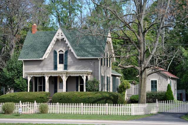
Photo: Wdzinc, CC BY-SA 3.0 · Wikimedia Commons
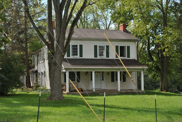
Photo: Wdzinc, CC BY-SA 3.0 · Wikimedia Commons
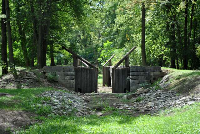
Photo: Wdzinc, CC BY-SA 3.0 · Wikimedia Commons
Local history sources: blog.jimgrey.net · huberheightschamber.com · en.wikipedia.org · en.wikipedia.org · mcdwater.org · en.wikipedia.org · commons.wikimedia.org · commons.wikimedia.org · commons.wikimedia.org
Historic places
3 places in Huber Heights on the National Register of Historic Places. Press a pin or a name for its whole record.
-
Ausenbaugh-McElhenny HouseBuilding · Dayton · listed 1975
- Address
- 7373 Taylorsville Rd.
- Where
- Dayton, Montgomery County · ZIP 45424
- What it is
- Building
- Listed on the National Register
- 1975
- NRIS reference number
- 75001503
- Coordinates
- 39.86089, -84.10240
National Register file (NPS) ↗ Search Wikipedia ↗ Street map and directions ↗ On the Cracked Buckeye map
-
Miami-Erie Canal Lock No. 70Site · Huber Heights · listed 1982
- Address
- Fishburg and Endicott Rds.
- Where
- Huber Heights, Montgomery County · ZIP 45424
- What it is
- Site
- Listed on the National Register
- 1982
- NRIS reference number
- 82001479
- Coordinates
- 39.84121, -84.15885
National Register file (NPS) ↗ Search Wikipedia ↗ Street map and directions ↗ On the Cracked Buckeye map
-
Taylorsville Canal InnBuilding · Dayton · listed 1977
- Address
- 4240 Taylorsville Rd.
- Where
- Dayton, Montgomery County · ZIP 45424
- What it is
- Building
- Listed on the National Register
- 1977
- NRIS reference number
- 77001078
- Coordinates
- 39.86343, -84.16495
National Register file (NPS) ↗ Search Wikipedia ↗ Street map and directions ↗ On the Cracked Buckeye map
Source: National Park Service, National Register of Historic Places point file. The listing year is shown where NPS's certification date agrees with the listing's reference number. Listing recognizes significance; it does not restrict a private owner.
Water
Wells in the Great Miami buried-valley aquifer, pumped to the Needmore Road and Rip Rap Road treatment plants The water here
- Huber Heights Public Water System72% of residentsGreat Miami Buried Valley Aquifer (wells)
- Dayton Public Water System14% of residentsGreat Miami Buried Valley Aquifer wells (recharged by Great Miami & Mad Rivers)
- Montgomery County Water Services 28% of residentsGreat Miami Buried Valley Aquifer wells (recharged by Great Miami & Mad Rivers)
- NAWA6% of residentsGreat Miami Buried Valley Aquifer (wells)
- Montgomery County Water Services 10% of residentsGreat Miami Buried Valley Aquifer wells (recharged by Great Miami & Mad Rivers)
- Miami Co-deer Cliff Run0% of residentsGreat Miami Buried Valley Aquifer (wells)
- Bethel Township Water System0% of residentsGroundwater wells (3 wells)
- Wright-patterson Afb Area A0% of residentsGreat Miami/Mad River Buried Valley Aquifer (base wells, Area A)
- Union City0% of residentsGroundwater wells (4 wells)
Hospitals, fire stations and more
Inside Huber Heights's boundary: 1 hospital, 1 health center, 2 dialysis centers, 1 nursing home, 3 fire and EMS stations, 1 college, 9 public schools, 2 private schools, 1 library, 4 museums, 1 police station, 8 public charging sites, 1 Superfund site, 5 Toxics Release Inventory facilities and 40 spill cases. Press a pin or a name for its whole record and its source.
Hospitals (1)
-
Huber Heights Holdings Llc Dba Am Behavioral HuberPsychiatric hospital · Huber Heights
- What it is
- Psychiatric hospital
- Address
- 6210 Bellefontaine Rd, Huber Heights, OH 45424
- County
- Montgomery County
- Beds
- 36
- Ownership
- Proprietary
- Phone
- (219) 804-2526
Where HIFLD got this record ↗ HIFLD hospitals (source) ↗ Street map and directions ↗
Source: HIFLD hospitals inventory via FEMA (closed hospitals it still lists left out, hospitals opened since added), with Medicare Care Compare ratings matched by name and address.
Community health centers (1)
-
Community Health Centers of Greater Dayton - Chambersburg Health CenterHealth center · Dayton
- Run by
- a federally qualified health center
- Setting
- Clinic
- City
- Dayton
- Coordinates
- 39.84732, -84.11561
Find a Health Center (HRSA) ↗ HRSA data (source) ↗ Street map and directions ↗
Source: HRSA health center service delivery sites, active, September 2026 (school-based sites left out). Health centers see patients whether or not they have insurance, with fees on a sliding scale.
Dialysis centers (2)
-
Davita Huber Heights DialysisDialysis · Huber Heights
- Address
- 7769 Old Country Court, Huber Heights, OH 45424
- Dialysis stations
- 15
- Medicare star rating
- 3 of 5 stars
- Services
- in-center hemodialysis, peritoneal dialysis, home hemodialysis training
- Ownership
- for profit
- Chain
- DaVita
- Medicare certified since
- 2016-01-28
- Phone
- (937) 237-0769
- Medicare ID
- 362833
Medicare Care Compare ↗ CMS dialysis facility list (source) ↗ Street map and directions ↗
-
Fresenius Medical Care Dayton Regional Dialysis NorthDialysis · Dayton
- Address
- 7211 Shull Road, Dayton, OH 45424
- Dialysis stations
- 28
- Medicare star rating
- 2 of 5 stars
- Services
- in-center hemodialysis, peritoneal dialysis, home hemodialysis training
- Shift starting after 5 pm
- Yes
- Ownership
- for profit
- Chain
- Fresenius Medical Care
- Medicare certified since
- 1990-02-02
- Phone
- (937) 237-2000
- Medicare ID
- 362512
Medicare Care Compare ↗ CMS dialysis facility list (source) ↗ Street map and directions ↗
Source: CMS dialysis facility list, September 2026, geocoded with the Census Bureau batch geocoder (an address it could not place sits at its ZIP center).
Nursing homes (1)
-
Laurels of Huber Heights The3 of 5 stars · Huber Heights
- Address
- 5440 Charlesgate Road, Huber Heights, OH 45424
- Certified beds
- 92
- Residents on an average day
- 82
- Medicare overall rating
- 3 of 5 stars
- Health inspections
- 3 of 5 stars
- Staffing
- 1 of 5 stars
- Quality measures
- 5 of 5 stars
- Penalties since 2023
- none
- Ownership
- For profit - Corporation
- Chain
- CIENA HEALTHCARE/LAUREL HEALTH CARE
- Takes
- Medicare and Medicaid
- Phone
- (937) 236-6707
- Medicare ID
- 365627
Medicare Care Compare ↗ CMS nursing home data (source) ↗ Street map and directions ↗
Source: CMS Care Compare nursing home provider and penalties files; Medicare star ratings run 1 to 5.
Fire and EMS stations (3)
-
Huber Heights Fire Department - Station 23Huber Heights
- Address
- 7435 Old Troy Pike, Huber Heights, OH 45424
- Coordinates
- 39.86127, -84.13887
USGS National Map structures (source) ↗ Street map and directions ↗
-
Huber Heights Fire Department Station 22Huber Heights
- Address
- 7008 Brandt Pike, Huber Heights, OH 45424
- Coordinates
- 39.85435, -84.10826
USGS National Map structures (source) ↗ Street map and directions ↗
-
Huber Heights Fire Department Station 25Huber Heights
- Address
- 9975 State Route 202, Huber Heights, OH 45371
- Coordinates
- 39.88527, -84.13558
USGS National Map structures (source) ↗ Street map and directions ↗
Source: USGS National Map structures (most Ohio records last updated 2019 to 2022), checked against the Columbus and Cleveland station lists. The department that answers a call is set by jurisdiction and mutual aid, not by distance.
Colleges (1)
-
Ohio Institute of Allied HealthPrivate nonprofit two-year college · Huber Heights
- What it is
- Private nonprofit two-year college
- City
- Huber Heights
- Students, 2023-24 (12-month count)
- 146
- Tuition and fees, in state
- $24,493
- IPEDS unit ID
- 483647
College Navigator (NCES) ↗ IPEDS data (source) ↗ Street map and directions ↗
Source: NCES IPEDS 2024 directory, 2023-24 enrollment and tuition, graduation rates for the 2017 (four-year) and 2020 (two-year) entering classes.
Public schools (9)
-
Charles Huber Elementary School3.5 of 5 stars · Huber Heights
- Address
- 8895 Emeraldgate Dr, Huber Heights, OH 45424
- School district
- Huber Heights City School District
- Kind (NCES)
- Regular School
- Students, 2023-24
- 632
- Teachers (full-time equivalent)
- 33.06
- Report card, 2025-26
- 3.5 of 5 stars
- Performance index
- 74.5%
- Ohio building IRN
- 064618
- NCES school ID
- 390487503393
NCES school record ↗ Ohio School Report Card ↗ Street map and directions ↗
-
Monticello Elementary School4 of 5 stars · Huber Heights
- Address
- 6523 Alter Rd, Huber Heights, OH 45424
- School district
- Huber Heights City School District
- Kind (NCES)
- Regular School
- Students, 2023-24
- 548
- Teachers (full-time equivalent)
- 33.56
- Report card, 2025-26
- 4 of 5 stars
- Performance index
- 73.7%
- Ohio building IRN
- 025403
- NCES school ID
- 390487503389
NCES school record ↗ Ohio School Report Card ↗ Street map and directions ↗
-
Robert H StudebakerDayton
- Address
- 5954 Longford Rd, Dayton, OH 45424
- Kind (NCES)
- Regular School
- Students, 2023-24
- 200
- Teachers (full-time equivalent)
- 8
- NCES school ID
- 390487505762
-
Rushmore Elementary School3.5 of 5 stars · Huber Heights
- Address
- 7701 Berchman Dr, Huber Heights, OH 45424
- School district
- Huber Heights City School District
- Kind (NCES)
- Regular School
- Students, 2023-24
- 620
- Teachers (full-time equivalent)
- 35.06
- Report card, 2025-26
- 3.5 of 5 stars
- Performance index
- 71.1%
- Ohio building IRN
- 032961
- NCES school ID
- 390487503390
NCES school record ↗ Ohio School Report Card ↗ Street map and directions ↗
-
Valley Forge Elementary School3 of 5 stars · Huber Heights
- Address
- 7191 Troy Manor Rd, Huber Heights, OH 45424
- School district
- Huber Heights City School District
- Kind (NCES)
- Regular School
- Students, 2023-24
- 548
- Teachers (full-time equivalent)
- 31.06
- Report card, 2025-26
- 3 of 5 stars
- Performance index
- 66.1%
- Ohio building IRN
- 061523
- NCES school ID
- 390487503394
NCES school record ↗ Ohio School Report Card ↗ Street map and directions ↗
-
Warrior Academy4 of 5 stars · Huber Heights
- Address
- 5954 Longford Rd, Huber Heights, OH 45424
- School district
- Huber Heights City School District
- Kind (NCES)
- Regular School
- Report card, 2025-26
- 4 of 5 stars
- Four-year graduation rate
- 100%
- Ohio building IRN
- 019722
- NCES school ID
- 390487506155
NCES school record ↗ Ohio School Report Card ↗ Street map and directions ↗
-
Wayne High School3 of 5 stars · Huber Heights
- Address
- 5400 Chambersburg Rd, Huber Heights, OH 45424
- School district
- Huber Heights City School District
- Kind (NCES)
- Regular School
- Students, 2023-24
- 1,759
- Teachers (full-time equivalent)
- 86.38
- Report card, 2025-26
- 3 of 5 stars
- Performance index
- 68.3%
- Four-year graduation rate
- 87.9%
- Ohio building IRN
- 040048
- NCES school ID
- 390487503395
NCES school record ↗ Ohio School Report Card ↗ Street map and directions ↗
-
Weisenborn Junior High2.5 of 5 stars · Huber Heights
- Address
- 6061 Troy Pike, Huber Heights, OH 45424
- School district
- Huber Heights City School District
- Kind (NCES)
- Regular School
- Students, 2023-24
- 912
- Teachers (full-time equivalent)
- 48.32
- Report card, 2025-26
- 2.5 of 5 stars
- Performance index
- 62.5%
- Ohio building IRN
- 066837
- NCES school ID
- 390487503396
NCES school record ↗ Ohio School Report Card ↗ Street map and directions ↗
-
Wright Brothers Elementary School3.5 of 5 stars · Huber Heights
- Address
- 5758 Harshmanville Rd, Huber Heights, OH 45424
- School district
- Huber Heights City School District
- Kind (NCES)
- Regular School
- Students, 2023-24
- 684
- Teachers (full-time equivalent)
- 34.06
- Report card, 2025-26
- 3.5 of 5 stars
- Performance index
- 68.3%
- Ohio building IRN
- 024273
- NCES school ID
- 390487503388
NCES school record ↗ Ohio School Report Card ↗ Street map and directions ↗
Source: NCES EDGE public school locations 2024-25 and Common Core of Data 2023-24 (type, students, teachers); Ohio School Report Cards 2025-26 (Department of Education and Workforce), matched by name within the district.
Private schools (2)
-
Dayton Montessori SocietyPrivate, nonsectarian, special program · Huber Heights
- Address
- 5515 Brandt Pike, Huber Heights, OH 45424
- Kind
- nonsectarian, special program
- Students, 2023-24
- 42
- Teachers (full-time equivalent)
- 2.3
- Students per teacher
- 18.2609
- Phone
- (937) 435-4572
- NCES private school ID
- A9105213
-
St Peter Elementary SchoolPrivate, Catholic · Huber Heights
- Address
- 6185 Chambersburg Rd, Huber Heights, OH 45424
- Kind
- Catholic
- Students, 2023-24
- 441
- Teachers (full-time equivalent)
- 24
- Students per teacher
- 18.375
- Phone
- (937) 233-8710
- NCES private school ID
- 01055886
Source: NCES Private School Survey 2023-24.
Public libraries (1)
-
Huber Heights Branch LibraryBranch · Huber Heights
- Address
- 6243 Brandt Pike, Huber Heights, OH 45424
- What it is
- Branch
- Library system
- Dayton Metro Library
- Open
- 3,042 hours a year, 52 weeks
- Building
- 27,000 sq ft
- System's visits, FY2024
- 1,987,700
- System's loans, FY2024
- 4,831,439
- People the system serves
- 452,238
- Phone
- (937) 463-2665
IMLS Public Libraries Survey (source) ↗ Street map and directions ↗
Source: IMLS Public Libraries Survey FY2024 (outlets and their systems). Any Ohio resident can get a free card at any Ohio public library.
Museums, historical societies, gardens and zoos (4)
-
Carriage Hill FarmMuseum · Dayton
- What it is
- Museum
- City
- Dayton
- Coordinates
- 39.87556, -84.10151
Search Wikipedia ↗ IMLS Museum Data Files (source) ↗ Street map and directions ↗
The museum list is IMLS's 2018 file; a museum may have closed or moved since.
-
Southwestern Ohio Public RadioHistorical society · Huber Heights
- What it is
- Historical society
- City
- Huber Heights
- Coordinates
- 39.84582, -84.12109
Search Wikipedia ↗ IMLS Museum Data Files (source) ↗ Street map and directions ↗
The museum list is IMLS's 2018 file; a museum may have closed or moved since.
-
Wayne Township-Huber Heights Historical SocietyHistorical society · Huber Heights
- What it is
- Historical society
- City
- Huber Heights
- Coordinates
- 39.84582, -84.12109
Search Wikipedia ↗ IMLS Museum Data Files (source) ↗ Street map and directions ↗
The museum list is IMLS's 2018 file; a museum may have closed or moved since.
-
Wing Chun MuseumMuseum · Dayton
- What it is
- Museum
- City
- Dayton
- Coordinates
- 39.83611, -84.12027
Search Wikipedia ↗ IMLS Museum Data Files (source) ↗ Street map and directions ↗
The museum list is IMLS's 2018 file; a museum may have closed or moved since.
Source: IMLS Museum Data Files, 2018.
Police stations (1)
-
Huber Heights Police DepartmentHuber Heights
- Address
- 6121 Taylorsville Road, Huber Heights, OH 45424
- Coordinates
- 39.86387, -84.13031
USGS National Map structures (source) ↗ Street map and directions ↗
Source: USGS National Map structures, police stations, corrected and completed by hand (September 2026). The department that answers a call is set by jurisdiction, not by distance.
Public EV charging (8)
-
Amvets Post 4646 Level 2 · Huber Heights
- Address
- 5420 Brandt Pike, Huber Heights, OH 45424
- Ports
- 6 Level 2
- Plugs
- J1772
- Network
- Blink Network
- Hours
- 24 hours daily
- Phone
- 888-998-2546
Station Locator (NREL) ↗ Alternative Fuels Data Center (source) ↗ Street map and directions ↗
-
CLOUD BRANDT STATION2 Level 2 · Huber Heights
- Address
- 4707 Brandt Pike, Huber Heights, OH 45424
- Ports
- 2 Level 2
- Plugs
- J1772
- Network
- ChargePoint Network
- Hours
- 24 hours daily
- Phone
- 888-758-4389
Station Locator (NREL) ↗ Alternative Fuels Data Center (source) ↗ Street map and directions ↗
-
CLOUD CITY HALL 12 Level 2 · Dayton
- Address
- 6141 Taylorsville Road, Dayton, OH 45424
- Ports
- 2 Level 2
- Plugs
- J1772
- Network
- ChargePoint Network
- Hours
- 24 hours daily
- Phone
- 888-758-4389
Station Locator (NREL) ↗ Alternative Fuels Data Center (source) ↗ Street map and directions ↗
-
CLOUD ROSE STATION24 Level 2 · Dayton
- Address
- 6800 Executive Blvd, Dayton, OH 45424
- Ports
- 4 Level 2
- Plugs
- J1772
- Network
- ChargePoint Network
- Hours
- 24 hours daily
- Phone
- 888-758-4389
Station Locator (NREL) ↗ Alternative Fuels Data Center (source) ↗ Street map and directions ↗
-
CLOUD SENIOR CENTER2 Level 2 · Huber Heights
- Address
- 7251 Shull Road, Huber Heights, OH 45424
- Ports
- 2 Level 2
- Plugs
- J1772
- Network
- ChargePoint Network
- Hours
- 24 hours daily
- Phone
- 888-758-4389
Station Locator (NREL) ↗ Alternative Fuels Data Center (source) ↗ Street map and directions ↗
-
Headquarters2 Level 2 · Tipp City
- Address
- 2750 US 40 Building 1, Tipp City, OH 45371
- Ports
- 2 Level 2
- Plugs
- J1772
- Network
- Blink Network
- Hours
- 24 hours daily
- Phone
- 888-998-2546
Station Locator (NREL) ↗ Alternative Fuels Data Center (source) ↗ Street map and directions ↗
-
MVRPC(EV#20)2 Level 2 · Dayton
- Address
- 7800 Shull Road, Dayton, OH 45424
- Ports
- 2 Level 2
- Plugs
- J1772
- Network
- Blink Network
- Hours
- 24 hours daily
- Phone
- 888-998-2546
Station Locator (NREL) ↗ Alternative Fuels Data Center (source) ↗ Street map and directions ↗
-
Walmart 1495 (Huber Heights, OH) DC fast6 DC fast · Huber Heights
- Address
- 7680 Brandt Pike, Huber Heights, OH 45424
- Ports
- 6 DC fast
- Plugs
- CCS
- Network
- Electrify America
- Hours
- 24 hours daily
- Phone
- 833-632-2778
Station Locator (NREL) ↗ Alternative Fuels Data Center (source) ↗ Street map and directions ↗
Source: NREL Alternative Fuels Data Center station list (May 2026), public and open stations, the posts at one address counted as one site.
Superfund sites (1)
-
Powell Road Landfill NPLSuperfund, NPL · Dayton
- Address
- So Side of Powell Rd 1Mi W 202, Dayton, OH 45424
- County
- Montgomery County
- Status
- On the National Priorities List
- EPA program ID
- OHD000382663
- EPA registry ID
- 110060885760
EPA facility record ↗ EPA Facility Registry Service (source) ↗ Street map and directions ↗
Source: EPA Facility Registry Service, Superfund (SEMS) and National Priorities List sites. Many program sites were assessed and needed no cleanup.
Facilities reporting toxic releases (5)
-
Enginetics CorpToxics Release Inventory · Huber Heights
- Address
- 7700 New Carlisle Pike, Huber Heights, OH 45424
- County
- Montgomery County County
- Status
- Reports to the Toxics Release Inventory
- EPA program ID
- 4542WNGNTC77NEW
- EPA registry ID
- 110004643459
EPA facility record ↗ EPA Facility Registry Service (source) ↗ Street map and directions ↗
-
Forterra Pipe & Precast, Llc - Dayton (Hh)Toxics Release Inventory · Huber Heights
- Address
- 7900 New Carlisle Pike Trail, Huber Heights, OH 45424
- County
- Montgomery County
- Status
- Reports to the Toxics Release Inventory (closed)
- EPA program ID
- 45424HNSND79NEW
- EPA registry ID
- 110020057613
EPA facility record ↗ EPA Facility Registry Service (source) ↗ Street map and directions ↗
-
Fukuvi Usa (0857823102)Toxics Release Inventory · Huber Heights
- Address
- 7631 Progress Court, Huber Heights, OH 45424
- County
- Montgomery County
- Status
- Reports to the Toxics Release Inventory (active)
- EPA program ID
- 45424FKVSN7631P
- EPA registry ID
- 110004726967
EPA facility record ↗ EPA Facility Registry Service (source) ↗ Street map and directions ↗
-
Metokote Corporation, Plant 13 (0857823023)Toxics Release Inventory · Huber Heights
- Address
- 8040 Center Point 70 Boulevard, Huber Heights, OH 45424
- County
- Montgomery County
- Status
- Reports to the Toxics Release Inventory (active)
- EPA program ID
- 45424MTKTC8040C
- EPA registry ID
- 110000814085
EPA facility record ↗ EPA Facility Registry Service (source) ↗ Street map and directions ↗
-
Trimble Engineering & Construction GroupToxics Release Inventory · Dayton
- Address
- 5475 Kellenburger Road, Dayton, OH 45424
- County
- Montgomery County
- Status
- Reports to the Toxics Release Inventory (active)
- EPA program ID
- 45424SPCTR5475K
- EPA registry ID
- 110013244355
EPA facility record ↗ EPA Facility Registry Service (source) ↗ Street map and directions ↗
Source: EPA Facility Registry Service, Toxics Release Inventory reporters. Reporting a release is required of large users of listed chemicals; it is not by itself a violation.
Spills reported since 2021 (40)
-
Material White2025-08-26 · Huber Heights
- Reported
- 2025-08-26
- What spilled
- Material White
- Where
- Huber Heights, Montgomery County
- Ohio EPA district office
- SWDO
- Ohio EPA case number
- 2508EPA0001453
Ohio EPA spill reports (source) ↗ Street map and directions ↗
-
Fuel Diesel / Diesel Fuel (Vehicle On Or Off Road)2025-08-19 · Huber Heights
- Reported
- 2025-08-19
- What spilled
- Fuel Diesel / Diesel Fuel (Vehicle On Or Off Road)
- Where
- Huber Heights, Montgomery County
- Ohio EPA district office
- SWDO
- Ohio EPA case number
- 2508EPA0001401
Ohio EPA spill reports (source) ↗ Street map and directions ↗
-
Drum(S)2025-08-15 · Huber Heights
- Reported
- 2025-08-15
- What spilled
- Drum(S)
- Largest amount reported
- 55 gallons
- Where
- Huber Heights, Montgomery County
- Ohio EPA district office
- SWDO
- Ohio EPA case number
- 2508EPA0001370
Ohio EPA spill reports (source) ↗ Street map and directions ↗
-
Sewage Sludge / Biosolids2025-06-29 · Huber Heights
- Reported
- 2025-06-29
- What spilled
- Sewage Sludge / Biosolids
- Where
- Huber Heights, Montgomery County
- Ohio EPA district office
- SWDO
- Ohio EPA case number
- 2506EPA0001083
Ohio EPA spill reports (source) ↗ Street map and directions ↗
-
Sewage Sludge / Biosolids2025-06-28 · Huber Heights
- Reported
- 2025-06-28
- What spilled
- Sewage Sludge / Biosolids
- Where
- Huber Heights, Montgomery County
- Ohio EPA district office
- SWDO
- Ohio EPA case number
- 2506EPA0001077
Ohio EPA spill reports (source) ↗ Street map and directions ↗
-
Sulfuric Acid (H2S04)2025-06-20 · Huber Heights
- Reported
- 2025-06-20
- What spilled
- Sulfuric Acid (H2S04)
- Largest amount reported
- 100 gallons
- Where
- Huber Heights, Montgomery County
- Ohio EPA district office
- SWDO
- Ohio EPA case number
- 2506EPA0001025
Ohio EPA spill reports (source) ↗ Street map and directions ↗
-
Material White2025-06-04 · Huber Heights
- Reported
- 2025-06-04
- What spilled
- Material White; Sewage Sludge / Biosolids
- Where
- Huber Heights, Montgomery County
- Ohio EPA district office
- SWDO
- Ohio EPA case number
- 2506EPA0000907
Ohio EPA spill reports (source) ↗ Street map and directions ↗
-
Sodium Hypochlorite (Naclo)2025-05-15 · Huber Heights
- Reported
- 2025-05-15
- What spilled
- Sodium Hypochlorite (Naclo); Other / All Other / Trade Name / Mixture / Solution Etc; Soap Nos (Not Specified); Fuel Gasoline ( 25% Ethanol Not E85)
- Where
- Huber Heights, Miami County
- Ohio EPA district office
- SWDO
- Ohio EPA case number
- 2505EPA0000774
Ohio EPA spill reports (source) ↗ Street map and directions ↗
-
Sewage Sludge / Biosolids2025-04-05 · Huber Heights
- Reported
- 2025-04-05
- What spilled
- Sewage Sludge / Biosolids
- Where
- Huber Heights, Montgomery County
- Ohio EPA district office
- SWDO
- Ohio EPA case number
- 2504EPA0000501
Ohio EPA spill reports (source) ↗ Street map and directions ↗
-
Fuel Gasoline ( 25% Ethanol Not E85)2025-02-03 · Huber Heights
- Reported
- 2025-02-03
- What spilled
- Fuel Gasoline ( 25% Ethanol Not E85)
- Largest amount reported
- 15 gallons
- Where
- Huber Heights, Montgomery County
- Ohio EPA district office
- SWDO
- Ohio EPA case number
- 2502EPA0000144
Ohio EPA spill reports (source) ↗ Street map and directions ↗
-
Oil Motor / Lube Oil / Vehicle2024-11-22 · Huber Heights
- Reported
- 2024-11-22
- What spilled
- Oil Motor / Lube Oil / Vehicle
- Largest amount reported
- 100 gallons
- Where
- Huber Heights, Montgomery County
- Ohio EPA district office
- SWDO
- Ohio EPA case number
- 2411EPA0001924
Ohio EPA spill reports (source) ↗ Street map and directions ↗
-
Other / All Other / Trade Name / Mixture / Solution Etc2024-10-22 · Huber Heights
- Reported
- 2024-10-22
- What spilled
- Other / All Other / Trade Name / Mixture / Solution Etc
- Where
- Huber Heights, Montgomery County
- Ohio EPA district office
- SWDO
- Ohio EPA case number
- 2410EPA0001778
Ohio EPA spill reports (source) ↗ Street map and directions ↗
-
Orphan Drum(S)2024-02-16 · Huber Heights
- Reported
- 2024-02-16
- What spilled
- Orphan Drum(S)
- Largest amount reported
- 55 gallons
- Where
- Huber Heights, Montgomery County
- Ohio EPA district office
- SWDO
- Ohio EPA case number
- 2402EPA0000251
Ohio EPA spill reports (source) ↗ Street map and directions ↗
-
Fish Kill Reached water2024-02-10 · Huber Heights
- Reported
- 2024-02-10
- What spilled
- Fish Kill
- Reached a waterway
- 99 - Unnamed
- Where
- Huber Heights, Montgomery County
- Ohio EPA district office
- SWDO
- Ohio EPA case number
- 2402EPA0000222
Ohio EPA spill reports (source) ↗ Street map and directions ↗
-
Fuel Diesel / Diesel Fuel (Vehicle On Or Off Road)2023-11-27 · Huber Heights
- Reported
- 2023-11-27
- What spilled
- Fuel Diesel / Diesel Fuel (Vehicle On Or Off Road)
- Where
- Huber Heights, Montgomery County
- Ohio EPA district office
- SWDO
- Ohio EPA case number
- 2311EPA0001985
Ohio EPA spill reports (source) ↗ Street map and directions ↗
-
Other / All Other / Trade Name / Mixture / Solution Etc2023-07-06 · Huber Heights
- Reported
- 2023-07-06
- What spilled
- Other / All Other / Trade Name / Mixture / Solution Etc
- Where
- Huber Heights, Montgomery County
- Ohio EPA district office
- SWDO
- Ohio EPA case number
- 2307EPA0001112
Ohio EPA spill reports (source) ↗ Street map and directions ↗
-
Fuel Diesel / Diesel Fuel (Vehicle On Or Off Road)2023-03-30 · Bethel Twp
- Reported
- 2023-03-30
- What spilled
- Fuel Diesel / Diesel Fuel (Vehicle On Or Off Road)
- Where
- Bethel Twp, Miami County
- Ohio EPA district office
- SWDO
- Ohio EPA case number
- 2303EPA0000482
Ohio EPA spill reports (source) ↗ Street map and directions ↗
-
Other / All Other / Trade Name / Mixture / Solution Etc2023-03-02 · Huber Heights
- Reported
- 2023-03-02
- What spilled
- Other / All Other / Trade Name / Mixture / Solution Etc
- Where
- Huber Heights, Montgomery County
- Ohio EPA district office
- SWDO
- Ohio EPA case number
- 2303EPA0000324
Ohio EPA spill reports (source) ↗ Street map and directions ↗
-
Fuel Diesel / Diesel Fuel (Vehicle On Or Off Road) Reached water2023-01-26 · Huber Heights
- Reported
- 2023-01-26
- What spilled
- Fuel Diesel / Diesel Fuel (Vehicle On Or Off Road)
- Reached a waterway
- 57 - Drylick Run
- Where
- Huber Heights, Montgomery County
- Ohio EPA district office
- SWDO
- Ohio EPA case number
- 2301EPA0000126
Ohio EPA spill reports (source) ↗ Street map and directions ↗
-
Sewage Human2023-01-13 · Huber Heights
- Reported
- 2023-01-13
- What spilled
- Sewage Human
- Largest amount reported
- 5 gallons
- Where
- Huber Heights, Montgomery County
- Ohio EPA district office
- SWDO
- Ohio EPA case number
- 2301EPA0000069
Ohio EPA spill reports (source) ↗ Street map and directions ↗
-
Material Unknown2022-08-31 · Huber Heights
- Reported
- 2022-08-31
- What spilled
- Material Unknown
- Where
- Huber Heights, Montgomery County
- Ohio EPA district office
- SWDO
- Ohio EPA case number
- 2208EPA0001339
Ohio EPA spill reports (source) ↗ Street map and directions ↗
-
Fuel Diesel / Diesel Fuel (Vehicle On Or Off Road)2022-06-21 · Huber Heights
- Reported
- 2022-06-21
- What spilled
- Fuel Diesel / Diesel Fuel (Vehicle On Or Off Road)
- Largest amount reported
- 120 gallons
- Where
- Huber Heights, Montgomery County
- Ohio EPA district office
- SWDO
- Ohio EPA case number
- 2206EPA0000932
Ohio EPA spill reports (source) ↗ Street map and directions ↗
-
Oil Transformer Non Pcb2022-05-24 · Huber Heights
- Reported
- 2022-05-24
- What spilled
- Oil Transformer Non Pcb
- Largest amount reported
- 150 gallons
- Where
- Huber Heights, Montgomery County
- Ohio EPA district office
- SWDO
- Ohio EPA case number
- 2205EPA0000766
Ohio EPA spill reports (source) ↗ Street map and directions ↗
-
Fuel Diesel / Diesel Fuel (Vehicle On Or Off Road)2022-05-12 · Huber Heights
- Reported
- 2022-05-12
- What spilled
- Fuel Diesel / Diesel Fuel (Vehicle On Or Off Road)
- Where
- Huber Heights, Montgomery County
- Ohio EPA district office
- SWDO
- Ohio EPA case number
- 2205EPA0000677
Ohio EPA spill reports (source) ↗ Street map and directions ↗
-
Sewage Human2022-05-06 · Huber Heights
- Reported
- 2022-05-06
- What spilled
- Sewage Human
- Where
- Huber Heights, Montgomery County
- Ohio EPA district office
- SWDO
- Ohio EPA case number
- 2205EPA0000648
Ohio EPA spill reports (source) ↗ Street map and directions ↗
-
Sludge (Non-Sewage)2022-04-30 · Huber Heights
- Reported
- 2022-04-30
- What spilled
- Sludge (Non-Sewage)
- Largest amount reported
- 1,000 gallons
- Where
- Huber Heights, Montgomery County
- Ohio EPA district office
- SWDO
- Ohio EPA case number
- 2204EPA0000619
Ohio EPA spill reports (source) ↗ Street map and directions ↗
-
Fuel Diesel / Diesel Fuel (Vehicle On Or Off Road)2022-03-30 · Huber Heights
- Reported
- 2022-03-30
- What spilled
- Fuel Diesel / Diesel Fuel (Vehicle On Or Off Road)
- Where
- Huber Heights, Montgomery County
- Ohio EPA district office
- SWDO
- Ohio EPA case number
- 2203EPA0000434
Ohio EPA spill reports (source) ↗ Street map and directions ↗
-
Oil Motor / Lube Oil / Vehicle2022-03-17 · Huber Heights
- Reported
- 2022-03-17
- What spilled
- Oil Motor / Lube Oil / Vehicle; Antifreeze Vehicle Cooling
- Largest amount reported
- 3 gallons
- Where
- Huber Heights, Montgomery County
- Ohio EPA district office
- SWDO
- Ohio EPA case number
- 2203EPA0000355
Ohio EPA spill reports (source) ↗ Street map and directions ↗
-
Foam2022-02-28 · Huber Heights
- Reported
- 2022-02-28
- What spilled
- Foam; Water (H20)
- Where
- Huber Heights, Montgomery County
- Ohio EPA district office
- SWDO
- Ohio EPA case number
- 2202EPA0000253
Ohio EPA spill reports (source) ↗ Street map and directions ↗
-
Sewage Human2022-02-17 · Huber Heights
- Reported
- 2022-02-17
- What spilled
- Sewage Human
- Where
- Huber Heights, Montgomery County
- Ohio EPA district office
- SWDO
- Ohio EPA case number
- 2202EPA0000193
Ohio EPA spill reports (source) ↗ Street map and directions ↗
-
Oil Transformer Non Pcb2021-07-24 · Huber Heights
- Reported
- 2021-07-24
- What spilled
- Oil Transformer Non Pcb
- Where
- Huber Heights, Montgomery County
- Ohio EPA district office
- SWDO
- Ohio EPA case number
- 2107EPA0001122
Ohio EPA spill reports (source) ↗ Street map and directions ↗
-
Fuel Diesel / Diesel Fuel (Vehicle On Or Off Road) Reached water2021-06-27 · Huber Heights
- Reported
- 2021-06-27
- What spilled
- Fuel Diesel / Diesel Fuel (Vehicle On Or Off Road)
- Reached a waterway
- 99 - Unnamed
- Where
- Huber Heights, Montgomery County
- Ohio EPA district office
- SWDO
- Ohio EPA case number
- 2106EPA0000938
Ohio EPA spill reports (source) ↗ Street map and directions ↗
-
Oil Motor / Lube Oil / Vehicle2021-04-07 · Huber Heights
- Reported
- 2021-04-07
- What spilled
- Oil Motor / Lube Oil / Vehicle
- Largest amount reported
- 5 gallons
- Where
- Huber Heights, Montgomery County
- Ohio EPA district office
- SWDO
- Ohio EPA case number
- 2104EPA0000476
Ohio EPA spill reports (source) ↗ Street map and directions ↗
-
Fuel Diesel / Diesel Fuel (Vehicle On Or Off Road)2021-01-11 · Huber Heights
- Reported
- 2021-01-11
- What spilled
- Fuel Diesel / Diesel Fuel (Vehicle On Or Off Road)
- Largest amount reported
- 25 gallons
- Where
- Huber Heights, Montgomery County
- Ohio EPA district office
- SWDO
- Ohio EPA case number
- 2101EPA0000034
Ohio EPA spill reports (source) ↗ Street map and directions ↗
-
Sewage Sludge / Biosolids2026-08-21 · Huber Heights
- Reported
- 2026-08-21
- What spilled
- Sewage Sludge / Biosolids
- Where
- Huber Heights, Montgomery County
- Ohio EPA district office
- SWDO
- Ohio EPA case number
- 2608EPA0001572
Ohio EPA spill reports (source) ↗ Street map and directions ↗
-
Battery / Batteries Dry Cell2026-08-07 · Huber Heights
- Reported
- 2026-08-07
- What spilled
- Battery / Batteries Dry Cell
- Where
- Huber Heights, Montgomery County
- Ohio EPA district office
- SWDO
- Ohio EPA case number
- 2608EPA0001448
Ohio EPA spill reports (source) ↗ Street map and directions ↗
-
Fuel Gasoline ( 25% Ethanol Not E85)2026-06-17 · Huber Heights
- Reported
- 2026-06-17
- What spilled
- Fuel Gasoline ( 25% Ethanol Not E85)
- Where
- Huber Heights, Montgomery County
- Ohio EPA district office
- SWDO
- Ohio EPA case number
- 2606EPA0001084
Ohio EPA spill reports (source) ↗ Street map and directions ↗
-
Fuel Diesel / Diesel Fuel (Vehicle On Or Off Road)2026-06-12 · Huber Heights
- Reported
- 2026-06-12
- What spilled
- Fuel Diesel / Diesel Fuel (Vehicle On Or Off Road)
- Where
- Huber Heights, Montgomery County
- Ohio EPA district office
- SWDO
- Ohio EPA case number
- 2606EPA0001042
Ohio EPA spill reports (source) ↗ Street map and directions ↗
-
Material Black2026-04-03 · Huber Heights
- Reported
- 2026-04-03
- What spilled
- Material Black; Sewage Sludge / Biosolids
- Where
- Huber Heights, Montgomery County
- Ohio EPA district office
- SWDO
- Ohio EPA case number
- 2604EPA0000564
Ohio EPA spill reports (source) ↗ Street map and directions ↗
-
Fuel Diesel / Diesel Fuel (Vehicle On Or Off Road)2026-03-02 · Huber Heights
- Reported
- 2026-03-02
- What spilled
- Fuel Diesel / Diesel Fuel (Vehicle On Or Off Road)
- Largest amount reported
- 10 gallons
- Where
- Huber Heights, Montgomery County
- Ohio EPA district office
- SWDO
- Ohio EPA case number
- 2603EPA0000276
Ohio EPA spill reports (source) ↗ Street map and directions ↗
Source: Ohio EPA emergency response spill reports, 2021 to September 2026, one point per case where Ohio EPA placed it. A report is what the caller or responder recorded; amounts are often blank or estimated.
Its ZIP codes
Each ZIP code that touches Huber Heights, with the share of its residents who live here and the same headline figures as the ZIP page.
Local government
Who holds office in Huber Heights, how its elections and ballot issues came out, and the state auditor's record.
Money issues on the ballot since 2025: 1 of 1 passed.
Ballot issues
| Date | Issue | For | Against | Result |
|---|---|---|---|---|
| 2025-05-06 | Issue: City of Huber Heights - Cont. 0.25% Income Tax - 10 yrs | 3,410 | 1,431 | Passed (70.44% for), unofficial |
Elections for office
| Date | Office | Candidates and votes |
|---|---|---|
| 2025-11-04 | Mayor (this county's part) (unofficial count) | Jeffrey Gore 3,513, 84.94%; Write-in 623, 15.06% |
| 2025-11-04 | Council Member, Ward 5 (this county's part) (unofficial count) | Mark Campbell 503, 100.0% |
| 2025-11-04 | Council Member, Ward 4 (this county's part) (unofficial count) | Anita Kitchen 572, 100.0% |
| 2025-11-04 | Council Member, Ward 3 (this county's part) (unofficial count) | Kate Baker 589, 100.0% |
| 2025-11-04 | Council Member, At Large (this county's part) (unofficial count) | Nancy L. Byrge 3,338, 100.0% |
| 2021-11-02 | Member of Council at Large | Nancy L. Byrge 306, 60.71%; Richard E. Shaw Jr. 198, 39.29% |
| 2021-05-04 | Mayor | Jeffrey Gore 128, 79.01%; Ed Lyons 18, 11.11%; Glenn T. Otto 16, 9.88% |
| 2019-11-05 | Member of Council, Ward 2 | Don Webb 350, 100.0% |
| 2019-11-05 | Member of Council at Large | Dana Lynn Plewe 246, 56.68%; Glenn T. Otto 188, 43.32% |
| 2017-11-07 | Mayor | Jeffrey Gore 379, 67.8%; David H. Wilson 180, 32.2% |
| 2017-11-07 | Council at-large | Nancy Byrge 341, 63.27%; Chase D. Warden 198, 36.73% |
| 2015-05-05 | Council At-Large (number of seats not on file, so winners are not marked) | Glenn T. Otto 83, 26.1%; Jaclynn Lee Shook 59, 18.55%; Matthew V. Truman 41, 12.89%; Jan Vargo 135, 42.45% |
Winners in bold. Results from the county board of elections' official canvass unless marked.
Auditor of State record
- No fiscal caution, watch or emergency on the Auditor of State's lists.
- Financial Health Indicators (the Auditor of State's 17 measures; critical / cautionary / positive): 2018 1 / 2 / 14; 2019 0 / 2 / 15; 2020 0 / 6 / 11; 2021 1 / 1 / 15; 2022 1 / 2 / 14; 2023 1 / 3 / 13.
- Financial Audit, 2024, released 2026-07-02
- Financial Audit, 2023, released 2025-05-29
- Compliance Examination, 2023, released 2025-02-11
The county
Montgomery County: 33 ZIP codes, 27 cities, villages and townships, 531,614 people.
Nearby places
Rain and snow
How much has actually fallen on Huber Heights, day by day, from 1893 to now. Daily totals, not averages.
- rain, last 30 days
- 2.01 in
- 2026-09-30 to 2026-10-29
- rain so far in 2026
- 44.5 in
- 9.8 in above normal for the date
- snow so far in 2026
- 19.3 in
- a normal year brings 20.3 in
- a normal year
- 41.0 in
- average of 30 years, 1991-2020
| Month | Rain (in) | Snow (in) | Days counted |
|---|---|---|---|
| October 2026 | 2.02 | — | 29 |
| September 2026 | 4.70 | — | 30 |
| August 2026 | 9.10 | — | 31 |
| July 2026 | 4.16 | — | 31 |
| June 2026 | 2.63 | — | 30 |
| May 2026 | 8.21 | — | 31 |
| April 2026 | 3.37 | — | 30 |
| March 2026 | 6.63 | 1.5 | 31 |
| February 2026 | 2.00 | 3.5 | 28 |
| January 2026 | 1.64 | 14.3 | 31 |
| December 2025 | 2.12 | 8.8 | 31 |
| November 2025 | 2.23 | 4.6 | 30 |
| Wettest year | 2011 — 59.9 in |
|---|---|
| Driest year | 1953 — 24.7 in |
| Snowiest year | 1978 — 45.5 in |
| Wettest day on record | 18 July 1931 — 4.30 in |
| Heaviest snowfall in a day | 17 February 1910 — 10.51 in |
| Deepest snow on the ground | 21 January 1978 — 19.21 in |
Mostly estimated. Only 11% of these days come from a gauge standing inside Huber Heights - the rest are worked out from the nearest gauges around it, so read them as close estimates rather than readings.
46,366 days of records, 1893-06-02 to 2026-10-29. Source: NOAA NCEI GHCN-Daily, 3,240 gauges in and around Ohio. A day is "gauged" when a gauge standing inside the boundary reported it, and the value is the mean of those gauges. Otherwise it is interpolated by inverse distance from every gauge reporting within 50 miles. Nothing is carried forward, back-filled or smoothed. Against NOAA nClimDiv county monthly precipitation over 136,848 complete county-months (checked 2026-10-31): correlation 0.9515, median absolute difference 0.217 in a month. Built 2026-10-31 from the Cracked Buckeye precipitation archive. Snow is the softer number — snowfall is measured by hand with a ruler, no agency publishes a gridded county snowfall series, and blowing snow defeats every observer.
Environmental permits and filings
What Ohio EPA has on file for Huber Heights: permits, inspections, violations, cleanups and the state loans behind sewer and water work. Every line links to the agency's own document.
- facilities and sites on file
- 62
- those placed on the map inside Huber Heights
| Program | Facilities and sites |
|---|---|
| Wastewater and stormwater discharge | 14 |
| Hazardous waste | 12 |
| Voluntary cleanup | 8 |
| Air pollution | 6 |
| Contaminated-site cleanup | 6 |
| Sewer and water-line construction | 5 |
| Composting | 2 |
| Public drinking water | 2 |
| Underground injection wells | 2 |
| Wetland and stream fill | 2 |
| Construction-debris landfills | 1 |
| Landfills | 1 |
| 1 smaller programs |
| Date | Facility or site | What |
|---|---|---|
| CARRIAGE TRAILS - SECTION 20 PHASE 1 | Wastewater and stormwater discharge permit | |
| METOKOTE CORP PLANT 13 | Air pollution permit | |
| METOKOTE CORP PLANT 13 | Air pollution report | |
| TAYLORSVILLE ROAD HARDFILL | Construction-debris landfills report | |
| CARRIAGE TRAILS - SECTION 20 PHASE 1 | Wastewater and stormwater discharge permit | |
| CARRIAGE TRAILS - SECTION 20 PHASE 1 | Wastewater and stormwater discharge permit | |
| CARRIAGE TRAILS - SECTION 20 PHASE 1 | Wastewater and stormwater discharge permit | |
| CARRIAGE TRAILS - SECTION 20 PHASE 1 | Wastewater and stormwater discharge permit | |
| CARRIAGE TRAILS - SECTION 20 PHASE 1 | Wastewater and stormwater discharge permit | |
| CARRIAGE TRAILS - SECTION 20 PHASE 1 | Wastewater and stormwater discharge permit | |
| CARRIAGE TRAILS - SECTION 20 PHASE 1 | Wastewater and stormwater discharge permit | |
| CARRIAGE TRAILS - SECTION 20 PHASE 1 | Wastewater and stormwater discharge permit | |
| CARRIAGE TRAILS - SECTION 20 PHASE 1 | Wastewater and stormwater discharge permit | |
| CARRIAGE TRAILS - SECTION 20 PHASE 1 | Wastewater and stormwater discharge permit | |
| CARRIAGE TRAILS - SECTION 20 PHASE 1 | Wastewater and stormwater discharge permit | |
| CARRIAGE TRAILS - SECTION 20 PHASE 1 | Wastewater and stormwater discharge permit | |
| CARRIAGE TRAILS - SECTION 20 PHASE 1 | Wastewater and stormwater discharge permit | |
| CREEKSIDE WOODS PHASE 1 | Wastewater and stormwater discharge permit | |
| CARRIAGE TRAILS - SECTION 20 PHASE 1 | Wastewater and stormwater discharge permit | |
| CARRIAGE TRAILS - SECTION 20 PHASE 1 | Wastewater and stormwater discharge permit | |
| CARRIAGE TRAILS - SECTION 20 PHASE 1 | Wastewater and stormwater discharge permit | |
| CARRIAGE TRAILS - SECTION 20 PHASE 1 | Wastewater and stormwater discharge permit | |
| CARRIAGE TRAILS - SECTION 20 PHASE 1 | Wastewater and stormwater discharge permit | |
| DUBLIN 7 | Wastewater and stormwater discharge permit | |
| WAYNETOWNE PLAZA SHOPPING CENTER | Voluntary cleanup inspection |
Source: Ohio EPA eDocument portal (edocpub.epa.ohio.gov), indexed 2026-10-14. Facilities are placed on the map from Ohio EPA's own map layers, EPA's Facility Registry, coordinates written in the filings, or a geocoded street address. A permit filed under a private person's name (most are household septic systems) is counted but never named, placed or linked; licenses for individual workers and open-burning notices are left out entirely.
Quick answers
What county is Huber Heights, Ohio in?
Huber Heights is a city in Montgomery County, Ohio, with 43,524 residents.
When was Huber Heights, Ohio founded?
Huber Heights was settled early-to-mid 1800s (as Wayne Township); incorporated January 23, 1981 (city); township organized January 1, 1810. Founders on record: Charles H. Huber (1950s-1990s residential development). Source
How did Huber Heights, Ohio get its name?
The city is named for Charles H. Source
What ZIP code is Huber Heights, Ohio?
Huber Heights is served by ZIP codes 45424 and 45371; 45424 holds the largest share of its residents.
Where does Huber Heights, Ohio get its water?
The main water source for Huber Heights (Huber Heights Public Water System): Wells in the Great Miami buried-valley aquifer, pumped to the Needmore Road and Rip Rap Road treatment plants.
Cite this page
Cite this page as:
Cracked Buckeye, "Huber Heights, Montgomery County", https://crackedbuckeye.com/place/huber-heights/, built 2026-10-31, accessed [date].
How to cite · Report a correction · Built 2026-10-31
