Local events in Jackson Township, Pickaway County
Nothing is posted for Jackson Township itself yet; here is what is on within 10 miles. All local events in Jackson Township, Pickaway County
Know a calendar we should watch? Send the link
Checked October 20; the events page is refreshed daily.
How Jackson Township, Pickaway County began
Jackson Township's recorded history begins in October 1774, when a private soldier named John Joliff, waiting out the peace talks that ended Lord Dunmore's War at nearby Camp Charlotte, surveyed a 4,000-to-5,000-acre tract here without compass or chain in what may have been the first land survey made anywhere in Ohio. Jonathan Renick, from Hardy County, Virginia, became the first white settler in 1798, taking up part of that same Virginia Military District tract on Darby Creek, and the township itself was organized sometime after Pickaway County's creation in 1810, split off from Scioto Township at a date no surviving record preserves. It never grew a village of its own, remaining a Darby Creek farming community of grist-mills and Virginia-descended families. An Adena burial mound on Florence Chapel Road, the W.C. Clemmons Mound, is the township's only individually listed historic site and the clearest surviving trace of the Native people who used this ground many centuries before Joliff ever set foot on it.
Settled 1798, by organized after 1810 from part of Scioto township's territory; exact date not recorded.
Where the name comes from
No source consulted gives a specific reason the township was named for Andrew Jackson; Ohio has thirty-seven townships of that name, and most simply honor the general and later president without a local story attached. Neither the 1880 nor the 1906 Pickaway County history discusses the choice.
Before the town
Jackson Township holds two distinct threads of Native history. The older is physical: the W.C. Clemmons Mound, on the south side of Florence Chapel Road northwest of Fox, is an Adena-culture burial mound (roughly 800 BC to AD 100) documented in William C. Mills's 1914 Archeological Atlas of Ohio and listed on the National Register of Historic Places in 1974. The other is remembered rather than excavated: the 1880 county history records that small, peaceable bands of Indians lingered in the township for some years after the first white settlement, among them a man called Captain Johnny, who kept a camp with other Indians on Darby Creek. Johnny and another Indian known as Cherokee Tom quarreled and eventually fought a knife duel that killed Tom; Johnny buried him on ground later occupied by the Florence family's house, where, decades afterward, diggers excavating a cellar found the remains of several Indians, evidently an existing burial ground rather than a single grave. Separately, John Joliff's 1774 survey of the township was made while Lord Dunmore's army lay at nearby Camp Charlotte concluding the treaty that ended Lord Dunmore's War with the Shawnee under Cornstalk and the Mingo under Logan, placing the township at the edge of one of the best-documented events in the region's contact-era history even though the treaty ground itself lay outside the township.
Nations recorded here: Shawnee, Mingo (Seneca-Cayuga), Adena culture.
- W.C. Clemmons Mound (mound) — south side of Florence Chapel Road, northwest of Fox, Jackson Township, Adena culture, roughly 800 BC-AD 100 (en.wikipedia.org)
- Captain Johnny's camp and burial ground (camp) — on Darby Creek, on ground later occupied by the Florence family house, Jackson Township, early settlement period, late 1790s-early 1800s (archive.org)
Timeline
- — While Lord Dunmore's army waits at Camp Charlotte to conclude the treaty ending Lord Dunmore's War, soldier John Joliff surveys a 4,000-to-5,000-acre tract in the township without compass or chain, in what is believed to be the first land survey made in the state.
- — Revolutionary War veteran Captain Henry Bedinger locates a bounty-land survey in the township in consideration of his wartime service; the tract, later called the Bedinger survey, passes down through his family for generations.
- — The Treaty of Greenville, signed at Fort Greenville in western Ohio, cedes most of what becomes Ohio to the United States.
- — Jonathan Renick, from Hardy County, Virginia, becomes the township's first settler, building a cabin on Darby Creek on part of the Joliff survey.
- — Anthony Hall arrives from Virginia and buys William Marquis's log grist-mill and saw-mill on Darby Creek, operating them until his death in 1825.
- — Pickaway County is organized; Jackson Township is formed at some later date from part of Scioto Township's original territory.
- — William Marquis, an early mill-builder and distiller on Darby Creek, dies on April 1.
- — William C. Mills documents the W.C. Clemmons Mound in his Archeological Atlas of Ohio, published by the Ohio State Archaeological and Historical Society.
- — The W.C. Clemmons Mound is listed on the National Register of Historic Places, May 2.
Stories
The First Survey in Ohio
In October 1774, Lord Dunmore's Virginia militia sat camped at Camp Charlotte on Scippo Creek, a few miles from what is now Jackson Township, waiting for the Shawnee under Cornstalk to accept peace terms that would end Lord Dunmore's War. Among the soldiers passing the time was a private named John Joliff, who noticed a fine, unclaimed stretch of land nearby and set about surveying it, working without either a compass or a measuring chain. William Renick told the county historian decades later that the survey held up anyway: land speculators, dismissively called 'land sharks,' tried repeatedly to invalidate Joliff's crude survey and claim the ground for themselves, but the courts confirmed its boundaries after considerable litigation. Local tradition holds it was the first land survey ever made in Ohio, run by a soldier with time on his hands while history was being negotiated a few miles away.
A Duel on Darby Creek
For years after the first settlers arrived, small bands of Indians continued to camp along Darby Creek, on generally friendly terms with their new neighbors. One of the last to stay was a man remembered only as Captain Johnny, described as a powerful man who shared a camp with other Indians, including one called Cherokee Tom. The two quarreled, and Tom left the area for a long stretch, apparently hoping the dispute had blown over; when he came back and returned to sleep in his old wigwam, Johnny woke him the next morning and told him he must fight. Tom, reluctant but unable to refuse, lost the knife duel that followed. Johnny borrowed a shovel from a Renick family member and buried him on ground that later belonged to the Florence family. Years afterward, when workers dug a cellar for the Florence house on that spot, they found the remains of several more Indians, not just Tom, evidence of an established burial ground rather than a single grave.
A Captain's Bounty Land, Never Sold
Henry Bedinger fought in the Revolution as a Virginia captain, was captured at Fort Washington, and spent four years a prisoner on Long Island. In 1796, in consideration of that service, he located a tract of bounty land in what became Jackson Township, part of the Virginia Military District set aside for veterans like him. He never lived on it himself; he gave it instead to his son-in-law, James S. Swearingen, whose own son Henry B. Swearingen was still farming the same ground when the county history was compiled in 1880, and whose family's ownership of the tract, by that account, had 'never been bought nor sold' in the more than eighty years since Bedinger first claimed it.
Photographs
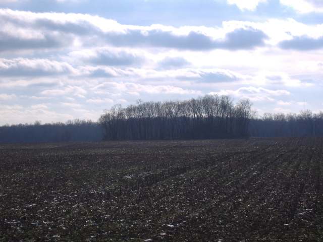
Photo: Aesopposea, via Wikimedia Commons, CC BY-SA 3.0 · Wikimedia Commons
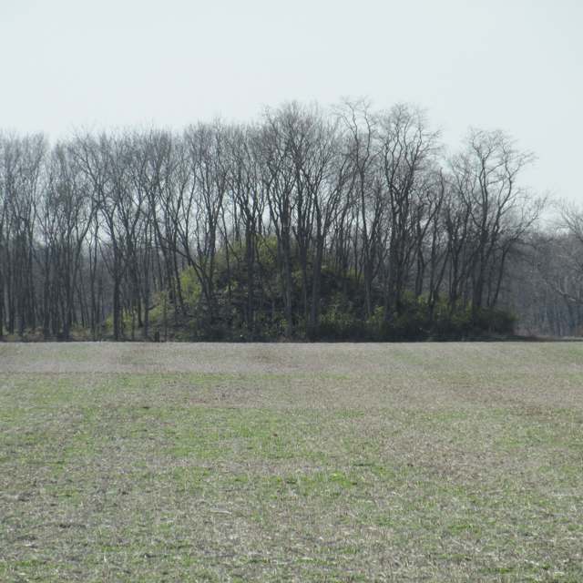
Photo: Aesopposea, via Wikimedia Commons, CC BY-SA 3.0 · Wikimedia Commons
Local history sources: archive.org · archive.org · en.wikipedia.org · en.wikipedia.org · en.wikipedia.org · en.wikipedia.org · commons.wikimedia.org · commons.wikimedia.org
Water
Sand-and-gravel wells in the Scioto River valley aquifer at the city's Island Road well field/treatment plant site, just east of the river. The water here
- Circleville City83% of residentsScioto River valley aquifer (sand & gravel wells)
- Earnhart Hill Water District13% of residentsScioto River valley (Teays) aquifer wells
- Williamsport Village3% of residentsGroundwater wells (2 wells)
- Darbyville Village0% of residentsGroundwater wells (3 wells)
- South Bloomfield Village0% of residentsGroundwater wells (3 wells)
- Ross County Water Co. Inc0% of residentsTeays Valley Aquifer (buried valley groundwater)
Hospitals, fire stations and more
Inside Jackson Township, Pickaway County's boundary: 4 shale and injection wells and 4 spill cases. Press a pin or a name for its whole record and its source.
Shale and injection wells (4)
-
Bj 78 Company(Swiw#7) 4 InjectionInjection well (Class II)
- What it is
- Injection well (Class II)
- Operator
- Hocking Hills Energy and Well Service Llc
- County
- Pickaway County
- API well number
- 34129201940000
- Coordinates
- 39.62355, -83.03082
ODNR oil and gas wells (source) ↗ Street map and directions ↗
-
Bj-78 (Erp #1) 6 InjectionInjection well (Class II)
- What it is
- Injection well (Class II)
- Operator
- Hocking Hills Energy and Well Service Llc
- County
- Pickaway County
- API well number
- 34129202420000
- Coordinates
- 39.62237, -83.03941
ODNR oil and gas wells (source) ↗ Street map and directions ↗
-
Bj-78 (Swiw #9) 1 InjectionInjection well (Class II)
- What it is
- Injection well (Class II)
- Operator
- Hocking Hills Energy and Well Service Llc
- County
- Pickaway County
- API well number
- 34129201050000
- Coordinates
- 39.61586, -83.04309
ODNR oil and gas wells (source) ↗ Street map and directions ↗
-
Warner-Justus Unit {Swiw #4} 1 InjectionInjection well (Class II)
- What it is
- Injection well (Class II)
- Operator
- Layline Oil and Gas Llc
- County
- Pickaway County
- API well number
- 34129201250000
- Coordinates
- 39.63853, -82.97421
ODNR oil and gas wells (source) ↗ Street map and directions ↗
Source: ODNR Division of Oil and Gas Resources well inventory (September 2026): drilled Utica, Marcellus and horizontal wells and Class II injection wells not plugged. Older vertical wells are on the full map.
Spills reported since 2021 (4)
-
Fat(S) / Oil / Grease / Tallow Food Types (Fog)2025-02-17 · Jackson Twp
- Reported
- 2025-02-17
- What spilled
- Fat(S) / Oil / Grease / Tallow Food Types (Fog)
- Largest amount reported
- 3,600 gallons
- Where
- Jackson Twp, Pickaway County
- Ohio EPA district office
- CDO
- Ohio EPA case number
- 2502EPA0000220
Ohio EPA spill reports (source) ↗ Street map and directions ↗
-
Fuel Diesel / Diesel Fuel (Vehicle On Or Off Road)2023-08-29 · Jackson Twp
- Reported
- 2023-08-29
- What spilled
- Fuel Diesel / Diesel Fuel (Vehicle On Or Off Road)
- Largest amount reported
- 25 gallons
- Where
- Jackson Twp, Pickaway County
- Ohio EPA district office
- CDO
- Ohio EPA case number
- 2308EPA0001525
Ohio EPA spill reports (source) ↗ Street map and directions ↗
-
Other / All Other / Trade Name / Mixture / Solution Etc2026-03-28 · Jackson Twp
- Reported
- 2026-03-28
- What spilled
- Other / All Other / Trade Name / Mixture / Solution Etc
- Where
- Jackson Twp, Pickaway County
- Ohio EPA district office
- CDO
- Ohio EPA case number
- 2603EPA0000508
Ohio EPA spill reports (source) ↗ Street map and directions ↗
-
Oil Petroleum Not Otherwise Specified (Nos)2026-03-23 · Jackson Twp
- Reported
- 2026-03-23
- What spilled
- Oil Petroleum Not Otherwise Specified (Nos)
- Where
- Jackson Twp, Pickaway County
- Ohio EPA district office
- CDO
- Ohio EPA case number
- 2603EPA0000464
Ohio EPA spill reports (source) ↗ Street map and directions ↗
Source: Ohio EPA emergency response spill reports, 2021 to September 2026, one point per case where Ohio EPA placed it. A report is what the caller or responder recorded; amounts are often blank or estimated.
Its ZIP codes
Each ZIP code that touches Jackson Township, Pickaway County, with the share of its residents who live here and the same headline figures as the ZIP page.
| ZIP | Share | Water | Radon | Home value | Schools | Flood |
|---|---|---|---|---|---|---|
| 43113 Circleville | 4% | Sand-and-gravel wells in the Scioto River valley aquifer at the city's Island Road well field/treatment plant site, just east of the river. | 8.0 pCi/L average radon | Median year built 1967 | Circleville City · 3 stars overall | 7.0% of residents in the 1% floodplain |
| 43164 Williamsport | 2% | Mostly private wells | 2.5 pCi/L average radon | Median year built 1964 | Westfall Local · 3 stars overall | 6.2% of residents in the 1% floodplain |
Local government
Who holds office in Jackson Township, Pickaway County, how its elections and ballot issues came out, and the state auditor's record.
Elections for office
| Date | Office | Candidates and votes |
|---|---|---|
| 2023-11-07 | Township Trustee | David Dresbach 165, 38.55%; Steve Garner 263, 61.45% |
| 2017-11-07 | Township Trustee | Ian M., Fausnaugh 213, 40.11%; Kevin R. Steward 103, 19.4%; L. Jay Welsh 215, 40.49% |
| 2017-11-07 | Township Trustee | Ian M. Fausnaugh 213, 40.11%; Kevin R. Steward 103, 19.4%; L. Jay Welsh 215, 40.49% |
Winners in bold. Results from the county board of elections' official canvass unless marked.
Auditor of State record
- No fiscal caution, watch or emergency on the Auditor of State's lists.
- Financial Audit, 2023 to 2024, released 2026-04-14
The county
Pickaway County: 8 ZIP codes, 22 cities, villages and townships, 56,176 people.
Nearby places
Quick answers
What county is Jackson Township, Ohio in?
Jackson Township, Pickaway County is a township in Pickaway County, Ohio, with 1,098 residents.
When was Jackson Township, Ohio founded?
Jackson Township, Pickaway County was settled 1798. Founders on record: organized after 1810 from part of Scioto township's territory; exact date not recorded. Source
What ZIP code is Jackson Township, Ohio?
Jackson Township, Pickaway County is served by ZIP codes 43113 and 43164; 43113 holds the largest share of its residents.
Where does Jackson Township, Ohio get its water?
The main water source for Jackson Township, Pickaway County (Circleville City): Sand-and-gravel wells in the Scioto River valley aquifer at the city's Island Road well field/treatment plant site, just east of the river.
Cite this page
Cite this page as:
Cracked Buckeye, "Jackson Township, Pickaway County", https://crackedbuckeye.com/place/jackson-township-pickaway-county/, built 2026-10-31, accessed [date].
How to cite · Report a correction · Built 2026-10-31