Local events in Muhlenberg Township, Pickaway County
6 events in the next 90 days from 2 public calendars. All local events in Muhlenberg Township, Pickaway County
Checked October 20; the events page is refreshed daily.
How Muhlenberg Township, Pickaway County began
Muhlenberg Township, the Scioto bottoms south and west of Circleville along Darby Creek, was cut out of Jackson, Scioto, Darby, and Monroe townships on December 8, 1830, and named for Francis Muhlenberg, youngest son of the Revolutionary War general and Episcopal minister Peter Muhlenberg, who had inherited part of his father's Virginia Military District land grant here and settled among the earlier pioneers in 1820. The land was surveyed around 1796 as bounty land for Virginia's Revolutionary veterans, and its first white settlers arrived from about 1805, taking up ground already used by Shawnee bands who returned every spring for years afterward to make maple sugar along the creek. For decades it was a stock-raising country, its farmers fattening cattle bought as far off as Kentucky and driving them east to Philadelphia and New York; today it is quiet farmland built around its only village, Darbyville.
Settled 1805-1807 (John Rush's family by 1805; Isaac Van Meter and Judge William Florence in 1806-1807), incorporated December 8, 1830, erected from parts of Jackson, Scioto, Darby, and Monroe townships; boundary revised March 10, 1851, by Pickaway County Commissioners, on petition.
Where the name comes from
The township was named for Francis Muhlenberg, youngest son of Gen. Peter Muhlenberg, who came into possession of part of his father's roughly 1,700-acre share of the Virginia Military District lands here and settled among the family of Judge William Florence in 1820. He married Mary Denny and died childless about two years later. A Democrat by conviction but well liked across party lines, he was elected to the Ohio legislature in 1823 on the Whig ticket and to Congress in 1825 or 1826, serving one term. His father, General Peter Muhlenberg, had been an Episcopal minister before the Revolutionary War; both county histories repeat the story that he preached a farewell sermon in full clerical robes one Sunday, then threw them off to reveal a colonel's uniform underneath and called on the men of his own congregation to enlist.
Before the town
The 1880 and 1906 county histories agree that this stretch of the Darby Creek valley was Shawnee country, occupied by small resident bands at the time of the earliest white settlement. Even after settlers arrived, Shawnee families kept returning every spring for years to make maple sugar in the township, moving on toward the Sandusky River and Lake Erie each autumn. A large burying ground stood on the creek's east bank a short distance above the site of Darbyville, behind the old camp of the band led by a chief named Darby, for whom Darby Creek itself is said to be named; two more camps stood nearby, one near the old toll-gate south of Darbyville and another farther down the creek near the township line. The record includes both a violent and a gentle story from this contact: an 1805 knife duel between two Shawnee men just below Darbyville, one of them known as "Old Pounder," and a schoolhouse visit in which a Shawnee man handed over his knife and tomahawk before entering, badly frightening the children, then later called at a settler's cabin only to ask for bread, saying "No hog, no hog" when offered meat. No mound or earthwork within the township's own borders is described in detail in the sources consulted, beyond two small, unnamed mounds noted near Darby Creek in the county's general survey of ancient works.
Nations recorded here: Shawnee.
- Burying ground and camp of Chief Darby's band (burial) — east bank of Darby Creek, a short distance above Darbyville, occupied into the early 1800s; sugar-camp visits continued for years after white settlement (archive.org)
- Indian camp near the old toll-gate (camp) — on Darby Creek, south of Darbyville, early 1800s (archive.org)
- Indian camp near the township line (camp) — farther down Darby Creek from Darbyville, near the Muhlenberg township line, early 1800s (archive.org)
- Two small mounds (mound) — northern part of the township, one on each side of Darby Creek, about a mile apart, prehistoric, culture not stated (archive.org)
Timeline
- — The Virginia Military District lands west of the Scioto River, including the future township, are surveyed as bounty land for Revolutionary War veterans; Gen. Peter Muhlenberg is allotted roughly 1,700 acres here.
- — An Indian duel with knives, fought between two Shawnee men just below the future site of Darbyville, ends in the death of the man known as "Old Pounder."
- — Judge William Florence arrives from Virginia and settles on part of the Muhlenberg tract; he goes on to become one of Pickaway County's first three commissioners and a state legislator.
- — Isaac Van Meter arrives from near Chillicothe and purchases 1,200 acres, part of which is later farmed by Elias Florence.
- — William Hill arrives from Hampshire County, Virginia, with his wife and eight children, along with his brothers Leroy and Robert Hill and about twenty-five others from the same Virginia neighborhood.
- — Francis Muhlenberg, youngest son of Gen. Peter Muhlenberg, settles in the township that will bear his name, living for a time with Judge Florence's family.
- — Darbyville is platted on July 27 on land patented by Cornelius Baldwin, surveyed for George Hill and David Thomas by Joel Walker.
- — Muhlenberg Township is formally erected from parts of Jackson, Scioto, Darby, and Monroe townships; the first election of township officers likely follows in the spring of 1831.
- — The township's southeast boundary is redrawn to place the widow Van Meter's land in Jackson township instead.
- — A township house is built on Darbyville's main street for $1,200, its lower floor built by the township and corporation and its upper floor jointly by the Good Templars and the Good Samaritan Grange.
Stories
The Preacher Who Became a Colonel
Gen. Peter Muhlenberg, for whose youngest son this township is named, was an ordained Episcopal minister in Woodstock, Virginia, when the Revolutionary War broke out. According to the story both Pickaway County histories repeat, he climbed into his pulpit one Sunday in his full clerical robes and preached an effective farewell sermon to his congregation. Then, before their eyes, he threw off the robes to reveal the uniform of a Continental Army colonel underneath, and called on the men of his own congregation to enlist and fight for their country. He went on to become a general in the Continental Army; his youngest son Francis later inherited a share of his Virginia Military District land grant on Darby Creek, settled there in 1820, and gave the township his family's name, though he himself left no children when he died just two years after marrying.
Old Pounder's Duel
In 1805, at a Shawnee camp just below the future site of Darbyville, a man known to the settlers only as "Old Pounder" quarreled with another Indian man whose name was never recorded. Their code of honor, the county history says, allowed no way of settling the injury but blood, and Pounder seems to have known how the fight would end: he asked and received a promise beforehand that he would be given a proper burial. He and the other man fought with knives, and Pounder was killed. He was buried not far from the creek bank. The following winter or spring, a boy named Elias Florence, later a colonel and congressman, was out hunting rabbits nearby with a companion when they stumbled on Pounder's exposed remains; frightened, they ran and told Judge William Florence, who returned with the boys and a hired man to bury the body a second time.
A Settler's Bear Fight on the Prairie
Around 1836 a settler named Thomas Roberts, who lived near Georgesville in Franklin County but farmed land on the upper Darby, was riding across one of the township's open prairies below the settlement when he came across a large bear armed with nothing but a tomahawk and a knife. Rather than let it go, Roberts decided, in the county history's words, to "have some sport," and chased the bear on horseback through the tall grass until it tired, heading it off again and again until he had driven it toward home. When he got close enough, he called his bear dog, which charged in and seized the bear in a furious fight. Roberts could not stand by and watch his dog be torn apart; he jumped down and struck at the bear with his tomahawk, which was immediately knocked from his hand, leaving him to finish the animal with a single knife thrust to the heart just before it could kill him. The dog survived its injuries and, the history notes approvingly, was cared for afterward "as such a faithful creature should be."
Photographs
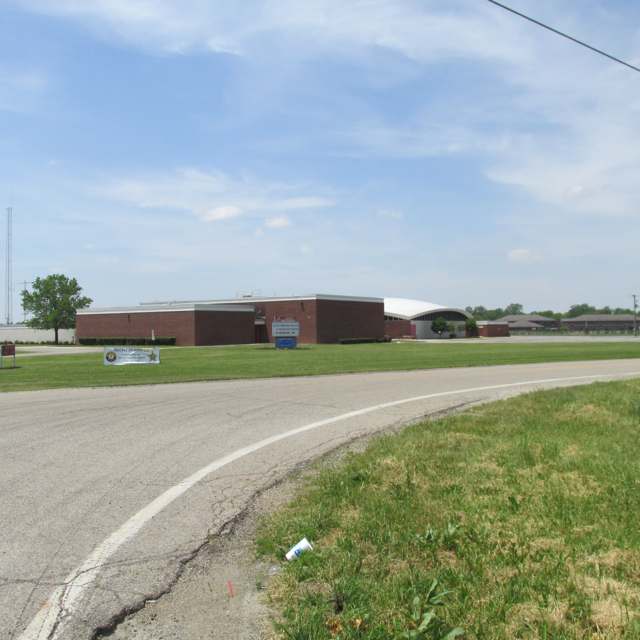
Photo: Aesopposea, via Wikimedia Commons, CC BY-SA 3.0 · Wikimedia Commons
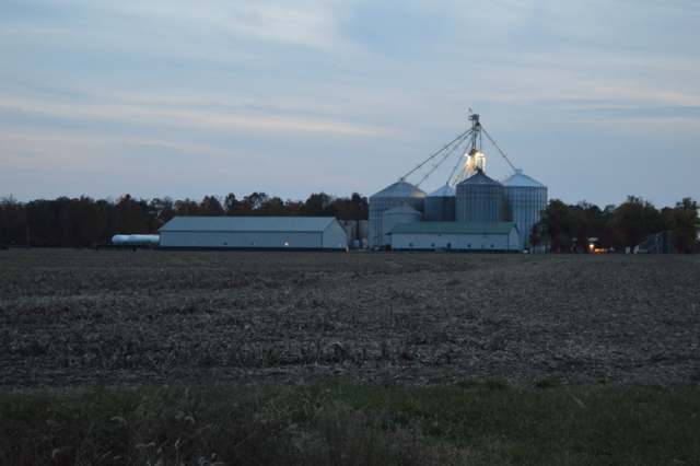
Photo: Nyttend, via Wikimedia Commons, public domain · Wikimedia Commons
Local history sources: archive.org · archive.org · en.wikipedia.org · en.wikipedia.org · commons.wikimedia.org · commons.wikimedia.org
Water
Mostly private wells The water here
- Circleville City65% of residentsScioto River valley aquifer (sand & gravel wells)
- Williamsport Village13% of residentsGroundwater wells (2 wells)
- Earnhart Hill Water District10% of residentsScioto River valley (Teays) aquifer wells
- Commercial Point Village4% of residentsGroundwater wells (6 wells)
- Darbyville Village3% of residentsGroundwater wells (3 wells)
- Village of Orient3% of residentsGroundwater wells (7 wells)
- Columbus Public Water System1% of residentsScioto River (Griggs & O'Shaughnessy), Hoover Reservoir on Big Walnut Ck, plus wells
- Johnson Mobile Home Park1% of residentsGroundwater wells (2 wells)
- Timberlake Water System0% of residentsGroundwater wells (2 wells)
- South Bloomfield Village0% of residentsGroundwater wells (3 wells)
- Ross County Water Co. Inc0% of residentsTeays Valley Aquifer (buried valley groundwater)
Hospitals, fire stations and more
Inside Muhlenberg Township, Pickaway County's boundary: 3 public schools. Press a pin or a name for its whole record and its source.
Public schools (3)
-
Westfall Elementary School4 of 5 stars · Williamsport
- Address
- 9391 State Route 56, Williamsport, OH 43164
- School district
- Westfall Local School District
- Kind (NCES)
- Regular School
- Students, 2023-24
- 627
- Teachers (full-time equivalent)
- 26
- Report card, 2025-26
- 4 of 5 stars
- Performance index
- 79.6%
- Ohio building IRN
- 146209
- NCES school ID
- 390491004650
NCES school record ↗ Ohio School Report Card ↗ Street map and directions ↗
-
Westfall High School2.5 of 5 stars · Williamsport
- Address
- 19463 Pherson Pike, Williamsport, OH 43164
- School district
- Westfall Local School District
- Kind (NCES)
- Regular School
- Students, 2023-24
- 421
- Teachers (full-time equivalent)
- 16
- Report card, 2025-26
- 2.5 of 5 stars
- Performance index
- 70.4%
- Four-year graduation rate
- 88.5%
- Ohio building IRN
- 040683
- NCES school ID
- 390491003496
NCES school record ↗ Ohio School Report Card ↗ Street map and directions ↗
-
Westfall Middle School3 of 5 stars · Williamsport
- Address
- 19545 Pherson Pike, Williamsport, OH 43164
- School district
- Westfall Local School District
- Kind (NCES)
- Regular School
- Students, 2023-24
- 324
- Teachers (full-time equivalent)
- 13
- Report card, 2025-26
- 3 of 5 stars
- Performance index
- 71.8%
- Ohio building IRN
- 064196
- NCES school ID
- 390491003497
NCES school record ↗ Ohio School Report Card ↗ Street map and directions ↗
Source: NCES EDGE public school locations 2024-25 and Common Core of Data 2023-24 (type, students, teachers); Ohio School Report Cards 2025-26 (Department of Education and Workforce), matched by name within the district.
Its ZIP codes
Each ZIP code that touches Muhlenberg Township, Pickaway County, with the share of its residents who live here and the same headline figures as the ZIP page.
| ZIP | Share | Water | Radon | Home value | Schools | Flood |
|---|---|---|---|---|---|---|
| 43164 Williamsport | 3% | Mostly private wells | 2.5 pCi/L average radon | Median year built 1964 | Westfall Local · 3 stars overall | 6.2% of residents in the 1% floodplain |
| 43146 Scioto Township and Orient | 2% | Mostly private wells | 8.0 pCi/L average radon | Median year built 1988 | Teays Valley Local · 4 stars overall | 1.4% of residents in the 1% floodplain |
| 43113 Circleville | 1% | Sand-and-gravel wells in the Scioto River valley aquifer at the city's Island Road well field/treatment plant site, just east of the river. | 8.0 pCi/L average radon | Median year built 1967 | Circleville City · 3 stars overall | 7.0% of residents in the 1% floodplain |
Local government
Who holds office in Muhlenberg Township, Pickaway County, how its elections and ballot issues came out, and the state auditor's record.
Elections for office
| Date | Office | Candidates and votes |
|---|---|---|
| 2017-11-07 | Township Trustee | R. Stan Summers 144, 51.06%; Jeffrey S. Wippel 138, 48.94% |
| 2017-11-07 | Township Trustee | R. Stan Summers 144, 51.06%; ffrey S. Wippel 138, 48.94% |
Winners in bold. Results from the county board of elections' official canvass unless marked.
Auditor of State record
- No fiscal caution, watch or emergency on the Auditor of State's lists.
- Agreed Upon Procedures, 2023 to 2024, released 2026-01-06
The county
Pickaway County: 8 ZIP codes, 22 cities, villages and townships, 56,176 people.
Nearby places
Quick answers
What county is Muhlenberg Township, Ohio in?
Muhlenberg Township, Pickaway County is a township in Pickaway County, Ohio, with 627 residents.
When was Muhlenberg Township, Ohio founded?
Muhlenberg Township, Pickaway County was settled 1805-1807 (John Rush's family by 1805; Isaac Van Meter and Judge William Florence in 1806-1807); incorporated December 8, 1830, erected from parts of Jackson, Scioto, Darby, and Monroe townships; boundary revised March 10, 1851. Founders on record: Pickaway County Commissioners, on petition. Source
How did Muhlenberg Township, Ohio get its name?
The township was named for Francis Muhlenberg, youngest son of Gen. Source
What ZIP code is Muhlenberg Township, Ohio?
Muhlenberg Township, Pickaway County is served by ZIP codes 43164 and 43146; 43164 holds the largest share of its residents.
Where does Muhlenberg Township, Ohio get its water?
The main water source for Muhlenberg Township, Pickaway County (Circleville City): Mostly private wells.
Cite this page
Cite this page as:
Cracked Buckeye, "Muhlenberg Township, Pickaway County", https://crackedbuckeye.com/place/muhlenberg-township-pickaway-county/, built 2026-10-31, accessed [date].
How to cite · Report a correction · Built 2026-10-31
