Garfield Heights
City · Cuyahoga County · 29,807 residents · 2% municipal income tax
Local events in Garfield Heights
67 events in the next 90 days from 4 public calendars. All local events in Garfield Heights
Checked October 20; the events page is refreshed daily.
How Garfield Heights began
Garfield Heights grew out of Newburgh Township, with settlement beginning around 1786; the Village of South Newburgh incorporated in 1907, renamed itself Garfield Heights Village in 1919 for nearby Garfield Park (honoring President James A. Garfield, a native of neighboring Orange Township), and became a city in 1930 once its population passed 5,000. The Sisters of St. Joseph of the Third Order of St. Francis, who had come to Ohio from Wisconsin in 1908, built a provincial convent here in 1926 and went on to found Marymount Hospital in 1949. Garfield Heights grew rapidly through the mid-20th century -- from 2,530 residents in 1920 to 15,589 by 1930 alone -- and is today a Cleveland suburb of about 30,000.
Settled 1786 (Newburgh Township), incorporated 1907 (Village of South Newburgh); 1919 (renamed Garfield Heights Village); 1930 (city), by Early Newburgh Township settlers; renamed for Garfield Park.
Where the name comes from
The city is named for Garfield Park, itself named for President James A. Garfield, who was born in neighboring Orange Township, Cuyahoga County, in 1831. The community was originally the Village of South Newburgh (incorporated 1907) before adopting the Garfield Heights name in 1919.
Before the town
No source we reviewed names a specific Native American village, trail or burial site within present Garfield Heights. The area lies within the Connecticut Western Reserve, secured for settlement by the 1785 Treaty of Fort McIntosh and the 1795 Treaty of Greenville.
Timeline
- — Settlement begins in the area that becomes Newburgh Township and, later, Garfield Heights.
- — The Village of South Newburgh incorporates.
- — The Sisters of St. Joseph of the Third Order of St. Francis arrive in Ohio from their motherhouse in Stevens Point, Wisconsin.
- — South Newburgh renames itself Garfield Heights Village, after nearby Garfield Park.
- — Garfield Heights' population is 2,530.
- — The Sisters of St. Joseph establish a provincial convent, St. Joseph Convent, in Garfield Heights.
- — Garfield Heights incorporates as a city after its population reaches 15,589, more than six times its 1920 figure.
- — Facing a shortage of hospital beds in the area, the Sisters of St. Joseph join a group of physicians to plan a new hospital.
- — Marymount Hospital opens in Garfield Heights as a 125-bed acute-care facility.
Stories
The sisters who built a hospital out of a convent
The Sisters of St. Joseph of the Third Order of St. Francis came to Ohio in 1908 from their motherhouse in Stevens Point, Wisconsin, and by 1926 had built a provincial convent in what was then still called Garfield Heights Village -- its Rose Lane grounds popular enough to be reproduced on postcards for years afterward. By 1939 the sisters had turned their attention to a more urgent local need: a shortage of hospital beds and emergency care in the growing suburb. Working with a group of local physicians -- Warren Chase, Chester Jablonski and Edmund Lewandowski among them -- and under Mother Mary Theobold, they planned a new hospital that finally opened in October 1949 as a 125-bed facility: Marymount Hospital, built on land next to the convent that had started it all, and still sponsored by the same order of sisters generations later.
Photographs
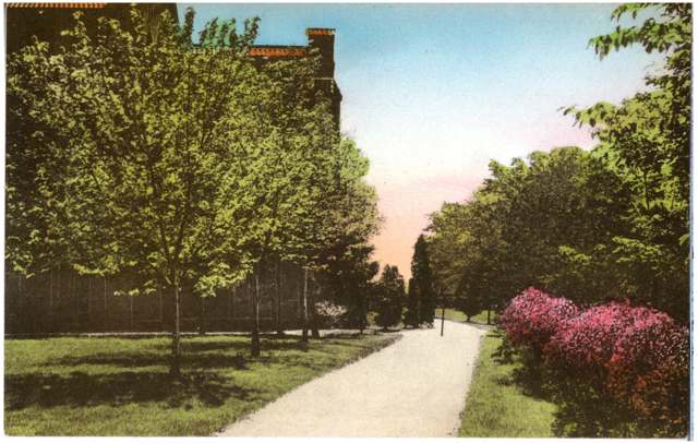
Photo: The Albertype Co., via Columbus Metropolitan Library and Digital Public Library of America, no known copyright restrictions · Wikimedia Commons
Local history sources: en.wikipedia.org · en.wikipedia.org · commons.wikimedia.org
Water
The Five Mile Crib, a small structure about 5 miles out in Lake Erie north of Cleveland's Edgewater Park The water here
- Cleveland Public Water System100% of residentsLake Erie
Hospitals, fire stations and more
Inside Garfield Heights's boundary: 1 hospital, 3 dialysis centers, 1 nursing home, 2 fire and EMS stations, 8 public schools, 2 private schools, 3 poor-rated bridges, 1 library, 1 museum, 1 police station, 1 public charging site, 2 Superfund sites, 7 Toxics Release Inventory facilities and 10 spill cases. Press a pin or a name for its whole record and its source.
Hospitals (1)
-
Marymount HospitalGeneral hospital · Garfield Heights
- What it is
- General hospital
- Address
- 12300 Mccracken Road, Garfield Heights, OH 44125
- County
- Cuyahoga County
- Beds
- 269
- Helipad
- Yes
- Ownership
- Non-profit
- Medicare overall rating
- 5 of 5 stars
- Emergency department (Medicare)
- Yes
- Phone
- (216) 581-0500
- Medicare ID
- 360143
Medicare Care Compare ↗ Hospital's website ↗ Where HIFLD got this record ↗ HIFLD hospitals (source) ↗ Street map and directions ↗
Source: HIFLD hospitals inventory via FEMA (closed hospitals it still lists left out, hospitals opened since added), with Medicare Care Compare ratings matched by name and address.
Dialysis centers (3)
-
Center For Dialysis Care, GarfieldDialysis · Garfield Heights
- Address
- 5595 Transportation Blvd., Suite 110, Garfield Heights, OH 44125
- Dialysis stations
- 15
- Medicare star rating
- 1 of 5 stars
- Services
- in-center hemodialysis
- Ownership
- for profit
- Chain
- Centers for Dialysis Care
- Medicare certified since
- 2005-07-13
- Phone
- (216) 581-0801
- Medicare ID
- 362678
Medicare Care Compare ↗ CMS dialysis facility list (source) ↗ Street map and directions ↗
-
Fmc Cleveland Home DialysisDialysis · Garfield Heights
- Address
- 9729 Granger Road, Garfield Heights, OH 44125
- Dialysis stations
- 4
- Medicare star rating
- 3 of 5 stars
- Services
- peritoneal dialysis, home hemodialysis training
- Ownership
- for profit
- Chain
- Fresenius Medical Care
- Medicare certified since
- 2014-07-29
- Phone
- (216) 438-7325
- Medicare ID
- 362814
Medicare Care Compare ↗ CMS dialysis facility list (source) ↗ Street map and directions ↗
-
Fresenius Kidney Care MarymountDialysis · Garfield Heights
- Address
- 12532 Rockside Road, Garfield Heights, OH 44125
- Dialysis stations
- 17
- Medicare star rating
- 3 of 5 stars
- Services
- in-center hemodialysis
- Ownership
- for profit
- Chain
- Fresenius Medical Care
- Medicare certified since
- 2021-10-14
- Phone
- (216) 332-5005
- Medicare ID
- 722500
Medicare Care Compare ↗ CMS dialysis facility list (source) ↗ Street map and directions ↗
Source: CMS dialysis facility list, September 2026, geocoded with the Census Bureau batch geocoder (an address it could not place sits at its ZIP center).
Nursing homes (1)
-
Jennings Hall3 of 5 stars · Garfield Heights
- Address
- 10204 Granger Road, Garfield Heights, OH 44125
- Certified beds
- 156
- Residents on an average day
- 160
- Medicare overall rating
- 3 of 5 stars
- Health inspections
- 3 of 5 stars
- Staffing
- 2 of 5 stars
- Quality measures
- 3 of 5 stars
- Penalties since 2023
- none
- Ownership
- Non profit - Corporation
- Continuing care retirement community
- Yes
- Takes
- Medicare and Medicaid
- Phone
- (216) 581-2900
- Medicare ID
- 366045
Medicare Care Compare ↗ CMS nursing home data (source) ↗ Street map and directions ↗
Source: CMS Care Compare nursing home provider and penalties files; Medicare star ratings run 1 to 5.
Fire and EMS stations (2)
-
Garfield Heights Fire Department Station 1Garfield Heights
- Address
- 5115 Turney Road, Garfield Heights, OH 44125
- Coordinates
- 41.42194, -81.60906
USGS National Map structures (source) ↗ Street map and directions ↗
-
Garfield Heights Fire Station 2Garfield Heights
- Address
- 4585 East 131st Street, Garfield Heights, OH 44105
- Coordinates
- 41.43494, -81.59197
USGS National Map structures (source) ↗ Street map and directions ↗
Source: USGS National Map structures (most Ohio records last updated 2019 to 2022), checked against the Columbus and Cleveland station lists. The department that answers a call is set by jurisdiction and mutual aid, not by distance.
Public schools (8)
-
Elmwood Elementary School2 of 5 stars · Garfield Heights
- Address
- 5275 Turney Rd, Garfield Heights, OH 44125
- School district
- Garfield Heights City School District
- Kind (NCES)
- Regular School
- Students, 2023-24
- 351
- Teachers (full-time equivalent)
- 19
- Report card, 2025-26
- 2 of 5 stars
- Performance index
- 55.9%
- Ohio building IRN
- 010413
- NCES school ID
- 390440400993
NCES school record ↗ Ohio School Report Card ↗ Street map and directions ↗
-
Garfield Heights High School3 of 5 stars · Garfield Heights
- Address
- 4900 Turney Rd, Garfield Heights, OH 44125
- School district
- Garfield Heights City School District
- Kind (NCES)
- Regular School
- Students, 2023-24
- 1,084
- Teachers (full-time equivalent)
- 58
- Report card, 2025-26
- 3 of 5 stars
- Performance index
- 55.5%
- Four-year graduation rate
- 92.3%
- Ohio building IRN
- 013136
- NCES school ID
- 390440400994
NCES school record ↗ Ohio School Report Card ↗ Street map and directions ↗
-
Garfield Heights Middle School2 of 5 stars · Garfield Heights
- Address
- 12000 Maple Leaf Dr, Garfield Heights, OH 44125
- School district
- Garfield Heights City School District
- Kind (NCES)
- Regular School
- Students, 2023-24
- 656
- Teachers (full-time equivalent)
- 42
- Report card, 2025-26
- 2 of 5 stars
- Performance index
- 43.9%
- Ohio building IRN
- 013144
- NCES school ID
- 390440400995
NCES school record ↗ Ohio School Report Card ↗ Street map and directions ↗
-
Maple Leaf Elementary School2.5 of 5 stars · Garfield Heights
- Address
- 5764 Turney Rd, Garfield Heights, OH 44125
- School district
- Garfield Heights City School District
- Kind (NCES)
- Regular School
- Students, 2023-24
- 384
- Teachers (full-time equivalent)
- 24
- Report card, 2025-26
- 2.5 of 5 stars
- Performance index
- 56.4%
- Ohio building IRN
- 022574
- NCES school ID
- 390440400580
NCES school record ↗ Ohio School Report Card ↗ Street map and directions ↗
-
North Shore High SchoolGarfield Heights
- Address
- 4744 Turney Rd, Garfield Heights, OH 44125
- Kind (NCES)
- Regular School
- Students, 2023-24
- 236
- Teachers (full-time equivalent)
- 7
- NCES school ID
- 390162506025
-
SMART AcademyGarfield Heights
- Address
- 4351 E 131st St, Garfield Heights, OH 44105
- Kind (NCES)
- Regular School
- Students, 2023-24
- 83
- Teachers (full-time equivalent)
- 9
- NCES school ID
- 390160005964
-
The Brilliance SchoolGarfield Heights
- Address
- 10608 Penfield Ave, Garfield Heights, OH 44125
- Kind (NCES)
- Regular School
- Students, 2023-24
- 219
- Teachers (full-time equivalent)
- 13
- NCES school ID
- 390147305721
-
William Foster Elementary School1 of 5 stars · Garfield Heights
- Address
- 12801 Bangor Ave, Garfield Heights, OH 44125
- School district
- Garfield Heights City School District
- Kind (NCES)
- Regular School
- Students, 2023-24
- 445
- Teachers (full-time equivalent)
- 28
- Report card, 2025-26
- 1 of 5 stars
- Ohio building IRN
- 041335
- NCES school ID
- 390440400999
NCES school record ↗ Ohio School Report Card ↗ Street map and directions ↗
Source: NCES EDGE public school locations 2024-25 and Common Core of Data 2023-24 (type, students, teachers); Ohio School Report Cards 2025-26 (Department of Education and Workforce), matched by name within the district.
Private schools (2)
-
St Benedict Catholic SchoolPrivate, Catholic · Garfield Heights
- Address
- 13633 Rockside Rd, Garfield Heights, OH 44125
- Kind
- Catholic
- Students, 2023-24
- 421
- Teachers (full-time equivalent)
- 22
- Students per teacher
- 19.1364
- Phone
- (216) 662-9380
- NCES private school ID
- A1903483
-
Trinity High SchoolPrivate, Catholic · Garfield Heights
- Address
- 12425 Granger Rd, Garfield Heights, OH 44125
- Kind
- Catholic
- Students, 2023-24
- 377
- Teachers (full-time equivalent)
- 35
- Students per teacher
- 10.7714
- Phone
- (216) 581-5759
- NCES private school ID
- 01057544
Source: NCES Private School Survey 2023-24.
Bridges rated poor (3)
-
Garfield Parkway over Mill CreekPoor · built 1929
- Condition
- Poor: a deck, superstructure, substructure or culvert rated 4 or below on the 0 to 9 scale
- What it is
- Culvert
- Built
- 1929
- Length
- 7 ft
- Owner
- Other
- Vehicles a day
- 2,000
- Coordinates
- 41.43097, -81.60155
National Bridge Inventory (source) ↗ Street map and directions ↗
-
Henry St Cr240 over Mill CreekPoor · built 1928
- Condition
- Poor: a deck, superstructure, substructure or culvert rated 4 or below on the 0 to 9 scale
- What it is
- Culvert
- Built
- 1928
- Length
- 8 ft
- Owner
- County
- Vehicles a day
- 110
- Coordinates
- 41.43085, -81.60083
National Bridge Inventory (source) ↗ Street map and directions ↗
-
SR 14 over Nsc W&le Rr @ Henry St.Poor · built 1929
- Condition
- Poor: a deck, superstructure, substructure or culvert rated 4 or below on the 0 to 9 scale
- What it is
- Bridge
- Built
- 1929
- Length
- 414 ft
- Owner
- State
- Vehicles a day
- 12,155
- Coordinates
- 41.43198, -81.60234
National Bridge Inventory (source) ↗ Street map and directions ↗
Source: FHWA National Bridge Inventory 2025. "Poor" means one major part rated 4 or below on the 0 to 9 scale; it calls for repair, not closing, unless the state posts or closes the bridge.
Public libraries (1)
-
Garfield Heights Branch LibraryBranch · Garfield Heights
- Address
- 5409 Turney Road, Garfield Heights, OH 44125
- What it is
- Branch
- Library system
- Cuyahoga County Public Library
- Open
- 3,498 hours a year, 52 weeks
- Building
- 32,625 sq ft
- System's visits, FY2024
- 3,917,784
- System's loans, FY2024
- 11,584,178
- People the system serves
- 626,288
- Phone
- (216) 475-8178
IMLS Public Libraries Survey (source) ↗ Street map and directions ↗
Source: IMLS Public Libraries Survey FY2024 (outlets and their systems). Any Ohio resident can get a free card at any Ohio public library.
Museums, historical societies, gardens and zoos (1)
-
Garfield Heights Historical SocietyHistorical society · Garfield Heights
- What it is
- Historical society
- City
- Garfield Heights
- Coordinates
- 41.41532, -81.60471
Search Wikipedia ↗ IMLS Museum Data Files (source) ↗ Street map and directions ↗
The museum list is IMLS's 2018 file; a museum may have closed or moved since.
Source: IMLS Museum Data Files, 2018.
Police stations (1)
-
Garfield Heights Police DepartmentGarfield Heights
- Address
- 5555 Turney Road, Garfield Heights, OH 44125
- Coordinates
- 41.41150, -81.60145
USGS National Map structures (source) ↗ Street map and directions ↗
Source: USGS National Map structures, police stations, corrected and completed by hand (September 2026). The department that answers a call is set by jurisdiction, not by distance.
Public EV charging (1)
-
McDonald's - Garfield Heights OH1 Level 2 · Garfield Heights
- Address
- 12690 Rockside Road, Garfield Heights, OH 44125
- Ports
- 1 Level 2
- Plugs
- J1772
- Network
- Blink Network
- Hours
- 24 hours daily
- Price
- Free
- Phone
- 888-998-2546
Station Locator (NREL) ↗ Alternative Fuels Data Center (source) ↗ Street map and directions ↗
Source: NREL Alternative Fuels Data Center station list (May 2026), public and open stations, the posts at one address counted as one site.
Superfund sites (2)
-
City View Shopping CenterSuperfund program · Garfield Heights
- Address
- 5298 Transportation Bolevard, Garfield Heights, OH 44125
- County
- Cuyahoga County
- Status
- Superfund program site, not on the National Priorities List
- EPA program ID
- OHN000510306
- EPA registry ID
- 110037286674
EPA facility record ↗ EPA Facility Registry Service (source) ↗ Street map and directions ↗
-
East 102Nd Mercury SpillSuperfund program · Cleveland
- Address
- 4137 E/102Nd Street, Cleveland, OH 44105
- County
- Cuyahoga County
- Status
- Superfund program site, not on the National Priorities List
- EPA program ID
- OHN000510405
- EPA registry ID
- 110040146785
EPA facility record ↗ EPA Facility Registry Service (source) ↗ Street map and directions ↗
Source: EPA Facility Registry Service, Superfund (SEMS) and National Priorities List sites. Many program sites were assessed and needed no cleanup.
Facilities reporting toxic releases (7)
-
Automated Packaging Systems, Inc. - GarfieldToxics Release Inventory · Garfield Heights
- Address
- 13555 Mccracken Road, Garfield Heights, OH 44125
- County
- Cuyahoga County
- Status
- Reports to the Toxics Release Inventory (active)
- EPA program ID
- 44125TMTDP13555
- EPA registry ID
- 110000815164
EPA facility record ↗ EPA Facility Registry Service (source) ↗ Street map and directions ↗
-
Du Pont Cleveland Refinish Service CenterToxics Release Inventory · Garfield Heights
- Address
- 9200 Midwest Ave., Garfield Heights, OH 44125
- County
- Cuyahoga County
- Status
- Reports to the Toxics Release Inventory (active)
- EPA program ID
- 44125DPNTC9200M
- EPA registry ID
- 110012705830
EPA facility record ↗ EPA Facility Registry Service (source) ↗ Street map and directions ↗
-
Garfield Alloys IncToxics Release Inventory · Garfield Heights
- Address
- 4878 Chaincraft Rd., Garfield Heights, OH 44125
- County
- Cuyahoga County
- Status
- Reports to the Toxics Release Inventory (active)
- EPA program ID
- 44125GRFLD4878C
- EPA registry ID
- 110000387368
EPA facility record ↗ EPA Facility Registry Service (source) ↗ Street map and directions ↗
-
Garfield Alloys Inc - Dross Processing FacilityToxics Release Inventory · Garfield Heights
- Address
- 12205 Broadway Ave, Garfield Heights, OH 44125
- County
- Cuyahoga County
- Status
- Reports to the Toxics Release Inventory
- EPA program ID
- 44125GRFLD1225B
- EPA registry ID
- 110038166908
EPA facility record ↗ EPA Facility Registry Service (source) ↗ Street map and directions ↗
-
General ChemicalToxics Release Inventory · Garfield Heights
- Address
- 5000 Warner Road, Garfield Heights, OH 44125
- County
- Cuyahoga County
- Status
- Reports to the Toxics Release Inventory (active)
- EPA program ID
- 44125GNRLC5000W
- EPA registry ID
- 110002110956
EPA facility record ↗ EPA Facility Registry Service (source) ↗ Street map and directions ↗
-
Ohio Aluminum Industries Inc.Toxics Release Inventory · Cleveland
- Address
- 4840 Warner Rd., Cleveland, OH 44125
- County
- Cuyahoga County
- Status
- Reports to the Toxics Release Inventory (active)
- EPA program ID
- 44125HLMNM4840W
- EPA registry ID
- 110000387386
EPA facility record ↗ EPA Facility Registry Service (source) ↗ Street map and directions ↗
-
Tomlinson IndustriesToxics Release Inventory · Cleveland
- Address
- 13700 Broadway Ave., Cleveland, OH 44125
- County
- Cuyahoga County
- Status
- Reports to the Toxics Release Inventory (active)
- EPA program ID
- 44125TMLNS13700
- EPA registry ID
- 110000387448
EPA facility record ↗ EPA Facility Registry Service (source) ↗ Street map and directions ↗
Source: EPA Facility Registry Service, Toxics Release Inventory reporters. Reporting a release is required of large users of listed chemicals; it is not by itself a violation.
Spills reported since 2021 (10)
-
Fuel Diesel / Diesel Fuel (Vehicle On Or Off Road)2025-12-31 · Cleveland
- Reported
- 2025-12-31
- What spilled
- Fuel Diesel / Diesel Fuel (Vehicle On Or Off Road)
- Where
- Cleveland, Cuyahoga County
- Ohio EPA district office
- NEDO
- Ohio EPA case number
- 2512EPA0002077
Ohio EPA spill reports (source) ↗ Street map and directions ↗
-
Orphan Drum(S)2025-03-28 · Garfield Heights
- Reported
- 2025-03-28
- What spilled
- Orphan Drum(S)
- Where
- Garfield Heights, Cuyahoga County
- Ohio EPA district office
- NEDO
- Ohio EPA case number
- 2503EPA0000445
Ohio EPA spill reports (source) ↗ Street map and directions ↗
-
Oil Transformer Non Pcb2025-03-28 · Garfield Heights
- Reported
- 2025-03-28
- What spilled
- Oil Transformer Non Pcb
- Largest amount reported
- 80 gallons
- Where
- Garfield Heights, Cuyahoga County
- Ohio EPA district office
- NEDO
- Ohio EPA case number
- 2503EPA0000444
Ohio EPA spill reports (source) ↗ Street map and directions ↗
-
Material Green2024-03-22 · Garfield Heights
- Reported
- 2024-03-22
- What spilled
- Material Green
- Where
- Garfield Heights, Cuyahoga County
- Ohio EPA district office
- NEDO
- Ohio EPA case number
- 2403EPA0000454
Ohio EPA spill reports (source) ↗ Street map and directions ↗
-
Oil Hydraulic Fluid(S) Reached water2023-06-11 · Garfield Heights
- Reported
- 2023-06-11
- What spilled
- Oil Hydraulic Fluid(S)
- Reached a waterway
- 18 - Mill Creek
- Where
- Garfield Heights, Cuyahoga County
- Ohio EPA district office
- NEDO
- Ohio EPA case number
- 2306EPA0000964
Ohio EPA spill reports (source) ↗ Street map and directions ↗
-
Food Grade Product Solid2023-03-20 · Garfield Heights
- Reported
- 2023-03-20
- What spilled
- Food Grade Product Solid
- Where
- Garfield Heights, Cuyahoga County
- Ohio EPA district office
- NEDO
- Ohio EPA case number
- 2303EPA0000404
Ohio EPA spill reports (source) ↗ Street map and directions ↗
-
Fuel Diesel / Diesel Fuel (Vehicle On Or Off Road) Reached water2023-03-13 · Garfield Heights
- Reported
- 2023-03-13
- What spilled
- Fuel Diesel / Diesel Fuel (Vehicle On Or Off Road)
- Reached a waterway
- 18 - Mill Creek
- Where
- Garfield Heights, Cuyahoga County
- Ohio EPA district office
- NEDO
- Ohio EPA case number
- 2303EPA0000380
Ohio EPA spill reports (source) ↗ Street map and directions ↗
-
Fuel Gasoline ( 25% Ethanol Not E85) Reached water2023-02-15 · Garfield Heights
- Reported
- 2023-02-15
- What spilled
- Fuel Gasoline ( 25% Ethanol Not E85)
- Reached a waterway
- 18 - Mill Creek
- Where
- Garfield Heights, Cuyahoga County
- Ohio EPA district office
- NEDO
- Ohio EPA case number
- 2302EPA0000237
Ohio EPA spill reports (source) ↗ Street map and directions ↗
-
Oil Petroleum Not Otherwise Specified (Nos)2026-08-26 · Garfield Heights
- Reported
- 2026-08-26
- What spilled
- Oil Petroleum Not Otherwise Specified (Nos)
- Where
- Garfield Heights, Cuyahoga County
- Ohio EPA district office
- NEDO
- Ohio EPA case number
- 2608EPA0001603
Ohio EPA spill reports (source) ↗ Street map and directions ↗
-
Material Gray Reached water2026-06-02 · Garfield Heights
- Reported
- 2026-06-02
- What spilled
- Material Gray
- Reached a waterway
- 99 - Unnamed
- Where
- Garfield Heights, Cuyahoga County
- Ohio EPA district office
- NEDO
- Ohio EPA case number
- 2606EPA0000964
Ohio EPA spill reports (source) ↗ Street map and directions ↗
Source: Ohio EPA emergency response spill reports, 2021 to September 2026, one point per case where Ohio EPA placed it. A report is what the caller or responder recorded; amounts are often blank or estimated.
Its ZIP codes
Each ZIP code that touches Garfield Heights, with the share of its residents who live here and the same headline figures as the ZIP page.
Local government
Who holds office in Garfield Heights, how its elections and ballot issues came out, and the state auditor's record.
Auditor of State record
- Fiscal emergency: declared 2008-10-14, released 2013-09-19. source
- Financial Health Indicators (the Auditor of State's 17 measures; critical / cautionary / positive): 2020 0 / 3 / 13; 2021 0 / 4 / 12; 2022 3 / 2 / 11; 2023 4 / 6 / 6; 2024 0 / 7 / 9; 2025 0 / 1 / 15.
- Financial Audit, 2021, released 2025-10-14
The county
Cuyahoga County: 52 ZIP codes, 59 cities, villages and townships, 1,270,867 people.
Nearby places
Rain and snow
How much has actually fallen on Garfield Heights, day by day, from 1871 to now. Daily totals, not averages.
- rain, last 30 days
- 1.97 in
- 2026-09-29 to 2026-10-28
- rain so far in 2026
- 34.1 in
- about normal for the date
- snow so far in 2026
- 44.6 in
- a normal year brings 67.3 in
- a normal year
- 40.3 in
- average of 30 years, 1991-2020
| Month | Rain (in) | Snow (in) | Days counted |
|---|---|---|---|
| October 2026 | 1.96 | — | 28 |
| September 2026 | 2.71 | — | 30 |
| August 2026 | 6.89 | — | 31 |
| July 2026 | 2.66 | — | 31 |
| June 2026 | 2.92 | — | 30 |
| May 2026 | 4.03 | — | 31 |
| April 2026 | 6.21 | 0.1 | 30 |
| March 2026 | 3.50 | 2.0 | 31 |
| February 2026 | 0.77 | 8.2 | 28 |
| January 2026 | 2.44 | 34.4 | 31 |
| December 2025 | 2.79 | 16.1 | 31 |
| November 2025 | 2.42 | 9.8 | 30 |
| Wettest year | 2011 — 63.8 in |
|---|---|
| Driest year | 1963 — 18.7 in |
| Snowiest year | 2005 — 108.5 in |
| Wettest day on record | 7 September 1996 — 4.59 in |
| Heaviest snowfall in a day | 10 November 1913 — 14.72 in |
| Deepest snow on the ground | 24 February 1993 — 20.98 in |
Mostly estimated. Only 4% of these days come from a gauge standing inside Garfield Heights - the rest are worked out from the nearest gauges around it, so read them as close estimates rather than readings.
56,914 days of records, 1871-01-01 to 2026-10-28. Source: NOAA NCEI GHCN-Daily, 3,240 gauges in and around Ohio. A day is "gauged" when a gauge standing inside the boundary reported it, and the value is the mean of those gauges. Otherwise it is interpolated by inverse distance from every gauge reporting within 50 miles. Nothing is carried forward, back-filled or smoothed. Against NOAA nClimDiv county monthly precipitation over 136,848 complete county-months (checked 2026-10-31): correlation 0.9515, median absolute difference 0.217 in a month. Built 2026-10-31 from the Cracked Buckeye precipitation archive. Snow is the softer number — snowfall is measured by hand with a ruler, no agency publishes a gridded county snowfall series, and blowing snow defeats every observer.
Environmental permits and filings
What Ohio EPA has on file for Garfield Heights: permits, inspections, violations, cleanups and the state loans behind sewer and water work. Every line links to the agency's own document.
- facilities and sites on file
- 79
- those placed on the map inside Garfield Heights
| Program | Facilities and sites |
|---|---|
| Hazardous waste | 19 |
| Air pollution | 17 |
| Voluntary cleanup | 16 |
| Wastewater and stormwater discharge | 12 |
| Site assessment | 7 |
| Landfills | 5 |
| Contaminated-site cleanup | 2 |
| Construction & Demolition Debris (C&Dd) Processing Facilities | 1 |
| Date | Facility or site | What |
|---|---|---|
| BAUMANN RECYCLING CENTER | Construction & Demolition Debris (C&Dd) Processing Facilities report | |
| PIR 3854 - CUMBERLAND AND FORDHAM | Wastewater and stormwater discharge permit | |
| MATOUSEK LANDFILL | Landfills report | |
| MATOUSEK LANDFILL | Landfills report | |
| CITY VIEW CENTER | Landfills compliance letter | |
| CITY VIEW CENTER | Landfills report | |
| MATOUSEK LANDFILL | Landfills report | |
| BAUMANN RECYCLING CENTER | Construction & Demolition Debris (C&Dd) Processing Facilities report | |
| KURTZ BROTHERS INC DBA WARNER ROAD/GENERAL CHEMICAL LLC | Wastewater and stormwater discharge inspection | |
| MATOUSEK LANDFILL | Landfills report | |
| MATOUSEK LANDFILL | Landfills report | |
| MATOUSEK LANDFILL | Landfills report | |
| MATOUSEK LANDFILL | Landfills report | |
| BAUMANN RECYCLING CENTER | Construction & Demolition Debris (C&Dd) Processing Facilities report | |
| CITY VIEW CENTER GARFIELD HEIGHTS | Voluntary cleanup inspection | |
| BAUMANN RECYCLING CENTER | Construction & Demolition Debris (C&Dd) Processing Facilities report | |
| CITY VIEW CENTER, GARFIELD HEIGHTS | Voluntary cleanup inspection | |
| BAUMANN ENTERPRISES INC | Air pollution director's approval | |
| MATOUSEK LANDFILL | Landfills report | |
| MATOUSEK LANDFILL | Landfills report | |
| BAUMANN RECYCLING CENTER | Construction & Demolition Debris (C&Dd) Processing Facilities report | |
| WARNER HILL LANDFILL | Landfills letter | |
| CITY VIEW CENTER | Landfills report | |
| MATOUSEK LANDFILL | Landfills report | |
| MATOUSEK LANDFILL | Landfills report |
Source: Ohio EPA eDocument portal (edocpub.epa.ohio.gov), indexed 2026-10-14. Facilities are placed on the map from Ohio EPA's own map layers, EPA's Facility Registry, coordinates written in the filings, or a geocoded street address. A permit filed under a private person's name (most are household septic systems) is counted but never named, placed or linked; licenses for individual workers and open-burning notices are left out entirely.
Quick answers
What county is Garfield Heights, Ohio in?
Garfield Heights is a city in Cuyahoga County, Ohio, with 29,807 residents.
When was Garfield Heights, Ohio founded?
Garfield Heights was settled 1786 (Newburgh Township); incorporated 1907 (Village of South Newburgh); 1919 (renamed Garfield Heights Village); 1930 (city). Founders on record: Early Newburgh Township settlers; renamed for Garfield Park. Source
How did Garfield Heights, Ohio get its name?
The city is named for Garfield Park, itself named for President James A. Source
What ZIP code is Garfield Heights, Ohio?
Garfield Heights is served by ZIP codes 44125 and 44105; 44125 holds the largest share of its residents.
Where does Garfield Heights, Ohio get its water?
The main water source for Garfield Heights (Cleveland Public Water System): The Five Mile Crib, a small structure about 5 miles out in Lake Erie north of Cleveland's Edgewater Park.
Cite this page
Cite this page as:
Cracked Buckeye, "Garfield Heights, Cuyahoga County", https://crackedbuckeye.com/place/garfield-heights/, built 2026-10-31, accessed [date].
How to cite · Report a correction · Built 2026-10-31
