Warrensville Heights
City · Cuyahoga County · 13,789 residents · 2.6% municipal income tax
Local events in Warrensville Heights
77 events in the next 90 days from 5 public calendars. All local events in Warrensville Heights
Checked October 20; the events page is refreshed daily.
How Warrensville Heights began
Warrensville Heights grew out of Warrensville Township, which Daniel Warren settled on January 4, 1810; at the house-warming that followed, his wife was given the honor of naming the new settlement and chose 'Warrensville.' The township incorporated as its own village in 1927 and stayed largely agricultural into the 20th century, becoming known by the 1930s as the 'Geranium Center of the U.S.' for its concentration of commercial greenhouses. Rapid postwar suburbanization brought city status in 1960, and the community's demographics shifted sharply in the following decades, from majority white in 1970 to majority Black by 1980. Warrensville Heights has since produced two of Cleveland's most prominent Black political figures: Marcia Fudge, a former mayor who went on to serve in Congress and as U.S. Secretary of Housing and Urban Development, and Shontel Brown, a former city council member later elected to Congress. The city of about 13,800 is led today by Mayor Brad Sellers, a former NBA first-round draft pick.
Settled 1810-01-04 (Daniel Warren), incorporated 1927 (village); 1960 (city), by Daniel Warren.
Where the name comes from
Daniel Warren, who had come from New Hampshire to Painesville in 1808 and then to Newburg, built a cabin in the township without using a single nail and moved his family in on January 4, 1810 -- his wife riding a borrowed horse with their three-week-old baby, Warren carrying their two-year-old son on his back. At the first sledding after their move, about fifty neighbors from Newburg and Cleveland came out for a house-warming; since Mrs. Warren was the first woman in the township, the company gave her the privilege of naming the settlement, and she proposed 'Warrensville,' adopted by acclamation. Warrensville Heights later took its own name from the township.
Before the town
No source we reviewed names a specific Native American village, trail or burial site within present Warrensville Heights. The area lies within the Connecticut Western Reserve, secured for settlement by the 1785 Treaty of Fort McIntosh and the 1795 Treaty of Greenville.
Timeline
- — Daniel Warren moves his family into a newly built cabin in what becomes Warrensville Township; his wife names the settlement 'Warrensville' at a house-warming attended by about fifty neighbors.
- — The Warrens' infant daughter dies, the first death recorded in the township. The same year James Prentiss, a Revolutionary War veteran and Daniel Warren's father-in-law, settles on lot thirty-two.
- — William H. Warren, son of Daniel and Mrs. Warren, is born on lot fifty-three -- the first birth recorded in Warrensville township.
- — Moses Warren, Daniel's father, moves into the township and settles on lot fifty-four, adjoining his son's land.
- — Cleveland and Cuyahoga County site major institutions -- including the County Infirmary (1904) and the Cleveland Workhouse and House of Correction (1912) -- on Warrensville Township land that in 1990 became the separate village of Highland Hills, not present Warrensville Heights.
- — Warrensville Heights incorporates as a village, separating from Warrensville Township.
- — Warrensville Heights becomes known as the 'Geranium Center of the U.S.' for its greenhouse industry.
- — Warrensville Heights becomes a city amid rapid postwar suburbanization.
- — Warrensville Heights' population is majority white.
- — Warrensville Heights' population has become majority Black.
Stories
A first woman names her township
Daniel Warren arrived in the Cleveland area from New Hampshire in 1808 owning almost nothing -- an upturned barrel served as his family's table, and nearly all their cooking was done in a single five-quart iron kettle. On January 4, 1810, he moved his wife and two small children into a hand-built cabin two and a half miles from any other house, his wife riding a borrowed horse with their three-week-old baby while Warren carried their toddler son on his back. At the first good sledding afterward, about fifty neighbors from Newburg and Cleveland traveled out to give the family a house-warming, crowding into the little cabin for what Warren himself later called an evening where 'a jollier set never graced a palace.' Because Mrs. Warren was the first woman living in the township, the assembled company gave her the honor of choosing its name; she proposed 'Warrensville,' and the room adopted it by acclamation before the party broke up past midnight. Mrs. Warren went on to face down wolves and bears alone in the cabin during her husband's absences at his trade as a brickmaker, and lived in the township until her death in 1869 -- nearly six decades after the night she named it.
From greenhouse geraniums to Congress and HUD
In the 1930s, Warrensville Heights' claim to national attention was horticultural: a concentration of commercial greenhouses earned it recognition as the 'Geranium Center of the U.S.,' a small agricultural suburb specializing in a single decorative flower shipped out to florists and gardeners around the country. That identity gave way within a generation to postwar suburban development and city status in 1960, and then to a sharper demographic shift than almost any other Cleveland-area suburb saw in the same period -- majority white as late as 1970, majority Black by 1980. Out of that transformed community came two of the most prominent Black political careers in recent Cleveland-area history: Marcia Fudge, who served as Warrensville Heights' mayor before representing the district in the U.S. House and later serving as U.S. Secretary of Housing and Urban Development, and Shontel Brown, who moved from the Warrensville Heights city council to Congress herself -- a path from a small suburb once known mainly for its flowers to two of the most visible offices in American government.
Photographs
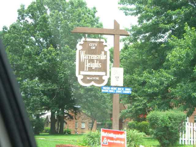
Photo: Nick81aku (Wikimedia Commons), public domain · Wikimedia Commons
Local history sources: en.wikipedia.org · commons.wikimedia.org · archive.org · case.edu
Water
The Five Mile Crib, a small structure about 5 miles out in Lake Erie north of Cleveland's Edgewater Park The water here
- Cleveland Public Water System100% of residentsLake Erie
Hospitals, fire stations and more
Inside Warrensville Heights's boundary: 2 hospitals, 2 dialysis centers, 1 nursing home, 2 fire and EMS stations, 1 high-hazard dam, 6 public schools, 1 library, 1 police station, 1 public charging site, 10 Toxics Release Inventory facilities and 6 spill cases. Press a pin or a name for its whole record and its source.
Hospitals (2)
-
Regency Hospital of Cleveland EastLong-term acute care hospital · Warrensville Heights
- What it is
- Long-term acute care hospital
- Address
- 4200 Interchange Corporate Center Road, Warrensville Heights, OH 44128
- County
- Cuyahoga County
- Beds
- 44
- Ownership
- Proprietary
- Phone
- (216) 910-3802
Hospital's website ↗ Where HIFLD got this record ↗ HIFLD hospitals (source) ↗ Street map and directions ↗
-
South Pointe HospitalGeneral hospital · Warrensville Hts
- What it is
- General hospital
- Address
- 20000 Harvard Road, Warrensville Hts, OH 44122
- County
- Cuyahoga County
- Beds
- 344
- Helipad
- Yes
- Ownership
- Non-profit
- Medicare overall rating
- 5 of 5 stars
- Emergency department (Medicare)
- No
- Phone
- (216) 491-6000
- Medicare ID
- 360144
Medicare Care Compare ↗ Where HIFLD got this record ↗ HIFLD hospitals (source) ↗ Street map and directions ↗
Source: HIFLD hospitals inventory via FEMA (closed hospitals it still lists left out, hospitals opened since added), with Medicare Care Compare ratings matched by name and address.
Dialysis centers (2)
-
Center For Dialysis Care, WarrensvilleDialysis · Warrensville Heights
- Address
- 4877 Galaxy Parkway Suite A, Warrensville Heights, OH 44128
- Dialysis stations
- 30
- Medicare star rating
- 1 of 5 stars
- Services
- in-center hemodialysis
- Shift starting after 5 pm
- Yes
- Ownership
- for profit
- Chain
- Centers for Dialysis Care
- Medicare certified since
- 1997-07-23
- Phone
- (216) 378-5050
- Medicare ID
- 362582
Medicare Care Compare ↗ CMS dialysis facility list (source) ↗ Street map and directions ↗
-
Fmc Ohio Renal Care Group SouthpointeDialysis · Beachwood
- Address
- 4200 Warrensville Center Road, Suite 100, Beachwood, OH 44122
- Dialysis stations
- 21
- Medicare star rating
- 3 of 5 stars
- Services
- in-center hemodialysis
- Ownership
- for profit
- Chain
- Fresenius Medical Care
- Medicare certified since
- 2018-04-18
- Phone
- (216) 561-3535
- Medicare ID
- 362876
Medicare Care Compare ↗ CMS dialysis facility list (source) ↗ Street map and directions ↗
Source: CMS dialysis facility list, September 2026, geocoded with the Census Bureau batch geocoder (an address it could not place sits at its ZIP center).
Nursing homes (1)
-
Avenue Care and Rehabilitation Center, The1 of 5 stars · Warrensville Heights
- Address
- 4120 Interchange Corporate Center Road, Warrensville Heights, OH 44128
- Certified beds
- 97
- Residents on an average day
- 82
- Medicare overall rating
- 1 of 5 stars
- Health inspections
- 1 of 5 stars
- Staffing
- 1 of 5 stars
- Quality measures
- 4 of 5 stars
- Penalties since 2023
- 2 fines totalling $34,146 (latest 2025-01-10)
- Ownership
- For profit - Limited Liability company
- Chain
- PROGRESSIVE QUALITY CARE
- Takes
- Medicare and Medicaid
- Phone
- (216) 896-9900
- Medicare ID
- 366394
- Map point
- the ZIP's center (the address did not geocode)
Medicare Care Compare ↗ CMS nursing home data (source) ↗ Street map and directions ↗
Source: CMS Care Compare nursing home provider and penalties files; Medicare star ratings run 1 to 5.
Fire and EMS stations (2)
-
Warrensville Heights Fire Department Station 1Warrensville Heights
- Address
- 4301 Warrensville Center Road, Warrensville Heights, OH 44128
- Coordinates
- 41.44192, -81.53527
USGS National Map structures (source) ↗ Street map and directions ↗
-
Warrensville Heights Fire Department Station 2Warrensville Heights
- Address
- 4545 Taylor Lane, Warrensville Heights, OH 44128
- Coordinates
- 41.43606, -81.49658
USGS National Map structures (source) ↗ Street map and directions ↗
Source: USGS National Map structures (most Ohio records last updated 2019 to 2022), checked against the Columbus and Cleveland station lists. The department that answers a call is set by jurisdiction and mutual aid, not by distance.
High-hazard dams (1)
-
Kerruish Stormwater Control Facility DamMill Creek · condition: satisfactory
- Hazard class
- High: a failure would probably cost a life
- Condition
- Satisfactory (assessed 07/19/2022)
- River or stream
- Mill Creek
- Purpose
- Flood Risk Reduction
- Type
- Earth
- Height
- 40 ft
- Storage
- 334 acre-feet
- Completed
- 1954
- Owner type
- Local Government
- County
- Cuyahoga County
- Nearest town (NID)
- City of Maple Heights
- Last inspection
- 11/09/2021
- Emergency action plan
- Yes
- NID ID
- OH02943
National Inventory of Dams record ↗ National Inventory of Dams (source) ↗ Street map and directions ↗
Source: U.S. Army Corps of Engineers National Inventory of Dams, August 2026. "High hazard" rates what a failure would cost downstream, not how likely one is; the condition is the state's assessment.
Public schools (6)
-
Green Inspiration AcademyCleveland
- Address
- 4901 Galaxy Pkwy Ste L, Cleveland, OH 44128
- Kind (NCES)
- Regular School
- Students, 2023-24
- 144
- Teachers (full-time equivalent)
- 11
- NCES school ID
- 390002501543
-
STEAM Academy of Warrensville HeightsWarrensville Heights
- Address
- 4700 Richmond Rd Ste 3000, Warrensville Heights, OH 44128
- Kind (NCES)
- Regular School
- Students, 2023-24
- 324
- Teachers (full-time equivalent)
- 14
- NCES school ID
- 390148205756
-
T2 Honors AcademyWarrensville Heights
- Address
- 18450 S Miles Rd, Warrensville Heights, OH 44128
- Kind (NCES)
- Regular School
- Students, 2023-24
- 93
- Teachers (full-time equivalent)
- 11
- NCES school ID
- 390156805832
-
Warrensville Heights Elementary School3 of 5 stars · Cleveland
- Address
- 21865 Clarkwood Pkwy, Cleveland, OH 44128
- School district
- Warrensville Heights City School District
- Kind (NCES)
- Regular School
- Students, 2023-24
- 702
- Teachers (full-time equivalent)
- 54.5
- Report card, 2025-26
- 3 of 5 stars
- Performance index
- 62.7%
- Ohio building IRN
- 012394
- NCES school ID
- 390450005598
NCES school record ↗ Ohio School Report Card ↗ Street map and directions ↗
-
Warrensville Heights High School3.5 of 5 stars · Warrensville Heights
- Address
- 4270 Northfield Rd, Warrensville Heights, OH 44128
- School district
- Warrensville Heights City School District
- Kind (NCES)
- Regular School
- Students, 2023-24
- 622
- Teachers (full-time equivalent)
- 47
- Report card, 2025-26
- 3.5 of 5 stars
- Performance index
- 64.9%
- Four-year graduation rate
- 97%
- Ohio building IRN
- 039263
- NCES school ID
- 390450001930
NCES school record ↗ Ohio School Report Card ↗ Street map and directions ↗
-
Warrensville Heights Middle School3 of 5 stars · Warrensville Heights
- Address
- 23401 Emery Rd, Warrensville Heights, OH 44128
- School district
- Warrensville Heights City School District
- Kind (NCES)
- Regular School
- Students, 2023-24
- 408
- Teachers (full-time equivalent)
- 34
- Report card, 2025-26
- 3 of 5 stars
- Performance index
- 57.8%
- Ohio building IRN
- 039271
- NCES school ID
- 390450001931
NCES school record ↗ Ohio School Report Card ↗ Street map and directions ↗
Source: NCES EDGE public school locations 2024-25 and Common Core of Data 2023-24 (type, students, teachers); Ohio School Report Cards 2025-26 (Department of Education and Workforce), matched by name within the district.
Public libraries (1)
-
Warrensville Heights Branch LibraryBranch · Warrensville Hts.
- Address
- 4415 Northfield Rd, Warrensville Hts., OH 44128
- What it is
- Branch
- Library system
- Cuyahoga County Public Library
- Open
- 3,499 hours a year, 52 weeks
- Building
- 27,500 sq ft
- System's visits, FY2024
- 3,917,784
- System's loans, FY2024
- 11,584,178
- People the system serves
- 626,288
- Phone
- (216) 464-5280
IMLS Public Libraries Survey (source) ↗ Street map and directions ↗
Source: IMLS Public Libraries Survey FY2024 (outlets and their systems). Any Ohio resident can get a free card at any Ohio public library.
Police stations (1)
-
Warrensville Heights Police DepartmentWarrensville Heights
- Address
- 4743 Richmond Road, Warrensville Heights, OH 44128
- Coordinates
- 41.43143, -81.49694
USGS National Map structures (source) ↗ Street map and directions ↗
Source: USGS National Map structures, police stations, corrected and completed by hand (September 2026). The department that answers a call is set by jurisdiction, not by distance.
Public EV charging (1)
-
CCPLWVH1 STATION 12 Level 2 · Warrensville Heights
- Address
- 4415 Northfield Rd, Warrensville Heights, OH 44128
- Ports
- 2 Level 2
- Plugs
- J1772
- Network
- ChargePoint Network
- Hours
- 24 hours daily
- Phone
- 888-758-4389
Station Locator (NREL) ↗ Alternative Fuels Data Center (source) ↗ Street map and directions ↗
Source: NREL Alternative Fuels Data Center station list (May 2026), public and open stations, the posts at one address counted as one site.
Facilities reporting toxic releases (10)
-
Cast Specialties IncToxics Release Inventory · Warrensville Heights
- Address
- 26711 Miles Rd., Warrensville Heights, OH 44128
- County
- Cuyahoga County
- Status
- Reports to the Toxics Release Inventory (active)
- EPA program ID
- 44128CSTSP26711
- EPA registry ID
- 110013287442
EPA facility record ↗ EPA Facility Registry Service (source) ↗ Street map and directions ↗
-
Cleveland DcToxics Release Inventory · Bedford
- Address
- 25000 Miles Rd, Bedford, OH 44146
- County
- Cuyahoga County County
- Status
- Reports to the Toxics Release Inventory (***unchanged***)
- EPA program ID
- 4414WCLVLN25MIL
- EPA registry ID
- 110071909307
EPA facility record ↗ EPA Facility Registry Service (source) ↗ Street map and directions ↗
-
Excello Specialty CoToxics Release Inventory · Cleveland
- Address
- 4495 Cranwood Pky., Cleveland, OH 44128
- County
- Cuyahoga County
- Status
- Reports to the Toxics Release Inventory (active)
- EPA program ID
- 44128XCLLS4495C
- EPA registry ID
- 110000387590
EPA facility record ↗ EPA Facility Registry Service (source) ↗ Street map and directions ↗
-
Ge HealthcareToxics Release Inventory · Warrensville Heights
- Address
- 18683 South Miles Road, Warrensville Heights, OH 44128
- County
- Cuyahoga County
- Status
- Reports to the Toxics Release Inventory (active)
- EPA program ID
- 44128XRYTB18683
- EPA registry ID
- 110008117803
EPA facility record ↗ EPA Facility Registry Service (source) ↗ Street map and directions ↗
-
Henkel Us Operations CorporationToxics Release Inventory · Cleveland
- Address
- 18731 Cranwood Parkway, Cleveland, OH 44128
- County
- Cuyahoga County
- Status
- Reports to the Toxics Release Inventory (active)
- EPA program ID
- 44128LCTTC4450C
- EPA registry ID
- 110000825590
EPA facility record ↗ EPA Facility Registry Service (source) ↗ Street map and directions ↗
-
Kinetico Engineered Systems Inc Warrensville BranchToxics Release Inventory · Bedford
- Address
- 21417 Aurora Rd., Bedford, OH 44146
- County
- Cuyahoga County
- Status
- Reports to the Toxics Release Inventory (active)
- EPA program ID
- 44146KNTCN21417
- EPA registry ID
- 110002111161
EPA facility record ↗ EPA Facility Registry Service (source) ↗ Street map and directions ↗
-
Lubriquip IncToxics Release Inventory · Warrensville Heights
- Address
- 18901 Cranwood Parkway, Warrensville Heights, OH 44128
- County
- Cuyahoga County
- Status
- Reports to the Toxics Release Inventory (active)
- EPA program ID
- 44128LBRQP1891C
- EPA registry ID
- 110009672194
EPA facility record ↗ EPA Facility Registry Service (source) ↗ Street map and directions ↗
-
Preform Sealants IncToxics Release Inventory · Warrensville Hts
- Address
- 18780 Cranwood Pky., Warrensville Hts, OH 44128
- County
- Cuyahoga County
- Status
- Reports to the Toxics Release Inventory (active)
- EPA program ID
- 44128PRFRM18780
- EPA registry ID
- 110002110992
EPA facility record ↗ EPA Facility Registry Service (source) ↗ Street map and directions ↗
-
Stanley Industries IncToxics Release Inventory · Warrensville Hts
- Address
- 19120 Cranwood Pky., Warrensville Hts, OH 44128
- County
- Cuyahoga County
- Status
- Reports to the Toxics Release Inventory (active)
- EPA program ID
- 44128STNLY19120
- EPA registry ID
- 110000387581
EPA facility record ↗ EPA Facility Registry Service (source) ↗ Street map and directions ↗
-
Tube Form IncToxics Release Inventory · Bedford Heights
- Address
- 25840 Miles Road, Bedford Heights, OH 44146
- County
- Cuyahoga County
- Status
- Reports to the Toxics Release Inventory (active)
- EPA program ID
- 44146TBFRM25840
- EPA registry ID
- 110002472761
EPA facility record ↗ EPA Facility Registry Service (source) ↗ Street map and directions ↗
Source: EPA Facility Registry Service, Toxics Release Inventory reporters. Reporting a release is required of large users of listed chemicals; it is not by itself a violation.
Spills reported since 2021 (6)
-
Material Unknown Reached water2024-10-18 · Warrensville Heights
- Reported
- 2024-10-18
- What spilled
- Material Unknown
- Reached a waterway
- 18 - Mill Creek
- Where
- Warrensville Heights, Cuyahoga County
- Ohio EPA district office
- NEDO
- Ohio EPA case number
- 2410EPA0001764
Ohio EPA spill reports (source) ↗ Street map and directions ↗
-
Fuel Diesel / Diesel Fuel (Vehicle On Or Off Road) Reached water2024-10-03 · Warrensville Heights
- Reported
- 2024-10-03
- What spilled
- Fuel Diesel / Diesel Fuel (Vehicle On Or Off Road); Sheen Organic
- Largest amount reported
- 10 gallons
- Reached a waterway
- 18 - Mill Creek
- Where
- Warrensville Heights, Cuyahoga County
- Ohio EPA district office
- NEDO
- Ohio EPA case number
- 2410EPA0001694
Ohio EPA spill reports (source) ↗ Street map and directions ↗
-
Sheen Rainbow / Hydrocarbon Reached water2023-11-21 · Warrensville Heights
- Reported
- 2023-11-21
- What spilled
- Sheen Rainbow / Hydrocarbon
- Reached a waterway
- 18 - Mill Creek
- Where
- Warrensville Heights, Cuyahoga County
- Ohio EPA district office
- NEDO
- Ohio EPA case number
- 2311EPA0001967
Ohio EPA spill reports (source) ↗ Street map and directions ↗
-
Oil Transformer Non Pcb2023-08-26 · Warrensville Heights
- Reported
- 2023-08-26
- What spilled
- Oil Transformer Non Pcb
- Largest amount reported
- 50 gallons
- Where
- Warrensville Heights, Cuyahoga County
- Ohio EPA district office
- NEDO
- Ohio EPA case number
- 2308EPA0001498
Ohio EPA spill reports (source) ↗ Street map and directions ↗
-
Asphalt / Bitumen Reached water2021-09-28 · Warrensville Heights
- Reported
- 2021-09-28
- What spilled
- Asphalt / Bitumen
- Largest amount reported
- 10 gallons
- Reached a waterway
- 99 - Unnamed
- Where
- Warrensville Heights, Cuyahoga County
- Ohio EPA district office
- NEDO
- Ohio EPA case number
- 2109EPA0001533
Ohio EPA spill reports (source) ↗ Street map and directions ↗
-
Oil Transformer Non Pcb2026-01-05 · Warrensville Heights
- Reported
- 2026-01-05
- What spilled
- Oil Transformer Non Pcb
- Largest amount reported
- 40 gallons
- Where
- Warrensville Heights, Cuyahoga County
- Ohio EPA district office
- NEDO
- Ohio EPA case number
- 2601EPA0000011
Ohio EPA spill reports (source) ↗ Street map and directions ↗
Source: Ohio EPA emergency response spill reports, 2021 to September 2026, one point per case where Ohio EPA placed it. A report is what the caller or responder recorded; amounts are often blank or estimated.
Its ZIP codes
Each ZIP code that touches Warrensville Heights, with the share of its residents who live here and the same headline figures as the ZIP page.
| ZIP | Share | Water | Radon | Home value | Schools | Flood |
|---|---|---|---|---|---|---|
| 44128 Cleveland | 40% | The Five Mile Crib, a small structure about 5 miles out in Lake Erie north of Cleveland's Edgewater Park | 2.0 pCi/L average radon | Median year built 1952 | Cleveland Municipal · 2.5 stars overall | 0.7% of residents in the 1% floodplain |
| 44122 Shaker Heights and Beachwood | 7% | The Five Mile Crib, a small structure about 5 miles out in Lake Erie north of Cleveland's Edgewater Park | 1.9 pCi/L average radon | Median year built 1954 | Shaker Heights City · 4 stars overall | 0.0% of residents in the 1% floodplain |
Local government
Who holds office in Warrensville Heights, how its elections and ballot issues came out, and the state auditor's record.
Auditor of State record
- No fiscal caution, watch or emergency on the Auditor of State's lists.
- Financial Health Indicators (the Auditor of State's 17 measures; critical / cautionary / positive): 2020 3 / 2 / 12; 2021 1 / 0 / 16; 2022 1 / 2 / 14; 2023 1 / 2 / 14; 2024 1 / 0 / 16; 2025 1 / 1 / 15.
- Financial Audit, 2025, released 2026-08-13
- Financial Audit, 2024, released 2025-10-21
- Compliance Examination, 2024, released 2025-08-05
The county
Cuyahoga County: 52 ZIP codes, 59 cities, villages and townships, 1,270,867 people.
Nearby places
Rain and snow
How much has actually fallen on Warrensville Heights, day by day, from 1871 to now. Daily totals, not averages.
- rain, last 30 days
- 2.07 in
- 2026-09-29 to 2026-10-28
- rain so far in 2026
- 34.6 in
- about normal for the date
- snow so far in 2026
- 48.8 in
- a normal year brings 37.6 in
- a normal year
- 41.1 in
- average of 20 years, 1991-2020
| Month | Rain (in) | Snow (in) | Days counted |
|---|---|---|---|
| October 2026 | 2.07 | — | 28 |
| September 2026 | 2.19 | — | 30 |
| August 2026 | 7.27 | — | 31 |
| July 2026 | 2.54 | — | 31 |
| June 2026 | 3.12 | — | 30 |
| May 2026 | 4.04 | — | 31 |
| April 2026 | 6.41 | 0.1 | 30 |
| March 2026 | 3.02 | 1.5 | 31 |
| February 2026 | 1.02 | 9.3 | 28 |
| January 2026 | 2.91 | 37.8 | 31 |
| December 2025 | 2.94 | 16.1 | 31 |
| November 2025 | 2.80 | 12.0 | 30 |
| Wettest year | 2011 — 65.8 in |
|---|---|
| Driest year | 1934 — 21.9 in |
| Snowiest year | 2010 — 104.7 in |
| Wettest day on record | 1 September 1901 — 3.81 in |
| Heaviest snowfall in a day | 25 November 1950 — 12.99 in |
| Deepest snow on the ground | 18 December 1951 — 22.01 in |
Estimated, not measured. No rain gauge has ever stood inside Warrensville Heights, so every figure here is worked out from the gauges around it - the nearest ones weighted most. Treat them as close estimates rather than readings.
43,290 days of records, 1871-01-01 to 2026-10-28. Source: NOAA NCEI GHCN-Daily, 3,240 gauges in and around Ohio. A day is "gauged" when a gauge standing inside the boundary reported it, and the value is the mean of those gauges. Otherwise it is interpolated by inverse distance from every gauge reporting within 50 miles. Nothing is carried forward, back-filled or smoothed. Against NOAA nClimDiv county monthly precipitation over 136,848 complete county-months (checked 2026-10-31): correlation 0.9515, median absolute difference 0.217 in a month. Built 2026-10-31 from the Cracked Buckeye precipitation archive. Snow is the softer number — snowfall is measured by hand with a ruler, no agency publishes a gridded county snowfall series, and blowing snow defeats every observer.
Environmental permits and filings
What Ohio EPA has on file for Warrensville Heights: permits, inspections, violations, cleanups and the state loans behind sewer and water work. Every line links to the agency's own document.
- facilities and sites on file
- 53
- those placed on the map inside Warrensville Heights
| Program | Facilities and sites |
|---|---|
| Hazardous waste | 19 |
| Air pollution | 13 |
| Wastewater and stormwater discharge | 11 |
| Voluntary cleanup | 5 |
| Site assessment | 2 |
| Brownfield | 1 |
| Contaminated-site cleanup | 1 |
| Federal Facilities | 1 |
| Date | Facility or site | What |
|---|---|---|
| PIR 4055 - EAST 190TH AND RIDGEWOOD | Wastewater and stormwater discharge permit | |
| TREMCO CPG INC LABORATORY | Air pollution permit | |
| HENKEL US OPERATIONS CORPORATION | Air pollution permit | |
| TREMCO CPG INC LABORATORY | Air pollution permit | |
| TRIBCO INC | Air pollution report | |
| HENKEL CORP | Air pollution report | |
| SOUTH POINTE HOSPITAL CCHS | Air pollution report | |
| HORIZONS INC | Air pollution report | |
| B&L ACQUISITIONS GROUP DBA COIT CLEANING & RESTORATION | Air pollution report | |
| HENKEL CORP | Air pollution permit | |
| CHEM 1 BLENDING INC | Hazardous waste compliance letter | |
| CITY OF WARRENSVILLE HEIGHTS | Brownfield assessment | |
| CITY OF WARRENSVILLE HEIGHTS | Brownfield assessment | |
| HENKEL US OPERATIONS CORPORATION | Air pollution permit | |
| HENKEL US OPERATIONS CORPORATION | Air pollution permit | |
| CITY OF WARRENSVILLE HEIGHTS | Brownfield assessment | |
| HEINEN'S WAREHOUSE | Wastewater and stormwater discharge permit | |
| HEINEN'S WAREHOUSE | Wastewater and stormwater discharge permit | |
| CITY OF WARRENSVILLE HEIGHTS | Brownfield assessment | |
| CITY OF WARRENSVILLE HEIGHTS | Brownfield assessment | |
| ZIRCON INDUSTRIES | Hazardous waste compliance letter | |
| CITY OF WARRENSVILLE HEIGHTS | Brownfield assessment | |
| CITY OF WARRENSVILLE HEIGHTS | Brownfield assessment | |
| GARFIELD PARK POND AND STREAM RESTORATION PROJECT | Wastewater and stormwater discharge permit | |
| 700 LAKE TOWNHOUSE AND CONDO DEVELOPMENT | Wastewater and stormwater discharge permit |
Source: Ohio EPA eDocument portal (edocpub.epa.ohio.gov), indexed 2026-10-14. Facilities are placed on the map from Ohio EPA's own map layers, EPA's Facility Registry, coordinates written in the filings, or a geocoded street address. A permit filed under a private person's name (most are household septic systems) is counted but never named, placed or linked; licenses for individual workers and open-burning notices are left out entirely.
Quick answers
What county is Warrensville Heights, Ohio in?
Warrensville Heights is a city in Cuyahoga County, Ohio, with 13,789 residents.
When was Warrensville Heights, Ohio founded?
Warrensville Heights was settled 1810-01-04 (Daniel Warren); incorporated 1927 (village); 1960 (city). Founders on record: Daniel Warren. Source
How did Warrensville Heights, Ohio get its name?
Daniel Warren, who had come from New Hampshire to Painesville in 1808 and then to Newburg, built a cabin in the township without using a single nail and moved his family in on January 4, 1810 -- his wife riding a borrowed horse with their three-week-old baby, Warren carrying their two-year-old son on his back. Source
What ZIP code is Warrensville Heights, Ohio?
Warrensville Heights is served by ZIP codes 44128 and 44122; 44128 holds the largest share of its residents.
Where does Warrensville Heights, Ohio get its water?
The main water source for Warrensville Heights (Cleveland Public Water System): The Five Mile Crib, a small structure about 5 miles out in Lake Erie north of Cleveland's Edgewater Park.
Cite this page
Cite this page as:
Cracked Buckeye, "Warrensville Heights, Cuyahoga County", https://crackedbuckeye.com/place/warrensville-heights/, built 2026-10-31, accessed [date].
How to cite · Report a correction · Built 2026-10-31
