How Washington Township, Franklin County began
Washington Township was organized under its present name in 1809, its boundaries fixed to their current limits in 1820 after Perry Township split off to the east, and its earliest settlers were the Sells family of Pennsylvania, who arrived at the future site of Dublin in 1801-1802. John Sells laid out Dublin in 1818, and Irish-born surveyor John Shields named it for his own birthplace; the town of Hilliard grew up after 1852 as a station on the Piqua and Indiana Railroad. Both places stayed small farm towns for more than a century, Dublin counting only 681 residents as late as 1970, until interstate highways, corporate relocations, and, in Hilliard's case, a 1960s connection to Columbus's water and sewer system touched off rapid suburban growth; today Dublin is a city and Hilliard occupies only a small part of the township that bears the name of its onetime rail stop.
Settled 1801-1802, incorporated 1809, by Ludwick Sells and his sons Samuel, Peter, Benjamin, and William, of Huntingdon County, Pennsylvania, first settled at the future site of Dublin; the township organized under its present name in 1809.
Where the name comes from
The township is one of forty-three Washington Townships in Ohio, presumably named, like the others, for George Washington; no source found gives a township-specific naming account. Within it, the village of Dublin was named in 1818 by surveyor John Shields for his own birthplace, Dublin, Ireland, in a speech offering the name to the new settlement's founders.
Before the town
The 1880 county history records that members of the Wyandot people, including a camp associated with "Chief Billy Wyandot," regularly camped on Indian Run north of Dublin in the township's early settlement years, and states plainly that no massacres or violent encounters were recorded there. Beyond this, no mound, earthwork, or named village specific to Washington Township turned up in the sources checked. The township's land lies within the area the Treaty of Greenville (August 3, 1795) ceded to the United States. Broader Native history for the county is covered in the Franklin County file.
Nations recorded here: Wyandot, Shawnee, Lenape (Delaware), Miami.
- Chief Billy Wyandot's camp (camp) — Indian Run, north of Dublin, early 1800s, prior to and during initial Euro-American settlement (ohiogenealogyexpress.com)
Timeline
- — Ludwick Sells and his sons Samuel, Peter, Benjamin, and William, of Huntingdon County, Pennsylvania, become among the first settlers, at the future site of Dublin.
- — The township's first church congregation, Christie Methodist Episcopal, organizes at settler George Ebey's house.
- — Washington Township is organized under its present name, at first including territory that later becomes Perry and Norwich townships.
- — John Sells and George Ebey build the township's first mill, a flouring mill with an attached sawmill, on the Scioto River.
- — John Sells lays out the village of Dublin; surveyor John Shields names it for his birthplace, Dublin, Ireland.
- — The township's boundaries are set to their present limits after Perry Township is formed from its eastern portion; a post office opens the same year with Daniel Wright as first postmaster.
- — Samuel Davis, a Revolutionary War veteran, has the brick Anson Davis House built on what is now Hayden Run Road for his son.
- — John Reed Hilliard buys ten acres of farmland from Hoseah High and Abraham Wendell; the resulting stop on the Piqua and Indiana Railroad, first called Hilliard's Station, is platted by John Hilliard in September 1853 and shortened to Hilliard in 1854.
- — Dublin incorporates as a village with Z. Hutchinson as mayor and William Graham as recorder.
- — Hilliard incorporates as a village on July 13 with about 280 residents.
- — The Hilliard Methodist Episcopal Church, now the oldest religious structure standing in Hilliard, is built on Main Street.
- — Hilliard connects to the Columbus regional water and sewer system, removing a major obstacle to new development.
- — Completion of the Interstate 270 outerbelt sets off a second wave of rapid growth in Hilliard.
- — Dublin, after annexing land from surrounding townships and surpassing 5,000 residents, becomes a city in August.
Stories
The Sells family and the naming of Dublin
Ludwick Sells and his sons Samuel, Peter, Benjamin, and William left Huntingdon County, Pennsylvania, around 1801-1802 to settle land along the Scioto River that would become Dublin; their elder brother John followed with his own family in the fall of 1808. John Sells laid out the village in 1818, working with a business partner named John Shields, an Irish-born surveyor. According to the 1880 county history, Shields told the settlement's founders that if given the honor of naming the new town, he would call it Dublin after his own birthplace, Dublin, Ireland, and the name stuck. By 1833 the young village had several mills and a store; it stayed a small farm town, incorporating only in 1855 and still counting just 681 residents as late as 1970, before highway construction and corporate relocations turned it into a Columbus suburb and, in 1987, a city.
Chief Billy Wyandot's camp on Indian Run
The stream north of Dublin known as Indian Run carries its name for a reason: the 1880 county history records that Wyandot people, including a group associated with a leader remembered as "Chief Billy Wyandot," regularly camped along it in the years around and after the Sells family's arrival. The same account states plainly that no massacres or violent clashes were recorded between the Wyandot campers and the township's early settlers, a detail the compilers apparently thought worth noting explicitly. Beyond this camp, no other Native village, mound, or trail specific to the township turned up in the sources checked for this entry, though the wider Scioto valley the township sits in was long traveled and used by multiple nations before and after the Treaty of Greenville.
A farm town becomes a corporate suburb
For more than a century after its 1818 founding, Dublin remained a quiet crossroads village serving the farms of Washington Township; its population was still only 681 in 1970. That changed fast once Interstate 270 reached the area: national and regional companies such as Ashland Inc. and Wendy's moved their headquarters to Dublin, and the Muirfield Village Golf Club development drew new residents to the area's northern edge. Dublin crossed the 5,000-resident threshold and was recognized as a city in August 1987, by which point it had annexed land not just from Washington Township but from neighboring townships in Delaware and Union counties as well, a legacy that still leaves parts of the city outside Franklin County altogether.
Hilliard's station on the Piqua and Indiana line
Hilliard began in 1852 when John Reed Hilliard bought ten acres of farmland from Hoseah High and Abraham Wendell along the route of the Piqua and Indiana Railroad. The resulting depot was known first as Hilliard's Station; John Hilliard platted the surrounding town in September 1853, a post office opened in 1854, and the name was shortened to simply Hilliard. It grew slowly as a rail and farm town, incorporating as a village in 1869 with roughly 280 residents, until a 1960s connection to the Columbus regional water and sewer system cleared the way for large subdivisions, and the completion of the Interstate 270 outerbelt in the early 1970s brought a second wave of fast growth that has continued into the city Hilliard is today.
Photographs
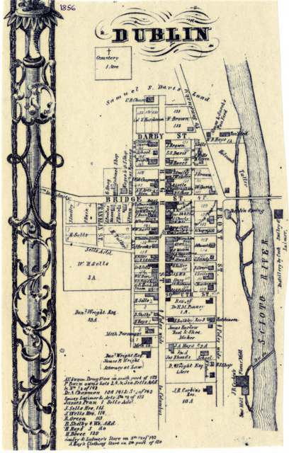
Photo: Columbus Metropolitan Library, via Digital Public Library of America / Ohio Digital Network, public domain · Wikimedia Commons
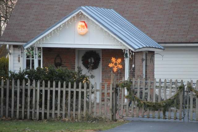
Photo: Photograph by Nyttend, CC0 · Wikimedia Commons
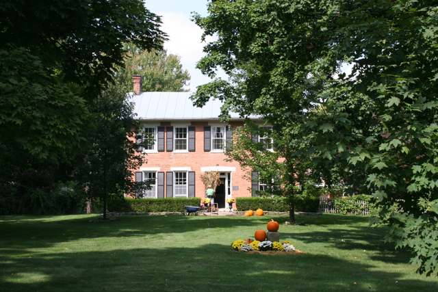
Photo: Wikimedia Commons contributor, CC BY-SA 3.0 · Wikimedia Commons
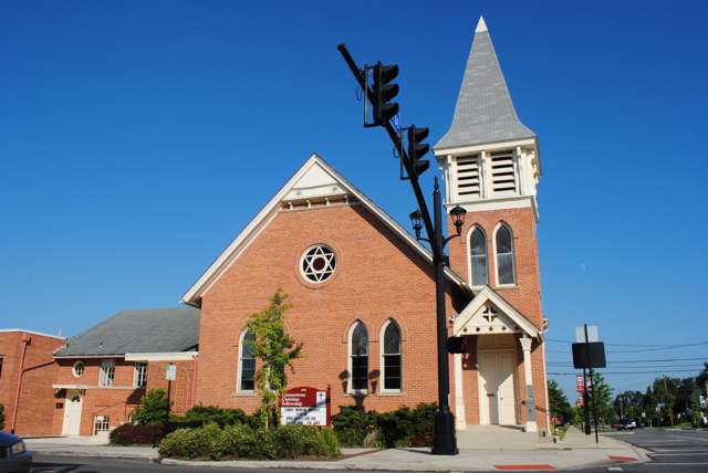
Photo: Photograph by Wdzinc, CC BY-SA 3.0 · Wikimedia Commons
Local history sources: en.wikipedia.org · ohiogenealogyexpress.com · en.wikipedia.org · en.wikipedia.org · en.wikipedia.org · en.wikipedia.org · en.wikipedia.org · commons.wikimedia.org · commons.wikimedia.org · commons.wikimedia.org · commons.wikimedia.org
Water
Big Walnut Creek at the plant's low-head dam and screen house on Morse Rd, below Hoover Dam The water here
- Columbus Public Water System99% of residentsScioto River (Griggs & O'Shaughnessy), Hoover Reservoir on Big Walnut Ck, plus wells
- Del-co Water Company, Inc.1% of residentsOlentangy River, O'Shaughnessy and Alum Creek reservoirs, plus Knox County wells
- Hayden Heights MHP1% of residentsGroundwater wells (2 wells)
- Country Side Mobile Home0% of residentsGroundwater wells
Its ZIP codes
Each ZIP code that touches Washington Township, Franklin County, with the share of its residents who live here and the same headline figures as the ZIP page.
| ZIP | Share | Water | Radon | Home value | Schools | Flood |
|---|---|---|---|---|---|---|
| 43016 Columbus and Dublin | 2% | Big Walnut Creek at the plant's low-head dam and screen house on Morse Rd, below Hoover Dam | 5.8 pCi/L average radon | Median year built 2002 | Dublin City · 4.5 stars overall | 0.3% of residents in the 1% floodplain |
The county
Franklin County: 45 ZIP codes, 42 cities, villages and townships, 1,356,733 people.
Nearby places
Cite this page
Cite this page as:
Cracked Buckeye (Open Shower Co), "Washington Township, Franklin County", https://crackedbuckeye.com/place/washington-township-franklin-county/, built 2026-09-16, accessed [date].
Machine-readable: /api/place/washington-township-franklin-county.json (open JSON, CC BY 4.0 for the compilation; the underlying records keep their own terms) · How to cite · Report a correction · Built 2026-09-16