Water system
Del-co Water Company, Inc.
EPA ID OH2101412 · Delaware County · 150,000 people served
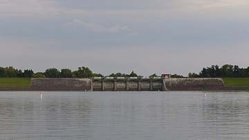
Del-co Water Company, Inc. treats its own water from Olentangy River, O'Shaughnessy and Alum Creek reservoirs, plus Knox County wells.
The system's record
- Aquifer
- Sand-and-gravel aquifer, Knox County well field
- Water bodies
- Olentangy River, O'Shaughnessy Reservoir (Scioto River), Alum Creek Reservoir
- Raw intakes
- Del Co Olentangy River
Olentangy Reservoir
Del Co McNamara Reservoir
Del Co Alum Creek Reservoir
Del Co O'Shaughnessy Reservoir Scioto - Active wells
- 4
- Serves
- 150,000 people · Delaware County
- EPA ID
- OH2101412
Del-Co draws from four plants: Olentangy Plant (Olentangy River plus O'Shaughnessy Reservoir on the Scioto River), Ralph E. Scott Plant (Alum Creek Reservoir), Timothy F. McNamara/Old State Plant (Olentangy watershed reservoirs), and Thomas E. Steward Plant (Knox County groundwater wells).
About this area's water
Did you know
- Del-Co is a member-owned nonprofit 501(c)(12) cooperative, not a city department, licensed by Ohio EPA to run four plants and thirty elevated tanks across eight central Ohio counties.
- Its six above-ground reservoirs hold more than 2.6 billion gallons of raw water, banked during high stream flows for use when the rivers run low.
- Nearly all of it comes from one basin: the Olentangy River, O'Shaughnessy Reservoir and Alum Creek Reservoir all sit in the Upper Scioto watershed, with Knox County wells the lone exception.
- Treatment starts with potassium permanganate dosed into the raw water for one specific reason: killing zebra mussels before they reach the plant.
History5
- 1969Del-Co Water Company founded by Ralph Scott, Timothy McNamara and Gerald Solt, financed through the USDA Farmers Home Administration.
- 1969Original system: a 1-million-gallon-per-day treatment plant, 200 miles of underground pipe and a single elevated tank.
- 2001In October 2001 Ohio EPA approved Del-Co's Wellhead/Drinking Water Source Protection Plan for the Knox County well field.
- 2025Effective May 1, 2025 Del-Co scrapped minimum allowances and dropped its conservation tier from 25,000 to 10,000 gallons a month.
- 2026Effective May 1, 2026 rates rose again: $5.00, $8.50 and $12.00 per 1,000 gallons across three tiers, base fee up $1 to $15.00.
Treatment & pressure
How it is treated
Raw water gets potassium permanganate for zebra mussel control, then ferric chloride and lime in a flash mixer, settling, carbon dioxide stabilization, filtration through fine coal and silicate sand, chlorine, fluoride, and phosphate for corrosion control.
Water pressure
Published: Del-Co says it has historically delivered 40-100 psi, per the Recommended Standards for Water Works. Roughly thirty elevated tanks span eight counties.
What it costs
$5.00 per 1,000 gallons
Typical household bill about $48 a month for water.
Effective May 1, 2026: $5.00/1,000 gal to 4,000; $8.50 to 10,000; $12.00 above; plus a $15.00 monthly base for a 5/8-inch meter. Residential.
Water quality & impurities7
| Contaminant | Level | Limit | Year |
|---|---|---|---|
| Total trihalomethanes (TTHM) Reported at 79.95 against an 80 ppb MCL; no violation. Sample range 24.8-75.3 ppb. | 79.95 ppb | 80 | 2025 |
| Haloacetic acids (HAA5) Disinfection byproduct; range 10.1-45.0 ppb, well under the limit. | 38.78 ppb | 60 | 2025 |
| Lead (90th percentile) 0 of 50 sites above the action level; range 0.26-3.15 ppb. Replaces a stale 2018 figure. | 0.85 ppb | 15 | 2024 |
| Copper (90th percentile) 0 of 50 sites above the action level; range 0.01-0.35 ppm. | 0.22 ppm | 1.3 | 2024 |
| Nitrate Farm runoff indicator; range 0.21-1.4 ppm, far below the limit. | 1.4 ppm | 10 | 2025 |
| Atrazine Row-crop herbicide runoff; range 0.31-0.76 ppb. | 0.47 ppb | 3 | 2025 |
| PFAS Ohio EPA sampled the Olentangy, Alum Creek and Knox plants; no detections. | ND ppt | 4 (PFOA/PFOS… | 2020 |
EPA compliance record
Lead at the tap: 90th-percentile result 0.8 ppb in 2024 (action level 15 ppb).
EPA record: no health-based violations since 2015.
Supply stress
Del-Co calls its Olentangy River, O'Shaughnessy and Alum Creek sources highly susceptible to contamination from farm runoff, septics and road and rail crossings, and its Knox County wellfield relatively so. Output averages near 13 MGD against 45 MGD design capacity in fast-growing Delaware County.
Sewers
Sanitary
Del-Co is a drinking-water-only cooperative and provides no sanitary sewer service. Sewers in its territory are run by local municipalities, townships or county sewer districts; not confirmed per-ZIP in this pass.
Storm
Not applicable. Del-Co operates no storm sewers; stormwater is handled by the townships and municipalities across its eight-county service area.
Sourcesverified
Compiled from the utility's own reports and public records, then independently re-checked against primary sources.
Main supplier in 19 ZIP codes
Serves
Main water supplier in 20 ZIP codes
- 43021 · Genoa Township and Galena100% of residents
- 43032 · Brown Township and Kilbourne100% of residents
- 43317 · Chesterville100% of residents
- 43320 · Canaan Township and Edison100% of residents
- 43321 · Fulton100% of residents
- 43325 · Washington Township and Iberia100% of residents
- 43334 · Bennington Township and Marengo100% of residents
- 43350 · Sparta100% of residents
- 43074 · Sunbury99% of residents
- 43065 · Powell84% of residents
- 43035 · Orange Township and Lewis Center80% of residents
- 43061 · Scioto Township and Ostrander79% of residents
- 43315 · Cardington73% of residents
- 43314 · Claridon Township and Caledonia72% of residents
- 43011 · Hilliar Township and Centerburg72% of residents
- 43082 · Genoa Township and Westerville71% of residents
- 43066 · Radnor Township and Radnor66% of residents
- 43356 · Waldo Township and Waldo65% of residents
- 43003 · Ashley53% of residents
- 43013 · Hartford Township and Croton2% of residents
Also present in 12 more ZIP codes
- 43015 · Delaware37% of residents
- 43338 · Mount Gilead24% of residents
- 43019 · Fredericktown10% of residents
- 44833 · Galion9% of residents
- 43017 · Dublin6% of residents
- 43031 · Johnstown3% of residents
- 43302 · Marion3% of residents
- 43081 · Westerville1% of residents
- 43064 · Jerome Township and Plain City1% of residents
- 43016 · Columbus and Dublin1% of residents
- 43054 · Columbus and New Albany0% of residents
- 43040 · Marysville0% of residents
Population-weighted resident shares; a ZIP code can have more than one system on record. Recomputed from each ZIP's own system list, not from the map's cached footprint.
Buys from · Sells to
Del-co Water Company, Inc. does not buy water from another system on record; it treats its own source water.
1 system on record buys water from Del-co Water Company, Inc.: Ashley Village.
Photograph
On the map
Show this system's territory on the map — 32 ZIP codes in all.
Sources
U.S. EPA SDWIS and Community Water System Service Area Boundaries (v3, 2026), Ohio EPA primacy data, 2020 census blocks: the system serving most residents, traced through purchases to the treating utility; Ohio EPA 2023 Sewer and Water Rate Survey (Ohio State, May 2025) for household bills; Ohio EPA DEFA loan awards since 2016 for the loans paragraph · EPA SDWIS · EPA service area boundaries · Ohio EPA drinking water · Ohio EPA rate survey
Del-co Water Company, Inc.'s own pages: delcowater.org, delcowater.org