Local events in Sandusky Township, Richland County
Nothing is posted for Sandusky Township itself yet; here is what is on within 10 miles. All local events in Sandusky Township, Richland County
Know a calendar we should watch? Send the link
Checked October 20; the events page is refreshed daily.
How Sandusky Township, Richland County began
Sandusky Township was organized February 12, 1818, from the western half of Springfield Township, twelve miles north to south and six wide; it lost its north half to Vernon Township in 1845 and four tiers of sections to the new Crawford County the same year, leaving a strip about seven miles long and two wide on the western edge of Richland County. Its name comes from the Wyandot name of the Sandusky River, whose headwaters cross its north part. Settlement began in 1817 with Christian Snyder and Jacob Fisher; Daniel Riblet's tavern at Riblet's Corners, on the Mansfield-Bucyrus road, was a stage stop and post office. The township lies between Ontario, Crestline and Galion, and East Crestline was its only town.
Settled 1817 (Christian Snyder and Jacob Fisher), incorporated February 12, 1818 (township organized), by organized at twelve miles by six from the western half of Springfield Township.
Where the name comes from
Named for the Sandusky River, whose headwaters cross the township's north part. Graham's 1880 county history derives 'Sandusky' from Wyandot words, giving Sah-un-dus-kee, 'clear water'; San-doos-tee, 'at the cold water'; and Sa-undustee, 'water within water pools', and says French traders called the river Sandusquet.
Before the town
Graham's 1880 county history says the township was a good hunting ground for the Wyandot and Lenape (Delaware), and that the Lenape leader Wingenund kept his camp for many years on the Sandusky River near Leesville, west of the township in present Crawford County. Colonel William Crawford's column crossed the township in 1782, near or a little north of the site of Crestline, on its way to the Sandusky Plains. Christian Snyder, who settled in 1817, said an Indian trail 'about the width of a sheep-path' ran east and west across the township close to his house; he often saw parties of Wyandot pass along it in single file without speaking, and they sometimes shared venison with the settlers. Native people and settlers both made maple sugar in quantity. Across Richland County, the wider record includes the Greenville (1795) and Fort Industry (1805) cessions.
Nations recorded here: Wyandot, Lenape (Delaware).
- East-west Wyandot trail (trail) — Across the original township, close to Christian Snyder's farm about two miles southwest of Crestline (a site that may now lie in Crawford County), in use when settlement began, 1817 (archive.org)
- Crawford's route of 1782 (trail) — Across the township near, or a little north of, the site of Crestline, from Spring Mills west toward Leesville, 1782 (archive.org)
Timeline
- — Colonel William Crawford's troops halt overnight at Spring Mills and cross the future township near the site of Crestline, bound for the Sandusky Plains.
- — The land is included in the new Springfield Township, organized out of Madison Township.
- — Christian Snyder and Jacob Fisher settle about two miles southwest of the site of Crestline and cut a road to their land from the Douglas settlement in Springfield Township.
- — Sandusky Township is organized February 12, twelve miles long and six wide, including present Vernon, Jackson and Polk townships; John Williams is elected justice of the peace at the first election, held at Mr. Mozier's house, with twelve votes cast.
- — Louis Lyberger and Henry Hersner settle, probably on Section 23, the first settlers known to be inside the present township.
- — A windstorm blows down Christian Snyder's house and barn and destroys his crops in his third year in the woods.
- — Daniel Riblet, from Union County, Pennsylvania, settles on Section 25 and keeps the Riblet House, a stage stop on the Mansfield-Bucyrus road about half way between Ontario and Galion, where one of the township's first post offices is kept.
- — Daniel Riblet begins two terms in the Ohio legislature (1840-44); he was also justice of the peace for eighteen years.
- — Christian Riblet, a Revolutionary War soldier who enlisted in 1779, dies April 6 and is buried in the cemetery near Riblet's Corners.
- — Crawford County is formed February 3 and takes four tiers of sections from the township's west side; on March 9 the north half becomes Vernon Township, leaving Sandusky seven miles by two.
- — About this year the Free-Will Baptists build a small frame church on Section 36 in the Harding settlement, later called the 'Red Squirrel church'.
- — The Methodists organize at Riblet's Chapel, a church near the Riblet tavern that the Lutherans had built and all denominations had used.
- — The Albrights (Evangelical Association) take over the empty Free-Will Baptist church.
Stories
The bear at the chimney
A pioneer family named Hibner lived, as nearly everyone did, in a log house with a large chimney across one end. One day while Mr. Hibner was away and Mrs. Hibner was at work, she heard a noise by the chimney and turned to see a bear's black paw reaching through a gap where a chimney stone had worked loose and rolled aside. She had laid her baby on a blanket on the floor near the fire, and the bear was trying to reach it. The child was just out of reach, and she snatched it further away; the bear gave up and left. Both the 1880 and 1908 county histories tell the story as typical of the township's early years.
Riblet's Corners
Daniel Riblet came from Union County, Pennsylvania, in 1831 and settled on Section 25, where his father Christian, a Revolutionary soldier, is buried. On the Mansfield-Bucyrus road, about half way between Ontario and Galion, he kept a tavern that began as a log house and later gained a frame addition. The stages stopped there, a post office was kept there, and militia musters were held there, making it the most important point in the township. Riblet was a justice of the peace for eighteen years and served in the legislature. By 1908 Baughman wrote that the post office, the tavern and the Riblets were all gone.
The Red Squirrel church
About 1850 the Free-Will Baptists built a small frame church on Section 36, near Bailey's Corners, and held services in it before it was finished. Baughman's 1908 history says a red squirrel once took a seat on a joist over the minister's head during a sermon and seemed to mimic his gestures. The congregation laughed, the preacher, who could not see it, was offended, and he forgave them when it was explained after the service. The Free-Will Baptist society later broke up, the Albrights took the building in 1877, and by 1908 it was no longer used for worship.
Photographs
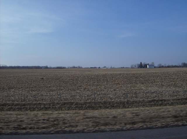
Photo: Nyttend / Wikimedia Commons, public domain · Wikimedia Commons
Local history sources: en.wikipedia.org · richlandcountyhistory.com · archive.org · archive.org · archive.org · archive.org · archive.org · archive.org · archive.org · archive.org · archive.org · commons.wikimedia.org
Water
Groundwater wells (3 wells) The water here
- Galion City51% of residentsBlack Fork/Rocky Fork of Olentangy River via Amman, Amick & Powers Reservoirs
- Crestline Village33% of residentsGroundwater wells (3 wells)
- Mansfield City7% of residentsClear Fork Reservoir (Clear Fork of the Mohican River), plus 9 city wells
- Del-co Water Company, Inc.7% of residentsOlentangy River, O'Shaughnessy and Alum Creek reservoirs, plus Knox County wells
- Ontario City1% of residentsGroundwater wells (3 wells)
- Aqua Ohio - Mansfield System #020% of residentsGroundwater wells (3 wells)
- Lakeview Estates MHP0% of residentsGroundwater wells (2 wells)
- Eastview Community Water Association0% of residentsGroundwater wells (3 wells)
- Aqua Ohio - Mansfield System #030% of residentsGroundwater wells (1 wells)
- Madison Water District0% of residentsGroundwater wells (4 wells)
- Spring Valley Mobile Home Park0% of residentsGroundwater wells (3 wells)
- Aqua Ohio - Mansfield System #080% of residentsGroundwater wells (1 wells)
- Hanley Acres Water Association0% of residentsGroundwater wells (2 wells)
- Willow Park Water Association0% of residentsGroundwater wells (2 wells)
- Hillside MHP0% of residentsGroundwater wells (1 wells)
Hospitals, fire stations and more
Inside Sandusky Township, Richland County's boundary: 1 Toxics Release Inventory facility. Press a pin or a name for its whole record and its source.
Facilities reporting toxic releases (1)
-
Pittsburgh Glass Works, Llc (0370000217)Toxics Release Inventory · Crestline
- Address
- 5066 Lincoln Highway, Crestline, OH 44827
- County
- Richland County
- Status
- Reports to the Toxics Release Inventory (active)
- EPA program ID
- 44827PPGND5066S
- EPA registry ID
- 110042023379
EPA facility record ↗ EPA Facility Registry Service (source) ↗ Street map and directions ↗
Source: EPA Facility Registry Service, Toxics Release Inventory reporters. Reporting a release is required of large users of listed chemicals; it is not by itself a violation.
Its ZIP codes
Each ZIP code that touches Sandusky Township, Richland County, with the share of its residents who live here and the same headline figures as the ZIP page.
| ZIP | Share | Water | Radon | Home value | Schools | Flood |
|---|---|---|---|---|---|---|
| 44827 Crestline | 5% | Groundwater wells (3 wells) | 5.7 pCi/L average radon | Median year built 1958 | Crestline Exempted Village · 2.5 stars overall | 9.0% of residents in the 1% floodplain |
| 44833 Galion | 3% | Black Fork/Rocky Fork of Olentangy River via Amman, Amick & Powers Reservoirs | 6.5 pCi/L average radon | Median year built 1956 | Galion City · 3 stars overall | 3.3% of residents in the 1% floodplain |
| 44903 Mansfield | 0% | Mostly private wells | 4.5 pCi/L average radon | Median year built 1957 | Mansfield City · 3 stars overall | 2.1% of residents in the 1% floodplain |
The county
Crawford County: 8 ZIP codes, 22 cities, villages and townships, 43,874 people.
Nearby places
Quick answers
What county is Sandusky Township, Ohio in?
Sandusky Township, Richland County is a township in Crawford County, Ohio, with 987 residents.
When was Sandusky Township, Ohio founded?
Sandusky Township, Richland County was settled 1817 (Christian Snyder and Jacob Fisher); incorporated February 12, 1818 (township organized). Founders on record: organized at twelve miles by six from the western half of Springfield Township. Source
How did Sandusky Township, Ohio get its name?
Named for the Sandusky River, whose headwaters cross the township's north part. Source
What ZIP code is Sandusky Township, Ohio?
Sandusky Township, Richland County is served by ZIP codes 44827 and 44833; 44827 holds the largest share of its residents.
Where does Sandusky Township, Ohio get its water?
The main water source for Sandusky Township, Richland County (Galion City): Groundwater wells (3 wells).
Cite this page
Cite this page as:
Cracked Buckeye, "Sandusky Township, Richland County", https://crackedbuckeye.com/place/sandusky-township-richland-county/, built 2026-10-31, accessed [date].
How to cite · Report a correction · Built 2026-10-31
